


Mori Atlas logo
Marine protected areaSistema Arrecifal Lobos-Tuxpan

Understanding the regional geography and marine landscape of this critical protected area in Veracruz.

Sistema Arrecifal Lobos-Tuxpan: Mapping the Northernmost Coral Reef Complex of the Gulf of Mexico

Sistema Arrecifal Lobos-Tuxpan represents a vital marine protected area located off the coast of Veracruz, serving as a transitional point where tropical reef ecosystems meet the dynamic conditions of the western Gulf of Mexico. This mapped territory encompasses shallow reef formations, underwater coral structures, and sandy cays like Isla Lobos, which serve as essential habitats for sea turtles and diverse marine life. The atlas perspective provided here reveals the complex two polygon reef configuration that defines the northern limit of substantial coral development in the Mexican Gulf.

coral reefmarine protected areaGulf of MexicoVeracruzislandsnorkeling
A stylized flat illustration of a coastal landscape at sunset, featuring a lighthouse on a small, tree-covered island surrounded by shallow reef waters, with distant cliffs and a pastel sky.

Sistema Arrecifal Lobos-Tuxpan

Marine protected area

Park overview

Structured park overview, official facts, and landscape profile for Sistema Arrecifal Lobos-Tuxpan

Sistema Arrecifal Lobos-Tuxpan park facts, protected area profile, and essential visitor context

Review the core facts for Sistema Arrecifal Lobos-Tuxpan, including designation, size, terrain, visitor scale, habitats, and operating context in one park-focused overview.

About Sistema Arrecifal Lobos-Tuxpan

Sistema Arrecifal Lobos-Tuxpan is a marine protected area that safeguards the northernmost coral reef chain along the Gulf of Mexico. The system runs parallel to the northern Veracruz coast, in the municipalities of Tuxpan and Tamiahua, and consists of two main protected polygons, Lobos and Tuxpan, organized around clusters of individual reefs. The Lobos polygon is the larger of the two and contains three reef formations, while the Tuxpan polygon contains three additional reefs, creating a chain of benthic structures separated by channels and sandy areas.

At the heart of the Lobos polygon lies Isla Lobos, a small sandy cay whose dimensions shift noticeably with the strong daily tidal range in the area. The island hosts a lighthouse, historic shipwreck remains, and a small permanent military surveillance presence. Beyond its human artifacts, Isla Lobos is a center of biological activity, surrounded by reef structures and serving as a refuge for seabirds and marine fauna. The surrounding reefs include mixed coral formations and reef habitats that support dense fish populations and a wide array of invertebrates.

The protected area represents a meaningful conservation achievement for the northern Gulf of Mexico, a region historically overshadowed by the better-known reef systems of the southern Gulf and Caribbean. By shielding both reef and cay ecosystems from unregulated pressures, the system creates a protected corridor for species that depend on nearshore Gulf habitats at the upper edge of their range. Ecological value aside, the system has become a focal point for regulated recreational activity, particularly snorkeling and diving around Isla Lobos, contributing to the growing profile of marine ecotourism in Veracruz.

Quick facts and research context for Sistema Arrecifal Lobos-Tuxpan

Sistema Arrecifal Lobos-Tuxpan lies off the northern Veracruz coast in the municipalities of Tuxpan and Tamiahua, and is administered under Mexico's national system of natural protected areas, SINANP, within SEMARNAT. The protected area was first decreed in 2009 and formally incorporated into the national protected-area framework in 2016, encompassing approximately 30,571 hectares of marine and coastal territory.

The reef system is structured around two main polygons, Lobos and Tuxpan, and includes several named reef formations. Isla Lobos, the only sandy cay within the system, is a focal point for both conservation activity and regulated visitor access. The system is recognized as the northernmost reef chain in the Gulf of Mexico and supports a rich assemblage of reef fish, corals, mollusks, and crustaceans, together with marine mammals and sea turtles.

Protection and recognition

Examine the official designation history, marine protection scope, and recognition data for Sistema Arrecifal Lobos-Tuxpan.

Sistema Arrecifal Lobos-Tuxpan Protection Status and Marine Designated Area Record

Established with a marine protection scope in 2009, Sistema Arrecifal Lobos-Tuxpan maintains documented conservation records without external international designations on file. Review the official establishment chronology and governance status to understand the administrative framework of this protected marine environment.

Protection details

Protection scope
Marine
Designated year
2009
Transboundary protection
No
Park context

Deeper park guide and search-rich context for Sistema Arrecifal Lobos-Tuxpan

Sistema Arrecifal Lobos-Tuxpan history, landscape, wildlife, and travel context

Explore Sistema Arrecifal Lobos-Tuxpan through its history, landscape character, ecosystems, wildlife, conservation priorities, cultural context, and seasonal travel timing in a structured park guide built for atlas discovery and search intent.

Why Sistema Arrecifal Lobos-Tuxpan stands out

The Lobos-Tuxpan system is best known as the northernmost reef chain in the Gulf of Mexico, forming a critical transitional zone between the warmer tropical reefs to the south and the cooler, more variable waters of the western Gulf. It is also recognized for its two-p polygon structure, which groups distinct reef formations around the Lobos complex and the Tuxpan complex off northern Veracruz. A defining feature is Isla Lobos, the only sandy cay in the system and a key nesting and resting site for seabirds and marine turtles, including the regionally important Kemp's ridley and loggerhead turtles. The reefs themselves support diverse coral communities, including formations such as mountain star coral and elkhorn- and staghorn-type branching corals, making the system an important northern outpost for reef biodiversity in the Gulf.
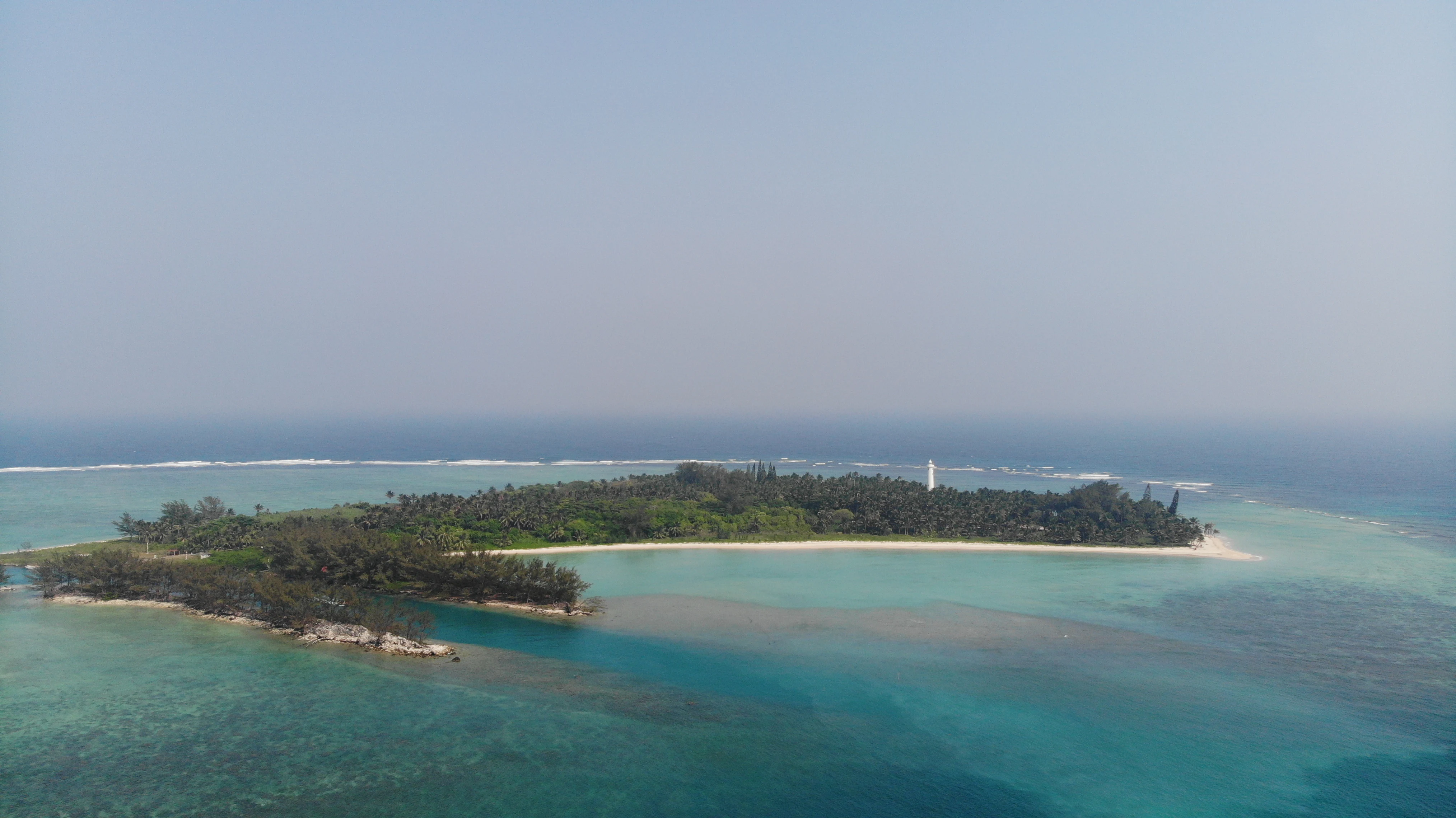
An aerial shot of a small, forested island surrounded by shallow turquoise reef waters and the deep blue ocean, with a white lighthouse standing on the shore.
Aerial view of Isla Lobos within the Sistema Arrecifal Lobos-Tuxpan marine protected area.

Sistema Arrecifal Lobos-Tuxpan history and protected-area timeline

The protection of Sistema Arrecifal Lobos-Tuxpan progressed through two distinct official milestones. Its initial legal protection came with a decree issued by Mexico's National Commission of Natural Protected Areas on 5 June 2009, formally establishing the area as a Natural Protected Area. This first decree recognized the ecological significance of the reef chain and laid the foundation for its long-term safeguarding under Mexican environmental law.

A second, institutional step followed on 8 June 2016, when the Secretariat of the Environment, SEMARNAT, incorporated the system into the Mexican National System of Protected Areas. This incorporation integrated the Lobos-Tuxpan reefs into the country's national framework for biodiversity conservation, enhancing their formal protection and aligning their management with broader national conservation policy. Together, these two decisions form the principal protection history of the site, transforming a regionally important reef chain into a federally recognized component of Mexico's natural heritage.

Sistema Arrecifal Lobos-Tuxpan landscape and geographic character

The landscape of Sistema Arrecifal Lobos-Tuxpan is dominated by shallow, submerged reef formations distributed across the continental shelf off northern Veracruz. Each reef in the system rises from the seabed to create complex three-dimensional structures of coral, rock, and sand that shape the underwater topography of the area. Between the reefs lie sandy flats and channels through which tides move, producing an environment whose physical character shifts subtly with currents and seasonal conditions.

On the surface, the system includes small emergent land features of which Isla Lobos is the most important. This cay, roughly rectangular in shape, measures on the order of several hundred meters across but visibly contracts and expands through the day as a pronounced tidal range reshapes its sandy perimeter. The island's low profile underscores the broader character of the system, where most of the area is defined by what lies beneath the waterline rather than above it.

At a regional scale, the Lobos-Tuxpan system marks the final substantial coral reef development moving northward along the Gulf coastline, beyond which reef formation becomes increasingly limited by cooler waters and river-driven sedimentation. This position gives the system a transitional geographic identity that shapes its appearance, structure, and ecological composition.

Sistema Arrecifal Lobos-Tuxpan ecosystems, habitats, and plant life

Ecologically, Sistema Arrecifal Lobos-Tuxpan functions as a northern stronghold for tropical reef ecosystems within the Gulf of Mexico. The reef habitats support extensive coral communities, including species such as mountain star coral and branching corals resembling elkhorn and staghorn forms, which in turn create shelter for a wide range of associated organisms. The seascape alternates between hard reef structures and softer sandy patches, giving rise to mosaic habitats where reef-dwelling species, sand-associated fauna, and migratory visitors can all find suitable conditions.

The system also encompasses emergent and shoreline habitats centered on Isla Lobos, where coastal vegetation, including coconut palms and various grasses, mixes with native and introduced species along the cay's shifting margins. These terrestrial habitats, although small in extent, are ecologically significant because they provide resting and nesting habitat for seabirds and serve as transitional zones between marine and terrestrial environments.

By combining reef, sand, and small island habitats in a single protected area, the system preserves a layered ecological gradient that captures many of the key components of nearshore Gulf ecosystems in a relatively compact geography.

Sistema Arrecifal Lobos-Tuxpan wildlife and species highlights

The wildlife of Sistema Arrecifal Lobos-Tuxpan reflects the productivity of its reef and island environments. Both reef polygons host marine mammals such as bottlenose dolphins and spotted dolphins, which are regularly observed in the surrounding waters. Sea turtles are another conspicuous presence, with species including the Kemp's ridley turtle and the loggerhead turtle documented in the area, using the system as part of their broader regional habitat.

The reef fish community is particularly diverse, with more than two hundred fish species recorded across the system. This assemblage includes species typical of Caribbean and southern Gulf reef systems, adapted to the variable conditions of the northern Gulf. Beyond fish, the reefs host roughly two dozen types of mollusks and about sixty crustacean species, populating the crevices, ledges, and coral branches of each reef formation.

On and around Isla Lobos, seabirds take advantage of the cay's relative isolation, while the surrounding shallow flats and reef edges provide foraging habitat for wading and coastal birds. The combination of marine mammals, sea turtles, reef fish, invertebrates, and birds gives the system a broad and recognizable wildlife profile for a Gulf protected area.

Sistema Arrecifal Lobos-Tuxpan conservation status and protection priorities

From a conservation perspective, Sistema Arrecifal Lobos-Tuxpan is significant because it safeguards a reef ecosystem at the very edge of its climatic and geographic range in the Gulf of Mexico. Coral reefs become increasingly rare as one moves northward along the Gulf coast, making the protected status of any reef chain in this region critical for the long-term survival of reef-dependent species in Mexican waters.

The dual-protection designation, as a Natural Protected Area since 2009 and as part of the national protected-area system since 2016, gives the reefs a robust legal framework. This framework governs activities such as fishing, anchoring, and visitor access, and supports the regulated entry of recreational visitors to areas around Isla Lobos for activities such as snorkeling and diving. By concentrating protective measures around both reef and cay components, the system preserves not only the biological communities of the corals themselves but also the supporting habitats and species that depend on the reef chain.

The presence of more than two hundred reef fish species and a diverse coral fauna within a single northern Gulf reef system further enhances its conservation value, providing a living baseline for monitoring changes in Gulf reef ecosystems under shifting environmental conditions.

Sistema Arrecifal Lobos-Tuxpan cultural meaning and human context

The cultural context of Sistema Arrecifal Lobos-Tuxpan is closely tied to the maritime identity of northern Veracruz, where fishing, navigation, and small-scale island use have long shaped local livelihoods. The presence of an old shipwreck near Isla Lobos and the historic lighthouse on the cay hints at the area's longstanding role as a maritime landmark and a point of reference for coastal navigation along this stretch of the Gulf coast.

Communities in the nearby municipalities of Tuxpan and Tamiahua have historical relationships with the marine environment, including artisanal fishing traditions that connect the surrounding coastal lagoons, particularly Laguna de Tamiahua, with the offshore reef system. The recent introduction of regulated visitor access to Isla Lobos for snorkeling and diving activities represents a comparatively new chapter, linking the area more explicitly to marine ecotourism and environmental education in the region.

Top sights and standout views in Sistema Arrecifal Lobos-Tuxpan

Sistema Arrecifal Lobos-Tuxpan stands out as the northernmost reef chain of the Gulf of Mexico, positioned where Caribbean-style coral ecosystems meet the cooler, more variable conditions of the western Gulf. Its dual-polygon structure brings together two distinct reef clusters, each with its own reef formations, while Isla Lobos offers one of the few sandy cay environments in the Mexican Gulf where reef, sand, and terrestrial habitats converge.

The system also stands out for the breadth of its biological record, with a diverse reef fish community, multiple coral species, marine mammals, and important sea turtle populations all documented within a relatively compact protected footprint. Its federal protection status, combined with regulated access for diving and snorkeling around Isla Lobos, makes it both a conservation stronghold and an emerging ecotourism point along the Veracruz coast.

Best time to visit Sistema Arrecifal Lobos-Tuxpan

The character of a visit to Sistema Arrecifal Lobos-Tuxpan is shaped by the strong tidal rhythms and the seasonal cycles of the southern Gulf. Daily tides visibly reshape Isla Lobos and influence visibility and conditions around the reefs, so timing visits around calmer sea states generally enhances the experience of both snorkeling and diving. Sea conditions in the Gulf are typically most favorable during periods of reduced storm activity, when the water tends to be calmer and visibility around the reefs improves.

Wildlife viewing varies with the seasons as well. Sea turtles, including Kemp's ridley and loggerhead turtles, are most commonly encountered in warmer months, while seabird activity around Isla Lobos and the broader reef area fluctuates with migratory and breeding cycles. Visitors interested in the richest overall biological activity often find the warmer, calmer stretches of the year most rewarding, though conditions in the northern Gulf can be variable and should always be considered when planning a trip.

Monthly climate preview

Long-term temperature ranges and monthly precipitation averages for Veracruz

Sistema Arrecifal Lobos-Tuxpan Climate Normals and Annual Weather Patterns

Representative coordinate records show measured monthly temperature variations alongside shifting precipitation totals across the protected area. Examining the complete twelve-month climatology profile reveals detailed long-term averages for detailed environmental research.
Annual mean24 °C
19 °C28 °C
Jan19°
Feb21°
Mar23°
Apr26°
May28°
Jun28°
Jul27°
Aug27°
Sep27°
Oct25°
Nov22°
Dec20°
Warmest month
June

28.1 °C

Coolest month
January

19.3 °C

Wettest month
September

9.1 mm/day

Driest month
February

1 mm/day

Park location guide

Geography guide, regional context, and park location map for Sistema Arrecifal Lobos-Tuxpan

Sistema Arrecifal Lobos-Tuxpan park geography, regions, and map view in Mexico

Understand where Sistema Arrecifal Lobos-Tuxpan sits in Mexico through a broader geographic reading of the surrounding landscape, nearby location context, and its mapped position within the national park landscape.

How Sistema Arrecifal Lobos-Tuxpan fits into Mexico

Mexico, officially the United Mexican States, is a country in North America spanning the Sierra Madre mountain ranges, coastal plains, and tropical regions. It borders the United States to the north, Guatemala and Belize to the southeast, and has coastlines along the Pacific Ocean, Gulf of Mexico, and Caribbean Sea. With a population exceeding 130 million, Mexico is home to one of the world's most significant concentrations of Indigenous languages alongside Spanish.

Wider geography shaping Sistema Arrecifal Lobos-Tuxpan in Mexico

Mexico occupies a land area of 1,972,550 km2, making it the thirteenth-largest country in the world. The terrain is highly diverse, featuring the Sierra Madre Occidental and Sierra Madre Oriental mountain ranges, the Mexican Plateau, coastal lowlands along the Pacific and Gulf/Caribbean margins, and the Yucatan Peninsula. The country spans multiple climate zones from desert in the north to tropical rainforest in the south.

Map view of Sistema Arrecifal Lobos-Tuxpan

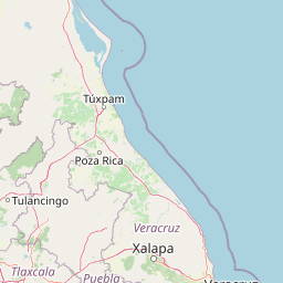
Use this park location map to pinpoint Sistema Arrecifal Lobos-Tuxpan in Mexico, understand its exact geographic position, and read its mapped placement within the surrounding landscape more clearly.

Pigeon | © OpenStreetMap contributors

Location context for Sistema Arrecifal Lobos-Tuxpan

Veracruz

Explore underwater reef formations, sandy cays, and coastal protected habitats

Visualizing Sistema Arrecifal Lobos-Tuxpan Photos and Marine Landscapes

Photographic records illustrate the submerged coral structures and insular cays defining Sistema Arrecifal Lobos-Tuxpan across the Gulf of Mexico continental shelf. Visual exploration reveals the marine topography and transitional habitats that characterize this northernmost regional reef system.

An aerial shot of a small, forested island surrounded by shallow turquoise reef waters and the deep blue ocean, with a white lighthouse standing on the shore.

Park atlas

Compare surrounding Gulf of Mexico reef formations and coastal habitats

Parks Near Sistema Arrecifal Lobos-Tuxpan and Regional Marine Protected Areas

Browse marine reserves, coral reef systems, and coastal protected areas situated near Sistema Arrecifal Lobos-Tuxpan. Comparing adjacent regional geography reveals broader conservation patterns across the western Gulf shoreline.
Protected areaPuebla
About 134 km away#1 closest

Southwest

Zona Protectora Forestal Vedada Cuenca Hidrográfica del Río Necaxa: Mountain Watershed Atlas

Protected Sierra Madre Oriental mountain landscapes and reservoirs

This protected area safeguards the complex upper watershed of the Necaxa River, where dense cloud forests meet engineered reservoirs. Spanning the mountainous border region, the area serves as a key case study in forest conservation, river basin management, and wetland habitat protection within the broader geographic framework of the Sierra Madre Oriental.

Area
421.29 km²
Established
1938
IUCN
VI
Relief
Mountain
National parkMexico
About 178 km away#2 closest

South

Cofre de Perote National Park: A National Park within Mexico's Geographic Atlas

Explore its protected landscape and regional map context.

Cofre de Perote National Park is a vital protected area within Mexico, offering a unique national park designation. This entry focuses on its geographic significance, mapping its boundaries and situating it within the country's broader protected lands. Users can explore the park's landscape identity and its atlas-relevant features, providing a factual basis for understanding its role in Mexico's natural heritage.

Established
1937
IUCN
II
Relief
Mountain
Climate
Alpine
National parkHidalgo
About 183 km away#3 closest

Southwest

El Chico National Park: National Park Boundaries and Regional Geography in Hidalgo

Explore the mapped protected landscape and terrain of this national park.

El Chico National Park is a distinct protected area offering insight into Mexico's regional geography and conservation landscapes. This page details its specific geographic footprint, the character of its natural terrain, and its place within Hidalgo's broader protected areas atlas. Users can examine mapped boundaries and understand the park's unique environmental context.

Area
27.39 km²
Established
1982
IUCN
II
Relief
Mountain
Protected areaVeracruz
About 189 km away#4 closest

South

Cascada de Texolo Protected Landscape: Geographic Profile and Waterfall Map Context

Veracruz highlands forest and ravine ecosystem.

Cascada de Texolo represents a protected forest and stream corridor in the Veracruz highlands of Mexico. Recognized as a Ramsar wetland, the site features a dramatic waterfall dropping into a dense ravine, surrounded by humid montane forest. This map-focused profile examines the landscape structure, stream networks, and the integration of the gorge into the regional geography of Xico and Xalapa.

Established
2006
Relief
Upland
Access
Access unknown
Scope
Terrestrial
National parkMexico
About 206 km away#5 closest

West

Los Mármoles National Park: Detailed Protected Landscape within Mexico's National Park Atlas

Explore the mapped boundaries and regional geography of this unique protected area.

Understand Los Mármoles National Park as a distinct protected landscape, integral to Mexico's atlas of natural areas. This park offers a unique geographic context, with its mapped boundaries providing a clear reference for its protected status. Delve into the regional landscape and discover the importance of this national park for conservation and geographic study.

IUCN
II
Biosphere reserveSan Luis Potosí
About 215 km away#6 closest

Northwest

Sierra del Abra-Tanchipa Biosphere Reserve: Geography and Protected Area Map Context

Rugged sierra terrain in the Huasteca Potosina region of Mexico

Sierra del Abra-Tanchipa forms a continuous block of protected natural territory in eastern San Luis Potosí, featuring steep ridges and limestone-influenced karst topography. As an established biosphere reserve, this area serves as a primary example of conservation within the Huasteca Potosina, preserving an important transition zone of tropical vegetation and complex mountain landforms.

Area
214.64 km²
Established
1994
Scope
Terrestrial
National parkTlaxcala
About 225 km away#7 closest

South

La Malinche National Park: Protected Landscape and Regional Geography in Tlaxcala

Explore mapped boundaries and natural terrain.

La Malinche National Park is a vital protected landscape offering rich insights into regional geography and natural terrain. This canonical entry provides focused details on the park's protected area identity, its mapped geographic scope within Tlaxcala, and its place in the broader atlas of Mexican conservation lands. Understand the specific landscape characteristics and geographic context that define this significant national park.

Established
1938
IUCN
II
Relief
Mountain
Access
Moderate access
National parkMexico
About 229 km away#8 closest

South

Pico de Orizaba National Park: Mexico's Key National Park for Atlas Exploration

Discover mapped boundaries and regional geographic context.

Access detailed atlas information for Pico de Orizaba National Park, a protected natural area in Mexico. This entry focuses on its geographic scope, mapped landscape features, and its significance as a national park within the region. Explore the park's protected boundaries and understand its place in the broader geographical context of Mexico.

IUCN
II

Common questions about visiting, size, designation, and location context for Sistema Arrecifal Lobos-Tuxpan

Sistema Arrecifal Lobos-Tuxpan FAQs for park facts, access, geography, and protected area context

Find quick answers about Sistema Arrecifal Lobos-Tuxpan, including protected-area facts, park geography, trail and visitor context, and how the park fits into its surrounding country and regional landscape.
MoriAtlas Explorer

Continue Your Protected Areas Search Across the Global Atlas

Deepen your exploration by continuing the structured search for national parks and protected areas worldwide. Utilize the comprehensive filtering capabilities to compare different conservation landscapes and refine your understanding of global park geography. Discover more about the distribution and characteristics of protected natural areas.

Global natural geography