
Mori Atlas logo
Protected areaSite naturel protégé de la Boucherette

Mapping the calcareous grasslands, orchid-rich scrubland, and historic quarry terrain of a unique French protected area

Site naturel protégé de la Boucherette: A Protected Limestone Landscape in the Mâconnais Region of Burgundy

The Site naturel protégé de la Boucherette represents a significant protected area within the southern Mâconnais hills of France. Spanning 104 hectares of sun-exposed limestone plateau, this natural space preserves a mosaic of pubescent oak woodlands, box scrubland, and dry calcareous teppe grassland. Visitors and researchers use the site to study diverse wild orchid populations, historical stone-working heritage, and panoramic vistas stretching across the Saône valley toward the Alps.

limestone grasslandpubescent oak woodlandbox scrublandwild orchidspanoramic viewpointcalcareous flora
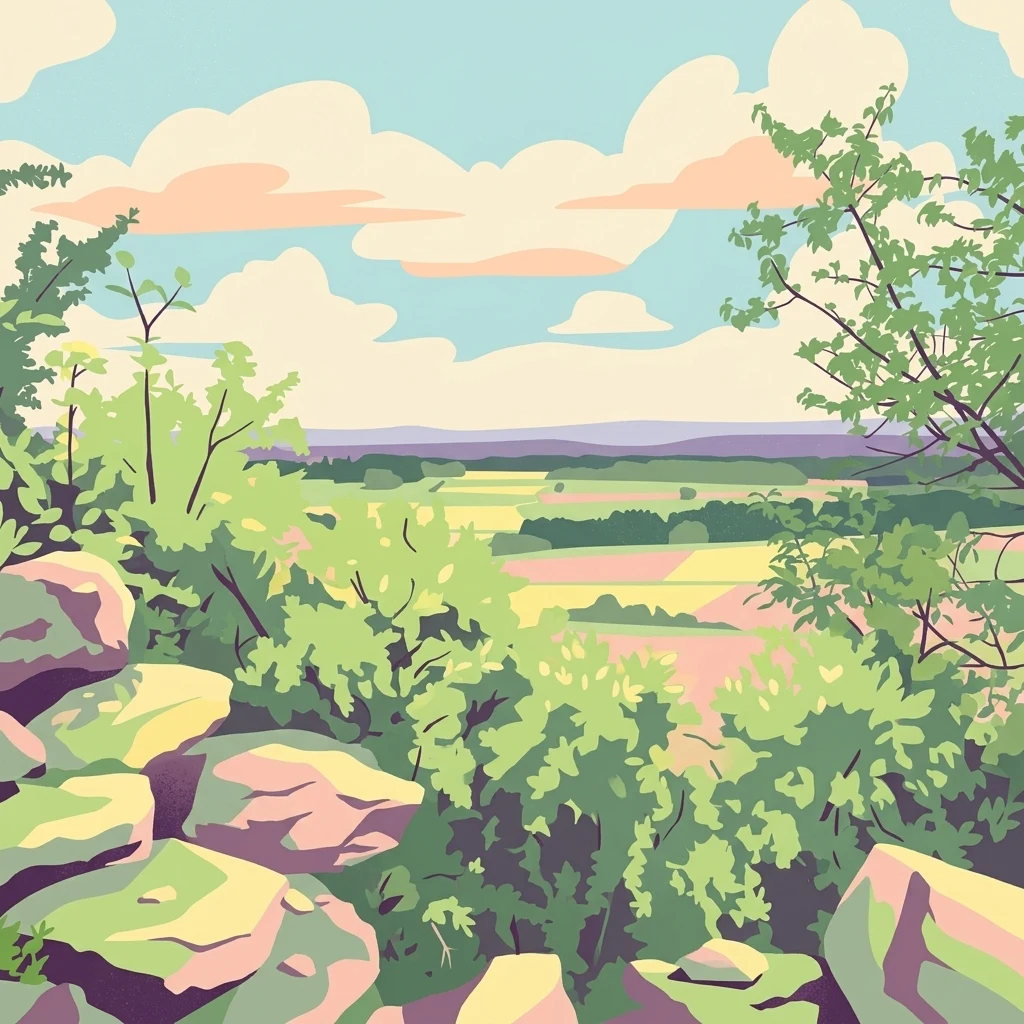
A digital illustration showing a view from rocky terrain with green bushes in the foreground, looking out over a patchwork of fields and forests in the distance under a cloudy sky.

Site naturel protégé de la Boucherette

Protected area

Park overview

Structured park overview, official facts, and landscape profile for Site naturel protégé de la Boucherette

Site naturel protégé de la Boucherette park facts, protected area profile, and essential visitor context

Review the core facts for Site naturel protégé de la Boucherette, including designation, size, terrain, visitor scale, habitats, and operating context in one park-focused overview.

About Site naturel protégé de la Boucherette

The Site naturel protégé de la Boucherette is a small but carefully curated protected natural area in southern Burgundy. Set on the south-facing flank of the Charvençon wood near the village of Lugny, it preserves a snapshot of the traditional landscape of the Haut-Mâconnais: warm, dry, calcareous terrain where Mediterranean-flavoured plants mingle with more temperate woodland species. The site spans 104 hectares across the communes of Lugny and, since a 2016 boundary adjustment, Cruzille.

Its identity is shaped by the combination of geology and historical land use. The plateau above the site is formed of Jurassic limestone, and the slope faces south toward the Saône valley, creating the hot, dry microclimate that supports its special flora. The land was once planted in vines until the phylloxera epidemic of the 1880s forced its abandonment, after which it served as communal pasture for many decades. The trail now traces history as well as ecology: it passes an old "lavière" where flat limestone slabs were quarried for roofing tiles, plus an eighteenth-century quarry that supplied stone for the cooperative winery buildings of Lugny in the 1920s.

Since its inauguration in 2000, the site has been developed as a botanical and educational trail managed by the Conservatoire d'espaces naturels de Bourgogne. A roughly one-kilometre loop leads through pubescent oak woodland, past the calcareous "teppe" grassland, up to a panoramic belvedère at about 319 metres marked by an old granite IGN geodetic point. On clear days the view extends from the foothills of the Massif Central and the Mâconnais mountains across the Saône valley toward the Alps, taking in the vineyards of Lugny, the villages of Collongette and Vermillat, the hilltop village of Burgy, and the valley of the river Ail. New interpretive signage installed by the Conservatoire at the end of 2020 reorganised the walk around the site's main habitats, from sun-baked limestone ledges to open forest edges and dense oak groves.

Quick facts and research context for Site naturel protégé de la Boucherette

The Boucherette site lies in the Haut-Mâconnais on the territory of Lugny, Saône-et-Loire, in the Bourgogne-Franche-Comté region of eastern France. It covers 104 hectares on a south-facing slope at the edge of the Charvençon wood, above the vineyards of the Lugny appellation and the Saône valley.

Originally classified in the mid-1980s as a ZNIEFF type I under the name "Bois et pelouses de Charvençon" (regional reference 00083312), the protected area was formally inaugurated on 3 June 2000 after three years of trail-building work. In 2016, its boundaries were adjusted to extend northwest into the neighbouring commune of Cruzille. The site is one of eight natural areas in Saône-et-Loire managed by the Conservatoire d'espaces naturels de Bourgogne (CENB), and it attracts an average of more than 1,000 visitors each year.

Protection and recognition

Documented terrestrial conservation scope and official designation records

Site naturel protégé de la Boucherette Protection Status and Boundaries

Site naturel protégé de la Boucherette maintains a documented terrestrial protection scope without supplementary international recognition sources. Official conservation records outline the established management framework and administrative boundaries for this protected area.

Protection details

Protection scope
Terrestrial
Transboundary protection
No
Park context

Deeper park guide and search-rich context for Site naturel protégé de la Boucherette

Site naturel protégé de la Boucherette history, landscape, wildlife, and travel context

Explore Site naturel protégé de la Boucherette through its history, landscape character, ecosystems, wildlife, conservation priorities, cultural context, and seasonal travel timing in a structured park guide built for atlas discovery and search intent.

Why Site naturel protégé de la Boucherette stands out

The Boucherette stands out above all for its remarkable diversity of wild orchids. About a dozen species of Orchis (including military, purple, pyramidal, and gnat orchids) and Ophrys (including fly and bumblebee orchids) bloom across its calcareous grassland in May and June, making it a small but rich destination for botanical visitors. It is equally recognised for its classic dry-limestone habitats: pubescent oak woodland, box-dominated scrubland, and the open "teppe" grassland that forms the heart of the site. These warm, sun-exposed limestone communities host other southern-leaning species such as the Italian catchfly, bloody geranium, and protected regional plants like the scorpion orchid and the emerus coronilla. The site is a compact but high-quality example of the calcareous flora that marks the transition between the Mâconnais hills and the Saône valley.
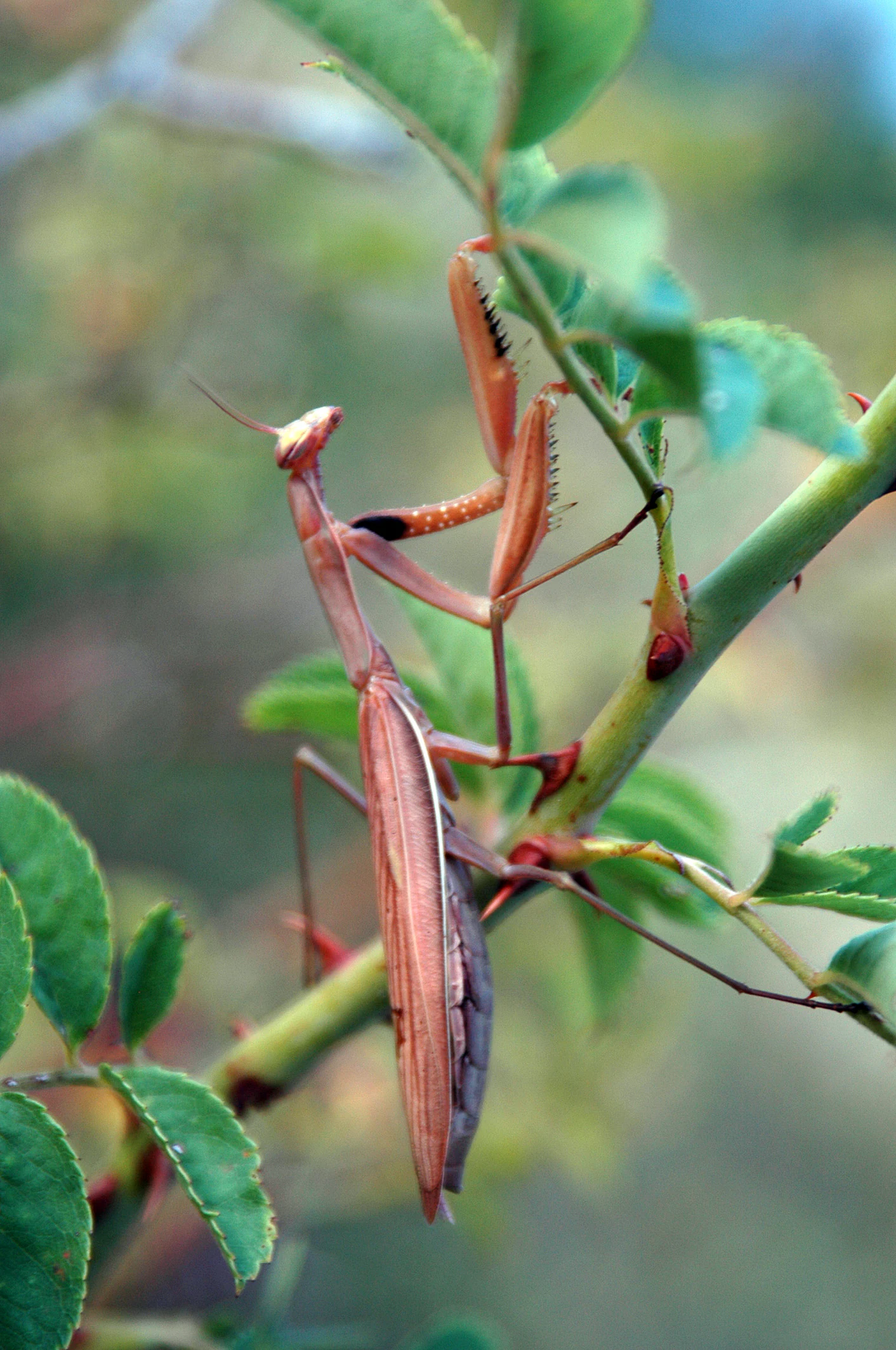
A brown praying mantis hanging upside down on a green thorny plant stem with leaves.
A praying mantis perched on a thorny green stem in the Boucherette protected natural site.

Site naturel protégé de la Boucherette history and protected-area timeline

The Boucherette's protected status is the product of two parallel stories: a scientific survey of the region's natural riches in the 1980s, and a long-running community effort to make those riches accessible to the public.

In 1982, the French Ministry of the Environment asked scientists to identify outstanding natural areas across the country. The Société d'histoire naturelle d'Autun took responsibility for the Haut-Mâconnais and Tournugeois, and highlighted several places of interest. Among them was the "Bois et pelouses de Charvençon" on Lugny, which became a ZNIEFF type I (a natural zone of ecological, faunistic and floristic interest) under regional reference 00083312. This listing marked the formal recognition of the site's botanical importance.

The drive to create a public trail began in 1996, after a site visit by Loïc Gasser, a botanist and ornithologist working for the Conseil général de Saône-et-Loire. Over 1999 and early 2000, volunteers and employees of the former communauté de communes du Haut-Mâconnais cleared box scrub, defined the path, cut a panoramic viewpoint, built an access barrier, and installed interpretation panels. The site was inaugurated on 3 June 2000 and has been managed since then by what is now the Conservatoire d'espaces naturels de Bourgogne. Renée Conry, a natural sciences teacher at the collège Victor Hugo in Lugny and long-time member of the Conservatoire, served for many years as voluntary site manager; her husband Daniel Conry continues in that role. In 2010 the Boucherette was selected as one of thirty-two sites in the regional "Découvertes nature en Bourgogne" network, and in 2016 the protected area was expanded northwest onto neighbouring Cruzille, taking the new name "Bois et pelouses de Charvençon, roche Sainte-Geneviève et barres de Sagy".

Site naturel protégé de la Boucherette landscape and geographic character

The landscape of the Boucherette is shaped by the geology of the southern Mâconnais hills and by long centuries of rural use. The site occupies the south-facing flank of a limestone plateau, where Jurassic rocks have been carved by erosion into a valley running down toward the Saône. The slope's exposure to the sun, combined with the thin, well-drained calcareous soils, produces the warm, arid conditions that favour its specialised flora.

Three broad habitats define the terrain. The open "teppe" is a dry calcareous grassland, once pastures and now actively maintained to prevent scrub encroachment through horse and donkey grazing and seasonal mowing. Above and around it, a belt of box (buis) scrubland gives way to a pubescent oak woodland dominated by Quercus pubescens, with scattered maples, ashes, birches, hazels, cherries, and other broadleaf species. Among the trees are also a handful of more exotic introductions, including atlas cedar and several pine species, remnants of earlier planting.

The trail also reveals the human fingerprint on the landscape. An ancient quarry, opened in the mid-eighteenth century and worked again in the 1920s for the cooperative winery at Lugny, has left a stone worked amphitheatre in the hillside. Nearby, an old "lavière", a flat stone quarry, testifies to the eighteenth- and nineteenth-century extraction of roofing slabs. At the top of the circuit, a belvedère standing at about 319 metres, marked by a granite geodetic pillar set between 1943 and 1945, opens up a wide panorama over the Mâconnais vineyards, the Saône valley, the Bresse, and on clear days the distant Alps.
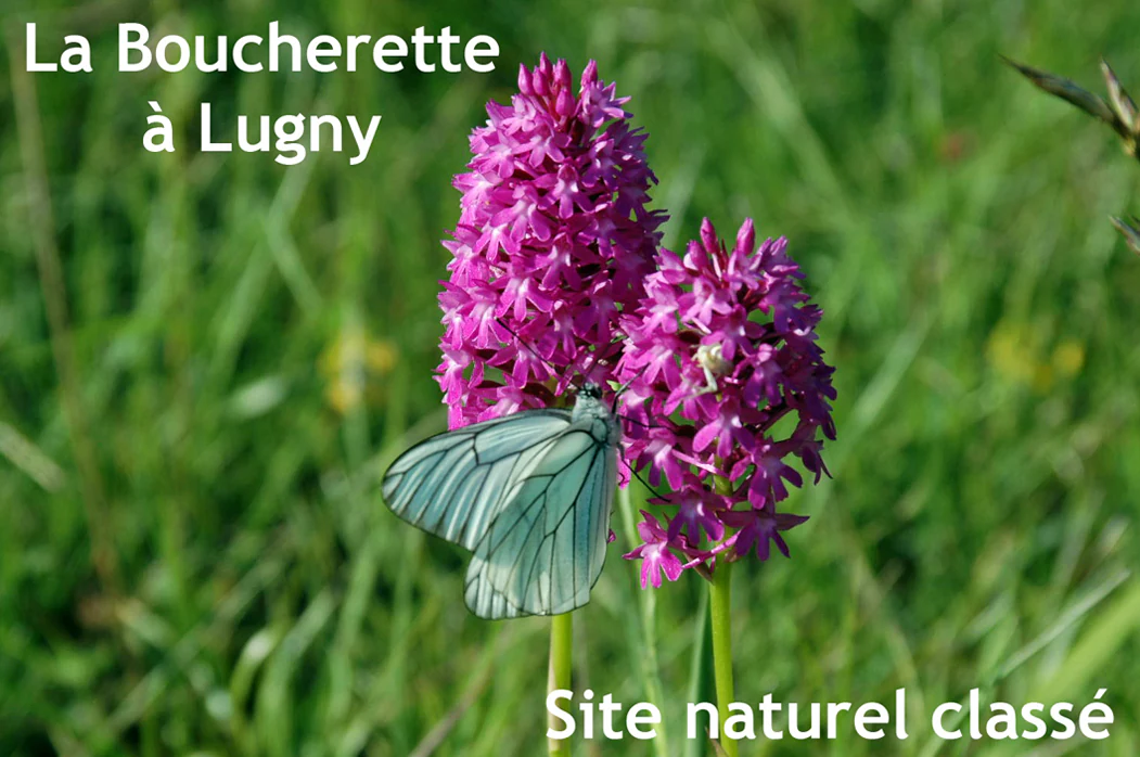
Close-up photograph of pink-purple orchid flowers with a white butterfly resting on them, set against a blurred green grassy background, with French text reading 'La Boucherette à Lugny' and 'Site naturel classé'
Pink orchid with a white butterfly at La Boucherette protected natural site in Lugny

Site naturel protégé de la Boucherette ecosystems, habitats, and plant life

Ecologically, the Boucherette is a textbook example of calcareous habitat zonation in southern Burgundy. The combination of rock type, slope aspect, and historical management has produced a mosaic in which very different communities sit side by side.

The driest, sunniest exposures support a thin Mediterranean-influenced vegetation of Italian catchfly (Silene italica), wild pink (Dianthus sylvestris), limodore (Limodorum abortivum), and other warmth-loving herbs. The open "teppe" grassland is home to the site's celebrated orchids, with about a dozen species of Orchis and Ophrys flowering each May and June, alongside a much broader catalogue of calcareous grassland plants. Box scrub, while affected in recent years by the box-tree moth (Cydalima perspectalis), remains visually dominant on many slopes and provides the characteristic "lande à buis" structure associated with the Mâconnais hills.

Beneath the box and on the more shaded slopes, the pubescent oak woodland creates a cooler, shadier microclimate. Here the bloody geranium (Geranium sanguineum), the beautiful phalangère (Anthericum liliago), the emerus coronilla, and protected regional plants such as the limodore mark the forest edges and clearings. The site also preserves older landmarks such as orchard trees gone wild (apple, pear, cherry-plum) and a striking variety of shrubs including spindle, wayfaring viburnum, dogwood, barberry, privet, and common juniper, giving the woodland an unusually rich understorey.
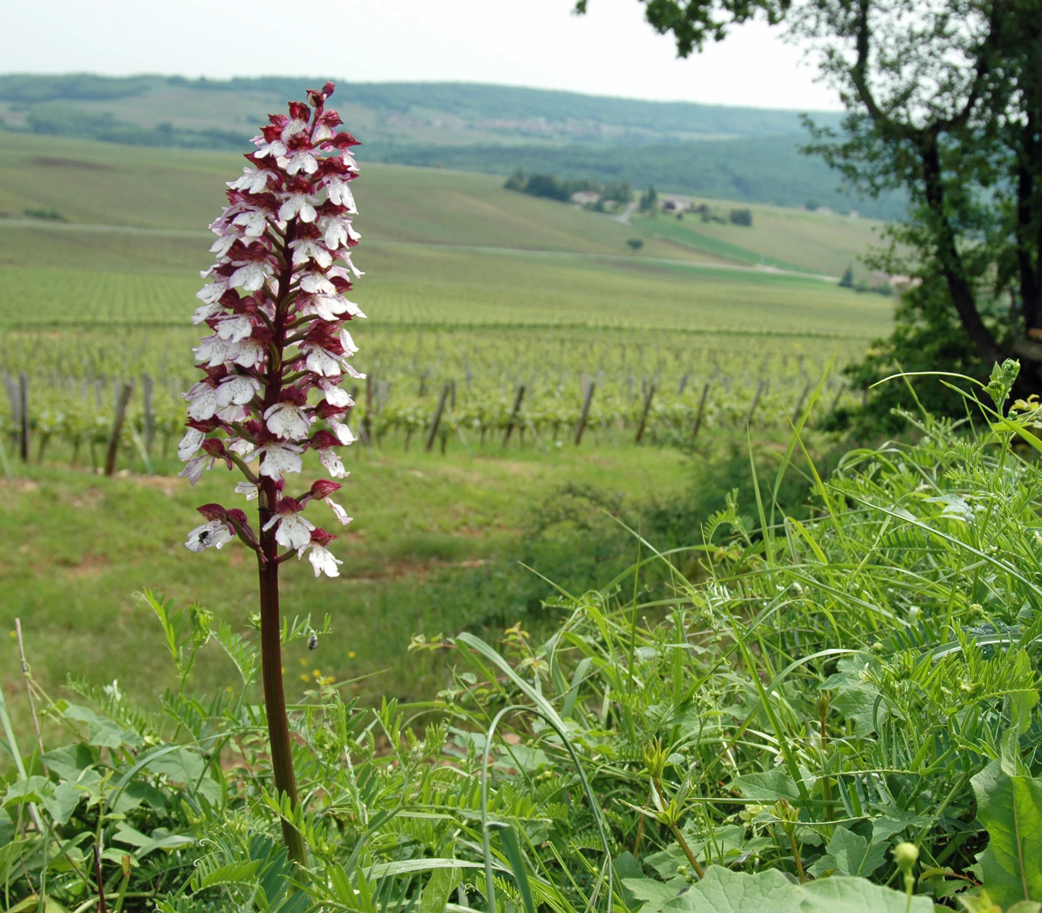
A tall orchid plant with white and deep red flowers growing in green grass, with a vineyard and rolling hills visible in the background.
A wild orchid with white and maroon blooms stands in a grassy field overlooking vineyard rows and rolling hills.

Site naturel protégé de la Boucherette wildlife and species highlights

The Boucherette supports a fauna typical of warm, dry limestone habitats in southern Burgundy. Reptiles are particularly characteristic: the European green lizard (Lacerta bilineata, sometimes called the two-striped lizard) finds reliable refuge on the sun-exposed ledges and rocky outcrops, along with other small reptiles drawn to the warm microclimate.

Insects are a strong presence. The praying mantis (Mantis religiosa) is regularly recorded on the site, and historically this location marked the northern limit of the range of the small mountain cicada (Cicadetta montana) in the region, although recent warming has pushed that limit further north and replaced it with the more common cicada (Cicada orni). The site's wild orchids also support the pollinator communities on which the area's botanical richness depends.

Birds are described as a major feature of the site, with a diverse community in the woodland, scrub, and open grassland mosaic. To prevent the open "teppe" from closing up into scrub, the site has been divided into five parcels that are managed with the help of pastured horses and donkeys, an approach that also benefits grassland invertebrates and the birdlife that depends on them. Although detailed bird species lists are not the focus of the source material, the mosaic landscape is described as exceptionally rich for birdwatching.
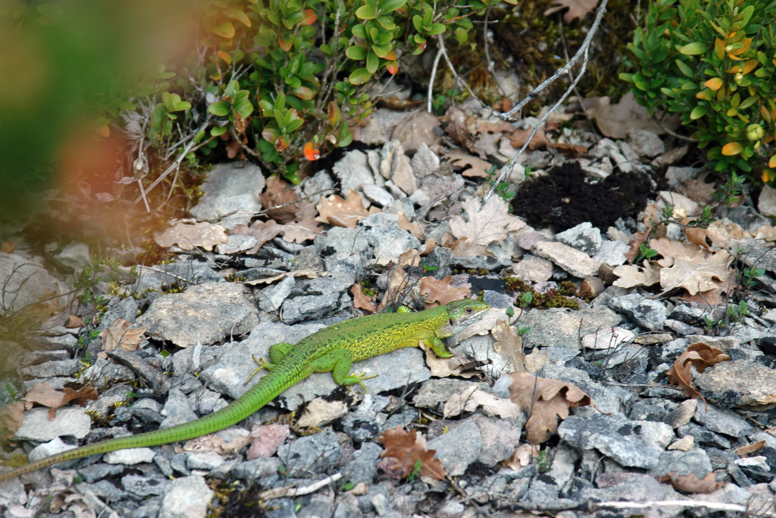
A bright green lizard walking across grey rocks and dry brown leaves with green bushes in the background.
A green lizard resting on rocky ground among dry leaves and shrubs at the Site naturel protégé de la Boucherette.

Site naturel protégé de la Boucherette conservation status and protection priorities

The Boucherette matters to conservation in Burgundy because it preserves a coherent example of the dry-limestone habitats that were once common across the Mâconnais and Tournugeois but have been heavily reduced by agricultural change, quarrying, and scrub encroachment. Its calcareous grasslands, box scrub, and pubescent oak woodland support a set of regionally protected species, including the limodore and the emerus coronilla, both protected in Burgundy, as well as a remarkable concentration of wild orchids.

The site sits inside a broader French framework of natural-area protection. In the mid-1980s it was identified as a ZNIEFF type I ("Bois et pelouses de Charvençon"), a designation aimed at gathering exhaustive knowledge of natural spaces whose value lies in ecological balance, ecosystem richness, or the presence of rare and threatened species. The site is one of eight in Saône-et-Loire managed by the Conservatoire d'espaces naturels de Bourgogne, which carries out regular flora surveys at fixed locations to track long-term change.

Active management at the Boucherette addresses the main threat to its conservation value: the natural tendency of open calcareous grassland to revert to woodland. Volunteer work combined with the use of pastured horses and donkeys keeps the "teppe" open, while periodic scrub clearance, including the removal of encroaching box, maintains the mosaic of habitats. At the same time, the site is grappling with the unintended effects of recent environmental change: the box-tree moth is modifying the appearance of the box populations, and climate warming has shifted the range of mountain cicadas northward. These pressures make the long-term monitoring carried out by the Conservatoire especially important.

Site naturel protégé de la Boucherette cultural meaning and human context

The Boucherette is closely bound to the identity of the Haut-Mâconnais and to the commune of Lugny. Its name has become a local cultural marker: one of the streets serving the hamlet of Collongette is called rue de La Boucherette, underlining the site's integration into village life.

The land itself carries a deep rural history. Planted in vines until the phylloxera crisis of the 1880s forced its abandonment, it then served for many decades as a communal pasture. The old stone quarry, opened in the mid-eighteenth century and worked again in the 1920s to supply the cave coopérative de Lugny, ties the site to the broader story of Mâconnais wine and building traditions. The collaborative conservation effort, led by local teachers, volunteers, and successive intercommunal structures (the former communautés de communes du Haut-Mâconnais, then du Mâconnais-Val de Saône, and now du Mâconnais-Tournugeois), reflects a strong culture of citizen science and local stewardship in the region.

In 2010, the Boucherette was selected to join the regional "Découvertes nature en Bourgogne" network, and it sits within the Pays d'art et d'histoire "Entre Cluny et Tournus", a label that links natural and cultural heritage across the southern Saône-et-Loire. The site thus serves not only as a refuge for calcareous flora but also as a small but recognisable element of Mâconnais territorial identity.

Top sights and standout views in Site naturel protégé de la Boucherette

The Boucherette's most distinctive highlight is its orchid-rich calcareous grassland, where roughly a dozen species of Orchis and Ophrys flower in late spring, making it one of the most rewarding small botanical sites in the Mâconnais.

Equally memorable is the panoramic belvedère at about 319 metres, offering a wide view over the vineyards of Lugny, the Saône valley, the Bresse, and, on clear days, the distant Alps. The trail's quiet rewards include a working dry limestone quarry, an ancient roof-stone "lavière", and a mosaic of pubescent oak woodland, box scrubland, and open "teppe" grassland that captures the essence of the south-Burgundy calcareous landscape.

Best time to visit Site naturel protégé de la Boucherette

The most rewarding time to visit the Boucherette is late spring, particularly May and June, when the calcareous grassland comes alive with the flowering of about a dozen orchid species including military, purple, pyramidal, and gnat orchids, alongside several Ophrys species. This is also when many of the other key Mediterranean-flavoured plants, such as the Italian catchfly and certain woodland-edge herbs, are at their most visible.

In summer, the open "teppe" remains interesting for insects and reptiles, including the green lizard, while the panoramic belvedère is at its most atmospheric in clear weather, when the views across the Saône valley and toward the Alps are most expansive. Autumn brings fruiting shrubs and a different palette of colours in the oak woodland. Whatever the season, light rain-friendly footwear is advisable on parts of the trail, and the main circuit is best explored on foot from the village of Lugny.
Monthly climate preview

Long-term representative point measurements tracking monthly temperature and precipitation patterns

Site naturel protégé de la Boucherette Climate Normals and Annual Temperature Rhythm

Historical climate data for Site naturel protégé de la Boucherette records long-term monthly temperature variations alongside recorded precipitation averages from 1991 to 2020. Examining the complete twelve-month normals provides deeper analytical context on annual meteorological patterns across the representative coordinate point.
Annual mean11 °C
2 °C21 °C
Jan
Feb
Mar
Apr10°
May14°
Jun18°
Jul21°
Aug21°
Sep16°
Oct12°
Nov
Dec
Warmest month
July

20.9 °C

Coolest month
January

1.8 °C

Wettest month
November

3.1 mm/day

Driest month
March

1.9 mm/day

Park location guide

Geography guide, regional context, and park location map for Site naturel protégé de la Boucherette

Site naturel protégé de la Boucherette park geography, regions, and map view in France

Understand where Site naturel protégé de la Boucherette sits in France through a broader geographic reading of the surrounding landscape, nearby location context, and its mapped position within the national park landscape.

How Site naturel protégé de la Boucherette fits into France

France is a unitary semi-presidential republic and one of the world's largest economies. It borders Belgium, Luxembourg, Germany, Switzerland, Italy, Monaco, Andorra, and Spain, with a maritime border to the United Kingdom. The country is known for its cultural influence, art, cuisine, and political history spanning centuries.

Wider geography shaping Site naturel protégé de la Boucherette in France

France is located in Western Europe. Metropolitan France extends from the Rhine to the Atlantic Ocean and from the Mediterranean Sea to the English Channel and North Sea. The country borders Belgium, Luxembourg, Germany, Switzerland, Italy, Monaco, Andorra, Spain, and has a maritime border with the United Kingdom.

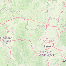
Map view of Site naturel protégé de la Boucherette

Use this park location map to pinpoint Site naturel protégé de la Boucherette in France, understand its exact geographic position, and read its mapped placement within the surrounding landscape more clearly.

Pigeon | © OpenStreetMap contributors

Visualizing calcareous grassland, box scrubland, and protected habitats

Site naturel protégé de la Boucherette Photos and Landscape Scenery

Photographic records reveal the distinct limestone terrain, rare wild orchids, and varied habitats that define Site naturel protégé de la Boucherette. Visual documentation offers clear insight into the protected landscape, panoramic viewpoints, and regional vegetation found across the Burgundy reserve.

A brown praying mantis hanging upside down on a green thorny plant stem with leaves.

A landscape view from a rocky outcrop with green bushes in the foreground, looking out over a valley of fields and vineyards under a blue sky with white clouds.

Close-up photograph of pink-purple orchid flowers with a white butterfly resting on them, set against a blurred green grassy background, with French text reading 'La Boucherette à Lugny' and 'Site naturel classé'

A tall orchid plant with white and deep red flowers growing in green grass, with a vineyard and rolling hills visible in the background.

A bright green lizard walking across grey rocks and dry brown leaves with green bushes in the background.

An informational sign mounted on a wooden post in a grassy wooded area, displaying illustrations and French text descriptions of various wild orchid species under the heading 'Au royaume des orchidées'.

Park atlas

Compare regional calcareous landscapes and connected natural habitats across Burgundy

Parks Near Site naturel protégé de la Boucherette and Surrounding Protected Areas

Visitors exploring Site naturel protégé de la Boucherette can browse other protected areas within the surrounding regional network. Evaluating adjacent limestone habitats and woodland reserves provides broader geographic context for regional conservation terrain.
A soft, panoramic watercolor illustration of rolling hills, mountains, and trees in pastel shades of green, yellow, and pink.
Nature reserveAuvergne-Rhône-Alpes
About 58 km away#1 closest

Southeast

Réserve naturelle nationale de la grotte de Hautecourt: Jura Mountain Cave Geography

Protected subterranean landscapes in the Ain department of France.

This nature reserve protects a complex underground environment characterized by a vertical 36-meter cave system and rich invertebrate biodiversity. Located on the flank of Mont Rosset in the Auvergne-Rhône-Alpes region, the area provides a crucial habitat that balances delicate subterranean passages with surface limestone ridges and dry grassland ecosystems.

Area
0.102 km²
Established
1980
IUCN
IV
Nature reserveBourgogne-Franche-Comté
About 58 km away#2 closest

East

Réserve naturelle nationale de la grotte de Gravelle: Underground Protected Nature Reserve

A limestone cave sanctuary in the Bourgogne-Franche-Comté region

This protected area represents a specialized subterranean habitat in the French Jura, preserving essential maternity and hibernation roosts for eleven bat species. The reserve, set within forested limestone cliffs, remains a key node in the regional network of protected underground sites, emphasizing the conservation of fragile environments.

Area
0.014 km²
Established
1992
IUCN
IV
Relief
Upland
A soft watercolor illustration depicting rolling green hills, gentle slopes, and small clusters of trees against a light, neutral background.
Nature reserveBourgogne-Franche-Comté
About 59 km away#3 closest

East

Réserve naturelle régionale de la côte de Mancy: Protected Landscapes and Geography

Limestone escarpments and calcareous grasslands in eastern France

Delve into the geography of Réserve naturelle régionale de la côte de Mancy, a 49-hectare nature reserve in the Jura department. This site features Jurassic limestone cliffs, thin calcareous soils, and scrubby woodlands, documenting a rich intersection of habitats that preserve rare reptiles and diverse butterfly populations within the Revermont.

Area
0.492 km²
Established
2010
IUCN
IV
Relief
Upland
Nature reserveAuvergne-Rhône-Alpes
About 71 km away#4 closest

East

Réserve naturelle régionale du récif fossile de Marchon - Christian Gourrat Geological Site

A protected Jurassic fossil reef in the Auvergne-Rhône-Alpes region

Located in the Ain department, this small nature reserve is scientifically renowned for its Kimmeridgian reef outcrop. The site protects a fossilized coral and rudist assemblage within the forêt de Marchon, offering a quiet, forested setting for studying France's ancient marine geological history.

Area
0.001 km²
Established
2015
IUCN
IV
Scope
Terrestrial
Wildlife reserveBourgogne-Franche-Comté
About 78 km away#5 closest

East

Tourbières et lacs de la montagne jurassienne: Mapping High-Altitude Wetlands and Glacial Landscapes

A vast protected wildlife reserve in the Bourgogne-Franche-Comté region

Covering more than 12,000 hectares, this wildlife reserve forms a crucial conservation benchmark for peatland and glacial lake systems in the Jura Massif. The landscape encompasses deep combes, broad plateaus, and clear-water basins like Lac de Saint-Point, providing a vital habitat mosaic for diverse flora and fauna across the French highlands.

Area
121.56 km²
Established
2021
Relief
Mountain
Climate
Temperate
A horizontal watercolor painting depicting a soft, impressionistic landscape with rolling green hills, pale yellow fields, and a sparse line of trees against a white background.
Nature reserveBourgogne-Franche-Comté
About 80 km away#6 closest

Northeast

Réserve naturelle régionale des grottes de la côte de la Baume, Jura Regional Nature Reserve

Karst caves and cliff-slope forest geography in France

Located in the Bourgogne-Franche-Comté region, this nature reserve protects a vital network of karst caves and unmanaged scree-slope ash forests. The site represents a specialized conservation effort centered on cliff-side habitats and underground sanctuaries within the Jura limestone landscape.

Area
0.054 km²
Established
2017
IUCN
IV
Relief
Upland
A horizontal watercolor painting depicting a soft, layered landscape with distant hills, gentle slopes, and clusters of evergreen trees in shades of green and purple.
Nature reserveBourgogne-Franche-Comté
About 80 km away#7 closest

East

Réserve naturelle régionale des tourbières du bief du Nanchez: Protected Jura Mountain Peatlands

Mapping bog systems and wet grassland geography in Eastern France

Located in the Jura department, this regional nature reserve preserves forty-nine hectares of vital peatland, including diverse mire communities and forested slopes. The site provides a critical look at montane landscape restoration, documenting significant bog flora and complex hydrological patterns along the Combe du Nanchez valley floor.

Area
0.488 km²
Established
2021
IUCN
IV
Relief
Upland
Nature reserveAuvergne-Rhône-Alpes
About 81 km away#8 closest

South

Réserve naturelle régionale de la mine du Verdy: A Subterranean Protected Area in France

Mapping the ecological geography of the Monts du Lyonnais.

The Réserve naturelle régionale de la mine du Verdy stands as France's smallest nature reserve, protecting an intricate network of abandoned mining galleries beneath the surface of the Monts du Lyonnais. This site serves as a crucial underground sanctuary for diverse bat species and cave-dwelling invertebrates, showcasing how repurposed industrial landscapes can harbor significant biodiversity within the Auvergne-Rhône-Alpes region.

Area
0.001 km²
Established
1990
IUCN
IV
Relief
Upland

Common questions about visiting, size, designation, and location context for Site naturel protégé de la Boucherette

Site naturel protégé de la Boucherette FAQs for park facts, access, geography, and protected area context

Find quick answers about Site naturel protégé de la Boucherette, including protected-area facts, park geography, trail and visitor context, and how the park fits into its surrounding country and regional landscape.
MoriAtlas Explorer

Continue Your Protected Areas Search Across the Global Atlas

Deepen your exploration by continuing the structured search for national parks and protected areas worldwide. Utilize the comprehensive filtering capabilities to compare different conservation landscapes and refine your understanding of global park geography. Discover more about the distribution and characteristics of protected natural areas.

Global natural geography