
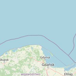
Lakes
Park geography
A comprehensive analysis of the topography, elevation, and coastal environment in Pomeranian Voivodeship
Slovincian National Park: Detailed Geographic Profile, Mapped Boundaries, and Natural Landscapes
Examine the physical characteristics of Slovincian National Park, a lowland area covering 186.18 square kilometers within the Pomeranian Voivodeship of Poland. This profile covers the park boundary span, elevation range from sea level to 115 meters, and integrated landscape features including coastal dunes, wetlands, and major lakes.

Poland's moving dunes and coastal wetlands on the Baltic
Slovincian National Park
Slovincian National Park is a protected area in the Pomeranian Voivodeship of northern Poland, situated along the Baltic coast between the towns of Łeba and Rowy. The park encompasses a distinctive landscape of moving sand dunes, coastal lakes, wetlands, and pine forests that together form one of Poland's most ecologically significant coastal ecosystems. Originally conceived in 1946, the park was formally established in 1967 and later expanded to cover over 327 square kilometers, including coastal waters of the Baltic Sea. The park's defining feature is its system of moving sand dunes, some reaching heights of 30 meters, which slowly migrate inland at rates of 3 to 10 meters per year. These dynamic dunes have separated what were once coastal bays from the sea, creating the characteristic chain of lagoon-like lakes that define the park's hydrology. The park protects approximately 32.5 kilometers of coastline and contains several large shallow lakes, including Łebsko and Gardno, which together with surrounding marshes and peat bogs form an extensive wetland complex. Slovincian National Park holds significant international conservation designations, including UNESCO biosphere reserve status since 1977 and recognition as a Ramsar Wetland of International Importance since 1995. The park is named after the Slovincians, a West Slavic people who historically inhabited this remote marshy region at the edge of Lake Łebsko, preserving cultural heritage connected to the landscape.
- Location
- Poland
- Park type
- National park
- Established
- 1967
- Area
- 186.2 km²
- Highest point
- 115 m
Location overview
Coastal Protected Area Classification in Pomeranian Voivodeship
Slovincian National Park: Mapping and Geographic Setting in Poland
Slovincian National Park is situated within the Pomeranian Voivodeship of Poland. It is classified as a coastal protected area and operates entirely under a single national jurisdiction.
- Countries
- Poland
- Regions
- Pomeranian Voivodeship
- Primary location
- Pomeranian Voivodeship
- Geographic setting
- Coastal
Boundary and coordinates
Slovincian maps 186.18 km² overall with a 32.5 km perimeter
Slovincian National Park mapped boundary, area, and perimeter
Slovincian National Park's stored geometry traces its mapped protected footprint. The database separately reports 186.18 km² overall, 84.05 km² of land, and a 32.5 km perimeter without reconciling the area figures.
- Boundary area
- 323.2 km²
- Boundary perimeter
- 32.5 km
- Northernmost point
- 54.7975° N
- Southernmost point
- 54.6239° N
- Easternmost point
- 17.5468° E
- Westernmost point
- 17.0531° E
- Geographic centre
- 54.7141° N, 17.3072° E
- North–south span
- 19.3 km
- East–west span
- 31.8 km
Elevation and terrain
Lowland relief spans and recorded natural feature attributes
Slovincian National Park Terrain and Elevation Profile
Recorded park elevation ranges span from zero to one hundred fifteen meters across lowland terrain classifications. Associated feature cards detail named natural landforms, water bodies, and viewpoints located within the protected boundary.
- Minimum elevation
- 0 m
- Maximum elevation
- 115 m
- Highest point
- 115 m
Selected named natural features
Lakes
Łebsko Lake
Lakes
Jezioro Dołgie Wielkie
Dunes
Madwiny
Peaks
Lączka Dune
30 m
Viewpoints
Czołpino Lighthouse
25.2 m high
Environmental setting
Temperate lowland terrain featuring coastal dunes, wetlands, and major water systems
Slovincian National Park Environmental Setting and Landscape Classifications
Recorded landscape features and habitat types provide complementary perspectives on the physical setting of Slovincian National Park. Associated environmental classifications link directly to relevant atlas destinations across the protected area.
- Relief
- Lowland
- Climate
- Temperate
- Water
- Major water bodies
- Forest cover
- Sparse forest
- Seasonality
- Year-round
Landscape features
Coast · Beach · Dunes · Lakes · Rivers · Wetland · Bog
Habitat types
Temperate coniferous forest · Peatland · Wetland · Coastal habitat
Park atlas
Trace the Regional Spread of Coastal Dunes, Wetlands, and Forest Reserves Across Northern Poland
Discover More Protected Areas and National Parks Near Slovincian National Park in Coastal Poland
Browse national parks and protected areas located near Slovincian National Park, enabling comparative exploration of similar coastal dunes, extensive wetlands, and rich pine forest ecosystems. This curated atlas view offers essential geographic context for understanding regional conservation efforts and tracing the spread of protected landscapes across Poland's Baltic coast.
National parkPomorskie Voivodeship
Park boundaries overlap#1 closest
Northwest

Słowiński Park Narodowy: Mapping the Baltic Sand Dunes and Wetland Geography
Coastal landscapes of the Polish Pomorskie region
Słowiński Park Narodowy protects a vital mosaic of moving sand dunes, raised bogs, and coastal lakes along the Baltic shoreline. This atlas entry focuses on the physical landscape dynamics of the Gardno-Łeba lowland, highlighting the interaction between dune belts, water bodies, and coastal forest habitats within the Pomorskie Voivodeship.
- Area
- 327.44 km²
- Established
- 1967
- Visitors
- 319K annual
- Relief
- Lowland
Nature reservePomeranian Voivodeship
About 8.4 km away#2 closest
East
Mierzeja Sarbska Nature Reserve: Protected Coastal Dunes and Barrier Landscape Mapping
Coastal geography within the Pomeranian Voivodeship
Mierzeja Sarbska Nature Reserve preserves a significant sandy barrier along the Baltic coast of northern Poland. The site features active parabolic dunes, interdunal deflation hollows, and unique relict wetland plant communities that provide critical insight into the regional landscape evolution of the Pomeranian Voivodeship.
- Area
- 5.47 km²
- Established
- 1976
- Relief
- Lowland
- Water
- Major water bodies
Nature reservePomeranian Voivodeship
About 20 km away#3 closest
Southwest
Rezerwat przyrody Jezioro Modła: Wetland Geography and Protected Coastal Habitat
Nature reserve mapping in Pomeranian Voivodeship, Poland
Focusing on a shallow coastal lake and its surrounding marshland ecosystem, Rezerwat przyrody Jezioro Modła provides vital breeding habitats for waterbirds. The reserve represents a core component of the Pomeranian shoreline, where shifting lake boundaries and dense vegetation define the terrain, highlighting the ecological significance of this protected region.
- Area
- 1.948 km²
- Established
- 1982
- Relief
- Lowland
- Climate
- Temperate
Nature reservePomeranian Voivodeship
About 26 km away#4 closest
East
Rezerwat przyrody Długosz Królewski w Łęczynie: Botanical Protected Area in Pomerania
Floristic nature reserve focused on royal fern conservation
Located in the heart of the Puszcza Wierzchucińska, this nature reserve is a critical site for the study and conservation of Osmunda regalis. The surrounding terrain of damp, peat-influenced woodland defines the unique character of this small, specialized protected area in northern Poland.
- Area
- 0.02 km²
- Established
- 1977
- Scope
- Terrestrial
- Water
- Minor water
Nature reservePomeranian Voivodeship
About 32 km away#5 closest
East
Długosz Królewski w Wierzchucinie: Mapping a Protected Floristic Peatland Reserve in Pomerania
Floristic nature reserve and bog ecosystem in northern Poland
This protected area in Gmina Krokowa preserves critical peatland habitats, including rare stands of royal fern and interrupted clubmoss. Its geography captures the history of the Wierzchucińska Forest, showcasing a complex environment of moist woodlands and bog mosaics characteristic of the Baltic coastal landscape in Poland.
- Area
- 1.482 km²
- Established
- 2003
- Relief
- Lowland
- Climate
- Temperate
Nature reservePomeranian Voivodeship
About 43 km away#6 closest
Southeast
Rezerwat przyrody Jezioro Turzycowe: Wetland Protected Area in Pomeranian Voivodeship
Kashubian Lake District bog forest and dystrophic lake atlas
Rezerwat przyrody Jezioro Turzycowe protects a concentrated mosaic of post-glacial wetland environments, including a dystrophic lake and raised bog habitats. This nature reserve offers deep insight into the specific hydrological and botanical conditions defining northern Polish wilderness corridors.
- Area
- 0.114 km²
- Established
- 1959
- Relief
- Upland
- Climate
- Temperate
Nature reservePomeranian Voivodeship
About 54 km away#7 closest
Southeast
Rezerwat przyrody Mechowiska Sulęczyńskie: Geography and Protected Area Landscape Analysis
Alkaline fen and peatland habitat in Pomeranian Voivodeship
Study the geographic distribution and protected status of Rezerwat przyrody Mechowiska Sulęczyńskie, an essential alkaline fen ecosystem in northern Poland. This reserve highlights the role of groundwater-fed landscapes in maintaining orchid populations and bryophyte-rich mires within a post-glacial region. The site serves as a reference point for peatland conservation and structural landscape integrity.
- Area
- 0.252 km²
- Established
- 2014
- Relief
- Lowland
- Climate
- Temperate
Protected areaPomeranian Voivodeship
55 km away#8 closest
South
Ostoja Masłowiczki: Protected Landscape and Post-Glacial Terrain in Pomeranian Voivodeship
Exploring the glacial basins, bogs, and forests of northern Poland.
Ostoja Masłowiczki is a protected area in the Bytów Lake District defined by its glacial heritage. The site provides a unique look at how moraine landscapes support a varied mosaic of habitats, ranging from acidic dystrophic lakes and active raised bogs to lush oak-hornbeam and beech forests within the Pomeranian region.
- Area
- 16.8 km²
- Established
- 2011
- Relief
- Lowland
- Climate
- Temperate
MoriAtlas Explorer
Continue Exploring Slovincian National Park's Unique Geography and Mapped Terrain
Dive deeper into the atlas of Slovincian National Park to understand its complex dune systems, coastal lakes, and protected wetlands. Use MoriAtlas to visualize the park's mapped boundaries and its place within the regional geography of Pomeranian Voivodeship. Discover the patterns of this dynamic landscape and its ecological significance for a comprehensive geographic overview.
Browse next
Global natural geography
Explore related park routes
Explore MoriAtlas Global ParksBrowse All MoriAtlas ParksGlobal Park Map DiscoveryMoriAtlas: Browse All CountriesBrowse All MoriAtlas ContinentsNational Park Environment AtlasGrand Canyon National Park AtlasYellowstone National Park AtlasYosemite National Park Atlas and GeographySerengeti National Park AtlasGalápagos National Park Protected LandscapeBanff National Park Geography and AtlasKruger National Park Atlas EntryUluṟu-Kata Tjuṯa National Park AtlasExplore Uluru-Kata Tjuta National Park GeographyPlitvice Lakes National Park AtlasFiordland National Park Protected LandscapeGreat Smoky Mountains National Park AtlasAfghanistan National Parks and Protected AreasAlbania National Parks and Protected AreasAlgeria National Parks and Protected AreasAmerican Samoa National Parks and Protected AreasAndorra National Parks and Protected AreasAngola National Parks and Protected AreasAntarctica National Parks and Protected AreasAntigua and Barbuda Park List