
Mori Atlas logo
National parkSnæfellsjökull National Park

A protected wilderness area defined by glacier summits, basalt pinnacles, and historic fishing remnants.

Snæfellsjökull National Park: Mapping the Volcanic Terrain and Coastal Landscapes of Iceland

Snæfellsjökull National Park encompasses the western tip of Iceland's Snæfellsnes peninsula, safeguarding a dramatic convergence of volcanic geology and maritime heritage. The landscape is dominated by a central stratovolcano capped with ancient ice, surrounded by a complex mosaic of craters, black-sand beaches, and moss-covered lava fields. This protected region preserves both the geological evolution of the Mid-Atlantic Ridge and the cultural remnants of early coastal settlements.

volcanoglacierIcelandSnæfellsnes peninsulavolcanic landscapelava fields

Snæfellsjökull National Park

National park

Park overview

Structured park overview, official facts, and landscape profile for Snæfellsjökull National Park

Snæfellsjökull National Park park facts, protected area profile, and essential visitor context

Review the core facts for Snæfellsjökull National Park, including designation, size, terrain, visitor scale, habitats, and operating context in one park-focused overview.

About Snæfellsjökull National Park

Snæfellsjökull National Park is one of three national parks in Iceland and the only one located in the west of the country. It encompasses the outermost western portion of the Snæfellsnes peninsula, with the Snæfellsjökull glacier-volcano at its heart. While the park's official boundaries follow the contours of the glacier and adjacent ridges, the broader protected experience extends across an entire peninsula defined by volcanic geology, deep coastal erosion, and a long maritime heritage.

The landscape is a textbook example of Iceland's volcanic character. The Snæfellsjökull volcano is an old central volcano whose documented eruptions produced pyroclastic flows, glacial outburst floods (jökulhlaups), and extensive lava fields. Some of the older formations, including palagonite ridges such as Bárðarkista and the hills north of the present-day glacier, originated in eruptions that took place under ice-age glaciers. Younger volcanic features include the Saxhóll crater, the Hólahólar crater row, the Lóndrangar eruption remnants, and Svalþúfa, which is thought to have formed in a submarine eruption similar to the birth of Surtsey.

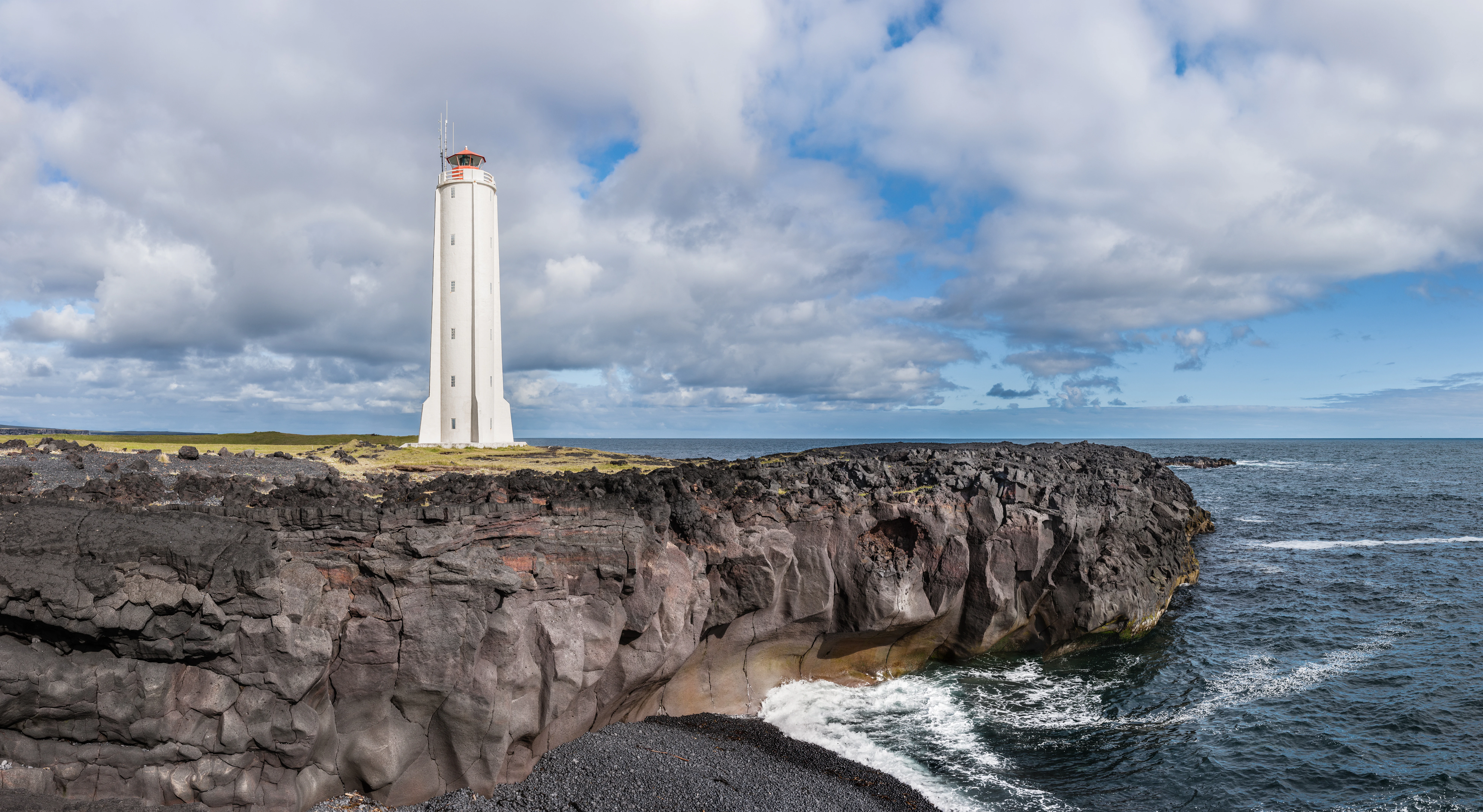
The park's coastline adds an equally dramatic dimension. Sites such as Djúpalónssandur with its black-sand beach and famous lifting stones, Malarrif with its historic lighthouse area, and the sea cliffs around Þúfubjarg and Dritvík illustrate the meeting of fire-formed rock with the unrelenting North Atlantic. The porous volcanic ground means much surface water disappears quickly, yet lush moss carpets, dwarf birch, and protected plant species such as cow-wheat and herb-paris manage to thrive across the lava fields and hillsides.

Culturally, the park preserves a tangible record of centuries of human life along this coast. From the settlement era onward, the richness of fishing grounds around the tip of Snæfellsnes made this one of Iceland's most populated coastal stretches in the 18th century, hosting large seasonal fishing communities such as Dritvík. Today the same coast is largely unpopulated between Hellnar and Gufuskálar, and the remaining ruins of winter fishing huts serve as a quiet reminder of the peninsula's historic role as a gateway to the sea.

Quick facts and research context for Snæfellsjökull National Park

Snæfellsjökull National Park is located on the Snæfellsnes peninsula in western Iceland, ending at the peninsula's westernmost point. The park surrounds the Snæfellsjökull glacier-volcano, a central volcano whose most recent eruptions occurred several thousand years ago.

The protected area covers roughly 170 square kilometers and was formally established on 28 June 2001. It is one of three national parks in Iceland and is administered with a main office at Hellissandur and visitor exhibition space at Hellnar. The park preserves volcanic landforms such as craters, lava fields, palagonite ridges, and coastal cliffs, alongside the ruins of historic seasonal fishing settlements including Dritvík.

Protection and recognition

Documented terrestrial conservation parameters and international recognition frameworks

Snæfellsjökull National Park Protection Status and Management Scope

Snæfellsjökull National Park maintains a documented terrestrial protection status within the regional conservation network. Structured management facts outline the administrative parameters and international recognition records established for the protected landscape.

Protection details

Protection scope
Terrestrial
Park context

Deeper park guide and search-rich context for Snæfellsjökull National Park

Snæfellsjökull National Park history, landscape, wildlife, and travel context

Explore Snæfellsjökull National Park through its history, landscape character, ecosystems, wildlife, conservation priorities, cultural context, and seasonal travel timing in a structured park guide built for atlas discovery and search intent.

Why Snæfellsjökull National Park stands out

The park is best known for the Snæfellsjökull glacier, which sits atop an old central volcano that has shaped the entire western Snæfellsnes peninsula. The glacier and the volcano it caps are the park's defining landmark and a focal point for visitors, scientists, and Icelandic cultural imagination alike, including its role as the entry point to the underworld in Jules Verne's Journey to the Center of the Earth. Equally distinctive is the surrounding coastal volcanic landscape: craters like Saxhóll and Hólahólar, the towering Lóndrangar basalt pinnacles that rise from the sea, palagonite ridges formed beneath ancient ice, and rugged black-sand beaches flanked by sea cliffs that host breeding colonies of seabirds such as Atlantic puffins, kittiwakes, and fulmars.
Snæfellsjökull National Park history and protected-area timeline

Snæfellsnes has been inhabited since Iceland's settlement period, with early settlers drawn to the area by the extraordinarily rich fishing grounds at the tip of the peninsula. The abundance of fish made this stretch of coast one of the most densely populated rural areas in 18th-century Iceland, although the population was generally poor and largely seasonal.

Coastal settlements such as Dritvík supported substantial communities during the fishing season; at its peak, Dritvík hosted up to 600 men during the seasonal cod fishery, with around 200 people living there year-round. Their work left behind the characteristic ruins of winter fishing huts and shore-based processing areas that can still be seen in the park today.

By the modern era, the settlements from Hellnar westward to Gufuskálar had been completely depopulated, leaving a coastline of cultural relics set within an untouched natural landscape. The Icelandic parliament formally established Snæfellsjökull National Park on 28 June 2001 with the express mission of protecting the natural treasures surrounding the Snæfellsjökull glacier volcano, preserving the remains of historic human settlement in the area, and making this landscape accessible to the public. The park's main office is located in Hellissandur, and since 2004 a visitor exhibition has operated in Hellnar, with additional seasonal staff providing guided walks and managing the park's access points during summer months.

Snæfellsjökull National Park landscape and geographic character

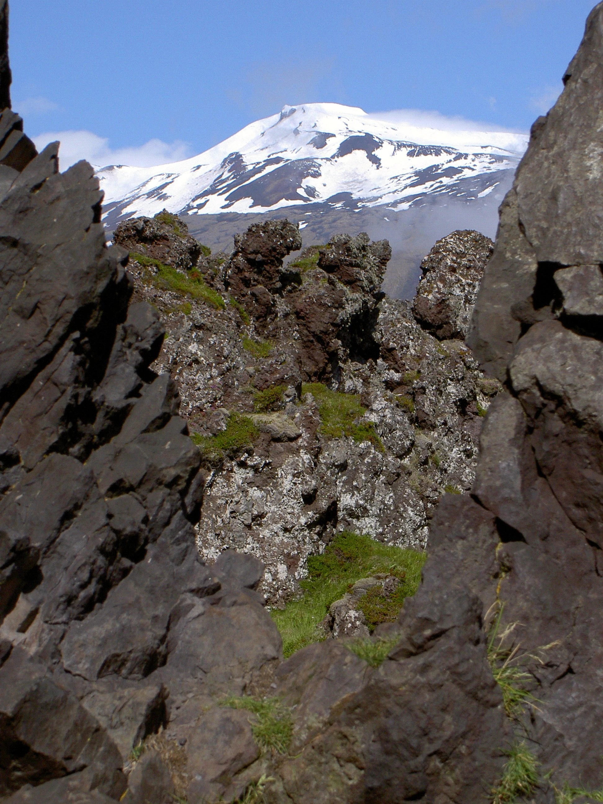
The landscape of Snæfellsjökull National Park is fundamentally volcanic, shaped by the Snæfellsjökull central volcano and thousands of years of eruptions. The most prominent feature is the glacier that caps the volcano's summit, covering roughly the upper reaches of the mountain mass and feeding the peninsula's sense of stark, icy grandeur.

Surrounding the glacier is a mosaic of craters, lava fields, and eroded volcanic remnants. The Saxhóll crater, with its symmetrical bowl shape, is one of the most striking single features accessible to visitors. Nearby, the Lóndrangar twin pinnacles are eroded remnants of an old volcanic conduit that now rise as tall sea stacks from the coastal plain, while Svalþúfa is thought to mark a crater of submarine origin akin to the formation of the island of Surtsey.

Some of the oldest landscape features in the park are palagonite ridges such as Bárðarkista and the hills north of the present-day glacier. These ridges formed during eruptions that took place beneath the Pleistocene ice sheet, producing the dense, fine-grained palagonite rock that gives them their distinctive rounded form. Combined with younger lava flow surfaces, black sand beaches, and coastal cliffs, the result is a landscape where fire and ice, sea and stone, meet in a continuously evolving shoreline.
Snæfellsjökull National Park ecosystems, habitats, and plant life

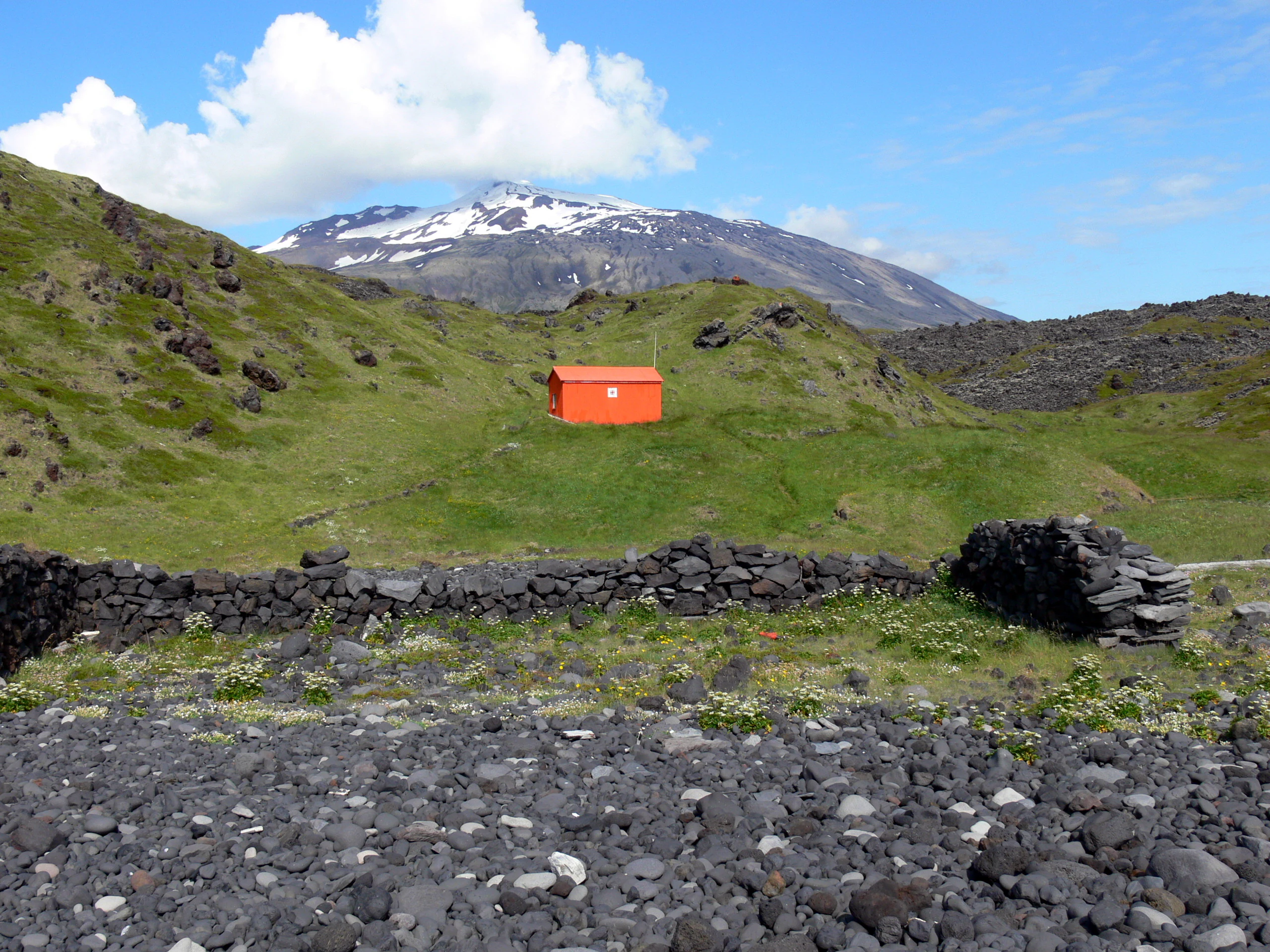
Despite Iceland's reputation for sparse vegetation, the porous volcanic ground of the Snæfellsnes peninsula supports a surprisingly rich and varied ecological character. Because rainfall drains rapidly through the lava substrate, the surface vegetation has adapted to conditions that resemble the Icelandic highlands. Thick carpets of moss dominate the lava fields and softer hill slopes, while low-growing shrubs such as dwarf birch and silver willow survive where conditions allow.

Certain sensitive plant species are legally protected, including common cow-wheat and herb-paris, which thrive in the park's hill meadows and lava margins. The interplay between mineral-rich volcanic soils, persistent moisture from fog and precipitation, and exposure to Atlantic weather gives the vegetation a distinctive mosaic quality, with patches of dense green interspersed among bare lava and black sand.

The park's nature is not confined to the land. Its marine and cliff environments are integral to its ecological identity, and the protected area's coastline forms part of one of Iceland's most important zones for cliff-nesting seabirds. The combination of mossy uplands, volcanic plains, and sheer coastal cliffs creates an unusually diverse range of habitats within a relatively compact area on the western edge of Snæfellsnes.
Snæfellsjökull National Park wildlife and species highlights

The wildlife of Snæfellsjökull National Park reflects the broader ecological character of Iceland's western peninsula, with terrestrial fauna adapted to harsh, exposed conditions and marine fauna concentrated on the dramatic coastal cliffs. The park's sea cliffs, especially around Þúfubjarg, host dense breeding colonies of seabirds in spring and summer.

Among the most celebrated species are Atlantic puffins, which nest in burrows along the cliff tops and draw visitors from across the region. Black-legged kittiwakes and northern fulmars are also common along these cliffs, where they raise their chicks on narrow ledges above the pounding surf. Eagles have been reported nesting further inland in the mountains, where they have access to the open airspace and the small mammal populations of the uplands.

The smaller birdlife of the park provides a key resource for predators. Arctic foxes, introduced martens, and raptors all depend on the abundance of nesting seabirds and their eggs, especially during the breeding season. The presence of these predators, together with the variety of nesting sites and prey, makes the park's coastal cliffs one of the most lively wildlife habitats on the Snæfellsnes peninsula, particularly during the summer months when migratory seabirds arrive in massive numbers.
Snæfellsjökull National Park conservation status and protection priorities

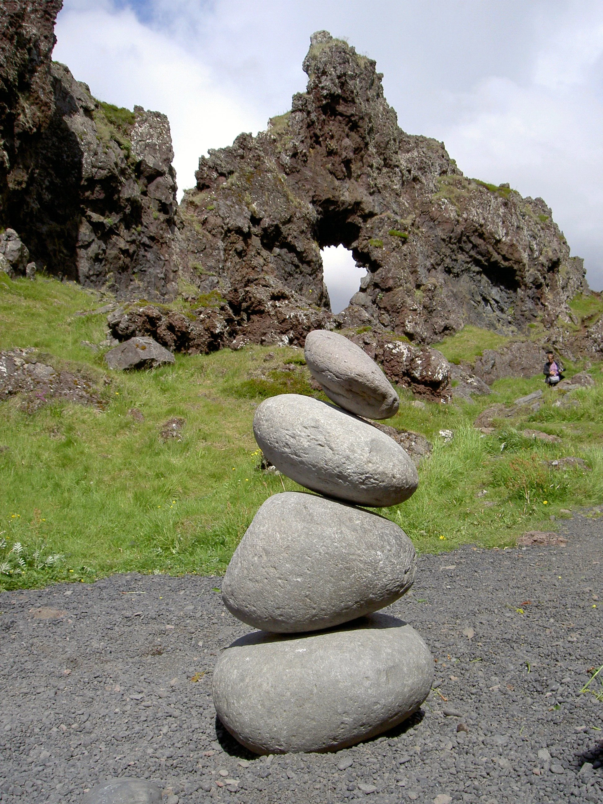
Snæfellsjökull National Park exists to safeguard one of Iceland's most iconic volcano-glacier landscapes and the cultural heritage attached to it. By bringing the western tip of Snæfellsnes under formal national protection, the park protects a representative example of Iceland's volcanic and coastal ecosystems, including lava fields, craters, palagonite ridges, sea cliffs, black-sand beaches, and the glacier itself, from incompatible development or exploitation.

The park's conservation significance lies in its combination of geological value and ecological richness. The Snæfellsjökull volcano is the subject of ongoing scientific research into eruption history, volcanic risk, and glacial-volcano interaction, and the park serves as a natural laboratory for studying jökulhlaups, palagonite formation, and post-glacial landscape evolution. At the same time, the cliffs and coastal habitats support internationally important seabird populations, while the moss heaths and lava-field vegetation protect rare and legally sensitive plant species.

By preserving the visible ruins of historic fishing settlements and integrating them into the park landscape, conservation efforts in Snæfellsjökull also recognize the cultural value of the peninsula's maritime past, treating the human story of Dritvík and similar sites as part of the protected environment rather than as separate heritage. The park's formal structure, with its permanent ranger and seasonal staff, supports both ecological monitoring and guided public engagement, reinforcing its role as a working protected area rather than a purely symbolic designation.

Snæfellsjökull National Park cultural meaning and human context

The cultural identity of Snæfellsjökull National Park is inseparable from the maritime heritage of the Snæfellsnes peninsula. For centuries, the rich fishing grounds off the western tip of the peninsula supported dense seasonal populations of fishermen, fish processors, and laborers, especially during the 18th and 19th centuries. Communities such as Dritvík became synonymous with the tough life of Iceland's coastal fishing economy, and their remains of winter huts and shore installations survive as evocative relics within the modern park.

Snæfellsjökull itself holds a special place in Icelandic and international cultural imagination. The glacier-straddled volcano inspired the opening of Jules Verne's classic novel Journey to the Center of the Earth, in which explorers descend into the earth through the Snæfellsjökull summit. This literary association has long shaped how the mountain is perceived by visitors from around the world and gives the park a cultural resonance that extends well beyond its natural values.

In Iceland itself, the Snæfellsjökull area is also tied to folk tradition and regional identity, with stories of hidden people, hidden valleys, and supernatural beings in Snæfellsnes folklore. The park's approach to landscape presentation, with exhibition space at Hellnar and a ranger presence linking visitors to both natural and historical interpretation, reflects this dual significance as a place of both ecological protection and living cultural memory.
Top sights and standout views in Snæfellsjökull National Park

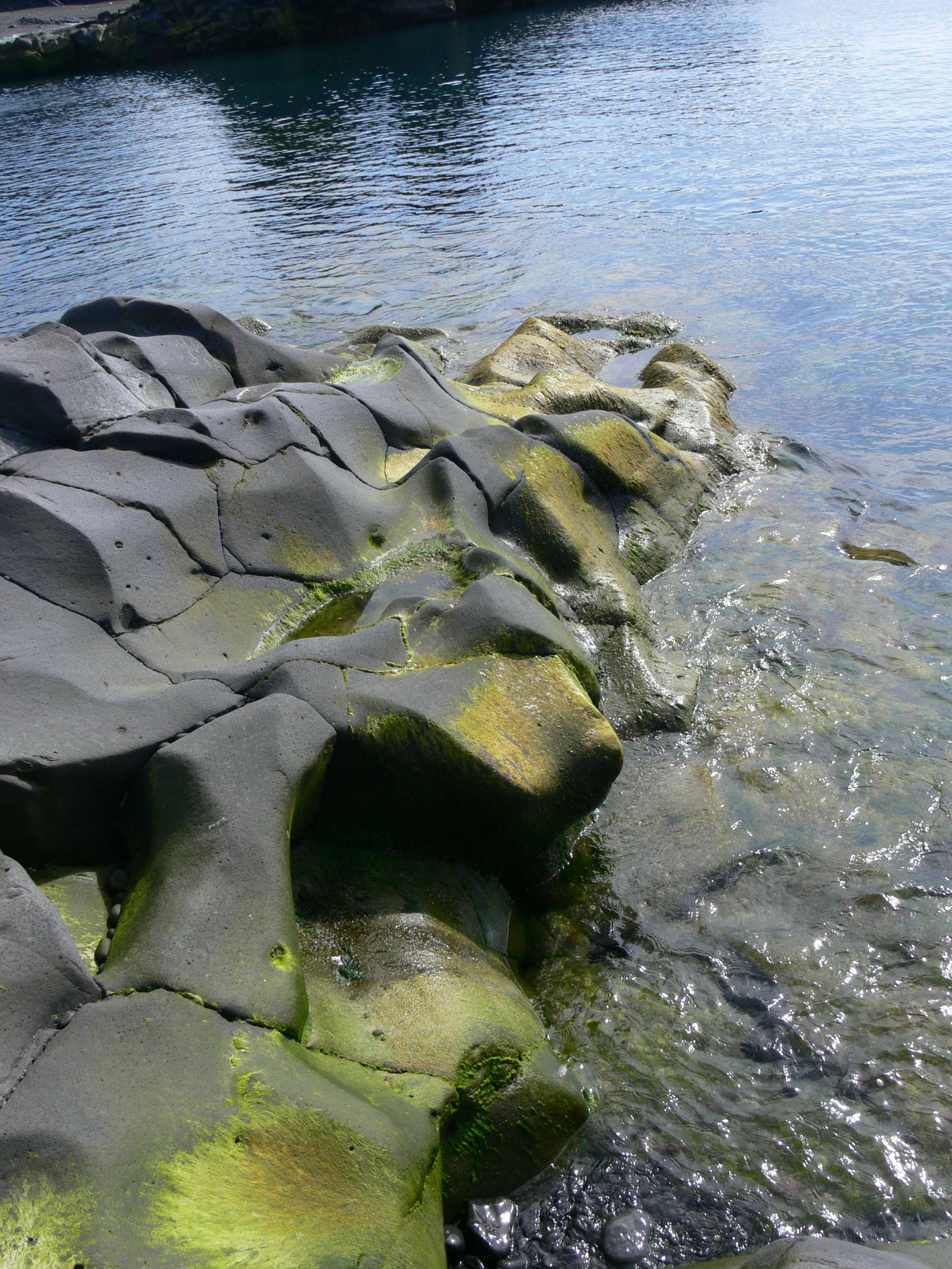
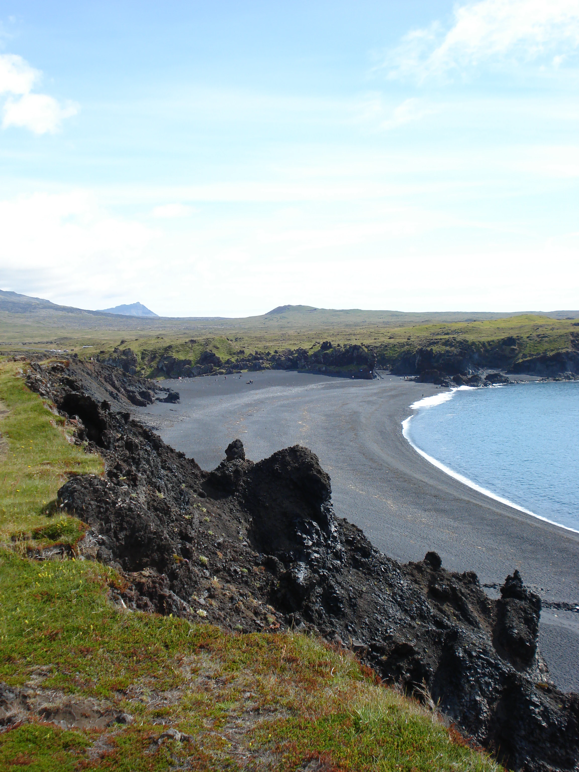
Snæfellsjökull National Park's most distinctive assets are concentrated in three interconnected themes: glacier-volcano scenery, volcanic coastal landforms, and historic maritime culture. The Snæfellsjökull glacier volcano dominates the skyline and is the park's signature landmark, both as a physical feature and as a cultural icon.

Along the coast, the park combines spectacular volcanic geology with rich seabird life, from the symmetrical Saxhóll crater and towering Lóndrangar pinnacles to the black sand and lifting stones of Djúpalónssandur. Cliff-nesting seabirds such as Atlantic puffins and kittiwakes, together with protected plant species in the mossy lava fields, give the park a biological character to match its geological drama.

Finally, the preserved ruins of seasonal fishing settlements like Dritvík, embedded in the coastal landscape, give the park a layered identity as both a natural reserve and a guardian of Iceland's coastal heritage, making it a destination where landscape, wildlife, and human history combine in a single, cohesive experience.
Best time to visit Snæfellsjökull National Park

The park's atmosphere shifts dramatically with Iceland's seasons, and the experience of any visit is closely tied to weather, light, and biological cycles. Summer, roughly from late May through early September, brings long daylight hours, milder temperatures, and the busiest wildlife season. Black-backed kittiwake colonies, puffins, fulmars, and other seabirds are most active on the coastal cliffs during this period, and most marked walking and riding paths across the park and surrounding peninsula are at their most accessible.

Spring and early summer also coincide with blooming of protected flowering plants in the mossy lava hills and with reduced snow cover on lower sections of the Snæfellsjökull glacier, making approaches to the volcano and surrounding craters more feasible. Late summer and early autumn offer quieter conditions, with softer light and lower tourist density, though weather becomes increasingly uncertain.

Winter brings short days, heavy snow, frost, and frequent storms from the North Atlantic, which limit safe access and close many of the higher routes. The contrast between the snowy, storm-lashed glacier and the dark lava coast is visually dramatic, but visitors should expect challenging conditions and limited services. As a glacier environment, weather conditions can change rapidly at any time of year, so flexibility around timing is valuable when planning a visit.
Monthly climate preview

Long-term representative point measurements tracking monthly temperature ranges and precipitation patterns

Snæfellsjökull National Park Climate Normals, Annual Temperature and Precipitation Rhythm

Representative coordinate records show measured monthly temperature variations and precipitation amounts spanning a complete annual cycle at Snæfellsjökull National Park. Detailed monthly climate normals provide broader analytical depth for tracking temperature thresholds and precipitation totals across the protected area.
Annual mean5 °C
0 °C10 °C
Jan
Feb
Mar
Apr
May
Jun
Jul10°
Aug10°
Sep
Oct
Nov
Dec
Warmest month
July

10.3 °C

Coolest month
February

0.5 °C

Wettest month
February

4.8 mm/day

Driest month
June

2 mm/day

Park location guide

Geography guide, regional context, and park location map for Snæfellsjökull National Park

Snæfellsjökull National Park park geography, regions, and map view in Iceland

Understand where Snæfellsjökull National Park sits in Iceland through a broader geographic reading of the surrounding landscape, nearby location context, and its mapped position within the national park landscape.

How Snæfellsjökull National Park fits into Iceland

Iceland is a Nordic island nation located between Europe and North America on the Mid-Atlantic Ridge. With a population of approximately 394,000 and an area of 103,125 km², it is one of the world's most sparsely populated countries. The country features dramatic volcanic terrain, extensive glaciers, geysers, and geothermal activity, all while maintaining a temperate climate warmed by the Gulf Stream.

Wider geography shaping Snæfellsjökull National Park in Iceland

Iceland is an island nation located in the North Atlantic Ocean between the Arctic Ocean and the Atlantic Ocean, situated on the Mid-Atlantic Ridge between Europe and North America. The interior consists of volcanic plateaus with sand and lava fields, while mountains and glaciers dominate the terrain. Numerous glacial rivers flow from the highlands through lowlands to the sea. The country sits at a latitude just south of the Arctic Circle.

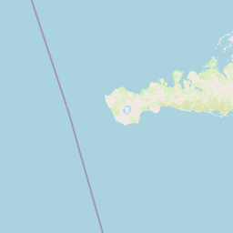
Map view of Snæfellsjökull National Park

Use this park location map to pinpoint Snæfellsjökull National Park in Iceland, understand its exact geographic position, and read its mapped placement within the surrounding landscape more clearly.

Pigeon | © OpenStreetMap contributors
Park atlas

Compare volcanic terrain and coastal landscapes across the surrounding region

Exploring Other Parks Near Snæfellsjökull National Park and Regional Protected Areas

Visitors comparing Snæfellsjökull National Park can browse other protected areas featuring similar volcanic geology and coastal terrain. Regional park discovery helps place glacial summits and lava fields within wider geographic contexts.
Watercolor illustration of a mountain landscape with a glacier-capped peak and surrounding green fields
National parkIceland
About 1.1 km away#1 closest

Southwest

Snæfellsjökull National Park: Geography and Protected Landscapes of Western Iceland

Glacial volcanoes, lava fields, and coastal topography.

Snæfellsjökull National Park sits at the western tip of the Snæfellsnes peninsula, creating a unique intersection of glacial, volcanic, and maritime environments. This database provides structured insights into the park's rugged terrain, including its moss-covered lava fields, sea-carved cliffs, and the namesake glacier that dominates the local landscape.

Established
2001
IUCN
II
National parkIceland
About 4.5 km away#2 closest

West

Snæfellsjökull National Park: An Atlas of Volcanic Terrain and Protected Icelandic Coastlines

Volcanic peaks and coastal ecosystems of the Snæfellsnes Peninsula.

Snæfellsjökull National Park stands as a defining protected landscape in western Iceland. Defined by its central glacier-crowned stratovolcano, the park territory maps out a complex transition from high-altitude volcanic basalt and lava fields to sheltered bays and dramatic seaside cliffs. This geographic record explores the intersection of glacial ice, maritime habitats, and the volcanic belt that shapes the outer edge of the Snæfellsnes Peninsula.

Relief
Mountain
Climate
Subpolar
Scope
Mixed
Water
Major water bodies
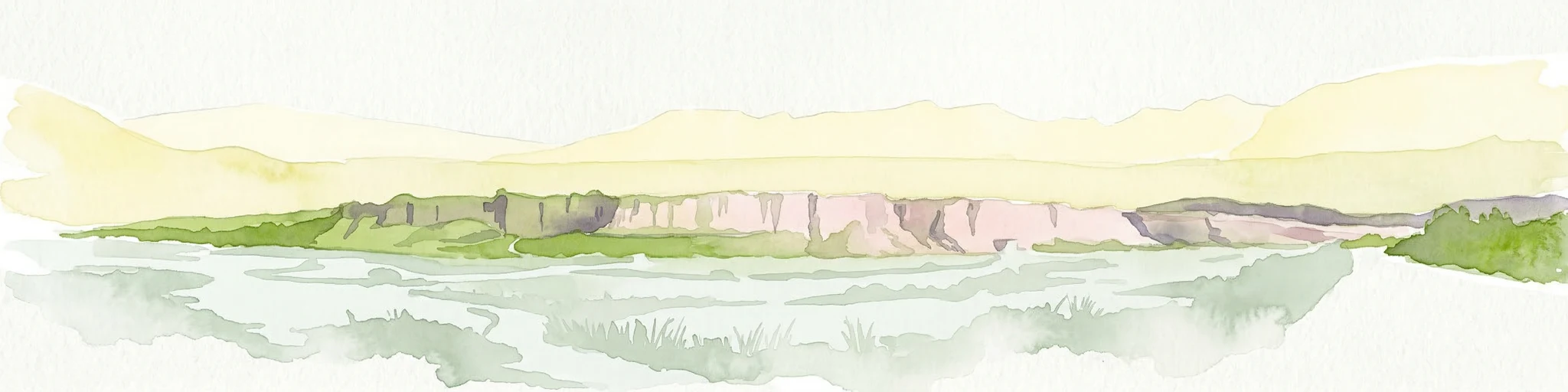
Watercolor painting depicting a landscape with cliffs, a body of water, and distant hills under a light sky
National parkSouthern Region
About 131 km away#3 closest

Southeast

Þingvellir National Park: Witness Tectonic Plates and Ancient Icelandic Governance

Explore the rift valley and historic parliament site in Iceland's Southern Region.

Þingvellir National Park offers a singular opportunity for geographic discovery, situated in Iceland's Southern Region. This protected national park is globally recognized for its visible expression of the Mid-Atlantic Ridge, where the North American and Eurasian tectonic plates actively diverge, creating a dramatic rift valley. Moreover, Þingvellir served as the site of the Althing, Iceland's ancient parliament, making it a crucial historical landmark. Explore this landscape to understand both powerful geological processes and the foundations of Icelandic democratic history through its mapped terrain.

Area
92.7 km²
Established
1930
IUCN
II
Relief
Lowland
Natural monumentIceland
About 200 km away#4 closest

East

Hveravellir Natural Monument: Geothermal Plateau Geography and Highland Protected Areas

Central Iceland geothermal field and volcanic plateau

Located on the Kjölur route, Hveravellir serves as a protected natural monument characterized by high-temperature geothermal activity. The area features a concentration of fumaroles, geysers, and mineral-rich springs set upon a stark volcanic plateau. This site offers significant insights into the geological processes shaping the central highlands of Iceland, blending ancient lava fields with active thermal surface transformations.

Area
2.5 km²
Relief
Highland
Climate
Subpolar
Access
Moderate access
Nature reserveIceland
About 228 km away#5 closest

Southeast

Surtsey Nature Reserve: Mapping Volcanic Landscapes and Ecological Succession in Iceland

A pristine laboratory of North Atlantic volcanic terrain.

Surtsey represents a rare geological event, a volcanic island created by sustained eruptions and now protected as a strict nature reserve. The island acts as a primary research site for observing how life colonizes barren volcanic substrates, from mosses and insects to seabird colonies. Its mapped boundaries encompass dramatic basaltic lava flows and tephra deposits, providing a vital window into the formative processes of oceanic islands.

Area
1.4 km²
Established
1963
Relief
Upland
Climate
Subpolar
Watercolor illustration showing a landscape with green fields, a winding path, pink flowers, and mountains in the background
National parkIceland
About 246 km away#6 closest

East

Vatnajökull National Park: Iceland's Expansive Protected Glacier and Volcanic Terrain

Mapped boundaries of a UNESCO World Heritage site dynamic with fire and ice.

Vatnajökull National Park offers a profound exploration of one of Earth's most dynamic natural environments. This Icelandic national park protects the vast Vatnajökull ice cap, a landscape shaped by active volcanoes and powerful glacial forces, creating a region of extraordinary geographic diversity. Discover the mapped terrain, from subglacial mountain ranges to dramatic caldera systems, and understand the unique protected area context of this significant European natural heritage.

Area
14,967 km²
Established
2008
IUCN
II
Relief
Mountain
Nature reserveIceland
About 329 km away#7 closest

East

Mývatn Nature Reserve: Mapping the Volcanic Lakes and Tephra Formations of Northern Iceland

Protected wetland landscapes and volcanic rift zone geography.

Mývatn represents a complex of protected wetlands and volcanic landforms, including the Hverfjall explosion crater and the Skútustaðir pseudocraters. This geography-rich basin in northern Iceland offers insight into post-glacial volcanic activity and serves as an internationally significant breeding site for diverse bird populations within a compact, walkable terrain.

Area
37 km²
Relief
Upland
Climate
Polar
Access
Easy access
Watercolor illustration showing a mountain landscape with green valleys, pink mountains, and a winding river
National parkIceland
About 339 km away#8 closest

East

Skaftafell National Park: Iceland's Accessible Protected Landscape with Glacial Terrain and Basalt Columns

Discover glacial landscapes and volcanic geology.

Skaftafell National Park is a vital protected area in Southeast Iceland, offering a unique atlas-level view of dramatic glacial landscapes. Located at the base of Vatnajökull, Europe's largest glacier, the park features accessible hiking trails that traverse outwash plains, birch woodlands, and glacial tongues like Skaftafellsjökull. Explore the iconic Svartifoss waterfall, framed by striking basalt columns, and understand the park's dynamic terrain shaped by volcanic activity and glacial processes, providing rich geographic context for protected landscape discovery.

Established
1967
IUCN
II
Scope
Terrestrial

Common questions about visiting, size, designation, and location context for Snæfellsjökull National Park

Snæfellsjökull National Park FAQs for park facts, access, geography, and protected area context

Find quick answers about Snæfellsjökull National Park, including protected-area facts, park geography, trail and visitor context, and how the park fits into its surrounding country and regional landscape.
MoriAtlas Explorer

Continue Your Protected Areas Search Across the Global Atlas

Deepen your exploration by continuing the structured search for national parks and protected areas worldwide. Utilize the comprehensive filtering capabilities to compare different conservation landscapes and refine your understanding of global park geography. Discover more about the distribution and characteristics of protected natural areas.

Global natural geography