Mori Atlas logo
National parkÞingvellir National Park

Discover the visible boundaries of tectonic plates and the birthplace of Icelandic democracy.

Þingvellir National Park: Iceland's Tectonic Rift and Ancient Parliamentary Landscape

Þingvellir National Park in Iceland's Southern Region stands as a prime example of a protected landscape where profound geological forces meet significant historical human activity. This park showcases the dramatic rift valley that marks the divergence of the North American and Eurasian tectonic plates, offering an unparalleled opportunity for atlas-based exploration of continental drift. Beyond its geological marvels, Þingvellir preserves the Althing, Iceland's ancient parliament, cementing its status as a site of immense cultural and historical importance, mapped within a unique natural setting.

Rift valleyTectonic platesWorld Heritage SiteHistorical siteIcelandic parliamentVolcanic landscape
Stylized illustration showing a river canyon with a waterfall, cliffs, mountains, and trees under a bright sun

Þingvellir National Park

National park

Park overview

Structured park overview, official facts, and landscape profile for Þingvellir National Park

Þingvellir National Park park facts, protected area profile, and essential visitor context
Review the core facts for Þingvellir National Park, including designation, size, terrain, visitor scale, habitats, and operating context in one park-focused overview.

About Þingvellir National Park

Þingvellir National Park represents a rare convergence of natural and cultural heritage that few places on Earth can match. The park's fundamental identity stems from its position atop the Mid-Atlantic Ridge, where the gradual separation of tectonic plates has created a landscape of remarkable geological drama. The Almannagjá gorge, the park's most prominent geological feature, forms a vivid boundary between the continental plates and can be traversed on foot, allowing visitors to cross from one tectonic plate to another in minutes.

The historical significance of Þingvellir is deeply embedded in the formation of the Icelandic nation. When the Althing was established here in 930, it created one of the world's earliest parliamentary institutions, predating most similar democratic assemblies by centuries. The annual gathering drew people from across Iceland, transforming this remote valley into a vibrant social and political center for two weeks each summer. Temporary settlements of turf and stone housed thousands of attendees, creating what was essentially Iceland's largest annual event—a tradition that continued for over eight centuries.

Beyond its parliamentary heritage, Þingvellir has served as a powerful symbol of Icelandic national identity through the centuries. During the 19th century independence movement, the site became a focal point for nationalist sentiment, representing Iceland's historical sovereignty and cultural continuity. In 1944, Iceland declared independence from Denmark at Þingvellir, symbolically linking the modern nation-state to the ancient parliamentary traditions established at this site. Today, the park remains a sacred space for Icelanders, embodying the enduring connection between landscape, history, and national identity.

Quick facts and research context for Þingvellir National Park

Þingvellir National Park covers 9,270 hectares in southwestern Iceland's Southern Region, established in 1930 as Iceland's first national park. The park sits in a rift valley along the Mid-Atlantic Ridge where the North American and Eurasian plates diverge, with the separation visible in dramatic faults and fissures throughout the landscape. Þingvallavatn, Iceland's largest natural lake, forms the southern boundary of the park. The Althing convened at Þingvellir from 930 to 1798, representing 868 years of continuous parliamentary assembly at this site. The park was inscribed as a UNESCO World Heritage Site in 2004 under cultural criteria (iii) and (vi).

Park context

Deeper park guide and search-rich context for Þingvellir National Park

Þingvellir National Park history, landscape, wildlife, and travel context
Explore Þingvellir National Park through its history, landscape character, ecosystems, wildlife, conservation priorities, cultural context, and seasonal travel timing in a structured park guide built for atlas discovery and search intent.

Why Þingvellir National Park stands out

Þingvellir is best known for its unique combination of extraordinary geological and historical significance. The park provides one of the clearest visible expressions of plate tectonics on the planet, with the great Almannagjá canyon vividly marking the rift between the North American and Eurasian plates. Visitors can literally stand between two continents and observe the ongoing geological process of continental drift. Simultaneously, the site preserves the physical setting where Iceland's democratic tradition was born, with the Lögberg (Law Rock) representing the precise location where the Althing convened for nearly nine centuries. The Silfra fissure, with its exceptionally clear water, has become world-famous among scuba divers and snorkelers seeking to swim between the tectonic plates.

A river flows through a rocky canyon with green vegetation on the banks and mountains in the background
Flosagja canyon in Þingvellir National Park, featuring a stream flowing between rocky cliffs and green vegetation

Þingvellir National Park history and protected-area timeline

The establishment of Þingvellir as a national park in 1930 represented a pivotal moment in Icelandic conservation history. The legislation passed in 1928 aimed to protect the remains of the ancient parliament site and create the nation's first national park, marking the thousandth anniversary of the Althing's founding. The park was decree as a protected national shrine for all Icelanders—perpetual property of the Icelandic nation under the preservation of parliament, never to be sold or mortgaged. This legal protection ensured that the historical and natural values of Þingvellir would be preserved for future generations.

The history of Þingvellir as a parliamentary site begins in 930 when the Althing was established there, creating what is considered one of the oldest parliamentary institutions in the world. According to the Book of Settlements, the location was chosen after the owner of the Bláskógar region was found guilty of murder, his land declared public, and subsequently designated for assembly proceedings. The site was selected for its accessibility to the most populous regions of Iceland, with the longest journey for a chieftain being approximately 17 days from the easternmost part of the country.

The Althing functioned as Iceland's supreme legislative and judicial authority from its establishment in 930 until 1271, when the country came under Norwegian rule following clashes between chieftain families. While legislative and judicial authority gradually transferred to Norwegian and later Danish rulers, the Althing continued to meet at Þingvellir until 1798, when the parliament was finally relocated to Reykjavík. The park also holds more recent historical significance as the site where Prime Minister Bjarni Benediktsson died in a fire at a government summer house in 1970.

Þingvellir National Park landscape and geographic character

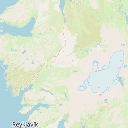
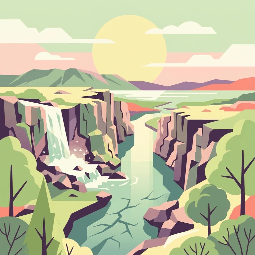
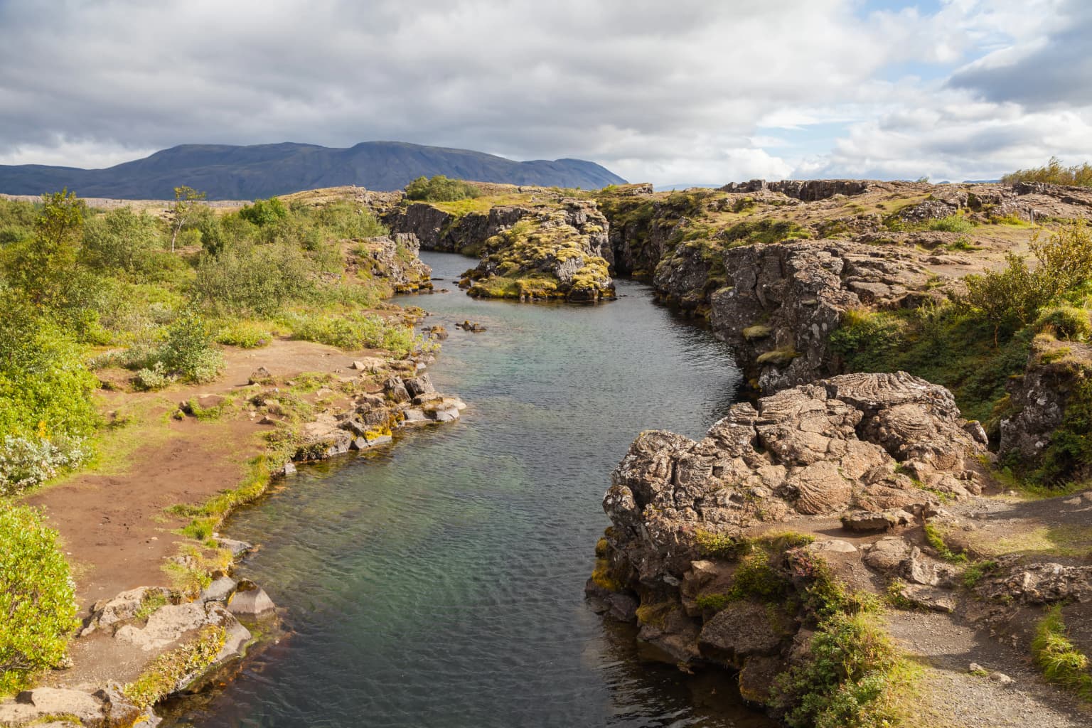
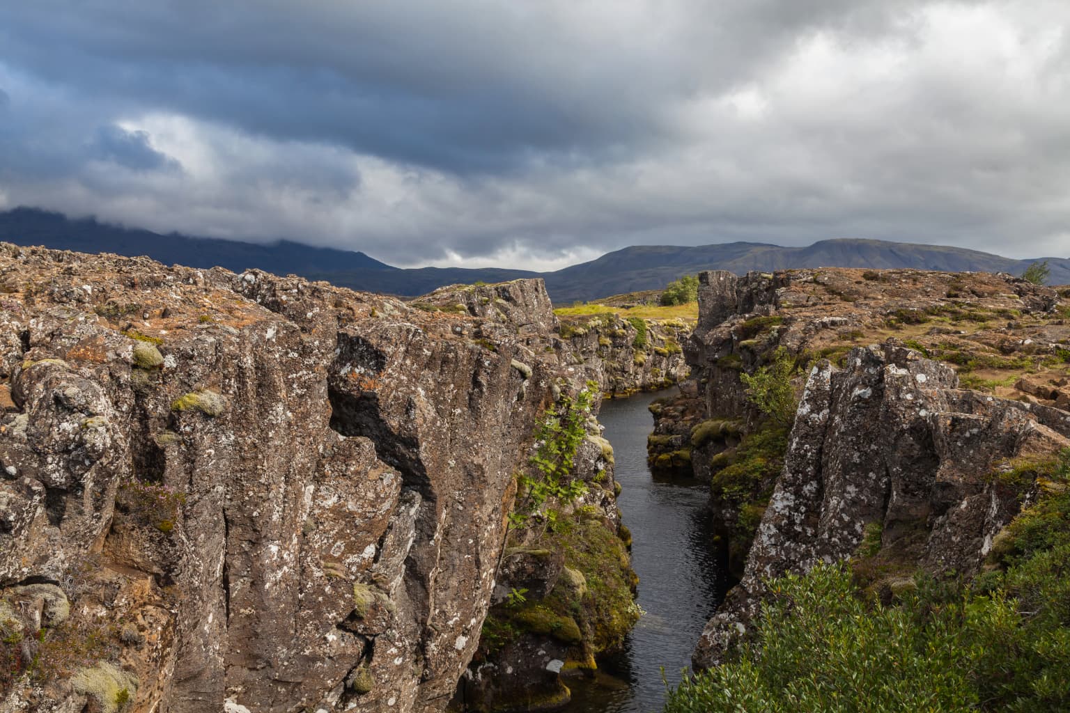
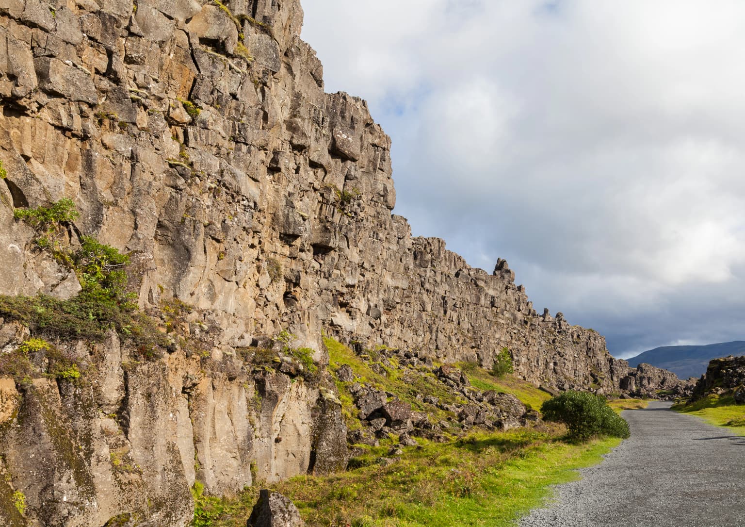
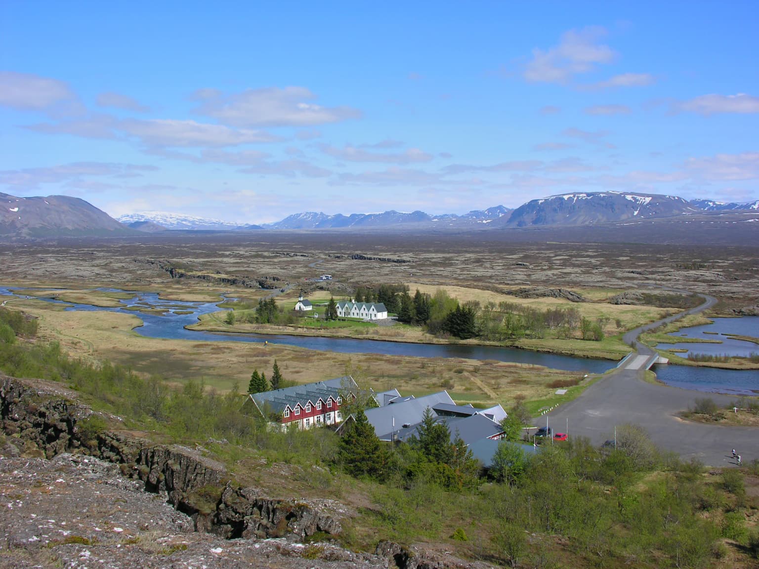
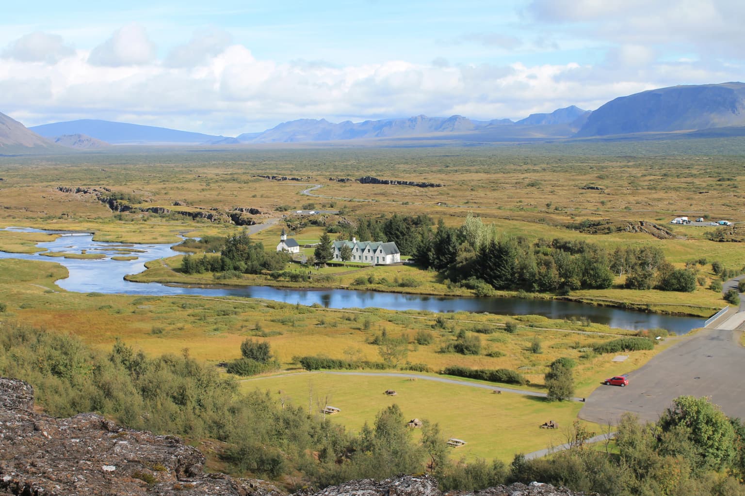
Þingvellir's landscape is defined by its position within the Mid-Atlantic Ridge, the submarine mountain range that bisects the Atlantic Ocean and marks the boundary between the North American and Eurasian tectonic plates. The park sits in a graben—a down-dropped block of the Earth's crust—creating a dramatic valley bounded by parallel fault scarps that represent the edges of the diverging plates. The most striking of these is Almannagjá, a massive canyon that runs through the park and clearly marks where the continental plates are pulling apart.

The landscape features numerous fissures, cracks, and faults that traverse the area, some filled with remarkably clear groundwater that has filtered through volcanic rock for decades. The Öxará river crosses the park, falling over the edge of the Almannagjá fault to create the picturesque Öxarárfoss waterfall. To the south lies Þingvallavatn, a large volcanic crater lake covering approximately 84 square kilometers, making it Iceland's largest natural lake. The lake occupies a caldera formed by volcanic activity and is fed by groundwater and small streams, with its deep waters reflecting the surrounding volcanic terrain.

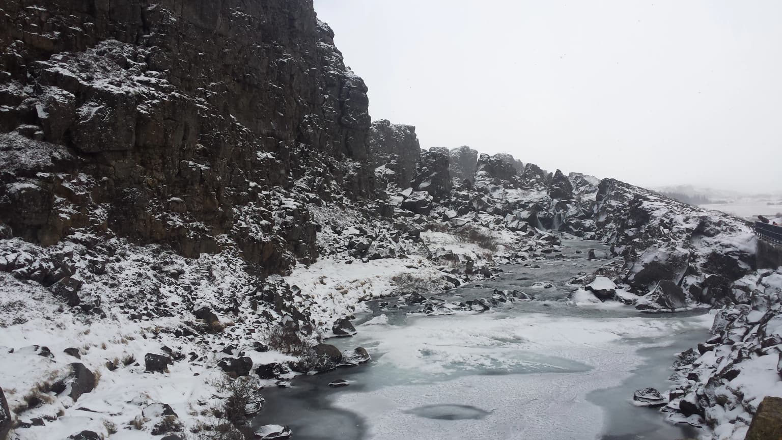
The geology of the region consists primarily of basaltic lava flows and volcanic rock, with the terrain ranging from relatively flat meadowland in the valley floor to steep cliff faces along the major fault lines. The vegetation consists mainly of moss, grass, and scrub, with birch woodlands in more sheltered areas. The stark, almost otherworldly quality of the landscape—characterized by dark basalt, green moss, and clear water—creates a visually distinctive environment that has inspired Icelandic artists for generations.

Rugged volcanic rock canyon with a narrow river flowing through, surrounded by steep cliffs under a cloudy sky
Canyon landscape within Þingvellir National Park showing rift valley geology

Þingvellir National Park ecosystems, habitats, and plant life

The ecological character of Þingvellir reflects the subarctic climate and volcanic geology of southwestern Iceland. The park encompasses a range of habitats, from the shores of Þingvallavatn lake through the rift valley floor to the rocky slopes and cliffs of the fault scarps. The freshwater environment of the lake itself supports a distinct ecosystem, while the groundwater-filled fissures provide unique aquatic habitats with exceptional water clarity.

The most remarkable aquatic environment is the Silfra fissure, a crack between the tectonic plates that has filled with groundwater filtered through volcanic rock for decades, resulting in extraordinary visibility—sometimes exceeding 100 meters. This ice-cold water creates a distinctive diving and snorkeling experience where visitors can observe the underwater rock formations and the remarkable clarity of the geological environment. The surrounding wetlands and lake margins provide habitat for waterfowl and other bird species, while the heathlands support populations of Arctic foxes and various small mammals.

The volcanic setting influences soil chemistry and vegetation patterns throughout the park, with areas of recent lava flow supporting pioneering plant species adapted to colonize bare rock. Mosses and lichens are particularly abundant, carpeting rocks and creating the characteristic green-hued landscape for which Icelandic terrain is known. The park's position along bird migration routes adds seasonal interest, with various species using the lake and surrounding areas as nesting or feeding grounds.

Snow-covered rocky cliffs and frozen river in a valley
Snow-covered landscape of Þingvellir National Park with frozen river and rocky cliffs

Þingvellir National Park wildlife and species highlights

While Þingvellir is not primarily known for abundant wildlife populations, the park does support several notable species that adapted to the subarctic Icelandic environment. The Arctic fox, Iceland's only native land mammal, can occasionally be spotted in the more remote areas of the park, though these elusive animals are rarely seen by visitors. The surrounding heathlands and wetlands provide habitat for various bird species, particularly waterfowl that utilize Þingvallavatn and its margins.

The lake itself supports fish populations, primarily brown trout and Arctic char, which have been important to the local ecosystem and fishing traditions. The clear waters of the Silfra fissure, despite their extreme cold and limited nutrients, support some aquatic life including algae and small crustaceans, though the primary interest for visitors lies in the geological rather than biological features. Seabirds including gulls and fulmars can be found along the lake shores and surrounding cliffs, particularly during the summer breeding season.

The park's position within the wider Icelandic landscape means that wildlife viewing is more about observing the natural environment and its ecological relationships than encountering large populations of conspicuous animals. The true wildlife interest lies in the geological processes shaping the landscape and the adaptations of plants and animals to this challenging subarctic environment.

Tall rocky cliff face with patches of green vegetation alongside a gravel road under partly cloudy sky
Rock formation at Law Rock in Thingvellir National Park, Iceland

Þingvellir National Park conservation status and protection priorities

Þingvellir holds exceptional conservation significance both as Iceland's first national park and as a UNESCO World Heritage Site. The park was established in 1930 specifically to preserve the historical and natural values of this remarkable landscape, with the legislation declaring it a protected national shrine for all Icelanders. This designation reflected the deep cultural importance of the site and established a precedent for nature conservation in Iceland that has guided subsequent protected area establishment.

The geological conservation value of Þingvellir is extraordinary, as the park preserves a dramatic example of active tectonic processes and continental rifting in a readily accessible setting. The clear visibility of the plate boundary and ongoing geological activity makes the site internationally significant for earth science research and education. There has been ongoing discussion about potential future World Heritage designation under geological criteria as part of a serial transboundary nomination for the Mid-Atlantic Ridge that might include other Atlantic sites such as Pico Island.

The cultural landscape conservation at Þingvellir also represents an important model, as the park preserves not only physical remains of the parliamentary assembly but also the broader natural setting that shaped Iceland's political and social development. The integration of geological and cultural conservation objectives reflects the understanding that these values are inseparable at this site—the landscape is both the stage for historical events and an active geological process that continues to shape the environment.

Þingvellir National Park cultural meaning and human context

Þingvellir's cultural significance extends far beyond its function as a parliamentary site to encompass the very foundations of Icelandic national identity. The Althing established at Þingvellir in 930 created the institutional framework for governance in the Icelandic Commonwealth and established traditions of democratic deliberation that have influenced political culture throughout the North Atlantic region. The name Þingvellir derives from the Old Norse words for assembly and field, literally meaning assembly fields—a designation that has endured for over a millennium.

The site has served as a powerful symbol of Icelandic sovereignty and identity throughout the centuries, particularly during the independence movement of the 19th and 20th centuries. The annual gathering at Þingvellir brought together people from across Iceland, creating opportunities for exchange of news, commerce, and cultural activity that helped forge a unified national consciousness. In 1944, Iceland declared independence from Denmark at Þingvellir, symbolically linking the modern nation to its ancient democratic traditions.

The park also contains the Þingvallakirkja (Þingvellir Church), a historic house of worship that has served the community for centuries, and the national cemetery where notable Icelanders including poet Jónas Hallgrímsson and industrialist Einar Benediktsson are buried. The site has inspired numerous Icelandic artists, particularly painters such as Jóhannes Sveinsson Kjarval and Ásgrímur Jónsson, who captured the dramatic landscape in their works. The National Gallery of Iceland holds more than 150 paintings by Ásgrímur Jónsson depicting Þingvellir.

Panoramic landscape of Þingvellir National Park with rivers, grassy fields, scattered buildings, distant mountains, and clear sky
Panoramic view of Þingvellir National Park showing rivers, meadows, and buildings from Almannagjá

Top sights and standout views in Þingvellir National Park

Þingvellir offers several outstanding features that distinguish it as one of Iceland's most significant protected areas. The Almannagjá canyon provides a striking visual representation of tectonic plate boundaries, allowing visitors to walk directly between the North American and Eurasian plates along a clearly defined trail. The Silfra fissure offers unique diving and snorkeling experiences in extraordinarily clear glacial groundwater between the tectonic plates. The historic Law Rock (Lögberg) preserves the physical setting of Iceland's ancient parliamentary assembly, where the foundations of Icelandic democratic tradition were established in 930.

The park forms part of Iceland's famous Golden Circle tourist route alongside Gullfoss waterfall and the Haukadalur geysers, making it one of the country's most visited destinations. Þingvallavatn, Iceland's largest natural lake, borders the park to the south and provides additional recreational opportunities. The combination of geological uniqueness, historical significance, and natural beauty makes Þingvellir a destination that illuminates both the natural forces shaping our planet and the human traditions that have developed in response to particular landscapes.

Wide landscape view showing a river winding through grassy fields with a small building, trees, and mountains in the background under a partly cloudy sky.
View from the information centre outlook of Thingvellir National Park, Iceland.

Best time to visit Þingvellir National Park

Þingvellir can be visited throughout the year, with each season offering a different perspective on the landscape. Summer months (June through August) bring the longest days, with the midnight sun providing extended opportunities for exploration and the surrounding landscape displaying vibrant green vegetation. This is the most popular time for visiting, and the park's facilities operate fully during these months. The extended daylight allows for hiking and exploration of the more remote areas of the park.

Winter (December through February) transforms Þingvellir into a stark, atmospheric landscape with limited daylight hours but dramatic lighting conditions. Snow covers the surrounding terrain, and the contrast between the white snow, dark basalt, and clear water creates particularly striking photography opportunities. The park remains open during winter, though facilities have reduced hours and some trails may be more challenging to navigate. The low visitor numbers during winter months offer a more contemplative experience of the historic and geological landscape.

Spring and autumn provide intermediate conditions with moderate visitor numbers and changing environmental qualities. The shoulder seasons offer the possibility of experiencing the park's dynamic weather patterns and witnessing the transition between summer and winter conditions. Regardless of season, visitors should be prepared for Iceland's changeable weather and the possibility of wind, rain, and rapidly changing conditions.

Park location guide

Geography guide, regional context, and park location map for Þingvellir National Park

Þingvellir National Park park geography, regions, and map view in Iceland
Understand where Þingvellir National Park sits in Iceland through a broader geographic reading of the surrounding landscape, nearby location context, and its mapped position within the national park landscape.

How Þingvellir National Park fits into Iceland

Iceland is a Nordic island nation located between Europe and North America on the Mid-Atlantic Ridge. With a population of approximately 394,000 and an area of 103,125 km², it is one of the world's most sparsely populated countries. The country features dramatic volcanic terrain, extensive glaciers, geysers, and geothermal activity, all while maintaining a temperate climate warmed by the Gulf Stream.

Wider geography shaping Þingvellir National Park in Iceland

Iceland is an island nation located in the North Atlantic Ocean between the Arctic Ocean and the Atlantic Ocean, situated on the Mid-Atlantic Ridge between Europe and North America. The interior consists of volcanic plateaus with sand and lava fields, while mountains and glaciers dominate the terrain. Numerous glacial rivers flow from the highlands through lowlands to the sea. The country sits at a latitude just south of the Arctic Circle.

Map view of Þingvellir National Park

Use this park location map to pinpoint Þingvellir National Park in Iceland, understand its exact geographic position, and read its mapped placement within the surrounding landscape more clearly.

Pigeon | © OpenStreetMap contributors

Location context for Þingvellir National Park

Southern Region

Trace the dramatic tectonic plate rifts, ancient assembly grounds, and distinctive protected-area environments of Iceland's iconic park.

Þingvellir National Park Photos: Visual Exploration of Iceland's Rift Valley Landscape and Historic Scenery
Browse a curated collection of Þingvellir National Park photos to visually explore its extraordinary geological features and rich historical landscape. These images offer key insights into the dramatic rift valley terrain, the serene Þingvallavatn lake, and the unique protected habitats that define this UNESCO World Heritage Site.

A river flows through a rocky canyon with green vegetation on the banks and mountains in the background

A tall waterfall cascading over dark rocky cliffs with flowing water, surrounded by large boulders and green moss under a partly cloudy sky

Rugged volcanic rock canyon with a narrow river flowing through, surrounded by steep cliffs under a cloudy sky

Snow-covered rocky cliffs and frozen river in a valley

Tall rocky cliff face with patches of green vegetation alongside a gravel road under partly cloudy sky

Scuba diver swimming in clear blue water between rocky walls in Silfra fissure.

Panoramic landscape of Þingvellir National Park with rivers, grassy fields, scattered buildings, distant mountains, and clear sky

Wide landscape view showing a river winding through grassy fields with a small building, trees, and mountains in the background under a partly cloudy sky.

Panoramic landscape of grassy terrain with a road, distant hills, and a cloudy sky

People in snorkeling gear swimming in a narrow waterway between rocky cliffs in Þingvellir National Park, Iceland

Park atlas

Extend your exploration of Icelandic protected areas, mapping their unique geological formations and historical landscapes beyond Þingvellir.

Compare National Parks and Protected Areas Adjacent to Þingvellir National Park's Rift Valley
Continue your park discovery from Þingvellir National Park by browsing other national parks and protected areas within Iceland, exploring their diverse geological formations and significant historical landscapes. Comparing these protected geographies provides crucial context for understanding Iceland's unique conservation efforts, tracing the regional spread of tectonic activity, and appreciating its rich heritage.
Watercolor painting depicting mountains, forested hills, and a river in a scenic landscape
National parkScotland

Cairngorms National Park: Explore Scotland's Largest Protected Mountain Landscape

Mapped boundaries and arctic-alpine geography.

As the United Kingdom's largest national park, Cairngorms National Park in Scotland presents a vast expanse of distinctive arctic-alpine terrain and ancient Caledonian forests. This protected landscape offers a unique opportunity to explore mapped geographic features, from its extensive mountain plateaus to its vital river systems. Discover the contours and context of this significant natural area within the broader atlas of Scotland's protected lands.

Area
4,528 km²
Established
2003
IUCN
V
Visitors
1.9M annual
National parkCounty Donegal

Glenveagh National Park: A Protected Landscape in the Heart of County Donegal

Mapped geography and natural terrain for Ireland's national park.

Delve into the geographic specifics of Glenveagh National Park, a protected area situated in County Donegal. This section provides detailed information on its mapped boundaries and regional landscape context. Understand how this national park fits within the natural geography of Ulster, offering a structured atlas view for detailed exploration of its unique terrain and protected status.

Area
169.58 km²
Established
1986
IUCN
II
Relief
Mixed relief
Watercolor illustration showing mountains, green forests, a loch, and a river in a landscape
National parkScotland

Loch Lomond and The Trossachs National Park: Scotland's National Park Atlas and Protected Landscape

Mapping Scotland's Highland Boundary Fault and diverse natural terrain.

As Scotland's first national park, Loch Lomond and The Trossachs National Park offers a prime example of a protected landscape shaped by significant geological features. This atlas entry highlights its strategic location along the Highland Boundary Fault, which delineates distinct highland and lowland terrains. Users can explore the park's extensive network of lochs, including Loch Lomond, its mountainous Munros, and its native woodland ecosystems, providing a rich geographic context for discovery.

Area
1,865 km²
Established
2002
IUCN
V
Visitors
2.9M annual
Watercolor illustration of green rolling hills and a body of water under a pale sky
National parkGreenland

Northeast Greenland National Park: Arctic Wilderness and Protected Landscape Atlas

Explore the world's largest national park and its mapped terrain.

Northeast Greenland National Park represents an extraordinary expanse of Arctic wilderness, renowned as the largest protected area globally. This national park protects a diverse landscape, from the interior Greenland Ice Sheet to dramatic glacial fjords and ice-free polar desert regions. Discover its extensive mapped boundaries and its significance as a sanctuary for vital Arctic megafauna, offering a profound case study in large-scale protected landscape geography.

Area
972,000 km²
Established
1974
IUCN
II
Relief
Mixed relief
Stylized illustration of mountainous landscape with colorful terrain, valley, and winding path under a partly cloudy sky
National parkCounty Galway

Connemara National Park: A Mapped Protected Landscape in County Galway

Explore national park geography and protected terrain details.

Delve into Connemara National Park, a distinct national park located in the western region of County Galway, Ireland. This entry serves as a gateway to understanding its protected landscape, mapped boundaries, and its role within the broader geographic context of Connacht. Explore how this protected area contributes to the diverse natural terrain of Ireland, viewed through an atlas-driven discovery lens.

Area
20 km²
Established
1980
IUCN
II
Relief
Mountain
National parkCounty Clare

Burren National Park: National Park in County Clare, Ireland

Explore protected landscape and mapped geography.

Burren National Park is a designated national park located in County Clare, Ireland. This MoriAtlas page provides detailed insights into its protected landscape character, its unique karst terrain, and its specific geographic boundaries. Understand how this protected area fits within the broader context of County Clare's Atlantic coast geography, enabling structured atlas-style exploration of its natural significance.

Area
15 km²
Established
1991
IUCN
II
Relief
Mountain
National parkVestland

Jostedalsbreen National Park: Europe's Premier Glacial Protected Landscape

Mapped terrain and protected area discovery in Vestland, Norway.

Jostedalsbreen National Park represents a unique geographic entity, safeguarding the largest glacier on the European mainland. This national park, situated in Norway's Vestland region, offers profound insights into glacial landscapes and mountain geography. Users can explore the vast ice mass that dominates the terrain, observe the U-shaped valleys carved by its movement, and understand the geological processes shaping this dynamic environment. The park's protected status highlights its importance for understanding glacial science and preserving a critical component of Norway's natural heritage.

Area
1,310 km²
Established
1991
IUCN
II
Relief
Mountain
National parkInnlandet

Breheimen National Park: Protected Glacial Landscapes and Mountain Terrain in Innlandet

Norway's prominent national park featuring active glaciers and alpine geography.

Breheimen National Park represents a significant protected landscape within Norway's Innlandet region, dedicated to conserving its unique glacial formations and dramatic alpine terrain. The park's vast area encompasses active glaciers, soaring peaks, and a notable diversity of natural environments, from lush valleys to barren plateaus. MoriAtlas facilitates a detailed exploration of Breheimen National Park, highlighting its mapped protected boundaries and its integral role in the regional geography and protected areas atlas.

Area
1,671 km²
Established
2009
IUCN
II
Relief
Mountain

Common questions about visiting, size, designation, and location context for Þingvellir National Park

Þingvellir National Park FAQs for park facts, access, geography, and protected area context
Find quick answers about Þingvellir National Park, including protected-area facts, park geography, trail and visitor context, and how the park fits into its surrounding country and regional landscape.
MoriAtlas Explorer

Continue Your Protected Areas Search Across the Global Atlas

Deepen your exploration by continuing the structured search for national parks and protected areas worldwide. Utilize the comprehensive filtering capabilities to compare different conservation landscapes and refine your understanding of global park geography. Discover more about the distribution and characteristics of protected natural areas.

Global natural geography