Mori Atlas logo
National parkJökulsárgljúfur National Park

Discover the mapped geography and protected terrain of this significant northern Iceland natural area.

Jökulsárgljúfur National Park: Iceland's Dramatic Volcanic Canyon and Glacial River Landscape

Jökulsárgljúfur National Park represents a significant protected landscape in northern Iceland, characterized by the immense canyon carved by the Jökulsá á Fjöllum glacial river. This area showcases a dramatic terrain shaped by volcanic activity and ancient glacial floods, featuring unique basalt formations and iron-rich hills. As a key component of Iceland's protected natural heritage, Jökulsárgljúfur offers a distinct perspective on the country's dynamic geography and geological history, inviting atlas-based discovery of its mapped boundaries and surrounding landscapes.

volcanic landscapescanyonsIceland national parksglacial riversVatnajökull National Parkbasalt formations

Jökulsárgljúfur National Park

National park

Park overview

Structured park overview, official facts, and landscape profile for Jökulsárgljúfur National Park

Jökulsárgljúfur National Park park facts, protected area profile, and essential visitor context
Review the core facts for Jökulsárgljúfur National Park, including designation, size, terrain, visitor scale, habitats, and operating context in one park-focused overview.

About Jökulsárgljúfur National Park

Jökulsárgljúfur National Park protected a remarkable segment of Iceland's highland frontier in the country's north. The park's defining characteristic was its chaotic volcanic terrain—a landscape forged by the raw power of glacial rivers, explosive volcanic activity, and catastrophic flooding events. The Jökulsá á Fjöllum river, which flows through the park, has carved a deep canyon through basalt and volcanic rock over millennia, creating a landscape of steep cliffs, rugged rock formations, and dramatic waterfalls. Prior to its incorporation into Vatnajökull National Park, Jökulsárgljúfur stood as a distinct protected area that preserved one of Iceland's most geologically significant and visually striking canyon environments. The park's integration into Europe's largest national park system ensured continued protection for its volcanic landscapes and ecological communities.

Quick facts and research context for Jökulsárgljúfur National Park

Jökulsárgljúfur was located in north Iceland around the Jökulsá á Fjöllum river, north of the famous Dettifoss waterfall. The park featured volcanic mountain terrain, deep canyon systems, and unique geological formations shaped by catastrophic glacial outburst floods (jökulhlaup) that occurred approximately 8,000 years ago. The area was designated as a national park prior to 2008 and was consolidated into Vatnajökull National Park in June 2008.

Park context

Deeper park guide and search-rich context for Jökulsárgljúfur National Park

Jökulsárgljúfur National Park history, landscape, wildlife, and travel context
Explore Jökulsárgljúfur National Park through its history, landscape character, ecosystems, wildlife, conservation priorities, cultural context, and seasonal travel timing in a structured park guide built for atlas discovery and search intent.

Why Jökulsárgljúfur National Park stands out

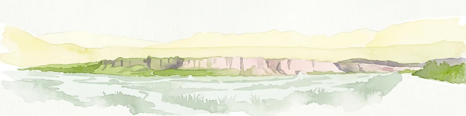
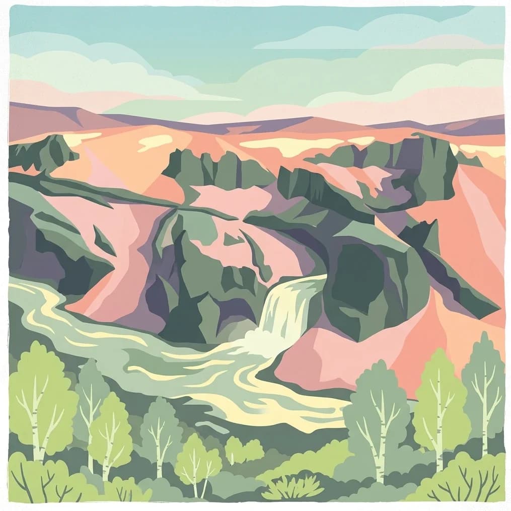
Jökulsárgljúfur was best known for its dramatic volcanic canyon landscape and the raw, untamed character of the Jökulsá á Fjöllum river valley. The park contained notable geological features including Vesturdalur with its distinctive Hljóðaklettar (echo rock) formations and the colorful Rauðhólar hills colored by iron oxidation. The nearby Ásbyrgi canyon, a horseshoe-shaped gorge to the north of the park, represented another striking feature of this volcanic landscape.

Jökulsárgljúfur National Park history and protected-area timeline

Jökulsárgljúfur was established as Iceland's 13th national park, protecting the Jökulsá á Fjöllum canyon system and surrounding volcanic terrain. The park remained an independent protected area until June 7, 2008, when it was incorporated into Vatnajökull National Park as part of a major expansion of Iceland's national park system. This consolidation brought the former Jökulsárgljúfur under the unified management of Vatnajökull National Park, which now covers approximately 14% of Iceland's territory and serves as the country's flagship conservation initiative.

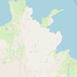
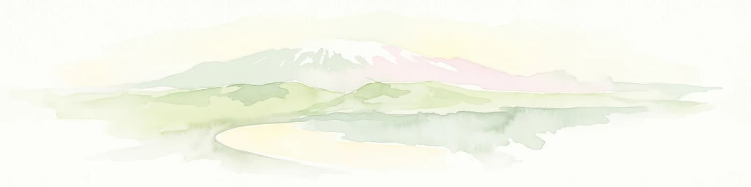
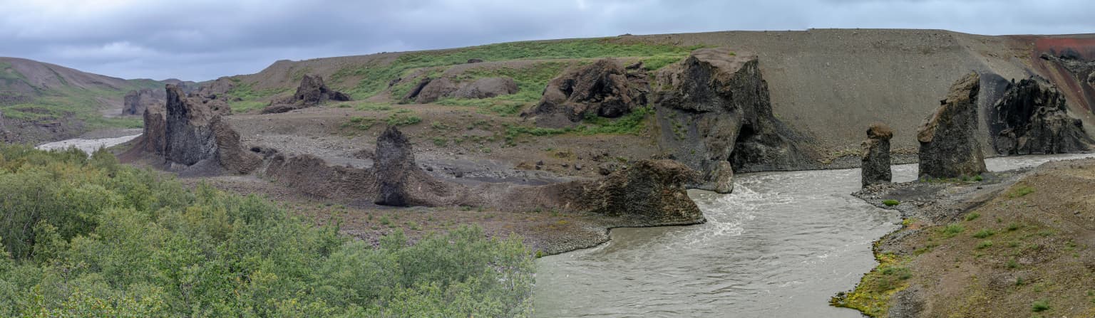
Jökulsárgljúfur National Park landscape and geographic character

The landscape of Jökulsárgljúfur is defined by the dramatic canyon of Jökulsá á Fjöllum, one of Iceland's most powerful glacial rivers. Volcanic mountains rise along the canyon edges, their slopes composed of basalt flows and volcanic debris. The terrain exhibits the chaotic character left by past volcanic eruptions and glacial outburst floods—the park's name itself evokes the powerful river that carved this landscape. Notable features include the distinctive rock formations of Vesturdalur and the iron-colored hills of Rauðhólar, where iron oxidation has painted the terrain in distinctive red and orange hues. The horseshoe-shaped Ásbyrgi canyon, located to the north of the former park boundary, represents another remarkable geological formation shaped by catastrophic water flows.

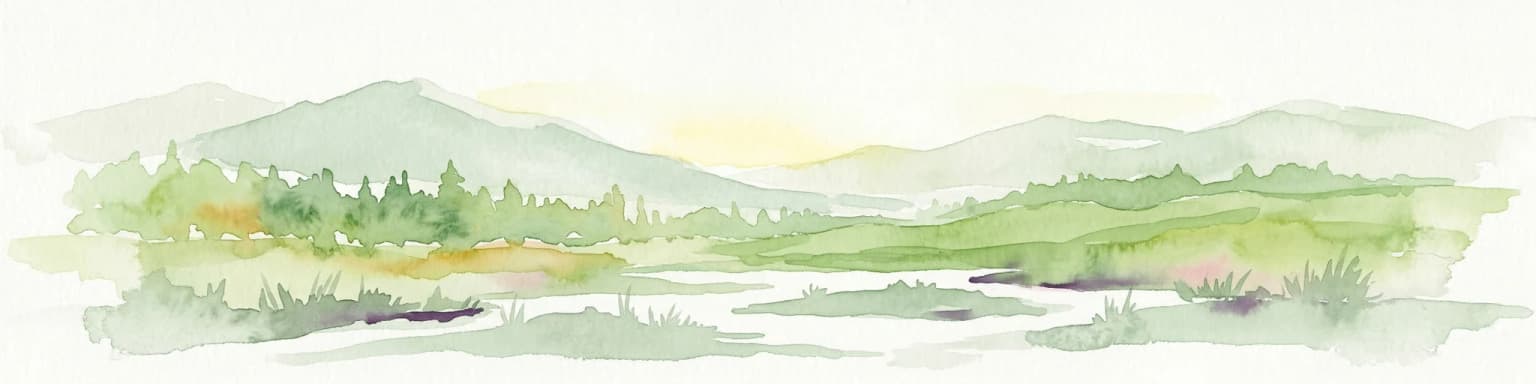
Jökulsárgljúfur National Park ecosystems, habitats, and plant life

The natural environment of Jökulsárgljúfur reflects Iceland's subarctic highland ecosystem. The volcanic terrain supports specialized vegetation adapted to the harsh conditions—mosses, lichens, and low-growing shrubs cling to the basalt cliffs and canyon walls. The river corridor provides habitat for fish and supports bird populations along its banks. The dramatic landscape represents a dynamic interface between volcanic geology and glacial hydrology, where ongoing erosion continues to shape the terrain.

Jökulsárgljúfur National Park wildlife and species highlights

Wildlife in the Jökulsárgljúfur area reflects Iceland's subarctic biodiversity. The Jökulsá á Fjöllum river system supports salmon and trout populations, while the surrounding terrain provides habitat for Arctic foxes and various bird species. The cliff formations offer nesting sites for ravens and other birds of prey. The harsh volcanic landscape, while not supporting the rich mammal communities found in lower-elevation areas, maintains its own ecological character through species adapted to Iceland's extreme conditions.

Jökulsárgljúfur National Park conservation status and protection priorities

The incorporation of Jökulsárgljúfur into Vatnajökull National Park in 2008 ensured continued protection for the area's volcanic landscapes and ecological communities. As part of Europe's largest national park, the former Jökulsárgljúfur benefits from comprehensive conservation management that addresses both geological preservation and ecological protection. The park's volcanic features represent important records of Iceland's geological history, while its river systems and associated habitats contribute to broader conservation goals for Iceland's northern ecosystems.

Top sights and standout views in Jökulsárgljúfur National Park

The standout features of Jökulsárgljúfur include the dramatic Jökulsá á Fjöllum canyon carved through volcanic terrain, the distinctive Hljóðaklettar (echo rock) formations in Vesturdalur, and the rust-colored hills of Rauðhólar created by iron oxidation. The park lies immediately north of Dettifoss, Europe's most powerful waterfall, and near the horseshoe-shaped Ásbyrgi canyon. The area preserves a landscape shaped by catastrophic jökulhlaup events approximately 8,000 years ago when volcanic fissures from the Askja system erupted beneath glacial ice.

Park location guide

Geography guide, regional context, and park location map for Jökulsárgljúfur National Park

Jökulsárgljúfur National Park park geography, regions, and map view in Iceland
Understand where Jökulsárgljúfur National Park sits in Iceland through a broader geographic reading of the surrounding landscape, nearby location context, and its mapped position within the national park landscape.

How Jökulsárgljúfur National Park fits into Iceland

Iceland is a Nordic island nation located between Europe and North America on the Mid-Atlantic Ridge. With a population of approximately 394,000 and an area of 103,125 km², it is one of the world's most sparsely populated countries. The country features dramatic volcanic terrain, extensive glaciers, geysers, and geothermal activity, all while maintaining a temperate climate warmed by the Gulf Stream.

Wider geography shaping Jökulsárgljúfur National Park in Iceland

Iceland is an island nation located in the North Atlantic Ocean between the Arctic Ocean and the Atlantic Ocean, situated on the Mid-Atlantic Ridge between Europe and North America. The interior consists of volcanic plateaus with sand and lava fields, while mountains and glaciers dominate the terrain. Numerous glacial rivers flow from the highlands through lowlands to the sea. The country sits at a latitude just south of the Arctic Circle.

Map view of Jökulsárgljúfur National Park

Use this park location map to pinpoint Jökulsárgljúfur National Park in Iceland, understand its exact geographic position, and read its mapped placement within the surrounding landscape more clearly.

Pigeon | © OpenStreetMap contributors
Park atlas

Browse the diverse protected landscapes of northern Iceland and beyond, tracing the regional spread of canyons, volcanic terrain, and glacial river valleys.

Discover More National Parks and Protected Areas Near Jökulsárgljúfur National Park in Iceland
Continue your exploration of Iceland's dramatic conservation landscapes by browsing other national parks and protected areas that share geographic features with Jökulsárgljúfur National Park. Map similar volcanic canyons, glacial river valleys, and unique basalt formations to understand their regional distribution and ecological significance within the island's terrain.
National park

Vatnajökull National Park: Iceland's Expansive Protected Glacier and Volcanic Terrain

Mapped boundaries of a UNESCO World Heritage site dynamic with fire and ice.

Vatnajökull National Park offers a profound exploration of one of Earth's most dynamic natural environments. This Icelandic national park protects the vast Vatnajökull ice cap, a landscape shaped by active volcanoes and powerful glacial forces, creating a region of extraordinary geographic diversity. Discover the mapped terrain, from subglacial mountain ranges to dramatic caldera systems, and understand the unique protected area context of this significant European natural heritage.

Area
14,967 km²
Established
2008
Relief
Mountain
Climate
Subpolar
National park

Skaftafell National Park: Iceland's Accessible Protected Landscape with Glacial Terrain and Basalt Columns

Discover glacial landscapes and volcanic geology.

Skaftafell National Park is a vital protected area in Southeast Iceland, offering a unique atlas-level view of dramatic glacial landscapes. Located at the base of Vatnajökull, Europe's largest glacier, the park features accessible hiking trails that traverse outwash plains, birch woodlands, and glacial tongues like Skaftafellsjökull. Explore the iconic Svartifoss waterfall, framed by striking basalt columns, and understand the park's dynamic terrain shaped by volcanic activity and glacial processes, providing rich geographic context for protected landscape discovery.

Established
1967
Scope
Terrestrial
Watercolor painting depicting a landscape with cliffs, a body of water, and distant hills under a light sky
National parkSouthern Region

Þingvellir National Park: Witness Tectonic Plates and Ancient Icelandic Governance

Explore the rift valley and historic parliament site in Iceland's Southern Region.

Þingvellir National Park offers a singular opportunity for geographic discovery, situated in Iceland's Southern Region. This protected national park is globally recognized for its visible expression of the Mid-Atlantic Ridge, where the North American and Eurasian tectonic plates actively diverge, creating a dramatic rift valley. Moreover, Þingvellir served as the site of the Althing, Iceland's ancient parliament, making it a crucial historical landmark. Explore this landscape to understand both powerful geological processes and the foundations of Icelandic democratic history through its mapped terrain.

Area
92.7 km²
Established
1930
IUCN
II
Relief
Lowland
National park

Snæfellsjökull National Park: Mapped Volcanic Terrain and Protected Landscape Identity

Discover the geographic context of Iceland's glacier volcano.

Snæfellsjökull National Park on the Snæfellsnes Peninsula is a prime example of Iceland's protected lands, defined by the iconic Snæfellsjökull glacier volcano. This page details the park's volcanic terrain, from expansive lava fields to dramatic sea cliffs, offering an atlas-driven exploration of its unique geographic features. Understand its significance as a protected area and its place within the broader landscape of western Iceland through detailed mapping and geographic data.

Established
2001
Watercolor painting depicting mountains, forested hills, and a river in a scenic landscape
National parkScotland

Cairngorms National Park: Explore Scotland's Largest Protected Mountain Landscape

Mapped boundaries and arctic-alpine geography.

As the United Kingdom's largest national park, Cairngorms National Park in Scotland presents a vast expanse of distinctive arctic-alpine terrain and ancient Caledonian forests. This protected landscape offers a unique opportunity to explore mapped geographic features, from its extensive mountain plateaus to its vital river systems. Discover the contours and context of this significant natural area within the broader atlas of Scotland's protected lands.

Area
4,528 km²
Established
2003
IUCN
V
Visitors
1.9M annual
Watercolor illustration of green rolling hills and a body of water under a pale sky
National parkGreenland

Northeast Greenland National Park: Arctic Wilderness and Protected Landscape Atlas

Explore the world's largest national park and its mapped terrain.

Northeast Greenland National Park represents an extraordinary expanse of Arctic wilderness, renowned as the largest protected area globally. This national park protects a diverse landscape, from the interior Greenland Ice Sheet to dramatic glacial fjords and ice-free polar desert regions. Discover its extensive mapped boundaries and its significance as a sanctuary for vital Arctic megafauna, offering a profound case study in large-scale protected landscape geography.

Area
972,000 km²
Established
1974
IUCN
II
Relief
Mixed relief
National parkVestland

Jostedalsbreen National Park: Europe's Premier Glacial Protected Landscape

Mapped terrain and protected area discovery in Vestland, Norway.

Jostedalsbreen National Park represents a unique geographic entity, safeguarding the largest glacier on the European mainland. This national park, situated in Norway's Vestland region, offers profound insights into glacial landscapes and mountain geography. Users can explore the vast ice mass that dominates the terrain, observe the U-shaped valleys carved by its movement, and understand the geological processes shaping this dynamic environment. The park's protected status highlights its importance for understanding glacial science and preserving a critical component of Norway's natural heritage.

Area
1,310 km²
Established
1991
IUCN
II
Relief
Mountain
National parkInnlandet

Breheimen National Park: Protected Glacial Landscapes and Mountain Terrain in Innlandet

Norway's prominent national park featuring active glaciers and alpine geography.

Breheimen National Park represents a significant protected landscape within Norway's Innlandet region, dedicated to conserving its unique glacial formations and dramatic alpine terrain. The park's vast area encompasses active glaciers, soaring peaks, and a notable diversity of natural environments, from lush valleys to barren plateaus. MoriAtlas facilitates a detailed exploration of Breheimen National Park, highlighting its mapped protected boundaries and its integral role in the regional geography and protected areas atlas.

Area
1,671 km²
Established
2009
IUCN
II
Relief
Mountain

Common questions about visiting, size, designation, and location context for Jökulsárgljúfur National Park

Jökulsárgljúfur National Park FAQs for park facts, access, geography, and protected area context
Find quick answers about Jökulsárgljúfur National Park, including protected-area facts, park geography, trail and visitor context, and how the park fits into its surrounding country and regional landscape.
MoriAtlas Explorer

Continue Your Protected Areas Search Across the Global Atlas

Deepen your exploration by continuing the structured search for national parks and protected areas worldwide. Utilize the comprehensive filtering capabilities to compare different conservation landscapes and refine your understanding of global park geography. Discover more about the distribution and characteristics of protected natural areas.

Global natural geography