Mori Atlas logo
Nearby park discovery

Regional mapping of protected land boundaries and surrounding mountainous terrain

Geographic Distribution of Protected Areas and Natural Landscapes Near Soonwald

Trace the broader geographic context of the Soonwald massif by analyzing adjacent protected areas and ridgeline systems within the Rheinland-Pfalz region. This regional focus identifies surrounding conservation landscapes and forest massifs through mapped proximity, offering a clear perspective on the spatial relationship between these natural sites and the surrounding mountain terrain.

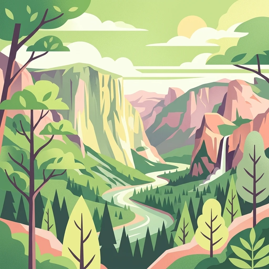
Stylized flat vector illustration of a scenic valley with steep rock cliffs, a winding river flowing through the center, a waterfall on the right, and pine forests in the foreground under a sunlit sky.

A forested quartzite ridge in the eastern Hunsrück, one of Germany's largest contiguous forest landscapes.

Soonwald

The Soonwald is a quartzite-dominated ridge system in the eastern part of the Hunsrück low mountain range in Rhineland-Palatinate, Germany. Rising to its highest point at the Ellerspring (657.5 m) and forming roughly 40 km of uninterrupted crestlines when the adjacent Lützelsoon and Binger Wald are included, it represents one of the most cohesive forested massifs of the German Mittelgebirge landscape. Geologically, its parallel ridges of hard Taunus quartzite over softer surrounding rocks have produced a tight, ridgeline-dominated terrain dissected by deeply incised streams. The whole Großer Soon lies within the Naturpark Soonwald-Nahe, and ecologically it is characterized by extensive mixed forest, old-growth nature reserves, and protected wet meadow fragments that shelter rare plants and breeding birds. Culturally, the Soonwald has been documented since 868 as a royal or monastic forest pasture, and it carries centuries of layered heritage: prehistoric barrows, medieval castle ruins overlooking the Nahe tributaries, Romantic-era literary attention from Hunsrück poets, and the persistent legend of the robber Schinderhannes. Although the region once stood as a candidate for a Rhineland-Palatinate national park, that designation was ultimately awarded to the nearby Hochwald instead.

Location
Germany
Park type
Protected landscape
Area
276.6 km²
Highest point
658 m
Soonwald Protected Landscape Atlas
Regional park map

See the ranked park cluster in its geographic setting

Nearby parks around Soonwald

This regional map shows the same 20 nearby parks ranked below around Soonwald. Select a ranked marker to highlight that park’s boundary where boundary data is available.
Reference park: SoonwaldRanked nearby parkSelected boundary: Soonwald20 nearby parks shown
20 nearby parks

Distance ranked collection and regional park geography for comparative analysis

Parks and Protected Areas Geographically Near Soonwald

Geographic separation metrics establish a ranked inventory of protected areas surrounding the Soonwald forest massif. Structured boundary data and recorded environmental characteristics enable precise comparison across regional conservation landscapes.
Nature reserveRhein-Hunsrück-Kreis
About 10 km away#1 closest

North

Struth Nature Reserve: Protected Wetland and Forest Geography in Rhein-Hunsruck-Kreis

Extensive wetland mosaic within the Hunsruck uplands

Struth is a sprawling nature reserve in Germany, known for its rare alder swamp woodlands and expansive wet meadows. Its geography reveals a transitional landscape between forested uplands and the Middle Rhine valley, offering a vital ecological corridor that includes protected habitat for threatened bat and beetle species across 871 hectares.

Area
8.71 km²
Established
1987
Relief
Upland
Scope
Terrestrial
A horizontal watercolor painting showing a serene valley landscape with distant rolling mountains, a central winding river or stream, and grassy banks in soft muted colors.
Nature reserveGermany
About 14 km away#2 closest

Northeast

Morgenbachtal Nature Reserve: A Geographic Atlas of the Middle Rhine Slate Cliffs

Exploration of the Binger Wald protected valley and its geological terrain.

Morgenbachtal presents a unique geographic profile characterized by two distinct ridge lines of crystalline slate cliffs. This protected area in Germany balances strict conservation with a complex landscape of narrow ravines, mixed forests, and historical landmarks like the Steckeschlääferklamm gorge and medieval castle ruins along the Rhine.

A watercolor painting showing a soft, atmospheric landscape with a river flowing through green hills and gentle, misty mountains.
Nature reserveRhineland-Palatinate
14 km away#3 closest

East

Inselrhein Nature Reserve, Rhineland-Palatinate: A Geographic and Protected-Area Atlas

River islands, floodplain forests, and Upper Rhine wetlands

Inselrhein features a chain of natural river islands and side channels forming a critical wetland habitat. The terrain transition from soft-wood to hardwood forest communities creates a layered landscape. Examine the protected boundaries and geographic significance of this river corridor between Mainz and Bingen, documented within the Rhineland-Palatinate atlas.

Relief
Lowland
Climate
Temperate
Access
Easy access
Scope
Terrestrial
A horizontal watercolor painting showing a river winding through lush green islands and low hills in the background.
Nature reserveHesse
14 km away#4 closest

Northeast

Lorcher Werth Nature Reserve: Protected Rhine Island Geography and Floodplain Forest

An ecologically significant island pair in the Middle Rhine, Hesse.

Lorcher Werth is a unique river island complex in Hesse, Germany, designated as a nature reserve and European Habitats Directive site. These uninhabited islands act as a vital refuge for floodplain habitats, currently undergoing a transformation toward natural Auwald forest. This site provides a rare, flat fluvial counterpoint to the surrounding steep and narrow landscapes of the Middle Rhine corridor.

Area
0.129 km²
Relief
Lowland
Climate
Temperate
Access
Highly restricted
A horizontal watercolor painting depicting a wide, jagged rock cliff face with green hills, set against a plain background.
Nature reserveRheinland-Pfalz
About 15 km away#5 closest

Southeast

Rotenfels Nature Reserve: A Geographical Portrait of the Nahe Valley Rhyolite Cliff

Geological landscape and protected habitat in Rheinland-Pfalz.

The Rotenfels nature reserve is anchored by a massive 200 meter high rock wall formed from red rhyolite. This protected landscape is recognized for its vertical drop into the Nahe River valley, creating a distinct microclimate that supports specialized cliff vegetation and raptor habitats within a traditionally farmed viticultural region.

Area
0.91 km²
Established
1939
Relief
Mountain
Climate
Temperate
Watercolor painting of a river landscape with rolling green hills, distant slopes, and soft vegetation in shades of green and pink against a white background.
Nature reserveRheingau-Taunus-Kreis
19 km away#6 closest

East

Rüdesheimer Aue Nature Reserve and Upper Rhine Protected Landscape

Riverine geography and protected floodplain forest

Rüdesheimer Aue represents a rare, uninhabited island refuge along the Upper Rhine. Its geography features shifting sediment bars, mudflats, and softwood floodplain forest cover, offering an essential staging ground for migratory waterbirds within the Rheingau-Taunus district of Hesse.

Area
0.057 km²
Relief
Lowland
Climate
Temperate
Access
Remote access
Watercolor painting of a forested landscape with rolling hills and distant mountains under a pale sky
National parkSaarland
20 km away#7 closest

Southwest

Hunsrück-Hochwald National Park: Saarland Protected Area Atlas and Landscape Context

Explore the mapped terrain and protected geography of this German national park.

Delve into the specific geography and protected landscape of Hunsrück-Hochwald National Park in Saarland. This detail page provides an atlas-centric view of the park's mapped boundaries, regional context, and its role as a national park. It serves as a foundational point for understanding the park's landscape features and its placement within the broader geographic atlas.

Area
100 km²
Established
2015
IUCN
II
Relief
Mountain
Watercolor painting of rolling green hills, small forest patches, and rocky outcrops under a soft, white background.
National parkRheinland-Pfalz
20 km away#8 closest

Southwest

Nationalpark Hunsrück-Hochwald: An Atlas and Geographic Overview of Protected Lands

Upland forest ecosystems and quartzite mountain terrain

The Hunsrück-Hochwald region showcases the transition of industrial-era forests toward near-natural wilderness. Its mapped territory integrates significant beech wood blocks with smaller wetland systems, reflecting a commitment to long-term biodiversity within the German uplands. Explore the structural composition and landscape features that define this protected zone.

Area
101.2 km²
Established
2015
IUCN
II
Relief
Mountain
A horizontal watercolor illustration depicting rolling green hills, a forest, a winding river, and hazy distant mountains.
Nature reserveRhineland-Palatinate
About 21 km away#9 closest

Southwest

Mörschieder Burr Nature Reserve: Geological Identity and Protected Forest Boundaries in Rhineland-Palatinate

A mapped quartzite summit within the Hunsrück forest landscape.

Spanning nearly 20 hectares, Mörschieder Burr preserves a rare expanse of vegetation-free scree slopes and Taunus quartzite outcrops in western Germany. The reserve acts as a geological anchor within the Idarwald forest, offering a concentrated look at the unique rocky terrain that defines this part of the Hunsrück-Hochwald National Park buffer zone.

Area
0.197 km²
Established
1940
A watercolor illustration of a calm body of water with a single tree in the center; distant rolling hills are visible in the background under a soft, pastel-colored sky.
Nature reserveLower Saxony
About 22 km away#10 closest

East

Fulder Aue, Ilmen Aue Nature Reserve: Mapped Protected Landscapes and Floodplain Geography

Alluvial river islands and wetland ecosystems in the Rhine valley.

The Fulder Aue, Ilmen Aue nature reserve serves as an vital example of an active Rhine floodplain. This area preserves a mosaic of islands, connecting channels, and soft-wood forest habitats. Learn about the geographic and hydrological dynamics that shape this protected space near Bingen am Rhein, showcasing its importance within the Rhine lowland system.

Area
3.38 km²
Established
1995
Relief
Lowland
Scope
Terrestrial
Nature reserveDonnersbergkreis
About 23 km away#11 closest

Southeast

Langhöll-Falkenberg Nature Reserve and Protected Landscape in Donnersbergkreis

Mapping the ecological gradient of this North Palatine valley reserve.

Langhöll-Falkenberg represents a distinct protected zone where dry upland slopes meet moist valley floor environments. The reserve functions as an essential habitat mosaic, combining semi-dry grasslands with alder carr and spring-fed mires. This structured view examines the site topography and its role in regional conservation across the North Palatine uplands of Rhineland-Palatinate.

Area
1 km²
Established
1999
IUCN
IV
Nature reserveRhineland-Palatinate
About 24 km away#12 closest

West

Naturschutzgebiet Spring Nature Reserve: Protected Wetland and Headwater Landscape Geography

Mapped upland habitats in the Hunsrück, Rhineland-Palatinate

Naturschutzgebiet Spring protects a specialized wetland complex, featuring headwater streams and peatland formations within the Idarwald. This conservation area highlights the fragile, water-dependent ecology of the Hunsrück, providing a clear geographic view of preserved mire and swamp forest terrain within Rhineland-Palatinate.

Area
0.74 km²
Established
1988
Relief
Upland
Scope
Terrestrial
A horizontal watercolor painting of rolling green hills, a small stream, and forested slopes against a pale sky.
Protected areaRheinland-Pfalz
24 km away#13 closest

South

Königsberg Protected Area: Geography, Forest Habitats, and Regional Landscape Identity

Examining the mountain ridges of the Nordpfälzer Bergland

Königsberg stands as a prominent mountain massif in the German state of Rheinland-Pfalz. This protected landscape is characterized by deep mixed beech-oak forests, significant geological scree formations, and an intricate history of mining. Its ridge-line terrain provides a critical study of upland geography, separating regional valleys while hosting a diverse array of protected natural habitats and medieval heritage sites.

Area
10.47 km²
Relief
Mountain
Climate
Temperate
Access
Moderate access
Protected landscapeRhineland-Palatinate
About 25 km away#14 closest

Southeast

Rheinhessische Schweiz: Protected Landscape and Regional Geography in Rhineland-Palatinate

Forested ridges and dry heathland terrain

Rheinhessische Schweiz represents a significant protected area defined by its dense deciduous forests, narrow valleys, and nutrient-poor porphyry soils. This atlas entry details the geographic composition of the Wiesener Randhöhen and the Neubamberger Riegel, highlighting the unique dry grassland ecosystems preserved within these North Palatine Uplands boundaries.

Area
67.66 km²
Established
1961
Relief
Upland
Climate
Temperate
A soft watercolor painting depicting a rolling landscape with fields, a small forest edge, and a mountain peak in the background.
Protected areaRhineland-Palatinate
27 km away#15 closest

Southeast

Donnersberg Protected Area: A Geographic Atlas of the Palatinate Region's Highest Massif

Geological landscapes, Celtic heritage sites, and forested mountain terrain.

The Donnersberg massif represents a critical point of geographic and archaeological interest in Rhineland-Palatinate. This protected area encompasses a 24-square-kilometer rhyolite cryptodome featuring high-altitude plateaus, a complex network of forest ecosystems, and well-preserved remnants of ancient Celtic fortifications. Its steep slopes and diverse rock formations offer a clear look at the geological and historical layering of the German landscape.

Area
24 km²
Relief
Mountain
Climate
Temperate
Access
Easy access
A pale, minimalist watercolor painting of a rolling green landscape with distant hills and a small group of trees on the right.
Nature reserveRhineland-Palatinate
About 27 km away#16 closest

North

Hintere Dick-Eisenbolz Nature Reserve: Geographic Context and Protected Landscape Data

Orchard meadows and invertebrate conservation in western Germany.

Situated in the Rhineland-Palatinate region of western Germany, Hintere Dick-Eisenbolz protects a 54-hectare expanse of traditional orchard meadows. This cultural landscape mosaic, characterized by fruit trees and grassland, supports high levels of insect diversity near the Rhine valley. The reserve remains an essential site for understanding the intersection of human-influenced agricultural land and critical biodiversity protection.

Area
0.546 km²
Established
1998
A horizontal watercolor painting of a river landscape with lush green trees, grasses, and a winding waterway under a soft light.
Nature reserveHessen
28 km away#17 closest

East

Mariannenaue Nature Reserve: Protected River Island Geography and Landscape Atlas

Rhine river island and floodplain forest in Hessen, Germany.

Mariannenaue serves as a prominent example of a protected inland island in the Upper Rhine. Its geography encompasses a complex mix of veteran floodplain forest, still-water habitats, and centuries-old vineyard cultivation. This detail page provides insights into the park boundaries, the surrounding riverine terrain, and the ecological network that connects this site to the broader Rheingau landscape.

Area
1.96 km²
Established
1972
Relief
Lowland
Climate
Temperate
Protected areaRheinland-Pfalz
About 28 km away#18 closest

Southwest

Truppenübungsplatz Baumholder: Protected Area and Geological Landmark in Rheinland-Pfalz

A vast military training ground and Natura 2000 ecological sanctuary.

Truppenübungsplatz Baumholder is a expansive protected landscape in Rheinland-Pfalz, functioning as both an active military installation and a preserved natural habitat. The terrain features a striking mix of dense deciduous forest, open firing corridors, and unusual volcanic geological remnants like rare lava flows and agate deposits. This site serves as a critical study in how restricted access shapes regional biodiversity.

Area
116 km²
Established
1937
Relief
Upland
Access
Highly restricted
Nature reserveRhineland-Palatinate
About 31 km away#19 closest

East

Hangflächen um den Heidesheimer Weg: Nature Reserve Geography and Protected Landscape Context

Mainz-Bingen, Rhineland-Palatinate Nature Reserve

Hangflächen um den Heidesheimer Weg contains an unusual ecological convergence of sand dunes, open flats, and calcareous grasslands near Ingelheim am Rhein. This nature reserve provides critical protection for a fragmented yet highly structured landscape where springs and wetland zones intersect with warm, dry slopes. The area preserves a significant biotope complex of national importance within the Upper Rhine Plain.

Area
3.348 km²
Established
2003
A horizontal watercolor illustration of a natural landscape featuring a small body of water or pond in the foreground, surrounded by grassy banks, low hills in the distance, and soft-colored vegetation.
Nature reserveRhineland-Palatinate
About 32 km away#20 closest

East

Sandgrube am Weilersberg Nature Reserve and Protected Landscape Map

Rhineland-Palatinate, Germany protected area

Sandgrube am Weilersberg is a protected nature reserve in Rhineland-Palatinate, Germany, known for its compact mosaic of calcareous sand slopes and wet meadows. Part of the Natura 2000 network, the site preserves rare steppe flora and wetland ecosystems that emerged following former sand extraction. The terrain supports significant entomological, botanical, and bryological diversity maintained through active grazing.

Area
0.095 km²
Established
1986
Relief
Lowland
Climate
Temperate
Distance methodology

Geographic measurements, not driving distances

How nearby park distances are calculated

Distances use park boundaries whenever the available geometry allows it. When one or both boundaries are missing, the mapped park locations provide a clearly labelled estimate. Every value represents straight-line geographic separation and does not use roads or routing.

Boundary distance

Calculated between the nearest points of both park boundaries.

Location-to-boundary estimate

Estimated from one mapped park location to the nearest boundary of the other park.

Mapped-location estimate

Estimated between the mapped locations of both parks.

MoriAtlas Explorer

Continue Exploring the Soonwald Protected Landscape and Hunsrück Geography

Navigate the complex ridgeline terrain and forested massifs of the Soonwald within MoriAtlas. This resource provides detailed geographic insights into the quartzite structures and protected natural boundaries of the Rhineland-Palatinate mountain regions, helping users build a comprehensive understanding of this significant landscape entity.

Global natural geography