
Mori Atlas logo
Protected landscapeSoonwald

Analyzing the contiguous forest massif and ridgeline geography of the Naturpark Soonwald-Nahe

Soonwald Protected Landscape: Exploring the Quartzite Ridge Systems of the Hunsrück Mountain Range

The Soonwald represents a cohesive forested massif and quartzite ridge system situated in the eastern Hunsrück range of Rhineland-Palatinate. This protected landscape is defined by parallel crests that extend for approximately 40 kilometers, rising to the Ellerspring summit at 657.5 meters. The terrain is characterized by deeply incised valleys, mature mixed forests, and protected wet meadows, forming an essential ecological and geographic landmark within the German Mittelgebirge.

Hunsrückquartzite ridgesmixed forestlow mountain rangeNaturpark Soonwald-Naheforest hiking
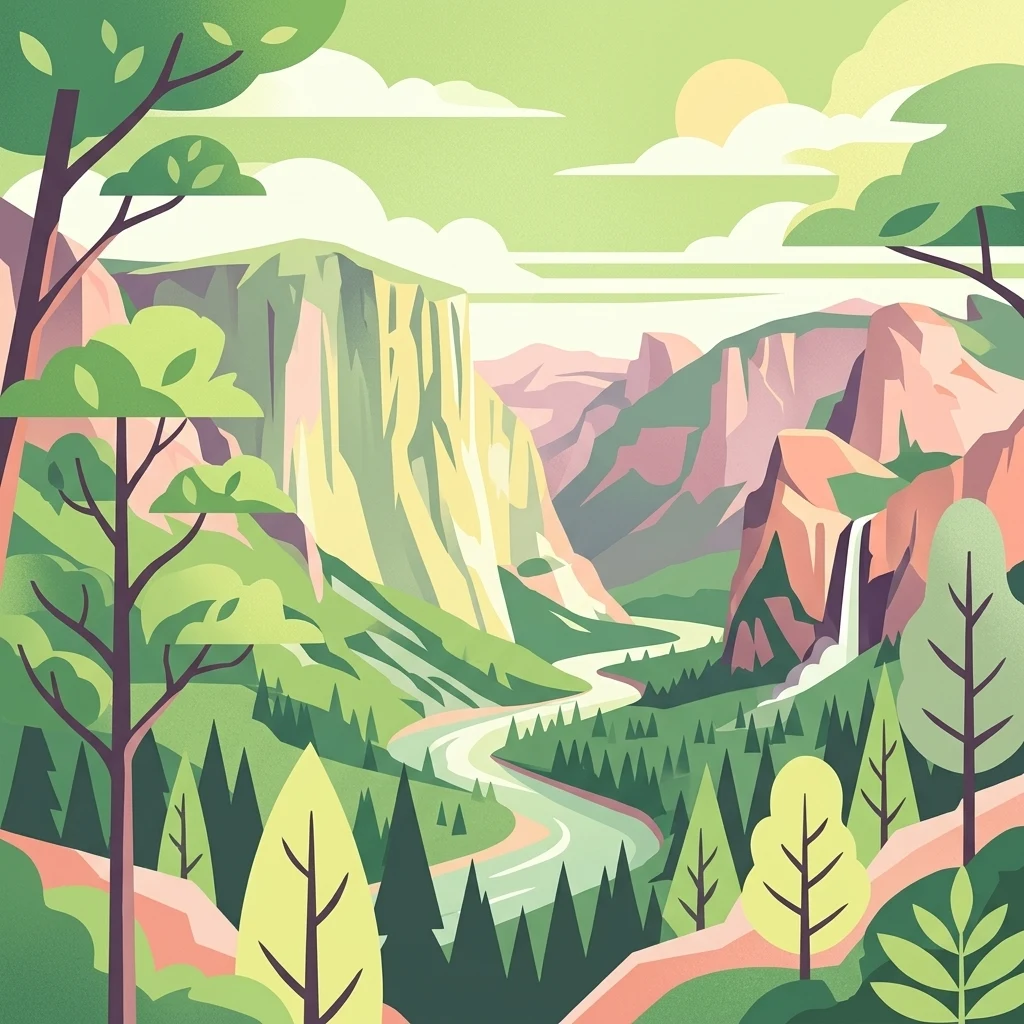
Stylized flat vector illustration of a scenic valley with steep rock cliffs, a winding river flowing through the center, a waterfall on the right, and pine forests in the foreground under a sunlit sky.

Soonwald

Protected landscape

Park overview

Structured park overview, official facts, and landscape profile for Soonwald

Soonwald park facts, protected area profile, and essential visitor context

Review the core facts for Soonwald, including designation, size, terrain, visitor scale, habitats, and operating context in one park-focused overview.

About Soonwald

The Soonwald forms the eastern crest country of the Hunsrück, where the Taunus quartzite strata reappear after their interruption beneath the Nahe valley and rise again as a chain of forested ridges. Topographically, the massif is defined by two main parallel quartzite crests that stretch in a northeast direction from the Simmerbachtal toward the Guldenbachtal, with a third, lower southwestern side ridge branching off near the Alteburg. Together these crests produce a remarkably fold-free, almost comb-like landscape that contrasts with the more deeply dissected slopes toward the Nahe in the south.

Below the ridgelines, the Soonwald transitions into the Soonwald-Vorstufe, a roughly 400-meter-high agricultural bench of phyllites, quartzites, and greenschists that descends northward from the Gauchsberg toward the Nahe. The bench carries the medieval clearance villages of the region, while the steep, forested scarp facing south creates a small but visually distinct landscape chamber between the ridges and the river.

The Soonwald's water network is unusually well organized: almost every stream that drains the massif originates within the forest itself and feeds into the Nahe basin, with the Simmerbach and Guldenbach serving as the two principal framing rivers. Inside the ridgelines, brooks like the Gräfenbach, Lametbach, Ellerbach, and Gaulsbach drain in characteristic rill patterns toward these larger streams, producing narrow valleys with old castle sites, traditional meadows, and rare plant communities.

Quick facts and research context for Soonwald

The Soonwald is the easternmost crest region of the Hunsrück, extending across the Rhein-Hunsrück-Kreis and the Landkreis Bad Kreuznach in Rhineland-Palatinate. Its highest summit, the Ellerspring, reaches 657.5 m above sea level, while its lowest point lies near the Simmerbach exit at around 210 m.

Geologically, it consists of parallel Taunus quartzite ridges, and ecologically the combined forest area of Soonwald and Lützelsoon covers roughly 20,000 to 35,000 hectares of nearly contiguous woodland. The Großer Soon falls entirely within the Naturpark Soonwald-Nahe, and the area hosts seven designated nature protection zones, several Naturwaldreservate, and notable populations of red deer, wild boar, and forest-nesting raptors.

Protection and recognition

Documented terrestrial protection scope and Natura 2000 registry details for Soonwald

Soonwald Protection Status and Official International Recognition Data

Soonwald maintains documented terrestrial protection status alongside verified Natura 2000 recognition records within the regional conservation network. Structured facts outline official designation frameworks and administrative boundaries established for the protected landscape.

International recognition

Protection details

Protection scope
Terrestrial
Transboundary protection
No
Park context

Deeper park guide and search-rich context for Soonwald

Soonwald history, landscape, wildlife, and travel context

Explore Soonwald through its history, landscape character, ecosystems, wildlife, conservation priorities, cultural context, and seasonal travel timing in a structured park guide built for atlas discovery and search intent.

Why Soonwald stands out

The Soonwald is best known for its long, uninterrupted quartzite ridge system forming about 40 km of parallel crests through the eastern Hunsrück. The unbroken ridgeline, the highest point at the Ellerspring, and the consistent forested character of the massif distinguish it from more broken low mountain ranges nearby. It is equally recognized as one of the larger contiguous mixed forest blocks of the Rhineland-Palatinate Mittelgebirge. Traditional spruce dominance is giving way to more diverse beech, oak, and fir mixtures, while the combination of protected wet meadows, mature beech high forests in nature reserves, and dark coniferous woodland has created a habitat mosaic valued by ornithologists for woodpeckers, red kite, black stork, and other rare breeding birds.
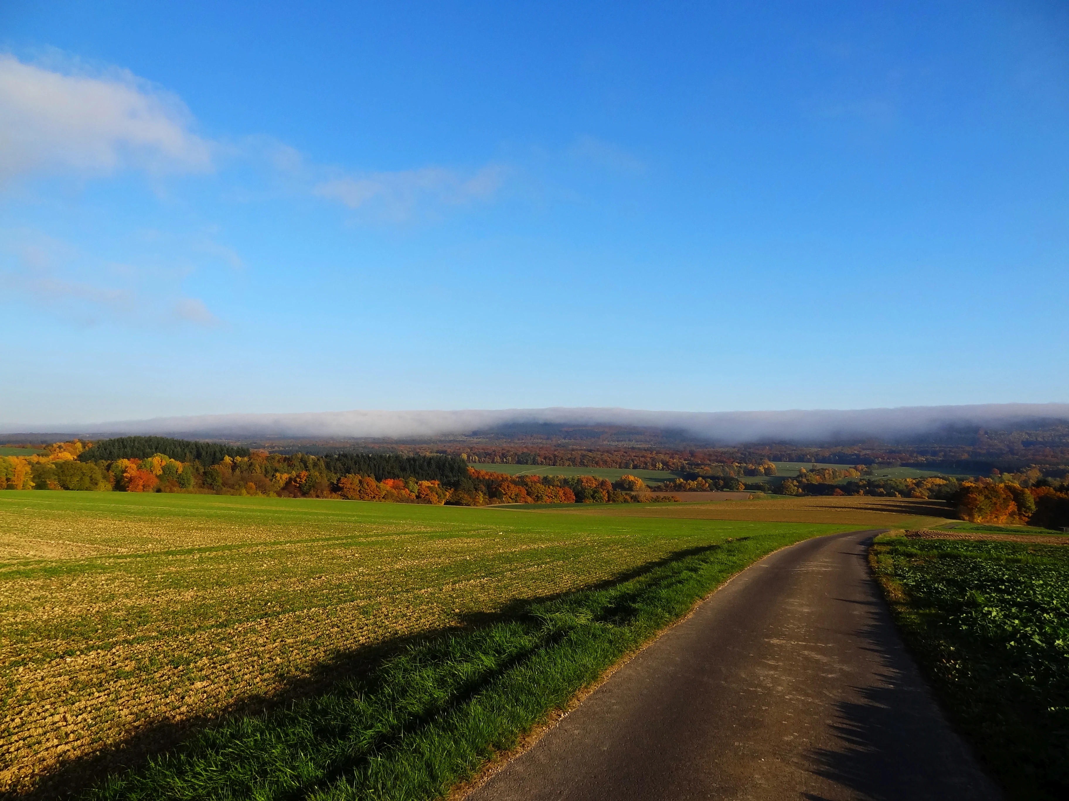
A paved path cuts through green and agricultural fields in the foreground, leading toward a distant line of forested hills capped with a low, horizontal bank of fog against a clear blue sky.
A rural road leads toward the forested ridges of the Soonwald, featuring a visible foehn cloud effect along the horizon.

Soonwald history and protected-area timeline

The Soonwald is first documented in 868 in a charter of Prüm Abbey as silva sana. Subsequent spellings such as nemus sane (1128), waldt San (1190), and off dem Sane (1438) gradually evolved into the modern name Soonwald. Etymological interpretations often link the root Sone or Senn to early use of the forest as grazing land for swine and other livestock, a tradition that shaped the forest character for centuries.

Originally the Soonwald formed part of the vast Vosagus or Wasgenwald, a Silva regis stretching from Alsace through the Saarland and the Hunsrück to the Mosel. Successive clearances opened today's surrounding villages and fields, while the core forested ridges remained comparatively untouched. Prehistoric tumuli near Argenthal, medieval castle ruins like Wildburg and Koppenstein, and the remnants of historic smelting works such as the Gräfenbacherhütte attest to long, continuous human interaction with the forest.

In the 19th century, the ruined hilltop castles became motifs of Romantic ballad poetry through the works of Otto von Vacano and Peter Joseph Rottmann. The regional figure of Schinderhannes, the legendary robber born nearby, gave his name to a regional cave, a long-distance cycling route, and enduring local lore. In more recent administrative history, the Soonwald along with the nearby Hochwald was considered by the Rhineland-Palatinate environmental ministry for national park designation, but the proposal ultimately favored the Hochwald because the Soonwald spans two counties with differing political support for the project.

Soonwald landscape and geographic character

The landscape of the Soonwald is dominated by long, parallel quartzite ridges running from southwest to northeast, with the main crests rising between roughly 540 m and 657.5 m. The principal summit, the Ellerspring, stands on the central ridge near Argenthal and Winterbach, while the Simmerkopf, Hochsteinchen, and Schanzerkopf mark notable high points along the northern chain. Depression between the ridges are limited: only the Lametbach breaks through the northern crest, and only the Gräfenbach through the southern crest, giving the massif an unusually compact, ridge-dominated appearance.

Beyond the forest core, the southern Soonwald-Vorstufe forms a contrasting agricultural bench of about 400 m elevation, interrupted by deeply incised brooks and crowned by the densely wooded Gauchsberg. Farther east, the quartzite crest continues as the Binger Wald before the Rhine cuts the structure down to around 70 m, after which it rises again as the Hohe Taunus on the far side of the river valley. The result is a landscape where deep, narrow valleys, abrupt forested crests, and dry agricultural plateaus alternate within a relatively short distance, all framed by the broader Nahe valley in the south.
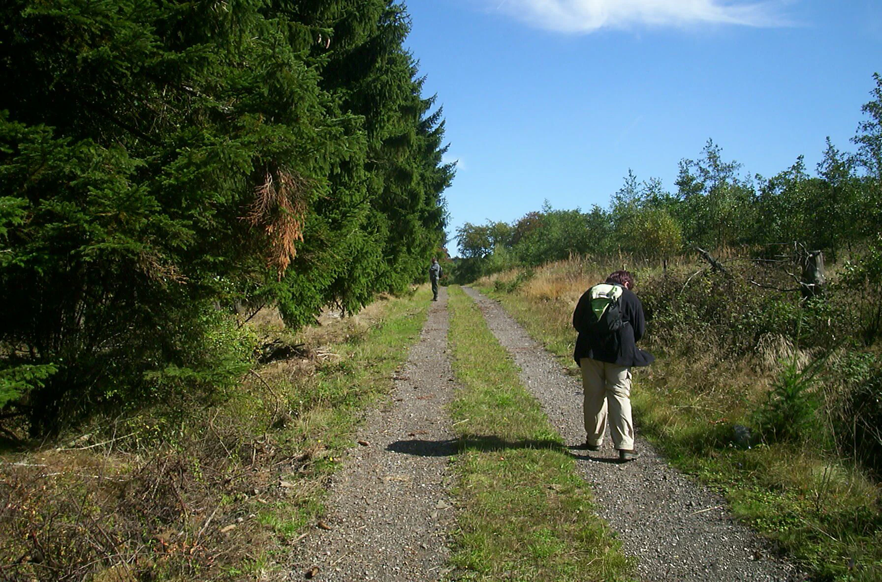
A hiker with a backpack walks away from the camera along a gravel path bordered by a dense evergreen forest on the left and sparse scrub on the right.
A hiker walking along the Rennweg trail in the Soonwald region.

Soonwald ecosystems, habitats, and plant life

Ecologically, the Soonwald and its southern neighbor the Lützelsoon form a largely closed forest area covering between roughly 20,000 and 35,000 hectares. Although modest in size by German forest standards, this combined woodland qualifies as one of the country's larger contiguous forest blocks. The flora is notable for combining species with strongly different ecological requirements within a small area, with roughly 850 fern and flowering plant taxa recorded.

The principal timber species are spruce and beech, accompanied by oak, alder, fir, and Douglas fir. Traditional monocultures are increasingly replaced by more diverse mixed stands, often following storm damage events that opened the canopy. Seven protected nature reserves within the Soonwald and Lützelsoon preserve meadow fragments and old forest stands, including the Glashütter Wiesen, the Landwiesen, and the former grazed woodland Im Eschen, where rare meadow plants such as devil's-bit scabious, marsh woundwort, and marsh marigold coexist with old pedunculate oaks.
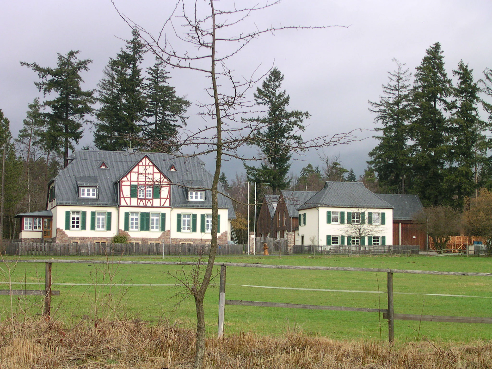
A traditional German forestry house with half-timbered accents and green shutters, surrounded by a green meadow and coniferous forest.
The Forsthaus Entenpfuhl, a historic forestry house located in the Soonwald region.

Soonwald wildlife and species highlights

The Soonwald supports breeding populations of several bird species regarded by organizations like Birdlife as indicators of high-quality forest habitat. Recorded species include black woodpecker, grey-headed woodpecker, middle spotted woodpecker, great grey shrike, kingfisher, red-backed shrike, black stork, red kite, and honey buzzard. Despite this ornithological significance, the region has not yet been formally designated as an EU bird protection area.

Among larger mammals, the forest holds thriving populations of red deer, wild boar, roe deer, and red fox. The mix of mature beech stands, old-growth oak remnants, and structurally rich mixed forest with embedded small meadows creates favorable conditions for both resident raptors and ground-dwelling game species, making the area attractive for wildlife observation alongside its traditional use as hunting ground.

Soonwald conservation status and protection priorities

The Soonwald's conservation significance rests on its large unbroken forest cover within the Naturpark Soonwald-Nahe, the presence of seven designated nature protection areas, and several Naturwaldreservate including the Lützelrech and the Schwappelbruch. The Lützelrech reserve in particular contains beech stands older than 230 years growing on Devonian quartzite, with a composition dominated by beech and supplemented by sessile oak and small-leaved lime.

Wet meadows such as the Glashütter Wiesen and the Landwiesen are protected primarily for their rare plant and insect communities. Although the regional government declined to nominate the Soonwald as a Natura 2000 bird protection area, the combination of traditional forestry shifting toward mixed forests, legally protected meadow fragments, and strict forest reserves gives the massif meaningful long-term conservation value within the broader Hunsrück landscape.

Soonwald cultural meaning and human context

The Soonwald is anchored in centuries of documented use as grazing forest, royal hunting ground, and monastic property, with its 868 attestation in a Prüm Abbey charter marking one of the earliest written records of any Hunsrück forest. The name itself is thought to reflect this pastoral past, and the medieval clearances that produced the surrounding villages still define the cultural pattern of field, forest, and scattered settlements today.

The region's heritage also includes medieval castles built to defend ore deposits and smelting sites, Romantic literary evocations of their ruins by the Hunsrück poets Otto von Vacano and Peter Joseph Rottmann, and the persistent legend of the robber Schinderhannes, born in the area in 1779. Forestry heritage is prominent as well: Friedrich Wilhelm Utsch and Johann Adam Melsheimer, two foresters of the Soonwald, are traditionally cited as inspirations for the folk song Der Jäger aus Kurpfalz. The former NATO airfield at Pferdsfeld, the long-distance Soonwaldsteig trail linking these sites, and the Bollinger oak near the route together weave the forest into a recognizable regional identity.

Top sights and standout views in Soonwald

Continuous quartzite ridgelines stretching about 20 km in the Großer Soon proper and roughly 40 km together with the Lützelsoon and Binger Wald form the physical backbone of the area. The Ellerspring at 657.5 m is the highest point, while the Hochsteinchen observation tower and the Alteburg with its ramparts and tower offer classic vantage points over the Hunsrück landscape.

Ecological highlights include the protected wet meadows of the Gräfenbach and Lametbach valleys, the Lützelrech nature forest reserve with ancient beech, and breeding populations of black stork, black woodpecker, and red kite. Cultural landmarks such as the Wildburg and Koppenstein castle ruins, the Bollinger oak, and the Soonwaldsteig long-distance trail combine natural and historical interest into a coherent walking and cycling destination.

Best time to visit Soonwald

The Soonwald is accessible year-round as a forested low mountain landscape, but the character of a visit shifts noticeably with the seasons. Spring and early summer bring rich wildflower displays in the protected meadows of the Gräfenbach and Lametbach valleys, and the forest is particularly fresh and vocal with breeding birds. Summer offers the most comfortable hiking conditions along the Soonwaldsteig, while autumn highlights the mixed beech and oak canopy with strong color and good light for viewpoints like the Hochsteinchen.

In autumn and winter the topography of the massif can also produce distinctive lee effects on weather, and snow on the higher summits accentuates the quartzite ridgelines. Winter visitors should expect forest roads to be quiet and some paths occasionally icy, but the open views from the crests remain rewarding even in colder months.

Monthly climate preview

Long-term representative coordinate climatology for monthly temperature and precipitation rhythm

Soonwald Climate Normals and Measured Annual Temperature and Precipitation Patterns

Analysis of NASA POWER 1991 to 2020 climatology data reveals the measured monthly temperature range and precipitation rates recorded at a representative Soonwald coordinate. Accessing the complete twelve-month profile provides detailed monthly averages for evaluating long-term environmental patterns across the protected area.
Annual mean9 °C
0 °C19 °C
Jan
Feb
Mar
Apr
May13°
Jun16°
Jul19°
Aug19°
Sep14°
Oct
Nov
Dec
Warmest month
July

18.9 °C

Coolest month
January

-0.1 °C

Wettest month
December

2.3 mm/day

Driest month
April

1.5 mm/day

Park location guide

Geography guide, regional context, and park location map for Soonwald

Soonwald park geography, regions, and map view in Germany

Understand where Soonwald sits in Germany through a broader geographic reading of the surrounding landscape, nearby location context, and its mapped position within the national park landscape.

How Soonwald fits into Germany

Germany is a federal republic in Western and Central Europe with a population of over 83 million across sixteen constituent states. It is Europe's largest economy by nominal GDP and a major global exporter and importer. The capital is Berlin, and the country borders Denmark, Poland, Czech Republic, Austria, Switzerland, France, Luxembourg, Belgium, and the Netherlands.

Wider geography shaping Soonwald in Germany

Germany is located in Western and Central Europe, spanning 357,022 km². It borders Denmark to the north, Poland and the Czech Republic to the east, Austria and Switzerland to the south, and France, Luxembourg, Belgium, and the Netherlands to the west. The country has coastlines on the Baltic Sea and North Sea to the north, with the Alps located in the southern region.

Map view of Soonwald

Use this park location map to pinpoint Soonwald in Germany, understand its exact geographic position, and read its mapped placement within the surrounding landscape more clearly.

Pigeon | © OpenStreetMap contributors

Location context for Soonwald

Rheinland-Pfalz
Recorded earthquake history

View the Historical Earthquake Catalogue for the Soonwald Region

Examine documented seismic records associated with the Soonwald ridge. This collection provides clear access to historical event dates, magnitudes, and epicentre distances for researchers and geography enthusiasts interested in the recorded activity surrounding this significant German landscape.

Soonwald Earthquake History Records

Catalogued events

42 events

Strongest magnitude

Magnitude 4.3

Most recent event

Feb 14, 2011

This history includes earthquakes recorded inside the park or within 50 km of its borders

Explore photographic records of quartzite crests, ancient beech forests, and high-altitude habitats.

Soonwald Photos and Landscape Scenery: Visualizing the Protected Hunsrück Ridges

Visual documentation captures the unbroken quartzite ridge systems, mixed forest blocks, and incised valley terrain that define the protected landscape. Examining these field photographs reveals the distinct ecological character, topography, and natural habitats spanning the mountainous Mittelgebirge terrain.

A paved path cuts through green and agricultural fields in the foreground, leading toward a distant line of forested hills capped with a low, horizontal bank of fog against a clear blue sky.

A large, mature oak tree stands in a clearing with a group of hikers gathered at its base on a sunny day.

A hiker with a backpack walks away from the camera along a gravel path bordered by a dense evergreen forest on the left and sparse scrub on the right.

A traditional German forestry house with half-timbered accents and green shutters, surrounded by a green meadow and coniferous forest.

Park atlas

Compare adjacent low mountain terrain and connected regional park geography

Exploring Parks Near Soonwald and Surrounding Protected Landscapes

Browse other parks near Soonwald to compare similar quartzite ridges and forested massifs across the surrounding region. Expanding into adjacent protected areas provides a wider view of the regional park geography and connected natural terrain.
Nature reserveRhein-Hunsrück-Kreis
About 10 km away#1 closest

North

Struth Nature Reserve: Protected Wetland and Forest Geography in Rhein-Hunsruck-Kreis

Extensive wetland mosaic within the Hunsruck uplands

Struth is a sprawling nature reserve in Germany, known for its rare alder swamp woodlands and expansive wet meadows. Its geography reveals a transitional landscape between forested uplands and the Middle Rhine valley, offering a vital ecological corridor that includes protected habitat for threatened bat and beetle species across 871 hectares.

Area
8.71 km²
Established
1987
Relief
Upland
Scope
Terrestrial
A horizontal watercolor painting showing a serene valley landscape with distant rolling mountains, a central winding river or stream, and grassy banks in soft muted colors.
Nature reserveGermany
About 14 km away#2 closest

Northeast

Morgenbachtal Nature Reserve: A Geographic Atlas of the Middle Rhine Slate Cliffs

Exploration of the Binger Wald protected valley and its geological terrain.

Morgenbachtal presents a unique geographic profile characterized by two distinct ridge lines of crystalline slate cliffs. This protected area in Germany balances strict conservation with a complex landscape of narrow ravines, mixed forests, and historical landmarks like the Steckeschlääferklamm gorge and medieval castle ruins along the Rhine.

A watercolor painting showing a soft, atmospheric landscape with a river flowing through green hills and gentle, misty mountains.
Nature reserveRhineland-Palatinate
14 km away#3 closest

East

Inselrhein Nature Reserve, Rhineland-Palatinate: A Geographic and Protected-Area Atlas

River islands, floodplain forests, and Upper Rhine wetlands

Inselrhein features a chain of natural river islands and side channels forming a critical wetland habitat. The terrain transition from soft-wood to hardwood forest communities creates a layered landscape. Examine the protected boundaries and geographic significance of this river corridor between Mainz and Bingen, documented within the Rhineland-Palatinate atlas.

Relief
Lowland
Climate
Temperate
Access
Easy access
Scope
Terrestrial
A horizontal watercolor painting showing a river winding through lush green islands and low hills in the background.
Nature reserveHesse
14 km away#4 closest

Northeast

Lorcher Werth Nature Reserve: Protected Rhine Island Geography and Floodplain Forest

An ecologically significant island pair in the Middle Rhine, Hesse.

Lorcher Werth is a unique river island complex in Hesse, Germany, designated as a nature reserve and European Habitats Directive site. These uninhabited islands act as a vital refuge for floodplain habitats, currently undergoing a transformation toward natural Auwald forest. This site provides a rare, flat fluvial counterpoint to the surrounding steep and narrow landscapes of the Middle Rhine corridor.

Area
0.129 km²
Relief
Lowland
Climate
Temperate
Access
Highly restricted
A horizontal watercolor painting depicting a wide, jagged rock cliff face with green hills, set against a plain background.
Nature reserveRheinland-Pfalz
About 15 km away#5 closest

Southeast

Rotenfels Nature Reserve: A Geographical Portrait of the Nahe Valley Rhyolite Cliff

Geological landscape and protected habitat in Rheinland-Pfalz.

The Rotenfels nature reserve is anchored by a massive 200 meter high rock wall formed from red rhyolite. This protected landscape is recognized for its vertical drop into the Nahe River valley, creating a distinct microclimate that supports specialized cliff vegetation and raptor habitats within a traditionally farmed viticultural region.

Area
0.91 km²
Established
1939
Relief
Mountain
Climate
Temperate
Watercolor painting of a river landscape with rolling green hills, distant slopes, and soft vegetation in shades of green and pink against a white background.
Nature reserveRheingau-Taunus-Kreis
19 km away#6 closest

East

Rüdesheimer Aue Nature Reserve and Upper Rhine Protected Landscape

Riverine geography and protected floodplain forest

Rüdesheimer Aue represents a rare, uninhabited island refuge along the Upper Rhine. Its geography features shifting sediment bars, mudflats, and softwood floodplain forest cover, offering an essential staging ground for migratory waterbirds within the Rheingau-Taunus district of Hesse.

Area
0.057 km²
Relief
Lowland
Climate
Temperate
Access
Remote access
Watercolor painting of a forested landscape with rolling hills and distant mountains under a pale sky
National parkSaarland
20 km away#7 closest

Southwest

Hunsrück-Hochwald National Park: Saarland Protected Area Atlas and Landscape Context

Explore the mapped terrain and protected geography of this German national park.

Delve into the specific geography and protected landscape of Hunsrück-Hochwald National Park in Saarland. This detail page provides an atlas-centric view of the park's mapped boundaries, regional context, and its role as a national park. It serves as a foundational point for understanding the park's landscape features and its placement within the broader geographic atlas.

Area
100 km²
Established
2015
IUCN
II
Relief
Mountain
Watercolor painting of rolling green hills, small forest patches, and rocky outcrops under a soft, white background.
National parkRheinland-Pfalz
20 km away#8 closest

Southwest

Nationalpark Hunsrück-Hochwald: An Atlas and Geographic Overview of Protected Lands

Upland forest ecosystems and quartzite mountain terrain

The Hunsrück-Hochwald region showcases the transition of industrial-era forests toward near-natural wilderness. Its mapped territory integrates significant beech wood blocks with smaller wetland systems, reflecting a commitment to long-term biodiversity within the German uplands. Explore the structural composition and landscape features that define this protected zone.

Area
101.2 km²
Established
2015
IUCN
II
Relief
Mountain

Common questions about visiting, size, designation, and location context for Soonwald

Soonwald FAQs for park facts, access, geography, and protected area context

Find quick answers about Soonwald, including protected-area facts, park geography, trail and visitor context, and how the park fits into its surrounding country and regional landscape.
MoriAtlas Explorer

Continue Your Protected Areas Search Across the Global Atlas

Deepen your exploration by continuing the structured search for national parks and protected areas worldwide. Utilize the comprehensive filtering capabilities to compare different conservation landscapes and refine your understanding of global park geography. Discover more about the distribution and characteristics of protected natural areas.

Global natural geography