
Mori Atlas logo
Protected areaSouthern Tanami Indigenous Protected Area

Tracing the desert ranges, vast sand plains, and protected ecological corridors of Warlpiri Country

Southern Tanami Indigenous Protected Area: A Definitive Atlas of Australia's Largest Indigenous Conservation Landscape

The Southern Tanami Indigenous Protected Area covers 101,600 square kilometres of the Tanami Desert, representing the largest Indigenous-led conservation estate in Australia. This protected landscape combines complex aeolian sand dune systems, ancient rocky ranges such as the Reynolds and Truer ranges, and open spinifex plains. Through Warlpiri management, the region functions as a vital desert habitat within the National Reserve System, bridging traditional land practices with regional conservation geography.

Indigenous Protected AreaTanami DesertCentral Australiaarid desertspinifex grasslandAboriginal land management
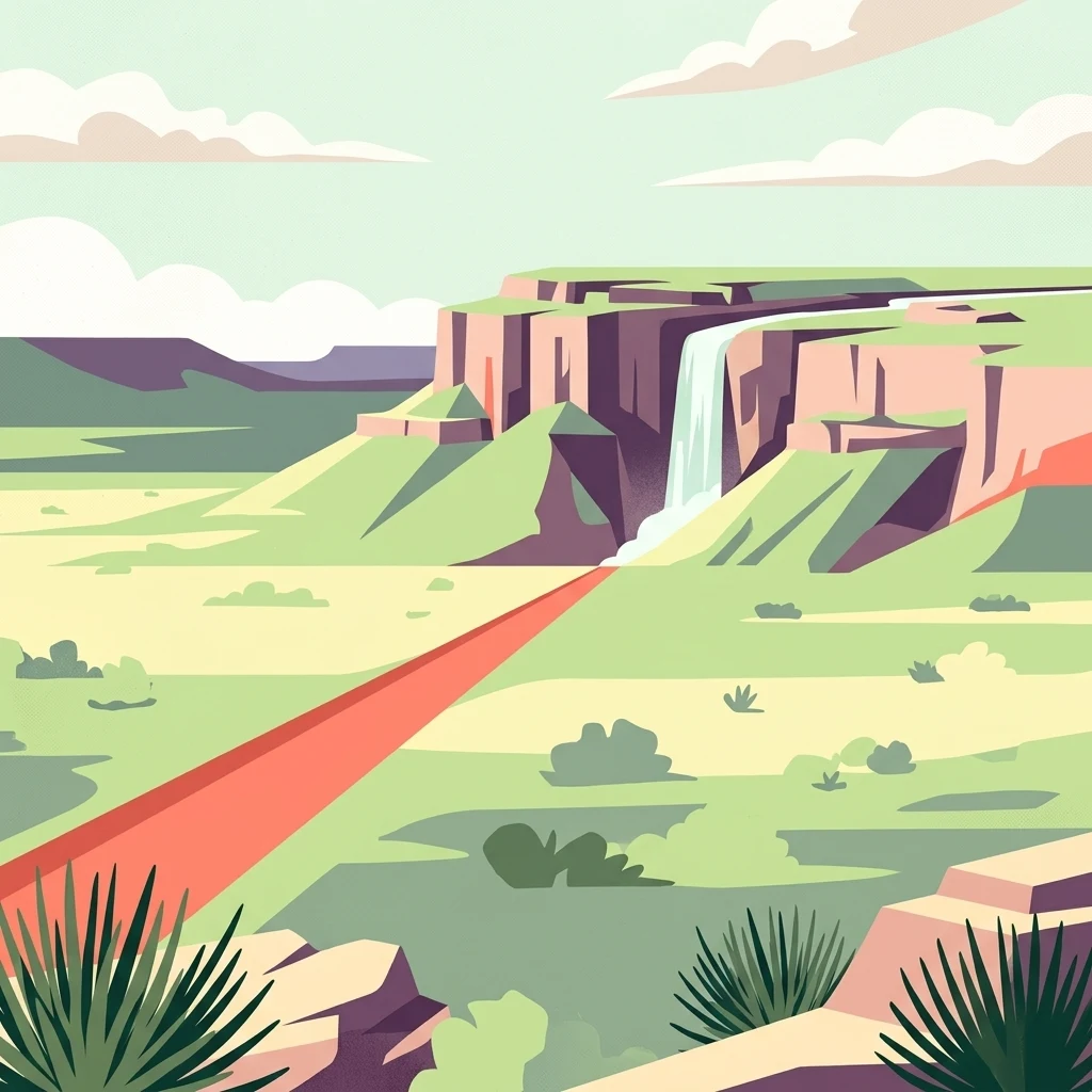
A flat-style digital illustration showing a desert canyon with a waterfall cascading from a cliff, a red dirt path in the foreground, and sparse desert vegetation.

Southern Tanami Indigenous Protected Area

Protected area

Park overview

Structured park overview, official facts, and landscape profile for Southern Tanami Indigenous Protected Area

Southern Tanami Indigenous Protected Area park facts, protected area profile, and essential visitor context

Review the core facts for Southern Tanami Indigenous Protected Area, including designation, size, terrain, visitor scale, habitats, and operating context in one park-focused overview.

About Southern Tanami Indigenous Protected Area

The Southern Tanami Indigenous Protected Area is a vast conservation region in the northern and central parts of the Tanami Desert, in the Northern Territory of Australia. At roughly 101,600 square kilometres, it ranks as Australia's largest Indigenous Protected Area and represents one of the most ambitious examples of Aboriginal-led landscape conservation in the country. The protected area is shaped by country that is desert, range, and sand plain, but it is equally defined by the cultural and ecological systems that the Warlpiri people have long maintained there.

Indigenous Protected Areas in Australia are parcels of land and sea country that are managed by First Nations groups for biodiversity and cultural outcomes through voluntary agreements with the Australian Government. The Southern Tanami IPA joined this growing national network when it was dedicated in July 2012. As part of Australia's National Reserve System, it sits within a broader framework of formally recognised reserves that protect the country's ecological heritage, but with a strong emphasis on Aboriginal cultural continuity and Indigenous land management.

The protected area encompasses a substantial share of one of Australia's most remote and ecologically distinctive deserts. Its landscape includes the Reynolds and Truer ranges, sweeping dune fields, and broad salt flats. Together, these features create the kind of habitat continuity that is increasingly rare across arid Australia.

Governance of the Southern Tanami IPA reflects a collaboration between the Warlpiri Traditional Owners, the Central Land Council, and Australian Government programs. The work on the ground is carried out primarily by the Warlpiri Rangers, who blend Yapa (Aboriginal) and Kardiya (non-Aboriginal) knowledge in their approach to fire management, species monitoring, habitat protection, and cultural site care. This combination of ranger-led, culturally informed land management under a formal IPA framework distinguishes the Southern Tanami from many other remote desert reserves, where large estates are administered without active Indigenous stewardship.

Quick facts and research context for Southern Tanami Indigenous Protected Area

The Southern Tanami Indigenous Protected Area covers approximately 101,600 square kilometres of the Tanami Desert in the Northern Territory. It is recognised as Australia's largest Indigenous Protected Area and was formally dedicated in July 2012.

It is managed under a voluntary conservation agreement between the Warlpiri Traditional Owners and the Australian Government, making it part of Australia's National Reserve System. Governance combines Yapa (Aboriginal) and Kardiya (non-Aboriginal) knowledge through the central land council ranger framework.

Protection and recognition

Documented terrestrial protection scope, designation year, and international recognition records

Southern Tanami Indigenous Protected Area Protection Status and Designation History

Southern Tanami Indigenous Protected Area maintains a documented terrestrial protection status established in the designation year 2012. Systematic conservation records detail the official management scope and international recognition standing across the protected landscape.

Protection details

Protection scope
Terrestrial
Designated year
2012
Transboundary protection
No
Park context

Deeper park guide and search-rich context for Southern Tanami Indigenous Protected Area

Southern Tanami Indigenous Protected Area history, landscape, wildlife, and travel context

Explore Southern Tanami Indigenous Protected Area through its history, landscape character, ecosystems, wildlife, conservation priorities, cultural context, and seasonal travel timing in a structured park guide built for atlas discovery and search intent.

Why Southern Tanami Indigenous Protected Area stands out

The Southern Tanami IPA is best known as Australia's most expansive Indigenous-led conservation landscape. Its identity is defined by continuous desert habitat, Indigenous land management at a vast spatial scale, and partnerships between Traditional Owners and national conservation frameworks. It is recognised for protecting huge tracts of spinifex hummock grassland with a flowering shrub overstorey across the Tanami interior. Its combination of natural and cultural value, formal Indigenous Protected Area status, and sheer size make it a landmark case in Australian desert conservation.
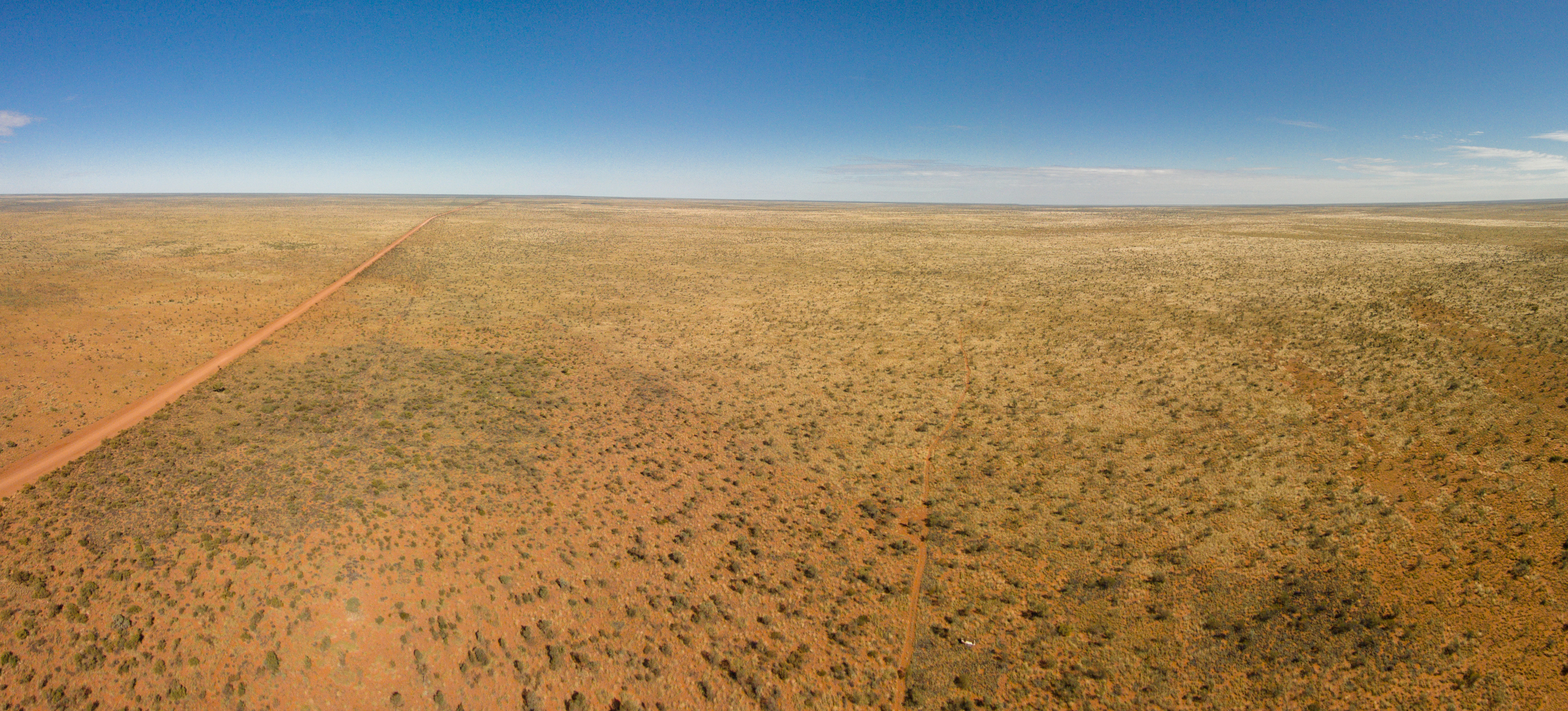
An expansive, low-altitude aerial view of the flat, arid Tanami Desert landscape, featuring red sandy soil, sparse low-lying scrub vegetation, and a straight, unpaved dirt track stretching into the distance under a clear blue sky.
A wide, arid panoramic view across the Tanami Desert.

Southern Tanami Indigenous Protected Area history and protected-area timeline

The formal history of the Southern Tanami Indigenous Protected Area is relatively recent. It was dedicated in July 2012, marking the moment when this large section of Warlpiri Country was recognised under Australia's Indigenous Protected Area program and incorporated into the National Reserve System.

Its establishment grew out of a long-running relationship between the Warlpiri Traditional Owners, the Central Land Council, and Australian Government conservation programs. The ranger groups that work across this landscape now bring together Yapa and Kardiya knowledge systems, integrating traditional land management with contemporary conservation practice.

The IPA also sits within a broader movement in which Aboriginal communities in Australia have used the IPA framework to formalise large-scale conservation work on their own land. The Southern Tanami became the country's largest example of this model when it was dedicated, and it has since served as a benchmark for what First Nations-led conservation can achieve in arid regions.

Southern Tanami Indigenous Protected Area landscape and geographic character

The Southern Tanami IPA encompasses a wide sweep of the Tanami Desert, one of Australia's least developed and most continuous arid landscapes. The protected area stretches across sand dune country, open desert plains, and ancient rocky terrain. Its terrain includes the Reynolds Range and the Truer Range, which rise above the surrounding sand plains and provide elevation, shelter, and different habitat patterns from the broader dunes.

The Aeolian sand systems of the Tanami are a defining feature of the protected area. Long dune corridors and broad sandplains stretch between the ranges, while salt pans add another layer of variation to the desert floor. These physical features shape how water, fire, nutrients, and wildlife move across the landscape, and they create the structural diversity that underpins the area's ecological significance.

Open, vast horizons characterise much of the area. Travellers and visitors experience long distances between landmarks, deep night skies, and a landscape where colours shift markedly through the day. The combination of ranges, dunes, and salt pans gives the Southern Tanami IPA a layered and varied desert character despite its overall arid appearance.

Southern Tanami Indigenous Protected Area ecosystems, habitats, and plant life

The vegetation of the Southern Tanami IPA is dominated by extensive tracts of spinifex hummock grassland, a defining plant community of arid inland Australia. A flowering shrub layer rises above the spinifex, contributing additional structure and seasonal diversity to the vegetation mosaic. Together, these plants form the foundation of the desert's ecological systems.

This vegetation architecture supports the broader ecosystem of the IPA. Spinifex clumps provide shelter and food resources for reptiles and small mammals, while the shrub layer offers additional habitat for birds and insects. The continuity of this habitat across such a large area is itself a major conservation value, because desert fragmentation elsewhere has reduced the resilience of many arid species.

Salt pans and dune swales introduce additional microhabitats. Drainage patterns and seasonal rainfall create temporary productivity in localised areas, and these become focal points for biological activity after rain. The result is an ecological system that is outwardly austere but ecologically rich when viewed across its full extent.

Southern Tanami Indigenous Protected Area wildlife and species highlights

The Southern Tanami IPA provides continuous habitat for a number of threatened and culturally significant desert mammals. The bilby (walpajirri) is among the iconic species protected here, reflecting the IPA's role in conserving one of Australia's most recognised threatened marsupials. The great desert skink (warrarna) and the brush-tailed mulgara (jajina) are also part of the protected area's wildlife profile, both recognised for their conservation significance in arid Australia.

Aboriginal language names feature prominently in the wildlife story of the Southern Tanami IPA. The presence of walpajirri, warrarna, and jajina on country is not only a matter of ecological monitoring but also reflects long-standing cultural relationships with these species. This points to one of the distinctive features of Indigenous-led conservation: wildlife is understood within a broader context of cultural knowledge and responsibility.

Beyond these headline species, the IPA protects the habitat on which a wider range of desert fauna depends. Birds, reptiles, and small mammals all rely on the spinifex-dominated system that the IPA helps safeguard. The protected area's size and habitat continuity offer particular value to wide-ranging and disturbance-sensitive species that need large intact desert landscapes.

Southern Tanami Indigenous Protected Area conservation status and protection priorities

Conservation is central to the identity of the Southern Tanami Indigenous Protected Area. By formal partnership with the Australian Government, the IPA is incorporated into Australia's National Reserve System, giving it recognition as part of the country's most important formal conservation estate. Its voluntary agreement framework also gives Traditional Owners a strong role in setting the priorities and methods of land management.

The IPA matters for conservation because it keeps a very large block of desert habitat intact. Continuous tracts of spinifex hummock grassland with a flowering shrub overstorey are increasingly rare in arid Australia, and the protected area preserves this habitat across more than a hundred thousand square kilometres. For threatened species such as the bilby, great desert skink, and brush-tailed mulgara, this scale of intact habitat is a major asset.

The conservation model applied here is distinctive. The Warlpiri Rangers integrate Yapa and Kardiya knowledge, combining traditional ecological understanding with contemporary conservation methods. Fire management, species monitoring, cultural site care, and habitat work all benefit from this blending of knowledge systems. The IPA therefore illustrates how Indigenous-led conservation can operate at a scale and depth that few purely top-down programs could match in remote desert country.

Southern Tanami Indigenous Protected Area cultural meaning and human context

The Southern Tanami IPA is deeply tied to the cultural identity and country of the Warlpiri people. The land covered by the protected area has been managed and known by Warlpiri Traditional Owners for many generations, and the IPA represents a formal continuation of that long-standing relationship. Cultural knowledge, law, and identity are inseparable from the way land here is understood and looked after.

Animals, plants, and landscape features within the IPA carry Warlpiri names and meanings. The bilby is walpajirri, the great desert skink is warrarna, and the brush-tailed mulgara is jajina. Using these names within conservation work reflects the conviction that species and culture are linked, and that protection of biodiversity also involves protection of language and story.

The IPA's cultural significance is also expressed through the involvement of the Central Land Council and the ranger program. By combining Yapa and Kardiya knowledge, the program recognises that effective land management in this region depends on both Aboriginal and non-Aboriginal expertise. The result is an approach to cultural heritage protection that is integrated into everyday land management, rather than separated from it.

Top sights and standout views in Southern Tanami Indigenous Protected Area

The Southern Tanami Indigenous Protected Area stands out for its sheer scale. At roughly 101,600 square kilometres, it is Australia's largest Indigenous Protected Area, and it protects an exceptional block of the Tanami Desert, including the Reynolds and Truer ranges, large dune systems, and salt pans.

It is notable for integrating Aboriginal and non-Aboriginal knowledge through the Warlpiri Rangers and the Central Land Council framework. Its continuous habitat supports threatened desert species such as the bilby, great desert skink, and brush-tailed mulgara. Formal recognition through Australia's National Reserve System gives the protected area a secure institutional position while keeping Traditional Owner governance at its centre.

Best time to visit Southern Tanami Indigenous Protected Area

The cooler dry season months are generally the most comfortable period for visiting arid-country regions such as the Southern Tanami IPA, when daytime temperatures are milder and skies are reliably clear. Nights are still cool to cold at this time of year, and access through remote desert tracks is typically easier than during hotter periods. The landscape tends to be at its most open and traversable in these months, which suits those interested in desert scenery, photography, and observing dry-country wildlife.

Summer in the Tanami is hot, with extreme daytime conditions across the sand plains and dune country. Wildlife activity, vegetation response, and seasonal visibility all change from one season to the next, and any trip would require careful planning around heat, water, and remoteness. Because the Southern Tanami IPA is remote and largely managed for conservation and cultural outcomes rather than for high-volume tourism, prospective visitors should think of it as country to be approached with respect and preparation rather than as a typical visitor attraction.

Monthly climate preview

Long-term temperature ranges and monthly precipitation averages for Northern Territory geography

Southern Tanami Indigenous Protected Area Climate Normals and Annual Weather Patterns

Representative coordinate records show average monthly temperatures peaking above thirty degrees Celsius alongside distinct precipitation variations across the year. Detailed twelve-month climate normals provide a complete picture of long-term temperature swings and rainfall patterns for this protected area.
Annual mean25 °C
16 °C32 °C
Jan32°
Feb31°
Mar29°
Apr25°
May20°
Jun17°
Jul16°
Aug19°
Sep24°
Oct28°
Nov31°
Dec32°
Warmest month
January

31.9 °C

Coolest month
July

16.3 °C

Wettest month
January

2.5 mm/day

Driest month
August

0.1 mm/day

Park location guide

Geography guide, regional context, and park location map for Southern Tanami Indigenous Protected Area

Southern Tanami Indigenous Protected Area park geography, regions, and map view in Australia

Understand where Southern Tanami Indigenous Protected Area sits in Australia through a broader geographic reading of the surrounding landscape, nearby location context, and its mapped position within the national park landscape.

How Southern Tanami Indigenous Protected Area fits into Australia

Australia is a constitutional monarchy and federal parliamentary democracy comprising six states and ten territories. With a population of nearly 28 million, it is one of the world's most urbanised countries, with most people concentrated on the eastern seaboard. The country has a high Human Development Index and is known for its cultural diversity, ancient Aboriginal heritage, and unique wildlife.

Wider geography shaping Southern Tanami Indigenous Protected Area in Australia

Australia occupies the entire Australian continent, the island of Tasmania, and numerous smaller islands. It is the world's flattest and driest inhabited continent, featuring vast deserts in the interior (the Outback), tropical rainforests along the eastern coast, and a coastline bordering the Indian and Pacific Oceans.

Map view of Southern Tanami Indigenous Protected Area

Use this park location map to pinpoint Southern Tanami Indigenous Protected Area in Australia, understand its exact geographic position, and read its mapped placement within the surrounding landscape more clearly.

Pigeon | © OpenStreetMap contributors

Location context for Southern Tanami Indigenous Protected Area

Northern Territory

Visual reference for arid sand dunes, spinifex plains, and desert habitats

Southern Tanami Indigenous Protected Area Landscape Photos and Scenery

Examine detailed photographs of Southern Tanami Indigenous Protected Area to understand its vast desert terrain, ancient mountain ranges, and continuous arid habitats. Visual documentation reveals the distinct geomorphology, sand dune corridors, and ecological scale of Central Australia conservation lands.

An expansive, low-altitude aerial view of the flat, arid Tanami Desert landscape, featuring red sandy soil, sparse low-lying scrub vegetation, and a straight, unpaved dirt track stretching into the distance under a clear blue sky.

Park atlas

Compare surrounding desert landscapes and regional protected areas in Central Australia

Explore Other Parks Near Southern Tanami Indigenous Protected Area

Browse nearby national parks and protected landscapes to compare regional desert habitats and arid terrain features. Continuing across the broader conservation network provides valuable context for understanding Central Australian ecosystems.
A watercolor illustration of a wide, rolling landscape with distant hills, sparse trees, and soft, warm tones.
Protected areaNorthern Territory
Mapped park locations coincide#1 closest

Northern Tanami Indigenous Protected Area: A Vast Desert Wilderness and Protected Landscape

Central Australia, Northern Territory mapping and ecological overview

Located in the heart of the Tanami Desert, this 40,050 square kilometer protected area stands as one of the largest Aboriginal-managed conservation sites in Australia. The region is defined by continuous hummock grasslands, wide horizons, and arid drainage systems. It provides critical habitat for threatened desert species while demonstrating the integration of traditional ecological knowledge with contemporary land management practices.

Area
40,050 km²
Established
2007
Relief
Lowland
Climate
Subtropical
Wildlife reserveNorthern Territory
About 148 km away#2 closest

South

Newhaven Wildlife Sanctuary: Exploring Desert Boundaries and Arid Protected Landscapes

Geographic atlas of a major Australian desert wildlife reserve

Newhaven Wildlife Sanctuary preserves a vast expanse of desert terrain across the Northern Territory, transitioning between the Tanami and Great Sandy deserts. This atlas entry provides a detailed view of its unique topography, including rhythmic sand dunes, broad claypans, and saline lake systems, highlighting its role as a monumental protected landscape for arid-zone restoration and habitat security.

Area
2,615.01 km²
Established
2000
IUCN
II
Relief
Upland
National parkNorthern Territory
About 266 km away#3 closest

Southeast

Tjoritja / West MacDonnell National Park: National Park Atlas and Protected Landscape

Explore the dramatic MacDonnell Ranges terrain and geography.

Delve into the protected geography of Tjoritja / West MacDonnell National Park, a significant national park in Australia's Northern Territory. This landscape features striking mountain formations, deep gorges like Standley Chasm and Glen Helen, and is intrinsically linked to the famous Larapinta Trail and the Arrernte people's cultural heritage. Understanding its mapped boundaries and regional context provides essential insight into this iconic Central Australian protected area.

Area
2,568.61 km²
Established
1992
IUCN
II
Relief
Mountain
Nature reserveNorthern Territory
About 281 km away#4 closest

Southeast

Anna's Reservoir Conservation Reserve: Protected Landscapes and Geography in the Northern Territory

Natural rock-hole terrain and arid catchment heritage

Located north of Alice Springs on Aileron Station, Anna's Reservoir Conservation Reserve is a protected area centered on a critical natural water source. The site offers a window into the intersection of Indigenous custodianship and inland exploration, protecting 85 hectares of arid environment characteristic of the central Australian interior.

Area
0.85 km²
Established
1971
Scope
Terrestrial
National parkNorthern Territory
About 295 km away#5 closest

South

Watarrka National Park: Central Australian National Park with Iconic Canyon Landscapes

Explore its mapped terrain and protected area geography.

Watarrka National Park, located in the Northern Territory, is distinguished by the dramatic sandstone formations of Kings Canyon. This protected area showcases a unique arid zone biodiversity, including rare plant species and ancient cycad forests. Its geological significance and Aboriginal heritage make it a compelling point of study for understanding Central Australia's natural and cultural landscapes through structured atlas exploration.

Area
1,051.85 km²
Established
1989
IUCN
II
Visitors
176.1K annual
Nature reserveNorthern Territory
About 302 km away#6 closest

Southeast

Tnorala Conservation Reserve: Geological Wonders and Protected Landscapes of the Northern Territory

An iconic circular impact crater preserved as a cultural and natural sanctuary

Tnorala Conservation Reserve stands as a sentinel in the Northern Territory, defined by its striking five-kilometre-wide ring of hills. This protected area offers a look at a massive, ancient impact crater remnant that rises sharply from the surrounding desert plains, serving as a critical point of geological interest and a deeply revered sacred site for the Western Arrernte people.

Relief
Mountain
Climate
Arid
Access
Access unknown
Scope
Terrestrial
Watercolor painting of an arid landscape featuring red sandstone rock formations, green scrub, and grasses against pale mountains.
Protected landscapeNorthern Territory
About 314 km away#7 closest

Southeast

Native Gap Conservation Reserve: Protected Landscape and Central Australian Geography

Mapped sandstone terrain within the Northern Territory Hann Range

Spanning just 11 hectares, this protected area is defined by its dramatic sandstone ridge and deep historical ties to the Arrente and Anmatyerr peoples. The reserve provides a distinct geographic reference point along the Stuart Highway, where desert flora and historic telegraph routes converge within the unique terrain of central Australia.

Area
0.11 km²
Established
1980
IUCN
V
Relief
Upland
Watercolor painting of a landscape with green valleys, pink and yellow mountain peaks, and distant hills
National parkNorthern Territory
About 339 km away#8 closest

Southeast

Finke Gorge National Park: Explore Its Protected Landscape and Geographic Identity

Mapped boundaries and natural terrain within Northern Territory.

Finke Gorge National Park represents a significant protected area within the Northern Territory, Australia. This national park offers valuable insights into the region's geography, mapped landscapes, and natural terrain. Detailed information helps users understand the park's protected boundaries and its role in the broader context of Australian conservation lands, ideal for focused atlas exploration.

Area
452.85 km²
Established
1966
IUCN
V
Visitors
18K annual

Common questions about visiting, size, designation, and location context for Southern Tanami Indigenous Protected Area

Southern Tanami Indigenous Protected Area FAQs for park facts, access, geography, and protected area context

Find quick answers about Southern Tanami Indigenous Protected Area, including protected-area facts, park geography, trail and visitor context, and how the park fits into its surrounding country and regional landscape.
MoriAtlas Explorer

Continue Your Protected Areas Search Across the Global Atlas

Deepen your exploration by continuing the structured search for national parks and protected areas worldwide. Utilize the comprehensive filtering capabilities to compare different conservation landscapes and refine your understanding of global park geography. Discover more about the distribution and characteristics of protected natural areas.

Global natural geography