
Mori Atlas logo
Protected landscapeNative Gap Conservation Reserve

Examining the geographic boundaries and cultural significance of a central Australian arid-zone landmark

Native Gap Conservation Reserve: A Protected Landscape and Sandstone Ridge in the Northern Territory

Native Gap Conservation Reserve represents a unique protected landscape in the central Australian desert. Rising from the Burt Plain, this 30-metre sandstone ridge within the Hann Range defines the regional terrain and serves as a vital anchor point for local Aboriginal creation stories and historical telegraph-era geography. Through these mapped boundaries, the reserve offers a condensed perspective on the arid-zone ecology and cultural heritage of the Northern Territory.

arid zonecentral australiasacred siteaboriginal heritagesandstone ridgehann range
A flat-style digital illustration of a desert canyon landscape with red rock walls, a waterfall in the distance, a winding path, sparse desert vegetation, and a bright sun in the sky.

Native Gap Conservation Reserve

Protected landscape

Park overview

Structured park overview, official facts, and landscape profile for Native Gap Conservation Reserve

Native Gap Conservation Reserve park facts, protected area profile, and essential visitor context

Review the core facts for Native Gap Conservation Reserve, including designation, size, terrain, visitor scale, habitats, and operating context in one park-focused overview.

About Native Gap Conservation Reserve

Native Gap Conservation Reserve occupies a narrow but symbolically important place in the network of protected areas managed by the Parks and Wildlife Commission of the Northern Territory. Tucked against the western side of the Stuart Highway and reached by an unsealed track leading towards a telecommunications tower on the Hann Range, the reserve sits deep in the arid zone north of Alice Springs and far south of Darwin. Its landscape is dominated by a striking sandstone ridge that rises about 30 metres above the flat Burt Plain surrounding it, giving the site a defined and easily recognisable profile in an otherwise broad and open terrain.

The reserve is defined as much by human history as by physical geography. The name Native Gap originated in 1872, when W. W. Mills, one of the builders of the Overland Telegraph, wrote to Charles Todd describing a gap in Hann's Range where a native well was located. By 1880, workers widening the gap for telegraph operations used explosives on the rock, inadvertently destroying the water-holding formations that had given the place its meaning to generations of Aboriginal travellers and to the new arrivals alike.

For the Arrente and Anmatyerr peoples, the traditional owners of the area, Native Gap, or Arurlte Artwatye, is a sacred site marking the convergence of several creation stories. In Arrente, Arurlte refers to the top of the shoulders across the neck, while Artwatye means gap, an evocative description of how the Hann Range opens at this point. This cultural framing, combined with the site's telegraph-era history and its arid-zone ecology, gives the reserve a multi-layered identity that defies its modest 11-hectare size.

Ecologically, the reserve is a compact showcase of central Australian arid land vegetation patterns, with distinct plant communities on the rocky ridge, in the gap, and across the sandy flats. Birdlife and small mammals typical of the region are present, including species closely tied to particular habitat niches such as spinifex, native figs, and rock outcrops. Native Gap is therefore not a destination-scale park but rather a small, high-density site, valuable for what it reveals about central Australian ecology, Aboriginal land meaning, and the sometimes layered consequences of colonial infrastructure projects.

Quick facts and research context for Native Gap Conservation Reserve

Native Gap Conservation Reserve is a small IUCN Category V protected area in Australia's Northern Territory, located beside the Stuart Highway north of Alice Springs. Established on 26 May 1980, it is managed by the Parks and Wildlife Commission of the Northern Territory. The reserve surrounds a 30-metre sandstone ridge in the Hann Range that rises above the Burt Plain.

The site is a registered Aboriginal sacred site associated with the Arrente and Anmatyerr peoples, and its Arrente name, Arurlte Artwatye, reflects the physical form of the gap in the range. Although small in size, the reserve illustrates how central Australian protected areas can carry layered significance, combining arid-zone ecology, telegraph-era colonial history, and enduring Indigenous cultural meaning.

Park context

Deeper park guide and search-rich context for Native Gap Conservation Reserve

Native Gap Conservation Reserve history, landscape, wildlife, and travel context

Explore Native Gap Conservation Reserve through its history, landscape character, ecosystems, wildlife, conservation priorities, cultural context, and seasonal travel timing in a structured park guide built for atlas discovery and search intent.

Why Native Gap Conservation Reserve stands out

Native Gap is best known as the place where the Arrente name Arurlte Artwatye, meaning the gap across the shoulders of the neck, meets a real geological gap in the Hann Range. The reserve is also recognised for the 30-metre sandstone ridge that defines its skyline and for the traditional water source it once sheltered, which first drew European attention in 1872 during construction of the Overland Telegraph. The reserve is equally notable as a culturally anchored landscape: it sits at the junction of multiple Aboriginal creation stories and remains a sacred site for the Arrente and Anmatyerr peoples. Together, those qualities give Native Gap a significance disproportionate to its very small footprint.
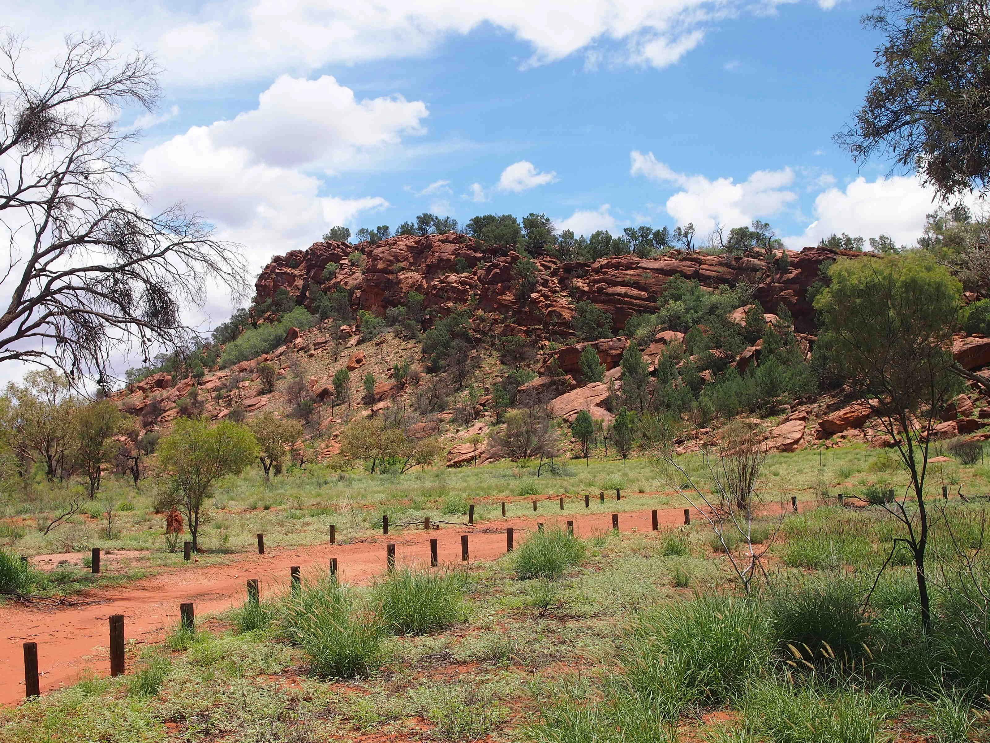
A landscape photograph of Native Gap Conservation Reserve showing a prominent red sandstone ridge rising above a grassy plain with a dirt track in the foreground.
A view of the red sandstone ridge at Native Gap Conservation Reserve.

Native Gap Conservation Reserve history and protected-area timeline

The modern history of Native Gap is closely bound to two overlapping stories: Aboriginal custodianship going back many generations, and the construction of the Overland Telegraph Line across central Australia in the 1870s. For the Arrente and Anmatyerr peoples, the site at the gap in the Hann Range had long been a sacred place where several creation stories meet, and the Arrente name Arurlte Artwatye captures the shape of that gap across the shoulders of the range.

The name 'Native Gap' entered European records in 1872, when W. W. Mills, one of the builders of the Overland Telegraph, reported to Charles Todd that the line had reached a gap in Hann's Range containing what he called a 'native well'. Within a few years, in 1880, workers on the telegraph returning to widen the gap for the route used explosives on the rock. In the process, they destroyed the natural water-holding structure that had made the gap significant both to Aboriginal people and to overland travellers.

Decades later, the site was formally recognised in the Northern Territory's protected-area system when Native Gap Conservation Reserve was established on 26 May 1980. Its management by the Parks and Wildlife Commission of the Northern Territory reflects the reserve's enduring status as both a cultural and a natural heritage site in central Australia.

Native Gap Conservation Reserve landscape and geographic character

Native Gap's landscape is defined by contrast in a setting that is otherwise remarkably flat. The reserve centres on a 30-metre sandstone ridge that rises abruptly out of the surrounding Burt Plain, giving the site a sharp, recognisable silhouette. That ridge is the defining landform of the reserve and the source of its name, as the gap it forms in the Hann Range originally sheltered a natural water source used by Aboriginal people and later by telegraph workers.

Beyond the ridge, the surrounding terrain is a classic central Australian arid plain of sandy flats and open grassland, punctuated by low rises that lead into the broader Hann Range. The elevation change between the sandy lowlands and the exposed sandstone cap is enough to create markedly different habitat conditions across a very small area, which has a strong influence on the vegetation patterns that have developed within the reserve's boundaries.

Native Gap Conservation Reserve ecosystems, habitats, and plant life

The reserve supports a compact but ecologically diverse sample of central Australian arid-zone vegetation, structured largely by the geology beneath it. On the sandstone ridge itself, plants adapted to rocky exposure dominate, including white cypress pine, Acacia monticola, Acacia melleodora, Eucalyptus gamophylla, and Eucalyptus sessilis, which can persist even on the most exposed parts of the ridge. Native figs such as Ficus brachypoda take advantage of moister crevices and shaded positions on the rocky terrain.

The sandy flats and lower slopes present a different ecological character, with ironwood, desert bloodwood, and ghost gums forming a more open woodland over a ground layer of desert grasses and spinifex. After rain, these flats come alive ephemerally, with sundews (Drosera) appearing in damp patches and Grevillea wickhamii contributing to a more varied shrub layer alongside occasional Gossypium species. The result is a small reserve that nonetheless displays several distinct arid-zone vegetation types within a short distance.

Native Gap Conservation Reserve wildlife and species highlights

Despite its very small area, Native Gap supports a typical cross-section of central Australian arid-zone fauna, with birdlife being particularly conspicuous. Western bowerbirds feed on the native figs growing around the rock outcrops, while little woodswallows, dusky grasswrens among the spinifex, and brown quail in wetter periods are characteristic species of the site. The reserve also hosts whistling kite, rainbow bee-eater, willie wagtail, inland thornbill, variegated fairywren, mistletoebird, grey-headed honeyeater, and Torresian crow, reflecting the broader mix of birds typical of the central Australian ranges and plains.

Mammals recorded on the reserve include the short-beaked echidna, the euro (a widespread arid-zone wallaroo), and the black-footed rock-wallaby, which finds highly suitable shelter in the rugged sandstone of the ridge. The presence of species tied both to rocky terrain and to open spinifex plains gives the reserve a representative, rather than narrowly specialised, arid-zone fauna.

Native Gap Conservation Reserve conservation status and protection priorities

Native Gap Conservation Reserve is protected as an IUCN Category V landscape, a designation used for protected areas where cultural values and traditional land use are integral to the conservation outcome alongside natural features. Managed by the Parks and Wildlife Commission of the Northern Territory, the reserve is small but symbolically important in the Northern Territory's protected-area network because of how it combines ecological, geological, and cultural values in a single site.

Conservation significance here extends beyond habitat preservation. The reserve safeguards a sandstone ridge, a gap in the Hann Range, and surrounding arid-zone vegetation communities that illustrate the ecological contrast between uplands and sandy flats in central Australia. At the same time, its status as a registered sacred site for the Arrente and Anmatyerr peoples means that its conservation is also tied to the protection of Aboriginal cultural heritage and creation-story landscapes in the region.

Native Gap Conservation Reserve cultural meaning and human context

Native Gap is, fundamentally, a cultural landscape. For the Arrente and Anmatyerr peoples, the traditional owners of the area, the gap in the Hann Range is a sacred site where several creation stories converge. The Arrente name Arurlte Artwatye describes the gap in physical terms as the place where the shoulders cross across the neck, echoing how the Hann Range opens at this point in the landscape.

The site also carries a more visible, often-overlooked layer of colonial-era history. The 1872 naming of the gap by Overland Telegraph builder W. W. Mills and the 1880 blasting work that destroyed the water-holding rocks are reminders that the present-day landscape is the product of both Indigenous stewardship and the infrastructure projects that opened central Australia to European settlement. Together these strands give Native Gap a distinct cultural depth that continues to shape how the reserve is understood and managed.

Top sights and standout views in Native Gap Conservation Reserve

Native Gap is a small reserve with outsized significance, anchored by the 30-metre sandstone ridge that defines its landscape and the gap in the Hann Range that gives it its name. Its Arrente name, Arurlte Artwatye, captures both the physical shape and the cultural meaning of the site, which sits at the meeting point of several Aboriginal creation stories for the Arrente and Anmatyerr peoples.

Equally notable is the reserve's layered history: the 1872 'native well' recorded by Overland Telegraph workers, the 1880 blasting that destroyed the water-holding rocks, and the 1980 establishment of the protected area. Today, Native Gap stands as a compact example of how central Australian protected areas can combine arid-zone ecology, Aboriginal sacred-site values, and telegraph-era history within a footprint of just 11 hectares.

Best time to visit Native Gap Conservation Reserve

Because Native Gap is a small, low-elevation arid-zone site without developed visitor infrastructure, season matters primarily for landscape character rather than for access logistics. Cooler months from roughly April to September, when central Australian days are milder and nights can be cold, generally offer the most comfortable conditions for exploring the reserve and the surrounding Hann Range.

The warmer summer months bring higher temperatures and the possibility of dramatic rainfall events in the desert. After rain, the sandy flats can briefly support sundews and other ephemeral plants, and bird activity, including brown quail and other wet-season visitors, tends to increase. Visiting in either shoulder season or shortly after summer rains can therefore reveal different facets of the reserve's ecology.
Monthly climate preview

Long-term monthly temperature averages and precipitation records for Native Gap Conservation Reserve

Native Gap Conservation Reserve Climate Normals and Annual Temperature Patterns

Representative coordinates for Native Gap Conservation Reserve record a wide annual range of average monthly temperatures alongside low daily precipitation values. Reviewing the complete twelve-month climate profile reveals comprehensive variations in long-term atmospheric norms.
Annual mean23 °C
14 °C31 °C
Jan31°
Feb30°
Mar27°
Apr23°
May18°
Jun14°
Jul14°
Aug16°
Sep22°
Oct26°
Nov29°
Dec30°
Warmest month
January

30.8 °C

Coolest month
July

13.9 °C

Wettest month
January

1.8 mm/day

Driest month
August

0.1 mm/day

Park location guide

Geography guide, regional context, and park location map for Native Gap Conservation Reserve

Native Gap Conservation Reserve park geography, regions, and map view in Australia

Understand where Native Gap Conservation Reserve sits in Australia through a broader geographic reading of the surrounding landscape, nearby location context, and its mapped position within the national park landscape.

How Native Gap Conservation Reserve fits into Australia

Australia is a constitutional monarchy and federal parliamentary democracy comprising six states and ten territories. With a population of nearly 28 million, it is one of the world's most urbanised countries, with most people concentrated on the eastern seaboard. The country has a high Human Development Index and is known for its cultural diversity, ancient Aboriginal heritage, and unique wildlife.

Wider geography shaping Native Gap Conservation Reserve in Australia

Australia occupies the entire Australian continent, the island of Tasmania, and numerous smaller islands. It is the world's flattest and driest inhabited continent, featuring vast deserts in the interior (the Outback), tropical rainforests along the eastern coast, and a coastline bordering the Indian and Pacific Oceans.

Map view of Native Gap Conservation Reserve

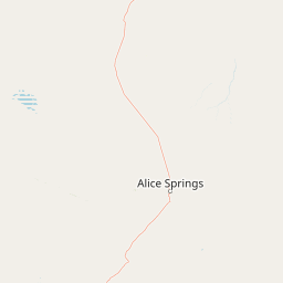
Use this park location map to pinpoint Native Gap Conservation Reserve in Australia, understand its exact geographic position, and read its mapped placement within the surrounding landscape more clearly.

Pigeon | © OpenStreetMap contributors

Location context for Native Gap Conservation Reserve

Northern Territory

Visual Reference for Central Australian Terrain and Protected Habitats

Native Gap Conservation Reserve Photos and Landscapes

Native Gap Conservation Reserve photos reveal the dramatic contrast of a thirty metre sandstone ridge rising above the flat Burt Plain. Protected area imagery provides clear visual context for the arid zone habitats, rocky outcrops, and cultural landscapes of central Australia.

A landscape photograph of Native Gap Conservation Reserve showing a prominent red sandstone ridge rising above a grassy plain with a dirt track in the foreground.

Park atlas

Compare nearby protected areas and regional reserves across central Australian terrain

Other Parks Near Native Gap Conservation Reserve and Surrounding Protected Landscapes

Browse other parks and protected areas situated across the surrounding central Australian landscape after viewing Native Gap Conservation Reserve. Extending the geographic comparison reveals how adjacent arid reserves and regional protected landscapes share similar terrain.
Nature reserveNorthern Territory
About 33 km away#1 closest

Northwest

Anna's Reservoir Conservation Reserve: Protected Landscapes and Geography in the Northern Territory

Natural rock-hole terrain and arid catchment heritage

Located north of Alice Springs on Aileron Station, Anna's Reservoir Conservation Reserve is a protected area centered on a critical natural water source. The site offers a window into the intersection of Indigenous custodianship and inland exploration, protecting 85 hectares of arid environment characteristic of the central Australian interior.

Area
0.85 km²
Established
1971
Scope
Terrestrial
National parkNorthern Territory
About 90 km away#2 closest

South

Tjoritja / West MacDonnell National Park: National Park Atlas and Protected Landscape

Explore the dramatic MacDonnell Ranges terrain and geography.

Delve into the protected geography of Tjoritja / West MacDonnell National Park, a significant national park in Australia's Northern Territory. This landscape features striking mountain formations, deep gorges like Standley Chasm and Glen Helen, and is intrinsically linked to the famous Larapinta Trail and the Arrernte people's cultural heritage. Understanding its mapped boundaries and regional context provides essential insight into this iconic Central Australian protected area.

Area
2,568.61 km²
Established
1992
IUCN
II
Relief
Mountain
National parkAustralia
About 102 km away#3 closest

South

West MacDonnell National Park: Australia's Outback Mountain Landscape and Protected Area

Explore mapped gorges, waterholes, and regional geography in the Red Centre.

West MacDonnell National Park serves as a key protected area within Australia's arid interior, delineating the dramatic western MacDonnell Ranges. This national park offers a unique opportunity to study its mapped landscape, characterized by ancient sandstone ridges, deep gorges, and permanent water sources that support endemic biodiversity. Its profound connection to Aboriginal cultural heritage and its status as a conservation reserve make it essential for understanding the geography and protected lands of central Australia's Red Centre.

Area
2,048 km²
Established
1992
IUCN
II
Relief
Mountain
Wildlife reserveNorthern Territory
About 118 km away#4 closest

South

Kuyunba Conservation Reserve: Wildlife Protected Landscape in Central Australia

Mapped geography and rocky habitat near Alice Springs

Kuyunba Conservation Reserve represents a focused approach to habitat protection in the Northern Territory. The terrain is defined by its rocky hills and boulder-filled escarpments, offering critical shelter for wildlife in an arid, drought-adapted desert region. This site provides a clear view of how targeted land management supports specialized ecological niches in inland Australia.

Area
6.29 km²
Established
1970
IUCN
V
Relief
Upland
Protected landscapeNorthern Territory
About 127 km away#5 closest

Southeast

Corroboree Rock Conservation Reserve: Geological and Cultural Protected Area in Central Australia

Mapped protected landscape within the East MacDonnell Ranges

Corroboree Rock Conservation Reserve features a striking dolomite rock formation tied to ancient Precambrian salt lake sediments. Located east of Alice Springs, the reserve provides a protected glimpse into central Australian arid range geography and holds profound cultural importance for the Eastern Arrernte Traditional Owners within the surrounding pastoral landscape.

Area
0.07 km²
Established
1962
IUCN
V
Visitors
15K annual
Protected landscapeNorthern Territory
About 129 km away#6 closest

Southeast

Trephina Gorge Nature Park: Mapped Geography and Protected Landscape Context

East MacDonnell Ranges, Northern Territory Australia

Trephina Gorge Nature Park represents a central feature of the arid MacDonnell Ranges, characterized by its deep gorge, white ghost gums against red rock, and expansive spinifex ridges. This record outlines the park boundaries, its role as a jointly managed conservation area, and its position within the broader geography of central Australia.

Established
1965
Relief
Mountain
Climate
Arid
Access
Access unknown
A wide watercolor illustration showing a winding river or creek bed flanked by green trees, with pink and red rocky hills in the background under a pale sky.
Nature reserveNorthern Territory
About 141 km away#7 closest

Southeast

N'Dhala Gorge Nature Park: Mapped Geography and Protected Cultural Heritage

Nature reserve located in the eastern MacDonnell Ranges

This nature reserve protects a vital valley corridor in the Northern Territory where sandstone ridges and sandy terrain meet. The park serves as a repository for approximately 6,000 ancient petroglyphs and sustains specialized arid plant species. Use this resource to understand the park's structural boundaries and its place within the broader geography of Central Australia.

Area
5.01 km²
Established
1962
IUCN
V
Relief
Mountain
Watercolor painting of a soft, abstract landscape with a line of trees against rolling hills and light, hazy colors.
Nature reserveNorthern Territory
About 145 km away#8 closest

South

Napwerte / Ewaninga Rock Carvings Conservation Reserve: Protected Desert Landscape Map

Cultural heritage and arid basin geography in the Northern Territory

Napwerte / Ewaninga Rock Carvings Conservation Reserve protects a unique desert site defined by its extensive collection of prehistoric Arrernte rock engravings. The landscape encompasses rocky outcrops, red sand dunes, and a seasonal claypan that captures rare rainfall, creating a significant intersection of archaeological history and arid-zone ecology in central Australia.

Area
0.06 km²
Established
1970
IUCN
V
Relief
Lowland

Common questions about visiting, size, designation, and location context for Native Gap Conservation Reserve

Native Gap Conservation Reserve FAQs for park facts, access, geography, and protected area context

Find quick answers about Native Gap Conservation Reserve, including protected-area facts, park geography, trail and visitor context, and how the park fits into its surrounding country and regional landscape.
MoriAtlas Explorer

Continue Your Protected Areas Search Across the Global Atlas

Deepen your exploration by continuing the structured search for national parks and protected areas worldwide. Utilize the comprehensive filtering capabilities to compare different conservation landscapes and refine your understanding of global park geography. Discover more about the distribution and characteristics of protected natural areas.

Global natural geography