Peaks
Molo Pinnacle
3,292 m

Analyzing the protected landscape boundaries, forest cover, and diverse mountain terrain
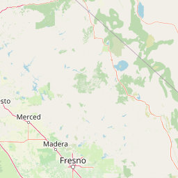
Stanislaus National Forest spans a recorded 3634.48 square kilometers of mountain terrain across the California landscape. This profile details the regional geography, covering temperate montane forests and significant waterways like the Tuolumne and Clavey Rivers. Examine the physical boundaries and identified natural features contained within this protected environment.
A historic Sierra Nevada forest of granite ridges, high lakes, and old growth, bordering Yosemite.
Stanislaus National Forest is a large U.S. national forest in the central Sierra Nevada of Northern California, situated primarily in Tuolumne County and extending into Alpine, Mariposa, and Calaveras counties. Established in 1897, it is among the oldest national forests in the United States and lies directly adjacent to the northwestern reaches of Yosemite National Park. The forest protects a broad swath of mountain terrain characterized by granite and volcanic formations, deep river canyons, alpine lakes, and extensive conifer stands, including one of the more significant old growth blocks in the region. Within its boundaries lies the Emigrant Wilderness, portions of the Mokelumne Wilderness, and segments of the Carson-Iceberg Wilderness, making Stanislaus National Forest an important hub for wilderness-based recreation in the Sierra. The forest is also ecologically and hydrologically significant, giving rise to several Wild and Scenic rivers, including the Tuolumne, and supporting a wide range of habitats from foothill woodlands to high subalpine zones. Its accessibility from the San Francisco Bay Area has shaped its identity as a major outdoor recreation landscape for Northern California.
Recorded country and regional administrative memberships
Stanislaus National Forest’s mapped boundary spans 3,634.48 km²
Mountain classification, peaks, rivers, lakes, and valley formations
Peaks
3,292 m
Lakes
Streams
Waterfalls
844 m
Rivers
Streams
Temperate mountain terrain, extensive coniferous forests, and major water networks
Mountains · Forest · Lakes · Rivers
Temperate coniferous forest · Montane forest
Compare adjacent protected landscapes, mountain terrain, and regional conservation areas
East

Mapping glaciated granite basins and volcanic ridges in Tuolumne County.
Emigrant Wilderness is a sprawling protected area defined by a distinct mix of granitic domes, cirques, and a unique volcanic sector in its northeastern reaches. Spanning from lower forest elevations to alpine peaks, the area provides a window into the complex geological history of the central Sierra Nevada. The terrain includes hundreds of high-country lakes and meadow systems that support diverse alpine ecosystems and represent the rugged nature of the Pacific Crest Trail corridor.
East
High-altitude glacial basins and Sierra crest wilderness
The Hoover Wilderness preserves a vital strip of high-elevation terrain along the eastern Sierra Nevada crest. Characterized by glacier-carved basins, interconnected alpine lakes, and sharp granite ridges, this protected area serves as a primary ecological gateway to the high country. Its landscape features define the headwaters of the Walker River, offering a compact yet significant look at California's protected alpine wilderness.

Northeast
A vast network of Nevada mountain ranges and alpine wilderness
Humboldt, Toiyabe National Forest serves as a defining public land entity across Nevada and eastern California. As the largest national forest in the contiguous United States, it preserves a striking collection of isolated mountain ranges, including the Ruby Mountains and the rugged Jarbidge wilderness, within a broader basin-and-range landscape. Examine the boundaries and terrain that characterize this complex, high-desert ecosystem.

Southeast
Geography of alpine lakes, conifer forests, and mountain basins
Spanning from 900 to nearly 14,000 feet in elevation, Sierra National Forest protects a massive vertical range of California terrain. Discover its iconic wilderness areas and reservoir-studded landscape, providing a deep look at the geographic connectivity between major national parks in the central Sierra Nevada.

Southeast
Mapped boundaries and regional setting for a key California national park.
Delve into the protected landscape identity of Yosemite National Park, examining its specific geographic features and its place within the broader atlas of California's natural areas. This entry provides detailed context on its mapped boundaries, regional positioning, and significance as a protected natural site, essential for understanding its landscape and conservation geography.

Southeast
High altitude wilderness and volcanic terrain in Eastern California
Spanning from the arid Owens Valley floor to the 14,000 foot crest of the Sierra Nevada, Inyo National Forest remains a cornerstone of the American West. This protected landscape contains the Ancient Bristlecone Pine Forest, Mount Whitney, and the Mono Inyo volcanic chain, providing a dense geographic record of glacial, tectonic, and ecological diversity across a vast managed corridor.
North
An atlas of granite river canyons and alpine ridge terrain
Tahoe National Forest defines a critical segment of the western Sierra Nevada, containing granite river canyons, numerous reservoirs, and summits reaching above 9,000 feet. This protected landscape acts as a vital headwater for California foothill communities and Nevada, hosting significant natural features like the Placer County Big Trees Grove and segments of the Pacific Crest Trail.

Southeast
California wilderness area with glacial basins and granite peaks
John Muir Wilderness represents one of the largest protected high-elevation areas in the contiguous United States. Spanning the Sierra Nevada crest, its granite terrain is sculpted by Pleistocene glaciation into sharp arêtes, deep canyons, and hundreds of alpine lakes. This wilderness serves as a vital geographic anchor for mountain ecosystems, offering an extensive look at the high-country landscape of eastern California.
Continue your geographic exploration into the central Sierra Nevada by examining the mapped boundaries and natural terrain of Stanislaus National Forest. This MoriAtlas destination provides a structured overview of the forest's wilderness areas, river systems, and diverse alpine environments across its California mountain setting.