
Mori Atlas logo
Protected landscapeStanislaus National Forest

A comprehensive look at the protected boundaries, mountain terrain, and river canyon geography

Stanislaus National Forest: Mapping the Sierra Nevada Granite and Volcanic Wilderness Landscape

Stanislaus National Forest represents a significant protected landscape within the central Sierra Nevada of California. This expanse encompasses deeply carved river canyons, extensive old growth conifer stands, and glacially sculpted granite peaks that define the regional geography. The forest protects vast wilderness areas and essential hydrologic zones, providing a critical geographic link between foothill woodlands and high subalpine mountain terrain.

Sierra Nevadanational forestmountain landscapewilderness areasold growth forestpine forests
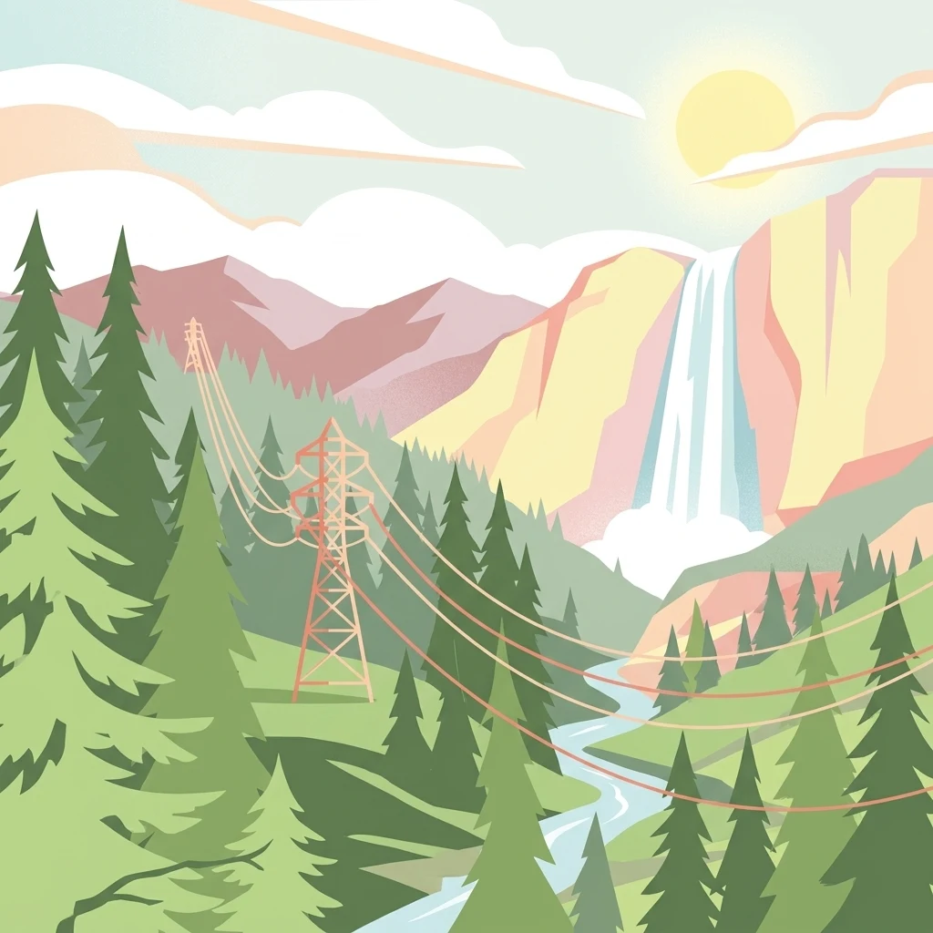
An artistic illustration featuring a bright sun over mountain peaks, a waterfall, pine trees, and a tall electrical transmission tower with wires running through the scene.

Stanislaus National Forest

Protected landscape

Park overview

Structured park overview, official facts, and landscape profile for Stanislaus National Forest

Stanislaus National Forest park facts, protected area profile, and essential visitor context

Review the core facts for Stanislaus National Forest, including designation, size, terrain, visitor scale, habitats, and operating context in one park-focused overview.

About Stanislaus National Forest

Stanislaus National Forest occupies a prominent stretch of the central Sierra Nevada, where the range transitions from the lower foothill woodlands of the California Mother Lode into rugged alpine terrain. The forest sits directly against the northwestern edge of Yosemite National Park, a location that has long positioned Stanislaus as both a buffer to one of America's most iconic national parks and a destination in its own right. Established in 1897, it belongs to the earliest generation of U.S. national forests and reflects the original intent of the forest reserve system: protecting watersheds, timber resources, and the broader ecological integrity of mountain landscapes.

The forest's landscape profile is shaped by a mix of glacial and volcanic processes. Granite formations coexist with volcanic ridges and plateaus, producing the kind of varied terrain that defines the central Sierra. Elevations span a wide gradient, allowing vegetation communities to shift from dry mixed conifer and oak woodlands in the foothills, through dense mid-elevation forests, and up into subalpine stands. The forest is also a hydrological keystone for the region, with rivers such as the Tuolumne, the Stanislaus, the Clavey, and a portion of the Merced originating on or near its lands. The Tuolumne and Cherry Creek in particular are recognized as Wild and Scenic rivers, supporting both ecological function and a strong whitewater recreation tradition.

Beyond its physical landscape, Stanislaus National Forest is defined by the wilderness areas embedded within it. The Emigrant Wilderness lies entirely inside the forest and serves as one of its strongest draws for backcountry travelers. Portions of the Mokelumne Wilderness and the Carson-Iceberg Wilderness, the latter home to landmarks such as Dardanelles Cone, are also part of the forest. These designated wildernesses protect large roadless expanses and protect the headwaters that feed the forest's extensive network of streams and alpine lakes. Together, they form a substantial connected wildland mosaic within the central Sierra.

Recreation is central to the forest's modern identity. Proximity to the San Francisco Bay Area and the Central Valley has made Stanislaus a popular destination for hiking, backpacking, camping, fishing, and winter sports. The forest's trail network spans roughly 1,100 miles of non-motorized routes, complemented by nearly 2,900 miles of roads. Two ski resorts, Dodge Ridge and Bear Valley, operate under special use permits, extending the forest's appeal into the winter season. Ranger district offices in Groveland, Hathaway Pines, and Pinecrest, along with the forest headquarters in Sonora, support visitor access across a wide geographic spread.

Quick facts and research context for Stanislaus National Forest

Stanislaus National Forest is managed by the U.S. Forest Service, with headquarters in Sonora, California, and local ranger district offices in Groveland, Hathaway Pines, and Pinecrest. It spans roughly 898,000 acres across parts of Tuolumne, Alpine, Mariposa, and Calaveras counties, and contains 78 lakes and more than 800 miles of rivers and streams. The forest also includes about 139,000 acres of old growth dominated by lodgepole pine, Jeffrey pine, and white fir. Two ski resorts, Dodge Ridge and Bear Valley, operate within the forest under special use permits.

Protection and recognition

Examine documented protection scope, management designation history, and territorial status.

Stanislaus National Forest Protection Status and Terrestrial Designation Record

Terrestrial protection status for Stanislaus National Forest establishes the baseline for conservation geography and administrative boundaries. Structured management records outline the documented scope of the protected landscape without external recognition sources.

Protection details

Protection scope
Terrestrial
Transboundary protection
No
Park context

Deeper park guide and search-rich context for Stanislaus National Forest

Stanislaus National Forest history, landscape, wildlife, and travel context

Explore Stanislaus National Forest through its history, landscape character, ecosystems, wildlife, conservation priorities, cultural context, and seasonal travel timing in a structured park guide built for atlas discovery and search intent.

Why Stanislaus National Forest stands out

Stanislaus National Forest is best known for its extensive Sierra Nevada wilderness character, anchored by the Emigrant Wilderness and shared borders with major Sierra wildlands. It is recognized for its deeply carved river canyons, particularly the Wild and Scenic Tuolumne River and Cherry Creek, which attract whitewater enthusiasts, and for the combination of volcanic and granite geology that creates dramatic, varied terrain. The old growth stands of lodgepole pine, Jeffrey pine, and white fir, together with the forest's accessibility from the Bay Area, also define its profile as a working landscape that balances conservation, recreation, and traditional uses such as cattle grazing.
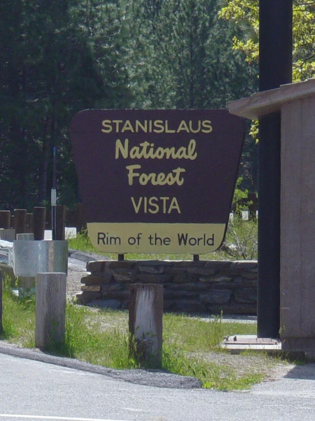
A brown and yellow official park sign reading Stanislaus National Forest VISTA Rim of the World, mounted on a stone base near a roadside.
An official sign marking the entrance to the Rim of the World vista within Stanislaus National Forest.

Stanislaus National Forest history and protected-area timeline

Stanislaus National Forest was established on February 22, 1897, making it one of the oldest national forests in the United States. From its inception, the forest was part of the broader federal movement to protect Sierra Nevada watersheds, timber resources, and headwater ecosystems in the late nineteenth century. It was named after the Stanislaus River, one of the principal watercourses that flow from the central Sierra.

Over time, the forest's boundaries were adjusted, and selected portions of its interior were set aside as designated wilderness, most notably the Emigrant Wilderness. The advent of Wild and Scenic river designations brought added protection to the Tuolumne River and Cherry Creek, while special use permits introduced a different kind of historical layer through ski resort development and continued grazing leases. In August 2013, the Rim Fire ignited on the Stanislaus National Forest and grew into the third-largest wildfire in California history at the time, leaving a lasting mark on the forest's contemporary story and shaping subsequent management and restoration efforts in the region.

Stanislaus National Forest landscape and geographic character

Stanislaus National Forest occupies a geologically varied section of the central Sierra Nevada. The terrain combines glacially sculpted granite features with volcanic formations, producing a landscape of dramatic contrasts across relatively short distances. Steep canyons, broad plateaus, exposed ridges, and rounded domes are all part of the forest's visual signature, and the transition from foothill oak and pine woodlands into high montane and subalpine environments happens entirely within the forest's boundaries.

The forest is defined hydrologically as much as geologically. The Tuolumne, Stanislaus, Clavey, and a portion of the Merced all flow from or through the forest, with the Tuolumne and Cherry Creek holding Wild and Scenic status. Together, these rivers have carved deep canyons that define both scenery and access. Eighty lakes and more than eight hundred miles of rivers and streams give the landscape an exceptionally water-rich character for a Sierra forest, while supporting the riparian zones that thread through its conifer-dominated slopes.

Avenues such as California State Route 120 cross the forest and offer major scenic corridors, including the Rim of the World vista point. Forest headquarters in Sonora, California anchor the western, lower-elevation side, while Pinecrest, Hathaway Pines, and Groveland serve as gateway communities to its higher, more rugged interior.
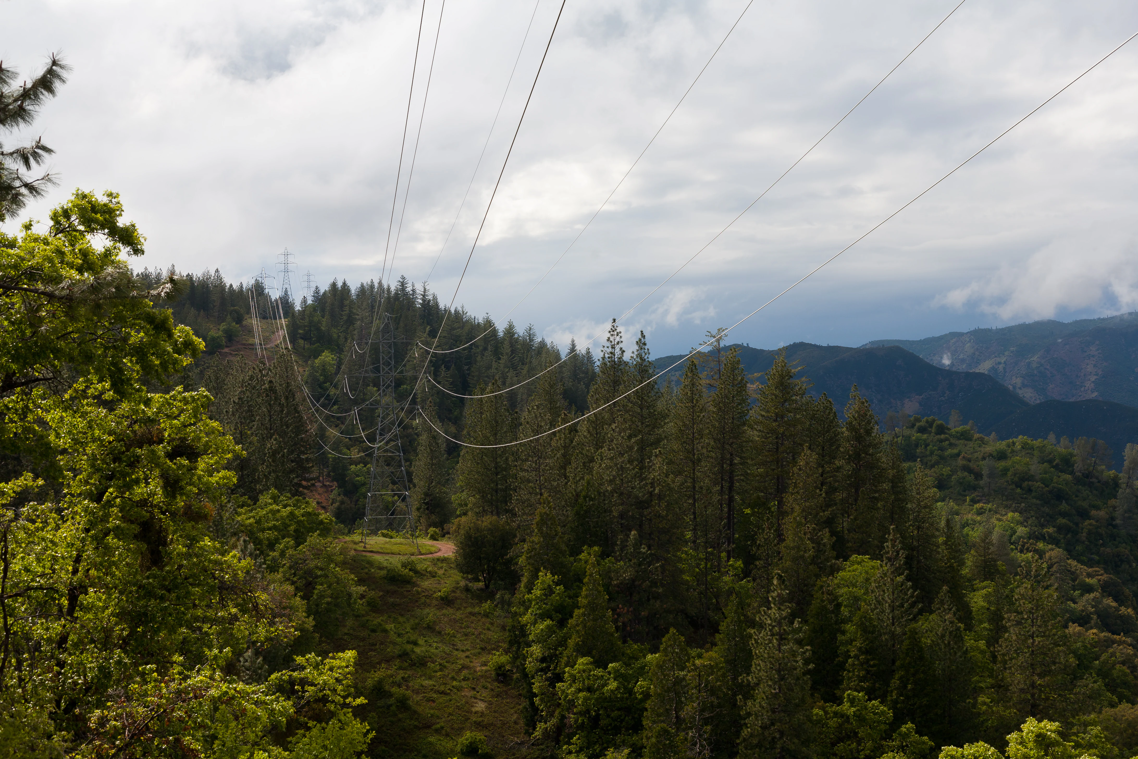
A wide landscape view of a coniferous forest in Stanislaus National Forest with large power lines stretching across the center of the frame against a backdrop of rolling hills and cloudy skies.
A view of Stanislaus National Forest featuring power lines crossing the forest canopy under a cloudy sky.

Stanislaus National Forest ecosystems, habitats, and plant life

Stanislaus National Forest protects a vertical sequence of Sierra Nevada ecosystems, from low-elevation foothill woodlands to subalpine forests and alpine edges. This range of habitats supports a high level of plant community diversity and gives the forest strong ecological value as a transitional landscape between the dry Sierra foothills and the moist, high-mountain environments of the central range.

Conifers dominate much of the forested area. Lodgepole pine, Jeffrey pine, and white fir form the backbone of the forest's canopy, particularly within its substantial old growth blocks. These old growth stands are ecologically important for wildlife, carbon storage, and watershed function, and they represent some of the more continuous tracts of mature Sierra forest in the region. Mixed conifer and oak woodlands occur at lower elevations along the western fringe.

Aquatic systems are central to the forest's ecology. Alpine lakes, meadows, and hundreds of miles of streams sustain aquatic species and riparian habitats, while Wild and Scenic river corridors such as the Tuolumne and Cherry Creek provide protected freshwater pathways. These waterways connect upper-elevation snowmelt zones with downstream users, giving the forest major hydrological as well as ecological significance.

Stanislaus National Forest wildlife and species highlights

The combination of coniferous forests, meadows, riparian corridors, and alpine environments supports a diverse Sierra Nevada fauna across Stanislaus National Forest. Wildlife patterns in the forest reflect the broader central Sierra, with species tied to old growth forest, high country, and river systems all finding habitat within its boundaries.

Old growth-dominated slopes of lodgepole pine, Jeffrey pine, and white fir provide important habitat for forest-interior species, while the mosaic of meadow, lake, and stream environments supports a wide range of aquatic and riparian life. River systems such as the Tuolumne and Cherry Creek maintain strong riparian habitat value, supporting fish and other aquatic species while also functioning as travel corridors for terrestrial wildlife. Higher elevations around the Emigrant, Carson-Iceberg, and Mokelumne Wilderness areas host species associated with the Sierra's subalpine and alpine zones.

Stanislaus National Forest conservation status and protection priorities

As one of the oldest national forests in the United States, Stanislaus National Forest carries significant conservation value rooted in both its age and its ecological setting. Established in 1897, it has long contributed to watershed protection, timber stewardship, and habitat preservation in the central Sierra Nevada. Its location adjacent to Yosemite National Park gives it an additional role in buffering a globally recognized protected landscape and supporting ecological connectivity in the region.

A substantial portion of the forest is dedicated to wilderness protection. The Emigrant Wilderness lies entirely within the forest, while portions of the Carson-Iceberg Wilderness and Mokelumne Wilderness extend into its boundaries. Roughly 139,000 acres of old growth forest, dominated by lodgepole pine, Jeffrey pine, and white fir, add to the forest's conservation significance. Wild and Scenic designations on the Tuolumne River and Cherry Creek further protect key aquatic systems. The 2013 Rim Fire, one of the largest in California's history, reshaped parts of the forest and continues to influence restoration and management priorities in the area.

Stanislaus National Forest cultural meaning and human context

Stanislaus National Forest sits within a region deeply tied to California's Gold Rush and Sierra foothill heritage, with the historic Mother Lode country bordering the forest's western edge. Communities such as Sonora, Groveland, Hathaway Pines, and Pinecrest serve as gateways to the forest and carry the cultural identity of mountain towns shaped by mining, logging, ranching, and outdoor recreation. Traditional land uses such as cattle grazing remain a part of the forest's working landscape, alongside more recent recreation-driven economies tied to skiing, rafting, and backcountry tourism.

Top sights and standout views in Stanislaus National Forest

Stanislaus National Forest anchors a major section of the central Sierra Nevada with a combination of wilderness, old growth forest, and Wild and Scenic rivers. The Emigrant Wilderness, portions of the Mokelumne and Carson-Iceberg Wilderness areas, and the Tuolumne and Cherry Creek corridors give the forest both ecological depth and recreational richness. Its accessibility from the San Francisco Bay Area, traditional ranching heritage, and dramatic transition from foothill to alpine terrain make it one of the most diverse and historically significant national forests in California.

Best time to visit Stanislaus National Forest

Summer and early fall are generally the most versatile seasons for visiting Stanislaus National Forest, when high-elevation lakes, meadows, and rivers are accessible and the trails through the Emigrant Wilderness and surrounding wildlands are typically snow-free. Late spring can be appealing for whitewater enthusiasts, as snowmelt swells the Tuolumne River and Cherry Creek. Winter brings a different character, with ski operations at Dodge Ridge and Bear Valley extending the forest's appeal into the snowy months, while much of the backcountry becomes a more specialized, snow-covered setting.
Monthly climate preview

Long-term temperature and precipitation records measured at a representative elevation

Stanislaus National Forest Climate Normals and Monthly Weather Patterns

Representative coordinate records show measured long-term temperature ranges and monthly precipitation levels across Stanislaus National Forest from 1991 to 2020. Examining the full twelve-month climate profile reveals complete seasonal temperature swings and precipitation variations for detailed study.
Annual mean7 °C
-1 °C19 °C
Jan-1°
Feb-1°
Mar
Apr
May
Jun14°
Jul19°
Aug18°
Sep15°
Oct
Nov
Dec-1°
Warmest month
July

18.9 °C

Coolest month
December

-1.3 °C

Wettest month
February

4.3 mm/day

Driest month
August

0.2 mm/day

Park location guide

Geography guide, regional context, and park location map for Stanislaus National Forest

Stanislaus National Forest park geography, regions, and map view in United States of America

Understand where Stanislaus National Forest sits in United States of America through a broader geographic reading of the surrounding landscape, nearby location context, and its mapped position within the national park landscape.

How Stanislaus National Forest fits into United States of America

The United States of America is a federal presidential republic and one of the world's largest countries by area and population. It consists of 50 states across a vast territory spanning multiple time zones, with its capital in Washington, D.C. and largest city in New York City. The nation has a diverse economy, influential political system, and significant cultural and military presence globally.

Wider geography shaping Stanislaus National Forest in United States of America

The United States occupies a vast territory in North America, bordered by Canada to the north and Mexico to the south. The 48 contiguous states stretch from the Atlantic to the Pacific Ocean, while Alaska occupies the northwestern region and Hawaii is an archipelago in the Pacific. The country encompasses diverse terrain including the Rocky Mountains, Appalachian Mountains, Great Plains, and extensive river systems.

Map view of Stanislaus National Forest

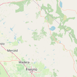
Use this park location map to pinpoint Stanislaus National Forest in United States of America, understand its exact geographic position, and read its mapped placement within the surrounding landscape more clearly.

Pigeon | © OpenStreetMap contributors

Location context for Stanislaus National Forest

California
Natural feature types

Browse the Geographic Feature Index for Stanislaus National Forest

Expand your understanding of the Sierra Nevada by browsing the named natural features associated with Stanislaus National Forest. This MoriAtlas index organizes landforms, watersheds, and wilderness terrain to reveal the complex geologic character of this significant protected landscape.
Recorded earthquake history

Explore Historical Earthquake Records Associated with Stanislaus National Forest

MoriAtlas maintains a comprehensive, filterable collection of recorded seismic events mapped to the proximity of Stanislaus National Forest. Review historical magnitudes, depths, and epicentre distances to better understand the seismic context of this significant Sierra Nevada wilderness landscape.

Stanislaus National Forest Earthquake Records

Catalogued events

621 events

Strongest magnitude

Magnitude 6.1

Most recent event

Feb 20, 2025

This history includes earthquakes recorded inside the park or within 50 km of its borders

Visualizing Sierra Nevada mountain terrain, river canyons, and old growth forests

Stanislaus National Forest Photos and Landscape Scenery

Visual documentation of Stanislaus National Forest reveals dramatic Sierra Nevada granite formations, deep river canyons, and extensive conifer stands. Examining these protected area images provides a clearer understanding of local habitat transitions and mountainous terrain characteristics.

A brown and yellow official park sign reading Stanislaus National Forest VISTA Rim of the World, mounted on a stone base near a roadside.

A wide, eye level view of a lake nestled within a dense coniferous forest and rolling hills, framed by tall pine trees on the sides.

A wide landscape view of a coniferous forest in Stanislaus National Forest with large power lines stretching across the center of the frame against a backdrop of rolling hills and cloudy skies.

Park atlas

Compare adjacent protected landscapes, mountain terrain, and regional conservation areas

Explore Parks Near Stanislaus National Forest and Surrounding Sierra Nevada Wildlands

Browse protected areas near Stanislaus National Forest to examine connected Sierra Nevada ecosystems and adjacent mountain terrain. Evaluating nearby wilderness corridors provides broader geographic context for regional conservation lands across Northern California.
Watercolor painting of a tranquil mountain lake surrounded by pine forests and distant rolling peaks in muted green and pink tones.
Wildlife reserveTuolumne County
Park boundaries overlap#1 closest

East

Emigrant Wilderness: A Detailed Geographic Atlas of Protected Sierra Nevada Landscapes

Mapping glaciated granite basins and volcanic ridges in Tuolumne County.

Emigrant Wilderness is a sprawling protected area defined by a distinct mix of granitic domes, cirques, and a unique volcanic sector in its northeastern reaches. Spanning from lower forest elevations to alpine peaks, the area provides a window into the complex geological history of the central Sierra Nevada. The terrain includes hundreds of high-country lakes and meadow systems that support diverse alpine ecosystems and represent the rugged nature of the Pacific Crest Trail corridor.

Area
454.37 km²
Established
1974
IUCN
Ib
Relief
Mountain
Wildlife reserveCalifornia
Park boundaries overlap#2 closest

East

Hoover Wilderness: Protected Alpine Geography in the Central Sierra Nevada, California

High-altitude glacial basins and Sierra crest wilderness

The Hoover Wilderness preserves a vital strip of high-elevation terrain along the eastern Sierra Nevada crest. Characterized by glacier-carved basins, interconnected alpine lakes, and sharp granite ridges, this protected area serves as a primary ecological gateway to the high country. Its landscape features define the headwaters of the Walker River, offering a compact yet significant look at California's protected alpine wilderness.

Area
518.89 km²
Established
1964
IUCN
Ib
Relief
Mountain
A watercolor painting showing soft green hills, distant pink-hued mountains, and a pale blue lake in a serene, stylized landscape.
Protected landscapeNevada
Park boundaries overlap#3 closest

Northeast

Humboldt, Toiyabe National Forest: Protected Landscape and Regional Mountain Geography

A vast network of Nevada mountain ranges and alpine wilderness

Humboldt, Toiyabe National Forest serves as a defining public land entity across Nevada and eastern California. As the largest national forest in the contiguous United States, it preserves a striking collection of isolated mountain ranges, including the Ruby Mountains and the rugged Jarbidge wilderness, within a broader basin-and-range landscape. Examine the boundaries and terrain that characterize this complex, high-desert ecosystem.

Area
25,454 km²
Established
1908
Relief
Mountain
Access
Easy access
A soft watercolor painting showing a range of gentle rolling hills and mountains in pale green, yellow, and violet tones against a white background.
Protected landscapeCalifornia
Park boundaries overlap#4 closest

Southeast

Sierra National Forest: Protected Landscapes of the Central California Sierra Nevada

Geography of alpine lakes, conifer forests, and mountain basins

Spanning from 900 to nearly 14,000 feet in elevation, Sierra National Forest protects a massive vertical range of California terrain. Discover its iconic wilderness areas and reservoir-studded landscape, providing a deep look at the geographic connectivity between major national parks in the central Sierra Nevada.

Area
5,300 km²
Established
1893
Relief
Mountain
Climate
Alpine
Watercolor painting showing mountains, a winding river, and green forests in the foreground and background
National parkCalifornia
Park boundaries overlap#5 closest

Southeast

Yosemite National Park: Protected Landscape Identity and Geographic Atlas Context

Mapped boundaries and regional setting for a key California national park.

Delve into the protected landscape identity of Yosemite National Park, examining its specific geographic features and its place within the broader atlas of California's natural areas. This entry provides detailed context on its mapped boundaries, regional positioning, and significance as a protected natural site, essential for understanding its landscape and conservation geography.

Area
3,070 km²
Established
1890
IUCN
II
Visitors
3.9M annual
A horizontal watercolor painting depicting a mountain range in the background with rolling hills and a winding river or stream in the foreground.
Protected landscapeCalifornia
30 km away#6 closest

Southeast

Inyo National Forest: An Atlas of Protected Landscapes and Sierra Nevada Geography

High altitude wilderness and volcanic terrain in Eastern California

Spanning from the arid Owens Valley floor to the 14,000 foot crest of the Sierra Nevada, Inyo National Forest remains a cornerstone of the American West. This protected landscape contains the Ancient Bristlecone Pine Forest, Mount Whitney, and the Mono Inyo volcanic chain, providing a dense geographic record of glacial, tectonic, and ecological diversity across a vast managed corridor.

Area
7,702.71 km²
Established
1907
IUCN
Ib
Relief
Mountain
Protected landscapeCalifornia
53 km away#7 closest

North

Tahoe National Forest: Exploring Protected Mountain Landscapes in the California Sierra Nevada

An atlas of granite river canyons and alpine ridge terrain

Tahoe National Forest defines a critical segment of the western Sierra Nevada, containing granite river canyons, numerous reservoirs, and summits reaching above 9,000 feet. This protected landscape acts as a vital headwater for California foothill communities and Nevada, hosting significant natural features like the Placer County Big Trees Grove and segments of the Pacific Crest Trail.

Area
3,526.82 km²
Established
1899
Relief
Mountain
Climate
Mediterranean
A watercolor painting showing a panoramic view of mountain ranges, a treeline, and a calm body of water in the foreground.
Wildlife reserveCalifornia
58 km away#8 closest

Southeast

John Muir Wilderness: Sierra Nevada Protected Landscape and High Mountain Geography

California wilderness area with glacial basins and granite peaks

John Muir Wilderness represents one of the largest protected high-elevation areas in the contiguous United States. Spanning the Sierra Nevada crest, its granite terrain is sculpted by Pleistocene glaciation into sharp arêtes, deep canyons, and hundreds of alpine lakes. This wilderness serves as a vital geographic anchor for mountain ecosystems, offering an extensive look at the high-country landscape of eastern California.

Area
2,641.76 km²
Established
1964
IUCN
Ib
Relief
Mountain

Common questions about visiting, size, designation, and location context for Stanislaus National Forest

Stanislaus National Forest FAQs for park facts, access, geography, and protected area context

Find quick answers about Stanislaus National Forest, including protected-area facts, park geography, trail and visitor context, and how the park fits into its surrounding country and regional landscape.
MoriAtlas Explorer

Continue Your Protected Areas Search Across the Global Atlas

Deepen your exploration by continuing the structured search for national parks and protected areas worldwide. Utilize the comprehensive filtering capabilities to compare different conservation landscapes and refine your understanding of global park geography. Discover more about the distribution and characteristics of protected natural areas.

Global natural geography