Mori Atlas logo
Nature reserveSylter Außenriff – Östliche Deutsche Bucht

A vast offshore marine protected landscape located within the German Exclusive Economic Zone

Sylter Außenriff – Östliche Deutsche Bucht: Marine Nature Reserve Geography and Atlas Map

(Naturschutzgebiet Sylter Außenriff – Östliche Deutsche Bucht)

Sylter Außenriff – Östliche Deutsche Bucht stands as a significant marine nature reserve in the southeastern North Sea. Spanning across extensive offshore grounds, the area encompasses a complex underwater landscape defined by moraine ridges, shallow sandbanks, and unique stone reefs that support vital harbor porpoise populations and migratory seabirds. This protected zone represents a cornerstone of marine spatial planning and ecological monitoring within the broader German North Sea coastal waters.

marine protected areaNatura 2000offshore reefsandbankNorth Seaseabird sanctuary

Sylter Außenriff – Östliche Deutsche Bucht

Nature reserve

Park overview

Structured park overview, official facts, and landscape profile for Sylter Außenriff, Östliche Deutsche Bucht

Sylter Außenriff, Östliche Deutsche Bucht park facts, protected area profile, and essential visitor context

Review the core facts for Sylter Außenriff, Östliche Deutsche Bucht, including designation, size, terrain, visitor scale, habitats, and operating context in one park-focused overview.

About Sylter Außenriff, Östliche Deutsche Bucht

Sylter Außenriff – Östliche Deutsche Bucht represents one of the largest marine protected areas in the German North Sea and an important node in the Natura 2000 network that connects Germany's Wadden Sea coast to offshore European waters. The reserve was created by merging the existing FFH site Sylter Außenriff with the earlier Bird Protection Area Östliche Deutsche Bucht, which itself had been designated in September 2005, and formalizing their joint management under a single 2017 ordinance that brought together roughly 560,300 hectares of open sea for conservation.

Geographically, the protected zone covers the outer grounds offshore of Sylt and Amrum and extends across the underwater moraine ridge that forms the northeastern flank of the Elbe Urstromtal, an ancient glacial valley system. The reserve borders the Schleswig-Holstein Wadden Sea National Park and Biosphere Reserve to the east and the seabird protection area around Helgoland to the south, while its northern limit follows the maritime boundary with Denmark. The result is a contiguous marine conservation corridor that bridges the Wadden Sea tidal flats with the deeper, more open waters of the German Bight.

Ecologically, the site stands out for its mosaic of sublittoral sandbanks, moraine-related hard substrates, and extensive offshore reefs. Sandbanks such as the Amrumbank are permanently submerged and structurally simple, while the reef areas host dense assemblages of long-lived benthic organisms. These varied habitats support the reserve's international importance for harbor porpoises and seals as well as for seabirds that depend on the outer grounds as feeding, resting, and wintering habitat far from the coast.

The reserve also sits at the center of increasing human use of the German EEZ. Recreational fishing is prohibited across large portions of the area, but several offshore wind energy installations, including the Butendiek wind farm, fall within its boundaries, and others such as DanTysk and Amrumbank West lie directly adjacent. This makes the site a key proving ground for balancing marine conservation with offshore energy development in one of Europe's busiest seas.

Quick facts and research context for Sylter Außenriff, Östliche Deutsche Bucht

Sylter Außenriff – Östliche Deutsche Bucht is a German offshore nature reserve in the southern North Sea, designated on 28 September 2017 within Germany's Exclusive Economic Zone. The combined reserve covers approximately 560,300 hectares and unites the 531,429-hectare FFH site Sylter Außenriff with the 313,513-hectare Bird Protection Area Östliche Deutsche Bucht under the European Natura 2000 framework. It lies west of the North Frisian Wadden Sea, reaching depths of roughly 8 to 48 meters, and protects sandbanks, moraine ridges, and exceptional offshore stone reefs along with internationally important seabird and marine mammal habitat.

Protection and recognition

Documented marine protection scope, 2017 designation history, and management framework details.

Sylter Außenriff – Östliche Deutsche Bucht Protection Status and Marine Area Designation

Marine protection status records for Sylter Außenriff – Östliche Deutsche Bucht outline the official designation history established in 2017. Structured conservation facts detail the marine management scope without assuming external international recognition sources.

Protection details

Protection scope
Marine
Designated year
2017
Transboundary protection
No
Park context

Deeper park guide and search-rich context for Sylter Außenriff, Östliche Deutsche Bucht

Sylter Außenriff, Östliche Deutsche Bucht history, landscape, wildlife, and travel context

Explore Sylter Außenriff, Östliche Deutsche Bucht through its history, landscape character, ecosystems, wildlife, conservation priorities, cultural context, and seasonal travel timing in a structured park guide built for atlas discovery and search intent.

Why Sylter Außenriff, Östliche Deutsche Bucht stands out

The reserve is best known for combining two contrasting but ecologically linked protected zones: an offshore reef and sandbank system in the Sylt outer grounds, and a vast marine bird protection area covering much of the eastern German Bight. Its reefs are considered unique within the coastal-distant waters of the German North Sea and harbor rich communities of sessile invertebrates such as dead man's fingers, edible sea urchins, sea anemones, sea squirts, bryozoans, and sponges. The area is also nationally and internationally significant for its concentration of harbor porpoises, the most frequently recorded population in the entire North Sea, and for supporting Annex I seabird species such as black-throated and red-throated divers, little gulls, and Arctic, common, and Sandwich terns alongside numerous migratory waterbirds.

Sylter Außenriff, Östliche Deutsche Bucht history and protected-area timeline

The conservation history of Sylter Außenriff – Östliche Deutsche Bucht reflects the gradual European push to protect marine areas beyond the coastline. Its earliest formal layer came with the Bird Protection Area Östliche Deutsche Bucht, which was designated on 24 September 2005 as a Special Protection Area under the EU Birds Directive. That site covered roughly 313,500 hectares of open sea west of the North Frisian Wadden Sea and north of Helgoland and became an anchor for seabird conservation in the German Bight.

The complementary Fauna-Flora-Habitat site Sylter Außenriff, registered as 1209-301, was established around the same time, covering about 531,429 hectares of sandbanks, reefs, and moraine ridges offshore of Sylt and Amrum. Together both designations created the ecological foundation for what would later become a single cooperative reserve.

On 28 September 2017, these two overlapping marine protected areas were formally unified through a federal ordinance establishing the Nature Reserve Sylter Außenriff – Östliche Deutsche Bucht. By merging the FFH site and the bird protection area under one legal framework, the new designation clarified protection rules across the entire area and made coordinated management of habitat types, marine mammal species, and bird species possible within one continuous offshore zone.

Sylter Außenriff, Östliche Deutsche Bucht landscape and geographic character

The reserve lies entirely underwater, forming a wide arc of open sea between the North Frisian islands and the deeper central North Sea. Its seabed is defined by the geological legacy of the last glaciation: the moraine ridge of the Elbe Urstromtal rises from the seafloor in the eastern and northern parts of the area, giving the reserve its characteristic relief of harder substrates amid otherwise flat sandy grounds.

Monthly climate preview

Long-term representative point measurements for annual temperature and precipitation rhythms

Sylter Außenriff – Östliche Deutsche Bucht Climate Normals and Weather by Month

Representative coordinate records show sustained temperature variations and shifting daily precipitation amounts across twelve baseline months. Examining the complete monthly climate dataset provides deeper numerical context for long-term meteorological patterns at this marine location.
Annual mean10 °C
4 °C17 °C
Jan
Feb
Mar
Apr
May10°
Jun14°
Jul16°
Aug17°
Sep16°
Oct12°
Nov
Dec
Warmest month
August

17.4 °C

Coolest month
February

3.7 °C

Wettest month
October

3.2 mm/day

Driest month
April

1.5 mm/day

Park location guide

Geography guide, regional context, and park location map for Sylter Außenriff, Östliche Deutsche Bucht

Sylter Außenriff, Östliche Deutsche Bucht park geography, regions, and map view in Germany

Understand where Sylter Außenriff, Östliche Deutsche Bucht sits in Germany through a broader geographic reading of the surrounding landscape, nearby location context, and its mapped position within the national park landscape.

How Sylter Außenriff, Östliche Deutsche Bucht fits into Germany

Germany is a federal republic in Western and Central Europe with a population of over 83 million across sixteen constituent states. It is Europe's largest economy by nominal GDP and a major global exporter and importer. The capital is Berlin, and the country borders Denmark, Poland, Czech Republic, Austria, Switzerland, France, Luxembourg, Belgium, and the Netherlands.

Wider geography shaping Sylter Außenriff, Östliche Deutsche Bucht in Germany

Germany is located in Western and Central Europe, spanning 357,022 km². It borders Denmark to the north, Poland and the Czech Republic to the east, Austria and Switzerland to the south, and France, Luxembourg, Belgium, and the Netherlands to the west. The country has coastlines on the Baltic Sea and North Sea to the north, with the Alps located in the southern region.

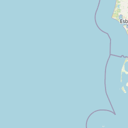
Map view of Sylter Außenriff, Östliche Deutsche Bucht

Use this park location map to pinpoint Sylter Außenriff, Östliche Deutsche Bucht in Germany, understand its exact geographic position, and read its mapped placement within the surrounding landscape more clearly.

Pigeon | © OpenStreetMap contributors
Park atlas

Compare surrounding regional marine reserves and protected North Sea landscapes.

Exploring Parks Near Sylter Außenriff and Other Protected Marine Areas

Browse other protected areas and marine reserves situated near Sylter Außenriff and the broader German Bight. Continuing into adjacent coastal sanctuaries reveals connected marine ecosystems and regional conservation networks.
Watercolor illustration of a landscape with green hills, a body of water, and grassy foregrounds
National parkSchleswig-Holstein
About 44 km away#1 closest

East

Schleswig-Holstein Wadden Sea National Park: Germany's Largest Protected Tidal Landscape

Explore the mapped geography of this vital North Sea national park.

Schleswig-Holstein Wadden Sea National Park is a monumental protected area, recognized globally as a UNESCO World Heritage Site for its extraordinary tidal wetland ecosystem. This page offers detailed insights into its geographic scope, from the North Frisian Islands to the Elbe estuary, highlighting the dynamic interplay of mudflats, salt marshes, and coastal terrain. Discover the park's critical role as a migratory bird flyway and marine nursery, providing rich data for geographic and atlas exploration of this unique North Sea protected landscape.

Area
4,410 km²
Established
1985
IUCN
II
Visitors
1.7M annual
National parkDenmark
About 76 km away#2 closest

Northeast

Wadden Sea National Park: Denmark's Premier Tidal Wetland and Migratory Bird Sanctuary

Mapped boundaries and unique protected landscape exploration.

Wadden Sea National Park is a vast national park encompassing the Danish portion of the Wadden Sea, a globally significant tidal wetland. Recognized for its critical role in bird migration, hosting millions of birds annually, it features a distinctive landscape of tidal flats, salt marshes, coastal dunes, and barrier islands. This protected area offers a unique lens through which to explore dynamic coastal geography, intertidal ecosystems, and the conservation of a World Heritage Site.

Area
1,466 km²
Established
2010
IUCN
II
Relief
Lowland
Watercolor painting of a green salt marsh landscape with a winding river and wildflowers.
Protected areaDenmark
About 104 km away#3 closest

Northeast

Skallingen Protected Area: Geography and Coastal Dynamics in the Danish Wadden Sea

Coastal peninsula landscape and tidal wetland geography

Skallingen is an active, naturally formed peninsula in Denmark, characterized by its horizontal gradients of beach, dune, and marsh. As a protected area within the wider Wadden Sea ecosystem, the land showcases the raw interplay of sediment and sea, offering a distinct look at one of Europe's most significant intertidal landscapes and its layered historical legacy.

Area
20 km²
Established
1634
Relief
Lowland
Climate
Temperate
Watercolor painting showing coastal wetlands with mudflats, salt marshes, and distant hills under a soft light
National parkLower Saxony
About 106 km away#4 closest

South

Lower Saxon Wadden Sea National Park: Protected Coastal Landscape & Geography Atlas

Explore mapped boundaries, intertidal zones, and Lower Saxony's natural terrain.

Delve into the Lower Saxon Wadden Sea National Park, a significant national park situated in Lower Saxony, Germany. This page serves as your atlas entry point for understanding its protected landscape, characterized by vast mudflats, salt marshes, and a crucial role as a migratory bird corridor. Discover the geographic context of this UNESCO World Heritage site and its unique intertidal ecosystem through structured map data and detailed landscape information.

Area
345.8 km²
Established
1986
IUCN
II
Relief
Lowland
Watercolor painting of a landscape with a winding river, green hills, and scattered vegetation under a pale sky
National parkHamburg
About 109 km away#5 closest

Southeast

Hamburg Wadden Sea National Park: North Sea Tidal Landscape and Protected Area

Explore the mapped geography of this unique coastal national park.

Hamburg Wadden Sea National Park, a vital part of the UNESCO-listed Wadden Sea, showcases a unique dynamic landscape of intertidal mudflats, sandbars, and dune islands. This protected national park provides critical habitat for numerous bird species and marine mammals, offering an unparalleled opportunity to study tidal ecosystem dynamics and coastal geography through detailed mapping and atlas exploration.

Area
137.5 km²
Established
1990
IUCN
II
Relief
Lowland
A soft watercolor illustration showing a hazy coastal landscape with green dunes, rolling hills, and a calm water surface against a white background.
Protected landscapeDenmark
About 113 km away#6 closest

Northeast

Naturpark Vesterhavet: Geography and Protected Boundaries of the Danish West Coast

Coastal dune, heath, and wetland landscapes in West Jutland

Naturpark Vesterhavet serves as a critical coastal nature park along the North Sea, stretching between Blåvandshuk and Nymindegab. The park integrates a distinct series of parallel landforms, including active dunes, coniferous plantations, expansive heathlands, and the significant restored wetlands of Filsø. This protected landscape acts as a primary hub for coastal conservation, mapping the intersection of avian habitats and classic West Jutland terrain.

Area
225 km²
Established
2015
Relief
Lowland
Climate
Temperate
Nature reserveDenmark
About 114 km away#7 closest

East

Draved Skov Nature Reserve: Mapping the Geography of Denmark's Primeval Forest Mosaic

A vital protected landscape in Southern Jutland featuring untouched forest and raised bogs.

Draved Skov provides an unparalleled look into natural lowland forest dynamics in Denmark. Covering 250 hectares of varying glacial terrain, this nature reserve showcases a complex mosaic of oak, linden, and alder ecosystems integrated with the expansive Kongens Mose raised bog, offering an essential look at Northern European wetland and woodland geography.

Area
2.5 km²
Established
1994
Relief
Lowland
Scope
Terrestrial
Protected areaSchleswig-Holstein
About 115 km away#8 closest

East

FFH-Gebiet Wälder an der Lecker Au: Protected Forest Landscapes and Geest Geography

A mapped Natura 2000 deciduous woodland corridor in North Friesland

FFH-Gebiet Wälder an der Lecker Au comprises three specialized sub-areas of ancient deciduous woodland in Schleswig-Holstein. This protected landscape documents centuries of forest continuity, hosting diverse habitats including beech, oak, and alluvial forests that anchor the regional biotope network within the flat Lecker Geest terrain.

Area
0.5 km²
Established
2004
Relief
Lowland
Climate
Temperate

Common questions about visiting, size, designation, and location context for Sylter Außenriff, Östliche Deutsche Bucht

Sylter Außenriff, Östliche Deutsche Bucht FAQs for park facts, access, geography, and protected area context

Find quick answers about Sylter Außenriff, Östliche Deutsche Bucht, including protected-area facts, park geography, trail and visitor context, and how the park fits into its surrounding country and regional landscape.
MoriAtlas Explorer

Continue Your Protected Areas Search Across the Global Atlas

Deepen your exploration by continuing the structured search for national parks and protected areas worldwide. Utilize the comprehensive filtering capabilities to compare different conservation landscapes and refine your understanding of global park geography. Discover more about the distribution and characteristics of protected natural areas.

Global natural geography