
Mori Atlas logo
National parkThy National Park

Explore the unique dune heaths, coastal terrain, and protected natural areas of Northwest Jutland.

Thy National Park: Denmark's Premier National Park for Mapped Landscape Discovery

(Nationalpark Thy)

Thy National Park represents a cornerstone of Denmark's protected landscapes, offering a vast canvas of dynamic dune systems, rare heathlands, and strategic conifer plantations along the North Sea coast. Established as the nation's first national park, this approximately 244-square-kilometer area in Northwest Jutland provides a unique opportunity for atlas-based exploration of coastal geography and protected natural terrain. Users can delve into the park's mapped boundaries, understand its ecological significance as a critical habitat, and appreciate its role within the broader regional landscape context for structured discovery.

National ParkDenmarkDune LandscapeHeathlandCoastalNorth Sea
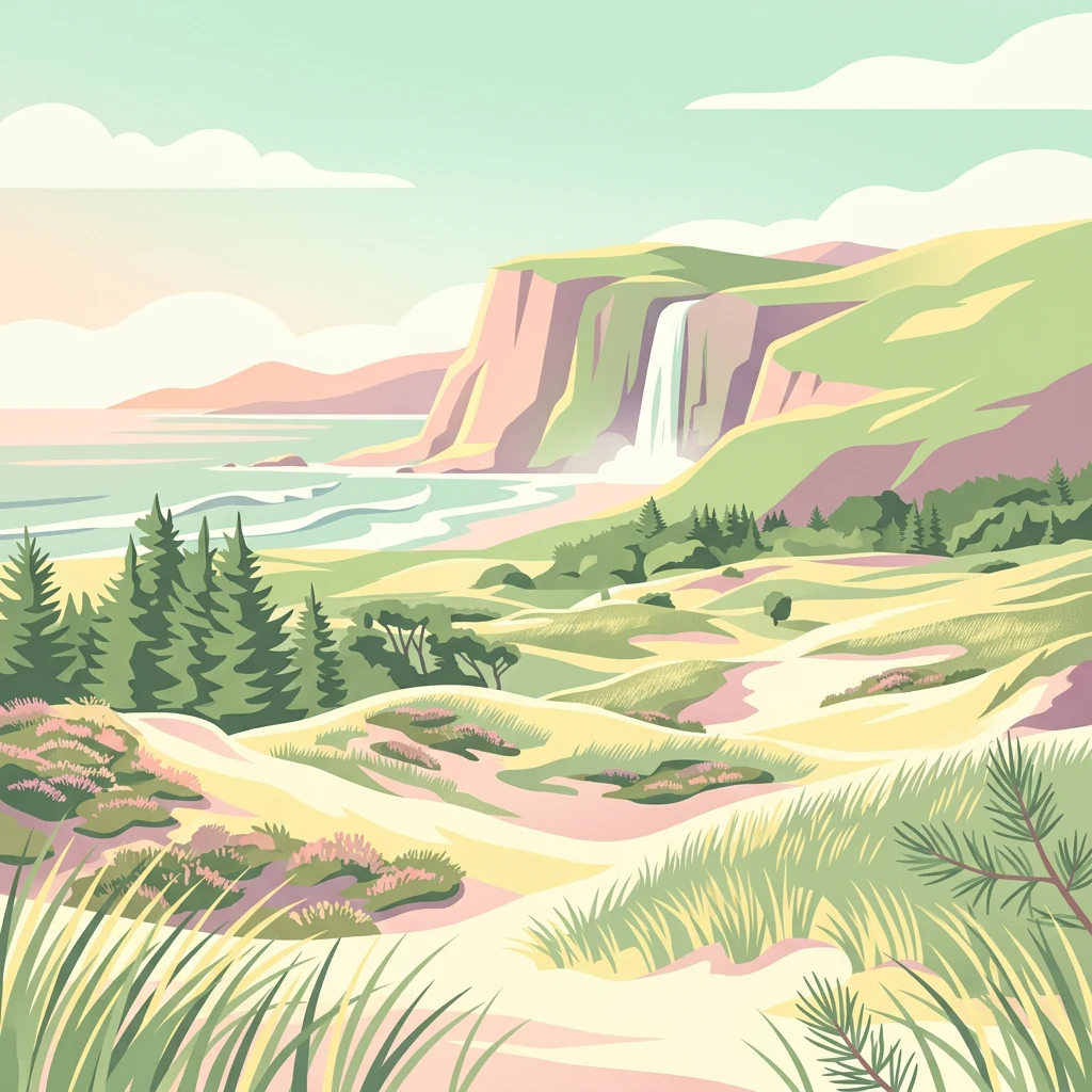
Illustrated coastal landscape featuring sandy dunes, pine trees, cliffs with a waterfall, and a beach with waves

Thy National Park

National park

Park overview

Structured park overview, official facts, and landscape profile for Thy National Park

Thy National Park park facts, protected area profile, and essential visitor context

Review the core facts for Thy National Park, including designation, size, terrain, visitor scale, habitats, and operating context in one park-focused overview.

About Thy National Park

Thy National Park represents Denmark's pioneering effort to protect and showcase the nation's most characteristic coastal landscapes. The park encompasses a windswept corridor along the North Sea in Northwest Jutland, where the interplay between sea, wind, and sand has shaped a distinctive environment over millennia. The landscape tells a story of human struggle against natural forces, as centuries of sand drift once threatened local communities before organized reforestation efforts began around 1800 and ultimately succeeded in stabilizing the terrain.

The park's significance extends beyond its natural beauty to include substantial cultural heritage. Stone Age settlers left traces in the form of dolmens, burial mounds, and kitchen middens, while Bronze Age barrows remain visible throughout the area. The landscape bears witness to periods of environmental collapse when over-exploitation led to sand encroachment, followed by centuries of adaptation to harsh North Sea conditions. World War II added another layer to this cultural tapestry, as the German Wehrmacht constructed extensive fortifications as part of the Atlantic Wall, with several bunkers and batteries now preserved as museums.

The park is managed under the principle that Danish national parks should contain the most unique and characteristic natural environments in the country, with the dual goals of improving nature quality and providing visitors with meaningful opportunities to experience and understand the landscape, its ecology, and its civilizational history.

Quick facts and research context for Thy National Park

Thy National Park occupies a coastal strip along Denmark's North Sea shore in the Thy district of Northwest Jutland, stretching roughly 55 kilometers north to south and 5 to 12 kilometers inland. The landscape is characterized by dynamic dune systems, heathlands, and plantation forests that were established to combat the historical problem of drifting sands. The park includes the Hanstholm Vildtreservat, one of Denmark's largest contiguous sandy heaths, and contains several notable lakes including Vandet Sø and Nors Sø, which are classified as rare lobeliesø lakes. The park was designated as Denmark's first national park in 2007 and is administered by the Danish Ministry of the Environment.

Protection and recognition

Mapping official conservation frameworks and environmental management boundaries in Denmark.

Thy National Park Protection Status and Protected Area Designation

Geographers can review official protection records, designation data, and management scopes assigned to Thy National Park. Comparing documented baseline frameworks helps researchers analyze the systematic distribution of conservation designations across the broader European coastline.

Protection details

Protection scope
Mixed
Transboundary protection
No
Park context

Deeper park guide and search-rich context for Thy National Park

Thy National Park history, landscape, wildlife, and travel context

Explore Thy National Park through its history, landscape character, ecosystems, wildlife, conservation priorities, cultural context, and seasonal travel timing in a structured park guide built for atlas discovery and search intent.

Why Thy National Park stands out

Thy National Park is best known for its extensive dune heaths, a rare habitat in European context, along with the successful century-long effort to stabilize drifting sands through strategic planting of marram grass and conifers. The park protects the Hanstholm Vildtreservat, Denmark's largest connected sandy heath, which serves as breeding ground for rare bird species including the European golden plover, crane, and wood sandpiper. The clear lobeliesø lakes with their distinctive aquatic flora, including the slender water lobelia, represent another defining feature, while the presence of wolves, reportedly returning to Denmark since 2009, adds to the park's ecological significance.
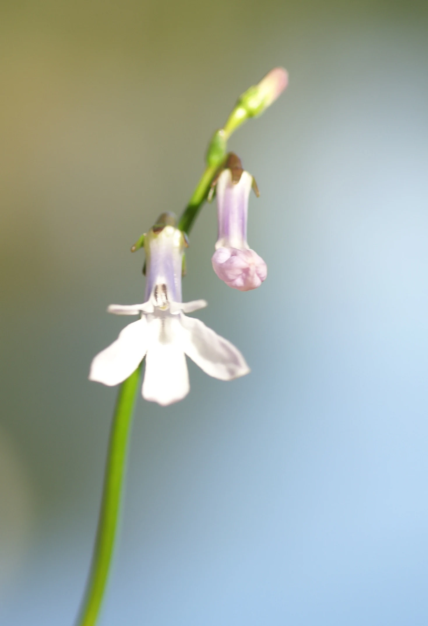
Close-up of a white and purple Lobelia dortmanna flower on a green stem against a blurred background
Close-up of Lobelia dortmanna flower with white petals and purple buds

Thy National Park history and protected-area timeline

Thy National Park was officially established on 29 June 2007 as Denmark's first national park in the country proper, following the creation of Northeast Greenland National Park in 1974. The park was opened to the public on 22 August 2008, marking a significant milestone in Danish conservation policy. The establishment followed decades of protection efforts that began with the creation of the Hanstholm Vildtreservat in the 1930s, which remains one of the largest protected heaths in Denmark.

The history of human interaction with the Thy landscape spans thousands of years, beginning with Stone Age cultures that settled the area as the post-glacial rebound lifted the land above sea level. Archaeological evidence from the Nordic Bronze Age is particularly abundant, with numerous barrows still visible, especially near Hanstholm. However, human activity eventually contributed to environmental degradation as excessive grazing and tree cutting led to the collapse of the formerly lush ecosystem, allowing drifting sands to dominate for several centuries.

The struggle against sand drift began around 1800 and required more than a century of sustained effort to ultimately succeed. Early attempts at planting various grasses and trees failed, but around the mid-1800s, effective methods were developed using marram grass and conifers. These dune plantations now stand as living witnesses to this hard-won battle against nature's forces, providing not only sand stabilization but also timber, firewood, and new habitats for wildlife including red deer and roe deer.

The park's more recent history includes World War II, when the German occupying forces constructed extensive fortifications along the coast as part of the Atlantic Wall due to Thy Strategic importance in controlling the North Sea. The Hanstholm Fortress now serves as a museum documenting this period.

Thy National Park landscape and geographic character

The landscape of Thy National Park is defined by the dynamic interaction between the North Sea and the Jutland coast, creating a diverse terrain of dunes, heaths, and inland areas. The coastal zone features wind-shaped dune systems that range from active white dunes still subject to sand movement to more stable gray dunes and green dunes with richer vegetation. These dunes stretch along the 55-kilometer coastline, with the most recent formations nearest the sea and older, more stabilized dunes found further inland within the plantations.

The park encompasses several distinct landscape zones. The western coastal area consists of beaches and active dunes, while the central zone features the park's signature sandy heaths—rare habitats in Denmark and throughout Europe. The eastern portions contain the conifer plantations established to halt sand drift, along with numerous small lakes and ponds. In the northern part, the Hanstholm Vildtreservat dominates with its extensive heathland, while the southern reaches feature Agger Tange, where tidal flats, lagoons, and reed beds create a different environmental character.

The underlying geology contributes to the landscape's complexity. Remains from the Stone Age Littorina Sea are visible as limestone cliffs along the coast and further inland. The post-glacial rebound that continues to lift the land has exposed ancient coastlines as inland cliffs, particularly around Nors Sø and Vandet Sø, and along the eastern edge of Hanstholm Vildtreservat. The Blegsøskrænten particularly marks a sharp division between the high chalk plateau and the sandy lowland.
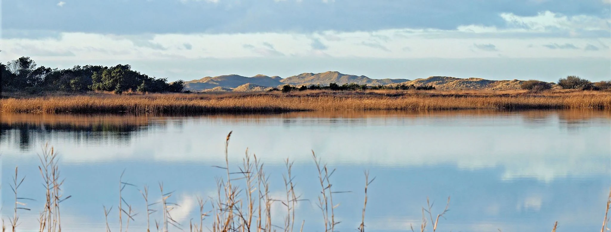
A calm lake reflecting the sky and distant hills with tall reeds in the foreground
Tormål Lake within Thy National Park, Denmark

Thy National Park ecosystems, habitats, and plant life

The nature of Thy National Park is characterized by remarkable diversity within a relatively small coastal area, ranging from salty strand beaches and bare sand dunes in the west to more fertile agricultural land in the east. The park protects several rare and internationally significant habitat types that are now legally protected due to their ecological value.

The dune heaths represent one of the park's most important habitats—a rare ecosystem in European context that supports specialized plant and animal communities. These heaths are maintained through ongoing conservation work including controlled burning, tree removal, and grazing by larger animals to prevent succession to forest. The heath vegetation, while appearing simple to untrained observers, is actually quite varied, dominated by common heather, sand sedge, marram grass, black crowberry, bell heather, and various lichens.

The park contains a notable collection of clear lobeliesø lakes—soft water lakes characterized by their distinctive aquatic vegetation including water lobelia, quillwort, and various charophyte algae. These lakes are indicator species of exceptionally clean water. Nors Sø near Hanstholm is classified as a kransnålalge-sø, an especially rare subtype. The park also protects wet hollows with quite different plant communities including bog bilberry, marsh gentian, cranberry, and various sundew species.

The coastal dunes support specialized species including beach morning glory and Scots lovage, both very rare in Denmark and found primarily along this stretch of coast. The plantations, though created for sand stabilization, now harbor significant biodiversity, including the large Hercules ant which is either rare or absent from the rest of Denmark.
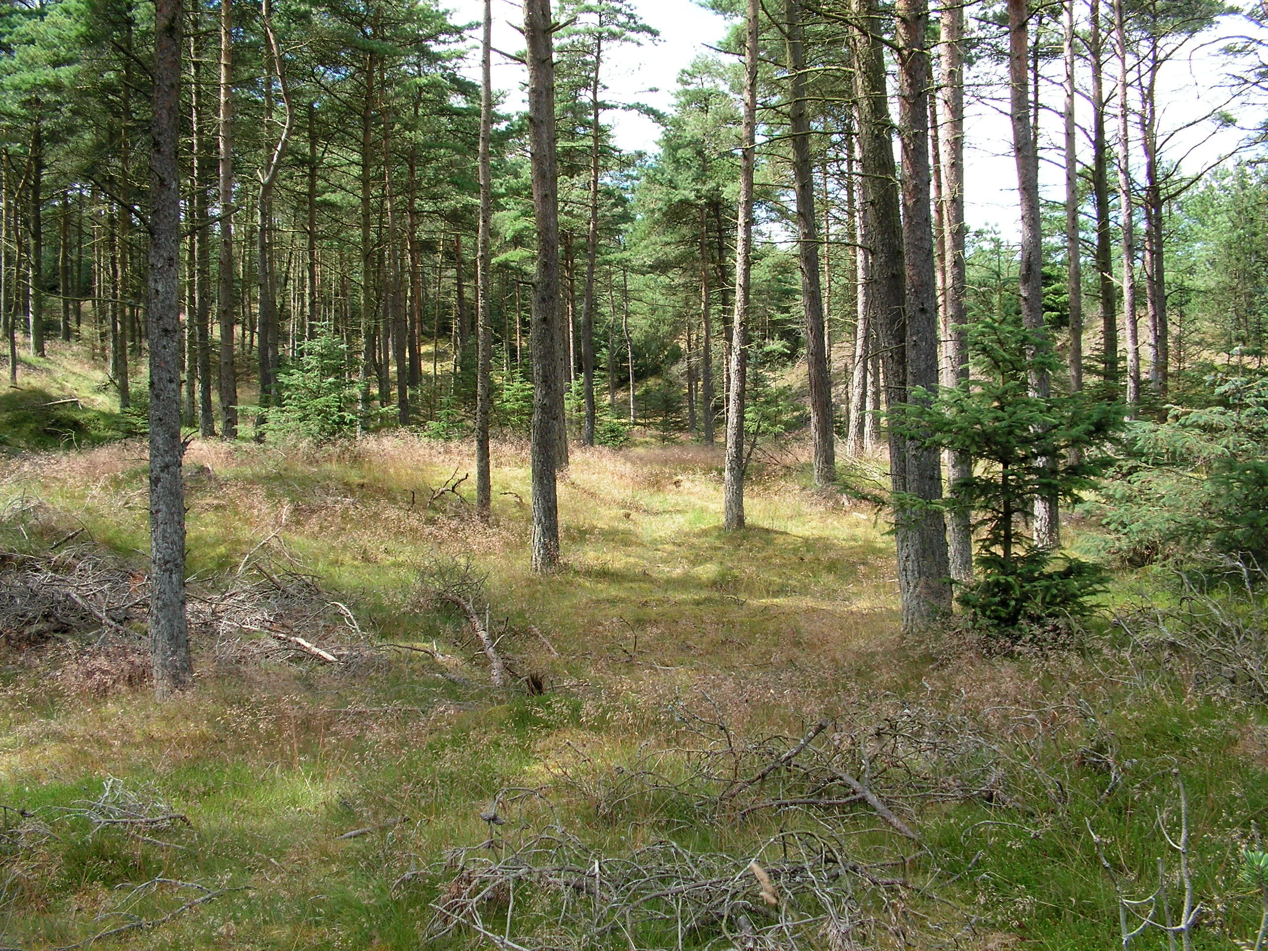
Pine forest with tall trees, grassy areas, and fallen branches
Tved Klitplantage in Thy National Park, Denmark

Thy National Park wildlife and species highlights

Thy National Park supports a rich diversity of wildlife, with particular significance for birdlife and rare species. The sandy heaths provide crucial breeding habitat for species that are rare or endangered in Denmark, including the European golden plover—which breeds nowhere else in the country—the common crane, and the wood sandpiper. The park is also home to the globally near-threatened black-tailed godwit.

The larger mammals in the park include red deer and roe deer, which have established populations in the plantation areas. Of particular note is the return of wolves to Thy, with several sightings reported since 2009. Wolves had been extirpated from Denmark since 1813, and a dead wolf found in autumn 2012 was believed to have migrated from the Lausitz region of Saxony, Germany. It is possible that a small pack now inhabits the area.

The park's smaller fauna includes the natterjack toad, a species associated with the sandy heath habitats. Many insect species thrive in the heath environments, while the lakes and ponds support diverse aquatic communities. The clear lakes with their pristine water conditions provide habitat for rare aquatic plants including the slender naiad, which is considered near-threatened on a global scale. The waters also host populations of water lobelia and various charophyte algae species.
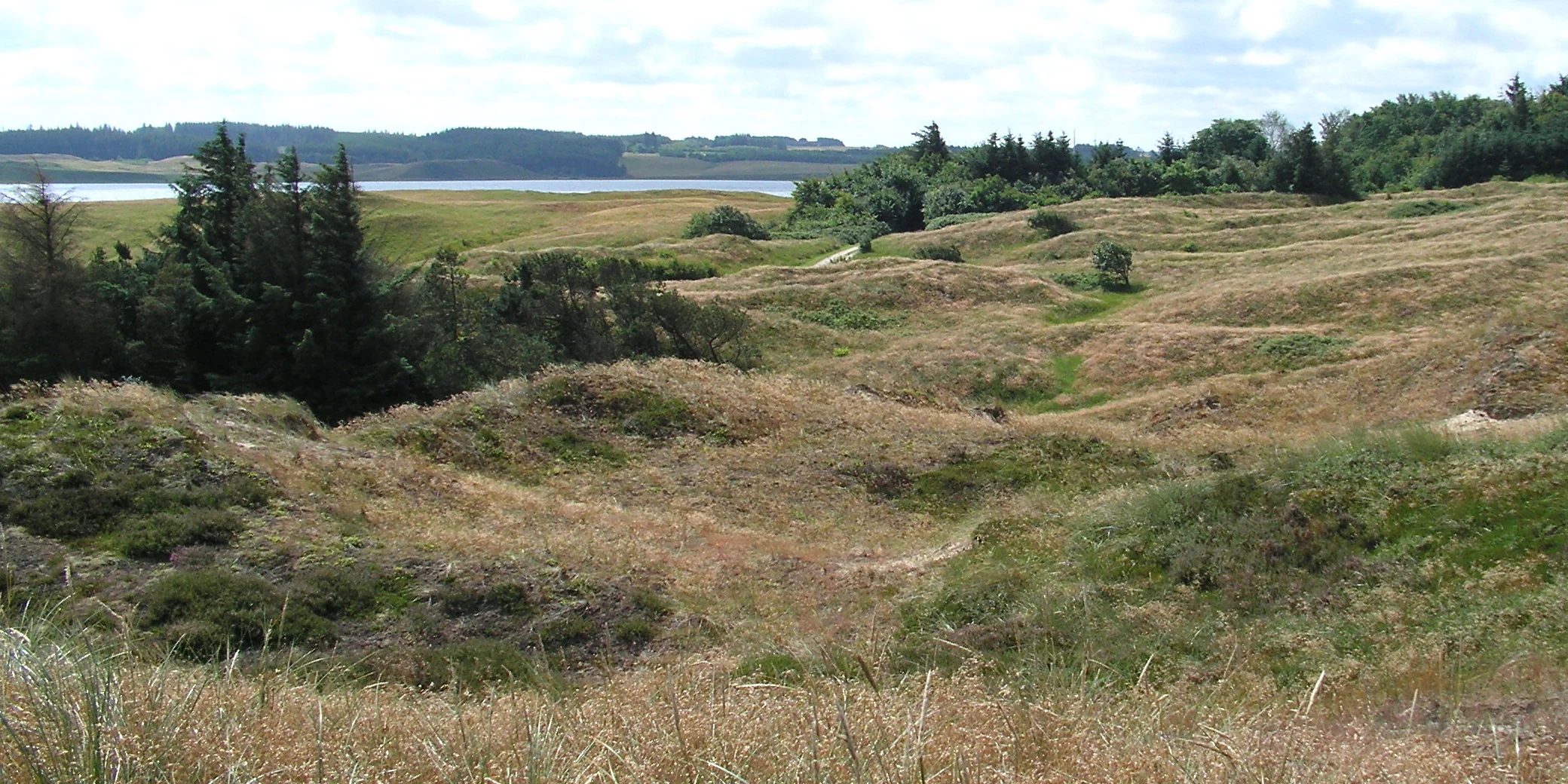
Wide view of sand dunes covered with heath vegetation and grasses, with a body of water and distant land visible in the background under a partly cloudy sky.
Rolling sand dunes and heathland in Thy National Park, Denmark.

Thy National Park conservation status and protection priorities

Thy National Park serves as a cornerstone of Danish nature conservation, protecting some of Denmark's most ecologically significant coastal habitats. The park's designation as a national park reflects its importance for preserving rare habitat types, particularly the sandy dune heaths which are legally protected as a rare habitat in European context. Parts of the park have been designated as bird protection areas and as Ramsar wetland sites, recognizing their international importance for waterfowl and migratory birds.

The park is included in the Natura 2000 network, which connects protected areas across Europe to ensure the conservation of biodiversity. Nissum Bredning with Harboøre and Agger Tange has been designated as a Ramsar site since 1977, providing international recognition for the wetland habitats in the southern part of the park. The 2025 agreement to establish Denmark's largest contiguous natural area on land, spanning over 400 square kilometers from southern Thy to eastern Han Herred, further enhances the conservation framework surrounding the park.

Conservation within the park requires active management to maintain the open heath habitats, which would otherwise succeed to forest without intervention. This includes grazing by large animals, occasional controlled burning, and removal of encroaching trees. The ongoing replacement of exotic tree species with native species in the plantations represents another conservation priority, creating more natural and ecologically valuable woodland habitats.

Thy National Park cultural meaning and human context

The cultural history of Thy National Park is deeply intertwined with the harsh North Sea environment and the ongoing struggle between human settlement and natural forces. Archaeological evidence demonstrates human presence from the end of the last Ice Age, when Stone Age cultures established settlements and left lasting marks on the landscape through dolmens, burial mounds, kitchen middens, and organized flint production.

The Bronze Age left particularly visible traces, with many barrows still standing in the northern areas near Hanstholm, though an unknown number have been buried by drifting sands over the centuries. Human activity continued through the Iron Age and Viking Age, with cultural remains often reflecting strong connections to the North Sea. It was during these later periods that the previously lush environment began to collapse under the pressure of excessive grazing and tree cutting, eventually allowing drifting sands to dominate the landscape for centuries.

The modern era brought dramatic changes including the establishment of the dune plantations beginning around 1800, which ultimately succeeded in stabilizing the sand. World War II left an indelible mark on the landscape when German forces constructed extensive fortifications as part of the Atlantic Wall, recognizing Thy strategic importance for controlling the North Sea. The Hanstholm Fortress, with its restored bunkers and batteries, now serves as a museum documenting this period of occupation and the broader context of World War II in Denmark.

Top sights and standout views in Thy National Park

Thy National Park stands as Denmark's first national park and protects one of the country's most significant coastal natural areas. The park's extensive dune heaths represent a rare habitat in European context, supporting specialized biodiversity and rare breeding birds including the European golden plover and crane. The successful century-long effort to stabilize drifting sands through strategic planting has created a landscape that serves as both a conservation model and a living testament to human-nature interaction. The park encompasses the Hanstholm Vildtreservat, Denmark's largest connected sandy heath, as well as rare lobeliesø lakes with exceptionally clean water and distinctive aquatic flora. The return of wolves to the area since 2009 adds ecological significance, representing the recovery of a species that had been absent from Denmark for nearly two centuries. The cultural layer includes prehistoric burial mounds, Bronze Age barrows, and World War II fortifications that now function as museums.

Best time to visit Thy National Park

Thy National Park can be enjoyed throughout the year, though each season offers a different experience of the landscape. The summer months bring the heathlands into bloom with purple heather covering the dunes, creating particularly striking scenery. However, the park's strong winds are a year-round feature, so visitors should come prepared for changeable weather regardless of season. The spring and autumn migrations bring large numbers of birds through the area, making these seasons particularly rewarding for birdwatchers. The Hanstholm Vildtreservat has restricted access from 1 April to 15 July to protect breeding birds, so visitors planning to explore this area should be aware of these seasonal closures. Winter offers a different character, with empty landscapes and the stark beauty of the dunes against gray skies, though shorter daylight hours limit exploration time.
Monthly climate preview

Long term weather by month patterns and precipitation profiles from coastal Danish data

Monthly Climate Normals and Average Temperature for Thy National Park

Decadal measurements at the park's low elevation baseline reveal temperate maritime cycles where average maximums reach 21.37 degrees Celsius in the warmest months while winter averages hover just above freezing. Accessing the complete monthly profile provides detailed daily precipitation averages and historical temperature ranges to help analyze the coastal Denmark environment.
Annual mean9 °C
3 °C17 °C
Jan
Feb
Mar
Apr
May10°
Jun13°
Jul16°
Aug17°
Sep15°
Oct11°
Nov
Dec
Warmest month
August

16.7 °C

Coolest month
February

3.2 °C

Wettest month
October

3.6 mm/day

Driest month
April

1.7 mm/day

Park location guide

Geography guide, regional context, and park location map for Thy National Park

Thy National Park park geography, regions, and map view in Denmark

Understand where Thy National Park sits in Denmark through a broader geographic reading of the surrounding landscape, nearby location context, and its mapped position within the national park landscape.

How Thy National Park fits into Denmark

Denmark is a constitutional monarchy and Nordic country in Northern Europe. It is the southernmost of the Scandinavian countries, bordering Germany to the south, Norway to the north, and Sweden to the southwest. The country consists of the Jutland peninsula and an archipelago of islands, with Copenhagen as its capital and largest city. Denmark has a population of over 6 million and is characterized by flat, arable land, sandy coasts, and a temperate climate.

Wider geography shaping Thy National Park in Denmark

Denmark occupies the Jutland peninsula and roughly 406 islands in Northern Europe. It is situated between the North Sea to the west and the Baltic Sea to the east. The country borders Germany to the south and is connected to Sweden via the Øresund Bridge. Denmark is predominantly flat terrain with low elevation, the highest point being Møllehøj at 170.86 meters.

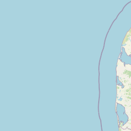
Map view of Thy National Park

Use this park location map to pinpoint Thy National Park in Denmark, understand its exact geographic position, and read its mapped placement within the surrounding landscape more clearly.

Pigeon | © OpenStreetMap contributors

Location context for Thy National Park

Thy
Natural feature types

Examine the Diverse Natural Features and Mapped Landscapes of Thy National Park

Use the MoriAtlas geographic database to trace the natural features that define the terrain of Thy National Park. From active North Sea dunes to inland heathland and glacial remnants, this collection offers a deeper understanding of the park's environmental geography.
Recorded earthquake history

Review Historical Earthquake Records Associated with Thy National Park

Access the comprehensive collection of seismic events recorded in the vicinity of Thy National Park. This MoriAtlas resource provides transparent access to historical epicenter data, magnitudes, and focal depths to inform your understanding of the region's recorded seismic timeline.

Thy National Park Earthquake History

Catalogued events

4 events

Strongest magnitude

Magnitude 4.4

Most recent event

Sep 16, 2018

This history includes earthquakes recorded inside the park or within 50 km of its borders

Discover the unique protected area through its windswept heaths, dynamic North Sea dunes, and serene lake environments

Explore Thy National Park Photos: Visual Guide to Denmark's Coastal Dune Landscapes

Browse a curated collection of Thy National Park photos to visually grasp the distinct terrain, including its vast dune heaths, coastal formations, and historic conifer plantations. These images provide crucial geographic context, helping you understand the diverse landscapes, unique habitats, and the characteristic visual identity of Denmark's first national park.

Close-up of a white and purple Lobelia dortmanna flower on a green stem against a blurred background

Coastal landscape featuring sandy dunes, grassy vegetation, and ocean waves under a partly cloudy sky

A calm lake reflecting the sky and distant hills with tall reeds in the foreground

Pine forest with tall trees, grassy areas, and fallen branches

Wide view of sand dunes covered with heath vegetation and grasses, with a body of water and distant land visible in the background under a partly cloudy sky.

Park atlas

Trace other protected areas around Thy National Park, comparing coastal dune, heathland, and conservation landscapes across Denmark's Jutland region.

Discover Other National Parks and Protected Areas near Thy National Park in Denmark

Browse other national parks and protected areas across Denmark's Jutland, extending beyond Thy National Park's coastal dunes, heaths, and managed conservation landscapes. Comparing these mapped entities provides a deeper understanding of regional protected-area geography, diverse conservation strategies, and unique ecological features.
A soft watercolor painting depicting a flat, open coastal landscape with rolling, pale-colored dunes in the distance and muted green grasses in the foreground against a white background.
Protected areaDenmark
Park boundaries overlap#1 closest

Southwest

Agger Tange Protected Area: Coastal Peninsula and Wetland Geography in Northwestern Denmark

Mapping the North Sea and Limfjorden interface

Agger Tange is a significant coastal landform in northwestern Denmark, characterized by its exposed western dunes and sheltered eastern salt marshes. This protected landscape documents the dramatic influence of storm surges on the Jutland coast, resulting in a complex network of lagoons and tidal flats that support critical bird habitats.

Area
24 km²
Established
1984
Relief
Lowland
Scope
Mixed
Protected areaDenmark
Mapped location lies within the park boundary#2 closest

Southwest

Natura 2000-område nr. 43 Klitheder mellem Stenbjerg og Lodbjerg Coastal Heath Atlas

Denmark protected coastal dunes and heathland geography

Spanning over 2,900 hectares on the Danish coast, this protected area features a coherent sequence of active dunes, inland heathlands, and freshwater slacks. The site provides essential habitat for breeding cranes and rare flora, reflecting the complex ecological transitions of the Thy coastline. Use this reference to trace the regional boundaries and unique terrain features of this designated European habitat.

Area
29.18 km²
Water
Minor water
A soft, painterly watercolor illustration of a shallow lake landscape featuring gentle green grassy foreground, a calm body of water, and distant treelined hills under a pale, warm sky.
Protected areaRegion Nordjylland
About 1.6 km away#3 closest

South

Ove Sø Protected Area: Geographic Overview of the Thy Wetland Landscape in Denmark

Mapped freshwater terrain in Region Nordjylland

Ove Sø features a long, shallow basin and complex wetland margins within the Thy landscape of Denmark. This entry provides a detailed look at the lake's hydrographic position, its connection to the Limfjorden system, and the protected status of its surrounding reed beds and meadow habitats.

Area
3.5 km²
Relief
Lowland
Scope
Terrestrial
Water
Water-dominated
Protected areaDenmark
5.1 km away#4 closest

South

Nissum Bredning Protected Area: Geography and Coastal Mapping in Denmark

Shallow bay ecosystems, glacial cliffs, and Limfjorden sand flats.

Nissum Bredning is a broad, low-lying basin in western Denmark known for its extensive shallow sand flats, including Fjordgrund and Gåseholm. The protected area encompasses a diverse coastal mosaic of brackish lagoons, salt meadows, and the distinctive Toftum Bjerge glacial cliff. This geography offers a clear view into the intersection of active North Sea currents and sheltered inland fjord environments.

Area
200 km²
Relief
Lowland
Climate
Temperate
Access
Easy access
Nature reserveRegion Nordjylland
5.4 km away#5 closest

Northeast

Korsø Knude Nature Reserve: Protected Chalk Headland and Coastal Terrain in Northern Jutland

Geographic analysis of lime-rich grassland and coastal dune systems

Korsø Knude protects a rare habitat mosaic where chalk geology meets shifting dune sand. This small but significant area in Region Nordjylland serves as a key site for specialized calcareous flora and coastal biodiversity, offering a distinct example of the Skagerrak coastline's natural terrain.

Area
0.2 km²
Established
1955
Relief
Upland
Climate
Temperate
Nature reserveRegion Nordjylland
12 km away#6 closest

Southeast

Mågerodde og Karby Odde Nature Reserve: Coastal Protected Landscapes in Region Nordjylland

Limfjorden shoreline, shallow bays, and saline meadows.

Mågerodde og Karby Odde serves as a key coastal reserve in Denmark, defined by its extensive Limfjorden shoreline and complex mix of aquatic and terrestrial habitats. From saline meadows and coastal lagoons to acidic grasslands and spring-fed mires, this protected area offers a look at a diverse maritime ecosystem. The site is recognized for its importance to migratory waterfowl and breeding coastal birds, providing a essential link in the regional geography of the Limfjorden.

Area
4.97 km²
Established
2011
Relief
Lowland
Climate
Temperate
Nature reserveRegion Nordjylland
14 km away#7 closest

Northeast

Lild Strand og Lild Strandkær: A Detailed Look at Denmark's Protected Coastal Dune Terrain

Mapping the dune heath, wetlands, and inland lakes of western Thy

Lild Strand og Lild Strandkær encompasses a significant protected landscape in Region Nordjylland. This site features a continuous stretch of coastal dune zonation, including foredunes and grey-green dunes, set against a chain of distinctive brown-water and Lobelia lakes. Its habitat mosaic offers a clear window into the ecological diversity of the Thy coastline through a structured geographic lens.

Area
7.49 km²
Established
2011
Relief
Lowland
Scope
Terrestrial
A wide panoramic watercolor illustration showing a landscape with green hills, pine trees, a body of water, and colorful foreground vegetation in pastel tones.
Natural monumentRudmose Aggerø
About 17 km away#8 closest

South

Rudmose Aggerø Natural Monument: Mapped Coastal and Fjord Landscapes in Denmark

Protected shallow-water habitats and rural island geography

Rudmose Aggerø presents a unique study in protected coastal geography. Situated in the western Limfjorden, this low-lying island features managed nature reserves and essential intertidal ecosystems. Its geography is shaped by the interplay of sandbanks and shallow marine environments, offering a serene perspective on Denmark's protected fjord landscapes.

Area
0.275 km²
Relief
Lowland
Climate
Temperate
Scope
Mixed

Common questions about visiting, size, designation, and location context for Thy National Park

Thy National Park FAQs for park facts, access, geography, and protected area context

Find quick answers about Thy National Park, including protected-area facts, park geography, trail and visitor context, and how the park fits into its surrounding country and regional landscape.
MoriAtlas Explorer

Continue Your Protected Areas Search Across the Global Atlas

Deepen your exploration by continuing the structured search for national parks and protected areas worldwide. Utilize the comprehensive filtering capabilities to compare different conservation landscapes and refine your understanding of global park geography. Discover more about the distribution and characteristics of protected natural areas.

Global natural geography