
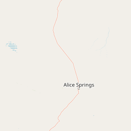
Viewpoints
Park geography
Review recorded geographic data, landscape classifications, and elevation metrics
Geography, Mapped Boundaries, and Terrain Profile of Tjoritja / West MacDonnell National Park
Tjoritja / West MacDonnell National Park in the Northern Territory covers a recorded area of 2568.61 square kilometers. This geographic profile details the mountain relief, arid climate zones, and riverine habitats found within these protected boundaries, reaching a peak elevation of 1380 meters.
Related tags
Desert MountainsArrernte CountryLong-distance HikingGorges and CanyonsCentral Australia
Ancient ranges andArrernte heritage in Australia's Red Centre
Tjoritja / West MacDonnell National Park
Tjoritja, also known as West MacDonnell National Park, is a vast protected area in Australia's Northern Territory that spans approximately 2,568 square kilometres along the MacDonnell Ranges west of Alice Springs. The park encompasses a dramatic linear landscape of mountain ranges, deep gorges, permanent waterholes, and ancient geological formations that have shaped both the physical and cultural identity of this region for tens of thousands of years. TheArrernte people, the traditional owners of this land, consider Tjoritja of profound cultural significance, with many sites throughout the park holding deep spiritual meaning within their living culture. The park is distinguished by its remarkable accessibility from Alice Springs, allowing visitors to explore a remote desert mountain environment with relative ease, while also serving as a gateway to deeper outback experiences along the famous Larapinta Trail.
- Location
- Australia
- Park type
- National park
- Established
- 1992
- Area
- 2,568.6 km²
- Highest point
- 1,380 m
Location overview
Regional placement within the Northern Territory of Australia
Map and Location of Tjoritja / West MacDonnell National Park in Australia
Tjoritja / West MacDonnell National Park is situated entirely within the Northern Territory of Australia. The terrestrial protected area operates under regional jurisdiction without transboundary, coastal, or marine borders.
- Countries
- Australia
- Regions
- Northern Territory
- Primary location
- Northern Territory
- Geographic setting
- Inland
Boundary and coordinates
Mapped perimeter geometry and derived spatial measurements
Tjoritja / West MacDonnell National Park Boundary Map and Spatial Extent
Interactive boundary outlines define the spatial extent of the protected landscape across the region. Derived measurements detail total area coverage and coordinate limits for spatial analysis.
- Boundary area
- 2,566.8 km²
- Boundary perimeter
- 629.9 km
- Northernmost point
- 23.3619° S
- Southernmost point
- 23.8149° S
- Easternmost point
- 133.8777° E
- Westernmost point
- 132.2828° E
- Geographic centre
- 23.6522° S, 132.995° E
- North–south span
- 50.2 km
- East–west span
- 162.8 km
Elevation and terrain
A 1,380-metre mountain high point and twenty features within
Tjoritja / West MacDonnell National Park elevation and terrain
Tjoritja / West MacDonnell National Park has mountain relief, a 1,380-metre maximum and high point, plus twenty features within. Peaks, viewpoints, rivers, streams, saddles, cliff, spring, and pond appear; Fringe Lilly Creek is both stream and river.
- Maximum elevation
- 1,380 m
- Highest point
- 1,380 m
Selected named natural features
Rivers
Davenport Creek
Peaks
Mount Giles
Peaks
Mount Sonder
1,380 m
Rivers
Roe Creek
Rivers
Redbank Creek
Environmental setting
Arid climate zones, mountain relief, and structural shrubland habitats across the region
Tjoritja / West MacDonnell National Park Environmental Setting and Landscape Classifications
Stored landscape features, habitat types, and climate categories provide structured insight into the physical setting of the protected area. Recorded classifications connect directly to relevant atlas destinations for regional comparison.
- Relief
- Mountain
- Climate
- Arid
- Water
- Minor water
- Forest cover
- Sparse forest
- Seasonality
- Year-round
Landscape features
Mountains · Valleys · Rivers · Waterfalls · Cliffs
Habitat types
Shrubland · Riverine habitat
Park atlas
Discover the regional park context and surrounding protected landscapes across the MacDonnell Ranges.
Explore Nearby National Parks and Protected Areas around Tjoritja / West MacDonnell National Park in Central Australia
Continue your exploration from Tjoritja / West MacDonnell National Park by browsing other national parks and protected areas across Central Australia's dramatic desert mountains and ancient gorges. Compare these conservation landscapes to understand the broader regional geography and diverse protected-area spread adjacent to the iconic MacDonnell Ranges.
National parkAustralia
Mapped location lies within the park boundary#1 closest

West MacDonnell National Park: Australia's Outback Mountain Landscape and Protected Area
Explore mapped gorges, waterholes, and regional geography in the Red Centre.
West MacDonnell National Park serves as a key protected area within Australia's arid interior, delineating the dramatic western MacDonnell Ranges. This national park offers a unique opportunity to study its mapped landscape, characterized by ancient sandstone ridges, deep gorges, and permanent water sources that support endemic biodiversity. Its profound connection to Aboriginal cultural heritage and its status as a conservation reserve make it essential for understanding the geography and protected lands of central Australia's Red Centre.
- Area
- 2,048 km²
- Established
- 1992
- IUCN
- II
- Relief
- Mountain
Wildlife reserveNorthern Territory
About 9.4 km away#2 closest
East
Kuyunba Conservation Reserve: Wildlife Protected Landscape in Central Australia
Mapped geography and rocky habitat near Alice Springs
Kuyunba Conservation Reserve represents a focused approach to habitat protection in the Northern Territory. The terrain is defined by its rocky hills and boulder-filled escarpments, offering critical shelter for wildlife in an arid, drought-adapted desert region. This site provides a clear view of how targeted land management supports specialized ecological niches in inland Australia.
- Area
- 6.29 km²
- Established
- 1970
- IUCN
- V
- Relief
- Upland
Nature reserveNorthern Territory
About 12 km away#3 closest
West
Tnorala Conservation Reserve: Geological Wonders and Protected Landscapes of the Northern Territory
An iconic circular impact crater preserved as a cultural and natural sanctuary
Tnorala Conservation Reserve stands as a sentinel in the Northern Territory, defined by its striking five-kilometre-wide ring of hills. This protected area offers a look at a massive, ancient impact crater remnant that rises sharply from the surrounding desert plains, serving as a critical point of geological interest and a deeply revered sacred site for the Western Arrernte people.
- Relief
- Mountain
- Climate
- Arid
- Access
- Access unknown
- Scope
- Terrestrial

National parkNorthern Territory
32 km away#4 closest
West
Finke Gorge National Park: Explore Its Protected Landscape and Geographic Identity
Mapped boundaries and natural terrain within Northern Territory.
Finke Gorge National Park represents a significant protected area within the Northern Territory, Australia. This national park offers valuable insights into the region's geography, mapped landscapes, and natural terrain. Detailed information helps users understand the park's protected boundaries and its role in the broader context of Australian conservation lands, ideal for focused atlas exploration.
- Area
- 452.85 km²
- Established
- 1966
- IUCN
- V
- Visitors
- 18K annual
Protected landscapeNorthern Territory
About 35 km away#5 closest
East
Corroboree Rock Conservation Reserve: Geological and Cultural Protected Area in Central Australia
Mapped protected landscape within the East MacDonnell Ranges
Corroboree Rock Conservation Reserve features a striking dolomite rock formation tied to ancient Precambrian salt lake sediments. Located east of Alice Springs, the reserve provides a protected glimpse into central Australian arid range geography and holds profound cultural importance for the Eastern Arrernte Traditional Owners within the surrounding pastoral landscape.
- Area
- 0.07 km²
- Established
- 1962
- IUCN
- V
- Visitors
- 15K annual
Nature reserveNorthern Territory
About 35 km away#6 closest
Southeast
Napwerte / Ewaninga Rock Carvings Conservation Reserve: Protected Desert Landscape Map
Cultural heritage and arid basin geography in the Northern Territory
Napwerte / Ewaninga Rock Carvings Conservation Reserve protects a unique desert site defined by its extensive collection of prehistoric Arrernte rock engravings. The landscape encompasses rocky outcrops, red sand dunes, and a seasonal claypan that captures rare rainfall, creating a significant intersection of archaeological history and arid-zone ecology in central Australia.
- Area
- 0.06 km²
- Established
- 1970
- IUCN
- V
- Relief
- Lowland
Protected landscapeNorthern Territory
About 54 km away#7 closest
East
Trephina Gorge Nature Park: Mapped Geography and Protected Landscape Context
East MacDonnell Ranges, Northern Territory Australia
Trephina Gorge Nature Park represents a central feature of the arid MacDonnell Ranges, characterized by its deep gorge, white ghost gums against red rock, and expansive spinifex ridges. This record outlines the park boundaries, its role as a jointly managed conservation area, and its position within the broader geography of central Australia.
- Established
- 1965
- Relief
- Mountain
- Climate
- Arid
- Access
- Access unknown
Nature reserveNorthern Territory
About 59 km away#8 closest
East
N'Dhala Gorge Nature Park: Mapped Geography and Protected Cultural Heritage
Nature reserve located in the eastern MacDonnell Ranges
This nature reserve protects a vital valley corridor in the Northern Territory where sandstone ridges and sandy terrain meet. The park serves as a repository for approximately 6,000 ancient petroglyphs and sustains specialized arid plant species. Use this resource to understand the park's structural boundaries and its place within the broader geography of Central Australia.
- Area
- 5.01 km²
- Established
- 1962
- IUCN
- V
- Relief
- Mountain
MoriAtlas Explorer
Continue Exploring Tjoritja / West MacDonnell National Park's Protected Geography and Map Context
Deepen your understanding of Tjoritja / West MacDonnell National Park by continuing to explore its distinct geographic features and protected landscape characteristics. Discover how its mapped terrain relates to the broader MacDonnell Ranges region and its importance as a national park. MoriAtlas provides the structured geographic context needed to appreciate this significant natural area.
Browse next
Global natural geography
Explore related park routes
Explore MoriAtlas Global ParksBrowse All MoriAtlas ParksGlobal Park Map DiscoveryMoriAtlas: Browse All CountriesBrowse All MoriAtlas ContinentsNational Park Environment AtlasGrand Canyon National Park AtlasYellowstone National Park AtlasYosemite National Park Atlas and GeographySerengeti National Park AtlasGalápagos National Park Protected LandscapeBanff National Park Geography and AtlasKruger National Park Atlas EntryUluṟu-Kata Tjuṯa National Park AtlasExplore Uluru-Kata Tjuta National Park GeographyPlitvice Lakes National Park AtlasFiordland National Park Protected LandscapeGreat Smoky Mountains National Park AtlasAfghanistan National Parks and Protected AreasAlbania National Parks and Protected AreasAlgeria National Parks and Protected AreasAmerican Samoa National Parks and Protected AreasAndorra National Parks and Protected AreasAngola National Parks and Protected AreasAntarctica National Parks and Protected AreasAntigua and Barbuda Park List