
Rivers
Park geography
Detailed insights into the terrain, karst landscape, and regional geography in Melaky
Tsingy de Bemaraha National Park: Comprehensive Geographic Profile and Boundary Mapping
Examine the structured geographic data for Tsingy de Bemaraha National Park within the Melaky region of Madagascar. This profile delineates the 723.4 square kilometer territory, highlighting core features like the Manambolo river system, karst plateaus, and associated gorges.
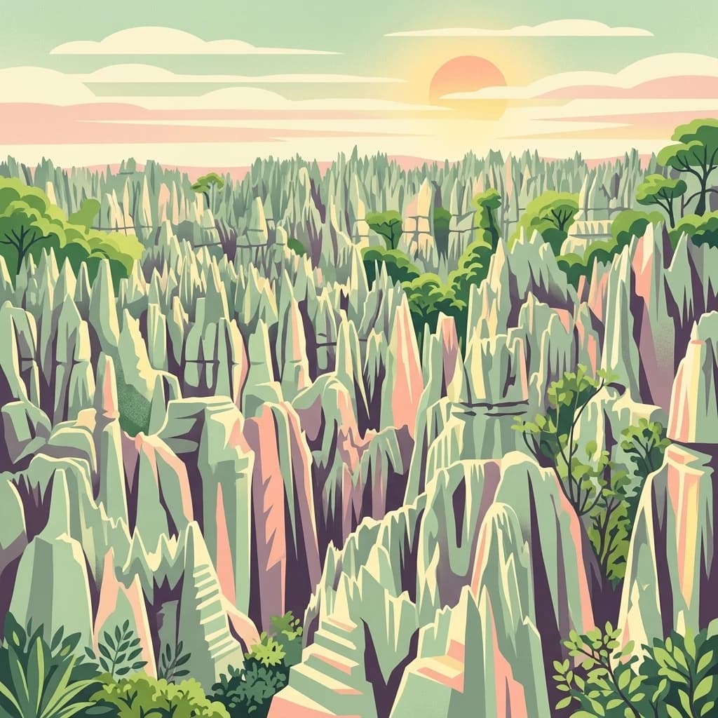
Madagascar's karstic wilderness of limestone needles and endemic biodiversity
Tsingy de Bemaraha National Park
Tsingy de Bemaraha National Park is a UNESCO World Heritage Site located in the Melaky region of northwestern Madagascar. The park protects an extraordinary landscape of karstic limestone formations known as the Great Tsingy and Little Tsingy, where erosion has created dramatic forests of razor-sharp vertical needles rising from the earth. The name 'tsingy' derives from the Malagasy language and translates roughly to 'where one cannot walk barefoot,' reflecting the treacherous nature of these formations. Established on August 1, 1997, the park covers approximately 723 square kilometers and encompasses a unique geological heritage that has given rise to exceptional biodiversity, with numerous species found nowhere else on Earth.
- Location
- Madagascar
- Park type
- National park
- Established
- 1997
- Area
- 723.4 km²
Location overview
Regional placement and island status within Melaky, Madagascar
Geographic Location of Tsingy de Bemaraha National Park
Tsingy de Bemaraha National Park is situated in the Melaky region of Madagascar. As an island-based protected area, it operates entirely within a single nation and contains no marine territory.
- Countries
- Madagascar
- Regions
- Melaky
- Primary location
- Melaky
- Geographic setting
- Island
Boundary and coordinates
Mapped park extent with spatial measurements
Tsingy de Bemaraha National Park boundary and 723.4 km² area
Tsingy de Bemaraha National Park records 723.4 km² and a terrestrial scope, while its entity is flagged as an island park despite having no land/marine allocation or perimeter in the facts. One boundary geometry is linked to the Madagascar park, so its outline and total scale can be represented without reconciling the stored flag or inventing component areas.
- Boundary area
- 732.1 km²
- Boundary perimeter
- 205.7 km
- Northernmost point
- 18.6498° S
- Southernmost point
- 19.1768° S
- Easternmost point
- 44.9631° E
- Westernmost point
- 44.6981° E
- Geographic centre
- 18.902° S, 44.8137° E
- North–south span
- 58.3 km
- East–west span
- 27.9 km
Terrain and natural features
Highland terrain classification and recorded internal natural features
Tsingy de Bemaraha National Park Terrain and Named Natural Features
Highland terrain classifications define the mountain park profile alongside recorded named features located within the protected boundary. Linked feature cards supply specific names, types, measurements, and spatial relationships where available.
Selected named natural features
Rivers
Beboka
Viewpoints
Petits Tsingy
Peaks
Salapango
177 m
Gorges
Gorge de Manambolo
Streams
Tsilika
Environmental setting
Karst limestone plateaus, tropical climate zones, and highland terrain
Tsingy de Bemaraha National Park Environmental Classification and Setting
Recorded landscape features and habitat types outline the physical setting and relief of this protected area. Stored classifications connect recorded categories to relevant atlas destinations for structured geographic review.
- Relief
- Highland
- Climate
- Tropical
- Water
- Minor water
- Forest cover
- Sparse forest
Landscape features
Plateau · Karst · Cave · Rivers · Cliffs · Hills · Forest
Habitat types
Karst habitat · Shrubland
Park atlas
Compare diverse protected landscapes and regional park geography around Madagascar's unique karst formations.
Exploring Other National Parks and Protected Areas Beyond Tsingy de Bemaraha National Park
Explore a curated selection of other national parks and protected areas geographically near Tsingy de Bemaraha National Park or within Madagascar, allowing for direct comparison of conservation landscapes and unique terrain. Broaden your understanding of regional park geography and discover how various protected-area designations preserve diverse ecosystems across the island.
Nature reserveMelaky
About 25 km away#1 closest
North

Tsingy de Bemaraha Strict Nature Reserve: Karst Pinnacles and Protected Landscapes
Exploration of Madagascar karst geography and Melaky forest zones
Tsingy de Bemaraha Strict Nature Reserve is recognized for its unique labyrinth of stone needles and extensive canyon systems carved into the limestone plateau. The protected area preserves a rich variety of habitats, including dry tropical forests and riverine corridors that support a high concentration of endemic species. Delve into the mapped boundaries and topographical complexity of this iconic Madagascar landscape to understand its vital role in regional conservation.
- Area
- 1,577.1 km²
- Established
- 1927
- IUCN
- Ia
- Relief
- Highland
Marine protected areaMelaky
57 km away#2 closest
Northwest
Barren Isles Marine Protected Area: Geographic Overview and Island Chain Mapping
Exploration of the nine islands in the Mozambique Channel.
The Barren Isles comprise a distinct chain of nine islands and sand banks stretching across the Mozambique Channel in Madagascar. This marine protected area offers a look into a complex coastal system that balances sensitive wetland habitats with seasonal maritime migration. Gain geographic perspective on this isolated archipelago located within the Melaky region, where shifting marine environments create a unique natural landscape.
- Water
- Water-dominated
Nature reserveMadagascar
About 116 km away#3 closest
South
Réserve spéciale d'Andranomena: Protected Nature Reserve in Western Madagascar
Deciduous forest canopy, seasonal wetlands, and endemic baobab ecosystems.
Réserve spéciale d'Andranomena protects a significant block of dry dense forest within the Menabe region. The territory is known for its monumental baobab specimens, intricate seasonal hydrology, and high concentrations of Malagasy endemic species. This nature reserve provides a critical baseline for understanding the western island landscape, bridging the gap between coastal dune influence and interior deciduous terrain.
- Area
- 64.2 km²
- Established
- 1958
- IUCN
- IV
- Relief
- Lowland
Nature reserveToliara Province
About 196 km away#4 closest
South
Kirindy Forest Nature Reserve: Protected Dry Deciduous Forest in Western Madagascar
Geography, protected boundaries, and unique dry forest ecosystems
Kirindy Forest offers a detailed look into the ecology of western Madagascar. As a protected nature reserve, it shelters three species of baobab trees and diverse primate populations. Its terrain ranges from flat to gently undulating, creating a distinct visual rhythm through alternating dry and rainy seasons within the Menabe region.
- Area
- 125 km²
- Relief
- Lowland
- Climate
- Tropical
- Access
- Moderate access
National parkMadagascar
About 196 km away#5 closest
South
Kirindy Mitea National Park: Madagascar National Park with Distinct Protected Landscape Identity
Explore the mapped geographic context of Kirindy Mitea National Park.
Kirindy Mitea National Park serves as a notable protected area, holding national park status within Madagascar's distinctive island geography. This entry focuses on understanding the park's unique protected landscape and its charted boundaries, offering essential context for atlas-driven exploration. Discover the geographic elements that define Kirindy Mitea National Park and its place within the broader conservation map of the region.
- Area
- 1,563.5 km²
- Established
- 1997
- IUCN
- IV
- Relief
- Mixed relief
National parkMahajanga Province
About 248 km away#6 closest
North
Tsingy de Namoroka National Park: Geography, Karst Formations, and Regional Context
Protected karst landscapes in Mahajanga Province.
Tsingy de Namoroka National Park stands as a prime example of Madagascar's unique geological heritage, featuring sprawling fields of razor-sharp limestone pinnacles and intricate cave networks. This protected area offers deep insight into the intersection of subterranean hydrology and dry forest ecology within the broader Mahajanga Province.
- Area
- 220.71 km²
- Established
- 1927
- IUCN
- II
- Relief
- Mixed relief
National parkBoeny
About 287 km away#7 closest
North
Baie de Baly National Park: Mapped Boundaries and Protected Landscape Context
Explore the geography and natural terrain of this national park.
Baie de Baly National Park presents a critical focal point for understanding protected areas within the Boeny region. As a national park, it showcases specific mapped boundaries that contribute to the broader geographic understanding of Madagascar's conservation landscapes. This detailed view allows for an atlas-driven exploration of the park's natural terrain and its significance as a distinct protected landmass within its regional context.
- Area
- 571.42 km²
- Established
- 1997
- IUCN
- II
- Climate
- Tropical
Protected areaAtsinanana
296 km away#8 closest
East
Nosivolo River Protected Area: A Geographic Profile of Madagascar’s Wetland Landscape
Freshwater habitat mapping and catchment geography
Investigate the physical geography of the Nosivolo River, a protected area in Madagascar characterized by its intact highland forest sources and diverse aquatic habitats. This profile provides context on the river’s role as a Ramsar-designated wetland and its function within the wider Mangoro River basin in the Atsinanana region.
- Established
- 2010
- Relief
- Mixed relief
- Scope
- Terrestrial
- Water
- Water-dominated
MoriAtlas Explorer
Continue Exploring Tsingy de Bemaraha National Park's Mapped Geography and Protected Landscape
Deepen your understanding of Tsingy de Bemaraha National Park by examining its precise geographic footprint and its role as a protected natural landscape. Further atlas exploration will reveal how this national park contributes to the regional geography of Melaky, offering structured insights into its boundaries and natural context. This focused exploration enhances your grasp of protected areas and their mapped distributions across Madagascar.
Browse next
Global natural geography
Explore related park routes
Explore MoriAtlas Global ParksBrowse All MoriAtlas ParksGlobal Park Map DiscoveryMoriAtlas: Browse All CountriesBrowse All MoriAtlas ContinentsNational Park Environment AtlasGrand Canyon National Park AtlasYellowstone National Park AtlasYosemite National Park Atlas and GeographySerengeti National Park AtlasGalápagos National Park Protected LandscapeBanff National Park Geography and AtlasKruger National Park Atlas EntryExplore Uluru-Kata Tjuta National Park GeographyPlitvice Lakes National Park AtlasFiordland National Park Protected LandscapeGreat Smoky Mountains National Park AtlasZion National Park Protected Landscape AtlasAfghanistan National Parks and Protected AreasAlbania National Parks and Protected AreasAlgeria National Parks and Protected AreasAmerican Samoa National Parks and Protected AreasAndorra National Parks and Protected AreasAngola National Parks and Protected AreasAntarctica National Parks and Protected AreasAntigua and Barbuda Park List