Mori Atlas logo
Wildlife reserveTurtle Islands Wildlife Sanctuary

Mapping the coastal terrain and protected nesting grounds of the Tawi-Tawi archipelago

Turtle Islands Wildlife Sanctuary: A Binational Protected Marine and Island Landscape

Turtle Islands Wildlife Sanctuary forms a critical network of six islands spanning the Sulu and Celebes Seas within the Tawi-Tawi region. This protected area serves as a primary international nesting site for green sea turtles and features distinct geological characteristics including the active mud volcanoes of Lihiman. Through its binational conservation efforts and coastal forest habitats, the sanctuary remains a significant focal point for marine biodiversity and archipelago geography in the southernmost Philippines.

sea turtle nestingmarine protected areaisland archipelagobeach forestgreen sea turtlehawksbill sea turtle

Turtle Islands Wildlife Sanctuary

Wildlife reserve

Park overview

Structured park overview, official facts, and landscape profile for Turtle Islands Wildlife Sanctuary

Turtle Islands Wildlife Sanctuary park facts, protected area profile, and essential visitor context

Review the core facts for Turtle Islands Wildlife Sanctuary, including designation, size, terrain, visitor scale, habitats, and operating context in one park-focused overview.

About Turtle Islands Wildlife Sanctuary

Turtle Islands Wildlife Sanctuary encompasses the entire municipality of Turtle Islands in the province of Tawi-Tawi, at the southwestern fringe of the Philippine archipelago. It consists of six islands, Great Bakkungan, Baguan, Boan, Langaan, Lihiman, and Taganak, set between the Sulu Sea to the north and the Celebes Sea to the south. The protected area covers a vast marine and island territory, making it one of the largest protected areas in the Philippines by area although most of that extent lies in surrounding waters rather than on land.

The sanctuary's geographic position places it directly on the Malaysia-Philippines maritime border. Three additional islands just to the south belong to Malaysia, and the combined Philippine and Malaysian island groups together form the Turtle Islands Heritage Protected Area, established jointly by both governments in 1996. This binational arrangement exists because the green sea turtle nesting populations do not recognise political boundaries; coordinated protection across the entire archipelago of islands is the only way to preserve the site's ecological value.

Within the Philippine portion, the islands are zoned to balance conservation with the needs of local communities. Four of the six islands, all except uninhabited Baguan and Langaan, are inhabited, with a combined population of more than 5,000 people. Taganak functions as the administrative centre and primary island, with its port serving as the main point of access. The sanctuary is administered through the Turtle Islands Protected Area Management Board under the Ministry of Environment, Natural Resources and Energy of the Bangsamoro autonomous region.

The protected area is most notable for its ecological identity, which is shaped by marine and coastal dynamics. Long stretches of sandy beach provide critical nesting habitat, surrounding seagrass beds and coral reefs support foraging turtles, and patches of beach forest and mangrove-associated species line the shorelines. Although the islands themselves are small and sparsely vegetated, the surrounding marine environment gives the sanctuary an importance far greater than its visible land area would suggest.

Park context

Deeper park guide and search-rich context for Turtle Islands Wildlife Sanctuary

Turtle Islands Wildlife Sanctuary history, landscape, wildlife, and travel context

Explore Turtle Islands Wildlife Sanctuary through its history, landscape character, ecosystems, wildlife, conservation priorities, cultural context, and seasonal travel timing in a structured park guide built for atlas discovery and search intent.

Why Turtle Islands Wildlife Sanctuary stands out

The sanctuary is best known internationally as one of the world's few remaining major nesting grounds for green sea turtles, a status it shares with three neighbouring Malaysian islands that together form the Turtle Islands Heritage Protected Area. The islands draw hundreds of nesting females each year between late August and December, with Baguan alone accounting for the majority of recorded nestings in the Philippine portion of the sanctuary. The site is also recognised for its role in cross-border conservation between the Philippines and Malaysia, and for the way it has integrated local fishing communities into turtle and habitat protection. Hawksbill sea turtles, vulnerable and near-threatened bird species, remnant beach forest, and active mud volcanoes on Lihiman add further layers to the sanctuary's identity.
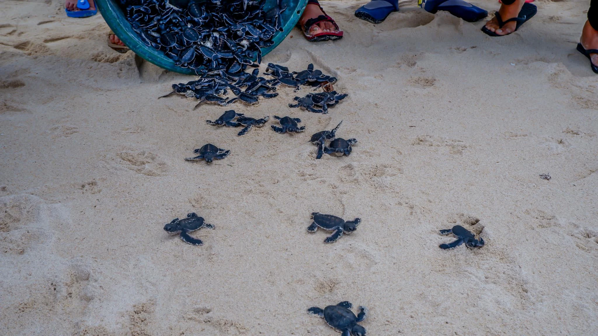
A large group of small, dark sea turtle hatchlings crawling on light-colored sand after being poured from a blue plastic basin.
Sea turtle hatchlings being released onto the sandy shore at Turtle Islands Wildlife Sanctuary.

Turtle Islands Wildlife Sanctuary history and protected-area timeline

The modern Turtle Islands Heritage Protected Area dates to 1996, when the governments of the Philippines and Malaysia jointly declared the combined island groups as a protected area. The declaration was driven by the recognition that the islands host one of the world's last significant nesting populations of green sea turtles, and that effective protection could only be achieved through coordinated action across the border.

Within the Philippine islands, early protection efforts focused on separating areas of strict scientific and conservation value from zones where traditional activities could continue under regulation. Historically, residents had hunted sea turtles and collected eggs as a supplementary source of income alongside fishing. Conservation staff worked to involve local communities directly in protection activities, and men, women, and children now participate in guarding nesting beaches and hatchling releases during the nesting season, which runs from late August through December.

The sanctuary's formal status within the Philippine protected-area system was confirmed in 2018, when Republic Act No. 11038, the Expanded National Integrated Protected Areas System Act, was signed by President Rodrigo Duterte in July 2018. The act reaffirmed the Turtle Islands as a national park-level protected area, consolidating earlier protection arrangements under a unified national legal framework.

Turtle Islands Wildlife Sanctuary landscape and geographic character

The landscape of Turtle Islands Wildlife Sanctuary is shaped by its identity as a small island archipelago set between two seas. The islands have low, sandy profiles with extensive beaches that grade into mangrove and shallow marine habitats. Coastal terrain dominates, and most of the islands are fringed by beach forest, rocky shorelines, and reef-associated shallows that together define the visible character of the sanctuary.

Most natural vegetation has been cleared or modified on the inhabited islands, leaving only limited remnants of beach forest on steep rock cliffs in Great Bakkungan and smaller patches elsewhere. Baguan stands out as the most heavily forested island, with beach forest covering the great majority of its land area. Lihiman, by contrast, is distinguished less by vegetation than by its active mud volcanoes on the northern part of the island, around which a plantation of Casuarina equisetifolia has been established.

The broader landscape impression is one of open sea, broad sandy nesting beaches, and low forested shorelines rather than dramatic topography. The sanctuary's scenery is inseparable from its marine setting; the islands function visually and ecologically as small land bases within an extensive seascape.

Turtle Islands Wildlife Sanctuary ecosystems, habitats, and plant life

Ecologically, the sanctuary is defined by marine and coastal habitat rather than terrestrial forest. Sandy beach habitat provides the critical nesting substrate for sea turtles, while surrounding seagrass meadows and coral reef ecosystems support the adult turtles' feeding ecology. The interdependence of land and sea is central to the sanctuary's ecological identity.

Vegetation on the islands is limited and unevenly distributed. Baguan retains the most substantial cover, with beach forest dominated by species such as Buchanania arborescens, figs, Lumnitzera littorea, Excoecaria agallocha, Xylocarpus granatum, Xylocarpus moluccensis, and Ceriops species. Langaan holds smaller patches of beach forest in similar composition. On Bakkungan and Boan, Antidesma species occupy the grassland areas, while the mud volcano area on Lihiman is ringed by introduced Casuarina equisetifolia plantation.

This patchwork of beach forest, mangrove-associated taxa, grassland, and plantation reflects both the limited land area available and the long history of human presence on the inhabited islands. The ecological value of the sanctuary therefore lies primarily in the quality and connectivity of its coastal and marine habitats, rather than in extensive terrestrial plant communities.

Turtle Islands Wildlife Sanctuary wildlife and species highlights

The wildlife profile of the sanctuary is dominated by marine turtles and coastal birdlife. Green sea turtles (Chelonia mydas) are the most important species, with hundreds of females arriving annually between late August and December to nest on the islands' beaches. The sanctuary also supports nesting hawksbill sea turtles (Eretmochelys imbricata), and both species are classified as endangered.

Nestings are concentrated heavily on Baguan, which alone accounts for approximately 63 percent of all turtle nestings recorded in the sanctuary. Conservation staff and community members collect eggs for protected hatching, then release hatchlings back to the sea, a process that has become one of the most visible symbols of the protected area's work.

The islands also host a notable bird fauna, with at least 71 species recorded. Among them, the vulnerable grey imperial pigeon (Ducula pickeringii), the near-threatened Mantanani scops owl (Otus mantananensis), and the Philippine megapode (Megapodius cumingii) stand out as species of conservation significance. Otters have also been observed in the islands, with smooth-coated otters considered the most likely species; this sighting has added to the sanctuary's broader biodiversity interest and raised questions about otter distribution in the southern Philippines.

Turtle Islands Wildlife Sanctuary conservation status and protection priorities

Turtle Islands Wildlife Sanctuary exists fundamentally because of its conservation value. The islands host one of the last significant green sea turtle nesting populations in the Indo-Pacific region, and their protection has been treated as a binational responsibility between the Philippines and Malaysia since 1996. The 1996 declaration of the Turtle Islands Heritage Protected Area established the principle that viable turtle conservation at this site requires coordinated action across the maritime border.

Within the Philippine islands, protection is organised through a zoning system. The strictest zones allow only scientific and conservation activities, while other zones permit regulated human use designed to minimise pressure on turtles and habitat. Access to sensitive zones is controlled and supervised, and traditional practices such as egg collection and turtle hunting have been substantially reduced through community engagement.

The sanctuary's importance was reaffirmed at the national level in 2018 with the signing of Republic Act No. 11038, the Expanded National Integrated Protected Areas System Act, which confirmed Turtle Islands as a national park under the unified Philippine protected-area framework. Administered by the Turtle Islands Protected Area Management Board under the Ministry of Environment, Natural Resources and Energy of the Bangsamoro autonomous region, the sanctuary serves as a model for community-involved sea turtle protection and for cross-border marine conservation in Southeast Asia.

Turtle Islands Wildlife Sanctuary cultural meaning and human context

The cultural identity of Turtle Islands is shaped by small coastal communities whose livelihoods have long been tied to the sea. Fishing remains the principal economic activity, and for generations turtles and turtle eggs provided a supplementary source of food and income. The transition from opportunistic harvest to active protection has required a meaningful shift in local practice and identity.

Today, residents of the inhabited islands, including Taganak, Great Bakkungan, Boan, and Lihiman, participate directly in conservation work. Local men, women, and children take part in beach patrols, nest protection, and hatchling releases during the nesting season. This involvement has helped reconcile the protected-area designation with traditional livelihoods and has given the sanctuary a distinctive community-based conservation culture.

The shared Turtle Islands Heritage Protected Area also carries a quiet symbol of cross-border cooperation, with Philippine and Malaysian island communities linked through a common conservation responsibility rather than separated by it. The administrative framework, now operating under the Bangsamoro autonomous region, reflects both the geographic isolation of the islands and their integration into broader regional governance.

Top sights and standout views in Turtle Islands Wildlife Sanctuary

The sanctuary's strongest points of distinction are its global importance for green sea turtle nesting, its binational protection arrangement with Malaysia, and the unusually high concentration of nestings on Baguan island, which accounts for roughly two-thirds of recorded nestings in the Philippine portion of the sanctuary.

Equally notable is the sanctuary's integration of local fishing communities into conservation work, from hatchling releases to beach patrols. The combination of marine protected area, remnant beach forest on Baguan, the unusual mud volcanoes of Lihiman, and the recorded presence of otters gives the sanctuary a layered ecological profile that extends well beyond its turtle-focused reputation.

Monthly climate preview

Long-term representative temperature ranges and precipitation patterns across the year

Turtle Islands Wildlife Sanctuary Climate and Monthly Weather Normals

Representative coordinates record measured monthly averages spanning consistent temperature rhythms and shifting daily precipitation rates across the sanctuary terrain. Examining the complete twelve-month climatology profile reveals detailed variations in baseline warmth and moisture distribution.
Annual mean27 °C
26 °C28 °C
Jan26°
Feb26°
Mar27°
Apr28°
May28°
Jun27°
Jul27°
Aug27°
Sep27°
Oct27°
Nov27°
Dec27°
Warmest month
May

27.8 °C

Coolest month
February

26.4 °C

Wettest month
December

11.5 mm/day

Driest month
April

4.5 mm/day

Park location guide

Geography guide, regional context, and park location map for Turtle Islands Wildlife Sanctuary

Turtle Islands Wildlife Sanctuary park geography, regions, and map view in Philippines

Understand where Turtle Islands Wildlife Sanctuary sits in Philippines through a broader geographic reading of the surrounding landscape, nearby location context, and its mapped position within the national park landscape.

How Turtle Islands Wildlife Sanctuary fits into Philippines

The Philippines, officially the Republic of the Philippines, is an archipelagic nation in Southeast Asia comprising approximately 7,641 islands categorized into three main geographical divisions: Luzon, Visayas, and Mindanao. Located in the western Pacific Ocean, it shares maritime borders with Taiwan, Japan, Palau, Indonesia, Malaysia, Vietnam, and China. Manila serves as the capital city, while Quezon City is the most populated city, both within Metro Manila.

Wider geography shaping Turtle Islands Wildlife Sanctuary in Philippines

The Philippines is an archipelagic nation in Southeast Asia, positioned in the western Pacific Ocean. Its islands are bounded by the South China Sea to the west, Philippine Sea to the east, and Celebes Sea to the south. The country shares maritime borders with Taiwan to the north, Japan to the northeast, Palau to the east and southeast, Indonesia to the south, Malaysia to the southwest, Vietnam to the west, and China to the northwest.

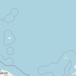
Map view of Turtle Islands Wildlife Sanctuary

Use this park location map to pinpoint Turtle Islands Wildlife Sanctuary in Philippines, understand its exact geographic position, and read its mapped placement within the surrounding landscape more clearly.

Pigeon | © OpenStreetMap contributors

Location context for Turtle Islands Wildlife Sanctuary

Tawi-Tawi

Visual exploration of sandy nesting beaches, marine habitats, and island terrain

Turtle Islands Wildlife Sanctuary Photos and Protected Landscape Scenery

Visual records reveal the low sandy profiles, coastal beach forests, and marine shallows that define the protected island archipelago. Examining these habitat views helps clarify the ecological character and physical geography of the marine sanctuary.

A large group of small, dark sea turtle hatchlings crawling on light-colored sand after being poured from a blue plastic basin.

Park atlas

Explore surrounding marine protected areas and regional island habitats

Parks Near Turtle Islands Wildlife Sanctuary and Connected Marine Reserves

Continue browsing national parks and protected areas adjacent to Turtle Islands Wildlife Sanctuary for broader geographic comparison. Comparing connected marine reserves reveals wider patterns in cross border conservation and island ecosystems.
National parkMalaysia
About 28 km away#1 closest

West

Turtle Islands National Park: Marine Protected Area and Island Geography in Malaysia

Coastal landscapes and coral reef protected zones

Explore the geographic footprint of Turtle Islands National Park, a marine-focused sanctuary in Malaysia. This protected area encompasses three islands and surrounding Sulu Sea reef ecosystems, providing critical nesting habitat for marine turtles. Learn about the island-based terrain and the marine boundaries that define this protected landscape.

Area
17.4 km²
Established
1977
Relief
Lowland
Climate
Tropical
National parkSabah
About 28 km away#2 closest

West

Turtle Islands National Park: Marine Geography and Protected Island Landscapes in Sabah

A Sulu Sea sanctuary for coral reefs and sea turtle nesting grounds.

Located north of Sandakan, Turtle Islands National Park is a key marine protected area defined by its island geography and extensive coral reef habitat. The park protects critical nesting beaches for green and hawksbill sea turtles, offering a focused look at how marine conservation intersects with tropical island terrain in the Sulu Sea. This geographic profile details the park's offshore environment and its connection to broader maritime conservation efforts in the region.

Area
17.4 km²
Established
1977
IUCN
II
Relief
Lowland
Wildlife reserveSabah
About 98 km away#3 closest

Southeast

Tabin Wildlife Reserve: Exploring Protected Landscapes and Terrain in Eastern Sabah

An essential conservation stronghold featuring unique mud volcano terrain and dipterocarp forest.

Tabin Wildlife Reserve encompasses a sprawling expanse of lowland jungle in the heart of the Dent Peninsula. This protected area plays a vital role in safeguarding Borneo's largest mammal populations and maintaining the ecological connectivity of riverine habitats and mineral-rich forest floors within the Sabah region.

Area
1,225 km²
Established
1984
IUCN
IV
Relief
Lowland
A soft watercolor painting of a winding river flowing through a lush, misty green forest under pale hills.
Wildlife reserveSabah
About 147 km away#4 closest

Southwest

Danum Valley Conservation Area: Protected Lowland Rainforest Geography in Sabah

Examining the boundaries and terrain of this Bornean wildlife reserve

Danum Valley Conservation Area serves as a primary site for understanding undisturbed lowland dipterocarp forest in Borneo. This wildlife reserve features a complex bowl shaped basin of rivers, ridges, and dense tropical canopy. Access geographic maps and site data to understand the structural integrity of this protected region located within the state of Sabah.

Area
438 km²
Established
1980
IUCN
Ia
Relief
Highland
National parkSabah
About 170 km away#5 closest

South

Tun Sakaran Marine Park National Park: Sabah Marine Archipelago Atlas

Explore the islands, sand cays, and coral reef geography.

Tun Sakaran Marine Park is a protected national park in Sabah, Malaysia, known for its stunning marine biodiversity and archipelago landscape. This atlas entry details the park's distinct islands, dynamic sand cays, and extensive coral reef systems within the Celebes Sea, offering insights into its unique geographic setting and ecological significance.

Area
101 km²
Established
2004
IUCN
II
Relief
Lowland
Marine protected areaSabah
About 180 km away#6 closest

Northwest

Tun Mustapha Marine Park: Mapping the Protected Marine Landscapes of Northern Sabah, Malaysia

An expansive marine protected area across fifty islands

Tun Mustapha Marine Park represents a major conservation landmark off the northern coast of Borneo. This profile details the park's geographic layout, its primary island groups including Banggi and Balambangan, and its position as a critical corridor for marine megafauna and coral reef biodiversity within the Sulu-Sulawesi ecoregion.

Area
8,988 km²
Established
2016
IUCN
II
Relief
Lowland
National parkMalaysia
About 183 km away#7 closest

West

Kinabalu National Park: Mapped Boundaries and Protected Landscape Atlas

Exploring Malaysia's Natural Terrain and Park Geography

Delve into the specific protected area identity of Kinabalu National Park, situated within Malaysia. This resource details its geographic scope and mapped terrain, providing a foundation for understanding its role as a national park. Examine the park's protected landscape context, offering valuable insights for anyone exploring regional geography and conservation areas through an atlas lens.

Area
754 km²
Established
1964
IUCN
II
Visitors
611.6K annual
A pale, minimalist watercolor painting depicting a gentle, rolling landscape with green and light red washes, suggesting hills and distant foliage against a soft, bright background.
National parkSabah
About 183 km away#8 closest

West

Kinabalu Park: Geographic Overview and Protected Landscape Mapping in Sabah, Malaysia

A study of vertical mountain terrain and biodiversity boundaries

Kinabalu Park stands as a defining natural entity in Sabah, Malaysia, characterized by its extreme elevation changes and concentration of rare botanical life. This atlas resource maps the park's physical geography, from its cloud-shrouded forests to its rocky summit plateaus, offering a detailed look at one of Southeast Asia's most significant protected mountain environments.

Area
754 km²
Established
1964
IUCN
II
Visitors
611.6K annual

Common questions about visiting, size, designation, and location context for Turtle Islands Wildlife Sanctuary

Turtle Islands Wildlife Sanctuary FAQs for park facts, access, geography, and protected area context

Find quick answers about Turtle Islands Wildlife Sanctuary, including protected-area facts, park geography, trail and visitor context, and how the park fits into its surrounding country and regional landscape.
MoriAtlas Explorer

Continue Your Protected Areas Search Across the Global Atlas

Deepen your exploration by continuing the structured search for national parks and protected areas worldwide. Utilize the comprehensive filtering capabilities to compare different conservation landscapes and refine your understanding of global park geography. Discover more about the distribution and characteristics of protected natural areas.

Global natural geography