

Mori Atlas logo
Wildlife reserveDanum Valley Conservation Area

A detailed look at protected valley terrain, river systems, and tropical dipterocarp forest boundaries

Danum Valley Conservation Area: Mapping the Primary Lowland Rainforests of Sabah Borneo

Danum Valley Conservation Area represents one of the most significant tracts of undisturbed primary lowland dipterocarp rainforest in Southeast Asia. Located within the state of Sabah on the island of Borneo, this protected landscape encompasses a bowl shaped basin with terrain rising toward upland ridges. The region features a network of dense forest rivers and ancient canopy structures that serve as a critical reference for tropical ecology, habitat restoration, and regional geography in Malaysia.

lowland rainforestdipterocarp foresttropical rainforestprimary forestwildlife reservebirdwatching
A digital illustration showing a lush, multi-layered tropical forest canopy under a hazy, pastel-colored sky with distant mountains.

Danum Valley Conservation Area

Wildlife reserve

Park overview

Structured park overview, official facts, and landscape profile for Danum Valley Conservation Area

Danum Valley Conservation Area park facts, protected area profile, and essential visitor context

Review the core facts for Danum Valley Conservation Area, including designation, size, terrain, visitor scale, habitats, and operating context in one park-focused overview.

About Danum Valley Conservation Area

Danum Valley Conservation Area lies deep within Sabah, in the eastern part of Malaysian Borneo, and safeguards one of the most ecologically significant lowland rainforest tracts remaining on the island. The conservation area spans 438 square kilometres of primary Borneo lowland rain forest, dominated by towering dipterocarp trees that form a closed canopy reaching more than 70 metres in places. Its central geography is a bowl-shaped valley ringed by terrain that climbs to a maximum elevation of 1,093 metres, with rivers and smaller streams carving through the forest floor.

The defining characteristic of Danum Valley is the absence of historical human settlement within its boundaries, meaning that before its designation no hunting, shifting cultivation, or commercial logging had modified the landscape. This rare continuity of intact forest gives Danum Valley a level of ecological integrity that few other lowland rainforest sites in Southeast Asia retain, and it underpins the area's importance for both conservation and scientific study.

The conservation area is administered by Yayasan Sabah and operates as a Class I Forest Reserve under Sabah's forest management framework. Within its boundaries, the Danum Valley Field Centre functions as a hub for tropical ecology research, education programmes, and large-scale dipterocarp tree propagation, while a limited number of lodges, including the Borneo Rainforest Lodge and Kawag Nature Lodge, support guided jungle trekking, river swimming, night safaris, and birdwatching. The site's standing has been recognised through proposals to nominate it as a UNESCO World Heritage Site, reflecting its international value as a benchmark for primary Bornean lowland rainforest.

Beyond its ecological role, Danum Valley is a key reference site for understanding the structure and dynamics of Southeast Asian lowland tropical forests. Long-term research here has contributed to knowledge about primate behaviour, insect biodiversity, plant community composition, and the regeneration of selectively logged forests elsewhere in the region, reinforcing the conservation area's standing as both a refuge for wildlife and a living laboratory for rainforest science.

Quick facts and research context for Danum Valley Conservation Area

Danum Valley Conservation Area is a 438 square kilometre protected lowland dipterocarp forest in Sabah, on the island of Borneo in Malaysia, established in 1980 and managed by Yayasan Sabah. The area is designated for conservation, research, education, and habitat restoration training, and is classified as a strict nature reserve under Sabah's forest reserve system.

The conservation area is notable as one of the few large Bornean lowland rainforests with no history of human settlement, logging, or hunting prior to protection, giving it exceptional value for ecological research. The nearest access town is Lahad Datu, roughly 82 kilometres away, and the principal field base is the Danum Valley Field Centre, alongside a small number of lodges such as the Borneo Rainforest Lodge and Kawag Nature Lodge.

Protection and recognition

Terrestrial conservation framework and verified protection metrics

Danum Valley Conservation Area Protection Status and Regional Designation Data

Danum Valley Conservation Area maintains a documented terrestrial protection scope without imported international recognition sources. Review verified management parameters and statutory designation records to understand the complete protected area profile.

Protection details

Protection scope
Terrestrial
Transboundary protection
No
Park context

Deeper park guide and search-rich context for Danum Valley Conservation Area

Danum Valley Conservation Area history, landscape, wildlife, and travel context

Explore Danum Valley Conservation Area through its history, landscape character, ecosystems, wildlife, conservation priorities, cultural context, and seasonal travel timing in a structured park guide built for atlas discovery and search intent.

Why Danum Valley Conservation Area stands out

Danum Valley is best known as one of the largest remaining tracts of primary lowland dipterocarp rainforest in Borneo, offering an unusually untouched habitat that hosts the Bornean orangutan, Müller's Bornean gibbon, clouded leopard, sun bear, Bornean pygmy elephant, and an exceptionally rich insect and land snail fauna. The conservation area is also renowned in the scientific community for long-term rainforest research at the Danum Valley Field Centre, which combines biodiversity monitoring with the propagation of dipterocarp trees on a large scale. It is similarly known among travellers and birdwatchers for its high canopy forest, frequent morning fog, and the presence of the rare spectacled flowerpecker, a species first recorded here.
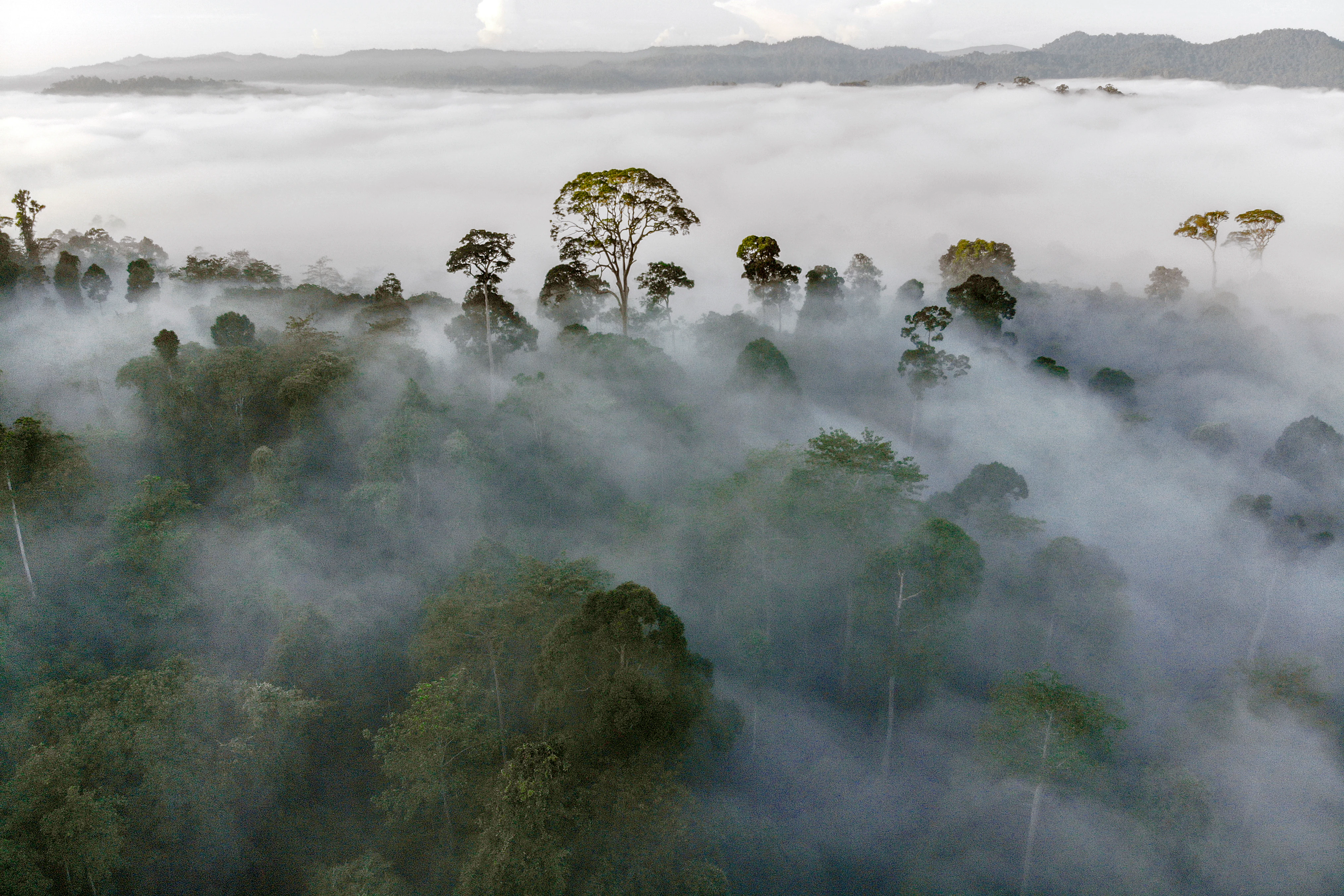
An aerial view of a tropical rainforest with tall trees rising above a dense layer of morning fog, with rolling hills in the background.
Morning mist blankets the dense dipterocarp canopy in Danum Valley.

Danum Valley Conservation Area history and protected-area timeline

Danum Valley Conservation Area was established in 1980 on land in Sabah that had no prior record of human settlement, and therefore lacked a history of permanent villages, agriculture, hunting pressure, or commercial timber extraction. This clean ecological baseline, unusual for a forest of its size in the region, made the area immediately valuable as a reference site for primary lowland rainforest.

Since its gazetting, the conservation area has been managed by Yayasan Sabah, a Sabah-based foundation involved in forestry, conservation, research, and environmental education. Under this management framework, the area has been developed as a strict nature reserve, a centre for scientific research, and a venue for habitat restoration training, with the Danum Valley Field Centre established as the principal base for these activities.

Over time, the conservation area has gained an international profile through its long-running research programmes, including large-scale propagation of dipterocarp trees by the hundreds of thousands, and through its recognition as a place where species of conservation concern, including the Bornean rhinoceros until recent years, were monitored. Its growing reputation has also led to proposals to nominate the site as a UNESCO World Heritage Site, reflecting the broader historical shift from seeing Bornean lowland rainforests primarily as a timber resource towards recognising their irreplaceable scientific and conservation value.

Danum Valley Conservation Area landscape and geographic character

Danum Valley occupies a bowl-shaped lowland basin set within broader upland terrain of Sabah in eastern Borneo. The valley floor is drained by a network of forest rivers along which river swimming and boat-based exploration are commonly carried out, while the surrounding topography rises in places to about 1,093 metres, the maximum land height within the conservation area.

Morning fog is a characteristic feature of the valley, settling through the canopy in the early hours before lifting as the day warms. Streams, low ridges, and gentle slopes break up the forest interior, giving the terrain a varied microtopography of ridges, valley flats, and riparian corridors.

The dominant visual impression is one of vast, unbroken forest. The dipterocarp-dominated canopy reaches more than 70 metres in places, shading a relatively open understorey and creating the close, humid atmosphere typical of primary lowland rainforest. Within this continuous forest matrix, the tropical trees, rivers, and frequent fog combine to produce a landscape that is structurally intact and largely undisturbed by human infrastructure, apart from the limited footprint of the field centre and a small number of lodges.
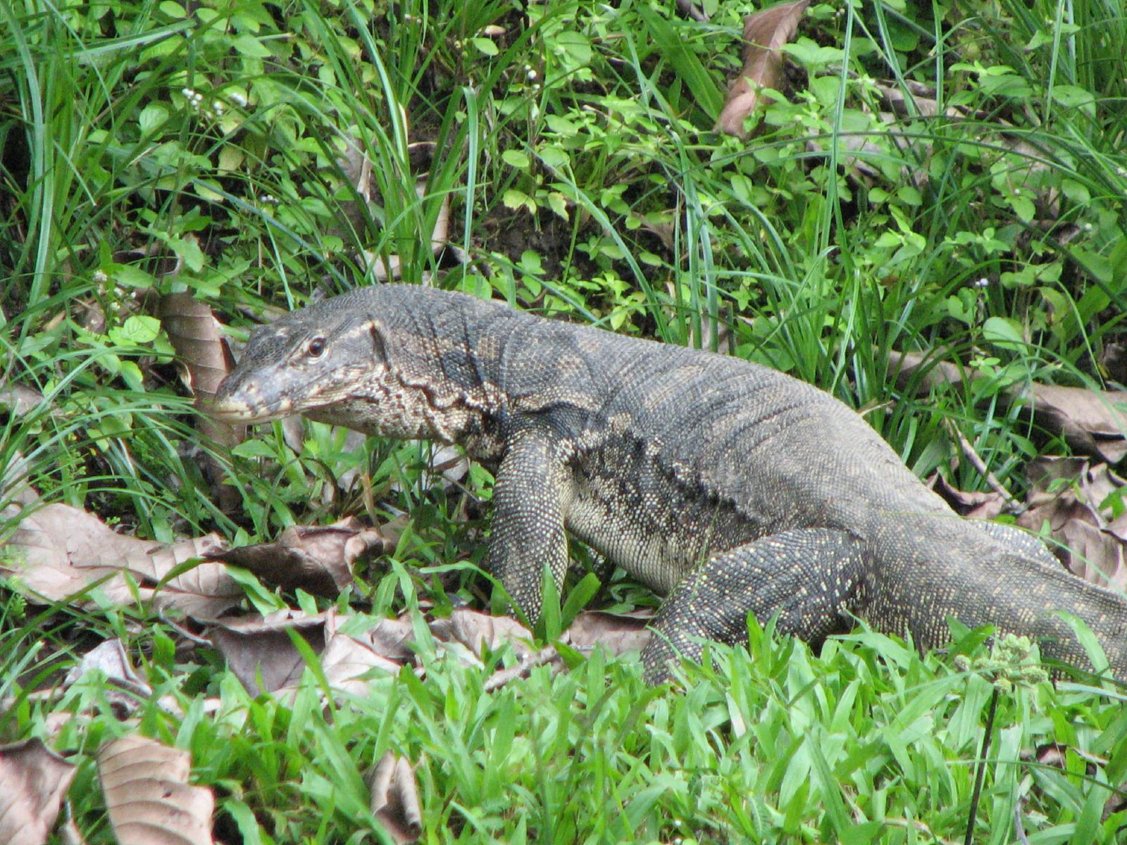
A large dark-colored water monitor lizard moving through green grass and fallen leaves.
A water monitor lizard in the lush vegetation of Danum Valley Conservation Area.

Danum Valley Conservation Area ecosystems, habitats, and plant life

The vegetation of Danum Valley is characteristic of the Borneo lowland rain forests ecoregion, with dipterocarp trees overwhelmingly dominant. Approximately 94 percent of the plants in the valley belong to the dipterocarp genus, and the greatest diversity of Dipterocarpus species is found on Borneo as a whole. Individual species such as Dipterocarpus acutangulus, D. borneensis, D. conformis, D. coriaceus, D. crinitus, D. gracilis, D. grandiflorus, and D. validus, among many others recorded here, contribute to the structural and ecological complexity of the forest.

The forest is exceptionally species-rich at the plant level, with more than 15,000 plant species documented in the valley. Above the main dipterocarp canopy, the 2019 discovery of Menara, a yellow meranti (Richetia faguetiana) measured at 97.58 metres, established the world's tallest known living tropical tree growing within the conservation area.

Beyond dipterocarps, the flora includes pitcher plants within the understorey and a layered rainforest structure of emergents, main canopy, subcanopy, shrubs, and ground cover. This stratification creates a wide range of microhabitats, from shaded forest floor along rivers to sunlit gaps where taller trees have fallen, supporting an unusually varied fauna and giving the valley its strongly tropical ecological character.

Danum Valley Conservation Area wildlife and species highlights

Danum Valley supports a rich fauna typical of primary Bornean lowland rainforest, with primates among its most prominent inhabitants. The conservation area is home to the Bornean orangutan, Müller's Bornean gibbon, and smaller primates such as Horsfield's tarsier, while larger mammals include several deer species, mousedeer, and the rare Bornean pygmy elephant.

Carnivores and other notable mammals are present across the forest, including the clouded leopard and the sun bear, while the Bornean rhinoceros was historically present in the area until its decline, with the last known individual removed to a captive breeding facility in 2014 after decades of population loss. Smaller but ecologically important species, such as the Asian water monitor, also inhabit the rivers and forest floor.

The conservation area is particularly significant for birdlife, with more than 270 bird species recorded within its boundaries. It is the only location where the enigmatic spectacled flowerpecker has been recorded, a finding that gave the species scientific recognition. The forest also harbours an exceptionally rich insect fauna, including extensive moth, beetle, and other invertebrate communities that have been a focus of research at the Danum Valley Field Centre, as well as one of the richest land snail faunas in the world, with at least 61 species documented in a one square kilometre plot.

Danum Valley Conservation Area conservation status and protection priorities

Danum Valley is recognised as one of the most important sites for the conservation of primary lowland dipterocarp rainforest in Borneo, primarily because of its long-standing freedom from logging, settlement, and hunting. The conservation area is managed as a Class I Forest Reserve under the supervision of Yayasan Sabah, with explicit objectives of conservation, research, education, and habitat restoration training.

Its value for conservation science is enhanced by the presence of the Danum Valley Field Centre, which supports long-term ecological monitoring, biodiversity inventories, and large-scale propagation of dipterocarp trees intended for reforestation of degraded sites elsewhere in Sabah. This combination of strict protection and active research gives the conservation area an unusually strong role in shaping regional habitat restoration strategies.

The conservation area also hosts populations of several species of significant conservation concern, including the Bornean orangutan, the Bornean pygmy elephant, and other wide-ranging forest mammals reliant on large, intact habitat blocks. The recovery and historical loss of the Bornean rhinoceros in the area underline the importance of continuous protection, while the proposals to nominate the site as a UNESCO World Heritage Site reflect recognition of Danum Valley as a globally significant example of primary Southeast Asian lowland rainforest.

Danum Valley Conservation Area cultural meaning and human context

Danum Valley has no documented history of human settlement within its boundaries, and there is no indigenous or village population traditionally associated with the forest itself. The area's cultural context is therefore defined less by long-standing human presence than by its emergence as a landmark of modern conservation thinking in Sabah and Malaysia.

The surrounding region of Sabah, however, is home to a mosaic of indigenous communities whose territories lie beyond the conservation area, and the wider Danum landscape forms part of a regional identity connected to the protection of Borneo's rainforest heritage. The conservation area's role as an educational and research hub has also given it a cultural dimension as a place where Malaysian and international scientists, students, and visitors come to engage with the forest.

Through Yayasan Sabah's management and the presence of lodges such as the Borneo Rainforest Lodge and Kawag Nature Lodge, Danum Valley has also become a focal point for ecotourism and conservation awareness in eastern Sabah, linking local livelihoods around Lahad Datu and nearby settlements to the broader project of safeguarding Bornean lowland rainforest.

Top sights and standout views in Danum Valley Conservation Area

Among Danum Valley's strongest points of distinction is its status as an exceptionally large, genuinely primary lowland dipterocarp forest, undisturbed by prior logging or settlement. This gives it an ecological baseline rarely matched elsewhere in Southeast Asia and makes it a reference site for rainforest research across the region.

Equally distinctive is its combination of conservation, research, and habitat restoration functions, centred on the Danum Valley Field Centre and Yayasan Sabah's management framework. The conservation area supports a remarkable mammal and bird fauna, the world's tallest known tropical tree in the form of the 97.58 metre yellow meranti Menara, and the only known locality for the spectacled flowerpecker.

Best time to visit Danum Valley Conservation Area

Danum Valley's character changes with the seasonal climate of Sabah, where the wettest months generally bring heavier rain, rising rivers, and frequent, dense mist lingering in the canopy, while drier periods tend to offer clearer forest interiors, more open understorey views, and easier conditions for extended jungle trekking and night safaris.

Cooler early mornings are a defining feature of the valley year round, with fog regularly settling over the lowland forest before lifting, a phenomenon that strongly shapes the photographic and wildlife-watching atmosphere. Birdwatching and primate viewing can be productive across the year, but drier spells are commonly favoured by visitors who want steadier weather for guided walks along the rainforest trails.

Because Danum Valley operates primarily as a research reserve with limited lodge capacity, the character of a visit tends to be shaped as much by the quiet, remote ambience of the intact lowland forest as by seasonal variation, with both wet and dry conditions offering different but consistently rich experiences of Borneo's lowland rainforest.
Monthly climate preview

Long-term monthly temperature and precipitation patterns sampled at representative park coordinates

Danum Valley Conservation Area Climate Normals, Temperature, and Precipitation Rhythm

Historical climate data for Danum Valley Conservation Area records mean monthly temperatures ranging from 23.78 to 25.27 degrees Celsius alongside daily precipitation rates varying between 4.79 and 9.54 millimeters. Examining the full twelve-month weather profile reveals the underlying long-term baseline conditions measured across the protected landscape.
Annual mean25 °C
24 °C25 °C
Jan24°
Feb24°
Mar25°
Apr25°
May25°
Jun25°
Jul24°
Aug24°
Sep25°
Oct25°
Nov25°
Dec24°
Warmest month
May

25.3 °C

Coolest month
January

23.8 °C

Wettest month
December

9.5 mm/day

Driest month
April

4.8 mm/day

Park location guide

Geography guide, regional context, and park location map for Danum Valley Conservation Area

Danum Valley Conservation Area park geography, regions, and map view in Malaysia

Understand where Danum Valley Conservation Area sits in Malaysia through a broader geographic reading of the surrounding landscape, nearby location context, and its mapped position within the national park landscape.

How Danum Valley Conservation Area fits into Malaysia

Malaysia is a federal constitutional monarchy located in Southeast Asia. The country consists of 13 states and three federal territories, divided by the South China Sea into Peninsular Malaysia on the Indochinese Peninsula and East Malaysia on the island of Borneo. With a population of over 34 million, it achieved independence from Britain in 1957 and became a modern federation in 1963. The country is recognized for its multicultural population, tropical climate, and significant economic role in the region.

Wider geography shaping Danum Valley Conservation Area in Malaysia

Malaysia occupies a strategic position in Southeast Asia, split by the South China Sea into two distinct regions. Peninsular Malaysia lies on the Indochinese Peninsula, sharing a land border with Thailand to the north and maritime borders with Singapore, Vietnam, and Indonesia. East Malaysia occupies the northern portion of Borneo, sharing land borders with Brunei and Indonesia, and maritime borders with the Philippines and Vietnam. The country's terrain includes coastal plains, mountain ranges such as the Titiwangsa in the peninsula, and extensive tropical rainforests.

Map view of Danum Valley Conservation Area

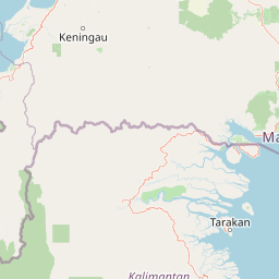
Use this park location map to pinpoint Danum Valley Conservation Area in Malaysia, understand its exact geographic position, and read its mapped placement within the surrounding landscape more clearly.

Pigeon | © OpenStreetMap contributors

Location context for Danum Valley Conservation Area

Sabah

Explore protected area views, high canopy forest terrain, and tropical lowland scenery across Borneo

Danum Valley Conservation Area Photos and Scenery: Visualizing Primary Rainforest Habitats

Visual documentation of Danum Valley Conservation Area reveals the complex structure of primary lowland dipterocarp rainforest, towering canopy trees, and river valleys. Examining these protected area photographs helps researchers and visitors understand the untouched forest terrain, morning fog patterns, and natural habitat boundaries of eastern Borneo.

An aerial view of a tropical rainforest with tall trees rising above a dense layer of morning fog, with rolling hills in the background.

A wire mesh suspension footbridge spans a muddy river surrounded by lush tropical rainforest, with two people walking across it.

A large dark-colored water monitor lizard moving through green grass and fallen leaves.

Park atlas

Compare regional parks, wildlife reserves, and protected landscapes across Sabah.

Explore Protected Areas Near Danum Valley Conservation Area and Surrounding Rainforests

Browse other parks near Danum Valley Conservation Area to examine related lowland rainforest ecosystems and connected protected landscapes. Regional park comparisons reveal broader ecological patterns across the surrounding Bornean terrain.
National parkSabah
About 63 km away#1 closest

Southeast

Tawau Hills National Park: Mapped Boundaries and Protected Landscape Identity in Sabah

Explore the geographic scope and regional context of Tawau Hills National Park.

Gain a structured understanding of Tawau Hills National Park as a protected area within the geography of Sabah, Malaysia. This resource details its significance as a national park, highlighting its mapped landscape and its contribution to the regional geographic context. Ideal for users interested in atlas exploration and comprehending the distribution of protected lands.

Area
280 km²
Established
1979
IUCN
II
Relief
Mountain
Nature reserveSabah
About 86 km away#2 closest

West

Maliau Basin Nature Reserve: Geographic Overview and Protected Landscape Mapping

Sandstone escarpments and river drainage in Sabah, Malaysia

Explore the structural geography of Maliau Basin, a prominent nature reserve in Sabah. This protected area is defined by its massive sandstone depression, multi-tiered waterfalls, and expansive primary forest coverage. Examine the watershed dynamics of the Maliau River and the mountainous terrain that isolates this significant wilderness from surrounding lowland regions.

Area
588 km²
Established
1981
IUCN
Ia
Water
Major water bodies
Wildlife reserveSabah
About 116 km away#3 closest

East

Tabin Wildlife Reserve: Exploring Protected Landscapes and Terrain in Eastern Sabah

An essential conservation stronghold featuring unique mud volcano terrain and dipterocarp forest.

Tabin Wildlife Reserve encompasses a sprawling expanse of lowland jungle in the heart of the Dent Peninsula. This protected area plays a vital role in safeguarding Borneo's largest mammal populations and maintaining the ecological connectivity of riverine habitats and mineral-rich forest floors within the Sabah region.

Area
1,225 km²
Established
1984
IUCN
IV
Relief
Lowland
National parkSabah
About 120 km away#4 closest

East

Tun Sakaran Marine Park National Park: Sabah Marine Archipelago Atlas

Explore the islands, sand cays, and coral reef geography.

Tun Sakaran Marine Park is a protected national park in Sabah, Malaysia, known for its stunning marine biodiversity and archipelago landscape. This atlas entry details the park's distinct islands, dynamic sand cays, and extensive coral reef systems within the Celebes Sea, offering insights into its unique geographic setting and ecological significance.

Area
101 km²
Established
2004
IUCN
II
Relief
Lowland
Watercolor painting of a lake surrounded by green trees and distant pastel-colored hills.
Marine protected areaSabah
About 139 km away#5 closest

Southeast

Sipadan Island Park: Marine Protected Area and Volcanic Seamount Landscape in Sabah, Malaysia

Exploration of submerged coral terrain, reef boundaries, and marine geography.

Sipadan Island Park encompasses 16,860 hectares of protected marine waters, centered on a singular volcanic seamount. This record details the park's underwater landscape, from shallow coral-fringed plateaus to deep-sea drop-offs, providing a clear geographic view of this essential Malaysian marine sanctuary.

Area
168.6 km²
Established
1933
Relief
Lowland
Climate
Tropical
National parkMalaysia
About 143 km away#6 closest

North

Turtle Islands National Park: Marine Protected Area and Island Geography in Malaysia

Coastal landscapes and coral reef protected zones

Explore the geographic footprint of Turtle Islands National Park, a marine-focused sanctuary in Malaysia. This protected area encompasses three islands and surrounding Sulu Sea reef ecosystems, providing critical nesting habitat for marine turtles. Learn about the island-based terrain and the marine boundaries that define this protected landscape.

Area
17.4 km²
Established
1977
Relief
Lowland
Climate
Tropical
National parkSabah
About 143 km away#7 closest

North

Turtle Islands National Park: Marine Geography and Protected Island Landscapes in Sabah

A Sulu Sea sanctuary for coral reefs and sea turtle nesting grounds.

Located north of Sandakan, Turtle Islands National Park is a key marine protected area defined by its island geography and extensive coral reef habitat. The park protects critical nesting beaches for green and hawksbill sea turtles, offering a focused look at how marine conservation intersects with tropical island terrain in the Sulu Sea. This geographic profile details the park's offshore environment and its connection to broader maritime conservation efforts in the region.

Area
17.4 km²
Established
1977
IUCN
II
Relief
Lowland
Wildlife reserveTawi-Tawi
About 147 km away#8 closest

Northeast

Turtle Islands Wildlife Sanctuary: Mapping the Protected Archipelago of Tawi-Tawi

Coastal landscapes, marine habitats, and island terrain

Spanning six islands at the maritime boundary of the Philippines and Malaysia, Turtle Islands Wildlife Sanctuary is defined by its extensive nesting beaches and remnant forest. This protected area integrates marine and coastal habitats, ranging from the volcanic activity on Lihiman to the forested shores of Baguan, offering a unique look at the maritime geography of the Tawi-Tawi region.

Area
2,429.67 km²
Established
1999

Common questions about visiting, size, designation, and location context for Danum Valley Conservation Area

Danum Valley Conservation Area FAQs for park facts, access, geography, and protected area context

Find quick answers about Danum Valley Conservation Area, including protected-area facts, park geography, trail and visitor context, and how the park fits into its surrounding country and regional landscape.
MoriAtlas Explorer

Continue Your Protected Areas Search Across the Global Atlas

Deepen your exploration by continuing the structured search for national parks and protected areas worldwide. Utilize the comprehensive filtering capabilities to compare different conservation landscapes and refine your understanding of global park geography. Discover more about the distribution and characteristics of protected natural areas.

Global natural geography
