Mori Atlas logo
National parkVerkhovyna National Nature Park

Explore the mapped boundaries and regional atlas of this key Ukrainian national park.

Verkhovyna National Nature Park: Protected Landscape and Geographic Context in Verkhovyna Raion

(Верховинський національний природний парк)

Verkhovyna National Nature Park stands as a significant protected landscape within the rural district of Verkhovyna Raion, western Ukraine. This page offers an atlas-focused view of the park, detailing its protected area identity and its placement within the broader Carpathian Mountains geography. Users can explore the park's mapped boundaries and understand its regional context, facilitating structured discovery of Ukraine's natural terrain and protected lands.

Carpathian MountainsRiver headwaters protectionMountain forestsSpruce forest ecosystemsHighland protected areaEastern European parks

Verkhovyna National Nature Park

National park

Park overview

Structured park overview, official facts, and landscape profile for Verkhovyna National Nature Park

Verkhovyna National Nature Park park facts, protected area profile, and essential visitor context
Review the core facts for Verkhovyna National Nature Park, including designation, size, terrain, visitor scale, habitats, and operating context in one park-focused overview.

About Verkhovyna National Nature Park

As a relatively young protected area established in 2010, Verkhovyna represents a more recent addition to Ukraine's national park system, created specifically to safeguard the ecological integrity of this highland river catchment. The park's location in the Marmaros crystalline massif provides geological significance, with limestone formations underlying much of the terrain and contributing to the distinctive character of local soils and vegetation communities. The protected area connects with the broader Carpathian conservation landscape, lying adjacent to Cheremosh National Nature Park to the east and contributing to a larger mosaic of protected lands that preserve the Carpathian mountain ecosystem.

Quick facts and research context for Verkhovyna National Nature Park

Verkhovyna National Nature Park covers approximately 12,023 hectares of mountainous terrain in the Carpathian Mountains of western Ukraine. The park is positioned at the headwaters of the Cheremosh River, a major tributary of the Prut River, which itself flows into the Danube. Located in Verkhovyna Raion, the park sits at the northwest portion of the Marmaros crystalline massif, characterized by limestone geology. The area experiences a humid continental climate with warm summers and receives approximately 1,002 mm of precipitation annually.

Park context

Deeper park guide and search-rich context for Verkhovyna National Nature Park

Verkhovyna National Nature Park history, landscape, wildlife, and travel context
Explore Verkhovyna National Nature Park through its history, landscape character, ecosystems, wildlife, conservation priorities, cultural context, and seasonal travel timing in a structured park guide built for atlas discovery and search intent.

Why Verkhovyna National Nature Park stands out

Verkhovyna is best known for protecting one of the most remote and pristine highland catchments in the Ukrainian Carpathians. The park encompasses the source regions of the Cheremosh River, preserving the ecological corridors and watersheds that feed this significant Carpathian waterway. Its elevation gradient supports distinct forest zones, from mixed forests in the lower reaches to mountain pine and green alder communities at higher elevations, creating a vertically stratified ecological profile uncommon in lowland protected areas.

Verkhovyna National Nature Park history and protected-area timeline

Verkhovyna National Nature Park was established in 2010 as part of Ukraine's expansion of its protected areas network in the Carpathian region. The creation of the park reflected growing recognition of the ecological importance of preserving the Cheremosh River headwaters and the surrounding mountainous landscape. The park is administered by the Ministry of Ecology and Natural Resources of Ukraine, which oversees its management and conservation objectives. As a relatively recent protected area designation, the park's recreational infrastructure continues to develop, with hiking paths established and educational programs implemented for local communities.

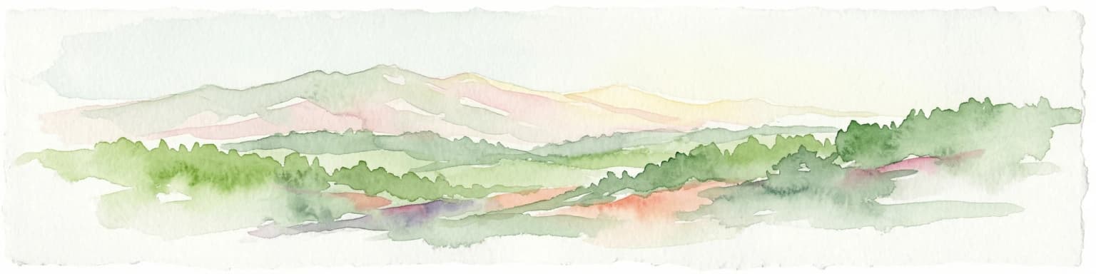
Verkhovyna National Nature Park landscape and geographic character

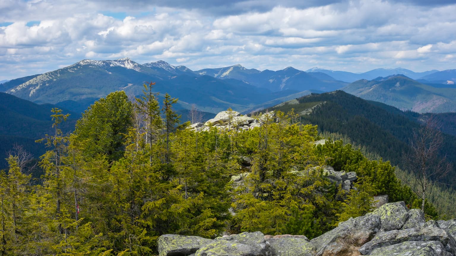
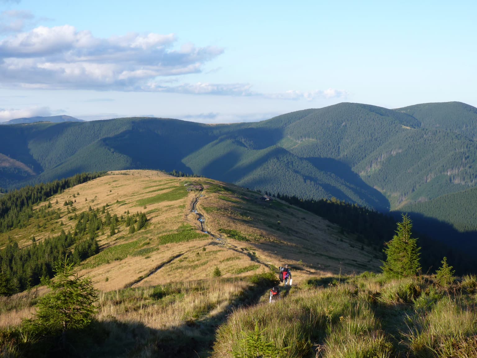
The landscape of Verkhovyna National Nature Park is defined by its position in one of the most rugged and mountainous sectors of the Ukrainian Carpathians. The Chivchino-Grinyava mountain range forms the core of the park's terrain, characterized by steep-sided valleys, exposed ridges, and the characteristic complexity of Carpathian topography. The park encompasses the headwaters of the Cheremosh River and its two main tributaries, creating a dendritic drainage pattern that reflects the underlying geological structure of the Marmaros crystalline massif. Limestone bedrock underlies much of the area, giving the landscape its distinctive geological character.

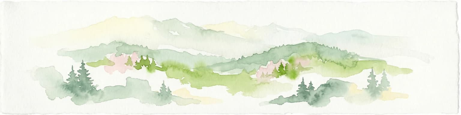
Verkhovyna National Nature Park ecosystems, habitats, and plant life

The ecological character of Verkhovyna is defined by a pronounced altitudinal zonation that creates distinct vegetation communities across a relatively short vertical gradient. Above 1,600 meters, the vegetation transitions to mountain pine and green alder communities adapted to the harsher conditions of high elevation. Between 1,200 and 1,600 meters, the forest is predominantly spruce, forming continuous cover across slopes and valleys. Below 1,200 meters, mixed forests prevail, creating a more diverse and layered canopy structure. The park also encompasses meadow and swamp floristic communities, adding ecological variety to the forested terrain.

Verkhovyna National Nature Park wildlife and species highlights

The park's diverse forest habitats and altitudinal gradient support a variety of wildlife species typical of the Carpathian ecosystem. The spruce forests at mid-elevations provide important habitat for species associated with old-growth coniferous forest, while the mixed forests at lower elevations support more diverse communities. The meadow and wetland areas within the park contribute to biodiversity by providing different habitat types. The Carpathian region as a whole is recognized for its ecological significance, and Verkhovyna contributes to the preservation of wildlife corridors within this mountain landscape.

Verkhovyna National Nature Park conservation status and protection priorities

Verkhovyna National Nature Park plays an important role in protecting the headwaters of the Cheremosh River system, preserving water quality and ecological function for downstream ecosystems. The park's protected status helps maintain the integrity of the Carpathian watershed and the ecological connections that support biodiversity across this mountainous region. The diverse forest types, from mixed hardwood-coniferous forests at lower elevations to pure spruce zones and alpine communities at higher elevations, represent a gradient of Carpathian forest ecosystems that benefit from protected area status.

Verkhovyna National Nature Park cultural meaning and human context

The park is situated in Verkhovyna Raion, a region of western Ukraine with strong cultural connections to the Carpathian mountain environment. The local communities in this area have historically maintained close relationships with the land, practicing traditional forms of agriculture and pastoral activity that are characteristic of Carpathian rural culture. Verkhovyna itself is a settlement that serves as an administrative center for the raion, and the park's presence contributes to the regional identity as a preserve of natural and cultural heritage in this mountainous corner of Ukraine.

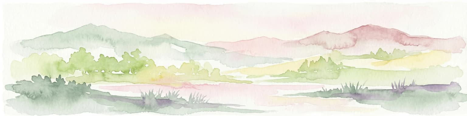
Top sights and standout views in Verkhovyna National Nature Park

The park protects a complete highland catchment system including the source regions of the Cheremosh River and its tributaries. The vertical ecological gradient from mixed forests through spruce zones to mountain pine and alpine meadows provides a condensed overview of Carpathian ecological zones. The limestone geology of the Marmaros massif adds geological significance to the protected landscape. Adjacency to Cheremosh National Nature Park creates opportunities for extended exploration of the Carpathian protected area network.

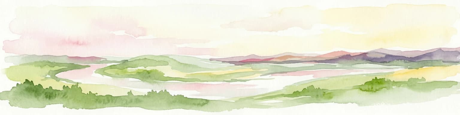
Best time to visit Verkhovyna National Nature Park

The warm summer months offer the most comfortable conditions for exploring the park, with temperatures suitable for hiking and outdoor activity in the Carpathian high country. From May through September, visitors can experience the full expression of the park's ecological diversity as vegetation reaches its seasonal peak and trail conditions are most favorable. The Dfb humid continental climate ensures that summer brings sufficient warmth and daylight hours for meaningful exploration, though visitors should be prepared for the variable weather common to mountainous terrain.

Park location guide

Geography guide, regional context, and park location map for Verkhovyna National Nature Park

Verkhovyna National Nature Park park geography, regions, and map view in Ukraine
Understand where Verkhovyna National Nature Park sits in Ukraine through a broader geographic reading of the surrounding landscape, nearby location context, and its mapped position within the national park landscape.

How Verkhovyna National Nature Park fits into Ukraine

Ukraine is a sovereign nation in Eastern Europe, bordered by Russia, Belarus, Poland, Slovakia, Hungary, Romania, Moldova, and the Black Sea. It is the second-largest country in Europe by area. Kyiv is the capital and largest city, followed by Kharkiv, Odesa, and Dnipro. The official language is Ukrainian. Ukraine has a population of approximately 32.9 million and operates as a unitary semi-presidential republic.

Wider geography shaping Verkhovyna National Nature Park in Ukraine

Ukraine occupies 603,628 km² in Eastern Europe, making it the second-largest country in Europe. It shares borders with Russia, Belarus, Poland, Slovakia, Hungary, Romania, and Moldova. The country has a southern coastline along the Black Sea and Sea of Azov. The terrain includes plains, steppes, and the Carpathian Mountains in the west.

Map view of Verkhovyna National Nature Park

Use this park location map to pinpoint Verkhovyna National Nature Park in Ukraine, understand its exact geographic position, and read its mapped placement within the surrounding landscape more clearly.

Pigeon | © OpenStreetMap contributors

Location context for Verkhovyna National Nature Park

Ivano-Frankivsk OblastVerkhovyna Raion
Park atlas

Trace the regional protected area network and connected landscapes of the Ukrainian Carpathians, offering context around Verkhovyna National Nature Park.

Discover More National Parks and Protected Areas Near Verkhovyna National Nature Park
After exploring Verkhovyna National Nature Park, discover other national parks and protected areas across the rugged Ukrainian Carpathians, including those protecting river headwaters and mountain forest ecosystems. Compare their unique landscapes, conservation priorities, and geographic locations to build a comprehensive understanding of the region's protected area network.
Watercolor illustration of a mountainous landscape with forests, a lake, and distant peaks.
National parkChernivtsi Oblast

Cheremosh National Nature Park: Protected Landscape and Geographic Context in UA

Explore mapped boundaries within Chernivtsi Oblast

Cheremosh National Nature Park represents a vital protected area within Ukraine's Chernivtsi Oblast. This entry offers a structured exploration of the park's geographic identity, focusing on its mapped boundaries and its significance as part of the regional natural landscape. Delve into the terrain and understand how Cheremosh National Nature Park contributes to the mapped geography of western Ukraine, providing a foundation for atlas-based discovery.

Area
71 km²
Established
2009
IUCN
II
Relief
Mountain
National parkChernivtsi Oblast

Vyzhnytsia National Nature Park: Protected National Park Landscape Exploration

Mapped boundaries and regional terrain in Chernivtsi Oblast.

Delve into the specific protected landscape of Vyzhnytsia National Nature Park, a designated national park in Ukraine's Chernivtsi Oblast. This detailed entry provides context on its geographic positioning, mapped natural features, and the surrounding regional terrain, aiding in structured atlas exploration and understanding its significance within the protected areas network.

Area
7,928.4 km²
Established
1995
IUCN
II
Relief
Mountain
National parkIvano-Frankivsk Oblast

Carpathian National Nature Park: Protected Landscape Within Ivano-Frankivsk Oblast

National Park mapped boundaries and regional geography.

Carpathian National Nature Park represents a significant protected area within Ivano-Frankivsk Oblast, Ukraine. This page offers detailed insights into its protected landscape identity, helping users understand its geographic setting and mapped boundaries. As part of the Carpathian region, the park serves as a key point for atlas-based discovery, providing context for its place within the broader geography of western Ukraine.

Area
515.7 km²
Established
1980
IUCN
II
Visitors
1M annual
Watercolor illustration of a mountainous landscape with rolling hills, a river, and green vegetation
Protected landscapeMaramureș County

Maramureș Mountains Natural Park: Protected Landscape and Carpathian Geography

Explore the mapped boundaries and dramatic terrain of Romania's largest nature park.

Delve into the Maramureș Mountains Natural Park, a protected landscape covering extensive tracts of the northern Carpathian Mountains. This page provides detailed geographic context, showcasing the park's mapped boundaries, diverse alpine terrain, and its role within the broader regional geography of Maramureș County. Understand the natural features and protected area significance of this expansive Carpathian wilderness for structured atlas exploration.

Area
1,488.5 km²
Established
2004
IUCN
V
Relief
Mountain
National park

Rodna Mountains National Park: Explore Protected Landscape and Geographic Atlas

Discover the mapped terrain and protected area context.

Rodna Mountains National Park represents a key protected landscape within Romania, offering rich opportunities for geographic discovery. This page provides detailed insight into its mapped boundaries and how it integrates into the regional terrain. Delve into the structured atlas data to understand the park's protected area status and its significance within the natural geography.

Relief
Mountain
Scope
Terrestrial
National parkIvano-Frankivsk Oblast

Syniohora National Nature Park: Protected Carpathian Landscape and Geographic Context

Explore the mapped terrain and protected area boundaries within the Gorgany mountains.

Syniohora National Nature Park, located in Ivano-Frankivsk Oblast, is a vital protected area safeguarding a significant portion of the Gorgany mountain massif. This park offers a unique opportunity to explore the mapped geography and natural landscape characteristic of the Ukrainian Carpathians. Its establishment as a national park underscores the importance of preserving the region's mountain terrain, protected forest ecosystems, and distinctive natural heritage for structured geographic discovery.

Area
108.66 km²
Established
2009
IUCN
II
Scope
Terrestrial
Watercolor illustration of a winding river through rolling green hills with distant mountains under a soft sky
National parkTernopil Oblast

Dniester Canyon National Nature Park: National Park Protected Landscape and Geographic Context

Mapped boundaries and regional geography in Ternopil Oblast

Delve into the protected landscape of Dniester Canyon National Nature Park, a designated national park in Ukraine. This entry offers a structured view of the park's geographic setting within Ternopil Oblast, focusing on its mapped boundaries and its role as a significant protected natural area. Understand its placement within the broader atlas of Ukrainian natural landscapes and regional geography, offering a factual basis for exploration.

Area
108 km²
Established
2010
IUCN
II
Relief
Mixed relief
Watercolor illustration of a mountainous landscape with green hills, trees, and a river valley
National parkUkraine

Khotyn National Nature Park: Ukraine's National Park Atlas and Protected Landscape

Explore geographic boundaries and natural terrain.

Delve into the details of Khotyn National Nature Park, a protected national park situated within Ukraine. This entry offers precise geographic insights, focusing on the park's mapped terrain and its role as a significant protected landscape. Discover the regional context and understand its distinct natural features, providing a structured view for atlas-based exploration of Ukrainian protected areas.

Area
94 km²
Established
2010
IUCN
II
Relief
Mixed relief

Common questions about visiting, size, designation, and location context for Verkhovyna National Nature Park

Verkhovyna National Nature Park FAQs for park facts, access, geography, and protected area context
Find quick answers about Verkhovyna National Nature Park, including protected-area facts, park geography, trail and visitor context, and how the park fits into its surrounding country and regional landscape.
MoriAtlas Explorer

Continue Your Protected Areas Search Across the Global Atlas

Deepen your exploration by continuing the structured search for national parks and protected areas worldwide. Utilize the comprehensive filtering capabilities to compare different conservation landscapes and refine your understanding of global park geography. Discover more about the distribution and characteristics of protected natural areas.

Global natural geography