Mori Atlas logo
National parkCheremosh National Nature Park

Discover the geographic context of this Ukrainian national park in Chernivtsi Oblast

Cheremosh National Nature Park: Mapped Boundaries and Regional Protected Landscape

(Cheremoskyi National Nature Park)

Cheremosh National Nature Park stands as a significant protected landscape within Ukraine, specifically situated in Chernivtsi Oblast. This page serves as your entry point to understanding its precise geographic scope and mapped boundaries, offering a unique lens through which to explore its role in the regional natural terrain. Situated in an area known for its Carpathian foothills and diverse river valleys, Cheremosh National Nature Park provides essential context for appreciating the mapped geography of western Ukraine.

National ParkCarpathian MountainsSpruce ForestsMountain MeadowsEastern CarpathiansBukovina
Stylized landscape illustration showing a winding river, forested mountains, rocky cliffs, and a partly cloudy sky.

Cheremosh National Nature Park

National park

Park overview

Structured park overview, official facts, and landscape profile for Cheremosh National Nature Park

Cheremosh National Nature Park park facts, protected area profile, and essential visitor context
Review the core facts for Cheremosh National Nature Park, including designation, size, terrain, visitor scale, habitats, and operating context in one park-focused overview.

About Cheremosh National Nature Park

Cheremosh National Nature Park occupies a significant position in Ukraine's protected area network as a representative of the Carpathian montane conifer forests ecoregion that extends across the Carpathian Mountains from Poland to southern Romania. The park lies within the northeastern section of the Eastern Carpathians in the historical region of Bukovina, a roughly 60-kilometer diameter sector that straddles the border between present-day Ukraine and Romania. The terrain is characterized by mountainous topography with elevations ranging from 947 to 1,574 meters, creating diverse microclimates and habitat conditions within the park boundaries. The geological foundation of the park is remarkably varied, incorporating metamorphic shale formations, grano-diorites, Triassic-Jurassic carbonates, and sedimentary rocks that together create the varied landscape the park protects. The creation of the park in 2009 by decree of President Viktor Yushchenko consolidated three pre-existing protected areas into a unified national park with the mandate of preserving valuable natural and historical-cultural complexes and objects.

Quick facts and research context for Cheremosh National Nature Park

Cheremosh National Nature Park occupies 7,117.5 hectares in the northeastern Carpathian Mountains within Chernivtsi Oblast, Ukraine. Established in 2009, the park sits in the historical region of Bukovina and protects mountain forest ecosystems at elevations between 947 and 1,574 meters. The area experiences a humid continental climate with warm summers, averaging -9.1°C in January and 21.5°C in August, with approximately 850mm of annual precipitation. The park contains 44 rare plant species, over 120 vertebrate species, and 5,000 invertebrate species under state protection.

Park context

Deeper park guide and search-rich context for Cheremosh National Nature Park

Cheremosh National Nature Park history, landscape, wildlife, and travel context
Explore Cheremosh National Nature Park through its history, landscape character, ecosystems, wildlife, conservation priorities, cultural context, and seasonal travel timing in a structured park guide built for atlas discovery and search intent.

Why Cheremosh National Nature Park stands out

Cheremosh National Nature Park is especially known for its extensive spruce forests that cover approximately 80% of the park area, creating a quintessential Carpathian mountain landscape. The park is notable for the remarkable diversity of mountain wildflowers that bloom across its meadows and forest clearings, and for its geological complexity resulting from the presence of diverse metamorphic shales, grano-diorites, Triassic-Jurassic carbonates, and sedimentary rock formations. The combination of deep coniferous forests, mountain meadows, limestone karst formations with caves, and the historical logging infrastructure remnants adds distinctive character to this protected area.

Misty mountain landscape with a lone tree on a grassy hill, wooden fence, and rolling hills in the background.
Misty mountain landscape with a lone tree and wooden fence in Cheremosh National Nature Park.

Cheremosh National Nature Park history and protected-area timeline

Cheremosh National Nature Park was established on December 11, 2009, by presidential decree of Viktor Yushchenko, with the purpose of preserving valuable natural and historical-cultural complexes and objects in the Carpathian region. The park was assembled from three existing nature reserves that had been protected under different designations. The Black Dil Nature Reserve was originally established in 1972 as a geological reserve, notable for its dense concentration of different rock types including metamorphic shale, grano-diorites, Triassic-Jurassic carbonates, and sedimentary formations. State Enterprise Putil Forest covered the upper reaches of the White Cheremosh River and protected important geological sites and landforms. The Marmaros Crystalline Massif contained a limestone mountain with caves and historical mining works. The establishment process involved incorporating lands from the State Enterprise Putil Forest (4,699 hectares), lands from the Carpathian State Specialized Forestry (857 hectares) to be transferred to permanent use, and additional lands (1,561.5 hectares) included without removal from the forestry enterprise.

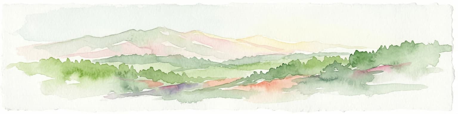
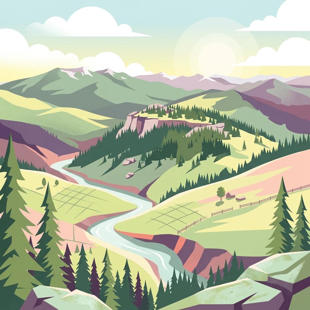
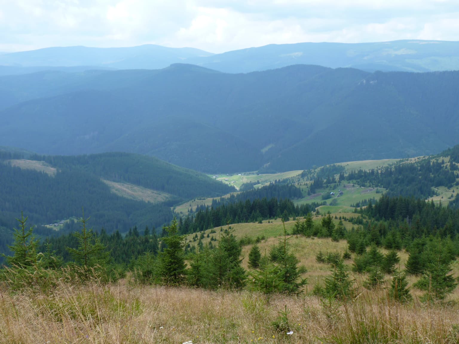
Cheremosh National Nature Park landscape and geographic character

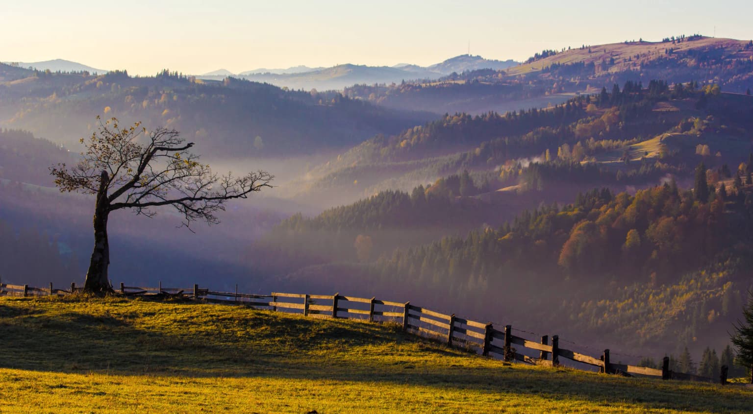
The landscape of Cheremosh National Nature Park is characterized by mountainous terrain in the northeastern Carpathians with elevations ranging from 947 to 1,574 meters above sea level. The terrain incorporates diverse geological formations including the Black Dil area with its complex assemblage of metamorphic and sedimentary rocks, the limestone karst features of the Marmaros Crystalline Massif with associated cave systems, and the river valleys of the upper White Cheremosh. The park features a mosaic of forest-covered slopes and open mountain meadows, with the spruce-dominated forest creating the dominant visual character of the landscape. The varied geology contributes to diverse landforms including rocky outcrops, steep slopes, and the distinctive karst topography associated with the limestone formations. Remnants of historical logging infrastructure, including dam remains used for timber floating operations, add historical cultural elements to the physical landscape.

Wide view of mountain ridges, valleys, and forested slopes under a partly cloudy sky
Mountain range and valley within Cheremosh National Nature Park

Cheremosh National Nature Park ecosystems, habitats, and plant life

The nature of Cheremosh National Nature Park is defined by its position within the Carpathian montane conifer forests ecoregion, which covers the full extent of the Carpathian Mountains across multiple countries. The dominant vegetation consists of spruce forest that covers approximately 80% of the park area, representing the characteristic Carpathian mountain forest type. Interspersed throughout the coniferous matrix are mountain meadows, lakes, and river systems, with the White Cheremosh River flowing through the park's upper reaches. At lower altitudes, the forest composition becomes more diverse with stands of old-growth forest containing fir, pine, and deciduous species including beech and other broadleaved trees. The park is particularly notable for the exceptional diversity of mountain wildflowers that appear in the meadow areas and forest clearings during the growing season. The protected species include 44 rare plant species, over 120 vertebrate species, and approximately 5,000 invertebrate species that receive formal state protection within the park boundaries.

Cheremosh National Nature Park wildlife and species highlights

The wildlife of Cheremosh National Nature Park includes over 120 vertebrate species protected within its boundaries, representing the biodiversity typical of Carpathian mountain forests. The diverse habitats created by the mosaic of spruce forests, mixed deciduous forests, mountain meadows, rivers, and rocky areas support a variety of wildlife species. The old-growth forest sections with their standing dead trees and fallen logs provide important habitat for cavity-nesting birds and forest-dwelling mammals. The mountain meadows and clearings support different species adapted to open grassland habitats. The river systems provide aquatic habitat and feeding areas for species associated with water. While specific species lists are not detailed in available sources, the park's position within the Carpathian montane ecoregion suggests the presence of characteristic species including various titmice, flycatchers, and other forest birds, as well as mammals such as deer, wild boar, and smaller forest mammals. The 5,000 invertebrate species under protection include diverse insects, spiders, and other arthropods that form an important part of the park's ecological communities.

Cheremosh National Nature Park conservation status and protection priorities

Cheremosh National Nature Park serves as an important conservation area within the Carpathian mountain ecosystem, one of Europe's significant biodiversity hotspots. The park protects representative examples of the Carpathian montane conifer forests ecoregion across its 7,117 hectares, preserving not only the forest communities but also the geological diversity that characterizes this part of the Carpathians. The designation combines previously established nature reserves into a unified protection framework that provides enhanced conservation for the diverse habitats present. The formal protection extends to 44 rare plant species, over 120 vertebrate species, and approximately 5,000 invertebrate species, creating a comprehensive protection regime for multiple taxonomic groups. The park's IUCN Category II designation as a national park reflects its purpose of protecting natural ecosystems while allowing for controlled public use and environmental education activities.

Cheremosh National Nature Park cultural meaning and human context

Cheremosh National Nature Park lies within the historical region of Bukovina, a cultural landscape that has been shaped by centuries of human activity in the Carpathian Mountains. The park's territory includes remnants of historical logging infrastructure, including the remains of dams (klyavzy) that were used for timber floating operations along the rivers. These structures represent the traditional forestry practices that have long been part of the regional economy in this part of the Carpathians. The nearby town of Putyla serves as the administrative center and nearest settlement to the park. The region has a complex historical identity, having been part of various political entities over the centuries and serving as a crossroads between Ukrainian, Romanian, and other cultural traditions. The creation of the park in 2009 reflects contemporary recognition of both the natural value and the historical heritage of the Bukovina region.

Top sights and standout views in Cheremosh National Nature Park

The highlights of Cheremosh National Nature Park include its extensive spruce-dominated forests representing the Carpathian montane conifer ecosystem, the remarkable diversity of mountain wildflowers that color the meadows during summer, and the geological diversity created by the varied rock formations including limestone karst features with caves. The park protects significant biodiversity with 44 rare plant species, over 120 vertebrate species, and 5,000 invertebrates under state protection. The combination of mountain terrain, deep forests, open meadows, and water features creates a visually diverse landscape characteristic of the northeastern Carpathians. The park offers hiking and mountain biking trails for visitors seeking to explore the Carpathian mountain environment.

Best time to visit Cheremosh National Nature Park

The best time to visit Cheremosh National Nature Park is during the summer months when the weather is most favorable for outdoor activities and the mountain wildflowers are in bloom across the meadows and forest clearings. July and August offer warm average temperatures around 21.5°C, making hiking comfortable at higher elevations. The park receives approximately 300mm of annual snowfall, creating winter conditions that may limit access to higher elevations. Spring and autumn offer different but potentially rewarding experiences, though visitors should be prepared for more variable weather conditions. The warm summer period with at least four months averaging above 10°C provides the most reliable conditions for exploring the park's trails and enjoying the natural environment.

Park location guide

Geography guide, regional context, and park location map for Cheremosh National Nature Park

Cheremosh National Nature Park park geography, regions, and map view in Ukraine
Understand where Cheremosh National Nature Park sits in Ukraine through a broader geographic reading of the surrounding landscape, nearby location context, and its mapped position within the national park landscape.

How Cheremosh National Nature Park fits into Ukraine

Ukraine is a sovereign nation in Eastern Europe, bordered by Russia, Belarus, Poland, Slovakia, Hungary, Romania, Moldova, and the Black Sea. It is the second-largest country in Europe by area. Kyiv is the capital and largest city, followed by Kharkiv, Odesa, and Dnipro. The official language is Ukrainian. Ukraine has a population of approximately 32.9 million and operates as a unitary semi-presidential republic.

Wider geography shaping Cheremosh National Nature Park in Ukraine

Ukraine occupies 603,628 km² in Eastern Europe, making it the second-largest country in Europe. It shares borders with Russia, Belarus, Poland, Slovakia, Hungary, Romania, and Moldova. The country has a southern coastline along the Black Sea and Sea of Azov. The terrain includes plains, steppes, and the Carpathian Mountains in the west.

Map view of Cheremosh National Nature Park

Use this park location map to pinpoint Cheremosh National Nature Park in Ukraine, understand its exact geographic position, and read its mapped placement within the surrounding landscape more clearly.

Pigeon | © OpenStreetMap contributors

Location context for Cheremosh National Nature Park

Chernivtsi Oblast

Browse images showcasing the park's extensive spruce forests, mountain meadows, and diverse Carpathian terrain

Cheremosh National Nature Park Photos, Landscapes, and Scenery: Visual Exploration
Visually explore Cheremosh National Nature Park through a curated gallery highlighting its distinct Carpathian landscapes, extensive spruce forests, and high-altitude mountain meadows. These images provide essential context for understanding the park's protected terrain, unique habitats, and the characteristic visual identity of this Ukrainian natural area.

Misty mountain landscape with a lone tree on a grassy hill, wooden fence, and rolling hills in the background.

Wide view of snow-covered mountain peaks in the distance with forested foreground and rocky outcrops

Wide view of mountain ridges, valleys, and forested slopes under a partly cloudy sky

Park atlas

Trace the regional spread of protected areas and compare similar Carpathian landscapes beyond this Ukrainian National Nature Park.

Discover Other National Parks Near Cheremosh National Nature Park in Ukraine's Carpathian Mountains
Explore additional national parks and protected areas across Ukraine's Western Carpathians and surrounding Chernivtsi Oblast after viewing Cheremosh National Nature Park. Comparing these distinct protected landscapes reveals broader regional conservation patterns, diverse mountain ecosystems, and the varied terrain of Eastern Europe.
National parkVerkhovyna Raion

Verkhovyna National Nature Park: Explore Protected Landscape Geography in Verkhovyna Raion

Discover Ukraine's Verkhovyna National Nature Park mapped terrain.

Verkhovyna National Nature Park represents a vital protected area within the Verkhovyna Raion of Ukraine. This detailed atlas entry focuses on the park's geographic significance, providing insights into its mapped boundaries and its role within the regional landscape context of the Carpathian Mountains. It serves as a focused point for understanding the park's protected status and its place in a structured geographic discovery framework.

Area
120 km²
Established
2010
IUCN
II
Relief
Mountain
National parkChernivtsi Oblast

Vyzhnytsia National Nature Park: Protected National Park Landscape Exploration

Mapped boundaries and regional terrain in Chernivtsi Oblast.

Delve into the specific protected landscape of Vyzhnytsia National Nature Park, a designated national park in Ukraine's Chernivtsi Oblast. This detailed entry provides context on its geographic positioning, mapped natural features, and the surrounding regional terrain, aiding in structured atlas exploration and understanding its significance within the protected areas network.

Area
7,928.4 km²
Established
1995
IUCN
II
Relief
Mountain
Watercolor illustration of a mountainous landscape with rolling hills, a river, and green vegetation
Protected landscapeMaramureș County

Maramureș Mountains Natural Park: Protected Landscape and Carpathian Geography

Explore the mapped boundaries and dramatic terrain of Romania's largest nature park.

Delve into the Maramureș Mountains Natural Park, a protected landscape covering extensive tracts of the northern Carpathian Mountains. This page provides detailed geographic context, showcasing the park's mapped boundaries, diverse alpine terrain, and its role within the broader regional geography of Maramureș County. Understand the natural features and protected area significance of this expansive Carpathian wilderness for structured atlas exploration.

Area
1,488.5 km²
Established
2004
IUCN
V
Relief
Mountain
National park

Rodna Mountains National Park: Explore Protected Landscape and Geographic Atlas

Discover the mapped terrain and protected area context.

Rodna Mountains National Park represents a key protected landscape within Romania, offering rich opportunities for geographic discovery. This page provides detailed insight into its mapped boundaries and how it integrates into the regional terrain. Delve into the structured atlas data to understand the park's protected area status and its significance within the natural geography.

Relief
Mountain
Scope
Terrestrial
National parkIvano-Frankivsk Oblast

Carpathian National Nature Park: Protected Landscape Within Ivano-Frankivsk Oblast

National Park mapped boundaries and regional geography.

Carpathian National Nature Park represents a significant protected area within Ivano-Frankivsk Oblast, Ukraine. This page offers detailed insights into its protected landscape identity, helping users understand its geographic setting and mapped boundaries. As part of the Carpathian region, the park serves as a key point for atlas-based discovery, providing context for its place within the broader geography of western Ukraine.

Area
515.7 km²
Established
1980
IUCN
II
Visitors
1M annual
Watercolor illustration of a winding river through rolling green hills with distant mountains under a soft sky
National parkTernopil Oblast

Dniester Canyon National Nature Park: National Park Protected Landscape and Geographic Context

Mapped boundaries and regional geography in Ternopil Oblast

Delve into the protected landscape of Dniester Canyon National Nature Park, a designated national park in Ukraine. This entry offers a structured view of the park's geographic setting within Ternopil Oblast, focusing on its mapped boundaries and its role as a significant protected natural area. Understand its placement within the broader atlas of Ukrainian natural landscapes and regional geography, offering a factual basis for exploration.

Area
108 km²
Established
2010
IUCN
II
Relief
Mixed relief
National parkIvano-Frankivsk Oblast

Syniohora National Nature Park: Protected Carpathian Landscape and Geographic Context

Explore the mapped terrain and protected area boundaries within the Gorgany mountains.

Syniohora National Nature Park, located in Ivano-Frankivsk Oblast, is a vital protected area safeguarding a significant portion of the Gorgany mountain massif. This park offers a unique opportunity to explore the mapped geography and natural landscape characteristic of the Ukrainian Carpathians. Its establishment as a national park underscores the importance of preserving the region's mountain terrain, protected forest ecosystems, and distinctive natural heritage for structured geographic discovery.

Area
108.66 km²
Established
2009
IUCN
II
Scope
Terrestrial
National park

Călimani National Park: Romania's Premier National Park Protected Landscape

Explore mapped boundaries and regional geographic context.

Uncover the geographic identity of Călimani National Park, a designated national park in Romania. This resource offers detailed insights into its protected landscape, mapped terrain, and surrounding natural context. Navigate through its specific park boundaries and understand how it fits into the wider regional geography, providing a clear atlas-style overview for dedicated discovery.

Area
240.41 km²
Established
2000
IUCN
II
Relief
Mountain

Common questions about visiting, size, designation, and location context for Cheremosh National Nature Park

Cheremosh National Nature Park FAQs for park facts, access, geography, and protected area context
Find quick answers about Cheremosh National Nature Park, including protected-area facts, park geography, trail and visitor context, and how the park fits into its surrounding country and regional landscape.
MoriAtlas Explorer

Continue Your Protected Areas Search Across the Global Atlas

Deepen your exploration by continuing the structured search for national parks and protected areas worldwide. Utilize the comprehensive filtering capabilities to compare different conservation landscapes and refine your understanding of global park geography. Discover more about the distribution and characteristics of protected natural areas.

Global natural geography