
Mori Atlas logo
Nature reserveWestliches Borchelsmoor

Examining the geographic boundaries and rewetting initiatives of this historic peatland remnant.

Westliches Borchelsmoor Nature Reserve and Protected Wetland Landscape in Germany

(Naturschutzgebiet Westliches Borchelsmoor)

Westliches Borchelsmoor serves as a vital protected area within Landkreis Rotenburg, Germany, encompassing 125 hectares of remnant raised bog. The terrain features a mosaic of old peat cuttings, birch carr woodland, and recovering wetland habitats that define the local North German Plain geography. Through ongoing rewetting and conservation efforts, this nature reserve maintains essential bog and woodland ecosystems that contribute to the broader Natura 2000 network.

raised bogpeat bogpeatlandmirebog woodlandbirch forest
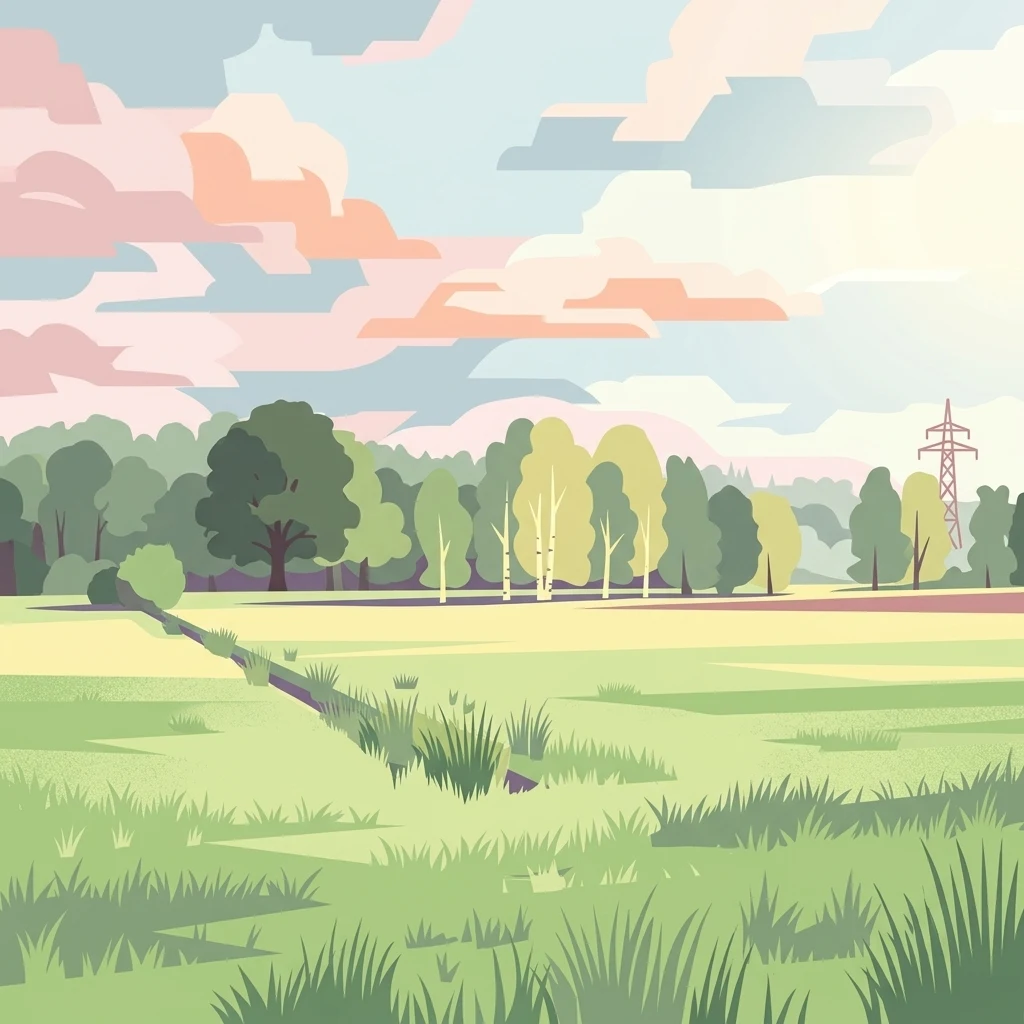
A flat digital illustration of an open meadow leading to a forest edge with a small drainage ditch in the foreground and a power line pylon on the right under a soft, pastel-colored sky.

Westliches Borchelsmoor

Nature reserve

Park overview

Structured park overview, official facts, and landscape profile for Westliches Borchelsmoor

Westliches Borchelsmoor park facts, protected area profile, and essential visitor context

Review the core facts for Westliches Borchelsmoor, including designation, size, terrain, visitor scale, habitats, and operating context in one park-focused overview.

About Westliches Borchelsmoor

Westliches Borchelsmoor lies in the flat, sandy plains of northern Lower Saxony, in an agricultural region shaped by glacial deposits and centuries of peatland drainage. The surrounding landscape around Rotenburg (Wümme) and Gyhum is dominantly farmland, and the reserve itself is a small but ecologically significant pocket of semi-natural habitat. It sits adjacent to the larger FFH site "Wiestetal, Glindbusch, Borchelsmoor," linking bog habitats with the nearby wetland systems of the Wieste river catchment.

The reserve represents a long history of human influence on the original Borchelsmoor peatland. Once a continuous dome of raised bog, the area was progressively cut for peat, leaving behind a highly fragmented pattern of ditches, exposed peat walls, and degraded peat surface. The present-day habitat mosaic reflects this history: heavily drained peatland predominates, but pockets of bog vegetation still persist where conditions allow.

Ecologically, the reserve protects a mixture of dry and wet bog woodland types, dominated by birch. Molinia-dominated grassland, also known as pipe grass communities, covers parts of the open peatland, while fragments of more intact bog vegetation, including characteristic bog pools or schlenken, survive within the protected area. Around the edges, especially to the north and south, the land transitions into extensively used wet grassland, providing transitional habitat and buffers between the bog core and the surrounding farmland.

Because most of the original peatland hydrology has been disrupted by drainage channels, modern management focuses on rewetting or "Wiedervernässung." Water that has historically been lost through ditches flowing to the Glindbach and Weidenbach is being retained on the site, in an attempt to restore peat-forming conditions and revive the bog vegetation. Restoration makes the reserve an example of a small but actively recovering bog system within an intensively used agricultural landscape.

Quick facts and research context for Westliches Borchelsmoor

Westliches Borchelsmoor is a 125-hectare nature reserve in the district of Rotenburg (Wümme) in Lower Saxony, Germany. It lies between Mulmshorn and the Bremen-Walsrode railway line and is the surviving fragment of the former widespread Borchelsmoor raised bog.

The site has been formally protected since October 2010 and carries the official designation NSG LÜ 289. The responsible authority is the district of Rotenburg (Wümme), while the NLWKN (Lower Saxony's state Agency for Water Management, Coastal Protection and Nature Conservation) maintains its public database entry.

Protection and recognition

Examine the verified terrestrial conservation scope and recognition history.

Westliches Borchelsmoor Protection Status and Designated Area Record

Examine the documented terrestrial protection status and management framework established for Westliches Borchelsmoor. Review the verified designation records and international recognition frameworks associated with this protected landscape.

Protection details

Protection scope
Terrestrial
Transboundary protection
No
WDPA ID
555514024
Park context

Deeper park guide and search-rich context for Westliches Borchelsmoor

Westliches Borchelsmoor history, landscape, wildlife, and travel context

Explore Westliches Borchelsmoor through its history, landscape character, ecosystems, wildlife, conservation priorities, cultural context, and seasonal travel timing in a structured park guide built for atlas discovery and search intent.

Why Westliches Borchelsmoor stands out

Westliches Borchelsmoor is known primarily for being a surviving fragment of the historical Borchelsmoor, a once-extensive raised bog whose peat was cut for generations. The reserve today offers a representative cross-section of a heavily modified but recovering peatland, including peat cuttings, Molinia grass, birch mire, and birch carr woodland.
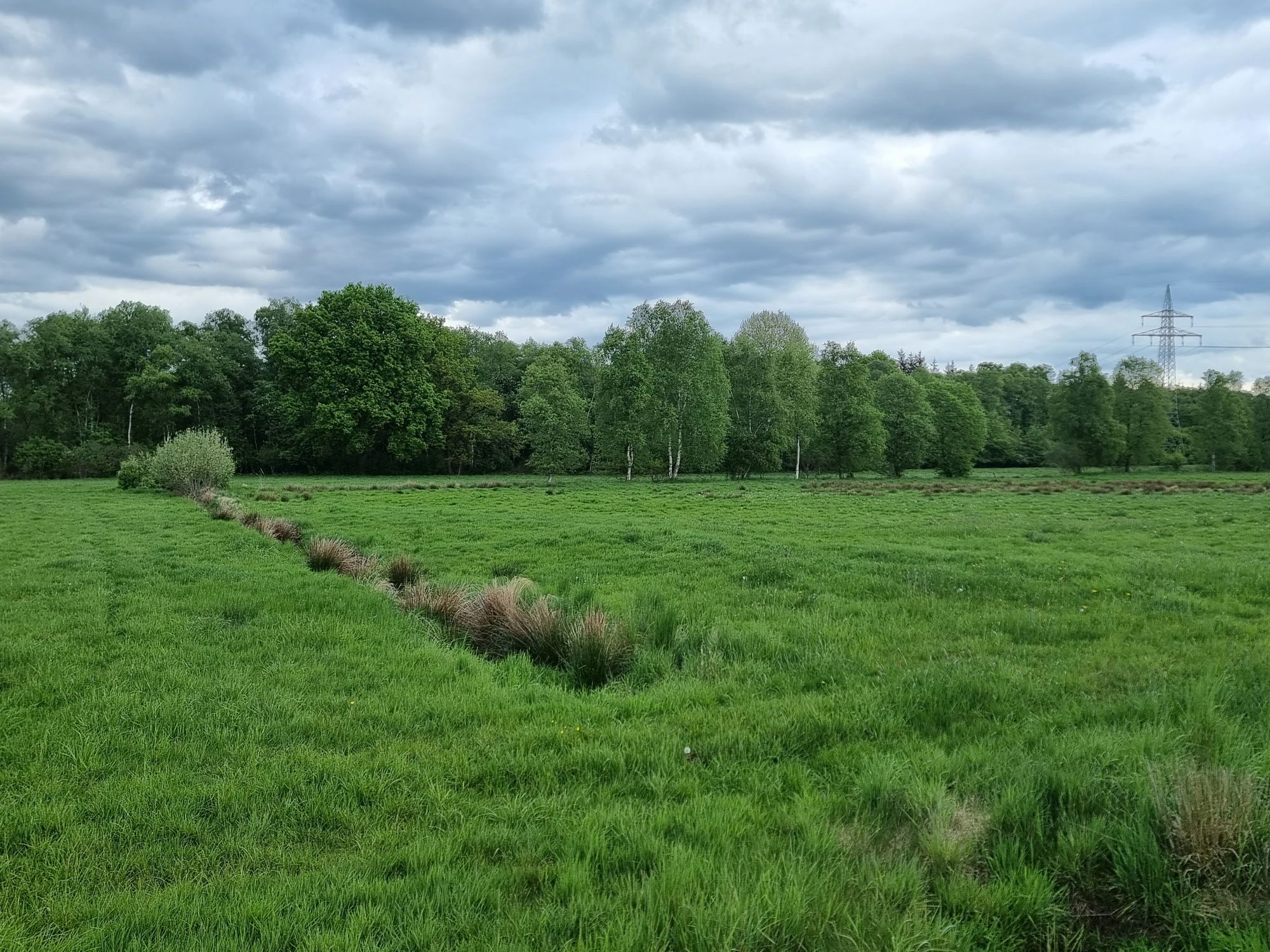
A green, grassy meadow stretches towards a tree line, with a narrow drainage ditch in the foreground and a power line pylon visible on the right against an overcast sky.
A view of the Westliches Borchelsmoor nature reserve featuring a green meadow and a distant tree line under a cloudy sky.

Westliches Borchelsmoor history and protected-area timeline

The wider Borchelsmoor was originally a broad raised bog in the northern Lower Saxony plain. Over generations it was gradually reduced through drainage and peat cutting, leaving behind a patchwork of cut-over peatland and degraded bog fragments.

Modern legal protection came relatively recently. On 16 October 2010, the Westliches Borchelsmoor was officially designated as a nature reserve under the German "Naturschutzgebiet" tool, with the official identifier NSG LÜ 289. The reserve is largely part of the larger Natura 2000 site "Wiestetal, Glindbusch, Borchelsmoor," connecting it to broader European habitat protection frameworks.

Since designation, management has moved toward active restoration of the bog hydrology. Draining ditches that historically fed the Glindbach and Weidenbach, both tributaries of the Wieste, which itself joins the Wümme near Ottersberg, have become a focus of rewetting efforts to help peat-forming processes resume where possible.

Westliches Borchelsmoor landscape and geographic character

The landscape of Westliches Borchelsmoor is shaped by its origin as a flat raised bog on the North German Plain. The terrain is low and gently undulating, with elevations roughly between 25 and 29 meters above sea level, a reminder that peat domes once raised the local ground surface above the surrounding mineral soils. After extensive drainage and peat cutting, much of the original dome character has been lost, leaving a subtle, irregular topography marked by old peat cuttings and drainage lines.

Within the reserve, the visual character shifts between open, drained peatland patches and areas of birch woodland. The form of the surviving bog suggests fragments of the original raised bog surface, intersected by dark peat cuts and pools that fill deeper holes left by centuries of turf extraction. Toward the edges, particularly in the north and south, the landscape softens into moist grassland, providing a smoother transition to the surrounding agricultural fields.

Westliches Borchelsmoor ecosystems, habitats, and plant life

The natural character of the reserve is built around the surviving vegetation of what was once a much larger raised bog. Although the wetland has been heavily modified, restoration aims to recover typical raised bog communities. Wherever the peat remains wetter, characteristic bog vegetation has a chance to develop, including the hummocks and hollows, known as Bult-Schlenken structures, that define intact raised bog surfaces.

A more visible component of the site is the birch-dominated woodland. Both subcontinental birch mire forests and birch carr occupy parts of the terrain, occupying the wetter hollows and the older peat cuttings. In more open spaces, Molinia grass (Pfeifengras) dominates, a tall, tussock-forming grass typical of degraded but still acidic peatlands.

In the wider reserve, the adjacent Glindbusch area to the northwest shares the same habitat palette, increasing the effective size of the protected bog-wet woodland complex.

Westliches Borchelsmoor conservation status and protection priorities

Westliches Borchelsmoor is part of the Natura 2000 conservation network as a component of the larger FFH area "Wiestetal, Glindbusch, Borchelsmoor." Its protected status is intended to preserve the remaining raised bog fragments in a landscape that is otherwise dominated by agriculture and peatland drainage. The reserve is classified under the German nature reserve ("Naturschutzgebiet") category, with the responsible lower nature protection authority being the district of Rotenburg (Wümme).

The conservation focus is strongly tied to hydrology. By interrupting or slowing the drainage channels that historically pulled water off the peatland, managers aim to raise the water table close to or even above the bog surface. This wetter condition is essential for the recovery of peat-forming vegetation and for the long-term re-establishment of bog-specific habitats.

Top sights and standout views in Westliches Borchelsmoor

The reserve's most distinctive feature is its identity as a remnant of the Borchelsmoor, an extensive historical raised bog of which only a fraction survives today. The combination of birch woodland, peat-cut remnants, and a rewetting program makes the site an example of ongoing peatland restoration.

Within the wider regional context, Westliches Borchelsmoor expands the protected wetland system northwest of Rotenburg (Wümme), complementing the adjacent Glindbusch reserve and contributing to the FFH site "Wiestetal, Glindbusch, Borchelsmoor."

Best time to visit Westliches Borchelsmoor

The reserve is at its most atmospheric in the warmer months, when open peatland vegetation such as Molinia grass greens up and bog pools are most visible. Late spring and summer also tend to be the best period for observing the mix of bog woodland and wet grassland communities. Because the bog terrain remains wet and soft even in summer, even in warmer months any visit should remain on established paths to avoid damaging recovering peatland surfaces.

Monthly climate preview

Track monthly temperature variations and precipitation averages across representative coordinates

Westliches Borchelsmoor Climate Normals, Long-Term Temperature and Precipitation

Representative coordinate records for Westliches Borchelsmoor show an annual temperature range spanning from sub-zero winter minimums to warm summer maximums alongside steady precipitation rates. Detailed monthly normals provide deeper insight into long-term meteorological patterns recorded across the protected area.
Annual mean9 °C
1 °C18 °C
Jan
Feb
Mar
Apr
May13°
Jun16°
Jul18°
Aug18°
Sep14°
Oct
Nov
Dec
Warmest month
July

18.1 °C

Coolest month
January

0.7 °C

Wettest month
July

2.5 mm/day

Driest month
April

1.4 mm/day

Park location guide

Geography guide, regional context, and park location map for Westliches Borchelsmoor

Westliches Borchelsmoor park geography, regions, and map view in Germany

Understand where Westliches Borchelsmoor sits in Germany through a broader geographic reading of the surrounding landscape, nearby location context, and its mapped position within the national park landscape.

How Westliches Borchelsmoor fits into Germany

Germany is a federal republic in Western and Central Europe with a population of over 83 million across sixteen constituent states. It is Europe's largest economy by nominal GDP and a major global exporter and importer. The capital is Berlin, and the country borders Denmark, Poland, Czech Republic, Austria, Switzerland, France, Luxembourg, Belgium, and the Netherlands.

Wider geography shaping Westliches Borchelsmoor in Germany

Germany is located in Western and Central Europe, spanning 357,022 km². It borders Denmark to the north, Poland and the Czech Republic to the east, Austria and Switzerland to the south, and France, Luxembourg, Belgium, and the Netherlands to the west. The country has coastlines on the Baltic Sea and North Sea to the north, with the Alps located in the southern region.

Map view of Westliches Borchelsmoor

Use this park location map to pinpoint Westliches Borchelsmoor in Germany, understand its exact geographic position, and read its mapped placement within the surrounding landscape more clearly.

Pigeon | © OpenStreetMap contributors

Location context for Westliches Borchelsmoor

Landkreis Rotenburg (Wümme)Lower Saxony

Visualizing the terrain, peat cuttings, and birch woodlands of Lower Saxony

Westliches Borchelsmoor Photos and Landscape Scenery

Visual records capture the distinctive character of Westliches Borchelsmoor, revealing low raised bog terrain, old peat cuts, and recovering birch carr habitats across the reserve. Examining these landscape views helps researchers understand ongoing wetland restoration efforts and the remaining protected ecosystems in the Rotenburg district.

A green, grassy meadow stretches towards a tree line, with a narrow drainage ditch in the foreground and a power line pylon visible on the right against an overcast sky.

Park atlas

Compare regional wetland reserves and connected peatland habitats across northern Lower Saxony.

Explore Other Parks Near Westliches Borchelsmoor and Surrounding Protected Landscapes

Browsing other parks near Westliches Borchelsmoor reveals neighboring nature reserves and protected wetland networks across the regional landscape. Extending the comparison helps map related peatland habitats and conservation areas within the wider North German Plain.
Nature reserveLower Saxony
About 4.8 km away#1 closest

Southeast

Stellmoor und Weichel: Geographic Profile of a Lower Saxony Nature Reserve

Protected geest woodlands and peat-bog mosaic landscapes

Examine the territorial boundaries and ecological features of Stellmoor und Weichel. Located on the flat geest ridge of Northern Germany, this reserve maps the transition from managed deciduous woodland to complex mire, willow thicket, and bog-fringe water systems, maintaining a long-standing natural forest reserve status.

Area
2.18 km²
Established
2018
IUCN
IV
Nature reserveLower Saxony
About 5.5 km away#2 closest

Southwest

Wiestetal Nature Reserve: Mapping the Wieste Stream and Riparian Habitat Corridor

Protected floodplain geography in Lower Saxony, Germany

Wiestetal acts as a critical nature reserve between Mulmshorn and Ottersberg, protecting the unique ecological character of the Wieste lowland stream. The area is defined by its meandering water channels, flooded sand quarry ponds, and diverse forest edges that sustain local biodiversity. This protected landscape offers a detailed look at the interplay between glacial sand deposits and the vibrant aquatic ecosystems of Northern Germany.

Area
3.82 km²
Established
2013
IUCN
IV
Relief
Upland
Nature reserveLandkreis Rotenburg (Wümme)
About 7.8 km away#3 closest

Southeast

Wümmeniederung mit Rodau, Wiedau und Trochelbach: Protected Wetland and Heath Landscape

Regional geography and floodplain connectivity in Landkreis Rotenburg

This nature reserve protects a sprawling lowland landscape characterized by the Wümme, Rodau, Wiedau, and Trochelbach rivers. The terrain features a mosaic of near-natural meandering streams, species-rich wet meadows, and rare raised bog remnants, providing a comprehensive overview of northern German lowland ecology.

Area
28.96 km²
Established
2020
IUCN
IV
Relief
Lowland
Nature reserveLower Saxony
About 16 km away#4 closest

South

Wolfsgrund Nature Reserve: Geographic Overview of Protected Heathlands in Lower Saxony

Inland dune topography and alder swamp forest ecology

Wolfsgrund represents a core protected area in Lower Saxony, defined by its unique inland dune geography and the narrow valley of the Everser Bach. The reserve encompasses a diverse ecological gradient, protecting sensitive dry heath, moist heathlands, and alder swamp forests that serve as a crucial refuge for regional biodiversity. This structured geographic overview highlights the terrain transitions and conservation significance of this essential German nature reserve.

Area
0.458 km²
Established
1977
IUCN
IV
Nature reserveLower Saxony
About 17 km away#5 closest

South

Waller Moor Nature Reserve: Geographic Context and Protected Landscape Profile

Mapping raised bog restoration in the Verden district of Lower Saxony

Waller Moor represents a focused effort to restore degraded peatland within Lower Saxony. By integrating grassland buffers and small pond habitats, the reserve preserves a specific lowland bog character. Its placement near the Spanger Holz woodland highlights the interplay between protected core habitats and managed regional terrain in northern Germany.

Area
0.25 km²
Established
1985
IUCN
IV
Relief
Lowland
Nature reserveLower Saxony
About 18 km away#6 closest

South

Wedeholz Nature Reserve: Geographic Overview of Lower Saxony Protected Forest Landscapes

Ancient oak forests, Geest terrain, and protected wetland habitats

Wedeholz represents a dense forest conservation area in Lower Saxony, defined by its mature oak and beech communities. The reserve terrain transitions from dry sandy Geest soils to delicate pine swamp forests and floating bogs, supporting a high density of deadwood-dependent species and woodland biodiversity within a compact, protected boundary.

Area
1.83 km²
Established
2019
IUCN
IV
Relief
Upland
Nature reserveNiedersachsen
About 22 km away#7 closest

South

Waller Flachteiche Nature Reserve: Exploring the Geography of Protected Landscapes in Niedersachsen

Mapped habitats of a former sand quarry wetland

Waller Flachteiche is a state-recognized nature reserve covering over 22 hectares of sandy, lowland terrain in Germany. The protected area offers a look at a recovered industrial site, where periodically drying ponds and diverse scrubland create a specialized habitat for rare amphibians and wetland flora. Its defined boundaries highlight a critical Natura 2000 component within the broader Niedersachsen region.

Area
0.227 km²
Established
2018
IUCN
IV
Nature reserveLower Saxony
About 23 km away#8 closest

Northwest

Swatte Flag Nature Reserve in Lower Saxony: Protected Landscape and Geographic Overview

An important refuge for heathland and bog-margin habitats.

Swatte Flag is a protected nature reserve in Lower Saxony, known for its two shallow Schlatt ponds and surrounding heathland mosaic. Established to manage rare habitat types within a reclaimed moorland landscape, the reserve features a sharp ecological contrast between its nutrient-poor grassland, wet bog pockets, and the adjacent intensive farmland.

Area
0.164 km²
Established
1965
IUCN
IV
Relief
Lowland

Common questions about visiting, size, designation, and location context for Westliches Borchelsmoor

Westliches Borchelsmoor FAQs for park facts, access, geography, and protected area context

Find quick answers about Westliches Borchelsmoor, including protected-area facts, park geography, trail and visitor context, and how the park fits into its surrounding country and regional landscape.
MoriAtlas Explorer

Continue Your Protected Areas Search Across the Global Atlas

Deepen your exploration by continuing the structured search for national parks and protected areas worldwide. Utilize the comprehensive filtering capabilities to compare different conservation landscapes and refine your understanding of global park geography. Discover more about the distribution and characteristics of protected natural areas.

Global natural geography