
Why Westliches Borchelsmoor stands out
Westliches Borchelsmoor is known primarily for being a surviving fragment of the historical Borchelsmoor, a once-extensive raised bog whose peat was cut for generations. The reserve today offers a representative cross-section of a heavily modified but recovering peatland, including peat cuttings, Molinia grass, birch mire, and birch carr woodland.
Westliches Borchelsmoor history and protected-area timeline
The wider Borchelsmoor was originally a broad raised bog in the northern Lower Saxony plain. Over generations it was gradually reduced through drainage and peat cutting, leaving behind a patchwork of cut-over peatland and degraded bog fragments.
Modern legal protection came relatively recently. On 16 October 2010, the Westliches Borchelsmoor was officially designated as a nature reserve under the German "Naturschutzgebiet" tool, with the official identifier NSG LÜ 289. The reserve is largely part of the larger Natura 2000 site "Wiestetal, Glindbusch, Borchelsmoor," connecting it to broader European habitat protection frameworks.
Since designation, management has moved toward active restoration of the bog hydrology. Draining ditches that historically fed the Glindbach and Weidenbach, both tributaries of the Wieste, which itself joins the Wümme near Ottersberg, have become a focus of rewetting efforts to help peat-forming processes resume where possible.
Westliches Borchelsmoor landscape and geographic character
The landscape of Westliches Borchelsmoor is shaped by its origin as a flat raised bog on the North German Plain. The terrain is low and gently undulating, with elevations roughly between 25 and 29 meters above sea level, a reminder that peat domes once raised the local ground surface above the surrounding mineral soils. After extensive drainage and peat cutting, much of the original dome character has been lost, leaving a subtle, irregular topography marked by old peat cuttings and drainage lines.
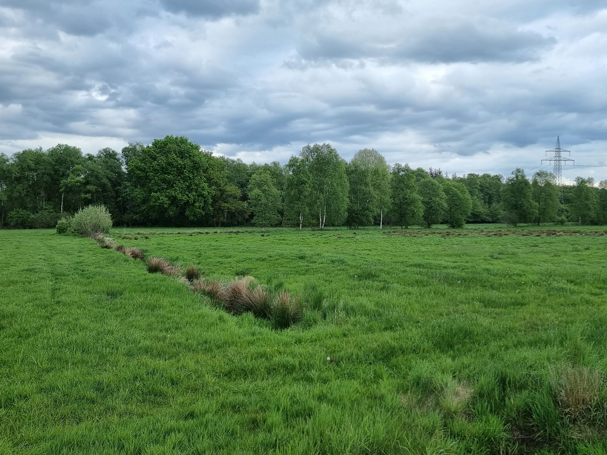
Within the reserve, the visual character shifts between open, drained peatland patches and areas of birch woodland. The form of the surviving bog suggests fragments of the original raised bog surface, intersected by dark peat cuts and pools that fill deeper holes left by centuries of turf extraction. Toward the edges, particularly in the north and south, the landscape softens into moist grassland, providing a smoother transition to the surrounding agricultural fields.
Westliches Borchelsmoor ecosystems, habitats, and plant life
The natural character of the reserve is built around the surviving vegetation of what was once a much larger raised bog. Although the wetland has been heavily modified, restoration aims to recover typical raised bog communities. Wherever the peat remains wetter, characteristic bog vegetation has a chance to develop, including the hummocks and hollows, known as Bult-Schlenken structures, that define intact raised bog surfaces.
A more visible component of the site is the birch-dominated woodland. Both subcontinental birch mire forests and birch carr occupy parts of the terrain, occupying the wetter hollows and the older peat cuttings. In more open spaces, Molinia grass (Pfeifengras) dominates, a tall, tussock-forming grass typical of degraded but still acidic peatlands.
In the wider reserve, the adjacent Glindbusch area to the northwest shares the same habitat palette, increasing the effective size of the protected bog-wet woodland complex.
Westliches Borchelsmoor conservation status and protection priorities
Westliches Borchelsmoor is part of the Natura 2000 conservation network as a component of the larger FFH area "Wiestetal, Glindbusch, Borchelsmoor." Its protected status is intended to preserve the remaining raised bog fragments in a landscape that is otherwise dominated by agriculture and peatland drainage. The reserve is classified under the German nature reserve ("Naturschutzgebiet") category, with the responsible lower nature protection authority being the district of Rotenburg (Wümme).
The conservation focus is strongly tied to hydrology. By interrupting or slowing the drainage channels that historically pulled water off the peatland, managers aim to raise the water table close to or even above the bog surface. This wetter condition is essential for the recovery of peat-forming vegetation and for the long-term re-establishment of bog-specific habitats.
Top sights and standout views in Westliches Borchelsmoor
The reserve's most distinctive feature is its identity as a remnant of the Borchelsmoor, an extensive historical raised bog of which only a fraction survives today. The combination of birch woodland, peat-cut remnants, and a rewetting program makes the site an example of ongoing peatland restoration.
Within the wider regional context, Westliches Borchelsmoor expands the protected wetland system northwest of Rotenburg (Wümme), complementing the adjacent Glindbusch reserve and contributing to the FFH site "Wiestetal, Glindbusch, Borchelsmoor."
Best time to visit Westliches Borchelsmoor
The reserve is at its most atmospheric in the warmer months, when open peatland vegetation such as Molinia grass greens up and bog pools are most visible. Late spring and summer also tend to be the best period for observing the mix of bog woodland and wet grassland communities. Because the bog terrain remains wet and soft even in summer, even in warmer months any visit should remain on established paths to avoid damaging recovering peatland surfaces.