

Mori Atlas logo
Natural monumentYagul

Analyzing the topographic features, ancient hill settlements, and valley boundaries of this protected area.

Yagul Natural Monument: A Protected Cultural and Geographic Landscape in Oaxaca, Mexico

(Zona Arqueológica de Yagul)

Yagul serves as a significant natural monument where fortified archaeological structures meet the semi-arid, rolling hills of the Tlacolula valley. This protected landscape preserves a rare synthesis of Zapotec architecture and diverse valley terrain, offering a clear view into the regional geography of Oaxaca. Through structured map data, one can examine the engineered platforms, surrounding ridges, and the spatial relationship between this ancient center and the broader prehistoric cave systems of the Central Valleys.

archaeological siteZapotec heritageMixtec heritagefortified hilltoppainted tombscultural landscape
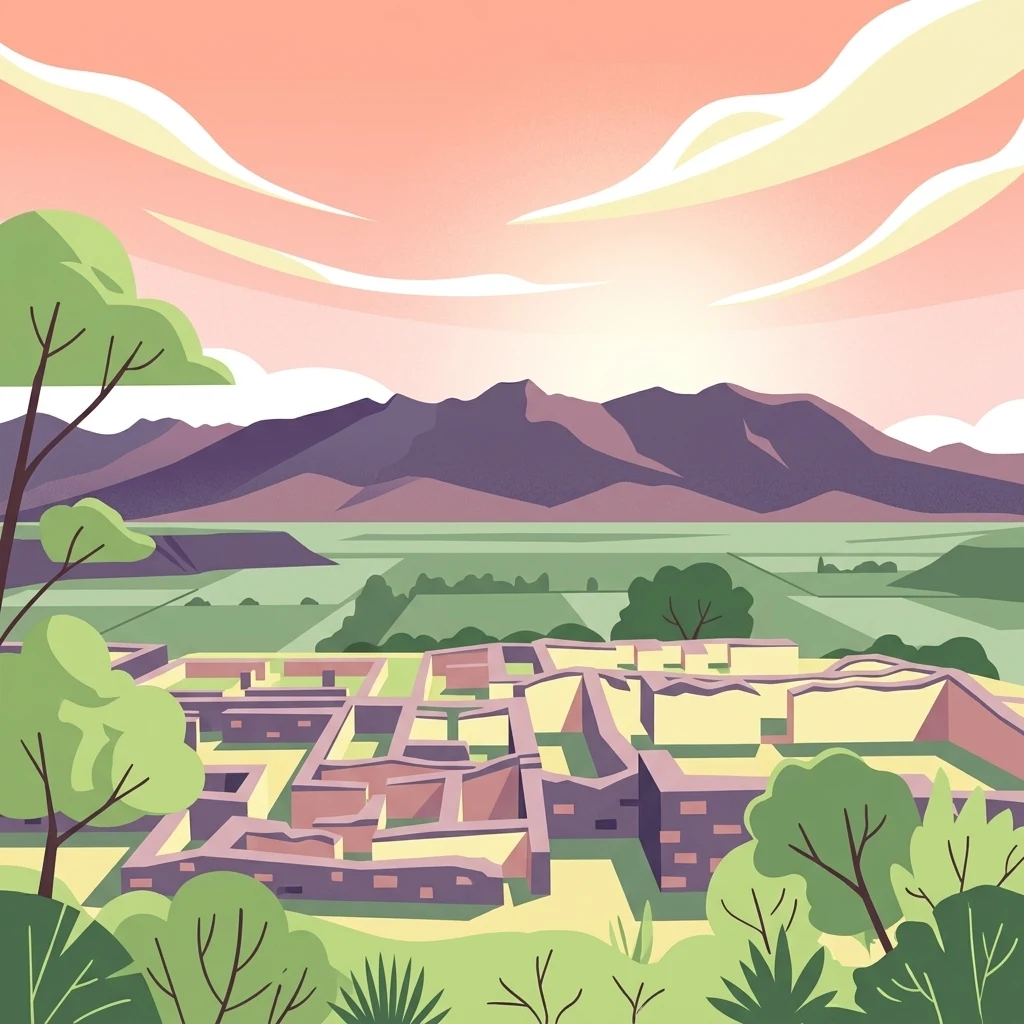
A colorful digital illustration showing stone ruins of an ancient archaeological complex in the foreground, with flat green fields and purple mountains under a soft pink sunset sky in the background.

Yagul

Natural monument

Park overview

Structured park overview, official facts, and landscape profile for Yagul

Yagul park facts, protected area profile, and essential visitor context

Review the core facts for Yagul, including designation, size, terrain, visitor scale, habitats, and operating context in one park-focused overview.

About Yagul

Yagul occupies a commanding position in the Tlacolula valley, a fertile arm of the Central Valleys of Oaxaca that has been a center of human settlement for thousands of years. The archaeological zone is built atop a large artificial platform, a deliberate engineering choice that combined defensive advantage with ceremonial prominence. From this elevated base, the settlement controlled a stretch of valley that had long been a corridor of exchange and agriculture in southern Mexico.

The site's longest period of importance came during the late classic and early postclassic eras of Mesoamerican chronology, when it functioned as a major Zapotec center. Its plazas, residential palaces, and ceremonial buildings reflect the architectural traditions of the Oaxaca valley, with carved stone reliefs integrated into stairways, walls, and freestanding monuments. At the same time, the funerary complex of Yagul distinguishes the site from many of its contemporaries. A series of tombs cut into the bedrock preserves traces of red pigment, geometric painted designs, and stucco finishes, providing a rare window into pre-Hispanic mural and decorative traditions.

Yagul was not only a ceremonial nucleus; it was also lived in. Residential architecture within the site retains evidence of plastered floors and walls painted with red ochre, suggesting that color was a deliberate part of the lived environment, not only of ritual space. Later in its history, after the fall of Monte Albán as the dominant Zapotec capital, Yagul entered a phase of Mixtec occupation, and its spaces were reused and reinterpreted by new groups who left their own cultural traces.

The broader significance of Yagul expanded in 2010, when the prehistoric caves scattered across the surrounding landscape, including the well-known Guila Naquitz cave, were brought together with the archaeological city of Yagul and the better-known site of Mitla under a single UNESCO World Heritage inscription. This framing treats Yagul not just as an isolated ruin, but as the urban centerpiece of a wider cultural landscape shaped by caves, agricultural terraces, and millennia of human activity. The surrounding Monumento Natural Yagul adds an ecological dimension, protecting valley habitats that still host a substantial share of the region's plant and animal diversity.

Quick facts and research context for Yagul

Yagul lies in the state of Oaxaca, Mexico, within the Tlacolula arm of the Central Valleys. The archaeological zone is built on an artificial platform overlooking the valley, and the surrounding area is designated as a Mexican natural monument, giving the place both cultural and environmental protection status.

The site is one of the major late-classic and early-postclassic centers of the Zapotec cultural tradition, with subsequent Mixtec presence. It was inscribed on the UNESCO World Heritage List in 2010 as part of the "Prehistoric Caves of Yagul and Mitla in the Central Valleys of Oaxaca" cultural landscape.

Protection and recognition

Documented establishment chronology and international recognition records for Yagul

Yagul Protection Status and Designated Terrestrial Conservation History

Yagul maintains a documented terrestrial protection status established in 2010 through official conservation records. Comprehensive designation histories and management scope parameters provide clear reference data for territorial analysis.

Protection details

Protection scope
Terrestrial
Designated year
2010
Transboundary protection
No
Park context

Deeper park guide and search-rich context for Yagul

Yagul history, landscape, wildlife, and travel context

Explore Yagul through its history, landscape character, ecosystems, wildlife, conservation priorities, cultural context, and seasonal travel timing in a structured park guide built for atlas discovery and search intent.

Why Yagul stands out

Yagul is best known for its fortified hilltop setting, its monumental carved-stone architecture, and its painted funerary tombs, including the elaborately decorated Tomb 30. Together these features make it one of the defining ceremonial and residential centers of the late Zapotec world in Oaxaca. The site is also recognized as part of one of the region's most notable cultural-landscape ensembles, where an ancient archaeological city coexists with nearby prehistoric cave sites that preserve some of the earliest evidence of plant domestication in the Americas.
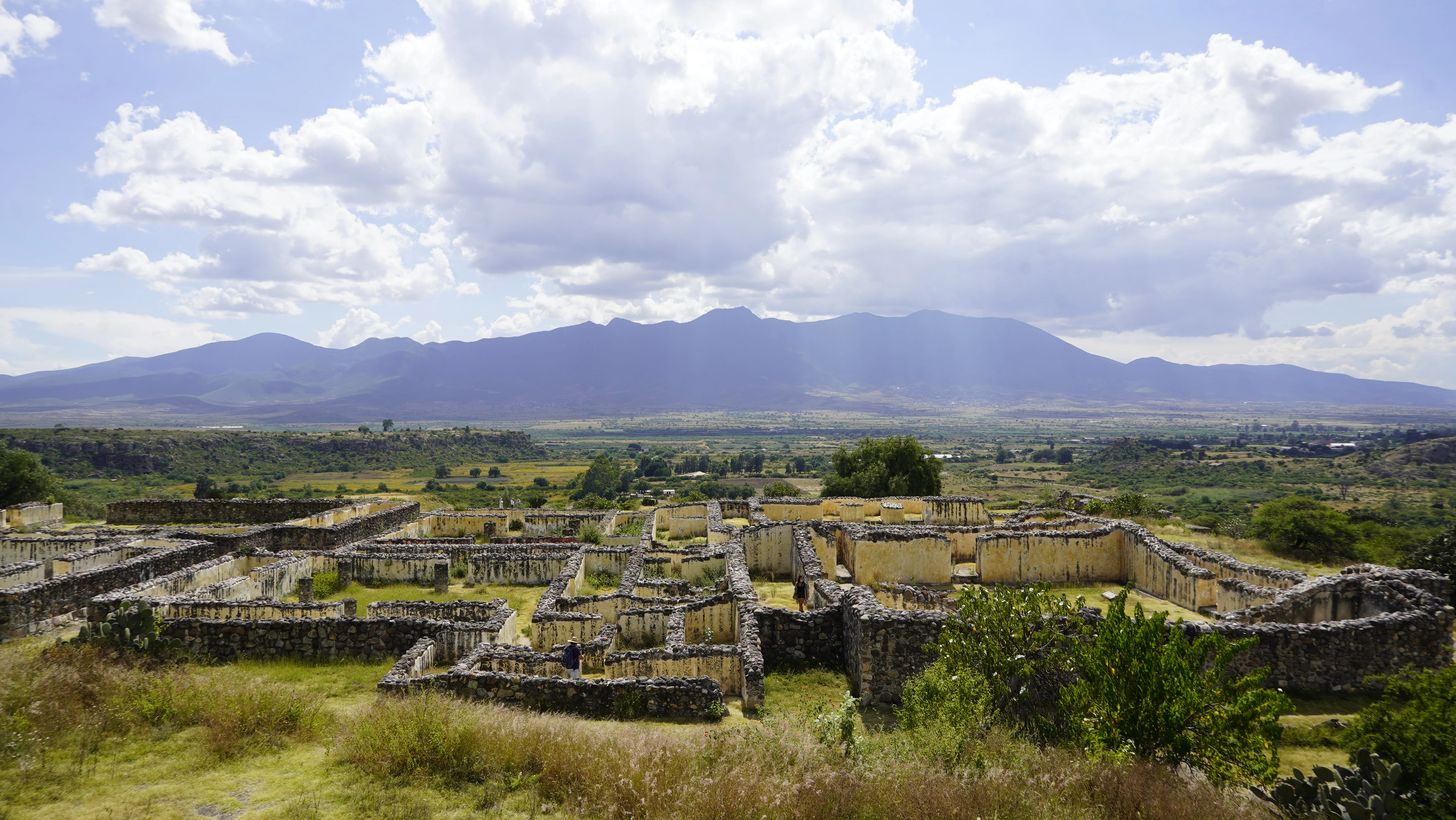
A wide angle landscape view of ancient Zapotec stone wall ruins and building foundations in the foreground, with an expansive valley and large mountains in the background under a blue sky with scattered clouds.
The stone ruins of the Yagul archaeological site in the Tlacolula Valley, set against a mountainous horizon.

Yagul history and protected-area timeline

Yagul's occupation history reaches far back into prehistory. The nearby Caballito Blanco area shows some of the earliest indications of human presence in the Oaxaca valley, and the wider landscape includes cave sites such as Guila Naquitz, which have yielded evidence of early plant domestication in the Americas. These deep-time layers of human activity form the prehistoric foundation on which later monumental Yagul was constructed.

During the late classic period, Yagul grew into a major Zapotec center, especially after the decline of Monte Albán. Its hilltop platform, fortifications, and palatial architecture reflect this era of regional reorganization, when rival city-states competed for control of the valleys. Tombs cut into the bedrock beneath the site, including the famous Tomb 30, were decorated with painted designs and stucco work that align Yagul with the broader tradition of Zapotec funerary art.

In the postclassic period, following further shifts in regional power, Yagul came under Mixtec influence. New occupants reused and adapted existing structures, leaving a layered cultural record in which Zapotec foundations and Mixtec additions coexist in the same architectural spaces. This dual heritage makes Yagul an unusually complete record of two successive cultural traditions within a single urban footprint.

The modern history of the site began with its identification, excavation, and study by Mexican archaeologists, including contributions from Ignacio Bernal and Lorenzo Gamio in the 1970s. From 1990 onward, the project "La pintura mural prehispánica en México" of the Instituto de Investigaciones Estéticas at UNAM has systematically documented the remaining mural evidence at Yagul. By 2010, UNESCO formally recognized Yagul and its surrounding prehistoric caves, along with Mitla, as a World Heritage Site, anchoring the place within both national and international heritage frameworks.

Yagul landscape and geographic character

Yagul sits within the Tlacolula valley, one of the three principal arms of the Central Valleys of Oaxaca. The terrain is semi-arid yet fertile, defined by gently rolling hills, sedimentary ridges, and broad alluvial floors that have supported agriculture since prehistoric times. This combination of valley plain and surrounding uplands gave ancient communities a productive base while also providing defensible ground for fortified centers such as Yagul itself.

The site's defining topographic feature is the large artificial platform on which its principal architecture rests. This engineered terrace reshaped the natural hillside into a level stage for plazas, palaces, and ceremonial spaces, and it visually dominates the surrounding valley. From the platform, the views extend across patterned agricultural land toward the valley's edges and the distant mountain horizons.

The landscape around Yagul is also marked by caves and rock shelters scattered through the hillsides. Some of these, like Guila Naquitz, are internationally significant for the archaeological deposits they preserve. The interplay between open valley land, cave-rich uplands, and the central fortified hill is what gives the Yagul cultural landscape its distinctive character.

Yagul ecosystems, habitats, and plant life

Beyond its archaeological importance, the area around Yagul is recognized for its ecological value. It is designated as Monumento Natural Yagul, a Mexican natural monument category that protects landscapes with notable biodiversity alongside their cultural features. This dual designation reflects the fact that the Oaxaca valleys harbor a rich mix of plant communities, including dry forest, scrubland, and cultivated vegetation, interspersed across relatively short distances.

Mexican biodiversity records compiled through CONABIO indicate that the protected natural monument area around Yagul supports a substantial number of plant and animal species, many of which are characteristic of the semi-arid valleys of southern Mexico. The combination of valley floor, slopes, and rocky outcrops creates microhabitats that sustain both resident species and seasonal migrants.

This ecological setting is also what sustains the traditional agricultural landscape around Yagul, where fields, terraces, and managed vegetation continue to coexist with patches of wild habitat. The resulting mosaic is part of the reason the area was recognized as a cultural landscape worthy of international protection.

Yagul wildlife and species highlights

Recorded biodiversity within the Monumento Natural Yagul includes more than 400 species of plants and animals, a reflection of the varied habitats packed into this section of the Tlacolula valley. Some of these species fall within Mexican categories of conservation concern under NOM-059, while others are exotic species that reflect long-term human influence on the valley's flora and fauna.

The valley's typical wildlife includes small mammals, reptiles, and birds adapted to semi-arid conditions, alongside pollinating insects and other invertebrates that thrive in mixed agricultural and wild vegetation. The nearby caves and rocky outcrops also provide refuge for bat species and other cave-associated fauna, building on the broader zoological significance of the Central Valleys region.

Yagul conservation status and protection priorities

Yagul benefits from layered protection. As an officially recognized archaeological zone, it is safeguarded by Mexican federal cultural-heritage authorities, while the surrounding landscape carries protection as Monumento Natural Yagul, a natural-monument designation that preserves biodiversity alongside cultural values.

In 2010, this combination of natural and cultural assets received international recognition when UNESCO inscribed "Cuevas Prehistóricas de Yagul y Mitla en los Valles Centrales de Oaxaca" as a World Heritage Site. The inscription frames conservation in unusually broad terms: it acknowledges not just a single monument, but a network of caves, archaeological sites, and cultivated land whose interrelationship defines a cultural landscape of regional and global importance.

The fact that many of the prehistoric sites associated with Yagul lie beneath meters of sediment has made their long-term preservation especially important. Recognition through both Mexican and international frameworks has helped channel research, monitoring, and protection efforts toward this fragile combination of buried prehistoric evidence and exposed archaeological architecture.

Yagul cultural meaning and human context

Yagul is deeply embedded in the cultural identity of Oaxaca. The Zapotec and Mixtec civilizations that successively shaped the site are foundational to the region's heritage, and their descendants continue to live in communities throughout the Central Valleys. The site's painted tombs, carved reliefs, and reused architecture are part of a broader valley-wide tradition that also includes nearby Mitla and the historic Zapotec capital of Monte Albán.

Traditional land use also plays a cultural role in the Yagul landscape. Agricultural fields, milpa cycles, and local gathering practices continue to shape the valley, and this sustained human presence is precisely what UNESCO recognized when it inscribed the area as a living cultural landscape rather than a static archaeological monument.

Top sights and standout views in Yagul

Yagul combines a fortified late-classic Zapotec capital with one of the most important concentrations of painted tombs in Oaxaca, including the celebrated Tomb 30. Its elevated, engineered platform gives the site an unusually complete architectural ensemble within a relatively compact footprint, and its layers of Zapotec and Mixtec occupation make it a textbook case of cultural succession in Mesoamerica.

What truly sets Yagul apart, however, is its place within the UNESCO cultural landscape that links it to Mitla and to prehistoric caves bearing evidence of early plant domestication. Few places in the Americas make it possible to move, within a single short drive, from a great ceremonial city to the caves where the agricultural foundations of the continent first took shape.

Best time to visit Yagul

The Central Valleys of Oaxaca enjoy a mild climate for much of the year, with warm days and cool nights typical of the dry season from roughly late autumn through early spring. This period is generally the most comfortable for exploring open-air archaeological sites such as Yagul, when skies tend to be clearer and valley temperatures more moderate.

The rainy season, generally running through the summer months, transforms the surrounding agricultural landscape into a greener setting and can produce dramatic skies over the valley, though afternoon storms and muddy paths are more likely. Travelers interested primarily in photography, painted-tomb visits, or combining Yagul with other Central Valleys sites generally find the cooler, drier months most rewarding.
Monthly climate preview

Trace annual temperature ranges and monthly precipitation patterns across measured coordinates in Oaxaca

Yagul Climate Normals and Long-Term Weather by Month

Long-term climatology data records measured average temperatures and monthly precipitation rhythms across representative coordinates in Yagul. Detailed monthly records supply complete temperature extremes and rainfall distributions for comprehensive geographical analysis.
Annual mean17 °C
14 °C21 °C
Jan14°
Feb16°
Mar19°
Apr21°
May21°
Jun19°
Jul18°
Aug18°
Sep18°
Oct17°
Nov15°
Dec14°
Warmest month
May

20.9 °C

Coolest month
January

14.2 °C

Wettest month
September

7.8 mm/day

Driest month
March

0.5 mm/day

Park location guide

Geography guide, regional context, and park location map for Yagul

Yagul park geography, regions, and map view in Mexico

Understand where Yagul sits in Mexico through a broader geographic reading of the surrounding landscape, nearby location context, and its mapped position within the national park landscape.

How Yagul fits into Mexico

Mexico, officially the United Mexican States, is a country in North America spanning the Sierra Madre mountain ranges, coastal plains, and tropical regions. It borders the United States to the north, Guatemala and Belize to the southeast, and has coastlines along the Pacific Ocean, Gulf of Mexico, and Caribbean Sea. With a population exceeding 130 million, Mexico is home to one of the world's most significant concentrations of Indigenous languages alongside Spanish.

Wider geography shaping Yagul in Mexico

Mexico occupies a land area of 1,972,550 km2, making it the thirteenth-largest country in the world. The terrain is highly diverse, featuring the Sierra Madre Occidental and Sierra Madre Oriental mountain ranges, the Mexican Plateau, coastal lowlands along the Pacific and Gulf/Caribbean margins, and the Yucatan Peninsula. The country spans multiple climate zones from desert in the north to tropical rainforest in the south.

Map view of Yagul

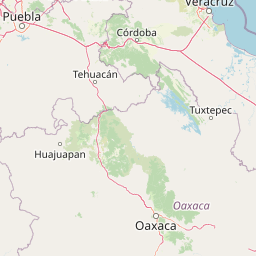
Use this park location map to pinpoint Yagul in Mexico, understand its exact geographic position, and read its mapped placement within the surrounding landscape more clearly.

Pigeon | © OpenStreetMap contributors

Location context for Yagul

Oaxaca

Visualizing the terrain, architectural ruins, and valley environment of Yagul

Yagul Photos and Protected Landscape Scenery in Oaxaca

Examine detailed Yagul photos and protected area imagery to understand the fortified hilltop setting, carved stone structures, and semi-arid valley terrain. Visual records reveal the topography and conservation context that define the ancient Zapotec capital within the Central Valleys of Oaxaca.

A wide angle landscape view of ancient Zapotec stone wall ruins and building foundations in the foreground, with an expansive valley and large mountains in the background under a blue sky with scattered clouds.

Park atlas

Compare surrounding regional geography and connected protected areas

Other Parks Near Yagul and Related Protected Landscapes to Explore Next

Browse nearby national parks and protected areas sharing the valley terrain and cultural landscape context of Yagul. Extending the geographic comparison reveals broader ecological patterns and neighboring archaeological reserves across the surrounding region.
National parkOaxaca
About 39 km away#1 closest

Northwest

Benito Juárez National Park: A Protected Landscape within Oaxaca's Regional Geography

Discover its mapped boundaries and national park atlas context

Benito Juárez National Park offers a vital focal point for understanding protected landscapes and regional geography in Oaxaca. This entry details the park's designated protected area status and its position within Mexico's mapped natural terrain. Explore the geographic context and atlas value of this national park, providing a foundation for structured discovery of its natural features and boundaries.

Area
27.37 km²
Established
1937
IUCN
II
Relief
Mountain
National parkOaxaca
About 140 km away#2 closest

South

Huatulco National Park: Oaxaca's Key National Park Protected Landscape

Explore its mapped boundaries and regional geography.

Delve into the protected landscape identity of Huatulco National Park, situated within the rich geography of Oaxaca, Mexico. This detail page provides critical atlas-level information, focusing on the park's mapped boundaries and its contribution to the regional conservation landscape. Understand the foundational geographic context that defines this significant national park, essential for any exploration of Mexico's protected areas.

Area
118.9 km²
Established
1998
IUCN
II
Relief
Mixed relief
National parkOaxaca
About 172 km away#3 closest

Southwest

Lagunas de Chacahua National Park: Protected Landscape and Oaxaca Regional Geography

Explore its mapped boundaries and natural terrain.

Lagunas de Chacahua National Park serves as a vital protected landscape within Oaxaca, Mexico. This dedicated entry provides an atlas-focused view of the park's geographic scope, highlighting its mapped boundaries and the surrounding regional terrain. Understand its significance as a protected area and its contribution to the natural landscape of Oaxaca, offering a detailed geographic context for discovery.

Area
132.73 km²
Established
1937
IUCN
II
Access
Moderate access
A watercolor painting showing a soft green wetland with calm water, grassy shorelines, and distant rolling hills in pale pink and green hues.
Protected areaVeracruz
About 198 km away#4 closest

North

Alvarado Lagoon System: Mapping the Protected Coastal Wetlands of Veracruz, Mexico

An essential reference for Gulf Coastal Plain wetland geography

The Alvarado Lagoon System acts as a major estuarine node within the southern Gulf Coastal Plain. This protected area connects the Papaloapan River watershed to the Gulf of Mexico through an intricate network of lagoons, mangrove forests, and coastal dunes, providing a vital window into the regional landscape of Veracruz.

Area
2,670.1 km²
Established
2004
Relief
Lowland
Climate
Tropical
National parkVeracruz
About 220 km away#5 closest

North

Cañón del Río Blanco National Park: Explore Its Mapped Protected Area and Regional Geography

Discover the geographic context and protected landscape of this national park.

Cañón del Río Blanco National Park offers a distinct protected-area identity within the geography of Veracruz. This canonical page focuses on the park's mapped boundaries and its significance as a national park. Use this resource for structured exploration of its protected landscape and regional setting, enhancing your understanding of Mexican protected areas.

Area
488 km²
Established
1938
IUCN
II
Relief
Mountain
National parkMexico
About 245 km away#6 closest

North

Pico de Orizaba National Park: Mexico's Key National Park for Atlas Exploration

Discover mapped boundaries and regional geographic context.

Access detailed atlas information for Pico de Orizaba National Park, a protected natural area in Mexico. This entry focuses on its geographic scope, mapped landscape features, and its significance as a national park within the region. Explore the park's protected boundaries and understand its place in the broader geographical context of Mexico.

IUCN
II
National parkMexico
About 256 km away#7 closest

North

Sistema Arrecifal Veracruzano National Marine Park: Mexico's Coastal National Park

Explore mapped boundaries and regional protected landscape.

Delve into the protected landscape of Sistema Arrecifal Veracruzano National Marine Park, a vital national park situated off the coast of Mexico. This page provides detailed insights into its mapped boundaries and geographic context, crucial for understanding the distribution of protected marine areas within the region. It serves as a gateway to appreciating the park's specific contribution to Mexico's conservation efforts and its place in broader geographic atlases.

IUCN
VI
Scope
Marine
Water
Water-dominated
Protected areaVeracruz
About 276 km away#8 closest

North

Cascada de Texolo Protected Landscape: Geographic Profile and Waterfall Map Context

Veracruz highlands forest and ravine ecosystem.

Cascada de Texolo represents a protected forest and stream corridor in the Veracruz highlands of Mexico. Recognized as a Ramsar wetland, the site features a dramatic waterfall dropping into a dense ravine, surrounded by humid montane forest. This map-focused profile examines the landscape structure, stream networks, and the integration of the gorge into the regional geography of Xico and Xalapa.

Established
2006
Relief
Upland
Access
Access unknown
Scope
Terrestrial

Common questions about visiting, size, designation, and location context for Yagul

Yagul FAQs for park facts, access, geography, and protected area context

Find quick answers about Yagul, including protected-area facts, park geography, trail and visitor context, and how the park fits into its surrounding country and regional landscape.
MoriAtlas Explorer

Continue Your Protected Areas Search Across the Global Atlas

Deepen your exploration by continuing the structured search for national parks and protected areas worldwide. Utilize the comprehensive filtering capabilities to compare different conservation landscapes and refine your understanding of global park geography. Discover more about the distribution and characteristics of protected natural areas.

Global natural geography