Mori Atlas logo
National parkHuatulco National Park

Trace the geographic extent and protected area boundaries of this key national park.

Huatulco National Park: Mapped Protected Landscape and Regional Geography in Oaxaca

(Bahías de Huatulco National Park)

Huatulco National Park represents a significant protected natural landscape within the state of Oaxaca, Mexico. This canonical entry provides detailed geographic context, focusing on the park's mapped boundaries and its role within the regional terrain. Discover the foundational atlas information for this national park, essential for understanding its place in Mexico's protected areas network and broader geographical landscape.

national parkcoastal protected areaPacific coastOaxacamangrove foresttropical dry forest

Huatulco National Park

National park

Park overview

Structured park overview, official facts, and landscape profile for Huatulco National Park

Huatulco National Park park facts, protected area profile, and essential visitor context
Review the core facts for Huatulco National Park, including designation, size, terrain, visitor scale, habitats, and operating context in one park-focused overview.

About Huatulco National Park

Huatulco National Park lies along the Pacific coast of Oaxaca state in southern Mexico, within the municipality that bears its name. The protected area was originally declared a protected zone before being formally designated as a national park on July 24, 1998, creating institutional protection for a coastal landscape of exceptional scenic and ecological value. The park's territory extends from the shoreline areas near Cruz Huatulco westward, encompassing a complex geography that includes nine named bays, coastal plains, forested slopes, and the marine waters immediately offshore. The surrounding region has developed as a tourism destination, with the park's natural landscapes serving as a central attraction for visitors to the Huatulco area. The 2003 Ramsar Wetland designation under the name Cuencas y corales de la zona costera de Huatulco further elevated the international recognition of this coastal protected area, specifically acknowledging the importance of its watersheds and coral formations.

Quick facts and research context for Huatulco National Park

Huatulco National Park occupies roughly 11,890 hectares along the Pacific coast of Oaxaca, Mexico, near the town of Santa María Huatulco. The protected area encompasses nine bays and a combination of low tropical dry forest covering about 80 percent of the land area, with mangrove ecosystems along the coastal belt. The park was established in 1998 and received Ramsar Wetland designation in 2003, recognizing its coastal and coral habitat significance. The area supports exceptional biodiversity, including over 9,000 plant species, more than 700 bird species, and numerous marine mammals that inhabit the offshore waters.

Park context

Deeper park guide and search-rich context for Huatulco National Park

Huatulco National Park history, landscape, wildlife, and travel context
Explore Huatulco National Park through its history, landscape character, ecosystems, wildlife, conservation priorities, cultural context, and seasonal travel timing in a structured park guide built for atlas discovery and search intent.

Why Huatulco National Park stands out

Huatulco National Park is best known for its dramatic coastline featuring nine distinct bays, each offering different coastal landscapes and snorkeling opportunities. The park's mangrove forests represent a critical coastal ecosystem type, while its low tropical dry forest harbors remarkable plant diversity with some trees reaching heights of 15 meters. The marine environment supports populations of dolphins, whales, and sea turtles that can be observed from the shore or during boat excursions. The combination of coastal bays, terrestrial forests, and marine ecosystems within a single protected area makes this park particularly distinctive along Mexico's Pacific coast.

Huatulco National Park history and protected-area timeline

The protection of Huatulco's coastal landscape began as a recognition of the area's ecological and scenic value along Mexico's Pacific coast. Formal designation as a national park occurred on July 24, 1998, establishing the legal framework for protecting the terrestrial and coastal environments within the park's boundaries. The subsequent Ramsar Wetland designation on November 27, 2003, added international recognition of the coastal and marine ecosystems, with the park's reference number being 1321 within the Ramsar Convention's list of Wetlands of International Importance. This dual designation reflects both national park status and specific recognition of the wetland and marine habitat values.

Huatulco National Park landscape and geographic character

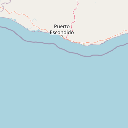
The physical landscape of Huatulco National Park is defined by its position along the Pacific coast, where the land descends from forested slopes directly into the sea. The park encompasses nine bays of varying sizes and characters, each offering different combinations of beach, cliff, and headland features. The terrestrial portion features low tropical dry forest as the dominant vegetation type, with the unusual characteristic of trees reaching heights of 15 meters, creating a relatively tall canopy for a dry forest environment. A coastal belt of mangrove vegetation occupies the transition zone between land and sea, stabilizing the shoreline and providing critical habitat for marine and terrestrial species. The overall terrain is characterized by moderate elevations that remain low enough to maintain tropical dry forest conditions rather than transitioning to higher-elevation forest types.

Huatulco National Park ecosystems, habitats, and plant life

The ecological character of Huatulco National Park reflects its location along Mexico's southern Pacific coast, where tropical conditions support remarkable plant diversity. The low tropical dry forest dominates approximately 80 percent of the park's terrestrial area, representing a habitat type that has become increasingly rare along the Pacific coast due to development pressure. The park's plant inventory includes approximately 9,000 species in the lowland areas, a figure that represents roughly half of all plant species recorded throughout Mexico, indicating exceptional botanical significance within a relatively limited area. The mangrove ecosystems along the coastal fringe represent a distinct habitat type, providing ecosystem services including shoreline stabilization, nutrient cycling, and nursery habitat for marine species. These coastal wetlands connect the terrestrial and marine environments, creating ecological continuity that supports the park's overall biodiversity.

Huatulco National Park wildlife and species highlights

The wildlife community within Huatulco National Park reflects the diversity of habitats present, spanning terrestrial forests, coastal wetlands, and marine environments. Terrestrial fauna surveys have identified 264 species, including mammals such as armadillos and white-tailed deer that inhabit the forest interior. The bird population is particularly noteworthy, with 701 species recorded within the park, including hummingbirds, pelicans, and hawks that utilize different habitat zones within the protected area. Reptile diversity includes 470 species, encompassing black iguanas, salamanders, and various snake species that occupy both forest and coastal environments. The marine environment supports additional wildlife populations, with dolphins, whales, and sea turtles regularly sighted in the waters offshore from the park's coastline. A total of 100 amphibian species has also been documented within the park's boundaries.

Huatulco National Park conservation status and protection priorities

Huatulco National Park represents an important conservation priority along Mexico's Pacific coast, combining protection of terrestrial forest ecosystems with coastal and marine environments. The dual designation as both a national park and a Ramsar Wetland reflects the comprehensive ecological values present, from inland forests to coral reef and coastal waters. The park protects a significant portion of the remaining low tropical dry forest in the region, a habitat type that has been reduced by agricultural expansion and development along the Pacific coast. The Ramsar designation specifically recognizes the importance of the coastal watersheds and coral ecosystems, ensuring international attention to the conservation of these marine and wetland habitats. The exceptional plant diversity, with nearly half of Mexico's plant species represented in a single protected area, demonstrates the ecological significance of maintaining protection for this coastal landscape.

Huatulco National Park cultural meaning and human context

The park is located within the Municipality of Santa María Huatulco, a region with historical ties to the indigenous communities of Oaxaca's Pacific coast. The name Huatulco derives from indigenous roots, reflecting the historical presence of local communities in this coastal area prior to European contact and continuing through the colonial period into the present day. The landscape surrounding the nine bays has been shaped by both natural processes and human activity over centuries, with traditional land uses contributing to the cultural landscape context. The modern tourism economy centered on Huatulco has developed in proximity to the protected area, creating both economic opportunities and conservation challenges as visitor numbers increase. The park's establishment in 1998 reflected a growing recognition of the need to balance development pressures with preservation of the region's natural heritage.

Top sights and standout views in Huatulco National Park

The nine bays of Huatulco National Park represent the park's most distinctive feature, each offering unique coastal scenery and recreational opportunities. The mangrove forests at the forest's edge provide critical habitat and can be explored through guided boat tours. The low tropical dry forest, with its surprisingly tall trees reaching 15 meters, creates a lush green environment that contrasts with the typical perception of dry forest as low and scrubby. Marine wildlife viewing, particularly the opportunity to observe dolphins, whales, and sea turtles in their natural habitat, draws visitors to the offshore waters. The exceptional bird diversity makes the park significant for ornithological observation, with species ranging from tiny hummingbirds to large pelicans and hawks.

Best time to visit Huatulco National Park

The optimal time to experience Huatulco National Park aligns with the dry season that typically runs from November through May, when rainfall is minimal and conditions are more predictable for outdoor exploration. The cooler months from December through February often offer more comfortable temperatures for hiking and wildlife observation within the forest. Whale watching opportunities are best from December through March when humpback whales migrate through the region. The wet season from June through October brings higher temperatures and more frequent rainfall, which can limit some activities but also contributes to the lush green appearance of the forest. Year-round warm temperatures characterize this Pacific coast location, making any season suitable for beach and water activities within the bay areas.

Park location guide

Geography guide, regional context, and park location map for Huatulco National Park

Huatulco National Park park geography, regions, and map view in Mexico
Understand where Huatulco National Park sits in Mexico through a broader geographic reading of the surrounding landscape, nearby location context, and its mapped position within the national park landscape.

How Huatulco National Park fits into Mexico

Mexico, officially the United Mexican States, is a country in North America spanning the Sierra Madre mountain ranges, coastal plains, and tropical regions. It borders the United States to the north, Guatemala and Belize to the southeast, and has coastlines along the Pacific Ocean, Gulf of Mexico, and Caribbean Sea. With a population exceeding 130 million, Mexico is home to one of the world's most significant concentrations of Indigenous languages alongside Spanish.

Wider geography shaping Huatulco National Park in Mexico

Mexico occupies a land area of 1,972,550 km2, making it the thirteenth-largest country in the world. The terrain is highly diverse, featuring the Sierra Madre Occidental and Sierra Madre Oriental mountain ranges, the Mexican Plateau, coastal lowlands along the Pacific and Gulf/Caribbean margins, and the Yucatan Peninsula. The country spans multiple climate zones from desert in the north to tropical rainforest in the south.

Map view of Huatulco National Park

Use this park location map to pinpoint Huatulco National Park in Mexico, understand its exact geographic position, and read its mapped placement within the surrounding landscape more clearly.

Pigeon | © OpenStreetMap contributors

Location context for Huatulco National Park

Oaxaca
Park atlas

Map the surrounding coastal geography and discover protected landscapes near Huatulco National Park, Oaxaca.

Explore Other National Parks and Protected Areas Near Huatulco National Park, Mexico
Continue your exploration from Huatulco National Park by browsing other national parks and protected areas located in Mexico's southern Pacific coastal region. Compare their unique ecological features, from tropical dry forests to mangrove systems, to understand the broader conservation landscape surrounding Oaxaca.
National parkOaxaca

Benito Juárez National Park: A Protected Landscape within Oaxaca's Regional Geography

Discover its mapped boundaries and national park atlas context

Benito Juárez National Park offers a vital focal point for understanding protected landscapes and regional geography in Oaxaca. This entry details the park's designated protected area status and its position within Mexico's mapped natural terrain. Explore the geographic context and atlas value of this national park, providing a foundation for structured discovery of its natural features and boundaries.

Area
27.37 km²
Established
1937
IUCN
II
Relief
Mountain
National parkVeracruz

Cañón del Río Blanco National Park: Explore Its Mapped Protected Area and Regional Geography

Discover the geographic context and protected landscape of this national park.

Cañón del Río Blanco National Park offers a distinct protected-area identity within the geography of Veracruz. This canonical page focuses on the park's mapped boundaries and its significance as a national park. Use this resource for structured exploration of its protected landscape and regional setting, enhancing your understanding of Mexican protected areas.

Area
488 km²
Established
1938
IUCN
II
Relief
Mountain
National parkGuerrero

General Juan N. Álvarez National Park: National Park Atlas and Geographic Context

Explore Mapped Boundaries and Protected Landscape Identity

General Juan N. Álvarez National Park offers a distinct protected landscape within Mexico's Guerrero region. This entry focuses on its identity as a national park, detailing its mapped geographic extent and conservation significance. Users can investigate the park's protected boundaries and its role within the regional geography, providing a foundation for atlas-based exploration of natural areas.

Area
5.28 km²
Established
1964
IUCN
II
Relief
Mountain
National parkMexico

Iztaccíhuatl, Popocatépetl National Park: Mexico's National Park Protected Area

Mapped boundaries and regional geographic context.

Iztaccíhuatl, Popocatépetl National Park is a protected natural landscape offering insight into Mexico's geography. This atlas entry focuses on the park's defined boundaries and its role within the national protected areas framework. Explore the unique geographic character and mapped extent of this significant park, understanding its position within the country's natural landscape atlas.

Area
398.19 km²
Established
1935
IUCN
II
Relief
Mountain
National parkMorelos

El Tepozteco National Park: Protected National Park in Morelos

Explore the mapped geography and protected landscape of this Mexican national park.

Delve into El Tepozteco National Park, a key protected area designated as a national park within the Morelos region of Mexico. This profile provides detailed insight into its mapped boundaries and its significance within the broader regional geography. It serves as a resource for understanding the park's protected landscape and its context for atlas-based geographic exploration.

Area
232.587 km²
Established
1937
IUCN
II
Relief
Mountain
National parkChiapas

Lagunas de Montebello National Park: Chiapas Protected Landscape Geography & Mapped Boundaries

Explore this national park's unique landscape context within Chiapas.

Lagunas de Montebello National Park offers a detailed view of protected landscape features and regional geographic context within Chiapas, Mexico. As a designated national park, its mapped boundaries are essential for understanding the distribution of protected areas and the natural terrain. This entity provides critical data for exploring the atlas of Mexican natural reserves and their specific environmental settings.

Area
64.11 km²
Established
1959
IUCN
II
Relief
Highland
National parkState of Mexico

Lagunas de Zempoala National Park: Protected Landscape and Geographic Atlas Entry

Explore mapped boundaries and natural terrain context.

Lagunas de Zempoala National Park is a dedicated protected area within the State of Mexico, serving as a vital point for understanding national park geography and landscape mapping. This entry provides foundational atlas data on its protected boundaries and its specific natural terrain. It is designed for users seeking structured information on the park's geographic scope and its importance as a mapped natural landscape for regional context.

Area
47.9 km²
Established
1936
IUCN
II
Relief
Mountain
National parkMexico

Cumbres del Ajusco National Park: Exploring Mexico's National Park Protected Landscape

Discover mapped boundaries and regional geography.

Cumbres del Ajusco National Park is an important national park offering rich opportunities for geographic exploration. This detailed profile focuses on its identity as a protected landscape within Mexico, providing essential context for map-based discovery. Understand the park's specific location, its mapped territory, and its role within the nation's network of conservation areas, facilitating a structured atlas view.

Area
9.2 km²
Established
1936
IUCN
II
Relief
Mountain

Common questions about visiting, size, designation, and location context for Huatulco National Park

Huatulco National Park FAQs for park facts, access, geography, and protected area context
Find quick answers about Huatulco National Park, including protected-area facts, park geography, trail and visitor context, and how the park fits into its surrounding country and regional landscape.
MoriAtlas Explorer

Continue Your Protected Areas Search Across the Global Atlas

Deepen your exploration by continuing the structured search for national parks and protected areas worldwide. Utilize the comprehensive filtering capabilities to compare different conservation landscapes and refine your understanding of global park geography. Discover more about the distribution and characteristics of protected natural areas.

Global natural geography