Mori Atlas logo
National parkLagunas de Montebello National Park

Discover mapped park boundaries and unique landscape context within Chiapas, Mexico.

Lagunas de Montebello National Park: Protected Landscape & Chiapas Regional Geography Atlas

(Parque Nacional Lagunas de Montebello)

Lagunas de Montebello National Park stands as a significant protected landscape within the dynamic geography of Chiapas, Mexico. This park's detailed map outlines its protected boundaries, offering a unique lens through which to understand the regional terrain and natural landscape context. Explore how this national park contributes to the broader atlas of protected areas in Mexico, providing critical geographic insight for dedicated discovery.

Lake SystemPine-Oak ForestsMaya RuinsRamsar SiteBiosphere ReserveHighland Wetlands

Lagunas de Montebello National Park

National park

Park overview

Structured park overview, official facts, and landscape profile for Lagunas de Montebello National Park

Lagunas de Montebello National Park park facts, protected area profile, and essential visitor context
Review the core facts for Lagunas de Montebello National Park, including designation, size, terrain, visitor scale, habitats, and operating context in one park-focused overview.

About Lagunas de Montebello National Park

Lagunas de Montebello National Park represents one of Chiapas most distinctive natural treasures, occupying a position on the marginal plains near the Guatemala border in the southeastern portion of the state. The park's defining feature is its extensive lake system, a cluster of 59 bodies of water collectively known as the Montebello Lakes, whose colors vary dramatically depending on their mineral composition and depth. This chromatic quality makes the lakes instantly recognizable and has made them a subject of both scientific interest and visitor fascination. The park was established in 1959 as the first national park in Chiapas, marking an early milestone in Mexico's protected area system for this biologically rich region. Over time, the park has accumulated additional designations that reflect its ecological importance, including UNESCO Biosphere Reserve status in 2009 and recognition as a Ramsar Wetland site in 2003. The park spans approximately 6,400 hectares, with a core zone of roughly 3,400 hectares receiving the highest level of protection. Visitors to the park can access around 15 of the lakes by vehicle or on foot, engaging in activities such as swimming, canoeing, and kayaking on the more accommodating bodies of water. The presence of the Chinkultic archaeological site within the park boundaries adds a significant cultural dimension, allowing visitors to experience pre-Columbian history amid the natural landscape. However, the park faces environmental challenges, including concerns about water quality degradation from untreated wastewater and agricultural runoff, and the complete drying of Metzabok Lake in 2019 due to drought conditions.

Quick facts and research context for Lagunas de Montebello National Park

The park sits at an elevation between 1,500 and 1,800 meters above sea level in the highlands of southeastern Chiapas, within the municipalities of La Trinitaria and La Independencia. It contains 59 lakes, approximately 15 of which are readily accessible to visitors, with Lago Tziscao being the largest. The park also shelters the pre-Columbian Maya archaeological site of Chinkultic, dating from the third century to the 13th century, featuring a notable asymmetrical ball court and carved stelae. The surrounding landscape supports Central American pine-oak forests and Mexican liquidambar trees, creating a visually rich setting where water, forest, and archaeological heritage converge.

Park context

Deeper park guide and search-rich context for Lagunas de Montebello National Park

Lagunas de Montebello National Park history, landscape, wildlife, and travel context
Explore Lagunas de Montebello National Park through its history, landscape character, ecosystems, wildlife, conservation priorities, cultural context, and seasonal travel timing in a structured park guide built for atlas discovery and search intent.

Why Lagunas de Montebello National Park stands out

Lagunas de Montebello is celebrated primarily for its extraordinary chain of multicolored lakes, a phenomenon rare among the world's protected areas. The lakes of the Lagunas de Colores group, including Encantada, Ensueño, Esmeralda, Agua Tinta, and Bosque Azul, exemplify this chromatic diversity. Beyond the lakes, the park offers a rare combination of natural and cultural attractions, including the partially excavated Maya ruins of Chinkultic with panoramic views from its main pyramid, the Acropolis. The presence of cenotes and the Grutas San Rafael del Arco limestone caves further distinguish this park from others in the region.

Lagunas de Montebello National Park history and protected-area timeline

Lagunas de Montebello National Park was established in 1959, making it the first national park in the state of Chiapas and one of the earlier protected areas in southeastern Mexico. Its creation reflected a growing recognition during the mid-20th century of the need to preserve unique natural landscapes that combined scenic beauty with ecological significance. The original designation focused on conserving the soils, forests, and lakes of the Montebello region while also developing the area as a tourism destination. Over the subsequent decades, the park's administrative framework evolved, with management responsibilities residing with Mexico's National Commission of Protected Areas. In 2003, the park received international recognition as a Ramsar Wetland site, acknowledging the significance of its lake systems within the broader context of wetland conservation. Further recognition came in 2009 when UNESCO designated the area as a Biosphere Reserve, reflecting its role in maintaining biodiversity and supporting sustainable development in the highland region of Chiapas. The Maya archaeological site of Chinkultic, located within the park boundaries, has been a subject of ongoing archaeological interest, with the site containing nearly 200 buildings including pyramids and a unique ball court whose hieroglyphic inscriptions date its dedication to May 591.

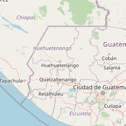
Lagunas de Montebello National Park landscape and geographic character

The landscape of Lagunas de Montebello is defined by its position on the high plains of Chiapas at elevations between 1,500 and 1,800 meters above sea level. The terrain exhibits the undulating topography characteristic of the highland region, with natural depressions that have given rise to the park's numerous lakes. These depressions vary in depth, with some lakes such as Balantetic and Esmeralda being relatively shallow at 3 and 7 meters respectively, while others including Pojoj and the Cinco Lagos group rank among the deepest in Mexico, reaching depths of up to 198 meters. The landscape supports Central American pine-oak forests, with prominent stands of Mexican liquidambar trees adding seasonal color to the lakeshores. Scattered throughout the park are cenotes and limestone caves, notably the Grutas San Rafael del Arco system, which can be explored on foot or horseback. The visual impact of the landscape is amplified by the striking colors of the lakes, a phenomenon arising from varying mineral concentrations that tint the waters in hues ranging from turquoise to purple.

Lagunas de Montebello National Park ecosystems, habitats, and plant life

The ecological character of Lagunas de Montebello is shaped by its position in the highlands of Chiapas, a region recognized for its biological diversity within Mesoamerica. The park's vegetation encompasses Central American pine-oak forests, with notable presence of Mexican liquidambar (Liquidambar styraciflua), a tree valued for its aromatic resin and attractive autumn coloration. The epiphytic vegetation that colonizes the forest canopy creates hanging gardens characteristic of humid highland environments. According to Mexico's National Biodiversity Information System, the park supports more than 2,315 species of plants and animals, with 185 species classified within some category of risk under Mexican environmental regulations and 24 exotic species recorded. The lake system itself represents a unique aquatic habitat within the region, with the varied depths and mineral compositions of the 59 lakes supporting different ecological communities. The Ramsar designation reflects the importance of these wetland systems for biodiversity conservation.

Lagunas de Montebello National Park wildlife and species highlights

The wildlife population in Lagunas de Montebello reflects the diverse habitats present in this highland area of Chiapas. Mammal species found in the park include white-tailed deer, armadillo, gray fox, anteater, and opossum, with larger predators such as puma and jaguar present in the region, though rarely encountered by visitors. The avian fauna is particularly notable, with both resident species and migratory birds present in the area. The resplendent quetzal, one of Mesoamerica's most iconic bird species, can be observed in the park's forests. Other bird species include wild duck, chachalaca, and various dove species. Reptile and amphibian populations are represented by turtles, several snake varieties, frogs, toads, and salamanders. The lakes support aquatic fauna and provide important habitat for waterfowl, particularly during migration seasons. However, conservation concerns have been raised about the impacts of environmental degradation on wildlife populations, particularly as water quality in some lakes has declined due to pollution and drought.

Lagunas de Montebello National Park conservation status and protection priorities

Lagunas de Montebello holds significant conservation value at both national and international levels, evidenced by its multiple protected area designations. As a national park with IUCN category II classification, the park receives formal protection under Mexico's protected areas framework. The 2003 Ramsar designation recognizes the international importance of the park's wetland systems, committing Mexico to their conservation under the Ramsar Convention on Wetlands. The 2009 UNESCO Biosphere Reserve designation further elevates the park's conservation status, integrating it into a global network of sites recognized for their ecological significance and contribution to biodiversity preservation. The core zone of approximately 3,400 hectares receives the highest protection level. However, the park faces serious conservation challenges, including deterioration of water quality in several lakes due to untreated wastewater from Comitán and agricultural runoff containing toxic agrochemicals. The complete drying of Metzabok Lake in 2019 demonstrates the vulnerability of these lake systems to drought and climate change, prompting scientific concern about the long-term fate of the lakes' distinctive colors.

Lagunas de Montebello National Park cultural meaning and human context

The cultural dimension of Lagunas de Montebello is anchored primarily in the presence of the Chinkultic archaeological site within the park boundaries. This pre-Columbian Maya city dates from the third century and was abandoned around the 13th century, leaving behind approximately 200 structures including pyramids, residential buildings, and a distinctive asymmetrical ball court. The hieroglyphic inscriptions on the ball court indicate it was dedicated in May 591, providing a concrete historical anchor for the site's occupation. The ruins are not fully excavated, with many structures still concealed beneath vegetation, and the Acropolis pyramid offers visitors sweeping views of the multicolored lakes below. The region has historical connections to both sides of the modern Mexico-Guatemala border, with the adjacent Guatemalan territory sometimes referring to the area as Laguna Brava. This borderland location has shaped the human geography of the region, though the park itself is focused primarily on natural conservation rather than ongoing indigenous community presence.

Top sights and standout views in Lagunas de Montebello National Park

The multicolored lakes remain the park's most compelling highlight, with approximately 15 lakes easily accessible for visitation and activities such as swimming, canoeing, and kayaking. The Lagunas de Colores group offers particularly vivid examples of the lake system's chromatic range. The Maya ruins of Chinkultic provide a rare combination of natural beauty and archaeological significance, with the Acropolis pyramid commanding panoramic views over the lake landscape. The Grutas San Rafael del Arco caves and cenotes offer additional subterranean exploration opportunities. The highland forest environment, with its pine, oak, and liquidambar trees, provides a distinctive setting different from the better-known lowland rainforests of Chiapas. The proximity to Guatemala adds a regional tourism dimension, with San Cristóbal de las Casas and Comitán serving as nearby gateways.

Best time to visit Lagunas de Montebello National Park

The park experiences a temperate climate with year-round rainfall, with an average temperature of 18°C. The most comfortable visiting conditions generally occur during the dry season from November through April, when visitor access to trails and lakes is less hindered by rainfall and the landscape remains accessible. The winter months bring morning mists that create atmospheric conditions over the lakes, though heavy fog can limit visibility. The summer rainy season from May through October brings more frequent precipitation but also greener vegetation and fuller water levels in some lakes. Visitors seeking to avoid peak crowds may find the shoulder seasons more comfortable, though the park's tourism infrastructure is less developed than more famous Mexican destinations, moderating visitor numbers throughout the year.

Park location guide

Geography guide, regional context, and park location map for Lagunas de Montebello National Park

Lagunas de Montebello National Park park geography, regions, and map view in Mexico
Understand where Lagunas de Montebello National Park sits in Mexico through a broader geographic reading of the surrounding landscape, nearby location context, and its mapped position within the national park landscape.

How Lagunas de Montebello National Park fits into Mexico

Mexico, officially the United Mexican States, is a country in North America spanning the Sierra Madre mountain ranges, coastal plains, and tropical regions. It borders the United States to the north, Guatemala and Belize to the southeast, and has coastlines along the Pacific Ocean, Gulf of Mexico, and Caribbean Sea. With a population exceeding 130 million, Mexico is home to one of the world's most significant concentrations of Indigenous languages alongside Spanish.

Wider geography shaping Lagunas de Montebello National Park in Mexico

Mexico occupies a land area of 1,972,550 km2, making it the thirteenth-largest country in the world. The terrain is highly diverse, featuring the Sierra Madre Occidental and Sierra Madre Oriental mountain ranges, the Mexican Plateau, coastal lowlands along the Pacific and Gulf/Caribbean margins, and the Yucatan Peninsula. The country spans multiple climate zones from desert in the north to tropical rainforest in the south.

Map view of Lagunas de Montebello National Park

Use this park location map to pinpoint Lagunas de Montebello National Park in Mexico, understand its exact geographic position, and read its mapped placement within the surrounding landscape more clearly.

Pigeon | © OpenStreetMap contributors

Location context for Lagunas de Montebello National Park

Chiapas
Park atlas

Compare the diverse protected areas and regional park geography spanning Chiapas, Mexico, extending discovery beyond Lagunas de Montebello National Park.

Discover Other National Parks and Protected Areas Near Lagunas de Montebello National Park
Explore a curated list of national parks and protected areas located in the Chiapas region of Mexico, offering diverse landscapes from highland wetlands and pine-oak forests to significant archaeological sites. Comparing these entities alongside Lagunas de Montebello National Park provides valuable geographic context for understanding regional conservation efforts and distinct natural features.
National parkPetén

El Rosario National Park: Protected National Park & Mapped Landscape Explorer

Geographic context and protected area boundaries within Petén.

Delve into the protected landscape of El Rosario National Park, identified as a national park within Guatemala's Petén region. This page provides an atlas-centric view, highlighting its mapped park boundaries and its significance in the regional geography. Understand the park as a distinct protected area contributing to the natural landscape context, ideal for geographic exploration and detailed mapping.

Area
11.05 km²
Established
1980
IUCN
II
Relief
Lowland
National parkToledo District

Sarstoon-Temash National Park: National Park Geography and Mapped Boundaries

Explore the protected landscape of Toledo District.

Sarstoon-Temash National Park is a key protected area located in Belize's Toledo District. As a national park, it offers distinct geographic features and mapped boundaries that are crucial for understanding regional conservation landscapes. This entry provides detailed context on its protected status and geographic setting, enabling a more profound atlas-based exploration of the natural terrain and its significance.

Area
165.92 km²
Established
1994
IUCN
II
Relief
Lowland
National parkCayo District

Elijio Panti National Park: Protected Landscape and Regional Geography in Cayo District

Explore the mapped boundaries and geographic features of this national park.

Elijio Panti National Park offers a unique focus on protected landscape discovery within Belize. Situated in the Cayo District, this national park provides a specific geographic anchor for understanding natural terrain and mapped boundaries. The page details its identity as a protected area, contributing to a structured atlas of conservation lands and regional geography.

Area
52.645 km²
Established
2001
IUCN
II
Relief
Mountain
National parkCayo District

Chiquibul National Park: Detailed Protected Area and National Park Geography

Explore mapped boundaries within Belize's Cayo District.

Chiquibul National Park offers a critical lens through which to view Belize's protected natural areas. As a designated national park located in the Cayo District, it provides essential data for understanding the extent and geographic positioning of conservation landscapes. Users can engage with detailed map information to trace the park's borders and appreciate its role within the national atlas of protected territories.

Area
1,073 km²
Established
1995
IUCN
II
Relief
Mountain
Stylized illustration of a mountain valley with waterfall, dense forest, and trees
National parkAhuachapán Department

El Imposible National Park: National Park Protected Landscape and Regional Geography Exploration

Atlas context and mapped boundaries for El Imposible National Park.

Delve into the protected landscape of El Imposible National Park, a key national park located within Ahuachapán Department, El Salvador. This resource provides detailed information on its geographic setting, mapped park boundaries, and its role within the regional natural context. Understand the essence of this protected natural area through structured atlas data, offering a unique lens for exploring its conservation significance and landscape features.

Area
38.2 km²
Established
1989
IUCN
II
Relief
Mountain
National parkEl Salvador

Montecristo National Park: El Salvador's Protected Landscape and Geographic Identity

Explore its mapped boundaries and regional terrain.

Montecristo National Park is a vital protected area that anchors a specific geographic identity within El Salvador. This MoriAtlas entry provides an atlas-driven view of the park, highlighting its mapped boundaries and the characteristics of its natural terrain. Understanding Montecristo National Park's protected status offers insight into the region's geography and its place within Central America's broader landscape.

Area
19.73 km²
Established
2008
IUCN
II
Relief
Mixed relief
National parkHonduras

Montecristo Trifinio National Park: Honduras National Park and Protected Landscape Atlas

Explore its mapped boundaries and regional geographic context.

Delve into the protected landscape of Montecristo Trifinio National Park, a designated national park within Honduras. This resource provides critical atlas-level information, detailing the park's geographic scope, mapped boundaries, and its significance as a protected natural area. Understand the terrain and landscape context to appreciate its unique role in the region's conservation framework and its place within the structured exploration of national parks.

Area
54 km²
Established
1987
IUCN
II
Relief
Mountain
National parkHonduras

Cerro Azul de Copán National Park: Honduras's Highland Cloud Forest Protected Area

Explore mapped geography and montane landscape context.

Cerro Azul de Copán National Park, located in the highlands of western Honduras, is a national park defined by its mountainous terrain and distinctive cloud forest environment. Rising to elevations of over 2,200 meters, the park preserves a crucial highland ecosystem known for its biodiversity and role in watershed protection. Its mapped geography offers insight into the unique montane forest structures and the broader natural landscape of Central America. Discover the protected land's specific environmental characteristics and its place within the region's atlas.

Area
154.6 km²
Established
1987
IUCN
II
Relief
Mountain

Common questions about visiting, size, designation, and location context for Lagunas de Montebello National Park

Lagunas de Montebello National Park FAQs for park facts, access, geography, and protected area context
Find quick answers about Lagunas de Montebello National Park, including protected-area facts, park geography, trail and visitor context, and how the park fits into its surrounding country and regional landscape.
MoriAtlas Explorer

Continue Your Protected Areas Search Across the Global Atlas

Deepen your exploration by continuing the structured search for national parks and protected areas worldwide. Utilize the comprehensive filtering capabilities to compare different conservation landscapes and refine your understanding of global park geography. Discover more about the distribution and characteristics of protected natural areas.

Global natural geography