Mori Atlas logo
National parkMontecristo Trifinio National Park

Explore the mapped boundaries and geographic context of this protected national park.

Montecristo Trifinio National Park: Central American Protected Landscape in Honduras

Montecristo Trifinio National Park stands as a significant protected natural area within the geography of Honduras. This page offers an atlas-driven perspective, focusing on the park's mapped boundaries and its place within the country's protected lands. Users can explore the fundamental geographic identity of Montecristo Trifinio National Park, understanding its landscape context and its designation as a national park within the broader Central American region.

Cloud ForestsTransboundary ConservationTri-border ParksCentral American Protected AreasMontane EcosystemsIUCN Category II

Montecristo Trifinio National Park

National park

Park overview

Structured park overview, official facts, and landscape profile for Montecristo Trifinio National Park

Montecristo Trifinio National Park park facts, protected area profile, and essential visitor context
Review the core facts for Montecristo Trifinio National Park, including designation, size, terrain, visitor scale, habitats, and operating context in one park-focused overview.

About Montecristo Trifinio National Park

Montecristo Trifinio National Park occupies a strategically important position in western Honduras, where the borders of Honduras, Guatemala, and El Salvador converge at the Montecristo massif. Established in 1987, this protected area encompasses approximately 54 square kilometers of mountainous cloud forest terrain. The creation of the park was the result of a trinational agreement between the three Central American countries, recognizing that the ecological integrity of the Montecristo region required coordinated protection beyond any single national boundary. Today, the park forms one component of a broader trinational conservation network: in Honduras it exists as Montecristo Trifinio National Park, in El Salvador as Montecristo National Park, and in Guatemala as the Trifinio Biosphere Reserve. This coordinated approach to protecting the shared ecosystem represents a significant achievement in Central American regional conservation efforts.

Quick facts and research context for Montecristo Trifinio National Park

Montecristo Trifinio National Park is located in western Honduras at the convergence of three Central American nations. The park covers 54 square kilometers of highland terrain within the Montecristo massif. Established in 1987, it holds IUCN Category II protected area status. The park forms part of a larger trinational conservation network that includes the Guatemalan Trifinio Biosphere Reserve and Montecristo National Park in El Salvador, creating a contiguous protected landscape across approximately 54 square kilometers of Honduran territory.

Park context

Deeper park guide and search-rich context for Montecristo Trifinio National Park

Montecristo Trifinio National Park history, landscape, wildlife, and travel context
Explore Montecristo Trifinio National Park through its history, landscape character, ecosystems, wildlife, conservation priorities, cultural context, and seasonal travel timing in a structured park guide built for atlas discovery and search intent.

Why Montecristo Trifinio National Park stands out

Montecristo Trifinio is best known as a transboundary conservation landmark, representing a unique trinational protected area initiative spanning Honduras, Guatemala, and El Salvador. The park protects the Montecristo massif, a critical biogeographic zone where three Central American countries meet. Its significance lies not only in the ecological value of its cloud forest and montane ecosystems but also in its role as a symbol of regional environmental cooperation. The park is part of a coordinated network that includes the Trifinio Biosphere Reserve in Guatemala, making it a key component of Central America's cross-border conservation strategy.

Montecristo Trifinio National Park history and protected-area timeline

Montecristo Trifinio National Park was established on January 1, 1987, as part of a trinational conservation initiative involving Honduras, Guatemala, and El Salvador. The creation of the park responded to the need to protect the Montecristo massif, an area of significant ecological and geographic importance where the three countries share a common border. The trinational approach to protecting this landscape reflected a growing recognition in Central America during the 1980s that effective conservation of transboundary ecosystems required coordinated institutional frameworks. This initiative resulted in the parallel establishment of protected areas in each country, creating a contiguous conservation network across the Montecristo region.

Montecristo Trifinio National Park landscape and geographic character

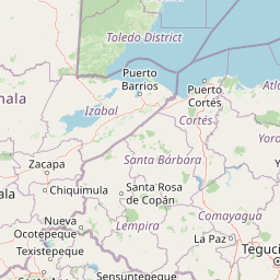
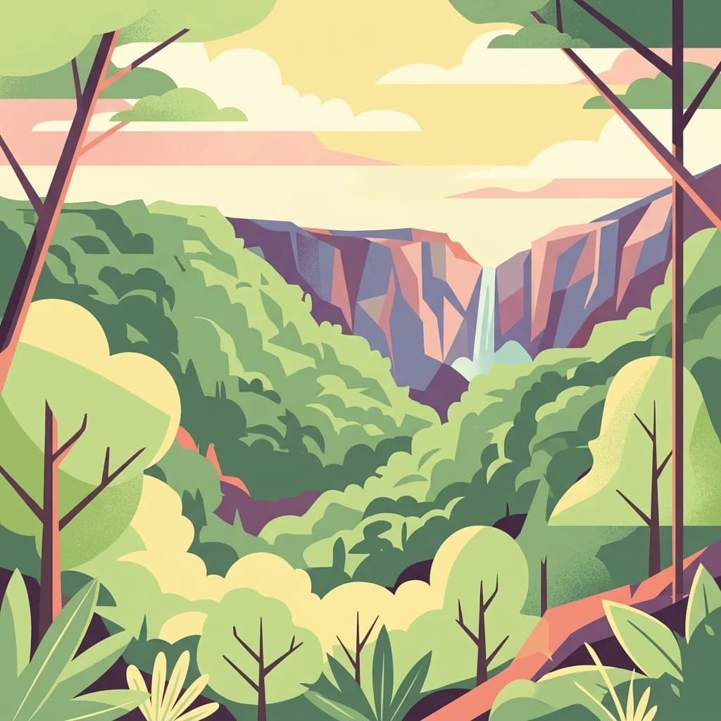
The Montecristo massif consists of mountainous terrain in western Honduras, forming part of the highland regions that extend across the Guatemala-El Salvador-Honduras border area. The landscape is characterized by steep slopes, ridgelines, and valleys typical of Central American montane environments. The area sits at elevations that support cloud forest ecosystems, where moisture-laden clouds from the Caribbean interact with the terrain to create persistent mist and high humidity conditions. The park's position at the tri-border convergence places it within a biogeographically significant zone that forms part of the larger Central American mountain systems.

Montecristo Trifinio National Park ecosystems, habitats, and plant life

Montecristo Trifinio protects important cloud forest and montane forest ecosystems within the Montecristo massif. Cloud forests in this region of Central America are characterized by dense vegetation, high biodiversity, and unique ecological adaptations to persistent mist and high moisture conditions. The trinational protected area network of which the park is a part creates an important ecological corridor that allows for wildlife movement across the Guatemala-El Salvador-Honduras border region. These montane cloud forests support distinctive plant communities adapted to the cool, humid conditions found at higher elevations in Central America.

Montecristo Trifinio National Park wildlife and species highlights

The cloud forest ecosystems of the Montecristo region support diverse wildlife communities typical of Central American highland environments. The trinational protected area network provides important habitat connectivity for species whose ranges span the border regions of Honduras, Guatemala, and El Salvador. While specific species documentation for Montecristo Trifinio National Park is limited in available sources, the broader Trifinio region is known to support populations of neotropical birds, mammals, and reptiles that depend on intact cloud forest habitats. The transboundary protected area network is particularly important for migratory species and wildlife that require large contiguous habitat areas.

Montecristo Trifinio National Park conservation status and protection priorities

Montecristo Trifinio National Park represents a significant achievement in trinational conservation cooperation in Central America. The park's designation as an IUCN Category II protected area reflects its primary purpose of conserving natural ecosystems. The creation of parallel protected areas in Honduras, Guatemala, and El Salvador around the Montecristo massif demonstrates how countries can work together to protect shared ecological resources. This transboundary approach to conservation is particularly important in Central America, where political borders often divide ecosystems that function as continuous ecological units. The Trifinio initiative provides a regional framework for coordinating conservation management across national boundaries.

Montecristo Trifinio National Park cultural meaning and human context

The Montecristo region holds cultural significance for local communities in the border area between Honduras, Guatemala, and El Salvador. The tri-border area has historically been a zone of interaction between indigenous and mestizo communities from all three countries. The landscape has been shaped by generations of traditional land use, including agriculture, grazing, and forest resource collection. The establishment of the trinational protected area network reflects both the ecological importance of the region and its significance in regional identity and heritage.

Top sights and standout views in Montecristo Trifinio National Park

The defining characteristic of Montecristo Trifinio National Park is its role as a trinational conservation landmark at the point where Honduras, Guatemala, and El Salvador meet. This transboundary protected area represents a pioneering model of regional environmental cooperation in Central America. The park protects cloud forest ecosystems within the Montecristo massif, creating a critical ecological corridor across the three-country border region. The coordinated protection initiative has resulted in a contiguous conservation network spanning the Trifinio area, with parallel protected area designations in each of the three countries.

Best time to visit Montecristo Trifinio National Park

The optimal time to visit Montecristo Trifinio National Park corresponds to the dry season typical of Central America's Pacific slope regions, generally from November through April. During this period, trails are more accessible and wildlife viewing conditions improve. The cloud forest environment maintains high humidity year-round, but the dry season offers more comfortable conditions for hiking and exploration. Visitors should be prepared for the persistent mist and damp conditions characteristic of cloud forest environments regardless of season.

Park location guide

Geography guide, regional context, and park location map for Montecristo Trifinio National Park

Montecristo Trifinio National Park park geography, regions, and map view in Honduras
Understand where Montecristo Trifinio National Park sits in Honduras through a broader geographic reading of the surrounding landscape, nearby location context, and its mapped position within the national park landscape.

How Montecristo Trifinio National Park fits into Honduras

Honduras, officially the Republic of Honduras, is a Central American nation with a predominantly Mestizo population. It gained independence in 1821 and operates as a unitary presidential republic. The country faces significant economic challenges, with over 70% of its population living in poverty, though it possesses valuable natural resources including minerals, coffee, and tropical fruits.

Wider geography shaping Montecristo Trifinio National Park in Honduras

Honduras is located in Central America, bordering Guatemala to the west, El Salvador to the southwest, Nicaragua to the southeast, the Pacific Ocean to the south at the Gulf of Fonseca, and the Caribbean Sea to the north at the Gulf of Honduras. The terrain includes mountainous regions and coastal lowlands.

Map view of Montecristo Trifinio National Park

Use this park location map to pinpoint Montecristo Trifinio National Park in Honduras, understand its exact geographic position, and read its mapped placement within the surrounding landscape more clearly.

Pigeon | © OpenStreetMap contributors
Park atlas

Trace the regional protected-area geography and conservation landscapes surrounding Montecristo Trifinio, including transboundary cloud forests.

Discover More National Parks and Protected Areas Near Montecristo Trifinio National Park
Expand your atlas exploration from Montecristo Trifinio National Park to browse other national parks and protected areas across the surrounding tri-border region of Honduras, Guatemala, and El Salvador. Compare unique cloud forest ecosystems, montane terrain, and transboundary conservation networks that define Central America's highland protected landscapes for deeper geographic context.
National parkEl Salvador

Montecristo National Park: El Salvador's Protected Landscape and Geographic Identity

Explore its mapped boundaries and regional terrain.

Montecristo National Park is a vital protected area that anchors a specific geographic identity within El Salvador. This MoriAtlas entry provides an atlas-driven view of the park, highlighting its mapped boundaries and the characteristics of its natural terrain. Understanding Montecristo National Park's protected status offers insight into the region's geography and its place within Central America's broader landscape.

Area
19.73 km²
Established
2008
IUCN
II
Relief
Mixed relief
National parkLempira Department

Celaque National Park: Mapped Protected Landscape within Lempira Department

National Park Protected Area & Geographic Context

Celaque National Park represents a key protected landscape situated in the Lempira Department of Honduras. This entry offers detailed atlas information, focusing on the park's identity as a national park and its mapped geographic extent. Users can explore the protected boundaries and understand its place within the regional terrain, providing essential context for geographic discovery.

Area
266.31 km²
Established
1987
IUCN
II
Relief
Mountain
National parkEl Salvador

El Boquerón National Park: National Park Atlas, Mapped Boundaries, and Regional Geography

Explore El Salvador's protected volcanic terrain and landscape.

Delve into the protected landscape of El Boquerón National Park, a significant national park in El Salvador. This resource provides detailed map context, focusing on the park's geographic boundaries and its position within the country's volcanic region. Understand the atlas-driven discovery value and unique regional setting of this protected area.

Area
2.05 km²
Established
2008
IUCN
II
Relief
Mountain
National parkHonduras

Cerro Azul de Copán National Park: Honduras's Highland Cloud Forest Protected Area

Explore mapped geography and montane landscape context.

Cerro Azul de Copán National Park, located in the highlands of western Honduras, is a national park defined by its mountainous terrain and distinctive cloud forest environment. Rising to elevations of over 2,200 meters, the park preserves a crucial highland ecosystem known for its biodiversity and role in watershed protection. Its mapped geography offers insight into the unique montane forest structures and the broader natural landscape of Central America. Discover the protected land's specific environmental characteristics and its place within the region's atlas.

Area
154.6 km²
Established
1987
IUCN
II
Relief
Mountain
Stylized illustration of a mountain valley with waterfall, dense forest, and trees
National parkAhuachapán Department

El Imposible National Park: National Park Protected Landscape and Regional Geography Exploration

Atlas context and mapped boundaries for El Imposible National Park.

Delve into the protected landscape of El Imposible National Park, a key national park located within Ahuachapán Department, El Salvador. This resource provides detailed information on its geographic setting, mapped park boundaries, and its role within the regional natural context. Understand the essence of this protected natural area through structured atlas data, offering a unique lens for exploring its conservation significance and landscape features.

Area
38.2 km²
Established
1989
IUCN
II
Relief
Mountain
National parkHonduras

Montaña Santa Bárbara National Park: National Park Geography and Protected Landscape

Mapped boundaries and regional landscape context in Honduras.

Delve into the protected landscape identity of Montaña Santa Bárbara National Park, a significant national park situated in Honduras. This entry provides atlas-focused details on its geographic footprint, mapped terrain, and its role within the nation's protected areas. Understand the park's environmental setting and its importance in the context of Honduran geography for structured exploration.

Area
121.3 km²
Established
1987
IUCN
II
Relief
Mountain
National parkHonduras

Cerro Azul Meámbar National Park: Protected Area and Mapped Landscape Context

Explore its geography and national park boundaries in Honduras.

Cerro Azul Meámbar National Park offers a unique perspective on Honduras's protected lands and national park geography. This entry provides an atlas-style overview of its mapped boundaries and its regional landscape context, crucial for understanding the distribution of conservation areas within Central America. Gain insight into its protected area status and geographic identity for focused landscape discovery.

Area
300 km²
Established
1987
IUCN
II
Relief
Mountain
National parkHonduras

Cusuco National Park: Protected Landscape and Geographic Atlas in Honduras

Explore mapped boundaries and regional natural terrain.

Cusuco National Park represents a crucial protected area within Honduras, offering rich detail for geographic exploration. This entry focuses on its identity as a national park, detailing its mapped boundaries and its contribution to the broader landscape context of Central America. Users can discover the specific protected lands and natural terrain that characterize this significant conservation site, building a foundational understanding for atlas-based study.

Area
234.4 km²
Established
1959
IUCN
II
Relief
Mountain

Common questions about visiting, size, designation, and location context for Montecristo Trifinio National Park

Montecristo Trifinio National Park FAQs for park facts, access, geography, and protected area context
Find quick answers about Montecristo Trifinio National Park, including protected-area facts, park geography, trail and visitor context, and how the park fits into its surrounding country and regional landscape.
MoriAtlas Explorer

Continue Your Protected Areas Search Across the Global Atlas

Deepen your exploration by continuing the structured search for national parks and protected areas worldwide. Utilize the comprehensive filtering capabilities to compare different conservation landscapes and refine your understanding of global park geography. Discover more about the distribution and characteristics of protected natural areas.

Global natural geography