Mori Atlas logo
National parkMontecristo National Park

Discover the mapped boundaries and natural terrain of this El Salvadorian national park.

Montecristo National Park: Protected Landscape and Regional Geography in El Salvador

Montecristo National Park represents a significant protected area within the geographic context of El Salvador. This page offers an atlas-style exploration of its protected landscape identity, focusing on mapped boundaries and the natural terrain that defines its unique regional geography. Understand where Montecristo National Park sits within Central America's volcanic landscapes and how its protected status contributes to the area's ecological and geographic significance.

Cloud ForestTransboundary Protected AreaMesoamericaNational ParkMountain ForestBiodiversity Hotspot

Montecristo National Park

National park

Park overview

Structured park overview, official facts, and landscape profile for Montecristo National Park

Montecristo National Park park facts, protected area profile, and essential visitor context
Review the core facts for Montecristo National Park, including designation, size, terrain, visitor scale, habitats, and operating context in one park-focused overview.

About Montecristo National Park

Montecristo National Park represents one of the last significant cloud forest remnants in El Salvador, a country where such ecosystems have been largely eliminated by decades of agricultural conversion. The park is centered on the Montecristo cloud forest, a montane environment where persistent mist and high humidity create conditions for specialized vegetation communities. Located in the northwestern corner of El Salvador near the tri-border area with Honduras and Guatemala, the park occupies a strategic position within the Trifinio Fraternidad Transboundary Biosphere Reserve, a trinational conservation framework established to protect shared ecological resources. The park's 2008 designation reflects El Salvador's commitment to preserving its remaining natural heritage, as the country has one of the highest deforestation rates in the region. The transboundary reserve concept recognizes that cloud forests and their associated biodiversity do not follow political boundaries, requiring coordinated management across national jurisdictions.

Quick facts and research context for Montecristo National Park

Montecristo National Park occupies 19.73 square kilometers in the Santa Ana Department of northwestern El Salvador, near the border with Honduras and Guatemala. The park was designated in 2008 under IUCN Category II (national park) and is part of the Trifinio Fraternidad Transboundary Biosphere Reserve, a trinational protected area network. The nearest settlement is Metapán. The cloud forest ecosystem experiences a tropical highland climate with significant rainfall concentrated between May and October, with annual precipitation exceeding 2,100 millimeters.

Park context

Deeper park guide and search-rich context for Montecristo National Park

Montecristo National Park history, landscape, wildlife, and travel context
Explore Montecristo National Park through its history, landscape character, ecosystems, wildlife, conservation priorities, cultural context, and seasonal travel timing in a structured park guide built for atlas discovery and search intent.

Why Montecristo National Park stands out

Montecristo National Park is best known for its cloud forest environment, one of the most endangered forest types in Central America. The park protects a crucial corridor of montane forest that supports biodiversity across international boundaries. It is recognized as a key component of the Trifinio Fraternidad Transboundary Biosphere Reserve, representing trinational cooperation in conservation. The park's elevation and moisture regime support epiphytes, ferns, and moisture-dependent species that characterize true cloud forest communities.

Montecristo National Park history and protected-area timeline

Montecristo National Park was established in 2008 as part of El Salvador's efforts to expand its protected area network and preserve remaining natural ecosystems. The park's creation was closely tied to the development of the Trifinio Fraternidad Transboundary Biosphere Reserve, a collaborative initiative involving El Salvador, Honduras, and Guatemala. This trinational reserve was designed to protect the shared cloud forest ecosystems that span the three countries' borders. Prior to national park designation, the area had been recognized for its ecological significance and was included in broader conservation planning for the Central American Isthmus. The establishment reflected growing regional recognition that effective conservation of cloud forest biodiversity required cross-border cooperation and coordinated management strategies.

Montecristo National Park landscape and geographic character

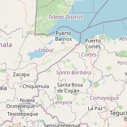
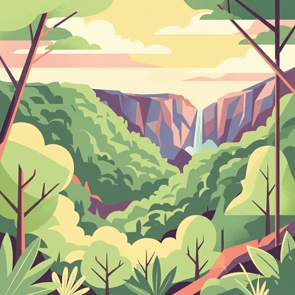
The landscape of Montecristo National Park is characterized by steep mountainous terrain rising from the surrounding lowlands of northwestern El Salvador. The cloud forest develops on the slopes and ridges where moisture from trade wind currents condenses as mist, creating the persistent cloud cover that defines this ecosystem type. The terrain features numerous ravines and drainage channels that carry water from the highland catchments. The forest canopy reaches significant heights in undisturbed areas, with emergent trees protruding above the general canopy level. The combination of elevation, slope, and moisture creates a rugged landscape with limited accessibility, factors that have historically limited human settlement and agricultural development in the area.

Montecristo National Park ecosystems, habitats, and plant life

The nature of Montecristo National Park centers on its cloud forest ecosystem, a habitat type characterized by frequent cloud immersion at canopy level. This moisture regime supports extraordinary biodiversity including extensive epiphyte communities (bromeliads, orchids, ferns), dense understory vegetation, and specialized fauna adapted to the humid forest environment. The park lies within the Mesoamerican biodiversity hotspot, one of the world's most species-rich regions. The cloud forest represents a transition zone between lowland tropical rainforests and higher-elevation pine-oak forests, containing elements of both. The high rainfall and consistent humidity maintain year-round growing conditions and support continuous ecological processes. The transboundary protected area network of which the park is a part helps maintain ecological connectivity across a landscape fragmented by agricultural development.

Montecristo National Park wildlife and species highlights

The wildlife of Montecristo National Park reflects the Mesoamerican cloud forest fauna, though detailed species documentation is limited in available sources. Cloud forests in this region typically support diverse bird communities including resplendent quetzals, toucans, and numerous migrant species. Mammals common to Central American cloud forests include various species of howler monkeys, coatis, and numerous bat species. The humid forest conditions support abundant amphibian populations, particularly salamanders and frogs, many of which are sensitive to environmental changes. The park's position within a transboundary reserve network helps maintain wildlife corridors that allow species to move across national boundaries in response to seasonal conditions or ecological changes.

Montecristo National Park conservation status and protection priorities

Montecristo National Park contributes to regional conservation by protecting one of the last cloud forest remnants in El Salvador. The park's inclusion in the Trifinio Fraternidad Transboundary Biosphere Reserve exemplifies trinational cooperation in environmental protection, recognizing that cloud forest ecosystems transcend political boundaries. This transboundary approach allows for coordinated management of wildlife corridors, water resources, and ecological processes that operate across national jurisdictions. The reserve designation also provides international recognition and potential access to technical and financial resources for conservation management. In a country where natural forest cover has been severely reduced, protecting remaining cloud forest areas is particularly important for biodiversity conservation and watershed protection.

Montecristo National Park cultural meaning and human context

The Montecristo area lies within a region of northwestern El Salvador that has historical connections to both Lenca and Pipil indigenous territories. The nearby town of Metapán has served as a regional center and historically had connections to broader trade networks across the Central American highlands. The cloud forest area would have been known to local communities as a source of water, forest products, and game. The modern protected area represents a shift from traditional land use patterns toward conservation-focused management, reflecting broader societal changes in how natural landscapes are valued and protected.

Best time to visit Montecristo National Park

The optimal time to visit Montecristo National Park corresponds to the drier season from November through April, when precipitation is reduced and trail conditions are more favorable. The wet season, particularly from May through October, brings heavy rainfall that can make trails slippery and access more difficult, though the cloud forest is at its most dramatic during this period with frequent mist and full hydration of the vegetation. The park's cloud forest character means that misty conditions can occur year-round, with the highest probability during the wet season. Visitor access may be influenced by seasonal road conditions and park management arrangements.

Park location guide

Geography guide, regional context, and park location map for Montecristo National Park

Montecristo National Park park geography, regions, and map view in El Salvador
Understand where Montecristo National Park sits in El Salvador through a broader geographic reading of the surrounding landscape, nearby location context, and its mapped position within the national park landscape.

How Montecristo National Park fits into El Salvador

El Salvador is a presidential republic in Central America. It gained independence from Spain in 1821 and has since experienced periods of political instability, including a civil war from 1979 to 1992. The country uses the US dollar as its currency and is known for its Pacific coastline and volcanic terrain.

Wider geography shaping Montecristo National Park in El Salvador

El Salvador is located in Central America, bordered by Honduras to the northeast, Guatemala to the northwest, and the Pacific Ocean to the south. The country sits along the Pacific Ring of Fire and has volcanic terrain.

Map view of Montecristo National Park

Use this park location map to pinpoint Montecristo National Park in El Salvador, understand its exact geographic position, and read its mapped placement within the surrounding landscape more clearly.

Pigeon | © OpenStreetMap contributors
Park atlas

Explore Connected Protected Landscapes and Regional Cloud Forest Geography in Central America

Discover Other National Parks and Protected Areas Near Montecristo National Park, El Salvador
After exploring Montecristo National Park's unique cloud forest, continue your geographic discovery by browsing other national parks and protected areas in the surrounding Mesoamerican biodiversity hotspot. Compare diverse montane terrain and transboundary conservation landscapes, understanding the regional spread of vital natural habitats across Central America.
National parkHonduras

Montecristo Trifinio National Park: Honduras National Park and Protected Landscape Atlas

Explore its mapped boundaries and regional geographic context.

Delve into the protected landscape of Montecristo Trifinio National Park, a designated national park within Honduras. This resource provides critical atlas-level information, detailing the park's geographic scope, mapped boundaries, and its significance as a protected natural area. Understand the terrain and landscape context to appreciate its unique role in the region's conservation framework and its place within the structured exploration of national parks.

Area
54 km²
Established
1987
IUCN
II
Relief
Mountain
National parkLempira Department

Celaque National Park: Mapped Protected Landscape within Lempira Department

National Park Protected Area & Geographic Context

Celaque National Park represents a key protected landscape situated in the Lempira Department of Honduras. This entry offers detailed atlas information, focusing on the park's identity as a national park and its mapped geographic extent. Users can explore the protected boundaries and understand its place within the regional terrain, providing essential context for geographic discovery.

Area
266.31 km²
Established
1987
IUCN
II
Relief
Mountain
National parkEl Salvador

El Boquerón National Park: National Park Atlas, Mapped Boundaries, and Regional Geography

Explore El Salvador's protected volcanic terrain and landscape.

Delve into the protected landscape of El Boquerón National Park, a significant national park in El Salvador. This resource provides detailed map context, focusing on the park's geographic boundaries and its position within the country's volcanic region. Understand the atlas-driven discovery value and unique regional setting of this protected area.

Area
2.05 km²
Established
2008
IUCN
II
Relief
Mountain
National parkHonduras

Cerro Azul de Copán National Park: Honduras's Highland Cloud Forest Protected Area

Explore mapped geography and montane landscape context.

Cerro Azul de Copán National Park, located in the highlands of western Honduras, is a national park defined by its mountainous terrain and distinctive cloud forest environment. Rising to elevations of over 2,200 meters, the park preserves a crucial highland ecosystem known for its biodiversity and role in watershed protection. Its mapped geography offers insight into the unique montane forest structures and the broader natural landscape of Central America. Discover the protected land's specific environmental characteristics and its place within the region's atlas.

Area
154.6 km²
Established
1987
IUCN
II
Relief
Mountain
Stylized illustration of a mountain valley with waterfall, dense forest, and trees
National parkAhuachapán Department

El Imposible National Park: National Park Protected Landscape and Regional Geography Exploration

Atlas context and mapped boundaries for El Imposible National Park.

Delve into the protected landscape of El Imposible National Park, a key national park located within Ahuachapán Department, El Salvador. This resource provides detailed information on its geographic setting, mapped park boundaries, and its role within the regional natural context. Understand the essence of this protected natural area through structured atlas data, offering a unique lens for exploring its conservation significance and landscape features.

Area
38.2 km²
Established
1989
IUCN
II
Relief
Mountain
National parkHonduras

Montaña Santa Bárbara National Park: National Park Geography and Protected Landscape

Mapped boundaries and regional landscape context in Honduras.

Delve into the protected landscape identity of Montaña Santa Bárbara National Park, a significant national park situated in Honduras. This entry provides atlas-focused details on its geographic footprint, mapped terrain, and its role within the nation's protected areas. Understand the park's environmental setting and its importance in the context of Honduran geography for structured exploration.

Area
121.3 km²
Established
1987
IUCN
II
Relief
Mountain
National parkHonduras

Cerro Azul Meámbar National Park: Protected Area and Mapped Landscape Context

Explore its geography and national park boundaries in Honduras.

Cerro Azul Meámbar National Park offers a unique perspective on Honduras's protected lands and national park geography. This entry provides an atlas-style overview of its mapped boundaries and its regional landscape context, crucial for understanding the distribution of conservation areas within Central America. Gain insight into its protected area status and geographic identity for focused landscape discovery.

Area
300 km²
Established
1987
IUCN
II
Relief
Mountain
National parkHonduras

Cusuco National Park: Protected Landscape and Geographic Atlas in Honduras

Explore mapped boundaries and regional natural terrain.

Cusuco National Park represents a crucial protected area within Honduras, offering rich detail for geographic exploration. This entry focuses on its identity as a national park, detailing its mapped boundaries and its contribution to the broader landscape context of Central America. Users can discover the specific protected lands and natural terrain that characterize this significant conservation site, building a foundational understanding for atlas-based study.

Area
234.4 km²
Established
1959
IUCN
II
Relief
Mountain

Common questions about visiting, size, designation, and location context for Montecristo National Park

Montecristo National Park FAQs for park facts, access, geography, and protected area context
Find quick answers about Montecristo National Park, including protected-area facts, park geography, trail and visitor context, and how the park fits into its surrounding country and regional landscape.
MoriAtlas Explorer

Continue Your Protected Areas Search Across the Global Atlas

Deepen your exploration by continuing the structured search for national parks and protected areas worldwide. Utilize the comprehensive filtering capabilities to compare different conservation landscapes and refine your understanding of global park geography. Discover more about the distribution and characteristics of protected natural areas.

Global natural geography