Mori Atlas logo
National parkCelaque National Park

An atlas exploration of Celaque National Park's protected area in Lempira Department

Celaque National Park: Protected Landscape Geography and Mapped Park Boundaries

(Parque Nacional Montaña de Celaque)

Celaque National Park stands as a significant protected area within Honduras, offering rich geographic context for atlas-based discovery. This page delves into the park's identity as a national park, detailing its mapped boundaries and situating its protected landscape within the broader regional geography of Lempira Department. Understand the physical setting and the unique natural terrain that defines this conservation area.

Cloud forestMountain ecosystemHonduras highest peakEndemic species refugeWatershed protectionNational park

Celaque National Park

National park

Park overview

Structured park overview, official facts, and landscape profile for Celaque National Park

Celaque National Park park facts, protected area profile, and essential visitor context
Review the core facts for Celaque National Park, including designation, size, terrain, visitor scale, habitats, and operating context in one park-focused overview.

About Celaque National Park

Celaque National Park represents one of Honduras' most significant protected areas, preserving a critical mountain ecosystem in the western highlands. The park straddles the Lempira Department, Ocotepeque, and Copán regions, encompassing rugged terrain that rises dramatically from lower elevations around 975 metres to the summit of Cerro Las Minas at approximately 2,870 metres. This elevation gradient supports distinct ecological zones, with cloud forest dominating the higher reaches where moisture-laden clouds settle on the forest canopy. The park's establishment in 1987 followed a decade of intensive logging that threatened the region's biodiversity and water resources. Local communities, particularly residents of La Campa, organized to protect their watershed and natural heritage, successfully advocating for national protection that removed some 266 square kilometres from logging, agriculture, and commercial forestry exploitation. Today, the park continues to face challenges from human settlements within its boundaries and surrounding land use pressures, though it remains a vital refuge for species adapted to its montane cloud forest environments.

Quick facts and research context for Celaque National Park

Celaque National Park protects Honduras' highest peak and a critical watershed serving 120 villages in western Honduras. The park spans 266.4 square kilometres at elevations between 975 and 2,870 metres, with a cloud forest classification receiving 1,600mm to 2,400mm of annual precipitation. Established on 5 August 1987, the park contains nine rivers that feed local communities including the district capital of Gracias. The region is notable for exceptional biodiversity including endemic species such as the endangered Bolitoglossa celaque salamander, and larger predators including pumas and ocelots.

Park context

Deeper park guide and search-rich context for Celaque National Park

Celaque National Park history, landscape, wildlife, and travel context
Explore Celaque National Park through its history, landscape character, ecosystems, wildlife, conservation priorities, cultural context, and seasonal travel timing in a structured park guide built for atlas discovery and search intent.

Why Celaque National Park stands out

Celaque National Park is best known as the home of Honduras' tallest mountain and as a critical cloud forest watershed serving thousands of local residents. The park's defining feature is Cerro Las Minas (Pico Celaque), a prominent peak in the Honduran highlands that supports diverse montane ecosystems across its dramatic elevation gradient. The mountain's significance extends beyond its ecological value to encompass vital hydrological functions, with the Lenca word "celaque" meaning "box of waters" referring to the way the cloud forest captures and releases water through its nine river systems. The park is also notable for its endemic salamander species, Bolitoglossa celaque, found nowhere else on Earth.

Celaque National Park history and protected-area timeline

The establishment of Celaque National Park emerged from a conservation movement led by local communities responding to extensive deforestation during the 1970s and 1980s. The Honduran Forestry Development Corporation conducted intensive logging operations throughout the Celaque peaks during this period, resulting in significant loss of biodiversity and threatening the water resources upon which nearby communities depended. Small-scale farming by communities within what would become the park also contributed to forest loss. The people of La Campa, recognizing the threat to their watershed and environment, formed a grassroots organization to oppose the logging. Their advocacy efforts succeeded in 1987 when the National Congress of Honduras declared Celaque a national park. Subsequent studies examining the period from 1987 to 1998 found positive trends, including an increase in mature forest area in remote high-elevation zones and decreased forest fragmentation in uninhabited portions of the park. However, more recent research has revealed continuing challenges, with agricultural expansion by communities inside the park boundaries, population growth, illegal logging, and the expansion of coffee plantations threatening the integrity of this protected area. Various non-governmental organizations now work with local communities on sustainable farming practices and ecotourism development.

Celaque National Park landscape and geographic character

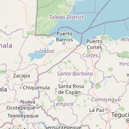
The landscape of Celaque National Park is characterized by dramatic mountain terrain rising steeply from the surrounding highlands of western Honduras. Cerro Las Minas, also known as Pico Celaque, stands as the nation's highest peak, commanding the centre of the park with its approximately 2,870-metre summit. The terrain is exceptionally rugged, with roughly two-thirds of the park's area featuring slopes exceeding 60 degrees, creating a landscape of steep ridges, deep ravines, and narrow valleys. The elevation range from 975 to 2,870 metres creates diverse topographic conditions that influence vegetation patterns and water drainage. Nine rivers originate within the Celaque mountains, descending through the rugged terrain to supply water to approximately 120 villages in the surrounding region, including the district capital of Gracias. The cloud forest characteristic of higher elevations is shaped by the interaction of moisture-laden clouds with the mountain's slopes, creating the persistent misty conditions that give this ecosystem its name.

Celaque National Park ecosystems, habitats, and plant life

Celaque National Park is classified as a cloud forest ecosystem, a rare and biodiverse habitat type characterized by persistent cloud cover at the canopy level. Mean precipitation ranges from approximately 1,600 millimetres at lower elevations to around 2,400 millimetres in higher zones, providing the moisture that sustains the dense forest vegetation. The cloud forest supports a complex array of plant species adapted to the humid, misty conditions and the acidic soils that develop in these environments. The forest structure typically features multiple layers, from the canopy formed by tall trees to the understory and forest floor, creating diverse microhabitats for numerous species. The park's position in western Honduras places it within a region of significant biogeographic importance, connecting highland forest habitats and serving as a refuge for species adapted to montane conditions. The forest also plays a critical hydrological role, capturing moisture from clouds and releasing it through streams and rivers that sustain communities throughout the region.

Celaque National Park wildlife and species highlights

The wildlife of Celaque National Park includes several notable species, with the park's diverse habitats supporting both common Central American fauna and species of special conservation concern. Large mammals present in the park include pumas (cougars) and ocelots, representing the apex predators of these forest ecosystems. These cats require extensive territories and intact habitat, making protected areas like Celaque important for their conservation. The park is also notable for its endemic salamander species, Bolitoglossa celaque, a lungless salamander found only in the mountains of Celaque. This species is listed as endangered and represents a significant conservation priority, as its entire known range is restricted to this single mountain system. The cloud forest environment supports numerous bird species, though the source material focuses primarily on the more notable mammal and amphibian residents. The diverse elevation gradient within the park creates opportunities for different species to occupy appropriate habitat zones, from lower forest areas to higher elevation cloud forest.

Celaque National Park conservation status and protection priorities

Celaque National Park represents an important conservation designation in Honduras, protecting a critical watershed and mountain ecosystem. The establishment of the park in 1987 provided formal protection for approximately 266 square kilometres of forest, shielding it from commercial logging and large-scale agricultural expansion. However, conservation efforts face significant challenges from the communities that reside within the park boundaries and from external pressures. Studies have documented ongoing forest fragmentation in inhabited areas, agricultural expansion using unsustainable practices, illegal logging, and the conversion of slopes to coffee plantations. Approximately eight communities inhabit the upper third of the park, creating a patchwork of human settlements within what is designated as protected territory. Non-governmental organizations, including the Federation of Community Development of Honduras (FEDECOH), work with local communities to promote sustainable farming practices and develop ecotourism as an alternative to activities that degrade the forest. Despite these efforts, the conservation of Celaque's biodiversity remains an ongoing concern requiring continued attention and resources.

Celaque National Park cultural meaning and human context

The cultural context of Celaque National Park is deeply connected to the indigenous Lenca heritage of western Honduras, though much of this cultural dimension is now historical rather than contemporary. The name "celaque" itself derives from the Lenca language, which is now extinct, and reportedly means "box of waters," reflecting the mountain's traditional importance as a water source for surrounding communities. The Lenca people are the largest indigenous group in Honduras and historically inhabited the western highlands where the park is located. The establishment of the park was significantly influenced by local community action, particularly by residents of La Campa who organized to protect their watershed from logging. Approximately 120 villages rely on the nine rivers originating in the Celaque mountains for their water supply, including the regional capital of Gracias. This human relationship with the mountain landscape predates the formal protected area designation and continues through the present day as communities work with conservation organizations to develop sustainable land management approaches.

Top sights and standout views in Celaque National Park

Celaque National Park's highest point, Cerro Las Minas, offers Honduras' most elevated trekking opportunity within a protected wilderness setting. The cloud forest ecosystem, though facing pressures from human activity, remains a functioning watershed that provides water to over one hundred communities in the western highlands. The presence of Bolitoglossa celaque, an endemic salamander found only in these mountains, makes the park globally significant for amphibian conservation. The park's establishment through community advocacy demonstrates a model of grassroots conservation in Honduras, where local residents recognized the value of their watershed and successfully campaigned for protection. The steep terrain, with slopes exceeding 60 degrees over much of the area, creates dramatic mountain scenery characteristic of the Honduran highlands.

Best time to visit Celaque National Park

The climate conditions in Celaque National Park are influenced by its cloud forest character and tropical mountain setting. The wet season typically brings higher precipitation, particularly at higher elevations where mean rainfall reaches around 2,400 millimetres annually. The drier months may offer more stable conditions for hiking and wildlife viewing, though the cloud forest's characteristic mist can occur year-round. Visitors interested in experiencing the park's waterfalls and flowing rivers may find the wet season more rewarding, while those preferring clearer views from the summit might prefer the relatively drier period. The mountain environment requires appropriate preparation for changing conditions, as weather can shift quickly in these highland areas.

Park location guide

Geography guide, regional context, and park location map for Celaque National Park

Celaque National Park park geography, regions, and map view in Honduras
Understand where Celaque National Park sits in Honduras through a broader geographic reading of the surrounding landscape, nearby location context, and its mapped position within the national park landscape.

How Celaque National Park fits into Honduras

Honduras, officially the Republic of Honduras, is a Central American nation with a predominantly Mestizo population. It gained independence in 1821 and operates as a unitary presidential republic. The country faces significant economic challenges, with over 70% of its population living in poverty, though it possesses valuable natural resources including minerals, coffee, and tropical fruits.

Wider geography shaping Celaque National Park in Honduras

Honduras is located in Central America, bordering Guatemala to the west, El Salvador to the southwest, Nicaragua to the southeast, the Pacific Ocean to the south at the Gulf of Fonseca, and the Caribbean Sea to the north at the Gulf of Honduras. The terrain includes mountainous regions and coastal lowlands.

Map view of Celaque National Park

Use this park location map to pinpoint Celaque National Park in Honduras, understand its exact geographic position, and read its mapped placement within the surrounding landscape more clearly.

Pigeon | © OpenStreetMap contributors

Location context for Celaque National Park

Lempira Department
Park atlas

Explore connected protected landscapes, mountain cloud forests, and vital watersheds across the broader Honduran highlands.

Discover Other National Parks and Protected Areas Near Celaque National Park
After exploring Celaque National Park, continue your discovery of other national parks and significant protected areas within the western Honduran highlands and surrounding regions. Compare diverse cloud forest ecosystems, rugged mountain terrain, and critical watershed landscapes to understand the broader conservation geography of Central America.
National parkEl Salvador

Montecristo National Park: El Salvador's Protected Landscape and Geographic Identity

Explore its mapped boundaries and regional terrain.

Montecristo National Park is a vital protected area that anchors a specific geographic identity within El Salvador. This MoriAtlas entry provides an atlas-driven view of the park, highlighting its mapped boundaries and the characteristics of its natural terrain. Understanding Montecristo National Park's protected status offers insight into the region's geography and its place within Central America's broader landscape.

Area
19.73 km²
Established
2008
IUCN
II
Relief
Mixed relief
National parkHonduras

Montecristo Trifinio National Park: Honduras National Park and Protected Landscape Atlas

Explore its mapped boundaries and regional geographic context.

Delve into the protected landscape of Montecristo Trifinio National Park, a designated national park within Honduras. This resource provides critical atlas-level information, detailing the park's geographic scope, mapped boundaries, and its significance as a protected natural area. Understand the terrain and landscape context to appreciate its unique role in the region's conservation framework and its place within the structured exploration of national parks.

Area
54 km²
Established
1987
IUCN
II
Relief
Mountain
National parkHonduras

Cerro Azul de Copán National Park: Honduras's Highland Cloud Forest Protected Area

Explore mapped geography and montane landscape context.

Cerro Azul de Copán National Park, located in the highlands of western Honduras, is a national park defined by its mountainous terrain and distinctive cloud forest environment. Rising to elevations of over 2,200 meters, the park preserves a crucial highland ecosystem known for its biodiversity and role in watershed protection. Its mapped geography offers insight into the unique montane forest structures and the broader natural landscape of Central America. Discover the protected land's specific environmental characteristics and its place within the region's atlas.

Area
154.6 km²
Established
1987
IUCN
II
Relief
Mountain
National parkHonduras

Montaña Santa Bárbara National Park: National Park Geography and Protected Landscape

Mapped boundaries and regional landscape context in Honduras.

Delve into the protected landscape identity of Montaña Santa Bárbara National Park, a significant national park situated in Honduras. This entry provides atlas-focused details on its geographic footprint, mapped terrain, and its role within the nation's protected areas. Understand the park's environmental setting and its importance in the context of Honduran geography for structured exploration.

Area
121.3 km²
Established
1987
IUCN
II
Relief
Mountain
National parkHonduras

Cerro Azul Meámbar National Park: Protected Area and Mapped Landscape Context

Explore its geography and national park boundaries in Honduras.

Cerro Azul Meámbar National Park offers a unique perspective on Honduras's protected lands and national park geography. This entry provides an atlas-style overview of its mapped boundaries and its regional landscape context, crucial for understanding the distribution of conservation areas within Central America. Gain insight into its protected area status and geographic identity for focused landscape discovery.

Area
300 km²
Established
1987
IUCN
II
Relief
Mountain
National parkEl Salvador

El Boquerón National Park: National Park Atlas, Mapped Boundaries, and Regional Geography

Explore El Salvador's protected volcanic terrain and landscape.

Delve into the protected landscape of El Boquerón National Park, a significant national park in El Salvador. This resource provides detailed map context, focusing on the park's geographic boundaries and its position within the country's volcanic region. Understand the atlas-driven discovery value and unique regional setting of this protected area.

Area
2.05 km²
Established
2008
IUCN
II
Relief
Mountain
National parkHonduras

Cusuco National Park: Protected Landscape and Geographic Atlas in Honduras

Explore mapped boundaries and regional natural terrain.

Cusuco National Park represents a crucial protected area within Honduras, offering rich detail for geographic exploration. This entry focuses on its identity as a national park, detailing its mapped boundaries and its contribution to the broader landscape context of Central America. Users can discover the specific protected lands and natural terrain that characterize this significant conservation site, building a foundational understanding for atlas-based study.

Area
234.4 km²
Established
1959
IUCN
II
Relief
Mountain
National parkHonduras

Montaña de Comayagua National Park: Honduras National Park and Protected Area Geography

Explore mapped boundaries and natural terrain within Central America.

Montaña de Comayagua National Park stands as a vital protected area, contributing significantly to the geographic tapestry of Honduras. This national park offers a focused perspective for atlas exploration, allowing users to trace its mapped boundaries and comprehend its role within the regional landscape. Delve into the park's protected identity and its unique position in the mapped geography of Central America.

Area
184.8 km²
Established
1987
IUCN
II
Relief
Mountain

Common questions about visiting, size, designation, and location context for Celaque National Park

Celaque National Park FAQs for park facts, access, geography, and protected area context
Find quick answers about Celaque National Park, including protected-area facts, park geography, trail and visitor context, and how the park fits into its surrounding country and regional landscape.
MoriAtlas Explorer

Continue Your Protected Areas Search Across the Global Atlas

Deepen your exploration by continuing the structured search for national parks and protected areas worldwide. Utilize the comprehensive filtering capabilities to compare different conservation landscapes and refine your understanding of global park geography. Discover more about the distribution and characteristics of protected natural areas.

Global natural geography