Mori Atlas logo
National parkChiquibul National Park

Discover the protected area geography and mapped boundaries within Cayo District.

Chiquibul National Park: Belize National Park Protected Landscape and Map Context

Chiquibul National Park represents a significant protected national park within the Cayo District of Belize, offering a valuable point of entry for exploring the region's natural landscapes. This park serves as a focal point for understanding the distribution of protected lands and their integration into the broader geographic context of Belize. Through detailed mapping and structured data, users can investigate the park's boundaries and its place within the natural terrain.

Tropical forestKarst landscapeMaya archaeologyCentral AmericaWildlife conservationScarlet macaws

Chiquibul National Park

National park

Park overview

Structured park overview, official facts, and landscape profile for Chiquibul National Park

Chiquibul National Park park facts, protected area profile, and essential visitor context
Review the core facts for Chiquibul National Park, including designation, size, terrain, visitor scale, habitats, and operating context in one park-focused overview.

About Chiquibul National Park

Chiquibul National Park represents one of Central America's most significant conservation landscapes, protecting a vast tract of tropical forest that forms the ecological heart of Belize. The park's location at the transition between the Maya Mountains and the surrounding lowlands creates remarkable habitat diversity, from montane forest slopes to lowland broadleaf forests and karst limestone formations. The park's boundaries encompass an area larger than many small countries, providing sufficient space for viable populations of wide-ranging species like jaguars and tapirs that require extensive territories. Perhaps most significantly, the park surrounds the Caracol archaeological site, where ongoing excavations continue to reveal the scale of this ancient Mayan capital, creating a unique integration of cultural and natural heritage protection. The park's relative remoteness and difficult access have historically limited human impact, allowing ecological processes to continue with minimal interruption.

Quick facts and research context for Chiquibul National Park

Chiquibul National Park covers 1,073 square kilometers in western Belize, making it the country's largest national park. It is located in Cayo District, with its western boundary following the Guatemala border. The park was established in 1995, evolving from the Chiquibul Forest Reserve designated in 1956. The park encompasses portions of the Maya Mountains including the south Vaca Plateau, and contains Doyle's Delight, the highest point in Belize at 1,167 meters. The area is characterized by extensive limestone karst topography, with the Chiquibul Cave System representing the longest known cave system in Central America.

Park context

Deeper park guide and search-rich context for Chiquibul National Park

Chiquibul National Park history, landscape, wildlife, and travel context
Explore Chiquibul National Park through its history, landscape character, ecosystems, wildlife, conservation priorities, cultural context, and seasonal travel timing in a structured park guide built for atlas discovery and search intent.

Why Chiquibul National Park stands out

Chiquibul National Park is best known for its extraordinary biodiversity and its role as a protected corridor surrounding the Caracol archaeological reserve, one of the ancient Maya civilization's major urban centers. The park harbors Belize's largest breeding population of scarlet macaws, and supports significant populations of jaguars, Baird's tapirs, and other keystone species of the Central American tropical forest. The park also contains the Chiquibul Cave System, the most extensive underground cave network in the Western Hemisphere, with massive chambers and passageways carved through limestone strata. The combination of archaeological significance, ecological intactness, and geological wonder makes Chiquibul one of Belize's most distinctive protected areas.

Chiquibul National Park history and protected-area timeline

Chiquibul National Park emerged from a prolonged conservation evolution that began in the mid-twentieth century. The area was first protected as Chiquibul Forest Reserve in 1956, reflecting early recognition of the forest's value. However, active logging concessions continued within the reserve for decades. Conservation advocates lobbied throughout the 1980s for stronger protection, arguing that the pristine portions of the reserve warranted national park status. In 1991, approximately three-quarters of the forest reserve that lacked active logging was redesignated as a national park under Belize's National Parks System Act. The park's borders were finalized in 1995, at which time the Caracol archaeological site became fully surrounded by the protected area. This transition from extractive use to strict conservation represents a broader pattern in Belize's environmental policy.

Chiquibul National Park landscape and geographic character

The physical landscape of Chiquibul National Park is defined by its position in the Maya Mountains, Belize's highest and most rugged terrain. The park includes the southern portions of the Vaca Plateau and the eastern slopes rising toward Doyle's Delight, the nation's highest summit at 1,167 meters above sea level. The underlying geology consists of extensive limestone formations that have produced Belize's most significant karst topography, with sinkholes, caves, and underground river systems carved over millennia. The Chiquibul Cave System represents a remarkable underground labyrinth extending across the boundary between Belize and Guatemala, with the Chiquibul River flowing above ground before disappearing into the cave network and resurfacing in Guatemalan territory. This cave system contains the largest known underground passages and chambers in the Western Hemisphere.

Chiquibul National Park ecosystems, habitats, and plant life

The ecological character of Chiquibul is defined by extensive tracts of lowland and premontane tropical forest that have persisted largely undisturbed since the decline of the Maya civilization. The forest canopy remains largely unbroken, supporting complex ecological relationships that have evolved over centuries. The park protects one of Central America's largest contiguous areas of tropical forest, creating a critical corridor for wildlife movement between Guatemala and Belize. The limestone karst environment adds further ecological complexity, with cave systems supporting specialized adapted species and the hydrological connections between surface and underground environments influencing broader ecosystem function. The Missouri Botanical Garden has documented remarkable plant diversity here, including species previously unknown to Central America.

Chiquibul National Park wildlife and species highlights

Chiquibul National Park supports exceptional wildlife diversity, with the park serving as a stronghold for many species that have been reduced or eliminated from other parts of their range. The park contains Belize's largest breeding population of scarlet macaws, whose brilliant plumage and loud calls are among the most iconic sights in the forest. Large mammals are well represented, with populations of jaguars, jaguarundis, ocelots, margays, and Baird's tapirs moving through the forest understory. The arboreal fauna includes Yucatan spider monkeys and kinkajous, while the avifauna features keel-billed motmots and king vultures. The ocellated turkey, a species endemic to the region, is also present. Notably, ongoing biological surveys continue to discover previously unknown insect and crustacean species, indicating that the full extent of the park's biodiversity has not yet been documented.

Chiquibul National Park conservation status and protection priorities

Chiquibul National Park represents a critical conservation priority for Belize and Central America as a whole. The park protects the largest remaining tract of contiguous forest in Belize and serves as a vital corridor connecting ecosystems across the Guatemala-Belize border. The largely unbroken forest cover provides habitat for species requiring large territories and intact ecological processes. The park's designation as an IUCN Category II protected area reflects its significance for both biodiversity conservation and natural landscape preservation. However, the park faces ongoing challenges including pressures from logging operations that continue in adjacent areas, archaeological tourism at Caracol, and the broader regional context of Central American deforestation. The protection of this vast area is essential for maintaining Belize's environmental identity and ecological integrity.

Chiquibul National Park cultural meaning and human context

Chiquibul National Park encompasses the ancient Mayan city of Caracol, which represents one of the most important archaeological sites in Belize and was once one of the largest cities in the Classic Maya world. While Caracol itself is managed as a separate archaeological reserve and is not included within the national park's official area calculation, the park's boundaries completely surround this ancient urban center. This integration of natural and cultural protection creates a unique management context where the preservation of the forest helps protect the archaeological landscape from erosion and unauthorized access. The broader park area contains evidence of continuous Maya presence spanning millennia, with the forest itself shaped by centuries of traditional land use and eventual abandonment that paradoxically allowed ecological recovery.

Top sights and standout views in Chiquibul National Park

Chiquibul National Park offers remarkable experiences centered on its combination of ecological and archaeological significance. Visitors can explore the boundaries of the Caracol archaeological zone, one of the Maya civilization's great cities, while surrounded by forest that has recovered since the Classic period. The park provides habitat for Central America's highest concentration of scarlet macaws, whose spectacular breeding displays are a major draw for wildlife enthusiasts. The Chiquibul Cave System represents a geological wonder of hemispheric significance, with passages and chambers of extraordinary scale. The presence of Belize's highest mountain, Doyle's Delight, adds topographic interest, while the karst landscape creates a distinctive visual character unlike the coastal and lowland environments more commonly associated with Belize.

Best time to visit Chiquibul National Park

The optimal time to visit Chiquibul National Park corresponds to the dry season from December through April, when rainfall is minimal and trail conditions are most favorable for exploration. This period coincides with the peak breeding season for scarlet macaws, offering the best opportunities for observing these spectacular birds. The dry months also provide optimal conditions for cave exploration within the Chiquibul Cave System. However, the wet season from May through November transforms the landscape, with green forest, flowing waterfalls, and increased wildlife activity, though some trails may become difficult to navigate. The park's remote location and limited infrastructure mean that visits require careful planning and typically involve arrangements through authorized tour operators.

Park location guide

Geography guide, regional context, and park location map for Chiquibul National Park

Chiquibul National Park park geography, regions, and map view in Belize
Understand where Chiquibul National Park sits in Belize through a broader geographic reading of the surrounding landscape, nearby location context, and its mapped position within the national park landscape.

How Chiquibul National Park fits into Belize

Belize is a Caribbean and Central American nation located on the Yucatán Peninsula's eastern coast. It gained independence from Britain in 1981 and remains a Commonwealth realm with Charles III as monarch. The country features diverse cultures, multiple spoken languages including Belizean Creole, Spanish, and Mayan languages, and is recognized for its rich marine biodiversity including the Mesoamerican Barrier Reef.

Wider geography shaping Chiquibul National Park in Belize

Belize occupies the eastern coast of the Yucatán Peninsula, stretching approximately 290 kilometres long and 110 kilometres wide. It is bordered by Mexico to the north and west, Guatemala to the south and west, and the Caribbean Sea to the east. The country also shares a maritime boundary with Honduras. The landscape includes coastal plains, swamps, and the Maya Mountains in the interior.

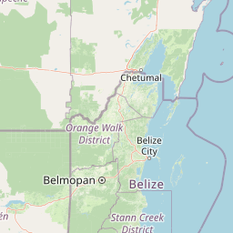
Map view of Chiquibul National Park

Use this park location map to pinpoint Chiquibul National Park in Belize, understand its exact geographic position, and read its mapped placement within the surrounding landscape more clearly.

Pigeon | © OpenStreetMap contributors

Location context for Chiquibul National Park

Cayo District
Park atlas

Compare surrounding protected landscapes, mapping regional conservation geography adjacent to Chiquibul National Park.

Explore Other National Parks and Protected Areas Near Chiquibul National Park
Continue your exploration of Belize's protected areas by browsing other national parks and reserves sharing ecological or geographical context with Chiquibul National Park. Discover how these conservation landscapes connect across the Cayo District and the Maya Mountains, providing valuable insights into Central American wilderness.
National parkCayo District

Elijio Panti National Park: Protected Landscape and Regional Geography in Cayo District

Explore the mapped boundaries and geographic features of this national park.

Elijio Panti National Park offers a unique focus on protected landscape discovery within Belize. Situated in the Cayo District, this national park provides a specific geographic anchor for understanding natural terrain and mapped boundaries. The page details its identity as a protected area, contributing to a structured atlas of conservation lands and regional geography.

Area
52.645 km²
Established
2001
IUCN
II
Relief
Mountain
National parkCayo District

St. Herman's Blue Hole National Park: National Park Protected Landscape and Geographic Setting

Mapped Boundaries and Regional Landscape Context in Cayo District

St. Herman's Blue Hole National Park is an integral protected landscape within Belize, situated in the Cayo District. This national park offers specific geographic features and mapped boundaries essential for understanding its place within regional conservation. MoriAtlas provides detailed context for exploring the park's protected terrain and its contribution to the broader geographic atlas, focusing on landscape identity and mapped outlines for analytical discovery.

Area
2 km²
Established
1986
Climate
Tropical
Access
Easy access
National parkToledo District

Payne's Creek National Park: National Park Protected Landscape and Geographic Atlas

Explore mapped boundaries and regional geography in Toledo District.

Payne's Creek National Park serves as a vital protected area within Belize, recognized as a national park. This entry details its specific location within the Toledo District, emphasizing the mapped extent of its protected boundaries. It provides a foundation for understanding the park's geographic character and its role within regional conservation landscapes, ideal for atlas-based discovery.

Area
152 km²
IUCN
II
Relief
Lowland
Climate
Tropical
National parkCayo District

Guanacaste National Park National Park: Explore its Protected Landscape and Geographic Setting

Mapped natural terrain and regional context within Cayo District.

Delve into the specifics of Guanacaste National Park, a protected national park located in the Cayo District of Belize. This detail page is designed for atlas exploration, offering insights into the park's geographic boundaries and its significance as a defined natural landscape. Understand how this protected area fits into the regional geography and contributes to the mapped natural heritage of Belize.

Area
0.2 km²
Established
1973
IUCN
II
Climate
Tropical
National parkToledo District

Sarstoon-Temash National Park: National Park Geography and Mapped Boundaries

Explore the protected landscape of Toledo District.

Sarstoon-Temash National Park is a key protected area located in Belize's Toledo District. As a national park, it offers distinct geographic features and mapped boundaries that are crucial for understanding regional conservation landscapes. This entry provides detailed context on its protected status and geographic setting, enabling a more profound atlas-based exploration of the natural terrain and its significance.

Area
165.92 km²
Established
1994
IUCN
II
Relief
Lowland
National parkPetén

El Rosario National Park: Protected National Park & Mapped Landscape Explorer

Geographic context and protected area boundaries within Petén.

Delve into the protected landscape of El Rosario National Park, identified as a national park within Guatemala's Petén region. This page provides an atlas-centric view, highlighting its mapped park boundaries and its significance in the regional geography. Understand the park as a distinct protected area contributing to the natural landscape context, ideal for geographic exploration and detailed mapping.

Area
11.05 km²
Established
1980
IUCN
II
Relief
Lowland
National parkHonduras

Cusuco National Park: Protected Landscape and Geographic Atlas in Honduras

Explore mapped boundaries and regional natural terrain.

Cusuco National Park represents a crucial protected area within Honduras, offering rich detail for geographic exploration. This entry focuses on its identity as a national park, detailing its mapped boundaries and its contribution to the broader landscape context of Central America. Users can discover the specific protected lands and natural terrain that characterize this significant conservation site, building a foundational understanding for atlas-based study.

Area
234.4 km²
Established
1959
IUCN
II
Relief
Mountain
National parkHonduras

Cerro Azul de Copán National Park: Honduras's Highland Cloud Forest Protected Area

Explore mapped geography and montane landscape context.

Cerro Azul de Copán National Park, located in the highlands of western Honduras, is a national park defined by its mountainous terrain and distinctive cloud forest environment. Rising to elevations of over 2,200 meters, the park preserves a crucial highland ecosystem known for its biodiversity and role in watershed protection. Its mapped geography offers insight into the unique montane forest structures and the broader natural landscape of Central America. Discover the protected land's specific environmental characteristics and its place within the region's atlas.

Area
154.6 km²
Established
1987
IUCN
II
Relief
Mountain

Common questions about visiting, size, designation, and location context for Chiquibul National Park

Chiquibul National Park FAQs for park facts, access, geography, and protected area context
Find quick answers about Chiquibul National Park, including protected-area facts, park geography, trail and visitor context, and how the park fits into its surrounding country and regional landscape.
MoriAtlas Explorer

Continue Your Protected Areas Search Across the Global Atlas

Deepen your exploration by continuing the structured search for national parks and protected areas worldwide. Utilize the comprehensive filtering capabilities to compare different conservation landscapes and refine your understanding of global park geography. Discover more about the distribution and characteristics of protected natural areas.

Global natural geography