
Lakes
Park geography
Mapping the physical landscape, wetland networks, and forest corridors of this protected area.
Comprehensive Geographic and Terrain Analysis of Zaborski Park Krajobrazowy in Poland
The geographic profile of Zaborski Park Krajobrazowy offers a detailed look at the 340.3 square kilometer protected landscape located in the Pomeranian Voivodeship. This analysis covers the lowland terrain, dense forest coverage, and the distribution of natural features including numerous lakes, rivers, and wetland habitats.

A forested, lake-rich protected landscape in the heart of the Tuchola Forest region of northern Poland.
Zaborski Landscape Park
Zaborski Landscape Park is a large protected landscape area in northern Poland, situated in the Pomeranian Voivodeship on the Kashubian territory known as the Zabory. It spans the municipalities of Chojnice and Brusy and lies within Bory Tucholskie, the Tuchola Forest, one of the largest forest complexes in Poland. The park protects a diverse mosaic of pine-dominated woodlands, glacial-origin lakes, river valleys, bogs, and small agricultural enclaves. Its territory surrounds the Bory Tucholskie National Park and is part of the UNESCO-designated Bory Tucholskie Biosphere Reserve. Eight nature reserves and numerous Natura 2000 sites further reinforce its ecological importance at both national and European levels. Beyond its ecological value, Zaborski Landscape Park represents a classic example of the post-glacial lowland landscape of northern Poland, combining lakes of varying trophic states, sand plain rivers, and relict plant species of boreal origin. It is a key destination for anyone interested in the natural character of the Polish lowlands south of the Baltic coast.
- Location
- Poland
- Park type
- Protected landscape
- Established
- 1990
- Area
- 340.3 km²
Location overview
Regional and national context for a terrestrial landscape park
Zaborski Landscape Park in Pomeranian Voivodeship, Poland
Zaborski Landscape Park is recorded in Pomeranian Voivodeship, Poland. The overview establishes these administrative relationships and identifies the landscape park's terrestrial scope.
- Countries
- Poland
- Regions
- Pomeranian Voivodeship
- Primary location
- Pomeranian Voivodeship
- Geographic setting
- Inland
Boundary and coordinates
Interactive protected area mapping and calculated spatial dimensions
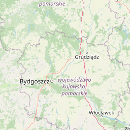
Zaborski Park Krajobrazowy Boundary Map and Geographic Extent
Visual boundary geometry outlines the protected perimeter of Zaborski Park Krajobrazowy on an interactive map. Derived spatial measurements and coordinate spans provide structured geographic reference data.
- Boundary area
- 396.3 km²
- Boundary perimeter
- 129.2 km
- Northernmost point
- 54.0319° N
- Southernmost point
- 53.7179° N
- Easternmost point
- 17.7239° E
- Westernmost point
- 17.413° E
- Geographic centre
- 53.8734° N, 17.567° E
- North–south span
- 35 km
- East–west span
- 20.4 km
Terrain and natural features
Lowland landscape classification and recorded water bodies within protected bounds
Zaborski Park Krajobrazowy Terrain and Hydrological Features
Zaborski Park Krajobrazowy encompasses lowland terrain classifications featuring multiple recorded lakes, rivers, and streams within its protected boundaries. Linked feature cards provide verified names, types, and spatial relationships for each natural feature.
Selected named natural features
Lakes
Jezioro Płęsno
Rivers
Młosina
Lakes
Jezioro Krzywce Wielkie
Streams
Młosienica
Lakes
Jezioro Małe Krzywce
Environmental setting
Temperate lowland forests, extensive wetlands, and major water networks across the terrain
Environmental Setting and Habitat Classifications of Zaborski Park Krajobrazowy
Recorded landscape features and habitat types frame the physical setting of Zaborski Park Krajobrazowy through complementary environmental classifications. Structured categories link directly to related protected areas and mapped atlas destinations.
- Relief
- Lowland
- Climate
- Temperate
- Water
- Major water bodies
- Forest cover
- Mostly forested
- Seasonality
- Year-round
Landscape features
Forest · Wetland · Bog · Lakes · Rivers
Habitat types
Temperate coniferous forest · Temperate broadleaf forest · Wetland · Peatland · Riverine habitat · Lacustrine habitat
Park atlas
Compare surrounding lowland forests, glacial lakes, and regional protected landscapes
Explore Other Parks and Protected Areas Near Zaborski Park Krajobrazowy
Browsing other parks near Zaborski Park Krajobrazowy reveals a wider network of post-glacial landscapes and forested river valleys across the region. Comparing adjacent protected areas provides deeper geographical context into the natural terrain of northern Poland.

National parkPomeranian Voivodeship
Park boundaries overlap#1 closest
South

Park Narodowy „Bory Tucholskie”: Geography of a Polish National Park and Protected Forest
Lowland pine ecosystems and glacial water networks
Located in the Pomeranian Voivodeship, Park Narodowy „Bory Tucholskie” protects a significant remnant of the Tuchola Forest. The terrain, characterized by postglacial sandy plains, inland dunes, and acidic lobelia lakes, provides a critical reference site for studying forest ecology and glacial geomorphology within the Polish national park system.
- Area
- 46.13 km²
- Established
- 1996
- Visitors
- 33K annual
- Relief
- Lowland

Nature reservePomeranian Voivodeship
Mapped location lies within the park boundary#2 closest
North
Rezerwat przyrody Dolina Kulawy: Mapping Peatlands and Wetlands in Pomeranian Voivodeship
A protected landscape featuring soligenous mires and glacial lakes.
Discover the intricate geography of Rezerwat przyrody Dolina Kulawy, a nature reserve centered on the Kulawa River valley in northern Poland. This protected area offers a unique look at soligenous peatlands, floodplain forests, and mesotrophic lake systems, providing essential context for the post-glacial landscape of the Bory Tucholskie region.
- Area
- 1.546 km²
- Established
- 2009
- Relief
- Lowland
- Climate
- Temperate
Nature reservePomeranian Voivodeship
Mapped location lies within the park boundary#3 closest
Southeast
Rezerwat przyrody Moczadło: Protected Nature Reserve and Lobelia Lake in Pomeranian Voivodeship
Mapped ecological zone within the Bory Tucholskie lake region
Gain insight into the protected landscape of Rezerwat przyrody Moczadło, a nature reserve in Pomeranian Voivodeship defined by its exceptionally clear oligotrophic waters. This site offers valuable data for those studying post-glacial lake ecosystems, rare aquatic flora, and the sensitive transition zones between open water and peat-forming pine forest landscapes.
- Area
- 0.262 km²
- Established
- 2011
- Water
- Major water bodies
Nature reservePomeranian Voivodeship
Mapped location lies within the park boundary#4 closest
Southwest
Rezerwat przyrody Jezioro Małe Łowne: Protected Bog and Lake Landscape in Poland
A nature reserve in Pomeranian Voivodeship's wetland geography.
Located in the heart of the Bory Tucholskie forest region, this nature reserve protects a shallow post-glacial lake and its surrounding mire habitats. The protected area features a dynamic floating bog mat, boggy pine forests, and transitional peatlands, offering a clear look at the lowland hydrology and glacial topography that characterizes this specific part of northern Poland.
- Area
- 0.378 km²
- Established
- 1993
- Relief
- Lowland
- Climate
- Temperate
Protected areaPomeranian Voivodeship
Park boundaries overlap#5 closest
South
Sandr Brdy: Protected Glacial Landscapes and Hydrological Networks in Pomeranian Voivodeship
A vital reference site for lowland habitat conservation and post-glacial terrain.
Sandr Brdy spans 7,492 hectares of outwash plains in northern Poland. Its terrain hosts a complex mosaic of calcareous fens, acid oak forests, and lobelia lakes, established to preserve fragile aquatic and terrestrial species like the gray wolf and lady's slipper orchid within a unique glacial framework.
- Area
- 74.926 km²
- Scope
- Terrestrial
- Water
- Major water bodies

National parkPomeranian Voivodeship
Park boundaries overlap#6 closest
South
Tuchola Forest National Park: Explore Poland's Largest Protected Woodland and Glacial Lakes
Detailed maps and geographic context of unique forest ecosystems and terrain.
MoriAtlas offers a comprehensive geographic overview of Tuchola Forest National Park, a vital protected area in Pomeranian Voivodeship, Poland. This page delves into the park's identity as Poland's largest contiguous forest, distinguished by its post-glacial landscape. Users can explore the mapped boundaries of its extensive coniferous forests, numerous interconnected glacial lakes, dynamic dunes, and ecologically rich peatlands. It serves as a key entry point for understanding the park's unique terrain and its significant place within the broader regional geography and protected lands atlas.
- Area
- 46.13 km²
- Established
- 1996
- IUCN
- II
- Visitors
- 33K annual
Nature reservePomeranian Voivodeship
About 0.9 km away#7 closest
Southwest
Jezioro Sporackie Nature Reserve: Mapped Geography and Protected Area Context
Exploring the lobelia lake and peatland mosaic in Pomeranian Voivodeship
Jezioro Sporackie Nature Reserve protects a vital ecological gradient ranging from nutrient-poor aquatic habitats to wooded terrestrial margins. The site preserves Sporacz, a glacial lake recognized for its specialized flora, alongside the surrounding transitional mire and forest compartments that form its primary buffer zone in Northern Poland.
- Area
- 0.176 km²
- Established
- 1965
- Relief
- Lowland
- Climate
- Temperate

Nature reservePomeranian Voivodeship
About 4.9 km away#8 closest
North
Mechowisko Radość Nature Reserve: Atlas of Protected Alkaline Fen Landscapes in Pomeranian Voivodeship
A rare calcareous mire ecosystem within the Bory Tucholskie post-glacial terrain
Mechowisko Radość Nature Reserve protects a specialized alkaline peatland ecosystem that developed in a formerly mesotrophic lakeside bay. This site highlights the complex hydrological and ecological processes of the Bory Tucholskie region, where flat, post-glacial landscapes sustain rare orchid and bryophyte assemblages through dedicated active conservation management.
- Area
- 0.096 km²
- Established
- 2013
- Relief
- Lowland
- Scope
- Terrestrial
MoriAtlas Explorer
Explore the Protected Landscapes and Geography of Zaborski Park Krajobrazowy
Deepen your understanding of Zaborski Park Krajobrazowy through our structured atlas. MoriAtlas provides clear insights into the terrain, hydrological features, and regional significance of this key protected area within the Pomeranian Voivodeship's complex lowland forest systems.
Browse next
Global natural geography
Explore related park routes
Explore MoriAtlas Global ParksBrowse All MoriAtlas ParksGlobal Park Map DiscoveryMoriAtlas: Browse All CountriesBrowse All MoriAtlas ContinentsNational Park Environment AtlasGrand Canyon National Park AtlasYellowstone National Park AtlasYosemite National Park Atlas and GeographySerengeti National Park AtlasGalápagos National Park Protected LandscapeBanff National Park Geography and AtlasKruger National Park Atlas EntryUluṟu-Kata Tjuṯa National Park AtlasExplore Uluru-Kata Tjuta National Park GeographyPlitvice Lakes National Park AtlasFiordland National Park Protected LandscapeGreat Smoky Mountains National Park AtlasAfghanistan National Parks and Protected AreasAlbania National Parks and Protected AreasAlgeria National Parks and Protected AreasAmerican Samoa National Parks and Protected AreasAndorra National Parks and Protected AreasAngola National Parks and Protected AreasAntarctica National Parks and Protected AreasAntigua and Barbuda Park List