
Mori Atlas logo
Nature reserveZagatala State Reserve

A vital conservation landscape stretching across the southern slopes of the Greater Caucasus mountain range.

Zagatala State Reserve: Mapping Protected Broadleaf Forests and Mountain Terrain in Northern Azerbaijan

(Zagatala State Nature Reserve)

Zagatala State Reserve serves as a primary protected area within the Zagatala District, encompassing an ecologically rich expanse of ancient broadleaf woodlands and subalpine meadows. This nature reserve preserves a diverse range of Caucasian flora and fauna, while its physical geography is defined by the deep gorges of the Katekhchay, Mazimchay, and Balakenchay river systems. Visitors can study the complex karst features, mineral springs, and prominent waterfall landscapes that define this significant northern Azerbaijan wilderness.

broadleaf forestGreater Caucasusmountain reserveforest reserveriver valleyswaterfalls
Stylized digital illustration showing a forest with large trees, ferns, rocky ground, and a small waterfall flowing between rocky hills under a pale sky.

Zagatala State Reserve

Nature reserve

Park overview

Structured park overview, official facts, and landscape profile for Zagatala State Reserve

Zagatala State Reserve park facts, protected area profile, and essential visitor context

Review the core facts for Zagatala State Reserve, including designation, size, terrain, visitor scale, habitats, and operating context in one park-focused overview.

About Zagatala State Reserve

Zagatala State Reserve is one of Azerbaijan's oldest and most important protected natural areas, situated in the northwestern part of the country where the Greater Caucasus mountains descend toward the Alazan valley. Established in 1929 in the Zagatala and Balakan districts, the reserve was created explicitly to preserve the natural plant and animal complexes associated with the southern slopes of the Caucasus range; a separate Balakan reserve was merged with it shortly afterward. Over the decades, the boundaries of the reserve have been adjusted and expanded, the most significant change occurring in 2008 when forest protection and rehabilitation lands were incorporated, substantially increasing the total protected area.

The defining feature of Zagatala State Reserve is its extensive cover of broadleaf forest, which accounts for more than half of the protected territory. Mature oak, hornbeam, beech, elm, linden, ash, chestnut, walnut, and birch stands dominate the lower and middle elevations, while a diverse understory of shrubs such as cornel, cherry, and yellow rhododendron fills the gaps between them. Many of the beech trees within the reserve are centuries old and reach impressive heights of up to thirty meters, giving parts of the forest an ancient, primeval character. This woodland heritage places Zagatala among the most significant temperate deciduous forest reserves in the South Caucasus.

Ecologically, the reserve is exceptionally rich. Roughly 900 species of higher plants have been recorded within its boundaries; this figure equals approximately one-sixth of Azerbaijan's flora, illustrating the area's botanical importance. Above the forest line, mountain meadows and subalpine habitats extend the ecological gradient upward into the high Caucasus. Wildlife includes brown bears, Roe deer, wild boar, lynx, forest cats, badgers, foxes, and squirrels, alongside bird species such as Caucasian tetras, large hawks, and eagles. Twelve plant species, along with lynx and Caucasian tetras, appear in the Red Book of Azerbaijan, while the Caucasian falcon, a raptor that feeds on other birds of prey, is recorded on the IUCN Red List.

Beyond biodiversity, the reserve is distinguished by its dramatic physical landscape. Three major rivers, Mazimchay, Balakenchay, and Katekhchay, rise among the peaks of the Greater Caucasus and descend through the reserve before eventually joining the Alazan River. The Katekh River valley in particular is framed by steep cliffs and rocky walls, while the confluence of its tributaries gives rise to therapeutic sulphate mineral springs, ancient cave formations, and the well-known Zagatala waterfall. Around ten waterfalls and more than fifteen mineral springs have been documented within the reserve, alongside ruins of an ancient church on a small plateau. Taken together, these features combine ancient forest, mountain wildlife, river gorges, and karst landscapes into a single protected area of considerable ecological and scenic value.

Quick facts and research context for Zagatala State Reserve

Zagatala State Reserve lies in northern Azerbaijan within the Zagatala and Balakan districts, on the eastern part of the southern slope of the Greater Caucasus mountain range. It is administered by Azerbaijan's Ministry of Ecology and Natural Resources and is classified as a strict state nature reserve.

Established in 1929 as one of the earliest protected areas in the country, the reserve was later expanded, most notably in 2008 when forest protection lands were added to enlarge its total area. More than half of its territory is covered by broadleaf forest, and the reserve holds over 900 plant species, representing roughly one-sixth of Azerbaijan's flora. Several plant and animal species found within its borders are recorded in the Red Book of Azerbaijan and the IUCN Red List.

Park context

Deeper park guide and search-rich context for Zagatala State Reserve

Zagatala State Reserve history, landscape, wildlife, and travel context

Explore Zagatala State Reserve through its history, landscape character, ecosystems, wildlife, conservation priorities, cultural context, and seasonal travel timing in a structured park guide built for atlas discovery and search intent.

Why Zagatala State Reserve stands out

Zagatala State Reserve is best known for protecting one of the largest and most ecologically intact broadleaf forest complexes on the southern slopes of the Greater Caucasus, including exceptionally old beech trees of 200 to 250 years in age. It shelters rare Caucasian flora and fauna, with multiple species appearing in the Red Book of Azerbaijan, and is an important refuge for lynx, brown bears, Roe deer, Caucasian tetras, and large raptors. The reserve is also recognized for its mountain river landscapes, mineral springs, deep gorges, caves, and waterfalls, which together form a distinctive blend of woodland and Caucasus mountain scenery. It is widely regarded as a key conservation priority in Azerbaijan, with proposals to expand it into a full biosphere reserve.
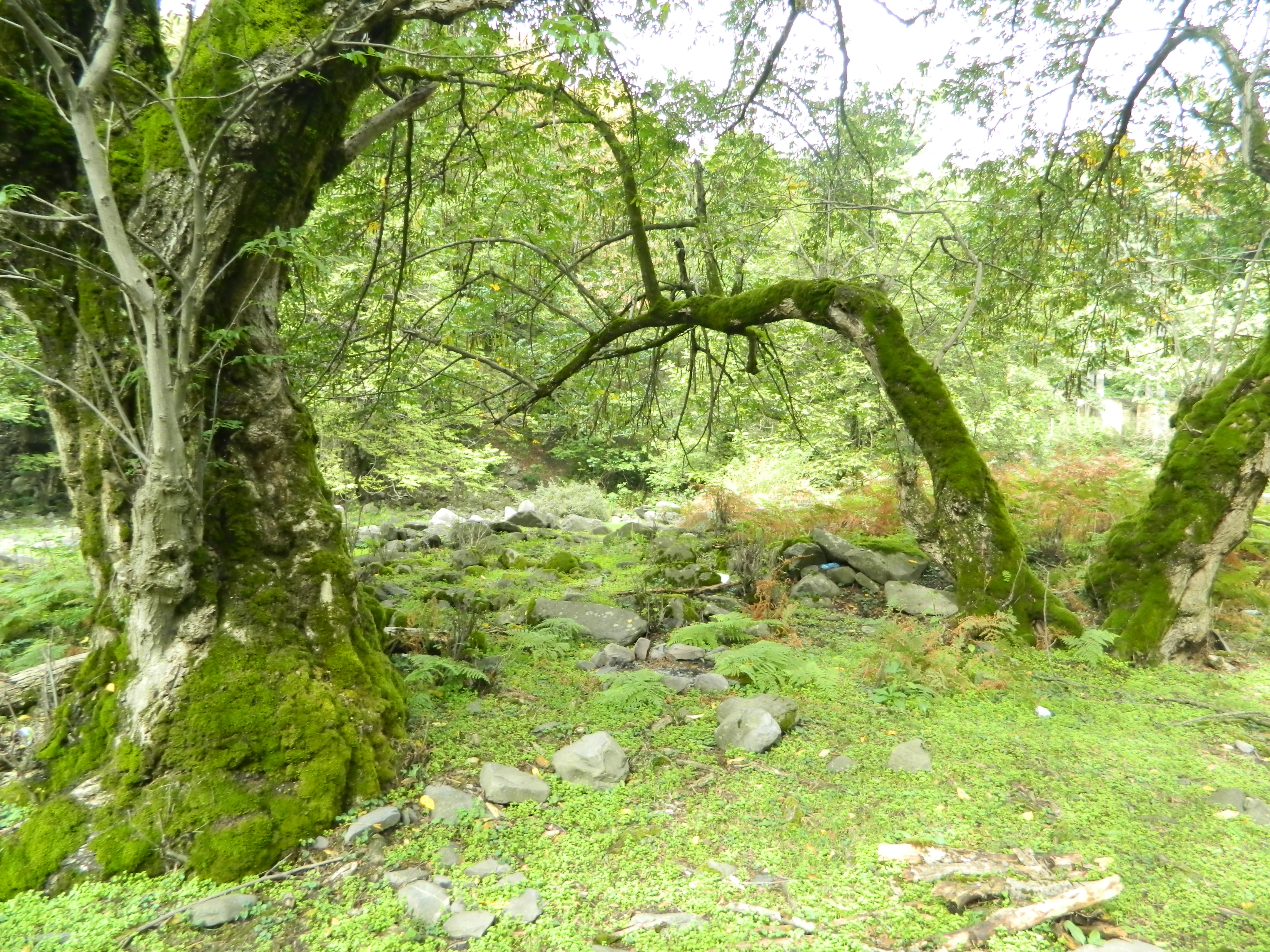
A lush, green forest scene featuring large, mature trees covered in thick green moss, with rocky ground and dense foliage in the background.
A moss-covered forest floor in the Zagatala State Reserve.

Zagatala State Reserve history and protected-area timeline

The Zagatala State Reserve was established in 1929, making it one of the earliest protected natural areas created in Azerbaijan. It was founded in the middle part of the southern foothills of the Greater Caucasus Mountains within the Zagatala and Balakan districts, with the principal aim of preserving and studying the plants and animals of this relatively untouched Caucasian ecosystem. A year later, in 1930, the Balakan reserve was created as a separate entity alongside it, eventually merging into the broader unified reserve system.

Throughout the twentieth and early twenty-first centuries, the boundaries and area of the reserve changed multiple times as successive administrations adjusted the protected perimeter. By the late twentieth century, the territory stood at roughly 28,844 hectares, with more than 900 plant species recorded within its borders. A particularly important milestone occurred in 2008, when, by a decision of the Cabinet of Ministers of Azerbaijan, additional lands belonging to the Zagatala and Balakan forest protection and rehabilitation facilities were incorporated, enlarging the reserve to its current extent of around 47,349 hectares.

Today the reserve is managed by the Ministry of Ecology and Natural Resources of Azerbaijan, and it continues to play a central role in national conservation planning. Proposals have been put forward by the Ministry to expand the reserve further and to elevate it to the status of a full biosphere reserve, reflecting an evolving recognition of the area's ecological importance.

Zagatala State Reserve landscape and geographic character

The physical setting of Zagatala State Reserve is shaped by the eastern part of the southern slope of the Greater Caucasus mountain range, with elevations rising from the forested foothills near the Alazan valley up into the high Caucasus. Although the protected zone encompasses a broad altitudinal range, the core landscape is dominated by deeply indented river valleys, forested ridges, subalpine meadows, and karst features.

The reserve's river network is one of its most distinctive physical features. Three large, water-rich rivers, Mazimchay, Balakenchay, and Katekhchay, originate from the peaks of the Greater Caucasus and flow through the reserve into the Alazan valley via the Alazan-Ayrichay corridor. The Katekh River in particular runs through a particularly spectacular section of the reserve, where its banks are framed by hard rock walls and steep cliffs on both sides. At the confluence of its tributaries Rochigelchay and Kilsachay, a small plateau has formed around a therapeutic sulphate mineral spring, and nearby stand the ruins of an ancient church.

Karst and hydrological features give the reserve much of its scenic character. The Pichel Cave, located around 800 to 1000 meters from the ruins of the ancient church, is an exceptionally large dry cavern used historically by reserve workers and capable of sheltering hundreds of people; its surroundings include ancient broadleaf forest and a striking overhanging rock formation adorned with evergreen vines. Waterfalls are another hallmark, the most famous being the Gabizdere or Zagatala waterfall, which drops around 20 meters into a narrow rocky gorge at the confluence of the Katekhchay and another tributary. In total, approximately ten waterfalls and fifteen to seventeen mineral springs occur within the reserve.

Zagatala State Reserve ecosystems, habitats, and plant life

Ecologically, Zagatala State Reserve represents one of the most important temperate broadleaf forest refuges in the entire South Caucasus. More than half of the reserve's surface is covered by broadleaf woodland composed of oak, hornbeam, beech, elm, linden, ash, chestnut, walnut, and birch, with the forest canopy in some places older than two centuries. Many beech individuals exceed 200 to 250 years in age and reach heights of up to 30 meters, giving stretches of the forest a genuinely primeval character.

The shrub layer adds further diversity, dominated by currants, cornel, cherry plum, maple, yellow rhododendron, and gandalash, while a transition to subalpine and mountain meadow communities is found at higher elevations. Around 900 plant species have been recorded within the reserve, a number equal to roughly one-sixth of Azerbaijan's overall flora; twelve of these species are listed in the Red Book of Azerbaijan, underscoring the botanical rarity of the area.

Water availability shapes the ecological character of the reserve just as much as its forests. The rivers Mazimchay, Balakenchay, and Katekhchay, along with numerous mineral springs, sustain riparian vegetation, moisture-loving plants, and rich understory communities. Karstic terrain, caves, and rocky ravines further increase habitat heterogeneity, supporting distinct plant communities in shaded, humid microclimates that contrast with the drier slopes and meadows higher up.

Zagatala State Reserve wildlife and species highlights

Zagatala State Reserve supports a notably diverse Caucasian mammal and bird fauna. Large mammals include the Dagestan mountain goat, Roe deer, red deer (maral), wild boar, brown bear, badger, red fox, forest cat, lynx, red squirrel, and weasel. These species occupy a gradient of habitats, from dense broadleaf forest at lower elevations to subalpine meadows and rocky cliffs higher up the slopes.

The reserve is particularly significant for several rare and protected species. Both the lynx and a mammal known as the caper are listed in Azerbaijan's Red Book, while among birds the large hawk, eagle, Caucasian ular, and Caucasian tetra also feature in the national Red Book. The Caucasian falcon, a predator that feeds on other raptors, is registered on the IUCN Red List, giving the reserve an international as well as national conservation importance.

The combination of mature forest, mountain meadows, river valleys, and rocky cliffs creates excellent habitat heterogeneity for birds of prey and forest-dwelling species alike. Raptors nest on cliff faces along the Katekhchay valley, while ground-dwelling and forest species benefit from the ancient, undisturbed character of the broadleaf stands.

Zagatala State Reserve conservation status and protection priorities

Zagatala State Reserve is one of the cornerstones of biodiversity conservation in Azerbaijan, recognized for protecting an extensive area of ancient broadleaf forest and the unique Caucasian flora and fauna associated with it. Roughly one-sixth of all plant species occurring in Azerbaijan are recorded here, and more than half of the reserve's territory is preserved as mature deciduous woodland; an unusual feature in a region where such forests have been heavily reduced elsewhere.

Conservation significance is reinforced by formal protection lists. Twelve plant species, the lynx, the caper, large hawks, eagles, Caucasian ulars, and Caucasian tetras are recorded in the Red Book of Azerbaijan, while the Caucasian falcon appears on the IUCN Red List. A nature museum operates within the reserve, supporting research and public awareness.

Long-running proposals to expand the reserve further and elevate it to biosphere reserve status reflect an ongoing national commitment to strengthening its conservation role. Administered by the Ministry of Ecology and Natural Resources of Azerbaijan, the reserve is a key reference site for understanding and preserving Caucasus forest ecosystems.

Zagatala State Reserve cultural meaning and human context

While primarily a protected natural area, Zagatala State Reserve also contains traces of long human presence in its remote valleys. On a small plateau near the confluence of the Rochigelchay and Kilsachay rivers, the ruins of a very ancient church stand beside a healing mineral spring, suggesting that the area supported small communities or places of retreat long before the reserve existed. This church ruin, together with the nearby Pichel Cave, has been informally used by reserve staff for shelter and reflects the practical human interaction with the landscape over many centuries.

More broadly, the reserve lies within a region of Azerbaijan whose identity is closely tied to the southern foothills of the Greater Caucasus. The Zagatala and Balakan districts have a distinct regional character, shaped by mountain terrain, Caucasian cultural influences, and traditional uses of forest resources. Contemporary conservation policy now seeks to balance this regional heritage with strict protection of the natural environment.

Top sights and standout views in Zagatala State Reserve

Zagatala State Reserve stands out as one of Azerbaijan's premier protected forest landscapes, with extensive ancient broadleaf woodlands housing beech specimens of 200 to 250 years old. It contains roughly 900 plant species, including twelve protected ones, and supports mammal and bird species such as lynx, brown bear, Roe deer, Caucasian tetra, and the internationally recognized Caucasian falcon.

Its dramatic physical setting adds further distinction. The Mazimchay, Balakenchay, and Katekhchay rivers flow through the reserve from the Greater Caucasus peaks into the Alazan valley, and along the way they create deep gorges, mineral springs, caves, and around ten waterfalls, the most famous being the Zagatala waterfall on the Katekhchay. These features combine primeval forest, mountain wildlife, and karst landscapes into a single highly diverse protected area.

Best time to visit Zagatala State Reserve

The character of a visit to Zagatala State Reserve shifts meaningfully with the seasons, although the reserve itself is a protected natural area with restricted general access. Spring and early summer bring fresh growth to the broadleaf forests, active river flows from mountain snowmelt, and increased wildlife activity, making this a particularly dynamic period for experiencing the forest's vitality. Late summer and early autumn, when the deciduous canopy matures and temperatures are milder in the foothills, offer comfortable conditions for viewing the wooded landscapes and rivers at lower elevations.

Winter brings cold conditions and snow at higher elevations, while the lower forests near the Alazan valley remain relatively accessible; the contrast between snowy peaks and forested foothills can be visually striking. Across all seasons, visitors interested in the reserve's landscape should keep in mind that its elevations range widely, so conditions can vary significantly between the foothills and the higher Caucasus slopes.
Monthly climate preview

Long-term temperature ranges and precipitation rhythm across twelve months at elevation

Zagatala State Reserve Climate Normals and Annual Weather Patterns

Zagatala State Reserve records a wide annual temperature spread alongside measured monthly precipitation totals from representative coordinates. Reviewing the complete multi-year climate profile provides deeper context on long-term thermal conditions across the protected terrain.
Annual mean1 °C
-11 °C13 °C
Jan-11°
Feb-10°
Mar-6°
Apr
May
Jun10°
Jul13°
Aug13°
Sep
Oct
Nov-4°
Dec-9°
Warmest month
July

13 °C

Coolest month
January

-11.2 °C

Wettest month
May

1.8 mm/day

Driest month
December

0.7 mm/day

Park location guide

Geography guide, regional context, and park location map for Zagatala State Reserve

Zagatala State Reserve park geography, regions, and map view in Azerbaijan

Understand where Zagatala State Reserve sits in Azerbaijan through a broader geographic reading of the surrounding landscape, nearby location context, and its mapped position within the national park landscape.

How Zagatala State Reserve fits into Azerbaijan

Azerbaijan is a unitary semi-presidential republic and one of six independent Turkic states. It declared independence from the Soviet Union in 1991 after nearly seven decades of Soviet rule. The country occupies 86,600 km² and has a population of approximately 10.3 million. It is known for its strategic location at the crossroads of Europe and Asia, its oil industry heritage, and its diverse cultural influences from Persian, Russian, and Turkic traditions.

Wider geography shaping Zagatala State Reserve in Azerbaijan

Azerbaijan occupies the eastern portion of the Caucasus region, situated between the Caspian Sea to the east and the Greater Caucasus mountains to the north. The terrain is diverse, featuring lowlands along the Caspian coast, mountainous areas in the north and west, and semi-desert plains in the central regions. The Kura and Aras rivers are major waterways draining into the Caspian Sea.

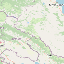
Map view of Zagatala State Reserve

Use this park location map to pinpoint Zagatala State Reserve in Azerbaijan, understand its exact geographic position, and read its mapped placement within the surrounding landscape more clearly.

Pigeon | © OpenStreetMap contributors

Location context for Zagatala State Reserve

Balakan DistrictZagatala District

Visual reference for ancient broadleaf forests, mountain rivers, and protected habitats

Zagatala State Reserve Photos, Landscapes, and Scenery in the Caucasus

Visual records reveal the rugged topography, deep river gorges, and dense broadleaf canopies defining the Zagatala State Reserve. Examining field photography helps researchers interpret the remote terrain, altitudinal zones, and protected natural environment of the southern Caucasus.

A lush, green forest scene featuring large, mature trees covered in thick green moss, with rocky ground and dense foliage in the background.

Several large, mature trees covered in dense green moss in a shaded forest setting with scattered rocks and lush ground vegetation.

Park atlas

Compare adjacent mountain reserves, river valleys, and broadleaf forest terrain in the Caucasus region.

Parks Near Zagatala State Reserve and Surrounding Protected Landscapes

Continue exploring protected areas near Zagatala State Reserve by comparing adjacent forest reserves and mountain terrain across the southern Greater Caucasus. Examining these related conservation landscapes provides deeper geographic context for regional biodiversity and river valley ecosystems.
Watercolor painting showing green hills, a river, and distant purple and orange mountains
National parkDedoplistsqaro Municipality
About 50 km away#1 closest

South

Vashlovani National Park: Georgia's Unique Lowland Desert and Badland Protected Landscape

Discover distinct semi-arid terrain and rare forest ecosystems.

Vashlovani National Park in Dedoplistsqaro Municipality represents a significant protected area preserving Georgia's rare lowland desert and semi-arid steppe ecosystems. This national park is characterized by its striking badland topography, known as the "Sharp Walls," wild pistachio forests, and riparian habitats along the Alazani River. Its unique geographic setting, far removed from Georgia's typical mountainous landscapes, makes Vashlovani a crucial site for understanding regional biodiversity and conservation within the Caucasus.

Area
442.51 km²
Established
1935
IUCN
II
Relief
Lowland
Watercolor painting of a mountainous landscape with green hills, valleys, and distant mountains under a pale sky
National parkGeorgia
About 116 km away#2 closest

Northwest

Tusheti National Park National Park: Geographic Exploration of Caucasus Protected Landscapes

Mapped protected area boundaries and alpine terrain in Georgia.

Tusheti National Park offers a deep dive into the rugged geography of the Greater Caucasus. This national park, situated in a remote corner of Georgia, protects a dramatic landscape characterized by high mountain ridges, glacial valleys, and diverse ecosystems. The park's mapped boundaries encompass significant alpine terrain, providing essential habitat and serving as a critical area for understanding regional protected land distribution and landscape context. Explore the unique geographic identity of Tusheti National Park.

Area
1,276.43 km²
Established
2003
IUCN
II
Relief
Mountain
Nature reserveAgdash District
About 132 km away#3 closest

Southeast

Turian-Chay State Reserve: Protected Foothill and Arid Woodland Landscape in Agdash District

Essential nature reserve located within the Central Aran foothills of Azerbaijan.

Turian-Chay State Reserve represents a critical conservation area within the Agdash District, defined by its sparse juniper and pistachio arid forests. The reserve functions as a protective barrier against soil erosion while providing year-round sanctuary for wildlife across the Boz-Dag Ridge. Its terrain offers a condensed cross-section of semi-desert plateaus and low-mountain valleys that define this specific climatic region of the Caucasus.

Area
225 km²
Established
1958
Relief
Mountain
Climate
Subtropical
Watercolor illustration of a landscape with mountains, a river, trees, and grassy fields
National parkMtskheta Municipality
About 141 km away#4 closest

West

Tbilisi National Park: Oldest Protected Landscape in Mtskheta Municipality

Explore Georgia's oldest national park and its mapped forest terrain.

Tbilisi National Park represents Georgia's oldest protected area, nestled in the Saguramo Range within Mtskheta Municipality. This page provides an atlas-focused view of its geographic features, including mountainous terrain and deciduous forest ecosystems. Users can explore the park's mapped boundaries and understand its significance as a crucial natural landscape close to Tbilisi, contributing to the region's protected areas network.

Area
380.02 km²
Established
1973
IUCN
II
Relief
Highland
Watercolor painting showing a landscape with green hills, trees, and distant mountains
National parkMtskheta-Mtianeti
About 154 km away#5 closest

Northwest

Pshav-Khevsureti National Park: Protected Mountain Landscape and Regional Geography in Mtskheta-Mtianeti

Explore rugged terrain and alpine ecosystems in Georgia's Caucasus.

Pshav-Khevsureti National Park is a key protected area in Georgia's Mtskheta-Mtianeti region, recognized for its dramatic mountain terrain, deep river valleys, and alpine zones. Established as a national park, it safeguards the watersheds of major rivers, supporting significant wildlife and offering a compelling geographic context for atlas exploration. This protected landscape provides insight into the unique natural and cultural heritage of the Khevsureti region, making it a focal point for understanding Georgia's protected area network and mountainous geography.

Area
1,400.44 km²
Established
2014
IUCN
II
Relief
Mountain
Watercolor illustration of a lake surrounded by greenery with mountains in the background
National parkAzerbaijan
About 157 km away#6 closest

South

Göygöl National Park: Iconic Alpine Lakes and Protected Caucasus Forest Landscape

Explore Azerbaijan's most visited national park and its rich geographic context.

Göygöl National Park is a key protected area in Azerbaijan, renowned for the crystal-clear alpine Lake Göygöl and its surrounding dense forests within the Lesser Caucasus mountains. This national park showcases over 420 plant species, significant wildlife populations, and dramatic mountainous terrain, making it a prime destination for understanding regional landscape diversity and protected land value. Use MoriAtlas to explore its mapped boundaries and connect it to the broader geographic context of Azerbaijan.

Area
127.55 km²
Established
2008
IUCN
II
Relief
Mountain
National parkDagestan
About 158 km away#7 closest

East

Samursky National Park: National Park Protected Landscape and Geographic Atlas

Explore Dagestan's Samursky National Park mapped terrain.

Gain a structured understanding of Samursky National Park, a key national park within Russia's Dagestan region. This page focuses on its protected landscape identity, mapped boundaries, and its place within the regional geography of the North Caucasus. Use this atlas-centric view to comprehend the park's contribution to Dagestan's natural terrain and conservation landscape.

Area
483 km²
Established
2019
IUCN
II
Relief
Mixed relief
National parkKhachmaz Rayon
About 162 km away#8 closest

East

Samur-Yalama National Park: Caspian Coastal Forest Protected Area

Mapped protected landscape in Azerbaijan's Khachmaz Rayon.

Delve into the protected geography of Samur-Yalama National Park, a key national park established in 2012 within Azerbaijan's Khachmaz Rayon. This 11,772-hectare area meticulously preserves vital Caspian coastal forest ecosystems, characterized by dominant chestnut oak and Persian ironwood stands. The park’s diverse terrain ranges from littoral zones to inland steppe, offering significant insights into regional landscape context and protected area management for atlas exploration and geographic analysis.

Area
117.72 km²
Established
2012
IUCN
II
Relief
Mixed relief

Common questions about visiting, size, designation, and location context for Zagatala State Reserve

Zagatala State Reserve FAQs for park facts, access, geography, and protected area context

Find quick answers about Zagatala State Reserve, including protected-area facts, park geography, trail and visitor context, and how the park fits into its surrounding country and regional landscape.
MoriAtlas Explorer

Continue Your Protected Areas Search Across the Global Atlas

Deepen your exploration by continuing the structured search for national parks and protected areas worldwide. Utilize the comprehensive filtering capabilities to compare different conservation landscapes and refine your understanding of global park geography. Discover more about the distribution and characteristics of protected natural areas.

Global natural geography