Mori Atlas logo
National parkVashlovani National Park

Discover unique semi-arid steppe and striking badland terrain in Dedoplistsqaro Municipality.

Vashlovani National Park: Georgia's Premier Lowland Desert and Forest Protected Area

Vashlovani National Park stands as a remarkable protected landscape in eastern Georgia's Dedoplistsqaro Municipality, offering a distinct geographic perspective from the country's mountainous terrain. This national park preserves a rare lowland semi-arid ecosystem characterized by dramatic badland formations, known locally as the "Sharp Walls," alongside unique wild pistachio woodlands and desert steppe vegetation. Situated between 50 and 150 meters above sea level, Vashlovani presents a starkly beautiful, geologically unique environment that is crucial for understanding the Caucasus region's diverse protected areas.

national parklowland ecosystemssemi-desertbadlandsforest protectionCaucasus
Illustration of a winding river flowing through a canyon with layered rock formations and grassy fields under a bright sky

Vashlovani National Park

National park

Park overview

Structured park overview, official facts, and landscape profile for Vashlovani National Park

Vashlovani National Park park facts, protected area profile, and essential visitor context
Review the core facts for Vashlovani National Park, including designation, size, terrain, visitor scale, habitats, and operating context in one park-focused overview.

About Vashlovani National Park

Vashlovani National Park occupies Georgia's southeastern corner in the Kakheti region, representing a remarkable ecological contrast to the country's famous alpine protected areas. The park's setting on the Iori Plateau places it at extremely low elevation for the Caucasus—only 50 to 150 meters above sea level—creating a semi-arid environment that supports vegetation types more commonly associated with continental steppe and desert zones. The landscape is characterized by eroded badland formations known locally as the "Sharp Walls," where weathered cliffs and gullies have created a terrain reminiscent of desert landscapes found far to the south. Between these dramatic formations, the park contains areas of semi-desert steppe vegetation and patches of arid deciduous forest. The Alazani River forms the park's eastern boundary, and its flood plain forests represent another important habitat within the protected area. This combination of desert terrain, forest corridors, and riverine environments creates a complex ecological mosaic that supports diverse wildlife. The park's establishment in 1935 as a reserve and subsequent expansion in 2003 to national park status reflects growing recognition of its conservation significance within Georgia's protected area network.

Quick facts and research context for Vashlovani National Park

Vashlovani National Park covers approximately 442.51 square kilometers in eastern Georgia's Kakheti region, making it one of the country's larger protected areas. The park occupies the Iori Plateau at elevations between 50 and 150 meters above sea level, creating a distinctly lowland character that contrasts sharply with Georgia's alpine parks. It was established as a state reserve in 1935 and gained national park status in 2003 when its territory was significantly expanded. The park is managed by Georgia's Agency of Protected Areas and contains a core protected state reserve within its boundaries.

Park context

Deeper park guide and search-rich context for Vashlovani National Park

Vashlovani National Park history, landscape, wildlife, and travel context
Explore Vashlovani National Park through its history, landscape character, ecosystems, wildlife, conservation priorities, cultural context, and seasonal travel timing in a structured park guide built for atlas discovery and search intent.

Why Vashlovani National Park stands out

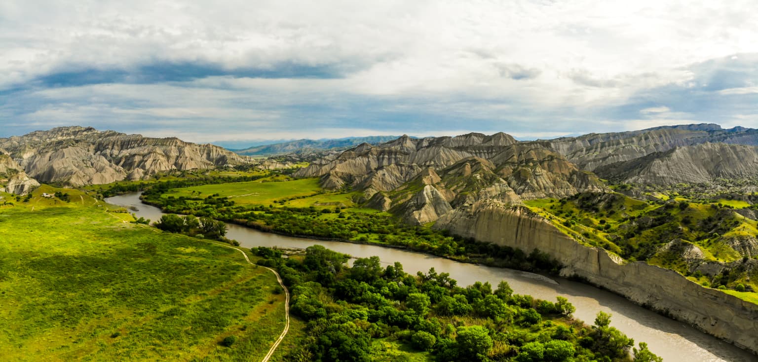
Vashlovani National Park is best known for its exceptional lowland desert and forest ecosystems that are rare in the Caucasus region. The park preserves wild pistachio woodlands, a distinctive feature of its floral identity, along with peonies and various orchid species. Its dramatic badland terrain, locally called the "Sharp Walls," features eroded canyon cliffs that create a striking desert landscape. The Alazani flood plains and adjoining forests form another characteristic environment. The park is also notable for its wildlife, including the presence of the critically important Caucasian leopard, with confirmed tracks and camera trap recordings documenting this elusive predator's return to the area.

A river winding through grassy hills and rocky badlands under a partly cloudy sky
Vashlovani National Park's river flowing through rugged badlands and grassy hills

Vashlovani National Park history and protected-area timeline

Vashlovani National Park traces its institutional history to 1935, when it was originally established as the Vashlovani State Reserve to protect its unique shallow forests and semi-arid ecosystems. For decades, the reserve served as a protected area managing the core natural assets of the region. A significant expansion occurred in April 2003, when the protected territory was enlarged by 84.80 square kilometers to create the modern national park with an area of 251.14 square kilometers. The expansion reflected growing understanding of the ecological connections between the original reserve and surrounding landscapes, as well as the need to provide adequate habitat connectivity for species like the Caucasian leopard. The park is currently managed by Georgia's Agency of Protected Areas, which oversees the country's protected area system. The expansion also coincided with increased conservation attention to the lowland ecosystems of eastern Georgia, which had historically received less protection focus than the country's mountainous regions.

Vashlovani National Park landscape and geographic character

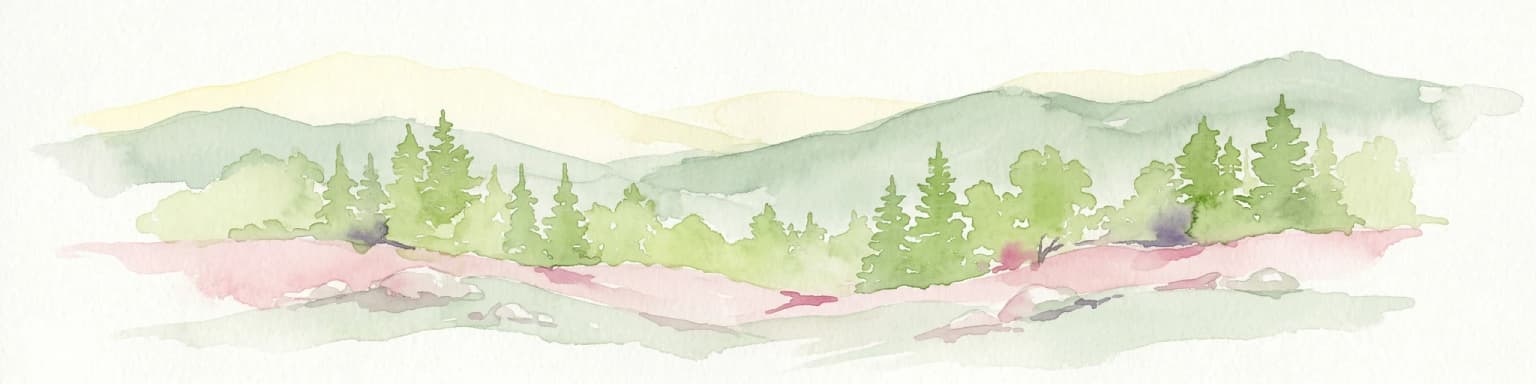
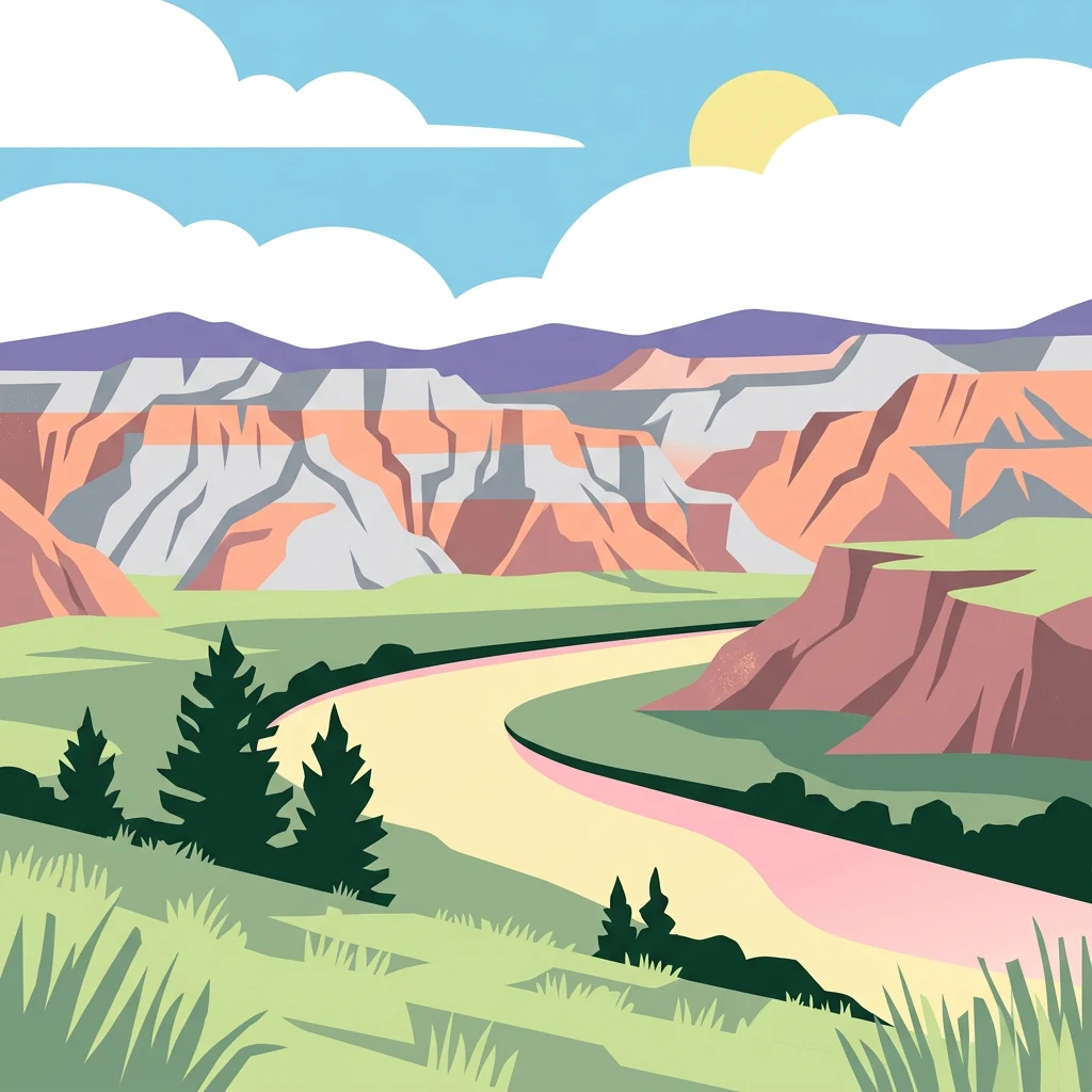
The landscape of Vashlovani National Park is defined by its lowland position on the Iori Plateau, creating an environment that stands in sharp contrast to the alpine and forest-covered mountains that dominate much of Georgia. The terrain features extensive badland formations—eroded areas of soft sedimentary rock that have been carved by water and wind into a maze of gullies, ravines, and sheer cliff faces. These dramatic formations, known locally as the "Sharp Walls," create a visually striking desert-like landscape with vertical faces and凹凸不平 surfaces. Between the badland areas, the terrain flattens into semi-desert steppe and scattered patches of arid deciduous forest. The Alazani River flows along the eastern boundary of the park, marking both the edge of the protected area and the international border with Azerbaijan. The river's flood plain supports riparian forests that provide important habitat connectivity through the otherwise dry landscape. The overall impression is one of a semi-arid wilderness where desert and forest elements intermingle across a relatively flat terrain.

Vashlovani National Park ecosystems, habitats, and plant life

The natural environment of Vashlovani National Park is defined by its unique position as a lowland protected area in Georgia, preserving ecosystems that are largely absent from the country's more mountainous parks. The park contains a mosaic of habitats including semi-desert steppe, badland terrain, arid deciduous forests, and riparian zones along the Alazani River. The forests feature particularly distinctive elements, with wild pistachio trees representing one of the park's most notable botanical features. These pistachio woodlands occur in a region where this Mediterranean-influenced species reaches its northern and eastern limits. The park also supports populations of peonies and various orchid species, adding to its botanical significance. The semi-desert steppe vegetation includes characteristic drought-adapted plant communities that thrive in the low-elevation, semi-arid conditions. Riverine forests along the Alazani provide additional habitat diversity, creating forest corridors that connect the park's various habitat patches.

Vashlovani National Park wildlife and species highlights

Vashlovani National Park supports a diverse fauna despite its relatively small size and semi-arid character. The reptile population includes at least 25 species, with notable records including Macrovipera lebetinus and Eryx jaculus representing venomous and non-venomous snake species adapted to the dry landscape. The park's bird fauna is particularly rich, with more than 100 native species documented. Raptors including the imperial eagle and black vulture soar over the badland terrain, while the rare black stork inhabits the riparian zones. Pheasants and numerous other bird species occupy the forest and steppe habitats. The mammal community numbers 46 species, including golden jackals, red foxes, wolves, Eurasian lynx, and brown bears—the latter two representing significant predators within the ecosystem. Jungle cats and porcupines round out the mammalian diversity. Most notably, Vashlovani has become a stronghold for the critically important Caucasian leopard, with tracks first discovered in 2003 and a camera trap recording a leopard within the park in 2004, marking a significant conservation milestone for this endangered subspecies in Georgia.

Vashlovani National Park conservation status and protection priorities

Vashlovani National Park holds significant conservation importance for Georgia and the broader Caucasus region. The park preserves lowland ecosystems that are poorly represented in the country's protected area network, which is dominated by mountainous terrain. Its semi-desert steppe, badland environments, and pistachio woodlands represent rare habitat types that require active management and protection. The park's significance has been elevated by the confirmed presence of the Caucasian leopard, an endangered subspecies with very limited populations throughout its range. The discovery of leopard tracks in 2003 and subsequent camera trap confirmation in 2004 demonstrated that Vashlovani provides crucial habitat for one of the Caucasus's most threatened large cats. The Alazani River flood plain forests also serve as important wildlife corridors, connecting the park with adjacent landscapes in Georgia and Azerbaijan. As an IUCN Category II protected area, the park balances conservation of its natural values with sustainable management objectives.

Vashlovani National Park cultural meaning and human context

Vashlovani National Park is situated in the Kakheti region of eastern Georgia, an area with deep historical and cultural significance as one of the country's oldest wine-producing regions. The local communities in the Dedoplistsqaro Municipality maintain traditional land use practices that have shaped the landscape surrounding the protected area. While the park itself is relatively remote from major population centers, the surrounding agricultural lands—particularly the small Shiraki and Eldari plains—represent an important interface between protected and managed landscapes. The park can be explored through several means including foot trails, horse riding routes, rowing boats along the Alazani, and designated vehicle routes, allowing visitors to experience this distinctive landscape while minimizing impacts on sensitive habitats.

Top sights and standout views in Vashlovani National Park

Vashlovani National Park offers visitors a distinctive lowland wilderness experience unlike any other protected area in Georgia. The park's badland formations—the "Sharp Walls"—create an almost surreal desert landscape of eroded cliffs and gullies that contrasts sharply with the alpine environments found in other Georgian parks. The wild pistachio forests represent a botanical highlight and a significant range limit for this species. Wildlife enthusiasts are drawn by the possibility of encountering the elusive Caucasian leopard, one of the rarest large cats in the region. The Alazani River and its flood plain forests provide scenic variety and important habitat for water birds including the black stork. The park's semi-arid character, with its combination of desert terrain, steppe, and forest, creates a unique ecological experience that appeals to those interested in the Caucasus region's less-famous habitats.

Best time to visit Vashlovani National Park

Vashlovani National Park can be visited throughout the year, though the experience varies considerably by season. The semi-arid climate means that the park is most comfortable during the cooler months of spring and autumn, when temperatures are moderate and the landscape retains its green character. Summer months can bring very hot conditions in the lowland terrain, potentially limiting outdoor activities. Winter offers a different experience, with the dry landscape taking on a more austere character. Spring brings flowering of the park's notable plant species, including peonies and orchids, adding color to the steppe and forest edges. The best overall conditions for wildlife viewing and landscape appreciation typically occur in the cooler shoulder seasons, when temperatures are more comfortable for hiking and the various habitats are at their most visually appealing.

Park location guide

Geography guide, regional context, and park location map for Vashlovani National Park

Vashlovani National Park park geography, regions, and map view in Georgia
Understand where Vashlovani National Park sits in Georgia through a broader geographic reading of the surrounding landscape, nearby location context, and its mapped position within the national park landscape.

How Vashlovani National Park fits into Georgia

Georgia is a transcontinental country spanning Eastern Europe and West Asia, situated in the Caucasus region along the Black Sea. It declared independence from the Soviet Union in 1991 and today functions as a unitary parliamentary republic with Tbilisi as its capital. The nation is notable for its distinctive Georgian language, Orthodox Christian traditions dating to the 4th century, and archaeological evidence of the world's earliest winemaking sites.

Wider geography shaping Vashlovani National Park in Georgia

Georgia occupies a strategic position at the crossroads of Eastern Europe and West Asia, bordered by Russia to the north and northeast, the Black Sea to the west, Turkey and Armenia to the south, and Azerbaijan to the southeast. The terrain is predominantly mountainous in the north with the Greater Caucasus range, transitioning to plains and valleys in the east. The country spans approximately 69,700 square kilometres.

Map view of Vashlovani National Park

Use this park location map to pinpoint Vashlovani National Park in Georgia, understand its exact geographic position, and read its mapped placement within the surrounding landscape more clearly.

Pigeon | © OpenStreetMap contributors

Location context for Vashlovani National Park

Dedoplistsqaro Municipality

Explore the distinctive lowland desert and badland terrain, with vivid images of its unique semi-arid habitats and riparian forests.

Vashlovani National Park Photos, Landscape, and Protected Area Scenery
Visually explore the unique badland terrain, semi-desert steppe, and lowland forest ecosystems of Vashlovani National Park through a curated collection of imagery. These photographs offer clear visual references for understanding the park's distinctive landscapes, diverse habitats, and overall protected-area character within Georgia's Kakheti region.

A river winding through grassy hills and rocky badlands under a partly cloudy sky

Wide view of rocky hill formations with scattered trees and clear blue sky in Vashlovani National Park

Park atlas

Compare surrounding protected areas, tracing their distinct landscapes and broader regional conservation geography.

Discover Nearby National Parks and Protected Areas Around Vashlovani National Park
After exploring Vashlovani National Park's distinctive lowland ecosystems, broaden your discovery by browsing other national parks and protected areas situated in Georgia and its surrounding regions. Compare diverse protected landscapes, trace the geographic spread of conservation efforts, and understand the regional context of protected areas through this extended atlas view.
National parkAzerbaijan

Göygöl National Park: Iconic Alpine Lakes and Protected Caucasus Forest Landscape

Explore Azerbaijan's most visited national park and its rich geographic context.

Göygöl National Park is a key protected area in Azerbaijan, renowned for the crystal-clear alpine Lake Göygöl and its surrounding dense forests within the Lesser Caucasus mountains. This national park showcases over 420 plant species, significant wildlife populations, and dramatic mountainous terrain, making it a prime destination for understanding regional landscape diversity and protected land value. Use MoriAtlas to explore its mapped boundaries and connect it to the broader geographic context of Azerbaijan.

Area
127.55 km²
Established
2008
Relief
Mountain
Climate
Temperate
National parkTavush Province

Dilijan National Park: Mapped Protected Landscape and Forested Terrain in Tavush Province

Explore ancient deciduous forests and medieval sites within this protected area.

Dilijan National Park offers a unique atlas perspective on Armenia's natural and cultural heritage. This protected landscape in Tavush Province is dominated by vast, ancient deciduous forests, including rare yew groves, making it a vital conservation area. Its mountainous terrain, carved by rivers and dotted with medieval monasteries like Haghartsin and Goshavank, provides a rich context for geographic discovery. Users can explore the park's mapped boundaries and understand its significance as a preserved woodland ecosystem within the Caucasus region through its detailed geographic information.

Area
240 km²
Established
2002
IUCN
II
Relief
Mixed relief
National parkGegharkunik Province

Sevan National Park: High-Altitude Lake and Protected Landscape in Gegharkunik

Explore map context, park boundaries, and regional geography.

Sevan National Park is a vital protected area located in Armenia's Gegharkunik Province, primarily safeguarding the remarkable high-altitude Lake Sevan. Established to protect this significant freshwater ecosystem, the park encompasses diverse surrounding landscapes including wetlands, forests, and steppes. Users exploring this canonical park detail page can delve into its geographic setting within the Armenian highlands, understand its importance as a protected landscape, and access structured data relevant to its unique natural environment. This MoriAtlas entry offers a focused lens on the park's conservation status and its contribution to regional geography.

Area
342 km²
Established
1978
IUCN
II
Relief
Highland
Watercolor illustration of a landscape with mountains, a river, trees, and grassy fields
National parkMtskheta Municipality

Tbilisi National Park: Oldest Protected Landscape in Mtskheta Municipality

Explore Georgia's oldest national park and its mapped forest terrain.

Tbilisi National Park represents Georgia's oldest protected area, nestled in the Saguramo Range within Mtskheta Municipality. This page provides an atlas-focused view of its geographic features, including mountainous terrain and deciduous forest ecosystems. Users can explore the park's mapped boundaries and understand its significance as a crucial natural landscape close to Tbilisi, contributing to the region's protected areas network.

Area
380.02 km²
Established
1973
IUCN
II
Relief
Highland
National parkGeorgia

Tusheti National Park National Park: Geographic Exploration of Caucasus Protected Landscapes

Mapped protected area boundaries and alpine terrain in Georgia.

Tusheti National Park offers a deep dive into the rugged geography of the Greater Caucasus. This national park, situated in a remote corner of Georgia, protects a dramatic landscape characterized by high mountain ridges, glacial valleys, and diverse ecosystems. The park's mapped boundaries encompass significant alpine terrain, providing essential habitat and serving as a critical area for understanding regional protected land distribution and landscape context. Explore the unique geographic identity of Tusheti National Park.

Area
1,276.43 km²
Established
2003
IUCN
II
Relief
Mountain
Watercolor painting of layered mountains with green, yellow, and pink hues.
National parkAzerbaijan

Shahdag National Park: Azerbaijan's Largest National Park and Highest Mountain Landscape

Explore the Greater Caucasus protected area and its unique ecosystems.

Shahdag National Park is the largest protected area in Azerbaijan, encompassing a significant portion of the Greater Caucasus mountain range. This national park is renowned for its dramatic elevation changes, creating diverse ecosystems that transition from dense, old-growth montane forests to high-alpine meadows and rugged, rocky summits. The park's landscape is defined by its towering peaks, including Mount Bazardüzü, the nation's highest point, and provides critical habitat for endemic species like the East Caucasian tur. Use this page to begin your atlas-based exploration of Shahdag National Park's protected geography and its distinctive natural terrain.

Area
1,305.08 km²
Established
2006
Relief
Mountain
Scope
Terrestrial
National parkAzerbaijan

Ag-Gel National Park

Azerbaijan Protected Wetland & Bird Sanctuary

Ag-Gel National Park is a protected wetland significant for migratory birds. Its landscape features a complex lake system and extensive reed beds, making it a vital conservation area in the Caspian region.

Area
179.24 km²
Established
2003
Relief
Lowland
Climate
Arid
Watercolor illustration of a mountainous landscape with green forests, rolling hills, and distant mountains under a light sky
National parkGeorgia

Algeti National Park: Explore Georgia's Protected Coniferous Forest Landscape

Mountain terrain, protected forests, and regional geography.

Algeti National Park, located in Georgia's Kvemo Kartli region, serves as a critical protected area preserving the easternmost populations of Caucasian Spruce and Nordmann Fir. This national park features a dramatic mountainous landscape within the Trialeti Range, characterized by deeply incised valleys, flowing rivers, and extensive old-growth forest ecosystems. Users can explore the park's geographic context, mapped boundaries, and the ecological significance of its unique coniferous and mixed forests, contributing to a broader understanding of protected lands in the Caucasus.

Area
68.22 km²
Established
2007
IUCN
II
Visitors
8K annual

Common questions about visiting, size, designation, and location context for Vashlovani National Park

Vashlovani National Park FAQs for park facts, access, geography, and protected area context
Find quick answers about Vashlovani National Park, including protected-area facts, park geography, trail and visitor context, and how the park fits into its surrounding country and regional landscape.
MoriAtlas Explorer

Continue Your Protected Areas Search Across the Global Atlas

Deepen your exploration by continuing the structured search for national parks and protected areas worldwide. Utilize the comprehensive filtering capabilities to compare different conservation landscapes and refine your understanding of global park geography. Discover more about the distribution and characteristics of protected natural areas.

Global natural geography