Mori Atlas logo
National parkShahdag National Park

Discover the vast protected mountainous terrain and endemic wildlife of the Greater Caucasus.

Shahdag National Park: Azerbaijan's Premier National Park and Highest Mountain Landscape

(Şahdağ Milli Parkı)

Shahdag National Park represents Azerbaijan's largest protected area, a vast expanse of dramatic mountainous terrain within the Greater Caucasus range. Spanning over 130,000 hectares, this national park offers a profound exploration of Azerbaijan's highest peak, Mount Bazardüzü, and its diverse ecosystems. Users can discover the park's distinct landscape zones, from old-growth montane forests to alpine meadows and rocky summits, all detailed within a geographic and atlas context. This page serves as your entry point to understanding Shahdag National Park's significant protected landscape identity and its place within the region's natural geography.

Greater CaucasusMontane forestsAlpine meadowsEndemic speciesMountain peaksEast Caucasian tur
Stylized illustration of a mountainous landscape with a waterfall, pine trees, and three white animals in a meadow

Shahdag National Park

National park

Park overview

Structured park overview, official facts, and landscape profile for Shahdag National Park

Shahdag National Park park facts, protected area profile, and essential visitor context
Review the core facts for Shahdag National Park, including designation, size, terrain, visitor scale, habitats, and operating context in one park-focused overview.

About Shahdag National Park

Shahdag National Park represents Azerbaijan's premier protected mountain landscape, extending across the dramatic terrain of the Greater Caucasus in the northern part of the country. The park's creation in 2006 marked a significant milestone in Azerbaijan's conservation network, and its subsequent expansion in 2010 to over 130,000 hectares cemented its role as the largest national park not only in Azerbaijan but across the entire Caucasus region. The park encompasses remarkable topographic diversity, rising from forested foothills through extensive subalpine meadows to the rocky crests of Azerbaijan's highest peaks. This vertical complexity, combined with the park's position at a biogeographic crossroads between European and Asian ecological zones, produces an extraordinary variety of habitats within a single protected landscape. The montane forests that dominate the lower and middle elevations represent some of the most intact old-growth forests remaining in the Caucasus, with stands of Caucasian oak, Oriental beech, and hornbeam reaching significant ages and sizes. These forests transition through mixed coniferous zones into alpine meadows that support unique herbaceous communities adapted to the harsh mountain environment. The park's significance extends beyond its ecological value to encompass its role in protecting watersheds that feed rivers essential for downstream agricultural and populated areas. The elevation range also creates diverse microclimates that influence weather patterns across the broader region. Management of the park balances conservation objectives with sustainable tourism potential, recognizing that the area's natural beauty and wildlife represent both ecological assets and opportunities for environmentally responsible visitor experiences.

Quick facts and research context for Shahdag National Park

Shahdag National Park covers 130,508.1 hectares in northern Azerbaijan, making it the largest national park in the Caucasus region. The park was established in 2006 and expanded in 2010, now spanning Quba, Qusar, İsmayıllı, Qəbələ, Oğuz, and Şamaxı Rayons. Mount Bazardüzü, Azerbaijan's highest peak at 4,466 meters, rises within the park's boundaries. The World Bank and government of Japan provided significant funding for the park's creation and infrastructure development. The park protects montane forest ecosystems and high-altitude habitats supporting endemic Caucasus wildlife species.

Park context

Deeper park guide and search-rich context for Shahdag National Park

Shahdag National Park history, landscape, wildlife, and travel context
Explore Shahdag National Park through its history, landscape character, ecosystems, wildlife, conservation priorities, cultural context, and seasonal travel timing in a structured park guide built for atlas discovery and search intent.

Why Shahdag National Park stands out

Shahdag National Park is best known for protecting the Caucasus region's most extensive montane forest landscape and harboring Azerbaijan's highest mountain, Mount Bazardüzü. The park serves as the primary stronghold for the East Caucasian tur, a rare mountain goat endemic to the eastern half of the Caucasus Mountains. Its vertical ecological gradient from broadleaf forests through subalpine zones to alpine summits makes it one of the most biologically diverse protected areas in the South Caucasus. The park also contains significant populations of Caucasian chamois, Bezoar ibex, and represents one of the few remaining habitats supporting large predators like the Caucasian lynx and Syrian brown bear in the region.

Snow-capped mountain peak with rugged terrain under clear blue sky
Snow-covered Bazardüzü peak viewed from Shahdag National Park

Shahdag National Park history and protected-area timeline

Shahdag National Park was established through presidential decree on December 8, 2006, initially covering approximately 115,900 hectares across six administrative districts in northern Azerbaijan. The establishment followed recognition of the region's exceptional ecological significance and the need to protect the Caucasus's montane forest ecosystems and endemic wildlife populations. The park was created through consolidation of existing state forest lands together with territory from the İsmayıllı and Pirqulu state nature reserves, representing a deliberate approach to creating a connected protected landscape rather than isolated fragments. On July 8, 2010, the park was significantly expanded by presidential decree, increasing its area by over 14,600 hectares to the current 130,508.1 hectares. This expansion strengthened ecological connectivity and improved protection for watersheds and wildlife corridors. International financial support proved critical to the park's development, with the World Bank providing a $17 million loan and $8 million grant, while the government of Japan contributed an $8 million grant for project implementation. These investments supported both conservation infrastructure and the development of sustainable tourism facilities. The park's management framework was formalized in 2007 with the approval of its boundary map and the development of park regulations by Azerbaijan's Ministry of Ecology and Natural Resources. The establishment rationale emphasized protection of globally significant mountain forest and high-altitude pasture ecosystems, conservation of endemic and endangered species including transboundary migratory animals, soil conservation, habitat restoration, and the development of ecotourism potential in an area with significant natural beauty.

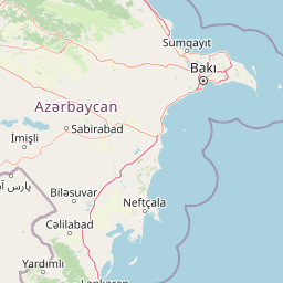
Shahdag National Park landscape and geographic character

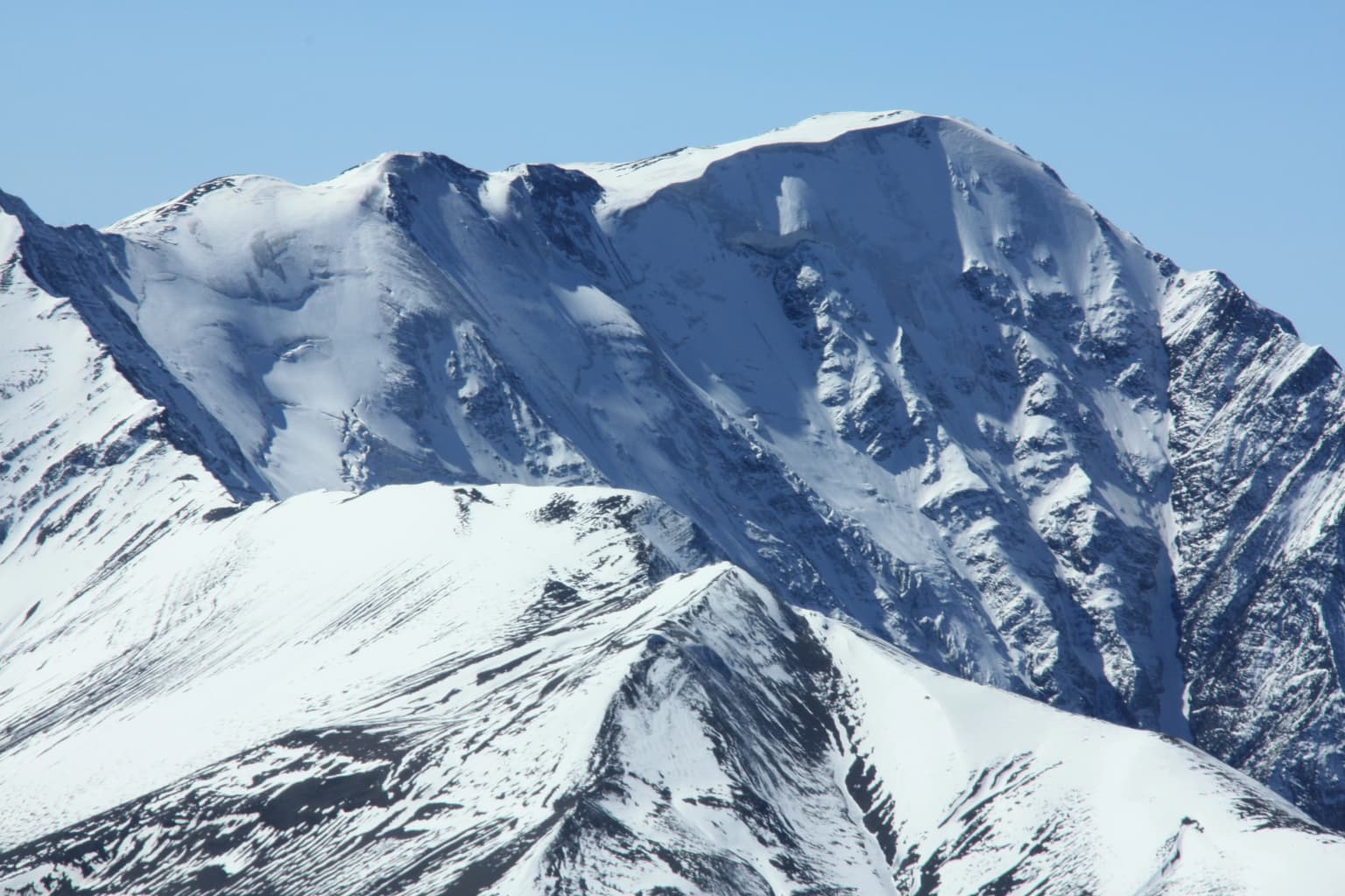
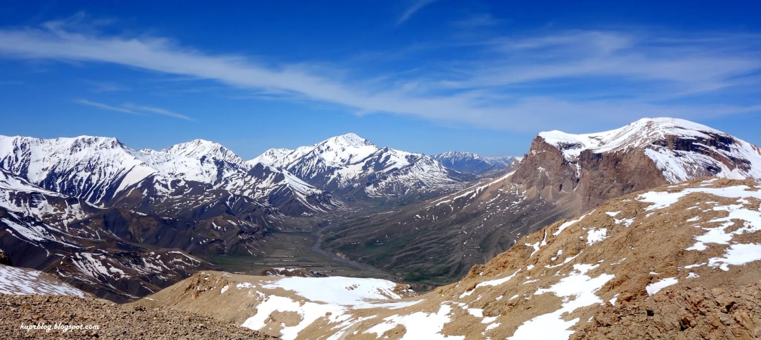
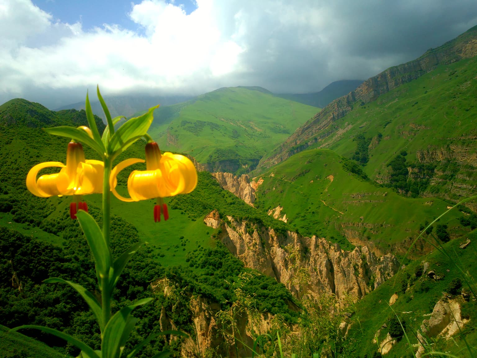
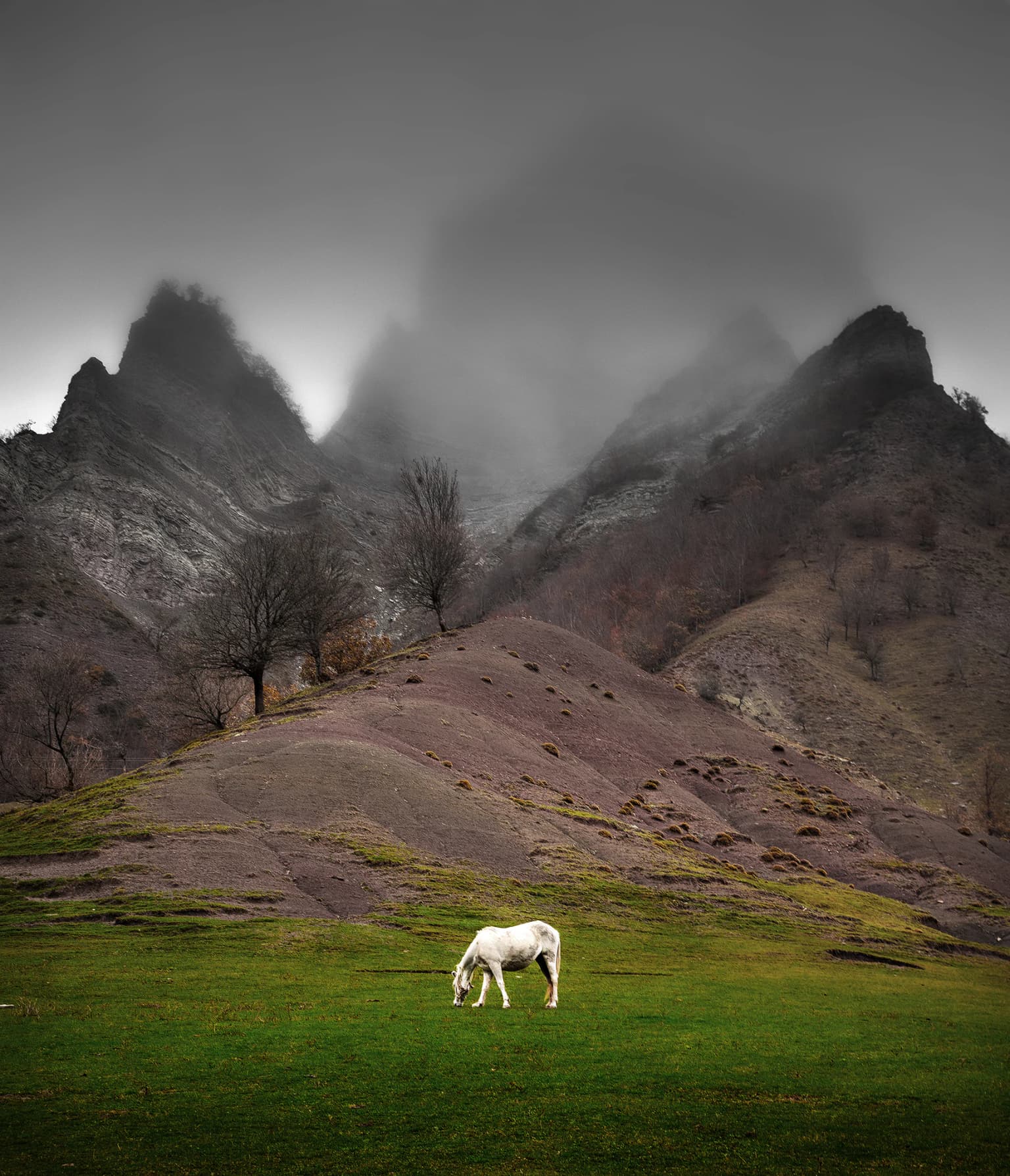
The landscape of Shahdag National Park is defined by the towering peaks and deep valleys of the Greater Caucasus Mountains, creating one of Azerbaijan's most visually dramatic protected landscapes. The park spans elevations from approximately 500 meters above sea level to 4,466 meters at the summit of Mount Bazardüzü, Azerbaijan's highest point. This extraordinary vertical range produces distinct landscape zones that transition from dense broadleaf forests through subalpine meadows and rocky alpine terrain to permanent snow and ice on the highest summits. The terrain is characterized by steep mountain slopes, deep river valleys, and extensive ridge systems that create a complex and visually stunning topography. The park contains several notable peaks including Mount Bazardüzü, Mount Tufan, and the Shahdag massif itself, each presenting different aspects and vegetation patterns depending on elevation and exposure. The landscape includes both gentle alpine plateaus used traditionally as summer pastures and dramatic cliff faces and rockfall zones that provide habitat for mountain goats and chamois. The forests that clothe the lower and mid-elevation slopes create a green mantle across the terrain, while the alpine zone above the tree line presents a more open landscape of grasses, sedges, and scattered rock outcrops. The park's position near the border with Russia places it at a critical junction in the Caucasus mountain chain, where the range reaches some of its greatest heights and most rugged character.

Wide-angle view of a mountain valley with snow-covered peaks, rocky terrain, and clear blue sky
Panoramic view of Shahyaylag Valley with snow-capped mountain peaks under a clear blue sky

Shahdag National Park ecosystems, habitats, and plant life

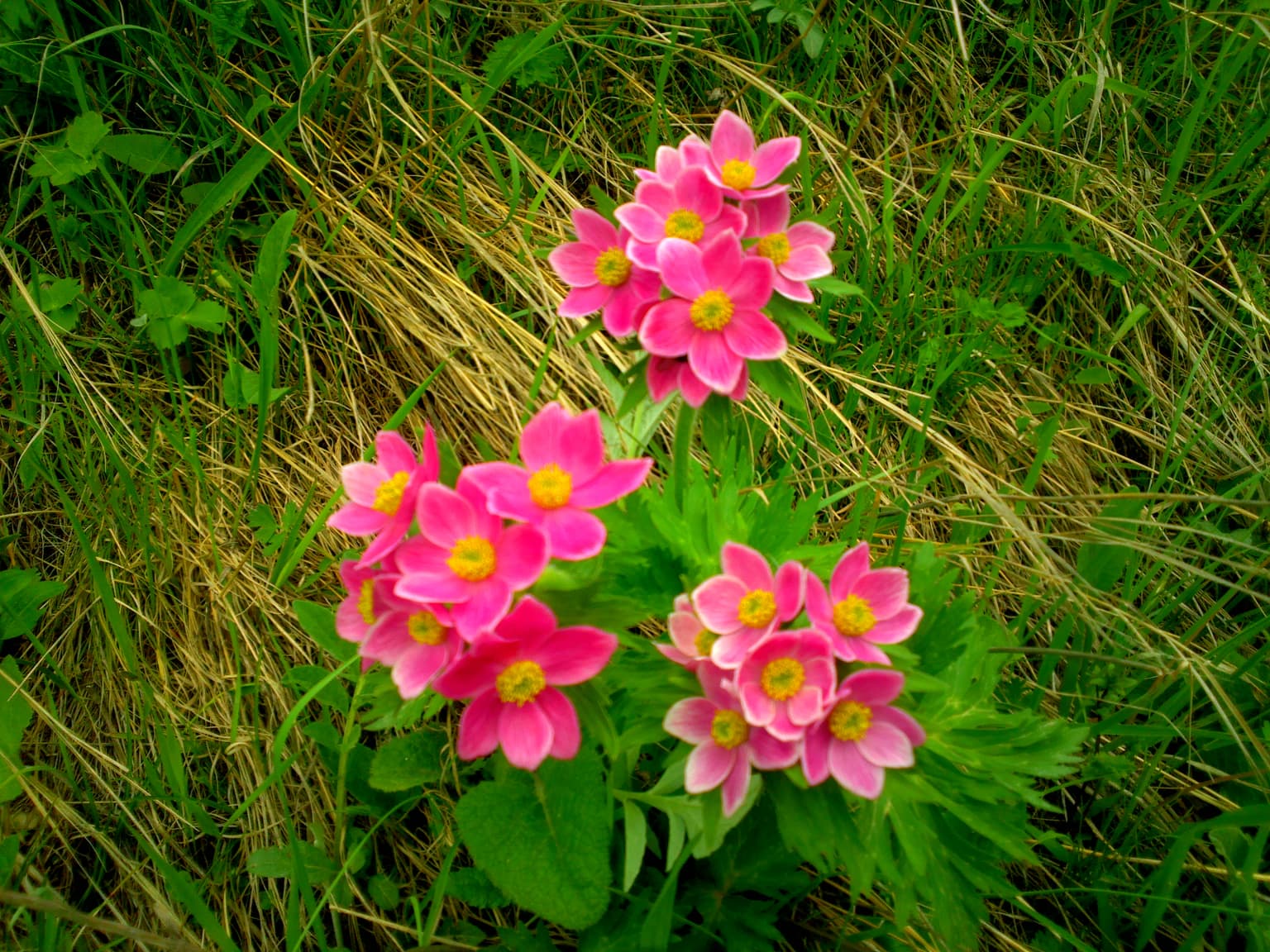
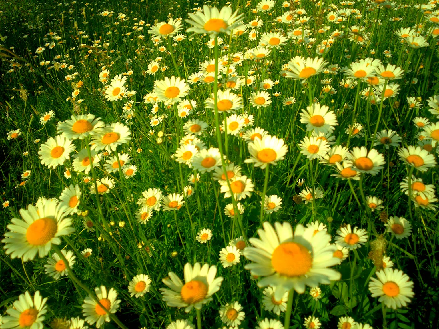
The ecological character of Shahdag National Park reflects the park's exceptional topographic and climatic diversity, creating a complex mosaic of habitats that supports remarkable biodiversity. The montane forests represent the most extensive remaining old-growth forest ecosystem in the Caucasus region, dominated by Caucasian oak in the lower elevations, transitioning to Oriental beech and hornbeam at middle elevations, with birch and conifer species appearing in the subalpine zone. These forests contain significant populations of commercially and ecologically important tree species including common yew, a species with notable conservation value, as well as walnut, wild cherry, and pear trees in more open areas. The shrub layer is equally diverse, featuring species such as hawthorn, dog rose, blackberry, medlar, and barberry that provide important food resources for wildlife. The forest composition changes with elevation and aspect, creating a heterogeneous landscape where pure stands of oak, beech, or hornbeam alternate with mixed forests that include multiple species. This structural diversity supports the rich animal communities that inhabit the park. The high-altitude ecosystems above the tree line support specialized alpine vegetation adapted to short growing seasons, low temperatures, and exposure. These meadow communities provide crucial summer grazing habitat for wild ungulates and support unique assemblages of alpine insects and other invertebrates.

Yellow lilies with red centers and green leaves in the foreground, green mountain slopes and rocky cliffs in the background, cloudy sky above
Yellow lilies with red markings in the mountain valley of Shahdag National Park

Shahdag National Park wildlife and species highlights

Shahdag National Park supports a remarkable mammalian fauna reflecting both its diverse habitats and its position at the eastern end of the Caucasus Mountains. The park is particularly important for its populations of wild mountain ungulates, including the East Caucasian tur, a distinctive goat-antelope endemic to the eastern Caucasus that represents one of the park's most significant conservation priorities. The East Caucasian tur inhabits the steep rocky terrain and alpine meadows at higher elevations, moving seasonally between different parts of the park. Also present are Caucasian chamois, representing a subspecies endemic to the Caucasus, and Bezoar ibex, a wild goat species that inhabits similar rocky terrain. Large predators include the Caucasian lynx, a subspecies of the Eurasian lynx adapted to forest habitats, and the Syrian brown bear, which uses both forest and alpine zones. Smaller carnivores include red fox, jungle cat, and various mustelids including badger and otter along watercourses. The park supports populations of wild boar, roe deer, and several canid species including Indian wolf and common jackal. Birdlife includes species such as Caucasian snowfinch, various raptors, and game birds including quail and partridge. The park has historical significance as part of the former range of the Asiatic lion in the Transcaucasus region before the 10th century. Conservation efforts have also focused on European bison reintroduction, with previous attempts in the 1960s and 1970s ending in failure, and a new initiative launched in 2026.

Close-up of pink wildflowers with yellow centers surrounded by green and brown grass
Pink wildflowers with yellow centers growing in grassy terrain at Shahdag National Park

Shahdag National Park conservation status and protection priorities

Shahdag National Park represents one of the most important conservation priorities in the South Caucasus, protecting both representative examples of Caucasus mountain ecosystems and globally significant populations of endemic species. The park's establishment responded to urgent conservation needs in a region where montane forests had experienced significant historical deforestation and degradation. Protection of the East Caucasian tur population is particularly significant, as this species is restricted to the eastern Caucasus and faces pressures from habitat fragmentation and unsustainable hunting. The park also protects important watershed values, with the forests and alpine zones regulating water flow to rivers that support downstream agriculture and communities. The significant international investment in the park's creation reflects its recognition as a priority for regional biodiversity conservation. Species listed in Azerbaijan's Red Book that occur within the park include the lynx,、山 eagle, and other birds of prey, all of which receive protection within the park's boundaries. The European bison reintroduction program represents a long-term conservation initiative to restore a species that was extirpated from the Caucasus region in the early 20th century, with the last individual reportedly killed in 1927.

Shahdag National Park cultural meaning and human context

The landscapes of Shahdag National Park have been inhabited and used by local communities for generations, with traditional transhumance practices shaping both the ecology and the cultural character of the region. The high-altitude meadows and summer pastures within the park have historically supported seasonal grazing by livestock, creating a cultural landscape that reflects the interaction between human communities and the mountain environment. The park encompasses territory within several rayon's (districts) that have distinct local traditions and histories. The town of Quba, located near the park, serves as an important gateway community and regional center with its own cultural heritage. The mountain communities in the region practice forms of pastoralism that have shaped the subalpine and alpine vegetation through centuries of grazing use. These traditional land use practices are considered in park management, which seeks to balance conservation objectives with the legitimate needs of local communities who have historical connections to the landscape. The park's establishment created a formal protected area where traditional uses are regulated while maintaining connectivity between communities and their ancestral lands.

White horse grazing in green field with rocky mountains and fog in background
White horse grazing in a green meadow with fog-covered mountain peaks in Shahdag National Park

Top sights and standout views in Shahdag National Park

The park's defining feature is Mount Bazardüzü, the highest peak in Azerbaijan at 4,466 meters, whose dramatic summit rises within the park's boundaries and can be seen from much of the protected area. The East Caucasian tur, a striking mountain goat-antelope found only in the eastern Caucasus, represents perhaps the park's most distinctive wildlife species and a major focus for conservation efforts. The old-growth montane forests of Caucasian oak, Oriental beech, and hornbeam represent some of the most intact forest ecosystems remaining in the Caucasus region. The vertical ecological gradient from forest through subalpine meadows to alpine peaks creates remarkable habitat diversity within a single protected landscape. The park is the largest national park in the Caucasus, spanning over 130,000 hectares across six administrative districts in northern Azerbaijan.

Field of white daisy-like flowers with yellow centers and green foliage, characteristic of Shahdag National Park
Daisy-like flowers blooming in a meadow within Shahdag National Park

Best time to visit Shahdag National Park

The summer months from June through September offer the most favorable conditions for exploring Shahdag National Park, when temperatures in the mountains are pleasant and the alpine meadows are accessible. July and August typically provide the warmest conditions at higher elevations and correspond with the peak of the flowering season in subalpine zones. The spring transition in May and early June brings snowmelt, flowing streams, and fresh green vegetation emerging after winter. Autumn in September and October offers the opportunity to observe fall coloration in the forests and potentially clearer visibility at higher elevations. Winter visits are more challenging due to snow and cold temperatures, but the park's higher elevations may offer opportunities for winter sports. The specific timing of visits may depend on whether visitors are interested in wildlife viewing, which is often better in the cooler parts of the day during summer, or landscape photography, where spring and autumn light can be particularly striking.

Park location guide

Geography guide, regional context, and park location map for Shahdag National Park

Shahdag National Park park geography, regions, and map view in Azerbaijan
Understand where Shahdag National Park sits in Azerbaijan through a broader geographic reading of the surrounding landscape, nearby location context, and its mapped position within the national park landscape.

How Shahdag National Park fits into Azerbaijan

Azerbaijan is a unitary semi-presidential republic and one of six independent Turkic states. It declared independence from the Soviet Union in 1991 after nearly seven decades of Soviet rule. The country occupies 86,600 km² and has a population of approximately 10.3 million. It is known for its strategic location at the crossroads of Europe and Asia, its oil industry heritage, and its diverse cultural influences from Persian, Russian, and Turkic traditions.

Wider geography shaping Shahdag National Park in Azerbaijan

Azerbaijan occupies the eastern portion of the Caucasus region, situated between the Caspian Sea to the east and the Greater Caucasus mountains to the north. The terrain is diverse, featuring lowlands along the Caspian coast, mountainous areas in the north and west, and semi-desert plains in the central regions. The Kura and Aras rivers are major waterways draining into the Caspian Sea.

Map view of Shahdag National Park

Use this park location map to pinpoint Shahdag National Park in Azerbaijan, understand its exact geographic position, and read its mapped placement within the surrounding landscape more clearly.

Pigeon | © OpenStreetMap contributors

Explore diverse montane forest habitats, dramatic alpine peaks, and the expansive protected terrain of this Greater Caucasus national park.

Shahdag National Park Photos: Visual Guide to Azerbaijan's Caucasus Mountain Landscapes
Explore a visual gallery showcasing Shahdag National Park's majestic landscapes and diverse mountain ecosystems. These images provide crucial insights into its dramatic Greater Caucasus terrain, from dense montane forests to towering alpine summits, revealing the core protected-area character and critical habitats safeguarding species like the East Caucasian tur.

Snow-capped mountain peak with rugged terrain under clear blue sky

White rose flower with yellow center and green leaves in foreground, rocky mountains and dense green forest in background under blue sky

Wide-angle view of a mountain valley with snow-covered peaks, rocky terrain, and clear blue sky

Yellow lilies with red centers and green leaves in the foreground, green mountain slopes and rocky cliffs in the background, cloudy sky above

Close-up of pink wildflowers with yellow centers surrounded by green and brown grass

Green ferns growing on a rocky cliff face with various shades of brown and gray rocks

White horse grazing in green field with rocky mountains and fog in background

Field of white daisy-like flowers with yellow centers and green foliage, characteristic of Shahdag National Park

Park atlas

Compare mapped geography and diverse conservation landscapes across the Greater Caucasus mountain range.

Explore Other National Parks and Protected Areas Near Shahdag National Park
Browse other national parks and protected areas situated within or adjacent to the Greater Caucasus, extending your geographic discovery beyond Shahdag National Park's boundaries. Compare diverse mountain landscapes, unique ecosystems, and regional conservation efforts to understand the broader protected-area context of Azerbaijan and its neighbors.
National parkAzerbaijan

Altyaghach National Park: Azerbaijan's Protected Natural Area & Forested Geography

Explore the mapped boundaries and temperate deciduous forests.

Altyaghach National Park is a key protected area in Azerbaijan, safeguarding a significant portion of the Greater Caucasus's temperate deciduous broadleaved forest ecosystems. Covering over 11,000 hectares, the park is instrumental in preserving biodiversity and restoring natural habitats, notably providing refuge for the rare East Caucasian tur and other protected species. Its landscape, characterized by rolling to steep terrain and diverse forest cover reaching approximately 941 meters in elevation, makes it a representative example of Caucasus mountain conservation within the country.

Area
110.35 km²
Established
2004
Relief
Mixed relief
Climate
Temperate
National parkKhachmaz Rayon

Samur-Yalama National Park: Caspian Coastal Forest Protected Area

Mapped protected landscape in Azerbaijan's Khachmaz Rayon.

Delve into the protected geography of Samur-Yalama National Park, a key national park established in 2012 within Azerbaijan's Khachmaz Rayon. This 11,772-hectare area meticulously preserves vital Caspian coastal forest ecosystems, characterized by dominant chestnut oak and Persian ironwood stands. The park’s diverse terrain ranges from littoral zones to inland steppe, offering significant insights into regional landscape context and protected area management for atlas exploration and geographic analysis.

Area
117.72 km²
Established
2012
Relief
Mixed relief
Scope
Mixed
National parkDagestan

Samursky National Park: National Park Protected Landscape and Geographic Atlas

Explore Dagestan's Samursky National Park mapped terrain.

Gain a structured understanding of Samursky National Park, a key national park within Russia's Dagestan region. This page focuses on its protected landscape identity, mapped boundaries, and its place within the regional geography of the North Caucasus. Use this atlas-centric view to comprehend the park's contribution to Dagestan's natural terrain and conservation landscape.

Area
483 km²
Established
2019
IUCN
II
National parkAzerbaijan

Ag-Gel National Park

Azerbaijan Protected Wetland & Bird Sanctuary

Ag-Gel National Park is a protected wetland significant for migratory birds. Its landscape features a complex lake system and extensive reed beds, making it a vital conservation area in the Caspian region.

Area
179.24 km²
Established
2003
Relief
Lowland
Climate
Arid
Watercolor painting showing green hills, a river, and distant purple and orange mountains
National parkDedoplistsqaro Municipality

Vashlovani National Park: Georgia's Unique Lowland Desert and Badland Protected Landscape

Discover distinct semi-arid terrain and rare forest ecosystems.

Vashlovani National Park in Dedoplistsqaro Municipality represents a significant protected area preserving Georgia's rare lowland desert and semi-arid steppe ecosystems. This national park is characterized by its striking badland topography, known as the "Sharp Walls," wild pistachio forests, and riparian habitats along the Alazani River. Its unique geographic setting, far removed from Georgia's typical mountainous landscapes, makes Vashlovani a crucial site for understanding regional biodiversity and conservation within the Caucasus.

Area
442.51 km²
Established
1935
IUCN
II
Relief
Lowland
National parkAzerbaijan

Shirvan National Park: Azerbaijan's Unique Protected Semi-Desert Ecosystem and Geography

Discover the mapped landscape, gazelle habitats, and wetland geography.

Shirvan National Park, located in Azerbaijan's Shirvan Lowland, safeguards a remarkable semi-desert environment situated on a former Caspian Sea floor. This protected area is distinguished by its low-lying terrain, ancient coastal ridges, and dune formations, providing essential habitat for the world's largest concentration of goitered gazelles. Wetlands around Çala Lake also support significant migratory bird populations, making Shirvan a crucial protected landscape for both terrestrial and avian wildlife and a key site for regional geographic study.

Area
543.735 km²
Established
2003
Relief
Lowland
Climate
Arid
National parkAzerbaijan

Göygöl National Park: Iconic Alpine Lakes and Protected Caucasus Forest Landscape

Explore Azerbaijan's most visited national park and its rich geographic context.

Göygöl National Park is a key protected area in Azerbaijan, renowned for the crystal-clear alpine Lake Göygöl and its surrounding dense forests within the Lesser Caucasus mountains. This national park showcases over 420 plant species, significant wildlife populations, and dramatic mountainous terrain, making it a prime destination for understanding regional landscape diversity and protected land value. Use MoriAtlas to explore its mapped boundaries and connect it to the broader geographic context of Azerbaijan.

Area
127.55 km²
Established
2008
Relief
Mountain
Climate
Temperate
Watercolor painting of rolling hills, a body of water, and vegetation
National parkBaku

Absheron National Park: Coastal Azerbaijan National Park with Caspian Seal Habitats

Explore mapped geography and semi-desert terrain near Baku.

Absheron National Park, located near Baku on the Absheron Peninsula, is a significant national park safeguarding coastal Caspian Sea environments. Its protected landscapes feature semi-arid terrain and are vital for the conservation of Caspian seals and migratory waterbirds. MoriAtlas provides a structured overview of this unique protected area, focusing on its geographic features, ecological importance, and its role as a key national park within Azerbaijan's atlas of natural reserves.

Area
7.83 km²
Established
2005
Relief
Lowland
Climate
Arid

Common questions about visiting, size, designation, and location context for Shahdag National Park

Shahdag National Park FAQs for park facts, access, geography, and protected area context
Find quick answers about Shahdag National Park, including protected-area facts, park geography, trail and visitor context, and how the park fits into its surrounding country and regional landscape.
MoriAtlas Explorer

Continue Your Protected Areas Search Across the Global Atlas

Deepen your exploration by continuing the structured search for national parks and protected areas worldwide. Utilize the comprehensive filtering capabilities to compare different conservation landscapes and refine your understanding of global park geography. Discover more about the distribution and characteristics of protected natural areas.

Global natural geography