Mori Atlas logo
National parkShirvan National Park

Mapping the unique terrain and conservation significance of Azerbaijan's lowland protected area.

Shirvan National Park: Protected Semi-Desert Landscape and Geography in Azerbaijan

(Şirvan Milli Parkı)

Shirvan National Park represents a significant protected landscape in southeastern Azerbaijan, established on over 54,000 hectares of the Shirvan Lowland. This former Caspian Sea bottom, lying below sea level, features a unique semi-desert terrain with ancient coastal ridges and dune formations. The park is a critical sanctuary for goitered gazelles and migratory waterfowl, offering a distinct focus for atlas-based geographic discovery and regional landscape context.

Semi-desert ecosystemNational parkGoitered gazelle conservationBird migration corridorWetlandsCaspian Sea coast

Shirvan National Park

National park

Park overview

Structured park overview, official facts, and landscape profile for Shirvan National Park

Shirvan National Park park facts, protected area profile, and essential visitor context
Review the core facts for Shirvan National Park, including designation, size, terrain, visitor scale, habitats, and operating context in one park-focused overview.

About Shirvan National Park

Shirvan National Park occupies a distinctive place among Azerbaijan's protected areas as the nation's primary semi-desert conservation landscape. Located in the southeastern Shirvan Lowland within the Kura-Araz plain, the park spans approximately 54,373 hectares of flat, low-lying terrain that was once the bed of the Caspian Sea. The landscape is characterized by an almost imperceptible westward rise in elevation, with ancient coastal ridges and lagoon remnants visible in certain areas. Dune formations created by wind action provide important cover and shelter for gazelle populations, making this terrain particularly well-suited to their conservation. The park was established on the foundation of the Shirvan State Reserve, which was created in 1969 specifically to protect goitered gazelle populations and the characteristic plant communities of the Shirvan Lowland. The surrounding area includes the Shirvan State Nature Reserve and the Bendovan State Nature Reserve, forming a contiguous protected zone of over 65,000 hectares. The park lies at a notably low elevation—20 to 25 meters below sea level—creating a unique hydrological and ecological context where groundwater and standing water bodies support life in an otherwise arid landscape. The absence of flowing rivers is compensated by the presence of the Caspian Sea to the east, collector canals, and Çala Lake, which together provide the water resources essential for the park's wildlife.

Quick facts and research context for Shirvan National Park

Shirvan National Park occupies 54,373.5 hectares in the southeastern Shirvan Lowland of Azerbaijan, within Salyan and Neftçala administrative districts. The terrain is a flat, low-lying accumulative plain situated 20–25 meters below sea level, shaped by the ancient Caspian Sea bed. The park experiences a moderate warm semi-desert to arid steppe climate with hot, dry summers and cool, dry winters. The area lacks permanent rivers or streams, but is bordered by the Caspian Sea to the east, the Bash Shirvan collector canal, and Çala Lake, which provides essential water sources for wildlife. The park protects the world's largest population of Persian gazelles and serves as a vital migration route, nesting area, and wintering ground for numerous bird species.

Park context

Deeper park guide and search-rich context for Shirvan National Park

Shirvan National Park history, landscape, wildlife, and travel context
Explore Shirvan National Park through its history, landscape character, ecosystems, wildlife, conservation priorities, cultural context, and seasonal travel timing in a structured park guide built for atlas discovery and search intent.

Why Shirvan National Park stands out

Shirvan National Park is best known for its population of Persian gazelles (goitered gazelle), which represents the world's largest concentration of this species. The park protects the natural semi-desert complexes of southeastern Shirvan, a unique landscape characterized by halophyte vegetation, ancient coastal ridges, and dune formations that provide critical habitat for gazelles. The wetland areas, particularly around Çala (Kizilqaz) Lake in the western part of the park, serve as a major staging ground for migratory birds along the Western Siberian flyway. The semi-desert landscape, with its distinctive wormwood and ephemeral grass formations covering about 40% of the territory, creates one of Azerbaijan's most ecologically specialized protected areas.

A goitered gazelle stands in dry grass with sparse vegetation in the background
Goitered gazelle standing in the semi-desert grassland of Shirvan National Park

Shirvan National Park history and protected-area timeline

Shirvan National Park was established on July 5, 2003, through a decree of the President of Azerbaijan, building upon the foundation of the Shirvan State Reserve. The original reserve was created in 1969 with the specific mission of protecting goitered gazelle populations and preserving the typical plant biotypes of the Shirvan Lowland. The establishment of the national park expanded protection to encompass neighboring areas, significantly increasing the total protected territory to encompass the semi-desert landscape in its entirety. The park's creation reflected Azerbaijan's broader commitment to biodiversity conservation, particularly for species of regional and global significance. The expansion from reserve to national park status also acknowledged the area's importance as a bird migration corridor and wintering ground. Historically, this region once fell within the range of the Asiatic lion and the Caspian tiger, both of which are now extinct in the Caucasus region, giving the landscape a sense of ecological legacy despite the loss of these apex predators.

Shirvan National Park landscape and geographic character

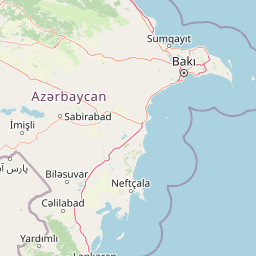
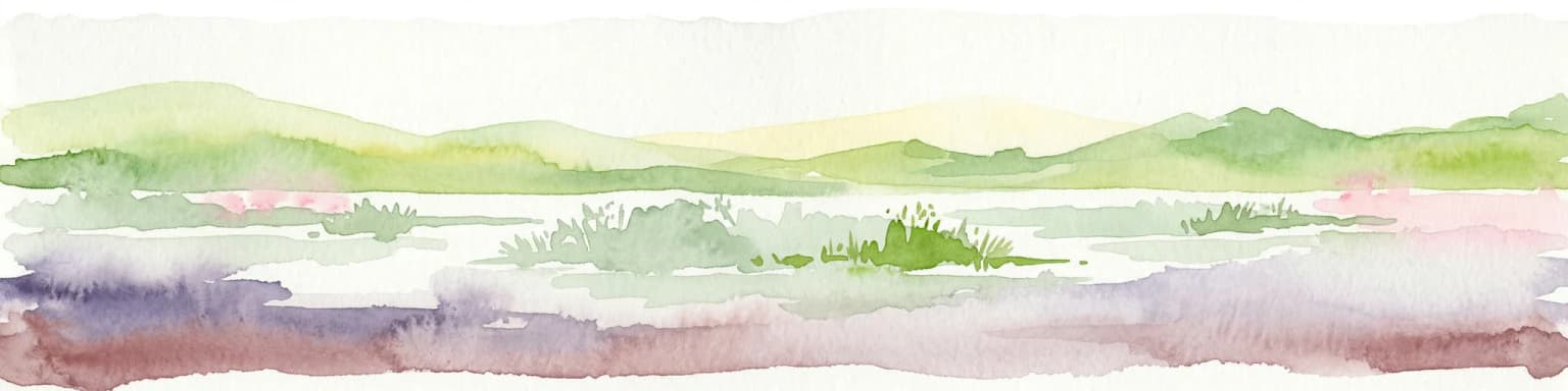
The landscape of Shirvan National Park is defined by its low-lying position as a former Caspian Sea bottom, now forming a flat accumulative plain. The terrain lies 20–25 meters below sea level, with a gentle slope rising slightly toward the west. Ancient coastal ridges and lagoon formations are visible in parts of the park, providing subtle topographical variation in an otherwise flat terrain. Wind-formed dune ridges—known locally as "düyün təpəcikləri"—create localized relief and provide essential shelter and camouflage for gazelles. The area lacks permanent rivers or streams, though it is bounded to the east by the Caspian Sea and to the north by the Bash Shirvan collector and other canal systems. Çala Lake, also known as Kizilqaz Lake, occupies a significant area within the park's western portion, creating wetland habitat amid the surrounding semi-desert. The landscape supports distinctive vegetation zones including halophyte communities on solonchak (salt-affected) soils, semi-desert wormwood formations, and meadow vegetation in humid depressions known as "chals."

Shirvan National Park ecosystems, habitats, and plant life

The nature of Shirvan National Park centers on semi-desert and arid steppe ecosystems that are unique within Azerbaijan's protected area network. The vegetation is adapted to the hot, dry summers and cool, dry winters of the Shirvan Lowland, with distinct plant communities reflecting soil salinity and moisture availability. Desert-type vegetation dominated by Halocnemum strobilaceum covers approximately 40% of the park, thriving on solonchak soils. More complex Halostachys communities grow on hilltops and slopes, while Salicornia vegetation occurs in the central wetlands where groundwater is close to the surface. Semi-desert vegetation dominated by ephemeral wormwood occupies another 40% of the park area and supports the richest species diversity, with 20-25 ephemeral species including bulbous poa and various brome grasses. Meadow-type vegetation develops in the humid depressions ("chals"), forming a two-layered herbaceous community with Alhagi in the upper layer and Aeluropus repens below. The plant communities provide essential forage for gazelles, particularly during winter when aromatic wormwood, saltwort, and other perennials form the natural diet of these animals.

Shirvan National Park wildlife and species highlights

The wildlife of Shirvan National Park is characterized by its semi-desert adaptations and the presence of significant conservation价值 species. The park holds the world's largest population of Persian gazelles (goitered gazelle, Gazella subgutturosa), the primary protected species for which the reserve was originally established. Reintroduction programs have successfully transferred gazelles from Shirvan to other protected areas in Azerbaijan and Georgia, including Vashlovani National Park, Qobustan, Ajinohur steppe, and Ag-Gel National Park. The mammal community includes red fox, wild boar, wolf, jackal, jungle cat, badger, and European hare. Among amphibians and reptiles, the park supports variable toad, tree frogs, marsh frog, European pond turtle, Caspian turtle, Greek tortoise, and various snakes including the grass snake and Levantine viper. The avifauna is particularly significant, with the park serving as a nesting area, migration route, and wintering ground for many valuable bird species. Winter brings large congregations of migratory waterfowl including greylag geese, mallards, and northern pintail to the lakes and water bodies. Notable birds include bustards, black francolins, little bustards, white-tailed eagles, steppe eagles, peregrine falcons, saker falcons, and black-bellied sandgrouse. Species listed in Azerbaijan's Red Book include the Greek tortoise, Persian gazelle, black francolin, bustard, little bustard, and several birds of prey.

Shirvan National Park conservation status and protection priorities

Shirvan National Park represents a cornerstone of Azerbaijan's conservation strategy for semi-desert ecosystems and threatened species. The park's primary conservation focus is the Persian gazelle, whose population in Shirvan represents the largest in the world, making the area globally significant for this species. The park has served as a source population for reintroduction efforts, with gazelles translocated to establish or reinforce populations in multiple protected areas across Azerbaijan and Georgia. The wetland areas, particularly around Çala Lake, are protected as important water-wading ecosystems that support nesting, migration, and wintering for numerous bird species. Many wildlife species present in the park are listed in Azerbaijan's Red Book, including the Greek tortoise, Persian gazelle, black francolin, and several birds of prey. The Caspian seal, although not a resident, occasionally visits the coastal waters adjacent to the park. The conservation framework acknowledges the historical significance of the area as former habitat for now-extinct species including the Asiatic lion and Caspian tiger, adding evolutionary context to the park's protection mandate.

Shirvan National Park cultural meaning and human context

Shirvan National Park occupies a landscape with historical ties to the broader Shirvan region of eastern Azerbaijan. The name "Shirvan" derives from the Persian word for lion, reflecting the historical presence of the Asiatic lion in the Trans-Caucasus. The park lies within the traditional territory associated with the Shirvan Lowland, an area that has been part of Azerbaijan's historical and cultural landscape. The semi-desert environment has supported pastoral and agricultural activities by local communities over generations. The nearby towns of Salyan and Neftçala serve as the closest urban centers to the park. In 2014, a documentary film titled "Shirvan National Park" was produced as part of the "Nine Wonders of Azerbaijan" project, highlighting the park's natural significance and bringing attention to its conservation values.

Top sights and standout views in Shirvan National Park

Shirvan National Park protects the world's largest population of Persian gazelles in a semi-desert landscape unique within the Caucasus region. The park's low-lying terrain, lying 20–25 meters below sea level, represents former Caspian Sea bottom now transformed into a specialized conservation landscape. The wetland areas around Çala Lake provide critical habitat for migratory birds along the Western Siberian flyway, with winter congregations of waterfowl creating a significant ornithological spectacle. Dune formations throughout the park provide essential cover for gazelle populations, while diverse vegetation communities including halophyte, wormwood, and ephemeral grass formations create ecological complexity. The park has proven successful as a source population for gazelle reintroduction programs, demonstrating its conservation value extends beyond its borders. The area represents one of Azerbaijan's most important semi-desert protected areas, safeguarding ecosystems that are rare in the regional context.

Best time to visit Shirvan National Park

The best time to visit Shirvan National Park is during the cooler months from autumn through early spring, when temperatures are more comfortable for outdoor exploration. The park experiences a continental semi-desert climate with hot, dry summers where temperatures can become extreme, making summer visits less comfortable. Winters are cool and dry, offering the opportunity to observe wintering bird populations, particularly waterfowl that congregate around Çala Lake and coastal areas. The winter months provide excellent birdwatching opportunities as migratory species including greylag geese, mallards, and northern pintail gather in significant numbers. Spring and autumn offer pleasant temperatures and the chance to observe the park's wildlife in moderate conditions, though specific seasonal characteristics such as blooming periods or wildlife behaviors are not extensively documented in available sources.

Park location guide

Geography guide, regional context, and park location map for Shirvan National Park

Shirvan National Park park geography, regions, and map view in Azerbaijan
Understand where Shirvan National Park sits in Azerbaijan through a broader geographic reading of the surrounding landscape, nearby location context, and its mapped position within the national park landscape.

How Shirvan National Park fits into Azerbaijan

Azerbaijan is a unitary semi-presidential republic and one of six independent Turkic states. It declared independence from the Soviet Union in 1991 after nearly seven decades of Soviet rule. The country occupies 86,600 km² and has a population of approximately 10.3 million. It is known for its strategic location at the crossroads of Europe and Asia, its oil industry heritage, and its diverse cultural influences from Persian, Russian, and Turkic traditions.

Wider geography shaping Shirvan National Park in Azerbaijan

Azerbaijan occupies the eastern portion of the Caucasus region, situated between the Caspian Sea to the east and the Greater Caucasus mountains to the north. The terrain is diverse, featuring lowlands along the Caspian coast, mountainous areas in the north and west, and semi-desert plains in the central regions. The Kura and Aras rivers are major waterways draining into the Caspian Sea.

Map view of Shirvan National Park

Use this park location map to pinpoint Shirvan National Park in Azerbaijan, understand its exact geographic position, and read its mapped placement within the surrounding landscape more clearly.

Pigeon | © OpenStreetMap contributors

Location context for Shirvan National Park

Salyan Rayon

Visually trace the park's distinctive semi-desert environment, low-lying terrain, and critical goitered gazelle habitats within Azerbaijan's protected landscape

Shirvan National Park Landscapes: See Azerbaijan's Semi-Desert Terrain and Protected Area Scenery
View imagery from Shirvan National Park to understand its unique semi-desert landscapes, distinctive halophyte vegetation, and critical wetland areas, including Çala Lake. Gain visual clarity on the park's specialized ecosystems, tracing its former Caspian seabed terrain and the critical habitats that sustain goitered gazelles and diverse migratory bird populations.

A goitered gazelle stands in dry grass with sparse vegetation in the background

Park atlas

Explore the regional spread of protected areas surrounding Shirvan National Park, comparing adjacent conservation landscapes in Azerbaijan.

Discover Protected Areas and National Parks Near Shirvan National Park, Azerbaijan
Delve into other national parks and protected areas within Azerbaijan, including those that share Shirvan National Park's unique semi-desert ecosystems, goitered gazelle habitats, and Caspian Sea coastal landscapes. This focused atlas view helps you compare distinct conservation landscapes, tracing the geographic spread of similar protected areas and understanding their regional importance.
Watercolor painting showing rolling green hills, a body of water, and distant mountains
National parkLankaran Rayon

Hirkan National Park: Ancient Hyrcanian Forest Protected Area in Lankaran Rayon

Explore mapped boundaries and unique regional geography.

Hirkan National Park stands as a significant protected area in Azerbaijan, renowned for its extensive old-growth Hyrcanian forests. This national park offers a unique window into ancient temperate rainforest ecosystems, featuring remarkable vertical forest zonation and a high concentration of endemic species within the Talysh Mountains and Lankaran Lowland. Its designation as part of the UNESCO World Heritage Hyrcanian Forests underscores its global importance for conservation and atlas-based geographic exploration of unique, relic landscapes.

Area
403.58 km²
Established
2004
Relief
Mixed relief
Climate
Subtropical
National parkAzerbaijan

Ag-Gel National Park

Azerbaijan Protected Wetland & Bird Sanctuary

Ag-Gel National Park is a protected wetland significant for migratory birds. Its landscape features a complex lake system and extensive reed beds, making it a vital conservation area in the Caspian region.

Area
179.24 km²
Established
2003
Relief
Lowland
Climate
Arid
Watercolor painting of rolling hills, a body of water, and vegetation
National parkBaku

Absheron National Park: Coastal Azerbaijan National Park with Caspian Seal Habitats

Explore mapped geography and semi-desert terrain near Baku.

Absheron National Park, located near Baku on the Absheron Peninsula, is a significant national park safeguarding coastal Caspian Sea environments. Its protected landscapes feature semi-arid terrain and are vital for the conservation of Caspian seals and migratory waterbirds. MoriAtlas provides a structured overview of this unique protected area, focusing on its geographic features, ecological importance, and its role as a key national park within Azerbaijan's atlas of natural reserves.

Area
7.83 km²
Established
2005
Relief
Lowland
Climate
Arid
National parkAzerbaijan

Altyaghach National Park: Azerbaijan's Protected Natural Area & Forested Geography

Explore the mapped boundaries and temperate deciduous forests.

Altyaghach National Park is a key protected area in Azerbaijan, safeguarding a significant portion of the Greater Caucasus's temperate deciduous broadleaved forest ecosystems. Covering over 11,000 hectares, the park is instrumental in preserving biodiversity and restoring natural habitats, notably providing refuge for the rare East Caucasian tur and other protected species. Its landscape, characterized by rolling to steep terrain and diverse forest cover reaching approximately 941 meters in elevation, makes it a representative example of Caucasus mountain conservation within the country.

Area
110.35 km²
Established
2004
Relief
Mixed relief
Climate
Temperate
Watercolor painting of layered mountains with green, yellow, and pink hues.
National parkAzerbaijan

Shahdag National Park: Azerbaijan's Largest National Park and Highest Mountain Landscape

Explore the Greater Caucasus protected area and its unique ecosystems.

Shahdag National Park is the largest protected area in Azerbaijan, encompassing a significant portion of the Greater Caucasus mountain range. This national park is renowned for its dramatic elevation changes, creating diverse ecosystems that transition from dense, old-growth montane forests to high-alpine meadows and rugged, rocky summits. The park's landscape is defined by its towering peaks, including Mount Bazardüzü, the nation's highest point, and provides critical habitat for endemic species like the East Caucasian tur. Use this page to begin your atlas-based exploration of Shahdag National Park's protected geography and its distinctive natural terrain.

Area
1,305.08 km²
Established
2006
Relief
Mountain
Scope
Terrestrial
National parkSyunik Province

Arevik National Park: Syunik Province's Protected Mountain Landscape and Biodiversity Atlas

Explore mapped boundaries, terrain, and ecosystems.

Arevik National Park offers a detailed look into the geography and protected landscape of Armenia's Syunik Province. This park is defined by the rugged Zangezur mountains and its remarkable vertical ecological zoning, transitioning from semi-desert to alpine environments. Examine its mapped terrain, significant butterfly and bird habitats, and the presence of key mammal species, providing a comprehensive atlas-style understanding of this protected area's natural identity.

Area
344 km²
Established
2009
IUCN
II
Relief
Mountain
National parkAzerbaijan

Göygöl National Park: Iconic Alpine Lakes and Protected Caucasus Forest Landscape

Explore Azerbaijan's most visited national park and its rich geographic context.

Göygöl National Park is a key protected area in Azerbaijan, renowned for the crystal-clear alpine Lake Göygöl and its surrounding dense forests within the Lesser Caucasus mountains. This national park showcases over 420 plant species, significant wildlife populations, and dramatic mountainous terrain, making it a prime destination for understanding regional landscape diversity and protected land value. Use MoriAtlas to explore its mapped boundaries and connect it to the broader geographic context of Azerbaijan.

Area
127.55 km²
Established
2008
Relief
Mountain
Climate
Temperate
National parkKhachmaz Rayon

Samur-Yalama National Park: Caspian Coastal Forest Protected Area

Mapped protected landscape in Azerbaijan's Khachmaz Rayon.

Delve into the protected geography of Samur-Yalama National Park, a key national park established in 2012 within Azerbaijan's Khachmaz Rayon. This 11,772-hectare area meticulously preserves vital Caspian coastal forest ecosystems, characterized by dominant chestnut oak and Persian ironwood stands. The park’s diverse terrain ranges from littoral zones to inland steppe, offering significant insights into regional landscape context and protected area management for atlas exploration and geographic analysis.

Area
117.72 km²
Established
2012
Relief
Mixed relief
Scope
Mixed

Common questions about visiting, size, designation, and location context for Shirvan National Park

Shirvan National Park FAQs for park facts, access, geography, and protected area context
Find quick answers about Shirvan National Park, including protected-area facts, park geography, trail and visitor context, and how the park fits into its surrounding country and regional landscape.
MoriAtlas Explorer

Continue Your Protected Areas Search Across the Global Atlas

Deepen your exploration by continuing the structured search for national parks and protected areas worldwide. Utilize the comprehensive filtering capabilities to compare different conservation landscapes and refine your understanding of global park geography. Discover more about the distribution and characteristics of protected natural areas.

Global natural geography