Mori Atlas logo
National parkAlgeti National Park

Discover the mapped boundaries and natural terrain of Georgia's significant coniferous forest ecosystem.

Algeti National Park: Protected Landscape and Geographic Context in Georgia

Algeti National Park represents a crucial protected landscape within Georgia, situated in the upper Algeti valley of the eastern Trialeti Range. This national park is renowned for preserving the easternmost extents of vital Caucasian Spruce and Nordmann Fir forests, establishing it as a cornerstone of coniferous woodland ecosystems in the Caucasus region. The park's mountainous terrain, marked by deep ravines and clear rivers, offers a distinct natural setting for atlas-based discovery and understanding of Georgia's unique geography and protected natural heritage.

protected forestmountain landscapeconiferous forestCaucasusbiodiversity hotspotold-growth forest
Watercolor painting of a mountainous valley with forests, hills, and light-colored clouds in the sky

Algeti National Park

National park

Park overview

Structured park overview, official facts, and landscape profile for Algeti National Park

Algeti National Park park facts, protected area profile, and essential visitor context
Review the core facts for Algeti National Park, including designation, size, terrain, visitor scale, habitats, and operating context in one park-focused overview.

About Algeti National Park

Algeti National Park occupies a significant position in Georgia's protected areas network, safeguarding the ecological integrity of the upper Algeti valley in the southeastern part of the country. The park's location within the Trialeti Range provides a transition zone between the lower-lying landscapes of eastern Georgia and the higher Caucasus mountains, creating diverse habitats within a relatively compact area. The park's establishment in 1965 as a state reserve reflected the Soviet Union's recognition of the forests' scientific and conservation value, particularly the easternmost populations of Caucasian Spruce and Nordmann Fir, which represent the limit of these species' distribution. The reorganization of the reserve into a national park in 2007 aligned with Georgia's modernized protected areas legislation and expanded the site's management mandate to encompass both conservation and sustainable recreation objectives. The park's proximity to Tbilisi, approximately 60 kilometers by road, makes it accessible for day visitors while maintaining its protective status. The surrounding region contains numerous archaeological sites spanning from the Neolithic period through the Medieval era, reflecting the long human presence in this valley and adding cultural dimension to the park's natural values.

Quick facts and research context for Algeti National Park

Algeti National Park spans roughly 157 square kilometers in southeastern Georgia's Kvemo Kartli region, protecting a mountainous valley landscape at elevations between 1,100 and 1,950 meters. The park was founded as a state reserve in 1965 and gained national park status in 2007. It is managed by Georgia's Agency of Protected Areas and receives approximately 8,000 visitors annually. The protected area safeguards the easternmost populations of Caucasian Spruce and Nordmann Fir in the Caucasus, making it ecologically significant for conifer conservation.

Park context

Deeper park guide and search-rich context for Algeti National Park

Algeti National Park history, landscape, wildlife, and travel context
Explore Algeti National Park through its history, landscape character, ecosystems, wildlife, conservation priorities, cultural context, and seasonal travel timing in a structured park guide built for atlas discovery and search intent.

Why Algeti National Park stands out

Algeti National Park is best known for its extensive old-growth forests of Caucasian Spruce and Nordmann Fir, which represent the easternmost extent of these species in the Caucasus. The park protects one of the most significant coniferous forest ecosystems in Georgia, with diverse forest types including spruce, oak, beech, pine, and hornbeam communities. The dramatic mountainous terrain of the Trialeti Range, with its deep ravines, clear rivers, and forested slopes, creates a distinctive landscape that supports remarkable biodiversity including brown bears, wolves, roe deer, and over 80 bird species.

A pine tree on a grassy hillside with a clear blue sky and scattered clouds
Pine tree in Algeti National Park, Georgia

Algeti National Park history and protected-area timeline

Algeti National Park traces its institutional history to 1965, when it was established as a state reserve during the Soviet era in Georgia. The original purpose of the reserve was the protection of the easternmost limits of Caucasian Spruce and Nordmann Fir forests, species of significant ecological and scientific interest in the Caucasus region. For over four decades, the area functioned as a state reserve under Soviet and then post-Soviet Georgian administration, maintaining its core conservation mission despite broader political and administrative transitions. In 2007, the reserve was reorganized and elevated to national park status as part of Georgia's comprehensive reform of its protected areas system. This transformation brought increased management resources, clearer public access provisions, and integration into the country's national parks network administered by the Agency of Protected Areas. The 2007 reorganization reflected Georgia's commitment to international conservation standards and sustainable nature tourism development.

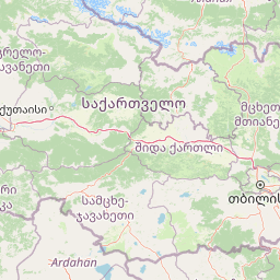
Algeti National Park landscape and geographic character

The physical landscape of Algeti National Park is defined by its position along the upper Algeti valley and the woody southern slopes of the eastern Trialeti Range. The terrain is characterized by strongly mountainous relief, deeply incised by numerous small rivers and ravines that carve through the forested slopes. The park's highest point is Mount Kldekari at approximately 2,000 meters above sea level, while the valley floors sit at lower elevations around 1,100 meters. The underlying geology consists of volcanic and sedimentary rocks, which influence soil types and vegetation patterns throughout the park. The Algeti River and its numerous smaller tributaries flow through the protected area, creating a dendritic drainage pattern that has shaped the valley morphology over geological time. The combination of elevation range, aspect variations, and water availability supports the diverse forest communities that characterize the park's landscape.

Red poppy flowers with green stems and leaves against green hills and blue sky with scattered clouds
Red poppy flowers in a meadow within Algeti National Park

Algeti National Park ecosystems, habitats, and plant life

The ecological character of Algeti National Park centers on its extensive forest cover, which occupies approximately 6,044 hectares of the protected area's 6,822 hectares. The forest composition reflects the park's significance as a repository of Caucasus biodiversity, with several distinct forest types present. Spruce forests dominate portions of the higher elevations, while oak forests cover substantial areas at middle elevations. Beech forests occur in moist ravines and northern aspects, and pine forests are found on drier sites. Smaller areas of hornbeam, fir, and birch complete the forest mosaic. The park supports remarkable plant diversity, with 1,664 plant species documented, including 80 tree species and 74 shrub species. The fungal diversity is equally impressive, with 250 species identified, including ten species first discovered within the park. The moist continental climate, with moderately cold winters and long warm summers, supports these rich ecological communities and maintains the park's role as a biodiversity reservoir in the Caucasus region.

Snow-covered field with forest of evergreen trees and snow-capped mountains under a cloudy sky
Snow-covered forest slopes and mountain peaks in Algeti National Park

Algeti National Park wildlife and species highlights

Algeti National Park supports a diverse fauna reflecting the Caucasus region's status as a biodiversity hotspot. Large predators present include brown bear and wolf, with occasional sightings of lynx noted in the more remote forest areas. Roe deer are permanent residents of the park's forests, while smaller mammals include badger, dormouse, hare, fox, and wild boar. The reptile and amphibian communities are represented by several species, with snakes including copperhead, common grass snake, water snake, and field snake documented in the park. Birdlife is particularly diverse, with over 80 species recorded in the Algeti valley. Raptors such as eagles and hawks are commonly observed, while the valley supports populations of kestrels, herons, storks, black woodpeckers, larks, thrushes, and other songbirds. The golden eagle, a species of conservation concern, is rarely but occasionally observed in the park. Several species protected under Georgia's Red Book occur in the park, including the brown bear and Caucasian grouse, highlighting the conservation significance of the protected area.

Wide view of forested hills under clear blue sky, with autumn foliage in shades of green, red, and yellow.
Autumn landscape view of Algeti National Park, featuring vibrant foliage on forested hillsides.

Algeti National Park conservation status and protection priorities

Algeti National Park serves multiple conservation functions within Georgia's protected areas network. The primary conservation purpose stems from its role as a refuge for Caucasian Spruce and Nordmann Fir, species whose easternmost populations occur within the park boundaries. These coniferous forests represent critical habitat for numerous species and provide ecosystem services including watershed protection, soil stabilization, and carbon sequestration. The park functions as a scientific research base, supporting botanical, zoological, and ecological studies of Caucasus ecosystems. Additional conservation values include water-retention and soil-protection functions, with the forested slopes playing a role in regulating water flow and preventing erosion in the Algeti valley. The designation as a Category II protected area under the IUCN framework reflects the park's primary objective of protecting natural ecosystems while allowing for limited sustainable use.

Algeti National Park cultural meaning and human context

The Algeti valley has supported human communities for millennia, and the area surrounding the national park contains numerous archaeological sites reflecting long-term human presence. Archaeological finds in the vicinity include materials from the Eneolithic period and Early Bronze Age, indicating prehistoric occupation of the valley. Remnants from later periods include Bronze Age cyclopean fortifications, Medieval churches and church ruins, and the ruins of Kldekari fortress dating to the ninth century. The eleventh-century Bitvisi castle-city stands near the park's northeastern boundary, while the fourth-century Manglisi temple is located nearby. These historical sites, though not within the national park boundaries themselves, contribute to the cultural landscape context and reflect the valley's historical significance as a corridor for movement and settlement in the Caucasus region.

Colorful deciduous trees, evergreen forest, and distant hills under a partly cloudy sky.
Autumnal landscape in Algeti National Park featuring colorful foliage and rolling hills.

Top sights and standout views in Algeti National Park

Algeti National Park stands out for its exceptional old-growth coniferous forests of Caucasian Spruce and Nordmann Fir, the easternmost populations of these species in their range. The park offers a distinctive Caucasus mountain landscape with forested slopes, clear rivers, and deep ravines within relatively close proximity to Tbilisi. The biodiversity value is substantial, with over 1,600 plant species and 250 fungal species documented, alongside diverse wildlife including brown bears, wolves, roe deer, and more than 80 bird species. The combination of natural heritage, accessibility, and cultural context makes the park significant for both conservation and educational purposes.

Wide landscape view of a forested valley with autumn-colored trees, rocky outcrops, and rolling hills.
Autumnal forested valley in Algeti National Park, Georgia, with rocky slopes and vibrant seasonal foliage.

Best time to visit Algeti National Park

The best time to visit Algeti National Park is during the warmer months from May through September, when weather conditions are most suitable for hiking and outdoor exploration. Spring brings blossoming flora and active wildlife in the lower elevations, while summer offers warm temperatures and full forest canopy coverage. Autumn provides colorful foliage displays and mushroom season, with the park's fungal diversity becoming evident. Winter visits are possible but limited by snow and colder temperatures at higher elevations. The shoulder seasons of late spring and early autumn often offer the most comfortable conditions for exploring the park's trails while avoiding peak visitor periods.

Park location guide

Geography guide, regional context, and park location map for Algeti National Park

Algeti National Park park geography, regions, and map view in Georgia
Understand where Algeti National Park sits in Georgia through a broader geographic reading of the surrounding landscape, nearby location context, and its mapped position within the national park landscape.

How Algeti National Park fits into Georgia

Georgia is a transcontinental country spanning Eastern Europe and West Asia, situated in the Caucasus region along the Black Sea. It declared independence from the Soviet Union in 1991 and today functions as a unitary parliamentary republic with Tbilisi as its capital. The nation is notable for its distinctive Georgian language, Orthodox Christian traditions dating to the 4th century, and archaeological evidence of the world's earliest winemaking sites.

Wider geography shaping Algeti National Park in Georgia

Georgia occupies a strategic position at the crossroads of Eastern Europe and West Asia, bordered by Russia to the north and northeast, the Black Sea to the west, Turkey and Armenia to the south, and Azerbaijan to the southeast. The terrain is predominantly mountainous in the north with the Greater Caucasus range, transitioning to plains and valleys in the east. The country spans approximately 69,700 square kilometres.

Map view of Algeti National Park

Use this park location map to pinpoint Algeti National Park in Georgia, understand its exact geographic position, and read its mapped placement within the surrounding landscape more clearly.

Pigeon | © OpenStreetMap contributors

Location context for Algeti National Park

Kvemo Kartli

Browse captivating scenery and diverse forest habitats across the protected Algeti valley and eastern Trialeti Range terrain.

Algeti National Park Photos: Visual Exploration of Georgia's Caucasus Mountain Landscapes
Visually explore Algeti National Park's diverse landscapes, understanding its distinctive Caucasus mountain terrain, old-growth coniferous forests, and intricate river valleys. These curated images offer essential insights into the park's unique protected-area character, showcasing critical habitats and the broad environmental context of this Georgian conservation gem.

A pine tree on a grassy hillside with a clear blue sky and scattered clouds

A landscape view of rolling hills with autumn-colored forests under a clear blue sky, with dry grassy fields in the foreground

Red poppy flowers with green stems and leaves against green hills and blue sky with scattered clouds

Snow-covered field with forest of evergreen trees and snow-capped mountains under a cloudy sky

Wide view of forested hills under clear blue sky, with autumn foliage in shades of green, red, and yellow.

A landscape view of Algeti National Park featuring mixed forest with autumn-colored trees and a mountain in the background under a clear blue sky

Colorful deciduous trees, evergreen forest, and distant hills under a partly cloudy sky.

Wide landscape view of a forested valley with autumn-colored trees, rocky outcrops, and rolling hills.

Rolling hills covered in autumn-colored trees with scattered trees in a field foreground

Wide landscape view of Algeti National Park showing autumn-colored hills, forested areas, and mountains under a partly cloudy sky

Wide view of lush green valleys and rolling hills with forested mountains in the distance under a partly cloudy sky

Green forest with wildflowers in the foreground, rolling mountains in the background, and a partly cloudy sky.

Grassy field with white wildflowers, scattered trees, and forested hills under a partly cloudy sky

Wide landscape view of forested hills with autumn foliage, showing green, red, and orange trees under a clear blue sky

Snow-covered mountain range with scattered pine trees in a valley

Snow-covered rocky mountain peaks with patches of snow on slopes, under a light blue sky with faint clouds

Park atlas

Explore the surrounding Caucasus region's diverse protected landscapes, comparing Algeti's forests with nearby mountain parks and natural reserves.

Discover Other National Parks and Protected Areas Near Algeti National Park, Georgia
Continue exploring protected areas within Georgia and the broader Caucasus region, building on the distinctive mountain forests and deep ravines of Algeti National Park. Compare the geographic spread of national parks across diverse terrains, tracing how various protected landscapes connect throughout this unique natural atlas.
Watercolor illustration of a landscape with mountains, a river, trees, and grassy fields
National parkMtskheta Municipality

Tbilisi National Park: Oldest Protected Landscape in Mtskheta Municipality

Explore Georgia's oldest national park and its mapped forest terrain.

Tbilisi National Park represents Georgia's oldest protected area, nestled in the Saguramo Range within Mtskheta Municipality. This page provides an atlas-focused view of its geographic features, including mountainous terrain and deciduous forest ecosystems. Users can explore the park's mapped boundaries and understand its significance as a crucial natural landscape close to Tbilisi, contributing to the region's protected areas network.

Area
380.02 km²
Established
1973
IUCN
II
Relief
Highland
National parkMtskheta-Mtianeti

Kazbegi National Park: Georgia's Alpine Protected Landscape & Regional Geography

Explore its dramatic terrain and protected area boundaries.

Kazbegi National Park offers a unique glimpse into the dramatic alpine geography of the Greater Caucasus. As a protected national park in the Mtskheta-Mtianeti region, it showcases rugged terrain, high-altitude ecosystems, and significant natural features. MoriAtlas provides a structured way to understand the park's physical characteristics, its mapped presence, and its place within the broader regional atlas, highlighting the distinct landscape of this Georgian protected area.

Area
1,446.17 km²
Established
1976
IUCN
II
Relief
Mountain
National parkShirak Province

Lake Arpi National Park: High-Altitude Wetland Protected Landscape in Shirak Province

Mapped boundaries of an important South Caucasus conservation area.

Lake Arpi National Park offers a unique window into high-altitude wetland ecosystems on the Shirak and Javakheti plateau, located at roughly 2000 meters above sea level. Established as a national park in 2009, it protects critical habitats, including the central Lake Arpi, and serves as a vital sanctuary for numerous bird species. This protected area is distinguished by its alpine meadows, significant bird populations, and its distinct geographic setting within Armenia's northwestern region, providing rich context for atlas-based exploration of protected lands.

Area
250 km²
Established
2009
IUCN
II
Relief
Mountain
Watercolor painting of green and pink mountain ranges under a light sky background
National parkSamtskhe–Javakheti

Javakheti National Park: Protected Highland Landscape and Wetland Atlas

Explore the unique geography and mapped park boundaries of this Georgian protected area.

Delve into Javakheti National Park, a significant protected landscape located in Georgia's Samtskhe, Javakheti region. This page serves as an entry point for understanding the park's distinctive highland terrain, its remarkable chain of lakes and marshes, and its protected area status. Explore the geographic context of this national park, its role in wetland conservation, and its value for structured atlas-based discovery of natural landscapes.

Area
238.53 km²
Established
2011
IUCN
II
Relief
Mixed relief
National parkGeorgia

Borjomi-Kharagauli National Park: Protected Landscape Atlas of Georgia's Lesser Caucasus

Explore its unique forests, wildlife, and mountain terrain.

Delve into Borjomi-Kharagauli National Park, a significant protected area in Georgia's Lesser Caucasus region. This national park is renowned for its extensive old-growth forests, including rare Colchian fragments, and a remarkable concentration of endemic species. The park's dramatic mountainous terrain, spanning over 1,000 square kilometers, offers a rich tapestry of landscapes from deep valleys to alpine meadows, providing critical habitat for large mammals and contributing significantly to the region's biodiversity. Explore its mapped boundaries and geographic context for a deeper understanding of this vital conservation landscape.

Area
1,093 km²
Established
1995
IUCN
II
Relief
Mountain
National parkGeorgia

Tusheti National Park National Park: Geographic Exploration of Caucasus Protected Landscapes

Mapped protected area boundaries and alpine terrain in Georgia.

Tusheti National Park offers a deep dive into the rugged geography of the Greater Caucasus. This national park, situated in a remote corner of Georgia, protects a dramatic landscape characterized by high mountain ridges, glacial valleys, and diverse ecosystems. The park's mapped boundaries encompass significant alpine terrain, providing essential habitat and serving as a critical area for understanding regional protected land distribution and landscape context. Explore the unique geographic identity of Tusheti National Park.

Area
1,276.43 km²
Established
2003
IUCN
II
Relief
Mountain
Watercolor painting showing a landscape with green hills, trees, and distant mountains
National parkMtskheta-Mtianeti

Pshav-Khevsureti National Park: Protected Mountain Landscape and Regional Geography in Mtskheta-Mtianeti

Explore rugged terrain and alpine ecosystems in Georgia's Caucasus.

Pshav-Khevsureti National Park is a key protected area in Georgia's Mtskheta-Mtianeti region, recognized for its dramatic mountain terrain, deep river valleys, and alpine zones. Established as a national park, it safeguards the watersheds of major rivers, supporting significant wildlife and offering a compelling geographic context for atlas exploration. This protected landscape provides insight into the unique natural and cultural heritage of the Khevsureti region, making it a focal point for understanding Georgia's protected area network and mountainous geography.

Area
1,400.44 km²
Established
2014
IUCN
II
Relief
Mountain
National parkTavush Province

Dilijan National Park: Mapped Protected Landscape and Forested Terrain in Tavush Province

Explore ancient deciduous forests and medieval sites within this protected area.

Dilijan National Park offers a unique atlas perspective on Armenia's natural and cultural heritage. This protected landscape in Tavush Province is dominated by vast, ancient deciduous forests, including rare yew groves, making it a vital conservation area. Its mountainous terrain, carved by rivers and dotted with medieval monasteries like Haghartsin and Goshavank, provides a rich context for geographic discovery. Users can explore the park's mapped boundaries and understand its significance as a preserved woodland ecosystem within the Caucasus region through its detailed geographic information.

Area
240 km²
Established
2002
IUCN
II
Relief
Mixed relief

Common questions about visiting, size, designation, and location context for Algeti National Park

Algeti National Park FAQs for park facts, access, geography, and protected area context
Find quick answers about Algeti National Park, including protected-area facts, park geography, trail and visitor context, and how the park fits into its surrounding country and regional landscape.
MoriAtlas Explorer

Continue Your Protected Areas Search Across the Global Atlas

Deepen your exploration by continuing the structured search for national parks and protected areas worldwide. Utilize the comprehensive filtering capabilities to compare different conservation landscapes and refine your understanding of global park geography. Discover more about the distribution and characteristics of protected natural areas.

Global natural geography