Mori Atlas logo
National parkBorjomi-Kharagauli National Park

Explore mapped boundaries and diverse terrains of one of Europe's largest national parks.

Borjomi-Kharagauli National Park: Georgia's Premier Protected Landscape in the Lesser Caucasus

Borjomi-Kharagauli National Park represents a cornerstone of Georgia's conservation efforts, encompassing over one percent of the nation's territory within the central Lesser Caucasus mountain range. This expansive protected landscape, covering approximately 1,093 square kilometers, is celebrated for its exceptional biological diversity and the preservation of one of the largest contiguous tracts of Caucasus mixed forests, including rare Colchian forest fragments. The park's rugged terrain features deep valleys, forested ridges, and alpine meadows, offering a rich context for understanding regional geography and protected-area significance.

Caucasus mountainsNational parkOld-growth forestEndemic speciesCaucasus mixed forestsProtected area

Borjomi-Kharagauli National Park

National park

Park overview

Structured park overview, official facts, and landscape profile for Borjomi-Kharagauli National Park

Borjomi-Kharagauli National Park park facts, protected area profile, and essential visitor context
Review the core facts for Borjomi-Kharagauli National Park, including designation, size, terrain, visitor scale, habitats, and operating context in one park-focused overview.

About Borjomi-Kharagauli National Park

Borjomi-Kharagauli National Park represents Georgia's commitment to preserving its natural heritage within the Lesser Caucasus, one of Europe's most ecologically significant mountain systems. The park's territory encompasses a remarkable altitudinal range that supports distinct ecological communities from valley forests through subalpine meadows to alpine zones. The region's name derives from the Georgian word for juniper, reflecting the area's historical character, though today broadleaf and conifer forests dominate the landscape. The park was conceived as a comprehensive protected area linking existing fragmented reserves into a cohesive conservation landscape, and it now serves as a critical corridor for wildlife movement through the Caucasus region. The area has a long history of royal protection dating to the Russian imperial period when Grand Duke Michael Nicolaievich established his summer residence at Likani and prohibited unauthorized logging and hunting, laying early foundations for conservation. Today, the park balances ecological preservation with growing tourism activity, offering visitors access to pristine natural environments while maintaining the ecological integrity that makes this area globally significant.

Quick facts and research context for Borjomi-Kharagauli National Park

Borjomi-Kharagauli National Park is situated in central Georgia within the Lesser Caucasus mountains, approximately 150 kilometers southwest of the capital Tbilisi. As one of the country's largest national parks, it incorporates six municipalities and protects the headwaters and watershed areas that feed the Borjomi valley, famous for its mineral water industry. The park was established in 1995 following decades of protection that began with the creation of the Borjomi State Nature Reserve in 1935. It is managed by Georgia's Agency of Protected Areas and has developed tourist infrastructure including twelve marked hiking routes offering excursions from one to five days in duration.

Park context

Deeper park guide and search-rich context for Borjomi-Kharagauli National Park

Borjomi-Kharagauli National Park history, landscape, wildlife, and travel context
Explore Borjomi-Kharagauli National Park through its history, landscape character, ecosystems, wildlife, conservation priorities, cultural context, and seasonal travel timing in a structured park guide built for atlas discovery and search intent.

Why Borjomi-Kharagauli National Park stands out

The park is renowned for its extraordinary biological diversity and intact forest ecosystems. It preserves one of the largest contiguous tracts of Caucasus mixed forests in the region, including rare Colchian forest fragments that represent relict Tertiary-era vegetation communities. The park sits at the junction of the Caucasus and Anatolian biodiversity hotspots and is recognized as one of WWF's 35 global priority ecoregions. Its wildlife includes globally significant populations of large mammals such as brown bear, lynx, and Caucasian red deer, alongside endemic species like the Caucasian salamander and Caucasian snowfinch that occur only in these mountains.

Borjomi-Kharagauli National Park history and protected-area timeline

The history of Borjomi-Kharagauli National Park reflects Georgia's broader political transitions and evolving approach to nature conservation. During the medieval period, theBorjomi valley served as an exclusive hunting ground for Georgian aristocracy, with the forest reserves maintained for royal recreation. When Georgia lost its independence and became part of the Russian Empire in the nineteenth century, the region gained international attention when Grand Duke Michael Nicolaievich, appointed as Governor General of Transcaucasia in 1862, was so captivated by the area's beauty that he established his summer residence at Likani. In 1871, Tsar Alexander II gifted the entire Borjomi valley to his brother, and Michael subsequently enclosed much of the forest and prohibited unauthorized timber harvesting and hunting, creating de facto protection that would influence the region's future. The modern conservation era began in 1935 with the establishment of the Borjomi State Nature Reserve, a strict protection area that remains within the park's boundaries today. Following Georgia's independence, the national park was formally established in 1995 with support from the World Wildlife Fund and the German government, representing the first national park created in the Caucasus region. The park was officially inaugurated in 2001, and since then has developed infrastructure and management programs while facing environmental challenges including the devastating 2008 wildfire that burned more than three square kilometers of forest.

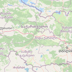
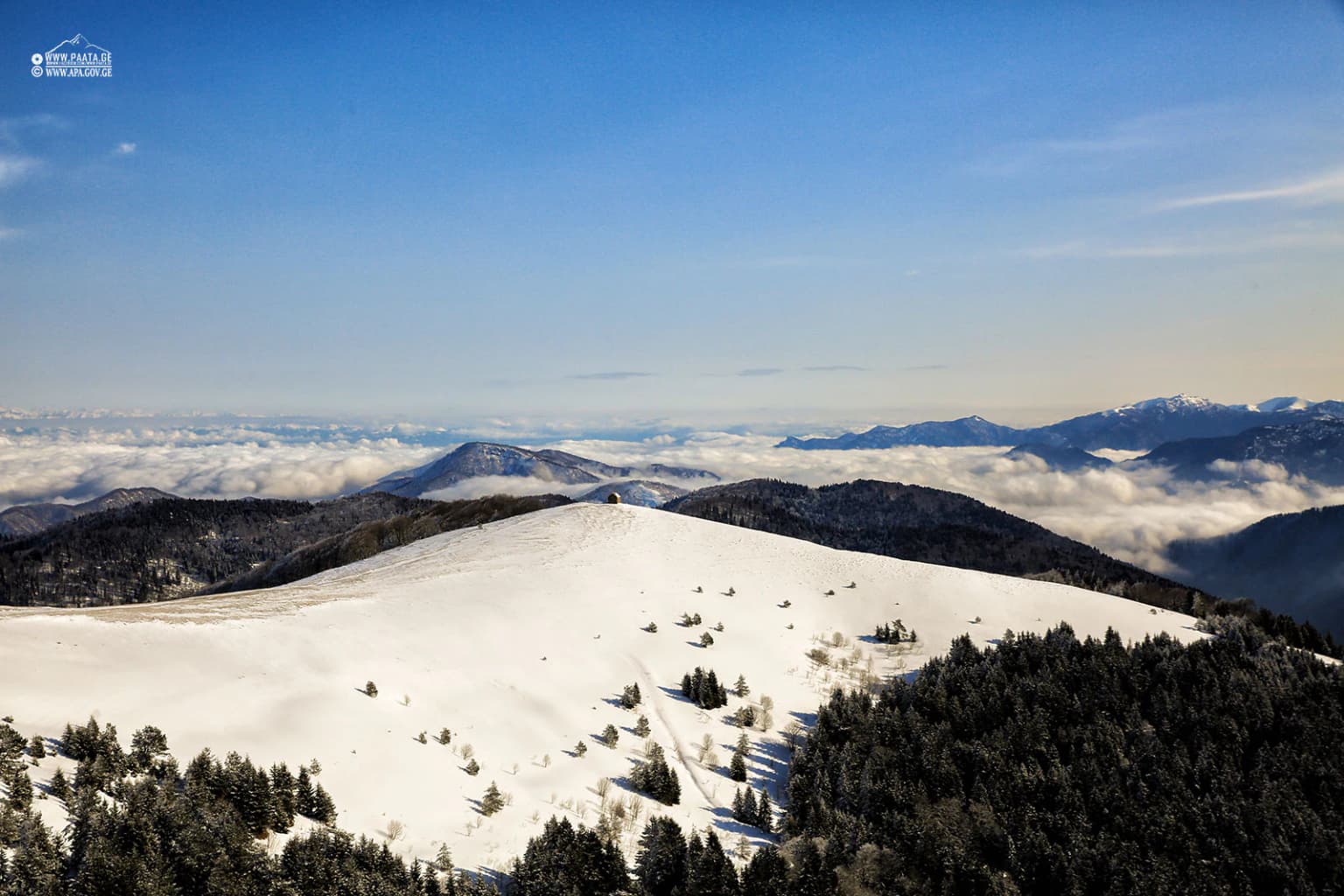
Borjomi-Kharagauli National Park landscape and geographic character

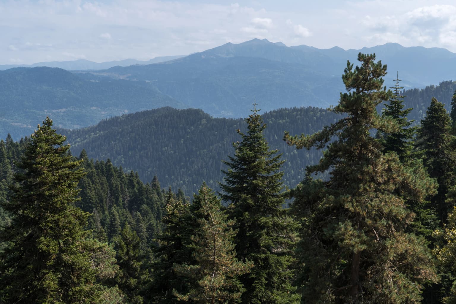
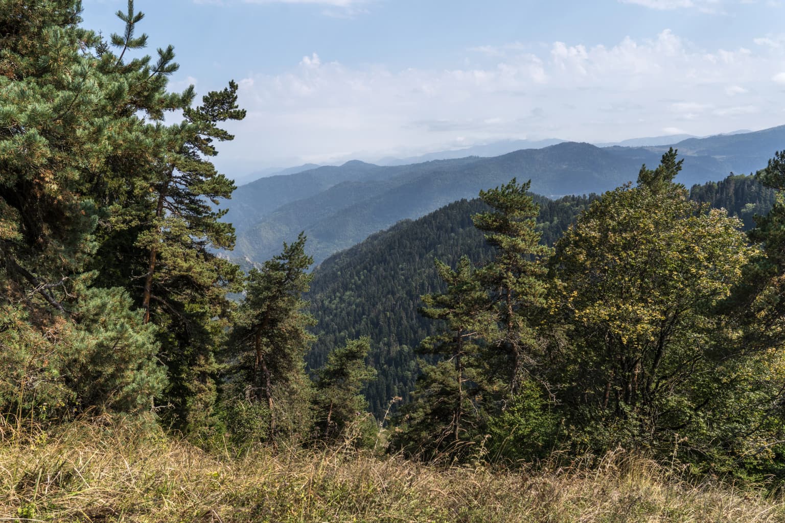
The physical landscape of Borjomi-Kharagauli National Park is characterized by rugged mountainous terrain within the Lesser Caucasus, with elevations ranging from approximately 1,000 meters to over 2,500 meters above sea level. The terrain features deep river valleys, forested ridges, and alpine meadows create a visually dramatic environment. The park encompasses parts of the Meskheti and Trialeti mountain ranges, with the Borjomi valley serving as a central geographic feature. The region's hydrology is significant, with the park protecting watershed areas that feed streams and rivers flowing through the Borjomi valley, an area famous for its mineral water springs. The combination of elevation, aspect, and geological substrate has created diverse microhabitats supporting the park's exceptional biodiversity.

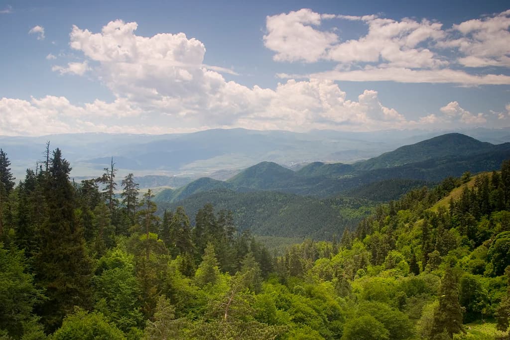
Borjomi-Kharagauli National Park ecosystems, habitats, and plant life

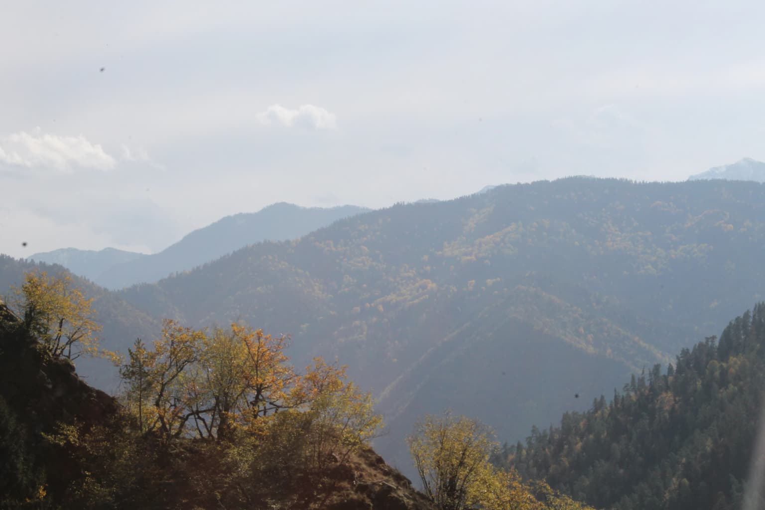
The ecological character of Borjomi-Kharagauli is defined by its position within the Caucasus mixed forests ecoregion, one of the most biologically diverse temperate forest ecosystems in the Northern Hemisphere. Approximately 75 percent of the park's territory is covered by forest, with the most extensive cover in the lower and middle elevation zones. The park contains some of the largest remaining tracts of untouched Caucasus mixed forest, including significant remnants of Colchian forests, a Tertiary relict vegetation type with species that survived from pre-glacial periods. At higher elevations, the forest transitions through subalpine zones characterized by Caucasian rhododendron krummholz and into alpine meadows. Conifer forests of Oriental spruce, Nordmann fir, and Caucasian pine dominate the montane zone between 1,400 and 1,800 meters elevation, with all conifer species being Caucasus endemics. The park's location at the boundary between Iranian-Anatolian and Caucasian ecoregions contributes to the presence of southern species at their northern limits.

Borjomi-Kharagauli National Park wildlife and species highlights

Borjomi-Kharagauli National Park supports exceptional faunal diversity, with 64 mammal species recorded including 11 Caucasus endemics and eight species listed in Georgia's Red Data Book. The large mammal community includes brown bear, gray wolf, lynx, and Caucasian red deer, with the latter two species maintaining significant populations in the protected environment. The park is particularly important for bird diversity, with 217 species of migratory and resident birds documented, including 13 Red Data Book species. Notable birds include the Caucasian snowfinch, the Caucasian grouse, the grey-faced woodpecker, and various birds of prey such as the golden eagle and steppe eagle. Reptile and amphibian diversity is outstanding, with approximately 30 reptile species and numerous amphibians, including the endemic Caucasian salamander and Caucasian parsley frog. The park's rivers support populations of brown trout, barbel, and roach, while 20 species of bats have been recorded within the protected area.

Borjomi-Kharagauli National Park conservation status and protection priorities

Borjomi-Kharagauli National Park occupies a critical position in global conservation as part of the Caucasus biodiversity hotspot, recognized by WWF as one of 35 global priority ecoregions and one of 34 global biodiversity hotspots by Conservation International. The park falls within two overlapping biodiversity hotspots—Caucasus and Anatolian—making it extraordinarily significant for conservation investment. Under the Caucasus Ecoregional Conservation Plan, the park forms a core area of one of 56 priority areas identified for conservation action. The protected area also serves a crucial ecological corridor function, connecting fragmented populations of large mammals across the Caucasus landscape. However, the park faces significant environmental challenges, including the proximity of the Baku-Tbilisi-Ceyhan pipeline to its boundary, which crosses the park's watershed and has raised concerns from environmental groups about potential contamination risks to both the ecosystem and the Borjomi mineral water aquifer. The devastating 2008 wildfire demonstrated the vulnerability of the ecosystem to climate-related disturbances and highlighted the broader environmental tensions in the region.

Borjomi-Kharagauli National Park cultural meaning and human context

The Borjomi valley has been a site of human significance for centuries, initially as a royal hunting preserve during Georgia's medieval kingdom period. The area gained international prominence during the Russian imperial era when it became a summer retreat for the imperial family, with the Grand Duke's residence at Likani becoming a center of aristocratic activity. The region's mineral springs have been exploited commercially since the late nineteenth century, and Borjomi water remains one of Georgia's most significant exports, creating a direct economic connection between the protected watershed and national economic interests. The current park administrative structure encompasses multiple municipalities and the town of Kharagauli, which serves as a visitor center for the protected area.

Top sights and standout views in Borjomi-Kharagauli National Park

The park stands as one of Europe's largest and most biologically significant national parks, protecting a remarkable cross-section of Caucasus biodiversity from valley forests to alpine meadows. Its twelve marked hiking trails allow visitors to experience pristine old-growth forests, encounter wildlife including brown bears and lynx, and explore the dramatic mountain landscapes of this global priority ecoregion. The park's management integrates the historical Borjomi Strict Nature Reserve within a broader conservation framework, offering both strict protection and sustainable tourism access. The combination of ecological significance, scenic beauty, and historical legacy makes Borjomi-Kharagauli central to Georgia's conservation identity.

Best time to visit Borjomi-Kharagauli National Park

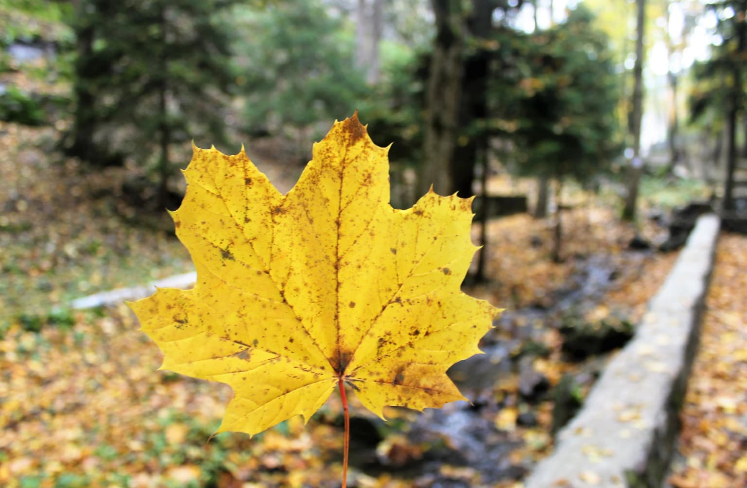
The park offers year-round recreation opportunities, though the most popular period for hiking and wildlife viewing occurs during the summer months from June through September when trails are fully accessible and the alpine meadows are at their most vibrant. Spring and early summer bring abundant wildflower displays in the subalpine zones, while autumn offers spectacular fall coloration in the broadleaf forests. Winter access is limited to certain areas but provides opportunities for cross-country skiing and experiencing the transformed alpine landscape. The shoulder seasons of May and October may offer fewer visitors and pleasant conditions for those seeking a more solitary wilderness experience.

Park location guide

Geography guide, regional context, and park location map for Borjomi-Kharagauli National Park

Borjomi-Kharagauli National Park park geography, regions, and map view in Georgia
Understand where Borjomi-Kharagauli National Park sits in Georgia through a broader geographic reading of the surrounding landscape, nearby location context, and its mapped position within the national park landscape.

How Borjomi-Kharagauli National Park fits into Georgia

Georgia is a transcontinental country spanning Eastern Europe and West Asia, situated in the Caucasus region along the Black Sea. It declared independence from the Soviet Union in 1991 and today functions as a unitary parliamentary republic with Tbilisi as its capital. The nation is notable for its distinctive Georgian language, Orthodox Christian traditions dating to the 4th century, and archaeological evidence of the world's earliest winemaking sites.

Wider geography shaping Borjomi-Kharagauli National Park in Georgia

Georgia occupies a strategic position at the crossroads of Eastern Europe and West Asia, bordered by Russia to the north and northeast, the Black Sea to the west, Turkey and Armenia to the south, and Azerbaijan to the southeast. The terrain is predominantly mountainous in the north with the Greater Caucasus range, transitioning to plains and valleys in the east. The country spans approximately 69,700 square kilometres.

Map view of Borjomi-Kharagauli National Park

Use this park location map to pinpoint Borjomi-Kharagauli National Park in Georgia, understand its exact geographic position, and read its mapped placement within the surrounding landscape more clearly.

Pigeon | © OpenStreetMap contributors

Location context for Borjomi-Kharagauli National Park

Samtskhe–Javakheti
Park atlas

Discover more of Georgia's Caucasus mountain protected landscapes and compare adjacent park geography after Borjomi-Kharagauli National Park.

Explore Other National Parks and Protected Areas Near Borjomi-Kharagauli National Park in Georgia
Continue your discovery of Georgia's diverse national parks and protected areas, mapping the regional spread of conservation landscapes in the Lesser Caucasus mountains. Compare Borjomi-Kharagauli National Park with other significant protected sites, understanding their unique geographic context and ecological connections across the country.
Watercolor painting of green and pink mountain ranges under a light sky background
National parkSamtskhe–Javakheti

Javakheti National Park: Protected Highland Landscape and Wetland Atlas

Explore the unique geography and mapped park boundaries of this Georgian protected area.

Delve into Javakheti National Park, a significant protected landscape located in Georgia's Samtskhe, Javakheti region. This page serves as an entry point for understanding the park's distinctive highland terrain, its remarkable chain of lakes and marshes, and its protected area status. Explore the geographic context of this national park, its role in wetland conservation, and its value for structured atlas-based discovery of natural landscapes.

Area
238.53 km²
Established
2011
IUCN
II
Relief
Mixed relief
Watercolor painting showing mountains, trees, and a lake in soft green and blue tones
National parkArtvin Province

Karagöl-Sahara National Park: Mapped Highland Lake and Plateau Protected Area

Discover Artvin Province's unique landslide lake and alpine terrain.

Karagöl-Sahara National Park presents a compelling protected landscape in Artvin Province, Turkey, renowned for its dramatic landslide lake, Karagöl, and the expansive Sahara plateau. This national park provides a unique map of highland geography, featuring dense conifer forests that give way to alpine meadows at elevations around 1,800 meters. Examine the geological character, including active landslide zones and sedimentary formations, that shape this distinctive terrain and contribute to its protected ecological value within the Black Sea Region.

Area
32.51 km²
Established
1994
Relief
Mountain
Climate
Boreal
Watercolor illustration of a landscape with rolling hills, forests, and a winding river.
National parkAdjara

Kintrishi National Park: Protected Colchic Forest Canyon Landscape in Adjara

Explore the mapped geographic boundaries of this unique Georgian national park.

Kintrishi National Park, located in Georgia's Adjara region, is a protected landscape renowned for its exceptionally intact Colchic deciduous forests within a steep river gorge. This area showcases dense woodland, dramatic terrain, and the unique Colchican willow species, offering rich geographic context. As a key protected area, Kintrishi National Park provides a valuable focus for atlas-based exploration of southwestern Georgia's natural heritage.

Area
186.84 km²
Established
2007
IUCN
II
Scope
Terrestrial
Watercolor illustration of a mountainous landscape with green forests, rolling hills, and distant mountains under a light sky
National parkGeorgia

Algeti National Park: Explore Georgia's Protected Coniferous Forest Landscape

Mountain terrain, protected forests, and regional geography.

Algeti National Park, located in Georgia's Kvemo Kartli region, serves as a critical protected area preserving the easternmost populations of Caucasian Spruce and Nordmann Fir. This national park features a dramatic mountainous landscape within the Trialeti Range, characterized by deeply incised valleys, flowing rivers, and extensive old-growth forest ecosystems. Users can explore the park's geographic context, mapped boundaries, and the ecological significance of its unique coniferous and mixed forests, contributing to a broader understanding of protected lands in the Caucasus.

Area
68.22 km²
Established
2007
IUCN
II
Visitors
8K annual
National parkShirak Province

Lake Arpi National Park: High-Altitude Wetland Protected Landscape in Shirak Province

Mapped boundaries of an important South Caucasus conservation area.

Lake Arpi National Park offers a unique window into high-altitude wetland ecosystems on the Shirak and Javakheti plateau, located at roughly 2000 meters above sea level. Established as a national park in 2009, it protects critical habitats, including the central Lake Arpi, and serves as a vital sanctuary for numerous bird species. This protected area is distinguished by its alpine meadows, significant bird populations, and its distinct geographic setting within Armenia's northwestern region, providing rich context for atlas-based exploration of protected lands.

Area
250 km²
Established
2009
IUCN
II
Relief
Mountain
Watercolor illustration of a landscape with green hills, trees, and a body of water
National parkAdjara

Mtirala National Park: Protected Colchic Rainforest Landscape & Geographic Atlas

Explore Adjara's unique terrain and mapped protected boundaries.

Mtirala National Park, located in Georgia's Adjara region, is a protected national park renowned for its exceptionally high rainfall and ancient Colchic relict forests. This atlas-focused profile details the park's unique topography, its watershed between the Chakvistskali and Khoristskali rivers, and its significance as a vital ecosystem. Understand the geographic context of this protected landscape and its role in the broader Caucasus geography.

Area
281.26 km²
Established
2006
IUCN
II
Relief
Mixed relief
National parkGeorgia

Kolkheti National Park: Mapped Wetland Landscape & Protected Area in Georgia

Explore the peat bogs, coastal ecosystems, and bird migration routes.

Discover Kolkheti National Park, a key protected national park located in Georgia's western coastal region. This atlas entry focuses on the park's extensive wetland environments, including its significant peat bogs and Lake Paliastomi, highlighting its role as a critical migratory bird corridor and a unique natural landscape within the Black Sea region. Understand its geographic context and protected area boundaries.

Area
807.99 km²
Established
1998
IUCN
II
Visitors
13.7K annual
National parkAdjara

Machakhela National Park: Adjara's Colchic Forest Protected Landscape

Explore Georgia's unique Caucasus mountain geography and mapped park boundaries.

Machakhela National Park represents a crucial protected area in Georgia's Adjara region, safeguarding the integrity of ancient Colchic broadleaf forests. This park's landscape is characterized by the steep Machakhelistsqali River valley, carved into the lower Caucasus mountains, offering a distinct geographic profile for atlas exploration. Discover the park's specific terrain, mapped boundaries, and its ecological significance as a vital component of the regional natural heritage.

Area
130.7 km²
Established
2012
IUCN
II
Relief
Mixed relief

Common questions about visiting, size, designation, and location context for Borjomi-Kharagauli National Park

Borjomi-Kharagauli National Park FAQs for park facts, access, geography, and protected area context
Find quick answers about Borjomi-Kharagauli National Park, including protected-area facts, park geography, trail and visitor context, and how the park fits into its surrounding country and regional landscape.
MoriAtlas Explorer

Continue Your Protected Areas Search Across the Global Atlas

Deepen your exploration by continuing the structured search for national parks and protected areas worldwide. Utilize the comprehensive filtering capabilities to compare different conservation landscapes and refine your understanding of global park geography. Discover more about the distribution and characteristics of protected natural areas.

Global natural geography