Mori Atlas logo
National parkKolkheti National Park

Discover the mapped terrain and protected boundaries of this vital Black Sea wetland.

Kolkheti National Park: Georgia's Coastal Wetland Protected Landscape & Atlas Entry

(Kolkheti (Mingrelia) National Park)

Kolkheti National Park represents a significant protected landscape in western Georgia, defined by its vast coastal wetlands and unique peat bog ecosystems along the Black Sea. This national park, part of the UNESCO World Heritage site 'Colchic Rainforests and Wetlands', offers a rich environment for understanding regional geography and mapped natural features. Explore the intricate network of waterways, coastal dunes, and peatlands that shape this crucial ecological corridor.

wetlandscoastal ecosystemsRamsar siteUNESCO World HeritagebirdwatchingBlack Sea

Kolkheti National Park

National park

Park overview

Structured park overview, official facts, and landscape profile for Kolkheti National Park

Kolkheti National Park park facts, protected area profile, and essential visitor context
Review the core facts for Kolkheti National Park, including designation, size, terrain, visitor scale, habitats, and operating context in one park-focused overview.

About Kolkheti National Park

Kolkheti National Park occupies a distinctive position along Georgia's Black Sea coast, protecting a complex landscape of wetlands, peat bogs, marshes, and deciduous forests that have developed over millennia on the coastal plain. The park's terrain is exceptionally flat, with elevations averaging just 0 to 10 meters above sea level, creating conditions ideal for wetland formation. A narrow dune ridge, ranging from 100 to 200 meters in width and rising 2 to 3 meters above the coastal plain, runs along the Black Sea shoreline, marking the boundary between the inland wetland systems and the marine environment. The park encompasses numerous lakes, including Lake Paliastomi, Patara Paliastomi, Imnati, and Parto Tskali, which form the heart of the wetland system. Over half of the protected area consists of wetlands, making it one of the most significant coastal wetland complexes in the Caucasus region. The park was created to protect the unique biodiversity of the Kolkheti lowlands, which represent a remarkable survival of forest and wetland ecosystems that once covered much of this coastal plain. The area holds exceptional scientific and conservation value, containing rich biogeographical and paleogeographical information that has attracted international research attention.

Quick facts and research context for Kolkheti National Park

Kolkheti National Park lies on the Black Sea coastal plain of western Georgia, spanning five municipalities across the Samegrelo-Zemo Svaneti and Guria regions. The park protects over 15,700 hectares of wetlands, making it one of Georgia's most important coastal wetland ecosystems. Its history dates to 1947 when a small 500-hectare Kolkheti State Nature Reserve was established, later expanded significantly in 1998-1999 with support from the World Bank and Global Environmental Facility. The park serves as a critical habitat for migratory birds, with 194 bird species recorded, including globally threatened species such as the black stork, crane, and great white egret. The area also supports populations of dolphins in its marine waters and serves as a spawning ground for Black Sea sturgeon.

Park context

Deeper park guide and search-rich context for Kolkheti National Park

Kolkheti National Park history, landscape, wildlife, and travel context
Explore Kolkheti National Park through its history, landscape character, ecosystems, wildlife, conservation priorities, cultural context, and seasonal travel timing in a structured park guide built for atlas discovery and search intent.

Why Kolkheti National Park stands out

Kolkheti National Park is best known for its extensive wetland ecosystems and unique deciduous wetland forests that form part of the Colchic Rainforests and Wetlands, a UNESCO World Heritage Site. The park protects one of the largest remaining tracts of coastal peat bogs in the Black Sea region, with peat layers exceeding 12 meters in thickness, representing 4,000 to 6,000 years of accumulation. The wetlands serve as a vital migratory bird corridor, hosting 194 bird species including 21 species during seasonal migrations. The park also contains Lake Paliastomi, a significant freshwater lake within the coastal wetland system, and supports populations of endangered mammals including otter, roe deer, and wild boar.

Kolkheti National Park history and protected-area timeline

The Kolkheti region possesses a remarkable historical legacy extending to antiquity. During the Tertiary period, this area formed part of a tropical and partly subtropical zone that stretched across Eurasia. Around 2000 BC, the first Georgian state, known as Kolkheti or Colchis, was established here—the same Colchis featured in Greek mythology as the realm of the Golden Fleece and the domain where Jason and the Argonauts sought the legendary golden fleece. The favorable geography and natural conditions of the region attracted Milesian Greek colonists in the 6th-5th centuries BC, who established trading posts at Phasis (modern Poti), Gyenos, and Sukhumi. The area later came under Roman influence, with major fortresses established along the coast. In modern times, large-scale drainage operations undertaken by Soviet authorities in the 1920s had a devastating impact on the wetland ecosystem, leading to the establishment of a small 500-hectare Kolkheti State Nature Reserve in 1947. Recognizing the exceptional scientific and heritage value of the surrounding wetlands, the area was designated as a Ramsar Site in 1996, paving the way for the formal establishment of Kolkheti National Park between 1998 and 1999, with financial support from the World Bank and Global Environmental Facility. The park opened to tourism in 2007.

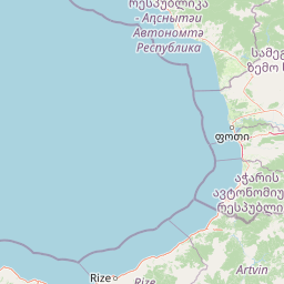
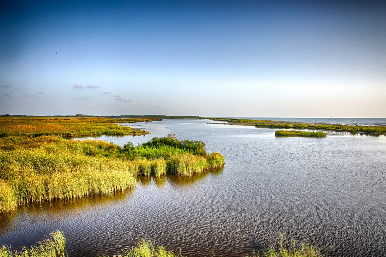
Kolkheti National Park landscape and geographic character

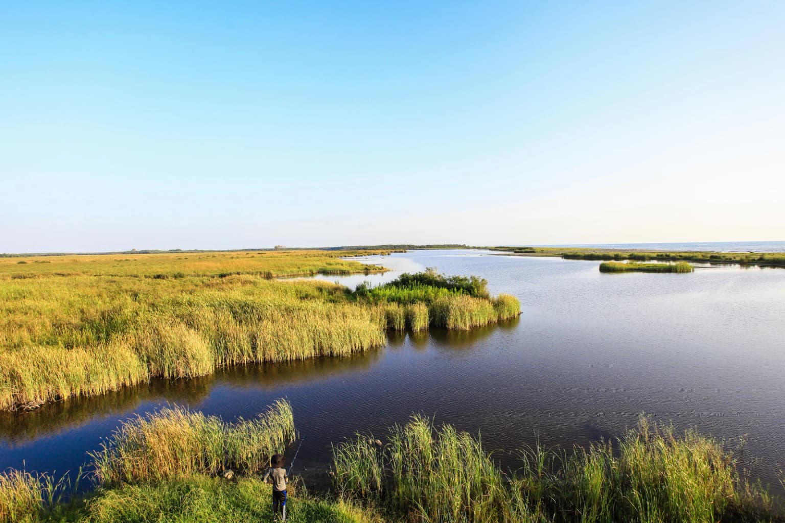
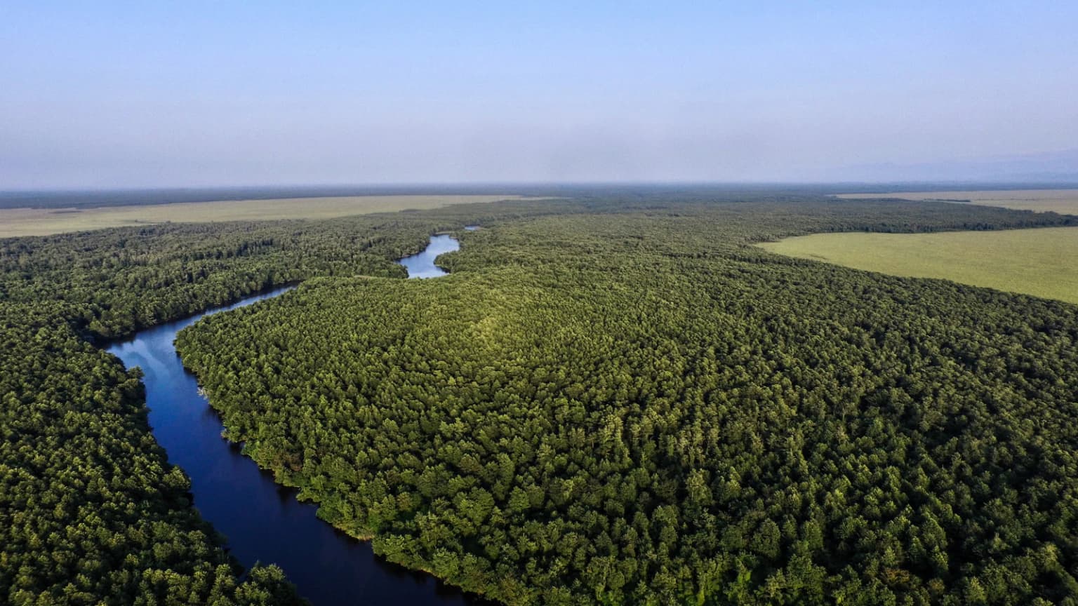
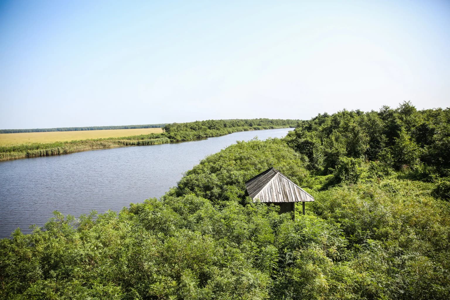
The landscape of Kolkheti National Park is defined by its low-lying coastal position on the Black Sea plain, creating an environment fundamentally shaped by water. The terrain consists almost entirely of flat coastal plain at elevations ranging from sea level to approximately 10 meters, with the park's eastern boundary extending into slightly higher ground. The most distinctive landscape feature is the narrow dune ridge that parallels the Black Sea coast, rising 2 to 3 meters above the surrounding plain and extending 100 to 200 meters inland from the shoreline. Behind this coastal barrier lies an extensive system of wetlands, marshes, and peat bogs that dominate the park's interior. The peat bog landscape is particularly remarkable, with deposits in some areas exceeding 12 meters in thickness—the result of clay, sand, silt, and organic material accumulating over the last 4,000 to 6,000 years. Several distinct peat bogs are distributed across the coastal plain, including Anaklia, Churia, Nabada, Imnati, Maltakva, Grigoleti, and Pichori. The park contains numerous lakes of varying sizes, with Lake Paliastomi being the largest and most significant, connected to the sea through natural channels. Numerous small, slow-flowing rivers including the Pichori, Kukani, Dedabera, Tkhorina, Tsia, Tsiva, Churia, and Munchia traverse the wetland system, their waters ultimately feeding the coastal lagoon complex.

Kolkheti National Park ecosystems, habitats, and plant life

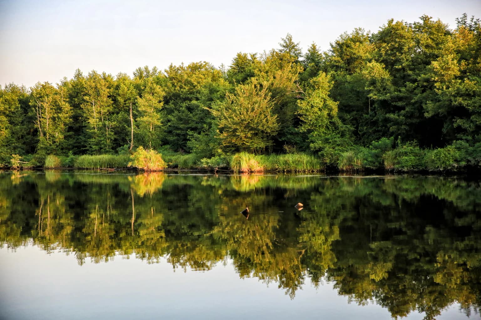
The ecological character of Kolkheti National Park is defined by its extensive wetlands and deciduous wetland forests, which support exceptional biodiversity in the Black Sea region. The park's warm and humid climate, with annual rainfall ranging from 1,500 to 1,600 millimeters distributed relatively evenly throughout the year, creates conditions ideal for wetland development and supports lush vegetation growth. The wetland forests are dominated by bearded alder, a species particularly adapted to saturated soils, along with several species of willows, oaks, and common ash. The understory contains evergreen species including Hedera colchica, while endemic oak species such as Quercus imeretina, Quercus dshorochensis, and Quercus hartwissiana represent significant botanical treasures. The coastal peat bogs support specialized plant communities including sphagnum mosses, Drosera rotundifolia, Rhynchospora alba, Carex lasiocarpa, and Menyanthes trifoliata. Aquatic vegetation is abundant throughout the lake and river systems, with species such as Nymphaea alba common in the park's hydrological habitats. The combination of wetland, forest, and aquatic habitats creates a complex ecological mosaic that supports remarkable species diversity.

Kolkheti National Park wildlife and species highlights

Kolkheti National Park supports significant wildlife populations across its wetland, forest, and marine habitats. The park's swamps and wetland forests are home to several endangered mammal species including roe deer, wild boar, otter, and the southern banded newt (Triturus vittatus). A population of coypu has also been introduced to the area. The park is particularly notable for its herpetofauna, supporting the Caucasian subspecies of common treefrog, marsh frog (Rana ridibunda), and numerous snake species including the ringed snake, dice snake, slowworm, and the more rarely encountered Aesculapian snake. The European pond turtle (Emys orbicularis) and Artwin wood lizard are also present. The marine waters of the park support three dolphin species: Delphinus delphis, Tursiops truncates, and Phocoena phocoena. The bird fauna is exceptional, with 194 species recorded including 21 migratory species. Several bird species found here are threatened and listed in the IUCN and Georgian Red Books, including the black stork, crane, and great white egret. The park also supports populations of white-tailed sea eagles, great crested grebes, various herons, ibises, spoonbills, and diverse waterfowl.

Kolkheti National Park conservation status and protection priorities

Kolkheti National Park represents one of the most significant conservation areas in the Caucasus region, protecting coastal wetland ecosystems of international importance. The wetlands of Central Kolkheti were designated as a Wetland of International Importance under the Ramsar Convention in 1997, recognizing their outstanding universal value as a habitat for waterfowl and their role in coastal protection and flood regulation. The park's significance was further elevated in 2021 when it became part of the UNESCO World Heritage-listed Colchic Rainforests and Wetlands, making it one of the few World Heritage sites in the Caucasus region. The protected area incorporates the land of the former Kolkheti State Nature Reserve, which was established in 1947 but was insufficient to protect the broader wetland ecosystem. The park faces ongoing conservation challenges, including pressure from oil and gas activities in adjacent marine areas that conflict with the designated protected zone. Despite these challenges, the park continues to serve as a critical refuge for threatened species and as a living laboratory for understanding coastal wetland ecology.

Kolkheti National Park cultural meaning and human context

The Kolkheti region holds profound cultural significance in Georgian history and mythology, representing one of the earliest centers of Georgian statehood. The area formed the heart of ancient Colchis, the first Georgian state established around 2000 BC, which is credited with minting the first Georgian coinage, the Kolkhuri Tetri. Colchis occupies a prominent place in Greek mythology, famously serving as the destination of Jason and the Argonauts in their quest for the Golden Fleece. According to legend, this was also where Prometheus was chained and punished for bringing fire to humanity. The region was subsequently colonized by Milesian Greeks in the 6th-5th centuries BC, establishing trading settlements that would become important nodes in ancient maritime trade networks. The indigenous population included various tribes such as the Laz, Machelones, and Heniochi, who maintained settlements along the Black Sea coast. This rich historical legacy, spanning millennia from ancient statehood through Greek colonization to the present day, imbues the landscape with cultural meaning beyond its ecological value.

Top sights and standout views in Kolkheti National Park

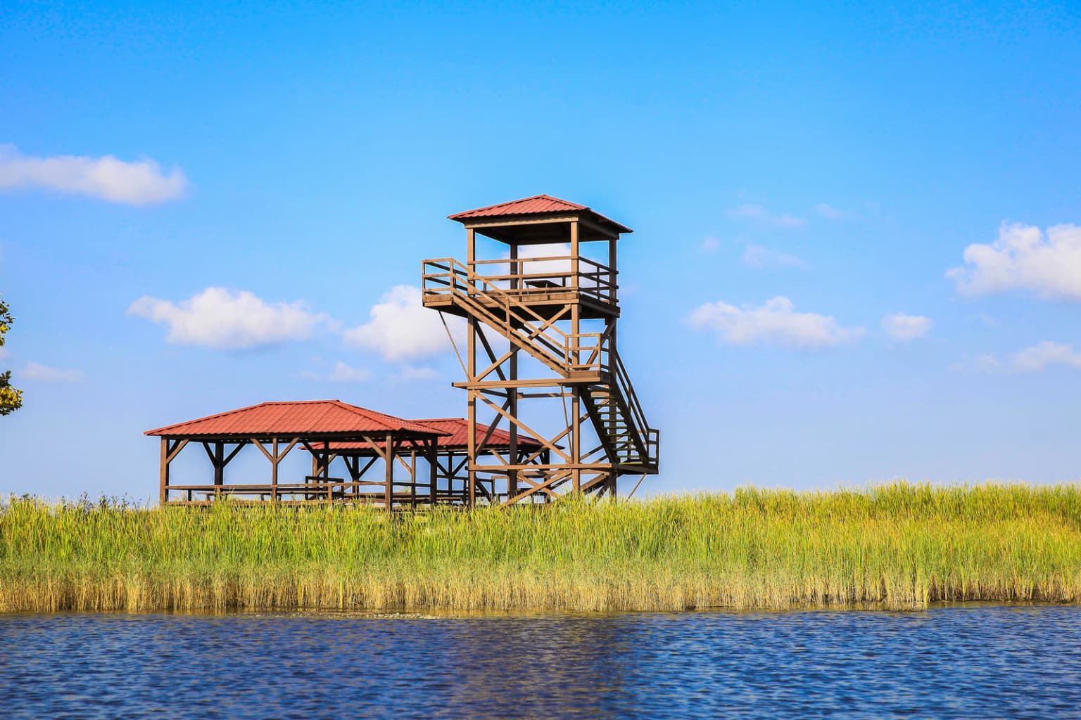
Kolkheti National Park offers visitors an exceptional opportunity to experience one of the Black Sea region's most important wetland ecosystems. The park's Lake Paliastomi and Pichori River support boating tours ranging from 3 kilometers to over 10 kilometers in length, providing intimate access to the wetland environment. Bird watching is a particularly rewarding activity, with the park's position along the East Atlantic Flyway making it a crucial stopover for migratory waterfowl and waders. The diversity of habitats—from open water and marshes to peat bogs and forested wetlands—creates excellent conditions for observing a wide range of species. The park's recent inclusion as part of the Colchic Rainforests and Wetlands World Heritage Site underscores its global significance and the exceptional quality of its natural heritage. Visitors can also engage in diving, hiking, and horse riding activities, though the park's primary appeal lies in its wildlife and landscape observation opportunities.

Best time to visit Kolkheti National Park

The best time to visit Kolkheti National Park depends on the type of experience sought, though the park offers year-round interest. The warm and humid climate means that summer months from June through August typically offer the most stable weather, with average temperatures around 22 degrees Celsius, though heat waves can push temperatures to 34 degrees Celsius. Spring and autumn provide milder conditions and are particularly favorable for bird watching, as these seasons correspond with the major migratory bird passages when the park hosts its highest concentrations of waterfowl and waders. Winter months, particularly January with average temperatures around 4.5 degrees Celsius, offer a different character with fewer visitors and the opportunity to observe overwintering species. The park experiences relatively even precipitation throughout the year, so visitors should be prepared for rain at any time. Heavy coastal winds are periodical, particularly during the cooler months, which can affect some outdoor activities.

Park location guide

Geography guide, regional context, and park location map for Kolkheti National Park

Kolkheti National Park park geography, regions, and map view in Georgia
Understand where Kolkheti National Park sits in Georgia through a broader geographic reading of the surrounding landscape, nearby location context, and its mapped position within the national park landscape.

How Kolkheti National Park fits into Georgia

Georgia is a transcontinental country spanning Eastern Europe and West Asia, situated in the Caucasus region along the Black Sea. It declared independence from the Soviet Union in 1991 and today functions as a unitary parliamentary republic with Tbilisi as its capital. The nation is notable for its distinctive Georgian language, Orthodox Christian traditions dating to the 4th century, and archaeological evidence of the world's earliest winemaking sites.

Wider geography shaping Kolkheti National Park in Georgia

Georgia occupies a strategic position at the crossroads of Eastern Europe and West Asia, bordered by Russia to the north and northeast, the Black Sea to the west, Turkey and Armenia to the south, and Azerbaijan to the southeast. The terrain is predominantly mountainous in the north with the Greater Caucasus range, transitioning to plains and valleys in the east. The country spans approximately 69,700 square kilometres.

Map view of Kolkheti National Park

Use this park location map to pinpoint Kolkheti National Park in Georgia, understand its exact geographic position, and read its mapped placement within the surrounding landscape more clearly.

Pigeon | © OpenStreetMap contributors

Location context for Kolkheti National Park

GuriaSamegrelo-Zemo Svaneti
Park atlas

Trace the regional spread of protected landscapes, comparing wetland ecosystems and coastal conservation areas across Georgia after Kolkheti National Park.

Discover National Parks and Protected Areas Around Kolkheti National Park and its Georgian Coast
Explore other national parks and protected areas geographically connected to Kolkheti National Park, including diverse wetland ecosystems, coastal conservation zones, and critical bird habitats within Georgia. Compare their unique landscapes, conservation priorities, and regional significance to deepen your understanding of the Black Sea's protected natural heritage and discover further opportunities for exploration.
Watercolor illustration of a landscape with green hills, trees, and a body of water
National parkAdjara

Mtirala National Park: Protected Colchic Rainforest Landscape & Geographic Atlas

Explore Adjara's unique terrain and mapped protected boundaries.

Mtirala National Park, located in Georgia's Adjara region, is a protected national park renowned for its exceptionally high rainfall and ancient Colchic relict forests. This atlas-focused profile details the park's unique topography, its watershed between the Chakvistskali and Khoristskali rivers, and its significance as a vital ecosystem. Understand the geographic context of this protected landscape and its role in the broader Caucasus geography.

Area
281.26 km²
Established
2006
IUCN
II
Relief
Mixed relief
Watercolor illustration of a landscape with rolling hills, forests, and a winding river.
National parkAdjara

Kintrishi National Park: Protected Colchic Forest Canyon Landscape in Adjara

Explore the mapped geographic boundaries of this unique Georgian national park.

Kintrishi National Park, located in Georgia's Adjara region, is a protected landscape renowned for its exceptionally intact Colchic deciduous forests within a steep river gorge. This area showcases dense woodland, dramatic terrain, and the unique Colchican willow species, offering rich geographic context. As a key protected area, Kintrishi National Park provides a valuable focus for atlas-based exploration of southwestern Georgia's natural heritage.

Area
186.84 km²
Established
2007
IUCN
II
Scope
Terrestrial
National parkAdjara

Machakhela National Park: Adjara's Colchic Forest Protected Landscape

Explore Georgia's unique Caucasus mountain geography and mapped park boundaries.

Machakhela National Park represents a crucial protected area in Georgia's Adjara region, safeguarding the integrity of ancient Colchic broadleaf forests. This park's landscape is characterized by the steep Machakhelistsqali River valley, carved into the lower Caucasus mountains, offering a distinct geographic profile for atlas exploration. Discover the park's specific terrain, mapped boundaries, and its ecological significance as a vital component of the regional natural heritage.

Area
130.7 km²
Established
2012
IUCN
II
Relief
Mixed relief
Watercolor illustration of a winding river through green hills with pink flowers in the foreground
National parkArtvin Province

Hatila Valley National Park: Dramatic V-Shaped Valley and Volcanic Terrain in Artvin Province

Explore protected landscape, waterfalls, and botanical diversity.

Hatila Valley National Park represents a significant protected area within Artvin Province, Turkey, notable for its exceptionally steep, V-shaped river valley. This national park features a striking volcanic landscape characterized by deep gorges, numerous waterfalls, and unique geomorphological structures. Its rich botanical diversity, with 769 documented plant species including many endemics, positions it as a key site for understanding protected landscapes and regional flora. The park's geographic setting at the eastern end of the Kaçkar Mountains provides context for its Mediterranean climate and varied terrain.

Area
169 km²
Established
1994
Relief
Mountain
Climate
Mediterranean
Watercolor painting showing mountains, trees, and a lake in soft green and blue tones
National parkArtvin Province

Karagöl-Sahara National Park: Mapped Highland Lake and Plateau Protected Area

Discover Artvin Province's unique landslide lake and alpine terrain.

Karagöl-Sahara National Park presents a compelling protected landscape in Artvin Province, Turkey, renowned for its dramatic landslide lake, Karagöl, and the expansive Sahara plateau. This national park provides a unique map of highland geography, featuring dense conifer forests that give way to alpine meadows at elevations around 1,800 meters. Examine the geological character, including active landslide zones and sedimentary formations, that shape this distinctive terrain and contribute to its protected ecological value within the Black Sea Region.

Area
32.51 km²
Established
1994
Relief
Mountain
Climate
Boreal
National parkGeorgia

Borjomi-Kharagauli National Park: Protected Landscape Atlas of Georgia's Lesser Caucasus

Explore its unique forests, wildlife, and mountain terrain.

Delve into Borjomi-Kharagauli National Park, a significant protected area in Georgia's Lesser Caucasus region. This national park is renowned for its extensive old-growth forests, including rare Colchian fragments, and a remarkable concentration of endemic species. The park's dramatic mountainous terrain, spanning over 1,000 square kilometers, offers a rich tapestry of landscapes from deep valleys to alpine meadows, providing critical habitat for large mammals and contributing significantly to the region's biodiversity. Explore its mapped boundaries and geographic context for a deeper understanding of this vital conservation landscape.

Area
1,093 km²
Established
1995
IUCN
II
Relief
Mountain
Watercolor painting depicting mountains, a winding river, and green forests in a mountainous landscape
Nature reserveKarachay-Cherkess Republic

Teberda Nature Reserve: Protected Area Mapping and Geographic Context

Explore the mapped boundaries and regional geography of this protected landscape.

Teberda Nature Reserve is a significant protected area located in the Karachay-Cherkess Republic, offering rich opportunities for geographic exploration. This page provides detailed atlas-style information, focusing on the reserve's mapped landscape and its protected-area identity. Understand the unique geographic context and contours of Teberda Nature Reserve, contributing to a structured understanding of Russia's natural protected lands.

Area
849.96 km²
Established
1936
IUCN
Ia
Visitors
200K annual
Watercolor painting of mountains, lake, and forest landscape with greenery and distant peaks
National parkKabardino-Balkaria

Prielbrusye National Park: Mapped Protected Landscape within Kabardino-Balkaria's Geography

Explore regional park boundaries and natural terrain context.

Prielbrusye National Park is a significant protected area featured in the MoriAtlas geographic discovery platform. This page details its identity as a national park, emphasizing its mapped boundaries and its position within the broader landscape of Kabardino-Balkaria. Users can explore the park's unique geographic context, understand its protected status, and integrate its information into a larger atlas-based understanding of regional natural territories.

Area
10,102 km²
Established
1986
IUCN
II
Relief
Mountain

Common questions about visiting, size, designation, and location context for Kolkheti National Park

Kolkheti National Park FAQs for park facts, access, geography, and protected area context
Find quick answers about Kolkheti National Park, including protected-area facts, park geography, trail and visitor context, and how the park fits into its surrounding country and regional landscape.
MoriAtlas Explorer

Continue Your Protected Areas Search Across the Global Atlas

Deepen your exploration by continuing the structured search for national parks and protected areas worldwide. Utilize the comprehensive filtering capabilities to compare different conservation landscapes and refine your understanding of global park geography. Discover more about the distribution and characteristics of protected natural areas.

Global natural geography