Mori Atlas logo
National parkMachakhela National Park

Discover the unique landscape, mapped boundaries, and regional context of this Adjara national park.

Machakhela National Park: Protected Colchic Forests in Adjara's Mountainous Geography

Machakhela National Park, a protected area within Georgia's Adjara region, offers a profound look into the ancient Colchic broadleaf forest biome. This national park preserves over 130 square kilometers of dramatic mountainous terrain, defined by the steep Machakhelistsqali River valley that descends towards the Black Sea. Users can explore the park's unique geography, mapped boundaries, and the rich ecological tapestry of this Caucasus mountain refuge, providing a vital locus for atlas-driven landscape discovery.

national parkColchic forestsbroadleaf forestCaucasus mountainsAdjaraGeorgia

Machakhela National Park

National park

Park overview

Structured park overview, official facts, and landscape profile for Machakhela National Park

Machakhela National Park park facts, protected area profile, and essential visitor context
Review the core facts for Machakhela National Park, including designation, size, terrain, visitor scale, habitats, and operating context in one park-focused overview.

About Machakhela National Park

Machakhela National Park occupies a significant ecological and cultural position in Georgia's protected area network. The park was established in 2012 with the dual purpose of conserving the unique biological diversity of the Colchic forest ecosystem while enabling sustainable natural tourism and recreational use. The Colchic forests of this region represent a distinct biogeographic subtype characterized by exceptional species richness, many endemic taxa, and a complex vertical structure that includes towering canopy trees, understory layers, and dense ground vegetation. The park is situated in the valley of the Machakhelistsqali River, whose waters have carved a deep gorge through the mountainous terrain, creating diverse microhabitats from riverbanks to cliff faces. The protection of this corridor is significant because it connects lowland forest zones with higher elevation habitats, enabling species migration and maintaining ecological connectivity. The park lies within the historical region of Machakheli, an area that developed a distinctive cultural landscape over centuries of human habitation, agriculture, and pastoral use, where medieval fortresses and traditional infrastructure remain embedded within the forest matrix. The visitor infrastructure includes a park visitor center located in the village of Acharisagmarti, with established hiking trails that allow exploration of the key landscape features while minimizing ecological impact.

Quick facts and research context for Machakhela National Park

Machakhela National Park is located in the Khelvachauri Municipality of Adjara, approximately 30 kilometers inland from the Black Sea port city of Batumi. The protected area was established in 2012 under IUCN Category II (national park) designation, covering an area of roughly 13,070 hectares. The park protects the Colchic forest ecosystem, a relict broadleaf forest type that represents one of the oldest and most biologically diverse forest communities in Europe. The park's territory is approximately 95% covered by forest and dense scrub vegetation. Two integrated hiking trails serve visitors, with the active tourism season running from May through October.

Park context

Deeper park guide and search-rich context for Machakhela National Park

Machakhela National Park history, landscape, wildlife, and travel context
Explore Machakhela National Park through its history, landscape character, ecosystems, wildlife, conservation priorities, cultural context, and seasonal travel timing in a structured park guide built for atlas discovery and search intent.

Why Machakhela National Park stands out

Machakhela National Park is best known for its preservation of intact Colchic forests, one of the most species-rich and ecologically significant forest types in the Caucasus region. The park protects rare and relict tree species including the Colchic box tree, chestnut, Colchic hazel, Georgian walnut, and species of hornbeam, creating a living museum of Tertiary-era flora. The dramatic topography of the Machakhela gorge, with its steep rocky walls and forested slopes, provides both scenic beauty and habitat diversity. The park also contains the historical landscape of Machakheli, a medieval territorial unit known for its defensive fortresses, stone arch bridges, and traditional winepresses embedded in the forest.

Machakhela National Park history and protected-area timeline

Machakhela National Park was established in 2012 as part of Georgia's expanded program to protect its most significant natural ecosystems and biodiversity hotspots. The creation of the park responded to the need to conserve the remaining intact tracts of Colchic forest, which had faced pressure from logging, agricultural expansion, and development in the lowland and mid-mountain zones of Adjara. The establishment of protected area status provided formal legal protection to the Machakhela valley's forest ecosystems and cultural landscape, enabling coordinated management of both natural and historical resources. The park falls under the jurisdiction of the Agency of Protected Areas of Georgia, which manages the nation's network of national parks, reserves, and protected territories. The selection of this area for national park status reflected both its ecological significance—particularly the presence of rare and relict forest species—and its cultural heritage value, with the medieval fortress complexes of Machakheli representing important historical assets.

Machakhela National Park landscape and geographic character

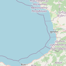
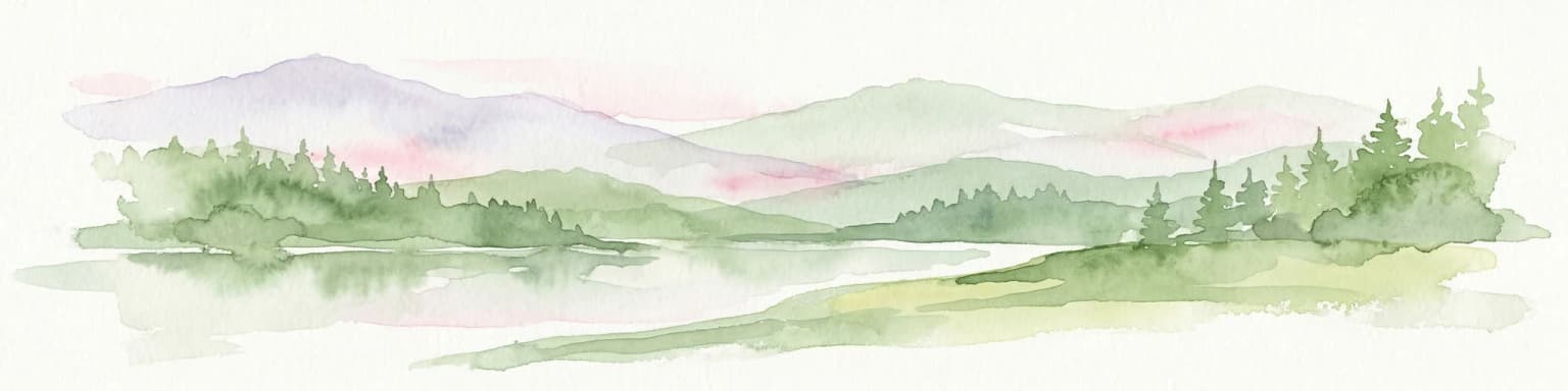
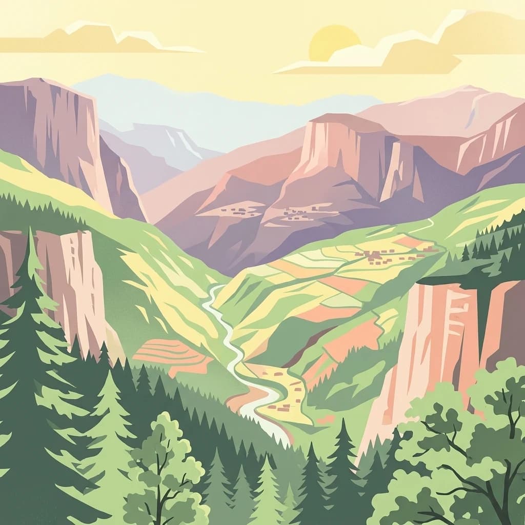
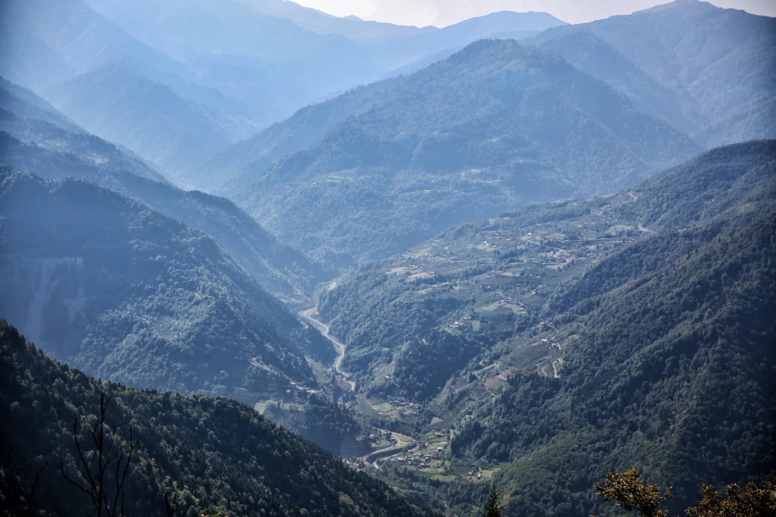
The physical landscape of Machakhela National Park is defined by the deep, steep-sided valley of the Machakhelistsqali River as it descends from the lower Caucasus slopes toward the Black Sea coastal plain. The terrain is dominated by mountainous relief with elevations ranging from roughly 200 meters in the valley bottoms to over 1,000 meters on the surrounding ridges. The slopes are often steep, with rocky outcrops and cliff faces interspersed with forested sections. The gorge itself creates dramatic visual compositions, with the river channel cutting through the terrain and the surrounding hillsides forming a natural corridor. The landscape receives substantial precipitation due to proximity to the Black Sea, contributing to the lush vegetation character and the year-round flow of the river system. From the slopes of Mtavarangelozi mountain, visitors can observe sweeping views extending across the Machakhela gorge toward the coastal city of Batumi and the sea beyond.

Machakhela National Park ecosystems, habitats, and plant life

The ecological character of Machakhela National Park is shaped by the Euxine-Colchic broadleaf forest ecosystem, one of the most distinctive and biodiverse forest types in the Palearctic region. These forests represent a relict community that persisted through glacial cycles in this humid refugium and retain many species with Tertiary-era origins. The forest cover dominates approximately 95% of the park's territory, composed of mixed broadleaf species forming a multilayered canopy. The Georgian page notes the presence of relic and rare species including Colchic box tree, chestnut, Colchic hazel, Georgian walnut, Unger's hornbeam, Smirnow's hornbeam, and elm, among others. This botanical assemblage creates a forest community of high conservation significance, with several species having restricted distributions and being of particular interest to biogeographers and conservation biologists. The humid climatic regime, influenced by proximity to the Black Sea, supports high productivity and structural complexity in the forest, with dense understory vegetation and rich ground flora.

Machakhela National Park wildlife and species highlights

While the provided sources focus primarily on the forest vegetation and cultural landscape, the Colchic forest ecosystem of Machakhela supports a diverse fauna community typical of Caucasus broadleaf forests. The dense forest structure provides habitat for numerous bird species, including both resident and migratory taxa that use the forest as breeding grounds or migration corridors. The presence of old-growth forest elements and the complex vertical structure create suitable conditions for cavity-nesting birds and species requiring mature forest habitat. The river corridor provides aquatic habitat and serves as a movement route for wildlife. The rocky outcrops and cliff faces offer potential habitat for mountain species. While specific species inventories are not detailed in the available sources, the broader Colchic forest zone is known to support populations of brown bear, lynx, wolf, and various smaller mammals, as well as a rich invertebrate fauna.

Machakhela National Park conservation status and protection priorities

Machakhela National Park represents an important conservation tool for the protection of Georgia's Colchic forest heritage. The park's establishment formalized protection for a forest ecosystem that had experienced historical pressure from logging and land conversion. The Colchic forests are recognized as a conservation priority at the regional and global levels due to their high species richness, endemism, and their status as a relict forest type. The national park designation provides a framework for long-term ecosystem protection while enabling compatible uses such as environmental tourism. The park's management approach integrates conservation of biological diversity with protection of the cultural landscape, recognizing that the historical features of the Machakheli region—including traditional land use patterns—contribute to the overall character and ecological value of the area.

Machakhela National Park cultural meaning and human context

The park occupies the historical region of Machakheli, a medieval territorial unit in southwestern Georgia that developed a distinctive cultural landscape over centuries of habitation. The name itself derives from this historical context, and the protected area contains physical evidence of long-term human relationship with the land. Medieval fortress ruins dot the landscape, representing the defensive architecture of the medieval period when this valley served as a strategic route through the Caucasus. Traditional stone arch bridges cross the river and its tributaries, infrastructure that once connected communities and facilitated movement through the mountainous terrain. Winepresses carved into the landscape reflect the viticultural tradition of the region, where terraced vineyards and associated processing facilities were integrated into the hillsides. These cultural features are not preserved in isolation but exist within the forest matrix, creating a landscape where natural and cultural heritage are intertwined.

Top sights and standout views in Machakhela National Park

The standout features of Machakhela National Park include its well-preserved Colchic forest ecosystems with numerous rare and relict species, the dramatic scenery of the Machakhela gorge with its steep cliffs and river valley, and the integration of historical cultural features within a protected natural landscape. The medieval fortress ruins of Machakheli, the traditional arch bridges, and the historic winepresses provide cultural context that distinguishes this park from more purely natural preserves. The panoramic views from Mtavarangelozi mountain extending toward Batumi and the Black Sea offer a dramatic vantage point. The park's two hiking trails allow visitors to explore these diverse features, with the active season from May through October providing favorable conditions for forest exploration in the subtropical climate of Adjara.

Best time to visit Machakhela National Park

The optimal period for visiting Machakhela National Park runs from May through October, which corresponds to the active tourist season in the region. During these months, the weather conditions are most favorable for hiking and outdoor exploration, with warmer temperatures and longer daylight hours. The spring months bring fresh green foliage and active wildlife activity as species become more visible following the winter period. Summer offers the fullest conditions for trail use but coincides with higher temperatures and increased precipitation in this humid climate zone. The autumn season provides colorful foliage displays and generally stable weather conditions. Winter visits would be more challenging due to reduced trail accessibility and colder temperatures in the mountainous terrain, though the forest retains its character year-round.

Park location guide

Geography guide, regional context, and park location map for Machakhela National Park

Machakhela National Park park geography, regions, and map view in Georgia
Understand where Machakhela National Park sits in Georgia through a broader geographic reading of the surrounding landscape, nearby location context, and its mapped position within the national park landscape.

How Machakhela National Park fits into Georgia

Georgia is a transcontinental country spanning Eastern Europe and West Asia, situated in the Caucasus region along the Black Sea. It declared independence from the Soviet Union in 1991 and today functions as a unitary parliamentary republic with Tbilisi as its capital. The nation is notable for its distinctive Georgian language, Orthodox Christian traditions dating to the 4th century, and archaeological evidence of the world's earliest winemaking sites.

Wider geography shaping Machakhela National Park in Georgia

Georgia occupies a strategic position at the crossroads of Eastern Europe and West Asia, bordered by Russia to the north and northeast, the Black Sea to the west, Turkey and Armenia to the south, and Azerbaijan to the southeast. The terrain is predominantly mountainous in the north with the Greater Caucasus range, transitioning to plains and valleys in the east. The country spans approximately 69,700 square kilometres.

Map view of Machakhela National Park

Use this park location map to pinpoint Machakhela National Park in Georgia, understand its exact geographic position, and read its mapped placement within the surrounding landscape more clearly.

Pigeon | © OpenStreetMap contributors

Location context for Machakhela National Park

Adjara
Park atlas

Trace connected protected areas, mapped landscapes, and regional park geography across Adjara, Georgia

Discover Nearby National Parks and Protected Areas Surrounding Machakhela National Park
After exploring Machakhela National Park's unique Colchic forests and dramatic gorge, continue your geographic discovery by browsing other national parks and protected areas in the surrounding Adjara region and wider Georgia. Comparing these diverse conservation landscapes provides valuable insights into the regional spread of protected ecosystems and their distinct natural features.
Watercolor illustration of a landscape with green hills, trees, and a body of water
National parkAdjara

Mtirala National Park: Protected Colchic Rainforest Landscape & Geographic Atlas

Explore Adjara's unique terrain and mapped protected boundaries.

Mtirala National Park, located in Georgia's Adjara region, is a protected national park renowned for its exceptionally high rainfall and ancient Colchic relict forests. This atlas-focused profile details the park's unique topography, its watershed between the Chakvistskali and Khoristskali rivers, and its significance as a vital ecosystem. Understand the geographic context of this protected landscape and its role in the broader Caucasus geography.

Area
281.26 km²
Established
2006
IUCN
II
Relief
Mixed relief
Watercolor illustration of a landscape with rolling hills, forests, and a winding river.
National parkAdjara

Kintrishi National Park: Protected Colchic Forest Canyon Landscape in Adjara

Explore the mapped geographic boundaries of this unique Georgian national park.

Kintrishi National Park, located in Georgia's Adjara region, is a protected landscape renowned for its exceptionally intact Colchic deciduous forests within a steep river gorge. This area showcases dense woodland, dramatic terrain, and the unique Colchican willow species, offering rich geographic context. As a key protected area, Kintrishi National Park provides a valuable focus for atlas-based exploration of southwestern Georgia's natural heritage.

Area
186.84 km²
Established
2007
IUCN
II
Scope
Terrestrial
Watercolor illustration of a winding river through green hills with pink flowers in the foreground
National parkArtvin Province

Hatila Valley National Park: Dramatic V-Shaped Valley and Volcanic Terrain in Artvin Province

Explore protected landscape, waterfalls, and botanical diversity.

Hatila Valley National Park represents a significant protected area within Artvin Province, Turkey, notable for its exceptionally steep, V-shaped river valley. This national park features a striking volcanic landscape characterized by deep gorges, numerous waterfalls, and unique geomorphological structures. Its rich botanical diversity, with 769 documented plant species including many endemics, positions it as a key site for understanding protected landscapes and regional flora. The park's geographic setting at the eastern end of the Kaçkar Mountains provides context for its Mediterranean climate and varied terrain.

Area
169 km²
Established
1994
Relief
Mountain
Climate
Mediterranean
National parkGeorgia

Kolkheti National Park: Mapped Wetland Landscape & Protected Area in Georgia

Explore the peat bogs, coastal ecosystems, and bird migration routes.

Discover Kolkheti National Park, a key protected national park located in Georgia's western coastal region. This atlas entry focuses on the park's extensive wetland environments, including its significant peat bogs and Lake Paliastomi, highlighting its role as a critical migratory bird corridor and a unique natural landscape within the Black Sea region. Understand its geographic context and protected area boundaries.

Area
807.99 km²
Established
1998
IUCN
II
Visitors
13.7K annual
Watercolor painting showing mountains, trees, and a lake in soft green and blue tones
National parkArtvin Province

Karagöl-Sahara National Park: Mapped Highland Lake and Plateau Protected Area

Discover Artvin Province's unique landslide lake and alpine terrain.

Karagöl-Sahara National Park presents a compelling protected landscape in Artvin Province, Turkey, renowned for its dramatic landslide lake, Karagöl, and the expansive Sahara plateau. This national park provides a unique map of highland geography, featuring dense conifer forests that give way to alpine meadows at elevations around 1,800 meters. Examine the geological character, including active landslide zones and sedimentary formations, that shape this distinctive terrain and contribute to its protected ecological value within the Black Sea Region.

Area
32.51 km²
Established
1994
Relief
Mountain
Climate
Boreal
National parkGeorgia

Borjomi-Kharagauli National Park: Protected Landscape Atlas of Georgia's Lesser Caucasus

Explore its unique forests, wildlife, and mountain terrain.

Delve into Borjomi-Kharagauli National Park, a significant protected area in Georgia's Lesser Caucasus region. This national park is renowned for its extensive old-growth forests, including rare Colchian fragments, and a remarkable concentration of endemic species. The park's dramatic mountainous terrain, spanning over 1,000 square kilometers, offers a rich tapestry of landscapes from deep valleys to alpine meadows, providing critical habitat for large mammals and contributing significantly to the region's biodiversity. Explore its mapped boundaries and geographic context for a deeper understanding of this vital conservation landscape.

Area
1,093 km²
Established
1995
IUCN
II
Relief
Mountain
Watercolor painting of green and pink mountain ranges under a light sky background
National parkSamtskhe–Javakheti

Javakheti National Park: Protected Highland Landscape and Wetland Atlas

Explore the unique geography and mapped park boundaries of this Georgian protected area.

Delve into Javakheti National Park, a significant protected landscape located in Georgia's Samtskhe, Javakheti region. This page serves as an entry point for understanding the park's distinctive highland terrain, its remarkable chain of lakes and marshes, and its protected area status. Explore the geographic context of this national park, its role in wetland conservation, and its value for structured atlas-based discovery of natural landscapes.

Area
238.53 km²
Established
2011
IUCN
II
Relief
Mixed relief
National parkTurkey

Sarıkamış-Allahuekber Mountains National Park: High-Altitude Protected Forest and WWI Memorial Landscape in Turkey

Explore the distinct protected terrain and historical geography of Turkey's eastern highlands.

Sarıkamış-Allahuekber Mountains National Park offers a unique exploration of high-altitude protected lands in Turkey. This national park is characterized by its remarkable pure Caucasian pine forests that thrive at elevations typically above the tree line, showcasing a rare alpine ecosystem. The park's rugged mountain terrain, marked by significant historical sites from the Battle of Sarikamish, provides a profound connection between natural landscape and human history within its mapped boundaries. Discover the geographic setting and protected status of this distinctive area.

Area
225.19 km²
Established
2004
Relief
Mountain
Scope
Terrestrial

Common questions about visiting, size, designation, and location context for Machakhela National Park

Machakhela National Park FAQs for park facts, access, geography, and protected area context
Find quick answers about Machakhela National Park, including protected-area facts, park geography, trail and visitor context, and how the park fits into its surrounding country and regional landscape.
MoriAtlas Explorer

Continue Your Protected Areas Search Across the Global Atlas

Deepen your exploration by continuing the structured search for national parks and protected areas worldwide. Utilize the comprehensive filtering capabilities to compare different conservation landscapes and refine your understanding of global park geography. Discover more about the distribution and characteristics of protected natural areas.

Global natural geography