
Why Aarelandschaft zwischen Thun und Bern stands out
The protected area is best known for being one of the largest and most ecologically important lowland floodplain remnants in the Swiss Mittelland, where fragments of original Auwald, springs, wet meadows, and side channels survive between two major urban areas. It is closely associated with the visible legacy of 19th century Aare river correction works, including stone embankments, groynes, and a rare engraved historical zero-point marker at the Raintalau near Rubigen. It also stands out as a layered protection landscape, where a single BLN corridor overlaps with national moorland, amphibian spawning, and Emerald Network designations, and is anchored by the long-running aarewasser revitalization program that reconnects floodplain function and human recreation use.
Aarelandschaft zwischen Thun und Bern history and protected-area timeline
The protected landscape's deeper history is rooted in the long, often dramatic struggle to control the Aare. Until the early 18th century the Aare's largest tributary, the Kander, entered the main river north of Thun and contributed large amounts of sediment and floodwater to the lower valley, while the Aare itself braiding across a wide Auenlandschaft repeatedly threatened villages, farmland, and the limited navigation that supported shipping and timber rafting. The 1714 Kander correction redirected the Kander into Lake Thun, controlled by sluices at Thun and ended most sediment input to the lower Aare but did not end flooding.
The decisive 19th century transformation came with the Aare correction. Following floods and navigation problems, the canton consulted leading water engineers Hans Conrad Escher and Johann Gottfried Tulla and adopted a correction program on 27 February 1825. Construction began in 1824 between Münsingen and the Gürbe mouth and was largely completed by 1859; the upper stretch from Thun to Uttigenfluh followed from 1871 to 1892, extending protection downstream to Bern's Schwellenmätteli. The works introduced transverse dams, training walls, regular groynes, and bridges replacing ferries, including the 1830 Jaberg bridge, the 1836 Hunzigen bridge, and the 1884 Schützenfar bridge.
By the 20th century the engineered Aare still flooded recurrently. After severe events in 1990 and 1995 the canton of Bern launched systematic river revitalization at Belp, Muri, and Rubigen, breaking embankments, creating widenings, side channels, gravel islands, and new standing waters. This long-term program, named aarewasser and supported by communes and the Schwellenkorporation Aare-Zulg-Korrektion, invests roughly 100 million Swiss francs in flood protection, drinking water security, ecological upgrading, and recreation, and in 2009 received the Gewässerpreis Schweiz award.
On the protection side, the area's predecessor designation was object 2.45 'Aarelandschaft Thun–Bern' in the 1960s KLN inventory. In 1983 it was incorporated into the BLN with object number 1314, on a slightly smaller area than originally proposed. The canton of Bern added a cantonal protection ordinance on 30 March 1977, and within the BLN perimeter a stack of additional federal designations has accumulated: the Aare/Giessen moor landscape of national importance, multiple amphibian spawning and flat moor sites, the Belper Giessen floodplain of national importance, the Belpau Emerald Network site, and a forest reserve at Mittelwald in the upper Belpau. The Belpberg hillside from Thalgut to the Hunzigen bridge also lies partially inside the Gantrisch Regional Nature Park.
Aarelandschaft zwischen Thun und Bern landscape and geographic character
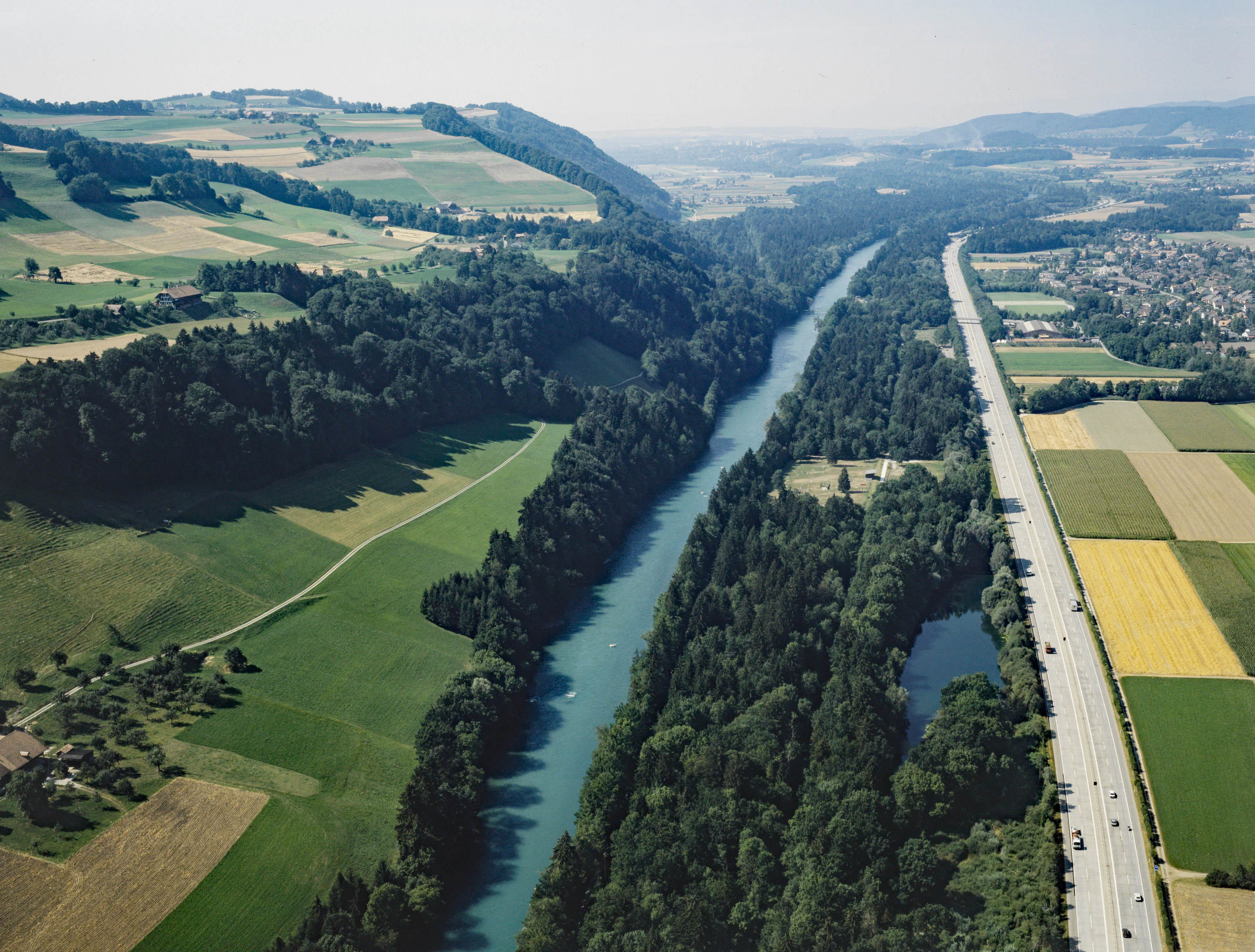
The Aarelandschaft occupies a long, narrow corridor through the Swiss Mittelland where the Aare falls roughly 40 meters in elevation, from about 546 meters above sea level near the Zulg confluence south of Thun to about 505 meters near Bern's Elfenau. The first impression today, however, is less of a wild river than of a heavily trained channel: stone-block bank reinforcements, regular groynes, and concrete reinforcements in 20th century erosion zones, with shallow rapids forming wherever bedrock or gravel banks constrict the flow.
The valley has two clearly different flanks. On the right bank, from Kiesen downstream past Münsingen, a broad former floodplain spreads out in the form of low alluvial fans; further north, the Belpmoos plain was built by the Gürbe river and continues to push the Aare toward the right side of the valley. On the left bank rises the long ridge of the Belpberg, in places dropping in steep Nagelfluh molasse cliffs almost directly into the river. The Raintalau sandstone cliff near Rubigen shows the Nagelfluh and sandstone layers prominently at the river's edge. Between these two flanks the landscape oscillates between surviving Auwald, moorland, and side-channel remnants on one side and reclaimed farmland, motorway, railway, and settlements on the other.
Underlying all of this is a deep Quaternary story. The buried Urtal beneath Münsingen and Belp, now filled with lake sediments, moraines, and river gravels, reaches several hundred meters below the present surface and stores significant groundwater reserves for the Bern region. Ice age glaciers of the Riss and Würm cold periods, first the Rhone glacier and later the Aare glacier, planed the surrounding landscape and left moraine and gravel terraces that today shape slopes and water sources. The visible result is a corridor of gravel banks, stone embankments, side ditches, springs, forest fragments, and brown molasse hills, framed distantly by the snowy Bernese Alps including the Blüemlisalp group seen from the air.
Aarelandschaft zwischen Thun und Bern ecosystems, habitats, and plant life
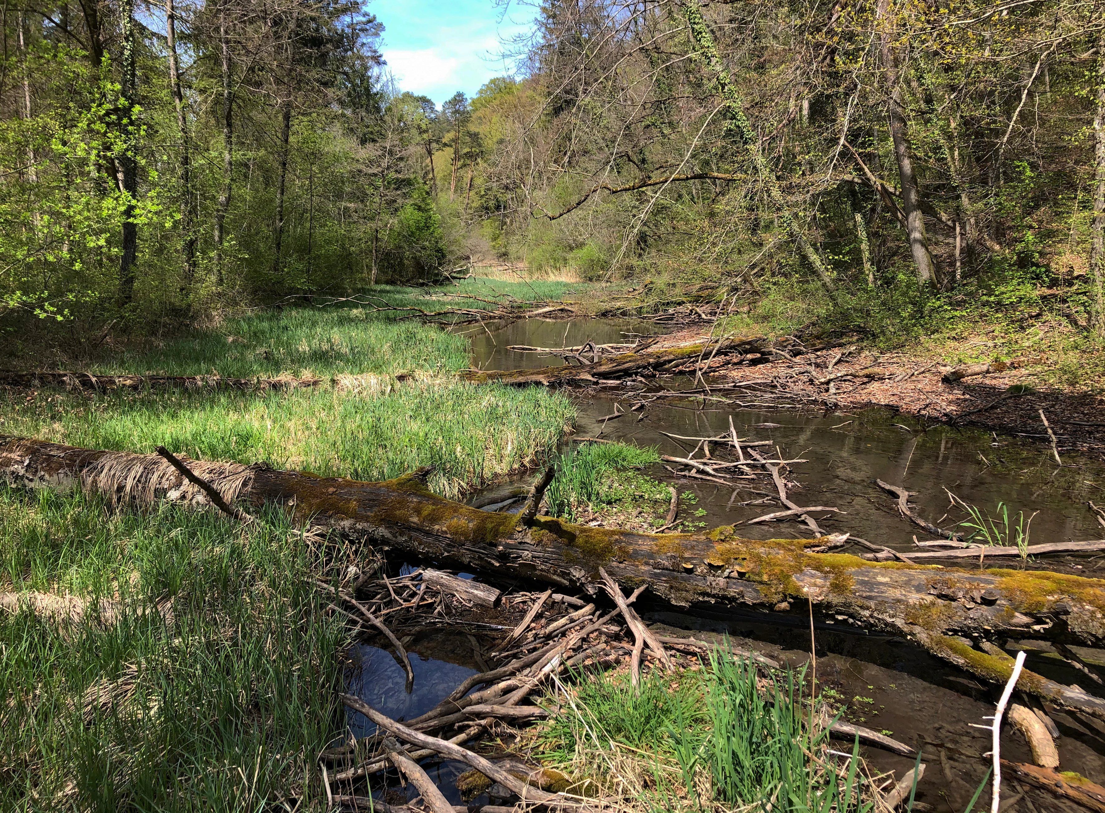
Despite centuries of river training, the Aarelandschaft retains one of the most important lowland floodplain complexes in the Swiss Mittelland. The vegetation mosaic includes surviving Auwald in the Belpau, at Wichtrach, near Kleinhöchstetten, and along the Eichholz forest next to the Elfenau. Where the original channel layout has been preserved in patches, softwood floodplain forest with willows and poplars fringes the riverbank, while older hardwood stands occupy slightly higher terraces. The structured mix of open gravel, brush, wet meadows, and forest is the key feature that supports the area's exceptional biodiversity.
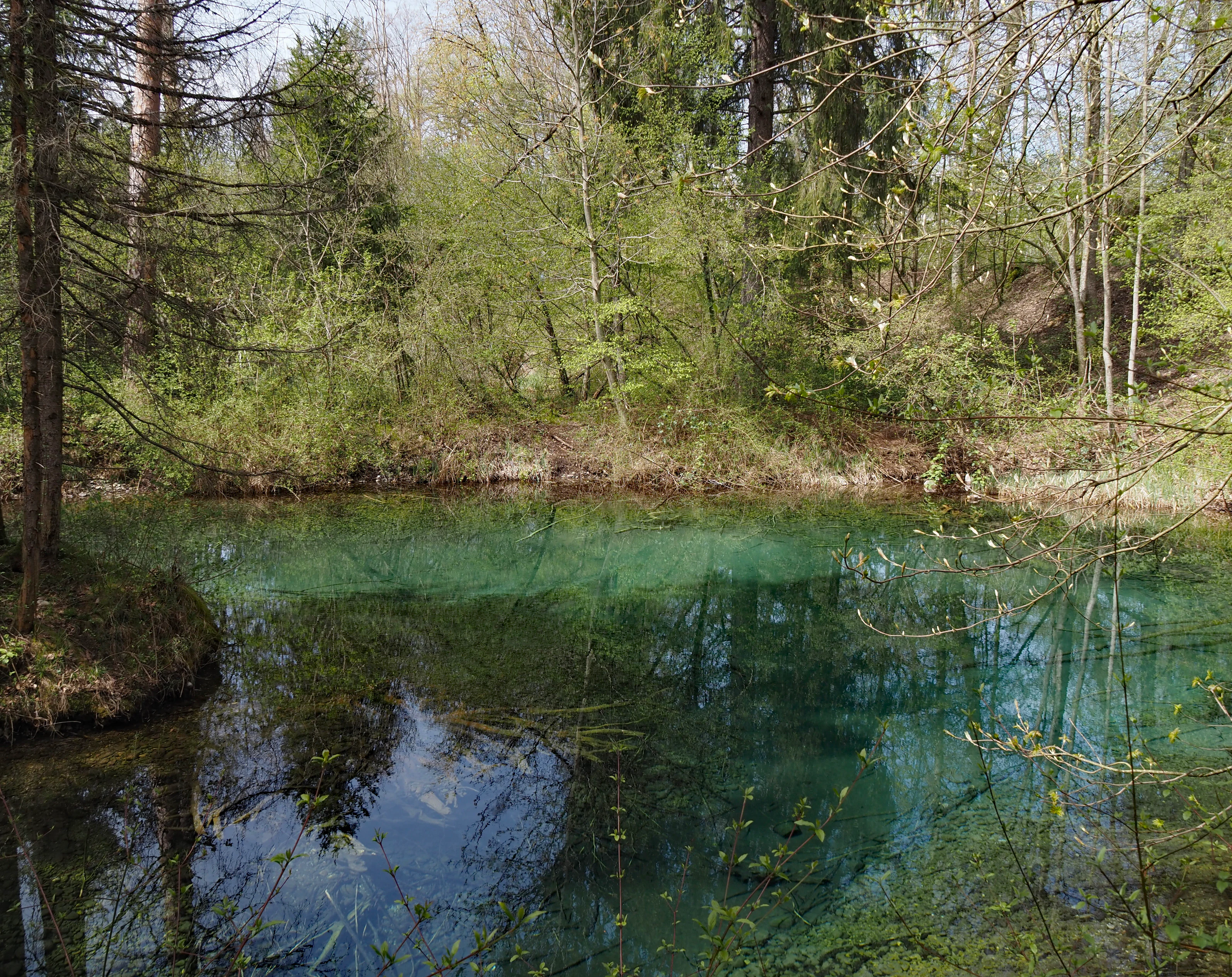
Habitat diversity is amplified by groundwater seepage zones called Giessen. These springs rise in the former floodplain between Bern and Thun and historically fed slow-moving side brooks lined with reeds and wetland species. Even today the Belper Giessen, the Giessen of Münsingen, the Elfenauer Giessen, and the Gürbe plain support characteristic wetland vegetation, while flatmoor and amphibian sites such as Hunzigeguet, the Au near Kleinhöchstetten, and the Au near Märchligen sustain peat-forming plant communities and provide breeding habitat for sensitive amphibian and aquatic species.
The broader ecological network extends above the river as well. The Belpberg hillside with its Nagelfluh cliffs and mixed deciduous forest connects to the larger forested regions of the Gantrisch area and the Emmental, although the A6 motorway and the railway embankment interrupt ground-level wildlife movement. A zone near Kiesen and Uttigen still preserves enough forest cover on both sides of the valley to function as a national wildlife corridor of major importance, supplemented by an underpass beneath the A6. On the Belpmoos, just outside the BLN perimeter, lies the largest species-rich dry meadow, or Magerwiese, of the Swiss Mittelland, surveyed botanist Mary Leibundgut, which adds an important dry-habitat component to the wetter river landscape and is valued for insects and birds.
Aarelandschaft zwischen Thun und Bern wildlife and species highlights
The corridor is recognized chiefly for its aquatic and wetland fauna rather than for charismatic mammals. Spring-fed Giessen channels, side brooks, gravel banks, and slowly moving waters support fish species characteristic of structured river habitats, while amphibians benefit from the seasonally flooded meadows, oxbows, and shallow ponds. The federal amphibian spawning site inventory lists at least seven distinct zones inside the area, including Wehrliau, Heimbergau, the Neuenzälgau near Kiesen, Belpau, the Aareaue bei Belp, the Kleinhöchstettenau, and Märchligenau-Flühli, illustrating how thoroughly the accessible wet patches are used as breeding grounds.
Wet meadows and floodplain stretches provide feeding and resting habitat for waterbirds, as illustrated by cormorants observed in the Hunzigenau, as well as numerous waterfowl, waders, and insectivores that depend on the structural richness of the floodplain. The forested Belpau and Auwald at Wichtrach host forest birds, bats, and small mammals, while the dry meadows of the adjacent Belpmoos support insect diversity that in turn sustains birds and reptiles. Setting aside the iconic Alpine species, the wildlife story here is the story of lowland floodplain communities: dependent on intact hydrology, dynamic disturbance, and continuity of habitat from forest interior to river edge.
Wildlife movement remains a key challenge. The motorway was built close to the Auwald rather than through the farmland, but it nevertheless cuts through the Hunzigenau and the Untere Kleinhöchstettenau. The fenced road combined with the railway embankment forms a continuous barrier for terrestrial mammals; only near Kiesen and Uttigen is there still enough forest on both sides to qualify that stretch as a national wildlife corridor, and an animal underpass helps maintain some connectivity. Conservation efforts and the aarewasser revitalization program aim explicitly to enlarge and reconnect habitats as the river is given more space to move.
Aarelandschaft zwischen Thun und Bern conservation status and protection priorities
Conservation is the central purpose of the Aarelandschaft zwischen Thun und Bern. Its BLN status as a landscape of national significance is reinforced by overlapping designations that give its biodiversity genuine legal weight: the Aare/Giessen moor landscape, the Belper Giessen floodplain, multiple nationally important amphibian spawning sites, nationally listed flat moors at Hunzigeguet and the Au near Märchligen, and the Belpau Emerald Network site under the Bern Convention. A forest reserve at Mittelwald in the upper Belpau further protects old-growth forest processes, and the Belpberg hillside lies partially within the Gantrisch Regional Nature Park, adding regional park protection on top of the federal framework.
The official protection objectives list eight priority elements: the coherent, richly structured river landscape as a whole; the river as habitat for flow-loving fish species; the connected floodplain system in its dynamic state, with its characteristic plants and animals; moor biotopes with their characteristic species; special geomorphological features such as springs, Giessen, gravel terraces, erosion edges, and old channels; the networking of habitats; forests, especially Auenwälder; and appropriate site-specific agriculture. These targets mean that conservation here must work through river dynamics, not against them, while still accommodating active farming and infrastructure corridors.
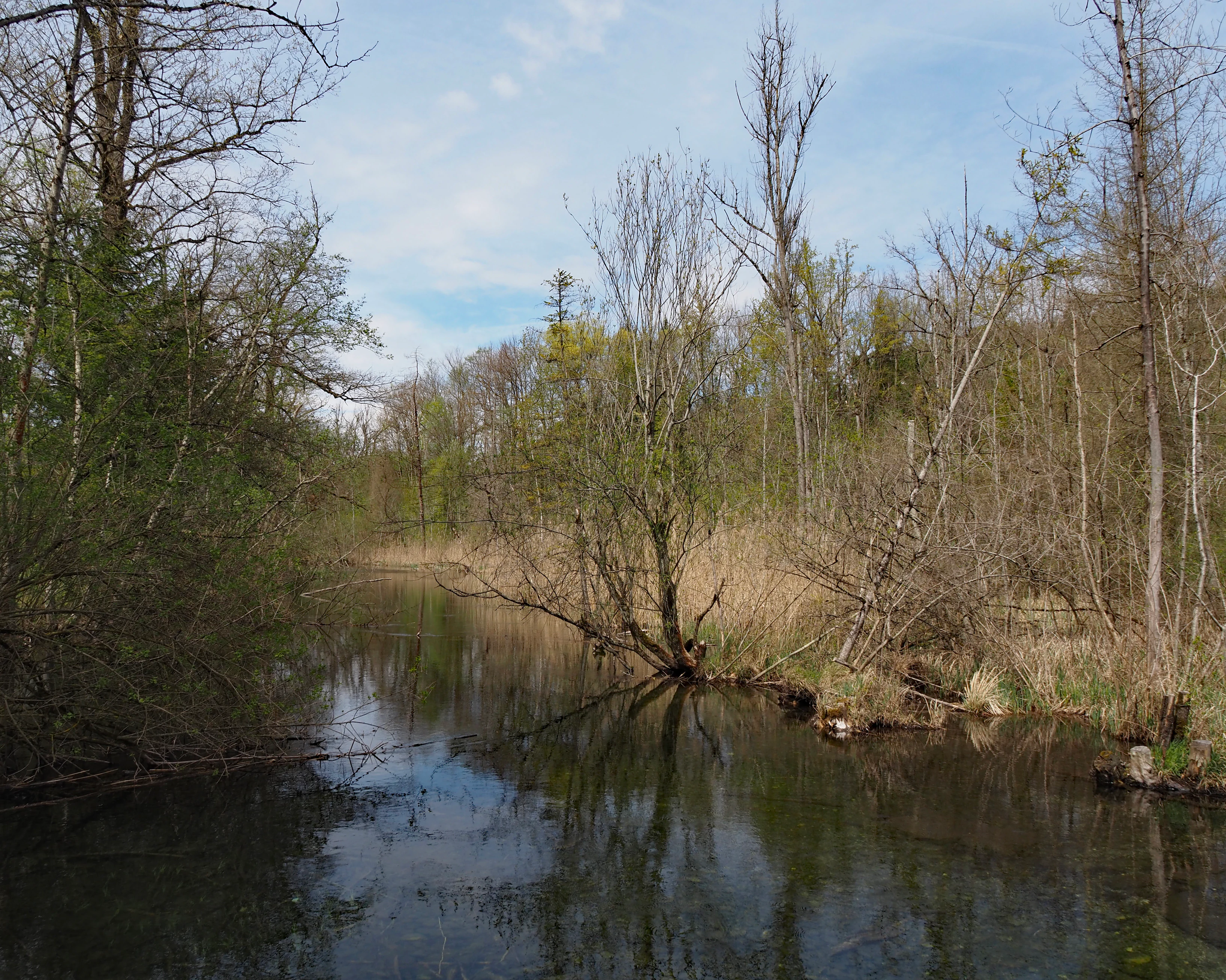
River revitalization is the most visible conservation program. After the severe floods of 1990 and 1995, the canton of Bern began re-naturalizing sections at Belp, Muri, and Rubigen, opening embankments, adding widenings and side channels, creating fresh gravel islands, and establishing new still waters. The umbrella project aarewasser, projected to span several decades and cost roughly 100 million Swiss francs, addresses flood protection, drinking water, ecological upgrading, and recreation together, and received the 2009 Gewässerpreis Schweiz award for the canton's renovation fund. Drinking water protection is also explicitly part of the conservation picture, since the deep Quaternary gravels of the valley hold major groundwater reserves used by the Wasserverbund Region Bern, with important groundwater protection zones inside the BLN perimeter, notably in the Belpau.
Aarelandschaft zwischen Thun und Bern cultural meaning and human context
The cultural identity of this stretch of the Aaretal is closely tied to the long contest between the river and the communities that depended on it. For centuries, villages clustered along the Aare relied on the river for transport, timber rafting, fishing, and meadow irrigation, while also suffering catastrophic floods that shaped local memory and political action. The 1714 Kander correction and, much more decisively, the 1825 onwards Aare correction transformed the valley from a feared braided floodplain into a stabilized, productive cultural landscape of meadows, fields, and settlements, and that engineering heritage is still legible in stone embankments, old channel traces, and the famous 1826 Raintalau zero-point stone.
The river also remains a cultural centerpiece for contemporary Bern and Thun. Picnic grounds, lidos such as the Munsingen pool, the Belp Giessebad, the Muri beach, and informal riverbank use show that everyday recreation around the Aare is part of the valley's identity, reinforced by national hiking routes 2 and 3, the cantonal Via Berna, and the national cycling Route 8 along the river. The Belpmoos, just outside the BLN perimeter, hosts both Bern-Belp airport and the largest species-rich dry meadow in the Mittelland; the tension between aviation infrastructure, agricultural use, the nature values, and now proposed solar projects reflects how the broader cultural landscape around the protection area continues to negotiate space between urbanization and nature.
On the left bank, villages from Jaberg through Thalgut, Hunzigen, Belp, Muri, and Köniz form the cultural fabric of the protected landscape, while on the right bank Heimberg, Uetendorf, Uttigen, Kiesen, Wichtrach, Rubigen, and Münsingen make up the other half. Few of these communities lie fully within the BLN perimeter, but most border it, and the protection of the river corridor is intimately a story about the relationship between valley towns and their shared river.
Top sights and standout views in Aarelandschaft zwischen Thun und Bern
The Aarelandschaft between Thun and Bern is a nationally protected river corridor that threads together fragments of original floodplain landscape between two major cities of the Swiss Mittelland, framed by the Belpberg molasse hills and the distant Bernese Alps. It overlaps multiple national protection layers, from the BLN landscape inventory to amphibian spawning sites, national moorlands, the Belper Giessen floodplain, and an Emerald Network site under the Bern Convention. The river itself, straightened by 19th century works but now partly revitalized through the long-running aarewasser program, is the unifying thread, supporting Auwald, springs, wet meadows, and nationally important amphibian and fish habitat.
Best time to visit Aarelandschaft zwischen Thun und Bern
Because the Aare landscape is experienced primarily along riverside paths, cycle routes, and forest edges rather than at high elevation, the valley is accessible in nearly every season, but the character changes markedly through the year. Spring and early summer bring high water from snowmelt in the Bernese Alps, when side channels fill, amphibians are active in the spawning areas around Hunzigenau, Märchligenau, and Kleinhöchstettenau, and the wet meadows of the Belpmoos are at their floristic peak. Summer is the classic period for swimming, picnicking, canoeing, and cycling along national route 8, with the Giessebad at Belp, the Münsingen pool, and the Muri lido all busy on warm days.
Autumn turns the Auwald into a rich display of color along the Belpau, Wichtrach, and Eichholz forests, while water levels drop and gravel banks become easier to see. Winter typically brings quiet conditions, with relatively mild valley weather that lets walkers use the national hiking routes 2 and 3, although the river itself remains cold and snow is more likely on the surrounding hills than at the riverbanks. Flooding risk applies mainly in late spring and during heavy summer thunderstorms, so flexible timing is wise when water levels are run high.