Mori Atlas logo
State or regional parkAguirre State Forest

A detailed look at the salt pond ecosystems and protected tidal land boundaries of this Commonwealth forest.

Aguirre State Forest: Mapping the Coastal Mangroves and Estuarine Geography of Southern Puerto Rico

Aguirre State Forest sits as a key protected coastal reserve along the southern border of Puerto Rico, encompassing complex mangrove forests and shallow tropical salt ponds. This atlas entry examines the park boundary and the intersection of marine and freshwater environments near Jobos Bay. Explore how these low lying floodplain forests and tidal channels form an integrated network of protected land within the broader geography of Guayama and Santa Isabel.

mangrove foresttropical salt pondscoastal reservesouth coast Puerto Ricobirdwatchingestuarine ecosystems

Aguirre State Forest

State or regional park

Park overview

Structured park overview, official facts, and landscape profile for Aguirre State Forest

Aguirre State Forest park facts, protected area profile, and essential visitor context

Review the core facts for Aguirre State Forest, including designation, size, terrain, visitor scale, habitats, and operating context in one park-focused overview.

About Aguirre State Forest

Aguirre State Forest is a coastal protected area in southern Puerto Rico whose identity is defined by water. Its mangroves, salt ponds, keys, and floodplain forests are typical of the Greater Antilles mangroves ecoregion and give the reserve a strongly estuarine character. The terrain is low and flat, sitting only a few meters above sea level, and the experience of the forest is closely linked to tidal rhythms, lagoon systems, and the proximity of Jobos Bay.

The forest sits between the municipalities of Guayama and Santa Isabel and shares boundaries with two additional protected natural areas: the Punta Pozuelo natural area, managed by the Conservation Trust of Puerto Rico, and the Punta Petrona nature reserve. This mosaic of contiguous reserves makes the Aguirre coastline one of the more ecologically cohesive stretches of southern Puerto Rico.

Managed by the Puerto Rico Department of Natural and Environmental Resources, Aguirre State Forest combines ecological conservation with public access. Visitors can use it for birdwatching, nature walks, camping, and kayaking, and the reserve's relationship with the adjacent Jobos Bay National Estuarine Research Reserve adds interpretive resources, further strengthening the forest's role as a place where ecological science, conservation, and casual recreation intersect.

Quick facts and research context for Aguirre State Forest

Aguirre State Forest is a 2,393-acre (roughly 970-hectare) reserve located along the south coast of Puerto Rico between Guayama and Santa Isabel. It is administered by the Puerto Rico Department of Natural and Environmental Resources and is classified ecologically as part of the Greater Antilles mangroves WWF ecoregion.

The reserve protects mangrove fringes, offshore keys, floodplain forests, and tropical salt ponds, and borders the Jobos Bay National Estuarine Research Reserve. Together with Punta Pozuelo and the Punta Petrona nature reserve, it contributes to one of the most important mangrove and estuarine complexes on Puerto Rico's southern shore.

Protection and recognition

Analysis of designated protected area status and official management frameworks

Aguirre State Forest Protection Status and Documented Conservation Scope

Examine the recorded protection status and administrative management scope established for Aguirre State Forest within public conservation registers. Review structured details regarding official protected area designation frameworks without imported international recognition sources.

Protection details

Protection scope
Mixed
Transboundary protection
No
Park context

Deeper park guide and search-rich context for Aguirre State Forest

Aguirre State Forest history, landscape, wildlife, and travel context

Explore Aguirre State Forest through its history, landscape character, ecosystems, wildlife, conservation priorities, cultural context, and seasonal travel timing in a structured park guide built for atlas discovery and search intent.

Why Aguirre State Forest stands out

Aguirre State Forest is best known for its extensive mangrove forests and tropical salt pond ecosystems, which dominate its coastal and estuarine setting. The four principal mangrove species: white, black, red, and buttonwood, form the structural backbone of the forest and create habitat for a wide range of birds, reptiles, and marine life. It is also recognized for its importance to migratory, coastal, and nesting birds. As part of the Jobos Bay Important Bird Area, the forest has been acknowledged by BirdLife International since 2007 and supports populations of yellow-shouldered blackbirds, yellow-crowned night herons, white-cheeked pintails, and a self-sustaining breeding group of red-crowned parrots.
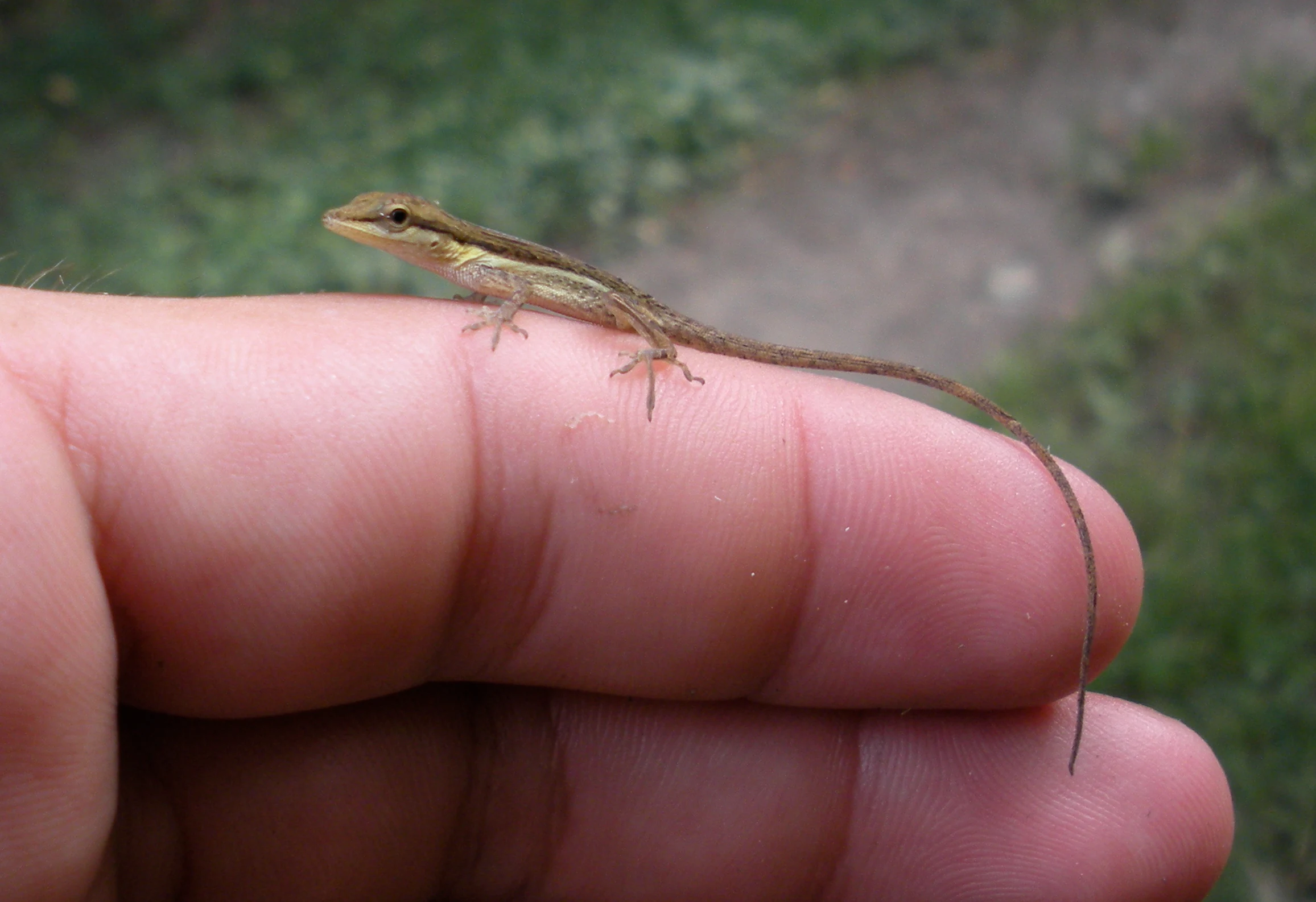
A tiny, slender lizard with a long tail resting on the tip of a person's finger, seen in close-up against a blurry outdoor background.
A small lizard, identified as a juvenile Anolis pulchellus, resting on a human finger.

Aguirre State Forest history and protected-area timeline

Aguirre State Forest was established in 1918 under the governorship of Arthur Yager to protect the mangrove forests stretching across the south coast between Guayama and Santa Isabel, in the area of Punta Petrona. At a time when Puerto Rico's coastal lowlands were under increasing pressure from agriculture, sugar production, and industrialization, the forest represented an early formal attempt to safeguard mangrove habitat at a meaningful geographic scale.

The forest's name reflects the surrounding landscape history. It takes its name from the nearby Central Aguirre, a large historic sugarcane plantation and refinery complex, and from the barrio of Aguirre in the municipality of Salinas. This shared nomenclature ties the reserve to Puerto Rico's sugarcane era, where industrial operations on the coast existed alongside the mangrove and lagoon systems that today form the heart of the protected area.

Over time, Aguirre State Forest's significance grew beyond its original conservation role. Its inclusion within the Jobos Bay Important Bird Area and its recognition by BirdLife International in 2007 marked a transition from a primarily local reserve to a site recognized for its wider Caribbean importance for marine and terrestrial birds.

Aguirre State Forest landscape and geographic character

The landscape of Aguirre State Forest is overwhelmingly coastal and low-lying. Most of the reserve lies only a few feet above sea level, with broad stretches of mangrove coast bordered by offshore keys and shallow lagoon systems. The mangroves themselves form a dense, often impenetrable fringe along tidal channels, while inland portions transition into freshwater floodplain forests that soften the boundary between land and sea.

The presence of tropical salt ponds is one of the most distinctive elements of the terrain. These shallow hypersaline flats are fringed by characteristic salt-tolerant grasses such as Batis maritima, Sesuvium portulacastrum, and Sporobolus virginicus, producing a patchwork of open water, bright salt-crusted margins, and dense mangrove stands. The visual character of the forest is shaped more by water than by elevation: channels, ponds, and tidal flats dominate the view, with trees and shrubs arranged around them rather than defining the broader topography.

Aguirre State Forest ecosystems, habitats, and plant life

Ecologically, Aguirre State Forest belongs firmly to the Greater Antilles mangroves WWF ecoregion. Its foundation species are the four mangrove tree types: white mangrove (Laguncularia racemosa), black mangrove (Avicennia germinans), red mangrove (Rhizophora mangle), and buttonwood (Conocarpus erectus), each occupying slightly different zones within the tidal gradient and collectively forming a structurally diverse coastal woodland.

The tropical salt pond ecosystem adds another layer of habitat complexity. Together with the mangrove channels, these ponds create transitional environments where salinity, water depth, and vegetation structure vary across short distances. This mosaic of conditions supports an unusually broad range of invertebrates, fish, reptiles, amphibians, and birds, and explains why such a relatively small coastal reserve sustains a notable level of overall biodiversity.

Aguirre State Forest wildlife and species highlights

Wildlife is one of the strongest reasons Aguirre State Forest stands out among Puerto Rico's state forests. Documented fauna in and around the reserve includes thirteen reptile species, four amphibian species, and three bat species, alongside the broader fauna of the adjacent Jobos Bay estuary. West Indian manatees are among the most charismatic species present, using the lagoons around the forest as foraging habitat.

The reserve's birdlife is exceptional. At least 184 bird species have been recorded within the forest, and it functions as an important nesting site. Yellow-crowned night herons, white-cheeked pintails, and yellow warblers are commonly cited residents, while the endangered yellow-shouldered blackbird (Agelaius xanthomus) is one of the forest's most conservation-relevant species. A breeding population of red-crowned parrots (Amazona viridigenalis), a species established in Puerto Rico through introductions in the second half of the twentieth century, is also present in the forest and the surrounding Central Aguirre area.

Aguirre State Forest conservation status and protection priorities

Aguirre State Forest matters most as a refuge for coastal mangrove and estuarine ecosystems that have been heavily reduced across the Caribbean. Its contiguous protection with the Jobos Bay National Estuarine Research Reserve, Punta Pozuelo, and Punta Petrona creates a network of safeguards that helps maintain mangrove integrity, water quality, and habitat connectivity along Puerto Rico's south coast.

The forest's inclusion in the Jobos Bay Important Bird Area and its recognition by BirdLife International since 2007 highlight its wider role in Caribbean bird conservation. The presence of yellow-shouldered blackbirds, large wading bird populations, and nesting habitat for multiple species gives the reserve a conservation value that extends beyond the borders of Puerto Rico itself.

Aguirre State Forest cultural meaning and human context

Aguirre State Forest is closely tied to Puerto Rico's south coast heritage, particularly the sugarcane economy. Its name derives from the Central Aguirre complex, one of the most important historic sugarcane plantations and refineries in Puerto Rico, and from the barrio of Aguirre in Salinas. The reserve therefore sits within a cultural landscape shaped by plantation agriculture, industrial development, and traditional coastal livelihoods.

The juxtaposition is part of the reserve's identity: mangrove and salt pond ecosystems coexist with former industrial infrastructure, providing a reminder that Puerto Rico's most ecologically valuable coastal sites have also been among the most economically developed. Today, the forest contributes to a more layered reading of the south coast, where natural and industrial histories remain physically adjacent.

Top sights and standout views in Aguirre State Forest

Aguirre State Forest's principal highlights include its four-species mangrove forest, its tropical salt pond ecosystem, and its 184 recorded bird species. It also stands out for the presence of endangered yellow-shouldered blackbirds and a resident breeding population of red-crowned parrots, and for the fact that West Indian manatees continue to use its lagoon systems.

Equally important is the reserve's integration into a wider coastal conservation landscape. Its adjacency to Jobos Bay, Punta Pozuelo, and Punta Petrona means the forest functions less as an isolated site and more as a key node in one of southern Puerto Rico's most significant estuarine and mangrove protection networks.

Best time to visit Aguirre State Forest

A coastal mangrove reserve like Aguirre State Forest is best appreciated when bird activity is high and conditions are comfortable for outdoor exploration. Cooler dry months on Puerto Rico's south coast typically bring stable weather, more active bird movement, and easier conditions for guided walks and kayaking around the mangrove channels and salt ponds.

Wet seasons can be rewarding as well, particularly for those interested in lush vegetation, full lagoon systems, and peak manatee presence in the larger water bodies, but visitors should expect more variable weather. Because the reserve centers on birdwatching, the cooler months that often coincide with greater migratory bird presence are generally the most productive times to visit.

Monthly climate preview

Long-term monthly temperature averages and precipitation patterns for Aguirre State Forest

Aguirre State Forest Climate Normals, Annual Temperature, and Precipitation Rhythm

Historical data records measured monthly temperature and precipitation rhythms across a representative coordinate in Aguirre State Forest. Examining the complete twelve-month climatology profile reveals detailed variations in average temperature and precipitation across the terrain.
Annual mean25 °C
24 °C27 °C
Jan24°
Feb24°
Mar24°
Apr25°
May26°
Jun26°
Jul27°
Aug27°
Sep27°
Oct26°
Nov25°
Dec24°
Warmest month
August

26.8 °C

Coolest month
January

23.6 °C

Wettest month
November

4.7 mm/day

Driest month
February

1.6 mm/day

Park location guide

Geography guide, regional context, and park location map for Aguirre State Forest

Aguirre State Forest park geography, regions, and map view in United States of America

Understand where Aguirre State Forest sits in United States of America through a broader geographic reading of the surrounding landscape, nearby location context, and its mapped position within the national park landscape.

How Aguirre State Forest fits into United States of America

The United States of America is a federal presidential republic and one of the world's largest countries by area and population. It consists of 50 states across a vast territory spanning multiple time zones, with its capital in Washington, D.C. and largest city in New York City. The nation has a diverse economy, influential political system, and significant cultural and military presence globally.

Wider geography shaping Aguirre State Forest in United States of America

The United States occupies a vast territory in North America, bordered by Canada to the north and Mexico to the south. The 48 contiguous states stretch from the Atlantic to the Pacific Ocean, while Alaska occupies the northwestern region and Hawaii is an archipelago in the Pacific. The country encompasses diverse terrain including the Rocky Mountains, Appalachian Mountains, Great Plains, and extensive river systems.

Map view of Aguirre State Forest

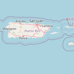
Use this park location map to pinpoint Aguirre State Forest in United States of America, understand its exact geographic position, and read its mapped placement within the surrounding landscape more clearly.

Pigeon | © OpenStreetMap contributors

Location context for Aguirre State Forest

Puerto Rico

Examine coastal mangrove ecosystems, tropical salt ponds, and estuarine terrain across southern Puerto Rico.

Aguirre State Forest Photos and Visual Landscape Exploration

Visual documentation captures the coastal morphology of Aguirre State Forest through detailed photography of tidal channels, salt flats, and dense mangrove fringes. Photographic records provide clear reference material for understanding the wetland habitats and estuarine geography defining the southern coast of Puerto Rico.

A tiny, slender lizard with a long tail resting on the tip of a person's finger, seen in close-up against a blurry outdoor background.

A tiny, dark-patterned lizard with a brownish head held between human fingers.

Park atlas

Discover related estuarine reserves, mangrove networks, and regional conservation landscapes

Explore Parks Near Aguirre State Forest and Surrounding Coastal Protected Areas

Compare Aguirre State Forest with other nearby protected areas across the coastal plains and estuarine networks of southern Puerto Rico. Examining adjacent conservation zones provides deeper geographic context for wetland habitats and regional bird sanctuaries.
Watercolor painting of a tropical mountain landscape with lush vegetation and palm trees in the foreground and rolling hills in the background.
State or regional parkPuerto Rico
About 22 km away#1 closest

Northeast

Carite State Forest: Volcanic Mountain Geography and Protected Watersheds in Puerto Rico

Mapping the Sierra de Cayey ecosystem and river headwaters.

Carite State Forest protects 2,600 hectares of rugged, volcanic mountain landscape in southeastern Puerto Rico. Known for its subtropical moist forest and high-elevation dwarf zones, the terrain provides a critical habitat for rare endemic species. The forest serves as a vital hydrological watershed, sustaining regional river systems through its complex network of ravines and forested mountain slopes.

Area
26 km²
Established
1935
Relief
Mountain
Climate
Tropical
Watercolor painting of a hilly, green landscape featuring rolling mountains in the distance and vegetation in the foreground.
State or regional parkUnited States of America
About 47 km away#2 closest

West

Cerrillos State Forest: Protected Subtropical Woodland and Reservoir Geography

Foothill landscapes and watershed features in Ponce, Puerto Rico

This protected area features a mix of tabonuco forest and water-based recreational terrain. Spanning the slopes of the Cordillera Central foothills, the forest encompasses the Cerrillos River and the man-made Lake Cerrillos reservoir, offering a distinct example of subtropical moist forest ecology within the United States commonwealth system.

Area
0.79 km²
Established
1996
Relief
Upland
Climate
Subtropical
State or regional parkPuerto Rico
About 49 km away#3 closest

Northwest

Los Tres Picachos State Forest: A Geographic Guide to Puerto Rico's Mountain Protected Areas

Cloud forests, volcanic terrain, and watershed protection

Los Tres Picachos State Forest encompasses a striking landscape in the Puerto Rican interior, marked by deep river valleys and its namesake triple peaks. This atlas feature provides insights into the forest's layered ecological zones and its role as a crucial hydrological anchor for the Toro Negro and Cialitos river systems within the Cordillera Central.

Established
1999
Relief
Mountain
Climate
Tropical
Access
Remote access
State or regional parkSan Juan
About 52 km away#4 closest

North

San Patricio State Forest: Protected Urban Karst and Mogote Terrain in San Juan

Mapping subtropical moist forest geography in Puerto Rico

San Patricio State Forest represents a unique conservation success as a reclaimed secondary forest within the San Juan metropolitan region. This protected area maintains the distinctive karst geology of Puerto Rico, featuring a prominent mogote landmark that provides habitat for endemic species and native plant communities amidst an urban environment.

Area
0.283 km²
Established
2000
Relief
Upland
Climate
Tropical
Watercolor painting of a coastal landscape with green hills, wetlands, and distant mountains in a soft palette.
State or regional parkLoíza
About 59 km away#5 closest

North

Piñones State Forest: Mapped Geography and Protected Coastal Terrain in Loíza, Puerto Rico

Coastal mangrove reserve and protected forestland

Piñones State Forest is a significant protected area on the northern coast of Puerto Rico. This reserve features a low-lying landscape defined by intricate mangrove systems, coastal dunes, and rare endemic plant populations. Its proximity to the San Juan metropolitan area provides an important ecological buffer, offering a unique opportunity to map and study the intersection of Caribbean coastal woodlands and protected natural boundaries.

Relief
Lowland
Climate
Tropical
Access
Easy access
Scope
Terrestrial
Protected areaAdjuntas
About 60 km away#6 closest

Northwest

Bosque del Pueblo: Protected Forest Geography and Cordillera Central Landscape

A mountain watershed and ecological corridor in Adjuntas

Bosque del Pueblo represents a key protected landscape within the central mountains of Puerto Rico. As a critical forest reserve located in Adjuntas, it preserves headwaters and supports rare bird populations, serving as a permanent ecological link between several major state forest units.

Area
2.987 km²
Established
1995
Relief
Mountain
Climate
Tropical
State or regional parkPuerto Rico
About 64 km away#7 closest

West

Guilarte State Forest: Protected Mountain Ecosystems and Cordillera Central Geography

Highland conservation and mapped mountain terrain in central Puerto Rico

Guilarte State Forest represents a essential protected area in the Cordillera Central of Puerto Rico. The reserve encompasses steep altitudinal shifts, ranging from mid-slope palm forests to summit-level cloud forests. As a headwater region for major river basins, the forest is a focal point for understanding the island's mountainous geography and conservation priorities for endemic species.

Area
19.514 km²
Established
1935
Relief
Mountain
Climate
Tropical
State or regional parkPuerto Rico
About 71 km away#8 closest

Northeast

Ceiba State Forest: Mapping the Coastal Wetlands and Reefs of Eastern Puerto Rico

Coastal mangrove ecosystems and protected wetland habitats

Ceiba State Forest represents a critical coastal protected area in Puerto Rico, known for its dense mangrove ecosystems and adjacent coral reef environments. The reserve provides a compact, interconnected study of tidal wetlands and sandy shorelines. Use this structured profile to examine the geographic characteristics and protected boundaries that define this important avian sanctuary and coastal zone.

Area
1.42 km²
Established
1979
IUCN
Ia
Relief
Lowland

Common questions about visiting, size, designation, and location context for Aguirre State Forest

Aguirre State Forest FAQs for park facts, access, geography, and protected area context

Find quick answers about Aguirre State Forest, including protected-area facts, park geography, trail and visitor context, and how the park fits into its surrounding country and regional landscape.
MoriAtlas Explorer

Continue Your Protected Areas Search Across the Global Atlas

Deepen your exploration by continuing the structured search for national parks and protected areas worldwide. Utilize the comprehensive filtering capabilities to compare different conservation landscapes and refine your understanding of global park geography. Discover more about the distribution and characteristics of protected natural areas.

Global natural geography