

Mori Atlas logo
Protected areaAlberca de los Espinos

Explore the geography and hydrological dynamics of this highland crater basin and Ramsar wetland

Alberca de los Espinos: A Volcanic Crater Lake and Protected Landscape in Michoacán, Mexico

Alberca de los Espinos stands as a distinct monogenetic volcanic crater, housing a deep, stratified lake within the Michoacán highlands. This protected area offers insights into the geological and hydrological rhythms of the Trans-Mexican Volcanic Belt, where thermal stratification triggers seasonal water color shifts. Its geography encompasses a 142-hectare basin that integrates natural heritage with cultural historical significance.

volcanic crater lakehighland lakeRamsar wetlandstate protected areatrans-mexican volcanic beltMichoacán highlands

Alberca de los Espinos

Protected area

Park overview

Structured park overview, official facts, and landscape profile for Alberca de los Espinos

Alberca de los Espinos park facts, protected area profile, and essential visitor context

Review the core facts for Alberca de los Espinos, including designation, size, terrain, visitor scale, habitats, and operating context in one park-focused overview.

About Alberca de los Espinos

Alberca de los Espinos is a protected volcanic crater lake in the highlands of Michoacán, Mexico, and one of the more compact yet ecologically distinct water bodies within the Trans-Mexican Volcanic Belt. The lake occupies a roughly semi-elliptical basin inside the crater of an inactive monogenetic volcano, whose highest rim point reaches about 2,100 meters above sea level. Radiocarbon studies place the volcano's last short-duration eruption at approximately 25,000 years ago, leaving behind a quiet, enclosed basin that has since filled with groundwater and precipitation.

The body of water itself spans about 10.62 hectares, reaching a maximum depth of around 29 meters. Its depth plays a defining ecological role: thermal stratification drives seasonal nutrient cycling that visibly changes the lake's color, shifting from brown in cooler months to green and blue tones in warmer periods as plankton populations rise. The setting, within the Ciénega de Zacapu and surrounded by a 142-hectare state-protected natural area, gives the site both scenic and conservation importance.

Today the lake is appreciated as much for its cultural memory as for its natural setting. Looking out across the water, visitors encounter a landscape shaped by indigenous Purépecha traditions, Franciscan missionary history, and modern environmental protection. Basic visitor infrastructure, including viewpoints, gazebos, paved footpaths down to the shore, and restrooms, has been in place since 2005 and is administered by the municipal government of Jiménez.

Quick facts and research context for Alberca de los Espinos

Alberca de los Espinos sits in the crater of an inactive monogenetic volcano whose last short-lived eruption is estimated at roughly 25,000 years ago, based on radiocarbon studies. The lake lies at about 1,980 meters above sea level, while the surrounding crater rim rises to around 2,100 meters. With a surface area near 10.6 hectares and a maximum depth of 29 meters, the lake is small but deep enough to develop clear thermal stratification, which drives its seasonal color changes.

The site holds dual conservation designations: a Michoacán state protected natural area established on March 14, 2003, and a Ramsar wetland designation granted on February 2, 2009. The municipality of Jiménez administers public access, and basic visitor amenities have been in place since 2005.

Protection and recognition

Documented terrestrial protection scope, designation history, and Ramsar records.

Alberca de los Espinos Protection Status and International Recognition

Alberca de los Espinos maintains a documented terrestrial protection scope established in 2009, alongside historical Ramsar wetland recognition from 1922. Structured conservation records outline the official designation timeline and international recognition sources associated with the protected landscape.

International recognition

Protection details

Protection scope
Terrestrial
Designated year
2009
Transboundary protection
No
Park context

Deeper park guide and search-rich context for Alberca de los Espinos

Alberca de los Espinos history, landscape, wildlife, and travel context

Explore Alberca de los Espinos through its history, landscape character, ecosystems, wildlife, conservation priorities, cultural context, and seasonal travel timing in a structured park guide built for atlas discovery and search intent.

Why Alberca de los Espinos stands out

Alberca de los Espinos is best known as a textbook example of a Mexican volcanic crater lake with strong seasonal hydrological dynamics. Because the lake is deep enough to stratify thermally, nutrient resuspension from the bottom gives the water a brown tone in cool months, while plankton blooms later turn it green and blue in warm months, producing a visibly shifting palette across the year. The site is equally recognized for its layered cultural significance. The lake was once a place of worship for the Purépecha deity Tiripeme Curicaueri, and colonial-era Franciscan activity reshaped its identity, giving rise to the alternate name Alberca de Santa Teresa and an annual October 15 commemoration. Together, these geological and cultural layers make the lake a singular landmark within the Ciénega de Zacapu region.
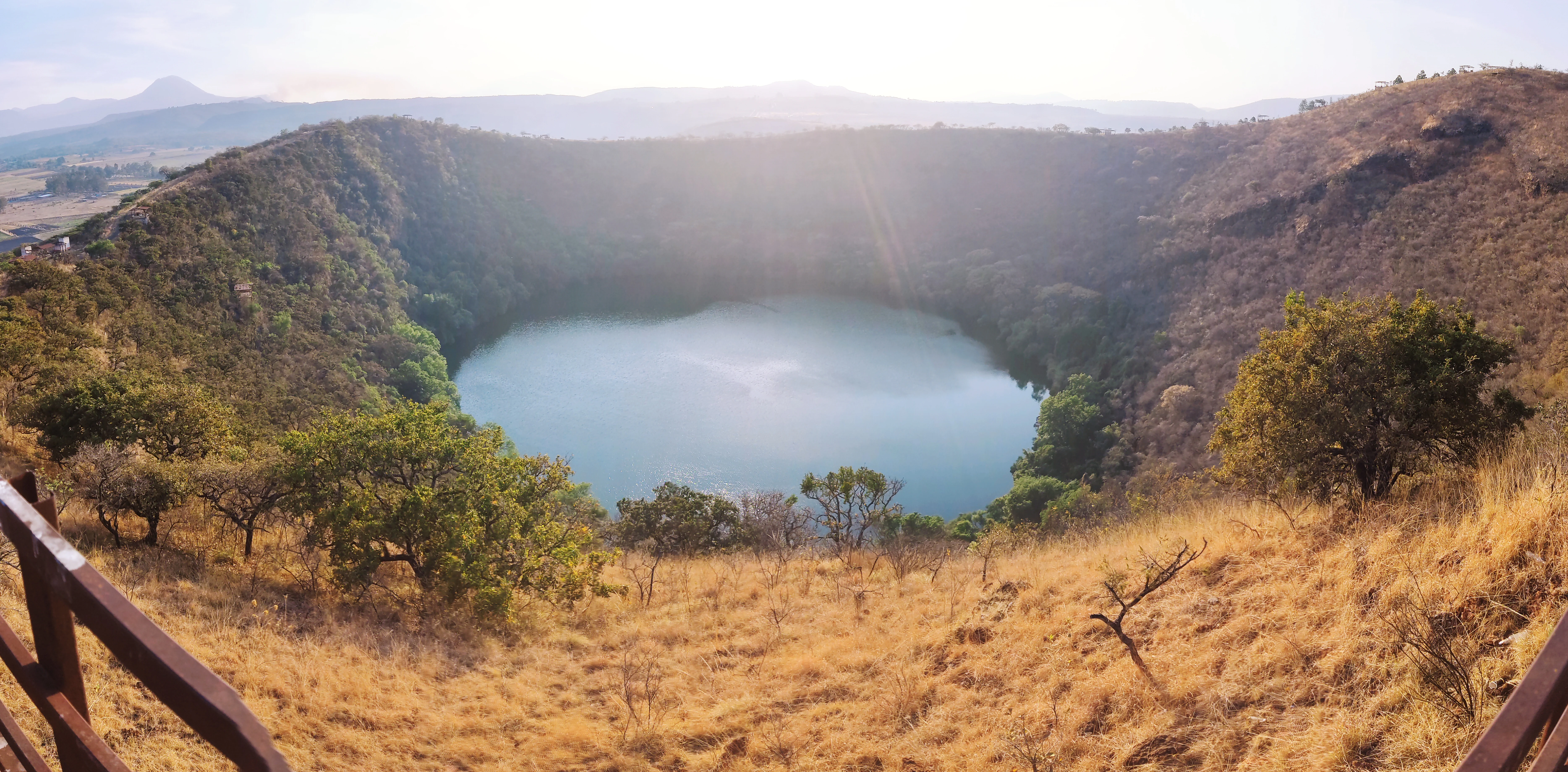
A wide panoramic view of a volcanic crater lake surrounded by steep vegetated slopes, with dry grass and a wooden railing visible in the foreground.
View of the Alberca de los Espinos volcanic crater lake from a scenic overlook.

Alberca de los Espinos history and protected-area timeline

The lake's human history long predates its current legal designations. In pre-Hispanic times the site, locally known as an axalapasco, was a place of worship tied to Tiripeme Curicaueri, a deity associated with the Purépecha cosmos, and also served as a location where local inhabitants bathed and gathered.

After the Spanish conquest, Franciscan missionaries repurposed the lake as a site for baptizing Indigenous people. According to local tradition, this angered Tiripeme, who was said to stir up whirlpools that dragged women bathing or washing clothes into the water. On October 15, 1550, the friar Jacobo Daciano is said to have climbed the volcano, raised a cross, and sprinkled holy water over the lake; a great whirlpool reportedly emerged and fled, after which the friar formally named the lake in honor of Santa Teresa. The October 15 Santa Teresa celebration continues as a marker of this colonial-era reframing of the site.

In modern institutional history, the surrounding area was declared a protected natural area by the state of Michoacán on March 14, 2003, granting it formal conservation recognition. Its ecological importance was further affirmed internationally on February 2, 2009, when the site was listed as a Ramsar wetland. Since 2005, modest recreational infrastructure has been developed around the lake to support managed public access under the municipal government of Jiménez.

Alberca de los Espinos landscape and geographic character

The defining feature of the landscape is the circular crater rim of an inactive monogenetic volcano, with its highest point at approximately 2,100 meters above sea level and a maximum crater diameter near 740 meters. Inside this rim sits the lake, set at about 1,980 meters above sea level, so visitors encounter a clear vertical contrast between the elevated crater edge and the still water surface below.

The lake itself has a semi-elliptical shape and spans roughly 350 meters across at its widest, forming a compact mirror-like expanse at the bottom of the basin. The enclosing slopes combine volcanic rock, surrounding vegetation, and built viewpoints that frame views of the water from above, while paved footpaths descend toward the shoreline. The wider regional setting places Alberca de los Espinos within the Ciénega de Zacapu and the Trans-Mexican Volcanic Belt, a zone known for its concentration of volcanic landforms and highland basins.
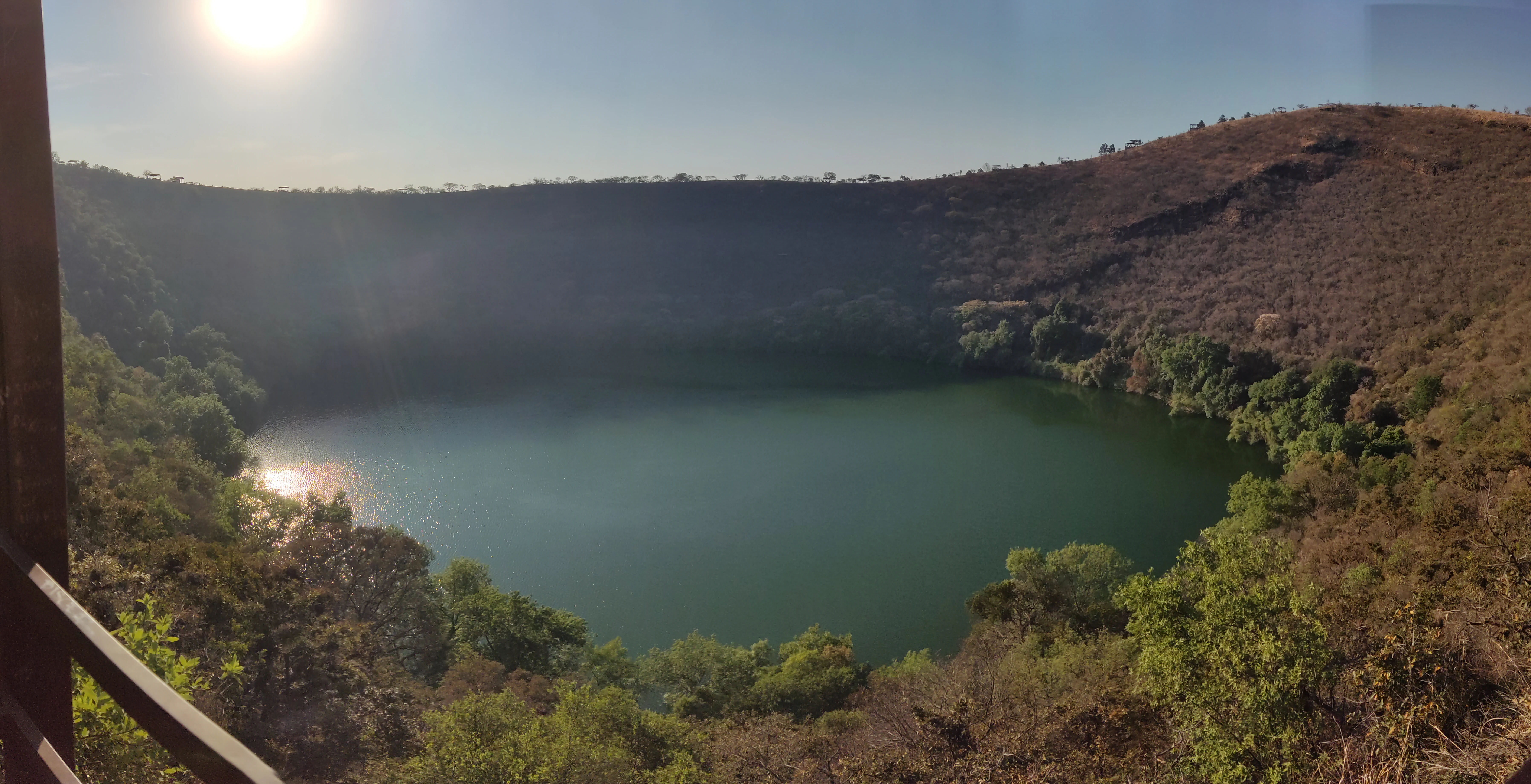
A volcanic crater lake with green water surrounded by steep crater walls covered in dry brown vegetation and scattered green trees, viewed from an elevated wooden viewpoint with the sun shining brightly in the upper left corner.
View of the Alberca de los Espinos volcanic crater lake from an elevated viewpoint, with sunlight reflecting off the green water and dry vegetation covering the crater walls.

Alberca de los Espinos ecosystems, habitats, and plant life

Ecologically, the lake stands out as a small but stratified volcanic water body embedded in a temperate highland matrix. Its depth of about 29 meters allows thermal stratification, which in turn drives a seasonal nutrient cycle that visibly changes the color of the water and supports plankton-based productivity. The site also hosts relict aquatic species, including endemic goodeids and local charal populations, alongside more generalized fish such as carp.

The surrounding 142-hectare protected area supports a mosaic of vegetation typical of Michoacán's volcanic highlands, with oaks, willows, mesquite, ahuehuete, capulín, and various Bursera and Erythrina species, as well as nopals, agave-like succulents, and introduced eucalyptus. This blend of native and semi-natural vegetation creates a transitional habitat between closed-canopy woodland, open scrub, and aquatic fringe, which supports the lake's broader wetland function as recognized by its Ramsar designation.
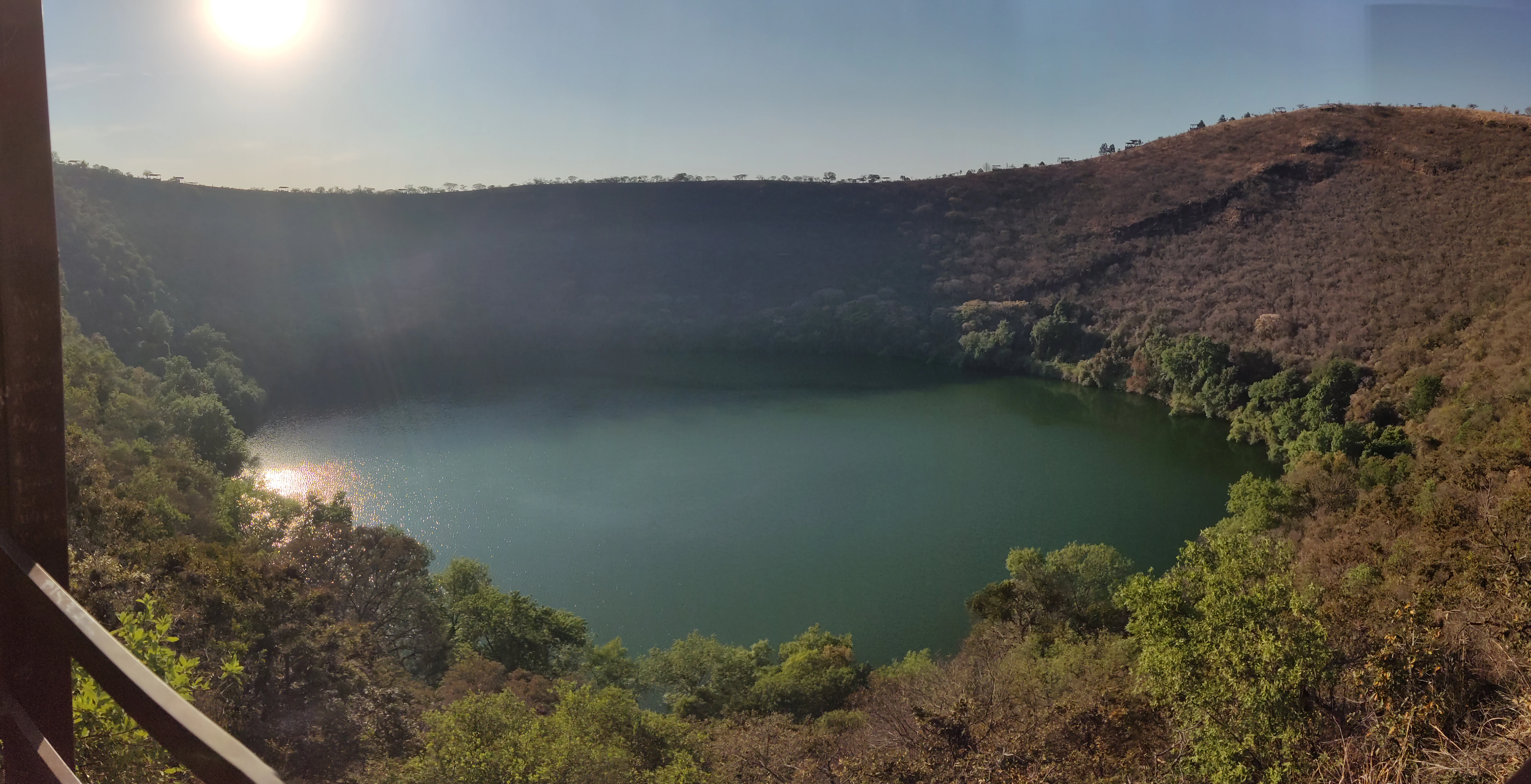
A wide shot of a green crater lake surrounded by steep, vegetated hills, with a wooden railing visible in the bottom left corner and bright sunlight causing glare in the upper left.
A view of the Alberca de los Espinos crater lake from a wooden observation deck, with sunlight reflecting off the water.

Alberca de los Espinos wildlife and species highlights

The wildlife profile of Alberca de los Espinos combines an aquatic component centered on the lake with a more typical highland terrestrial fauna around the crater slopes. The lake supports native Mexican fish such as charales of the genus Chirostoma, the blackfin goodea, and the bulldog goodeid, together with introduced Eurasian carp, reflecting both relict native diversity and modern species turnover.

On land and in the surrounding scrub and woodland, observers can encounter gray fox, hooded skunk, bobcat, gophers, Mexican cottontail, and common opossum. Birdlife includes Inca dove, lesser roadrunner, and red-tailed hawk, with additional wetland-associated species such as Mexican duck and dabchicks contributing to the site's birdwatching interest. Taken together, the wildlife communities reflect the broader Ciénega de Zacapu region's mix of wetland, scrub, and highland woodland habitats.

Alberca de los Espinos conservation status and protection priorities

Alberca de los Espinos holds both state and international conservation recognition, making it more than just a scenic lake. The surrounding area was declared a state protected natural area by Michoacán on March 14, 2003, placing it under formal protection for its biological, hydrological, and landscape values. Six years later, on February 2, 2009, the lake was inscribed as a Ramsar wetland site, highlighting its importance as a habitat for waterbirds and native aquatic species and underscoring its role in regional water cycles.

The site's conservation profile is shaped by a combination of small size, ecological fragility, and layered threats typical of Mexican highland lakes. Thermal stratification and seasonal nutrient pulses make the lake sensitive to catchment disturbance, while the presence of introduced fish species alongside native goodeids and charales points to ongoing ecological pressures. Its protected status and municipal management framework together aim to balance public access and recreation with the protection of a small but ecologically rich volcanic lake.

Alberca de los Espinos cultural meaning and human context

The cultural context of Alberca de los Espinos reaches back into Purépecha spiritual geography, where the lake was a place of devotion linked to Tiripeme Curicaueri and also a space for daily activities like bathing. After the Spanish conquest, the site was transformed into a setting for Christian baptism, and the Franciscans, particularly Fray Jacobo Daciano, became central figures in the lake's colonial-era retelling.

Today this dual heritage shapes local identity. The lake carries the additional name Alberca de Santa Teresa in honor of the 1550 baptism, and October 15 remains an associated commemorative date. At the same time, the lake's continued role as a community-accessible natural area, with basic visitor infrastructure provided under municipal administration, keeps it embedded in contemporary local life in Jiménez and the wider Ciénega de Zacapu.

Top sights and standout views in Alberca de los Espinos

Alberca de los Espinos combines a small monogenetic volcanic crater, a stratified highland lake, and layered Purépecha and Franciscan heritage into a single compact site. The seasonal color shifts of the water, driven by thermal stratification and plankton dynamics, give the lake a distinct visual rhythm that sets it apart from typical open-water reservoirs. Federal-level recognition as both a state protected natural area and a Ramsar wetland underscores its standing within Mexico's conservation framework.

Best time to visit Alberca de los Espinos

Because the lake's appearance and atmosphere shift with the seasons, the time of year meaningfully shapes the experience. Cooler months tend to bring brown-toned water driven by nutrient resuspension from depth, while warmer months typically bring green and blue tones as plankton blooms develop, making the warmer season particularly photogenic. Birdwatching can be rewarding when migratory and wetland-associated species are most active, and clearer highland weather during the warmer months also suits visits to the crater viewpoints and the descent path to the water.
Monthly climate preview

Long-term temperature and monthly precipitation patterns recorded across representative park coordinates

Alberca de los Espinos Climate Normals and Annual Weather Rhythm

Alberca de los Espinos exhibits a measured annual cycle of monthly temperatures and precipitation rates based on historical coordinate climatology. Opening the complete twelve-month record reveals deeper variations in average minimum and maximum thresholds across the protected area.
Annual mean17 °C
13 °C21 °C
Jan13°
Feb15°
Mar17°
Apr20°
May21°
Jun20°
Jul18°
Aug18°
Sep17°
Oct16°
Nov15°
Dec14°
Warmest month
May

21 °C

Coolest month
January

13.2 °C

Wettest month
July

5.5 mm/day

Driest month
April

0.1 mm/day

Park location guide

Geography guide, regional context, and park location map for Alberca de los Espinos

Alberca de los Espinos park geography, regions, and map view in Mexico

Understand where Alberca de los Espinos sits in Mexico through a broader geographic reading of the surrounding landscape, nearby location context, and its mapped position within the national park landscape.

How Alberca de los Espinos fits into Mexico

Mexico, officially the United Mexican States, is a country in North America spanning the Sierra Madre mountain ranges, coastal plains, and tropical regions. It borders the United States to the north, Guatemala and Belize to the southeast, and has coastlines along the Pacific Ocean, Gulf of Mexico, and Caribbean Sea. With a population exceeding 130 million, Mexico is home to one of the world's most significant concentrations of Indigenous languages alongside Spanish.

Wider geography shaping Alberca de los Espinos in Mexico

Mexico occupies a land area of 1,972,550 km2, making it the thirteenth-largest country in the world. The terrain is highly diverse, featuring the Sierra Madre Occidental and Sierra Madre Oriental mountain ranges, the Mexican Plateau, coastal lowlands along the Pacific and Gulf/Caribbean margins, and the Yucatan Peninsula. The country spans multiple climate zones from desert in the north to tropical rainforest in the south.

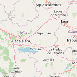
Map view of Alberca de los Espinos

Use this park location map to pinpoint Alberca de los Espinos in Mexico, understand its exact geographic position, and read its mapped placement within the surrounding landscape more clearly.

Pigeon | © OpenStreetMap contributors

Location context for Alberca de los Espinos

Michoacán

Visual reference of volcanic crater topography, basin habitats, and highland protected area scenery.

Alberca de los Espinos Photos and Landscape Scenery Visual Exploration

Visual records illustrate the rugged volcanic crater rim and seasonal water color shifts defining Alberca de los Espinos. Examining these protected area images reveals the distinct highland terrain and basin habitats characterizing the Michoacán landscape.

A wide panoramic view of a volcanic crater lake surrounded by steep vegetated slopes, with dry grass and a wooden railing visible in the foreground.

Wide shot of a blue volcanic crater lake surrounded by dry grassy hills and scattered trees, with a wooden fence in the foreground.

A volcanic crater lake with green water surrounded by steep crater walls covered in dry brown vegetation and scattered green trees, viewed from an elevated wooden viewpoint with the sun shining brightly in the upper left corner.

A wide shot of a green crater lake surrounded by steep, vegetated hills, with a wooden railing visible in the bottom left corner and bright sunlight causing glare in the upper left.

Park atlas

Compare nearby volcanic crater lakes and protected highland landscapes across Michoacán

Explore Other Parks Near Alberca de los Espinos and Regional Protected Areas

Browse protected areas near Alberca de los Espinos to compare regional volcanic landforms and highland water bodies. Examining adjacent reserves provides deeper geographic context for understanding the wider Trans Mexican Volcanic Belt.
Protected areaMichoacán
About 9.4 km away#1 closest

South

Zacapu Lagoon Protected Area: Mapping the Highland Wetlands of Central Michoacán, Mexico

An endemic-rich spring-fed wetland within the Lerma River basin system

Located in the state of Michoacán, Zacapu Lagoon serves as a vital protected area and perennial wetland. This highland site is defined by its spring-fed waters and riparian vegetation, providing a crucial refuge for narrow-range endemic fish and amphibian species. The lagoon functions as a benchmark for understanding aquatic biodiversity within the complex hydrological network of the Mexican highlands.

Area
0.216 km²
Established
2003
Relief
Lowland
Scope
Terrestrial
Protected areaMichoacán
About 35 km away#2 closest

South

Lake Pátzcuaro Protected Area: A Geographic Exploration of the Michoacán Volcanic Basin

Highland volcanic geography and protected wetland ecosystems

Located in a unique endorheic basin at 2,000 metres elevation, Lake Pátzcuaro stands as a landmark of central Mexico. The protected area encompasses dramatic volcanic ridges, expansive marshland fringes, and islands that define the regional geography. Explore the mapped terrain of these highland waters, which serve as a critical ecological corridor and a focal point for understanding the physical and environmental heritage of the Michoacán highlands.

Area
126.4 km²
Relief
Highland
Climate
Temperate
Access
Easy access
National parkMichoacán
About 46 km away#3 closest

West

Lago de Camécuaro National Park: National Park Protected Landscape and Geographic Atlas

Mapped boundaries and regional natural landscape context for Michoacán.

Lago de Camécuaro National Park offers a focused exploration of a distinct protected area within Michoacán, Mexico. Understand its specific geographic identity through mapped boundaries and regional terrain context, suitable for atlas-based discovery of natural landscapes and conservation areas. This entry provides a factual overview of the park's protected status and its placement within the broader geography of the region.

Area
0.097 km²
Established
1941
IUCN
II
Relief
Upland
National parkMichoacán
About 63 km away#4 closest

Southwest

Barranca del Cupatitzio National Park: National Park, Michoacán Protected Area

Mapped boundaries and regional geographic context.

Barranca del Cupatitzio National Park stands as a designated national park, providing critical geographic information for atlas exploration. Understand its specific mapped protected area boundaries and discover its role within the regional geography of Michoacán. This profile highlights the park's landscape identity and its significance as a key protected natural site for detailed geographic study.

Area
4.582 km²
Established
1938
IUCN
II
Visitors
255.2K annual
Protected areaGuanajuato
About 75 km away#5 closest

Northeast

Lake Yuriria: Exploring the Protected Landscape and Volcanic Terrain of Guanajuato

A historic artificial wetland and Ramsar-recognized migratory bird habitat.

Lake Yuriria serves as a benchmark for landscape conservation in the Bajio region. Spanning an extensive wetland area within a volcanic basin, this protected zone provides essential habitat for over 140 bird species and remains a cornerstone of the regional geography for its water regulation and agricultural impact.

Area
72 km²
Established
1548
Relief
Lowland
Climate
Subtropical
Wildlife reserveMichoacán
About 78 km away#6 closest

Southwest

Área de protección de flora y fauna Pico de Tancítaro: Geographic and Landscape Overview

Protected volcanic highlands in the state of Michoacán

Trace the ridges and forested valleys of this federal wildlife reserve. The area integrates sustainable land use with the protection of native highland ecosystems, marking a core point of interest for those tracking the volcanic geography of Mexico's Trans-Mexican Volcanic Belt.

Area
234.06 km²
Established
2009
Relief
Mountain
Scope
Terrestrial
Natural monumentGuanajuato
About 80 km away#7 closest

Northeast

Siete Luminarias Natural Monument: Exploring Maar Volcanic Craters in Guanajuato

A protected volcanic landscape on the Mexican Plateau.

Siete Luminarias encompasses seven well-defined volcanic maars surrounding the town of Valle de Santiago. This natural monument illustrates a rare geological occurrence where ancient underground explosions created broad, flat-floored craters that remain as essential features of the local Bajio terrain and regional geologic identity.

Area
89.28 km²
Established
1997
Relief
Upland
Climate
Subtropical
National parkMichoacán
About 99 km away#8 closest

East

Cerro de Garnica National Park: Its Geography and Protected Landscape Identity

Explore mapped boundaries within Michoacán's natural terrain.

Cerro de Garnica National Park serves as a distinct protected area contributing to the geographic understanding of Michoacán. This page offers a focused view on its mapped boundaries and natural landscape characteristics, providing essential context for atlas exploration. Discover the park's specific identity as a national park and its place within the regional geography, highlighting its value for structured discovery.

Area
19.36 km²
Established
1936
IUCN
II
Relief
Mountain

Common questions about visiting, size, designation, and location context for Alberca de los Espinos

Alberca de los Espinos FAQs for park facts, access, geography, and protected area context

Find quick answers about Alberca de los Espinos, including protected-area facts, park geography, trail and visitor context, and how the park fits into its surrounding country and regional landscape.
MoriAtlas Explorer

Continue Your Protected Areas Search Across the Global Atlas

Deepen your exploration by continuing the structured search for national parks and protected areas worldwide. Utilize the comprehensive filtering capabilities to compare different conservation landscapes and refine your understanding of global park geography. Discover more about the distribution and characteristics of protected natural areas.

Global natural geography