

Mori Atlas logo
National parkAmboseli National Park

Mapped boundaries and regional context for Amboseli National Park.

Amboseli National Park: Kenya National Park Protected Landscape Geography

Amboseli National Park stands as a key protected area within Kenya's diverse geographic landscape. This page offers an in-depth atlas-style exploration, detailing the park's mapped boundaries and its regional setting. Understand Amboseli National Park as a distinct national park entity, providing foundational data for geographic context and landscape discovery.

WetlandsElephant ConservationBirdwatchingMount KilimanjaroSavanna EcosystemsTransboundary Conservation

Amboseli National Park

National park

Park overview

Structured park overview, official facts, and landscape profile for Amboseli National Park

Amboseli National Park park facts, protected area profile, and essential visitor context
Review the core facts for Amboseli National Park, including designation, size, terrain, visitor scale, habitats, and operating context in one park-focused overview.

About Amboseli National Park

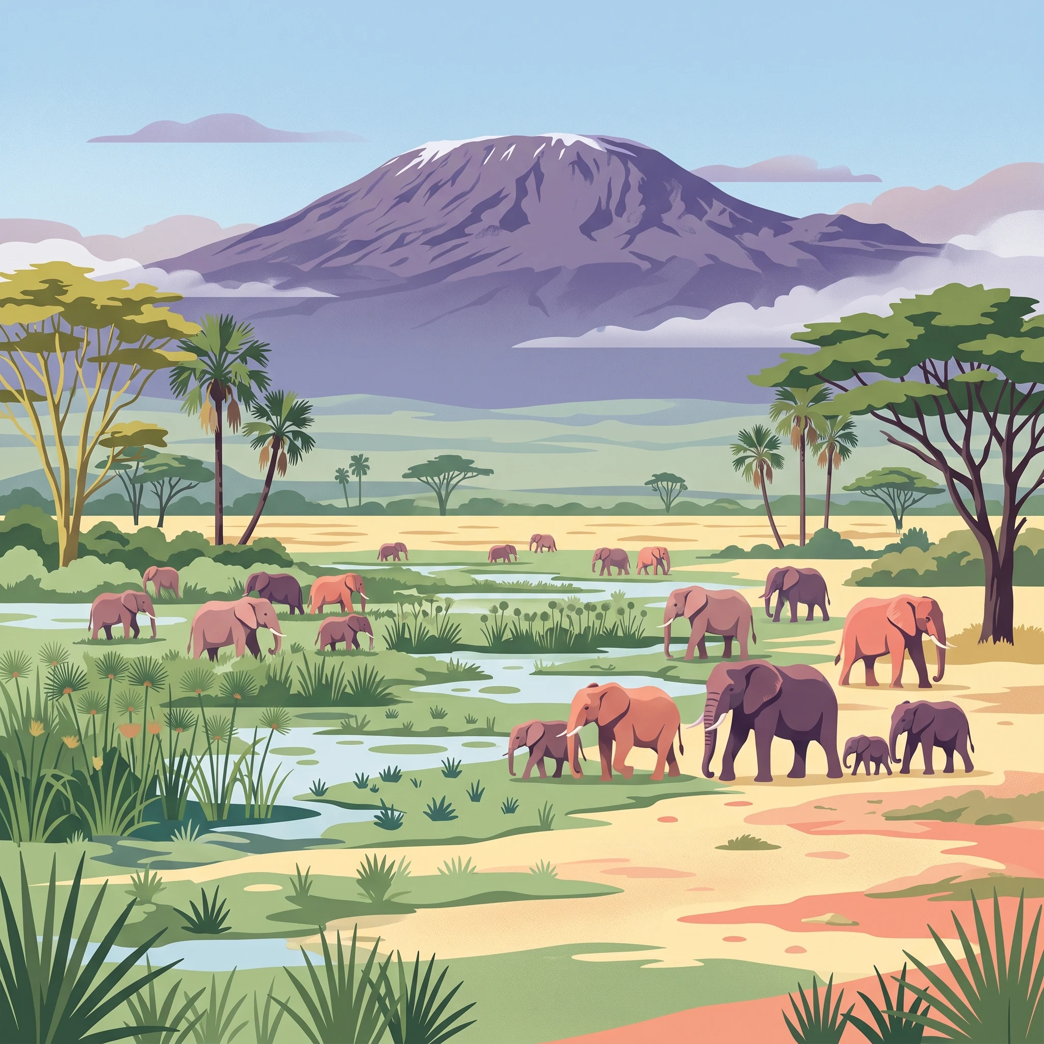
Amboseli National Park occupies a unique ecological position at the foot of Mount Kilimanjaro, where volcanic slopes give way to expansive savanna and marshland. The park's defining characteristic is the presence of permanent swamps fed by underground springs from the mountain's glaciers, creating lush green oases in an otherwise arid landscape. These wetlands support extraordinary biodiversity and form the lifeblood of the ecosystem. The park sits at the center of a larger transboundary conservation area that extends across the Kenya-Tanzania border, making it part of a wildlife corridor that allows for seasonal migrations and genetic exchange between populations. The Maasai people have inhabited this region for centuries, and their traditional pastoralist lifestyle remains intertwined with the land. The park's name derives from a Maasai word referencing the area's dusty, saline character, though the wetlands tell a different story of abundance and resilience. Visitors experience a landscape where the world's highest free-standing mountain provides a dramatic backdrop to grazing herds of elephants, giraffes, and zebras moving across the savanna.

Quick facts and research context for Amboseli National Park

Amboseli National Park lies in Loitoktok District, Kajiado County, approximately 240 kilometers southeast of Nairobi. The park covers 392 square kilometers and forms the core of a larger 8,000-square-kilometer ecosystem crossing the Kenya-Tanzania border. It was established as a reserve in 1906, became a game reserve in 1948, and was gazetted as a national park in 1974. The park is governed jointly by the Kenya Wildlife Service, the Olkejuado County Council, and the local Maasai community. The area supports over 400 bird species and significant populations of large mammals, with the park receiving approximately 120,000 visitors annually.

Park context

Deeper park guide and search-rich context for Amboseli National Park

Amboseli National Park history, landscape, wildlife, and travel context
Explore Amboseli National Park through its history, landscape character, ecosystems, wildlife, conservation priorities, cultural context, and seasonal travel timing in a structured park guide built for atlas discovery and search intent.

Why Amboseli National Park stands out

Amboseli is best known for its iconic views of Mount Kilimanjaro rising behind vast savanna wetlands, and for its population of African bush elephants that have been the subject of decades of groundbreaking research. The park gained international fame through Echo, the most studied elephant in the world, whose life and family were documented by conservationist Cynthia Moss for nearly four decades. The combination of the mountain backdrop, the swamp ecosystems, and the large elephant herds creates one of Africa's most photographed wildlife landscapes. The park also stands out for its bird diversity, supporting over 400 species including water birds and 47 raptor species.

Amboseli National Park history and protected-area timeline

The first European to enter the region was Jeremy Thompson in 1883, who penetrated what was known to outsiders as the feared Maasai region of Empusel, meaning 'salty, dusty place' in the Maa language. Thompson was astonished by the extraordinary array of wildlife and the stark contrast between the dry lake bed and the swamp oases, a contrast that remains today. In 1906, the British colonial administration set aside the area as the Southern Reserve for the Maasai people. In 1948, the reserve was returned to local control and redesignated as a game reserve. The area gained national park status in 1974 to protect the core of this distinctive ecosystem. In 1991, Amboseli was designated as a UNESCO site, recognizing its international significance. A notable development occurred in 2005 when Kenyan President Mwai Kibaki declared that park control should transfer from the Kenya Wildlife Service to the Olkejuado County Council and the Maasai community, a decision that generated legal challenges and debates about the future of community-based conservation in Kenya.

Amboseli National Park landscape and geographic character

The landscape of Amboseli is defined by a striking juxtaposition of environments. The park sits on the floor of a former Pleistocene lake, now a vast expanse of dusty, cracked earth and alkaline flats that reflect the intense equatorial sun. Interspersed across this arid base are the permanent swamps, fed by underground seepage from Mount Kilimanjaro's melting glaciers, which create islands of lush vegetation and open water. The surrounding savanna is dominated by semiarid grasslands and thorny scrub, with occasional acacia trees providing shade. The horizon is dominated by Kilimanjaro's snow-capped peak, which rises dramatically to 5,895 meters and influences the local climate through its effect on wind patterns and precipitation. The swamps themselves support tall bulrushes and papyrus, creating habitat that contrasts sharply with the dusty plains, and seasonal rains transform the dry lakebed into a shallow wetland that attracts enormous flocks of waterfowl.

Amboseli National Park ecosystems, habitats, and plant life

The ecological significance of Amboseli stems largely from its wetland system, which provides critical habitat in an otherwise semiarid region. The two main swamps serve as permanent water sources that sustain wildlife throughout the year, drawing animals from the surrounding plains during the dry season and supporting breeding populations of water birds. The ecosystem exists within a larger 8,000-square-kilometer transboundary area that includes parts of Tanzania, allowing for wildlife movements across international boundaries. The park's position at the foot of Mount Kilimanjaro creates a unique altitudinal gradient from the mountain's slopes through savanna to the lake basin. The semiarid vegetation consists mainly of grassland and bushland, with species adapted to the seasonal rainfall patterns and the alkaline soils of the old lakebed. This mix of habitats supports the remarkable bird diversity for which the park is known, with over 400 species recorded, including pelicans, kingfishers, crakes, hamerkops, and numerous raptors.

Amboseli National Park wildlife and species highlights

Amboseli is home to a remarkable assembly of large mammals, with African bush elephants being the most iconic residents. The park's elephant population gained worldwide attention through Echo, a matriarch whose family was studied continuously for almost four decades by American conservationist Cynthia Moss. Echo became the subject of numerous books and documentaries, and her death in 2009 at approximately 60 years old marked the end of an era in elephant research. The park supports healthy populations of other megafauna including Masai giraffes, Cape buffalo, blue wildebeest, and Grant's zebra. Predators include lions, cheetahs, and spotted hyenas, while primates such as yellow baboons are common around the swamp edges. The birdlife is exceptionally diverse, with over 400 species documented, including substantial populations of water birds like pelicans and herons, as well as 47 raptor species. The combination of wetland and savanna habitats creates ideal conditions for both resident and migratory species.

Amboseli National Park conservation status and protection priorities

Amboseli's conservation significance stems from its role as a protected core area within a larger transboundary ecosystem, and from its unique wetland resources in an arid region. The park's designation as a UNESCO site in 1991 reflected its international importance for biodiversity conservation. The governance structure involving the Kenya Wildlife Service, the Olkejuado County Council, and the Maasai community represents a model of collaborative management that seeks to balance wildlife protection with community benefits. The park's elephant population has been the subject of intensive research that has contributed significantly to understanding elephant behavior, social structures, and conservation needs. The challenges facing the ecosystem include pressures from growing human populations, climate change impacts on the Kilimanjaro glaciers that feed the swamps, and the ongoing debates about community versus state management of protected areas.

Amboseli National Park cultural meaning and human context

The Maasai people are the traditional inhabitants of the Amboseli region, and their pastoralist culture remains deeply connected to the landscape. The park sits within land that historically served as grazing grounds for Maasai herds, and the relationship between the Maasai and this environment predates the establishment of formal protection. The name 'Amboseli' is derived from a Maasai term reflecting the area's dusty, saline character, though the Maasai have long understood and utilized the value of the permanent swamps. The park's governance structure intentionally includes the Maasai community, recognizing that effective conservation requires local buy-in and that the community has legitimate claims to the land and its resources. This approach reflects evolving thinking about conservation that acknowledges indigenous rights and the importance of community-based natural resource management.

Top sights and standout views in Amboseli National Park

The defining highlight of Amboseli National Park is the view of Mount Kilimanjaro rising behind wetland scenery teeming with elephants, a combination that has become one of Africa's most recognizable natural images. The opportunity to observe large elephant herds, particularly families led by experienced matriarchs, offers insights into complex social behaviors developed through decades of research. The birdlife is spectacular, with the wetland areas providing excellent opportunities to observe water birds and raptors. The contrast between the dusty, ancient lakebed and the lush green swamps creates a visually striking landscape that changes dramatically with the seasons. Visitors can experience the Maasai culture through community-based tourism initiatives that offer authentic cultural exchanges.

Best time to visit Amboseli National Park

The best time to visit Amboseli depends on what visitors hope to experience. The dry seasons from June to October and January to February typically offer easier wildlife viewing as animals concentrate around the permanent water sources. The long rainy season from March to May can make some roads impassable but transforms the landscape into lush green, and the birdlife is especially active during migration periods. The short rains from November to December bring temporary flooding to the dry lakebed, creating ephemeral wetlands that attract diverse bird species. Kilimanjaro is most visible during dry periods when cloud cover is reduced, though the mountain's appearance changes throughout the year. The cooler months from June to August may offer more comfortable conditions for game drives, while the hotter period from September to November can be intense but coincides with optimal wildlife viewing opportunities.
Park location guide

Geography guide, regional context, and park location map for Amboseli National Park

Amboseli National Park park geography, regions, and map view in Kenya
Understand where Amboseli National Park sits in Kenya through a broader geographic reading of the surrounding landscape, nearby location context, and its mapped position within the national park landscape.

How Amboseli National Park fits into Kenya

Kenya is a presidential republic in East Africa and the seventh-most populous country on the continent. Its capital is Nairobi, and it borders five countries and the Indian Ocean. The country features significant geographic diversity including Mount Kenya, the Rift Valley, and coastal regions.

Wider geography shaping Amboseli National Park in Kenya

Kenya is located in East Africa, bordering South Sudan to the northwest, Ethiopia to the north, Somalia to the east, Tanzania to the southwest, and Uganda and Lake Victoria to the west. The southeastern border meets the Indian Ocean. The geography includes the Rift Valley highlands with Mount Kenya, coastal plains, and northern arid regions.

Map view of Amboseli National Park

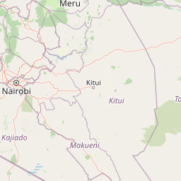
Use this park location map to pinpoint Amboseli National Park in Kenya, understand its exact geographic position, and read its mapped placement within the surrounding landscape more clearly.

Pigeon | © OpenStreetMap contributors

Location context for Amboseli National Park

Kajiado County
Park atlas

Compare adjacent protected landscapes and trace the regional park geography of the Mount Kilimanjaro ecosystem.

Discover Nearby National Parks and Protected Areas Around Amboseli National Park in Kenya
Trace a comprehensive park atlas of protected areas surrounding Amboseli National Park, exploring a diverse array of savanna, wetland, and transboundary conservation landscapes. Compare regional park geography to understand how the unique elephant habitats and Mount Kilimanjaro's influence shape the wider ecosystem across Kenya and Tanzania.
National parkKilimanjaro Region

Kilimanjaro National Park: Protected Landscape Geography and Atlas Exploration

Explore its mapped boundaries and regional context.

Delve into Kilimanjaro National Park, a protected national park situated in the Kilimanjaro Region. This detail page offers an atlas-driven view of the park's geographic scope, focusing on its mapped boundaries and the surrounding natural landscape. Understand the unique terrain and regional context that make this protected area a significant feature within Tanzania's geography.

Area
1,688 km²
Established
1973
IUCN
II
Visitors
52K annual
National parkArusha Region

Arusha National Park: A Protected Landscape in Tanzania's Arusha Region

Explore its mapped boundaries and regional geography.

Arusha National Park represents a significant protected landscape within the Arusha Region of Tanzania, offering specific geographic details for atlas-based exploration. This national park's identity is tied to its mapped natural terrain and its position within the broader regional context. Users can delve into the park's protected status and geographic features, making it a valuable entity for understanding the landscape of northern Tanzania.

Area
137 km²
Established
1960
IUCN
II
Visitors
66.8K annual
National parkTaita-Taveta County

Tsavo West National Park: Kenya's Protected National Park and Regional Geography

Explore mapped boundaries and natural landscapes in Taita-Taveta County.

Tsavo West National Park offers a focused exploration of protected landscape and regional geography within Kenya. Discover the mapped extent of this national park, understanding its role as a conservation area in Taita-Taveta County. This entry provides key geographic context and atlas-style information, highlighting the natural terrain and protected boundaries for detailed discovery.

Area
9,065 km²
Established
1948
IUCN
II
Relief
Mixed relief
National parkKenya

Nairobi National Park: Detailed Geographic Overview and Protected Landscape Atlas

Explore the mapped boundaries and regional context of this Kenyan national park.

Nairobi National Park represents a significant protected national park entity within Kenya. This MoriAtlas entry provides detailed insight into its geographic placement and mapped landscape characteristics. Users can delve into the park's specific location, its protected boundaries, and its contribution to the regional geography of East Africa, facilitating structured map-based exploration and understanding of this vital conservation area.

Area
117 km²
Established
1946
IUCN
II
Relief
Mixed relief
National parkArusha Region

Lake Manyara National Park: Protected Landscape & Rift Valley Geography in Arusha Region

Unique habitats from groundwater forests to alkaline lake shores.

Lake Manyara National Park is a distinct protected landscape situated within the Great Rift Valley of Tanzania's Arusha Region. The park's geography is shaped by the imposing escarpment wall and the alkaline Lake Manyara, creating a mosaic of habitats including rare groundwater forests, acacia woodlands, and saline grasslands. Its unique environment supports diverse wildlife and offers a prime example of regional landscape context and protected area dynamics.

Area
648 km²
Established
1960
IUCN
II
Visitors
178.5K annual
National parkKenya

Tsavo East National Park: Kenya's Protected Natural Landscape for Geographic Exploration

Explore mapped boundaries and regional park geography.

Tsavo East National Park in Kenya offers a rich entry point for understanding protected landscapes and regional geography. As a designated national park, its mapped boundaries and natural terrain provide essential context for geographic exploration within East Africa. This page serves as a focused discovery point for the park's specific environmental attributes and its role in the broader atlas of protected areas.

Area
13,747 km²
Established
1948
IUCN
II
Relief
Lowland
National parkManyara Region

Tarangire National Park: A Detailed Look at its Mapped Boundaries and Protected Landscape

National park geography in Manyara Region, Tanzania

Tarangire National Park stands as a core protected area within Tanzania's Manyara Region, offering a deep dive into its specific geographic attributes and mapped boundaries. This page provides essential atlas context for understanding the park's landscape character and its placement within the regional geography. Focus on the park's protected status and its unique natural terrain, providing a factual basis for geographic discovery and research.

Area
2,850 km²
Established
1970
IUCN
II
Visitors
161.8K annual
National parkNakuru County

Hell's Gate National Park: National Park Atlas and Mapped Landscape Exploration

Discover Nakuru County's protected terrain and geographic context.

Explore the mapped boundaries and unique geographic identity of Hell's Gate National Park, a protected national park within Kenya's Nakuru County. This detailed atlas view focuses on the park's natural landscape and its place within the regional geography, offering structured discovery of its protected terrain and surrounding context. Understand the visual and geographic essence of this significant conservation area.

Area
68.25 km²
Established
1984
IUCN
II
Relief
Mountain

Common questions about visiting, size, designation, and location context for Amboseli National Park

Amboseli National Park FAQs for park facts, access, geography, and protected area context
Find quick answers about Amboseli National Park, including protected-area facts, park geography, trail and visitor context, and how the park fits into its surrounding country and regional landscape.
MoriAtlas Explorer

Continue Your Protected Areas Search Across the Global Atlas

Deepen your exploration by continuing the structured search for national parks and protected areas worldwide. Utilize the comprehensive filtering capabilities to compare different conservation landscapes and refine your understanding of global park geography. Discover more about the distribution and characteristics of protected natural areas.

Global natural geography
