
Why Angas Downs Indigenous Protected Area stands out
Angas Downs is best known as a rare example of Anangu-led, Tjukurpa-based land management applied across a vast arid landscape. It shows how Indigenous customary knowledge can be combined with scientific conservation practice to restore desert habitats, protect sacred sites, and recover culturally important game species. The IPA also stands out for its striking diversity of central Australian landscapes in a single property, from mulga woodlands and spinifex sand dunes to gypsum depressions, quartzite ranges, and seasonal floodplains. Its remoteness, scale, and continuity with ancient Aboriginal land use give it a unique identity among Australian Indigenous Protected Areas.
Angas Downs Indigenous Protected Area history and protected-area timeline
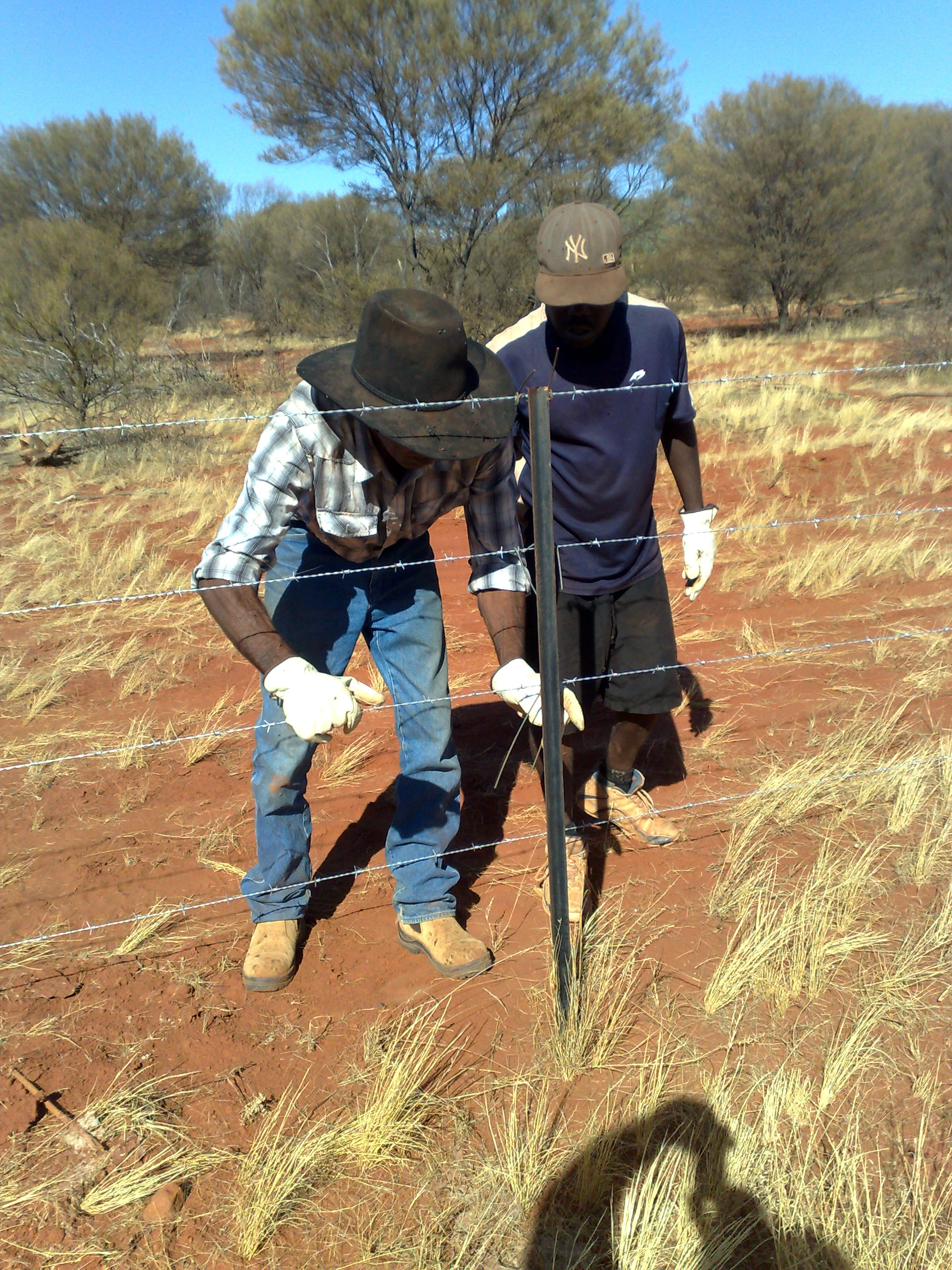
Angas Downs Station was first taken up for pastoral purposes by William Liddle in 1927. He and his descendants ran sheep and later cattle on the lease through much of the twentieth century. By the 1980s and 1990s the enterprise, like many remote Australian pastoral operations, faced mounting financial pressure and was eventually taken over by the mortgagee in 1994.
In that same year the Imanpa Development Association purchased the property, giving the local Aboriginal community stewardship over a lease that had traditionally supported their families. The lease has since been managed through the Association's company, Lisanote Pty Ltd, and descendants of William Liddle still maintain living areas on Angas Downs. Anthropologist Frederick GG Rose visited the station between July and October 1962, documenting Aboriginal life, the Liddle family genealogy, and the cultural changes associated with colonial contact, later published in his book The Wind of Change in Central Australia.
By the early 2000s, decades of past management and external pressures had degraded the landscape and reduced native wildlife populations. In response, the Imanpa community worked with the Australian Government to formally declare Angas Downs an Indigenous Protected Area on 10 June 2009, integrating the property into Australia's National Reserve System. The declaration marked a decisive shift toward combining traditional Anangu knowledge with contemporary conservation practice, and established Angas Downs as a flagship example of community-led land management in arid Australia.
Angas Downs Indigenous Protected Area landscape and geographic character
The landscape of Angas Downs is shaped by the arid heart of central Australia, with elevations, plains, and ranges typical of the southern Northern Territory. The property captures an unusually broad suite of desert landforms, giving it strong visual and ecological contrast within a single protected area.
Mulga woodlands, dominated by Acacia aneura, form a major vegetation matrix across much of the estate, interspersed with desert oak (Allocasuarina decaisneana) woodlands that thrive on sandy substrates. Spinifex (Triodia spp.) hummock grasslands cloak extensive sand dune systems, while hardy shrubs and groundcover species occupy the intervening swales.
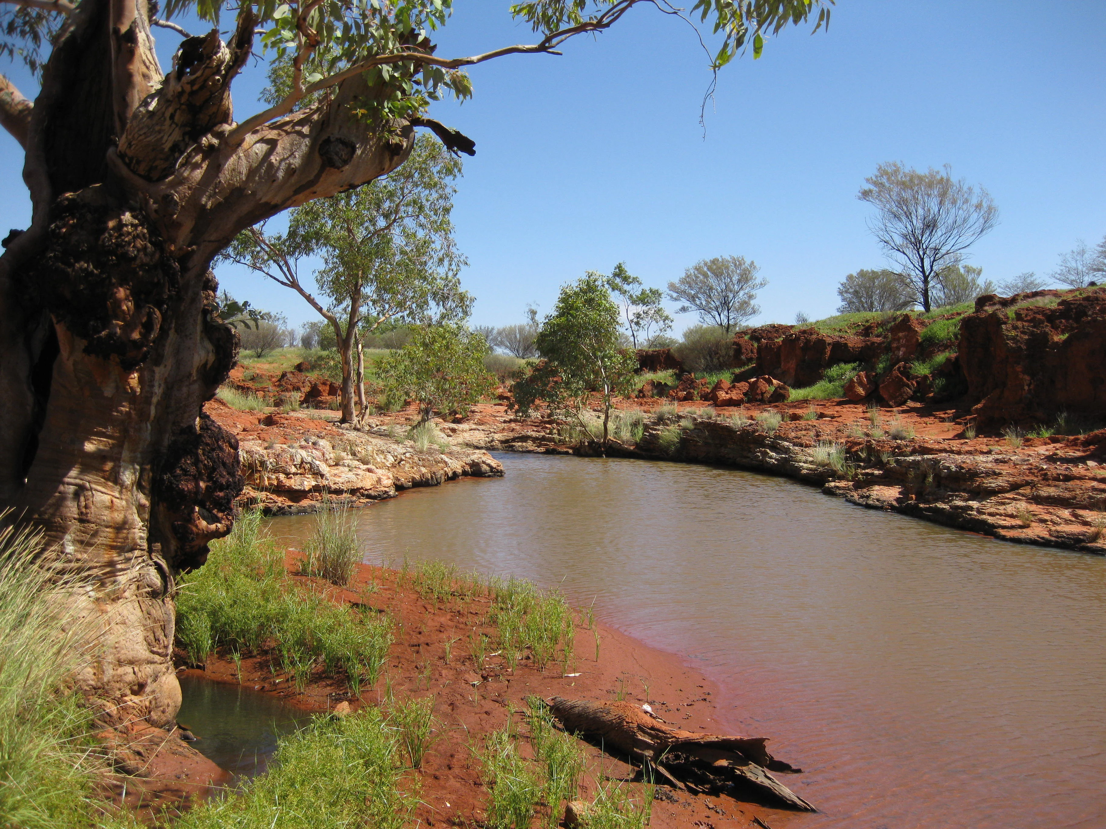
Geologically, the property includes gypsum depressions, open limestone plains, alluvial floodplains that pulse with life after rain, and quartzite hills such as the Liddle Range. Waterholes and soaks, including the Wilbia (Wilpiya) soak, are important focal points in the landscape, both ecologically and culturally, and their restoration has become a key part of land management at Angas Downs.
Angas Downs Indigenous Protected Area ecosystems, habitats, and plant life
Angas Downs protects a rich mosaic of arid-zone ecosystems, where subtle differences in soil, slope, and water availability produce strikingly different vegetation communities. This ecological complexity makes the IPA a significant refuge for plants and animals adapted to Australia's desert interior.
Vegetation types range from dense mulga and desert oak woodlands to open spinifex grasslands, gypsum-locked depressions with specialised flora, and quartzite ranges that host sparse but distinctive plant communities. The vulnerable Quandong (Santalum acuminatum) occurs on the property, although heavy browsing by feral camels remains a serious threat to its populations.
Seasonal rains transform parts of the landscape, particularly the alluvial floodplains and waterholes, producing rapid bursts of plant growth and renewed activity among reptiles and small mammals. The interplay between permanent refugia, such as rocky ranges, and ephemeral wetlands gives Angas Downs a dynamic ecological rhythm central to its conservation value.
Angas Downs Indigenous Protected Area wildlife and species highlights
Wildlife is a central focus of management at Angas Downs, and the IPA has recorded an impressive diversity of arid-adapted species. Surveys have documented 99 bird species, more than 50 reptile species, and a growing list of native mammals and amphibians.
Among the mammals recorded are echidnas, Ooldea dunnarts, lesser hairy-footed dunnarts, kultarrs, euros, red kangaroos, Gould's wattled bats, lesser long-eared bats, spinifex hopping mice, sandy inland mice, dingos, and probable crest-tailed mulgaras. Remote cameras have captured the endangered woma python in the central sandstone ranges, a particularly significant record for the property.
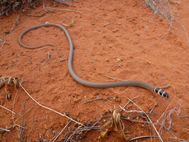
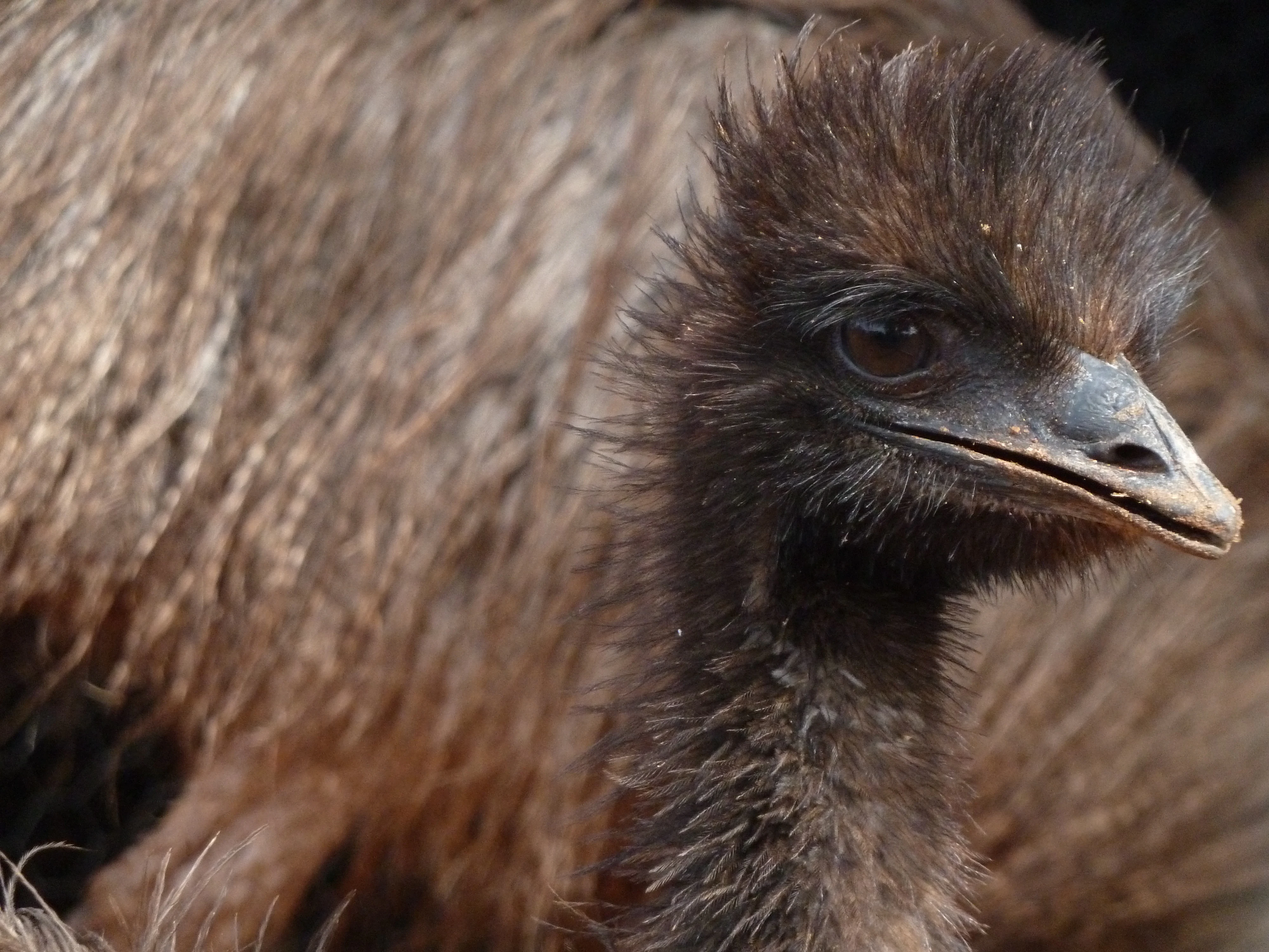
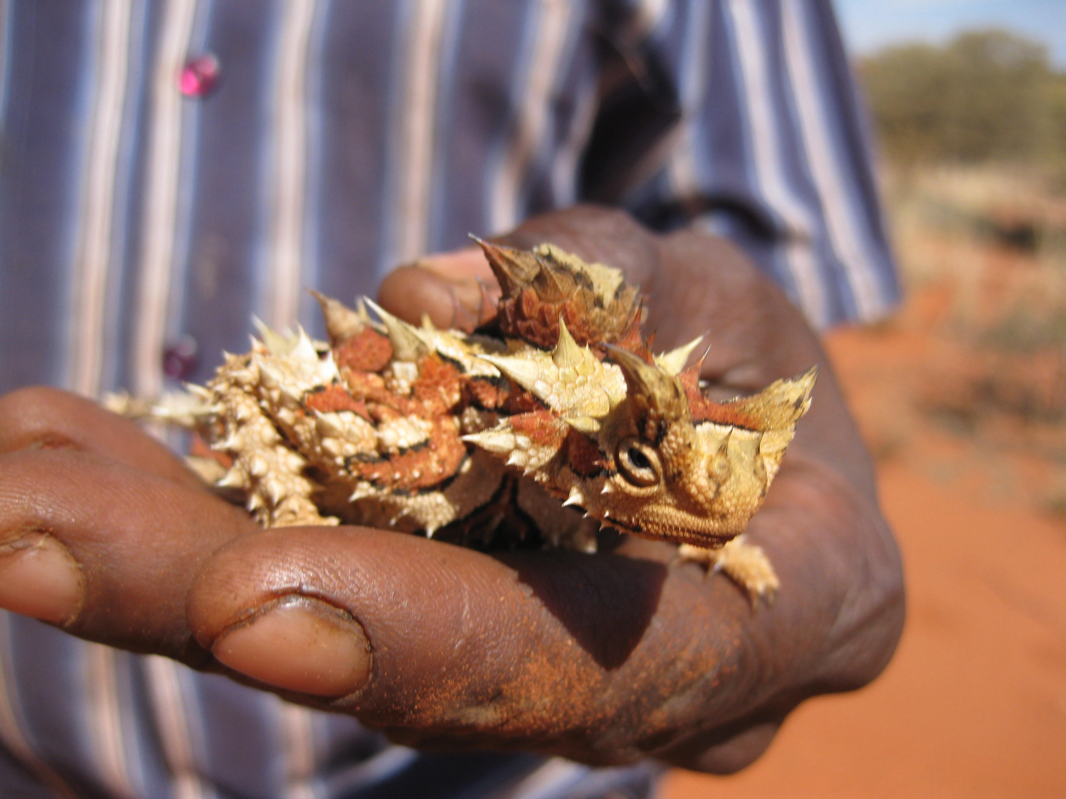
Birdlife includes emblematic desert species such as emus and bustards, both important in Tjukurpa, alongside mulga parrots, Major Mitchell's cockatoos, Australian ringnecks, Bourke's parrots, and budgerigars. Reptiles range from common skinks like the Centralian blue-tongued lizard to more specialised species such as the western hooded scaly-foot, Jan's banded snake, and the jewelled gecko (Strophurus elderi). Thorny devils (Moloch horridus), which feature as the IPA's mascot, are also present, highlighting the property's special reptile heritage.
Angas Downs Indigenous Protected Area conservation status and protection priorities
Angas Downs has substantial conservation significance as a large, contiguous, Aboriginal-managed refuge in a heavily modified arid landscape. Prior to its declaration as an IPA, decades of grazing and feral animal pressure had reduced native wildlife populations and damaged habitats, making restoration a central priority.
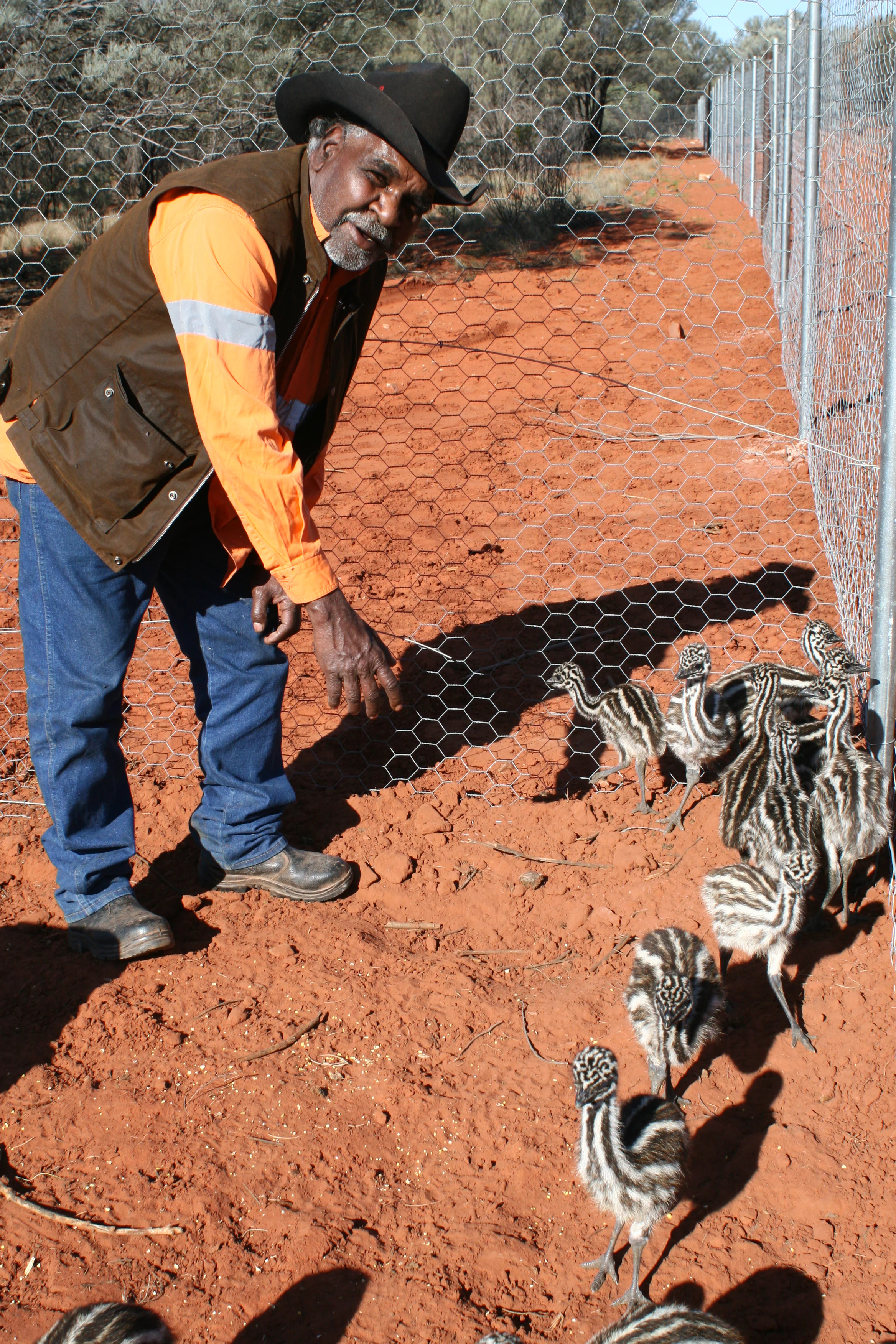
The IPA's conservation program focuses on rebuilding populations of culturally important game species such as emus and red kangaroos, controlling feral camels, horses, and cats, restoring water sources, and protecting vulnerable plant species including quandong and rare Christmas tree mulga. Aerial surveys have been used to map kangaroo, camel, and feral horse densities, providing a scientific basis for adaptive management.
A substantial wildlife sanctuary area of about 288 square kilometres is being developed within the property, fenced to exclude feral herbivores and allow recovery of native fauna and flora. Patch burning, informed by both traditional Anangu practice and ecological science, is used to rejuvenate habitat and reduce wildfire risk. The combination of Indigenous-led decision making with technical support from programs like Caring for Country and Working on Country gives Angas Downs a distinctive conservation model that influences Indigenous land management across Australia.
Angas Downs Indigenous Protected Area cultural meaning and human context
Angas Downs is inseparable from the cultural identity of the Anangu people of the region, particularly the Matuntara descendants who are the original occupiers of the area, along with Yankunytjatjara and Pitjantjatjara community members based at Imanpa. The land is rich in Tjukurpa sites and sacred places where ceremonies still occur, and managing country is understood as essential to maintaining law, identity, and wellbeing.
Elders describe the loss of Tjukurpa as a root cause of many contemporary social and health challenges, and restoration of the land is viewed as inseparable from restoring culture. Anangu rangers play a key role in transmitting knowledge between generations, and elders such as the Tjilpis (senior men) and Myinkmaku (senior women) guide decision making about land use.
The IPA also represents a broader reconciliation story, in which an Aboriginal community has transformed a former pastoral lease into a place of cultural revitalisation, employment, and pride. Pastoral heritage remains part of this layered identity, with descendants of the Liddle family still living on the property and the site's post-1960s history documented in ethnographic work by Frederick GG Rose.
Top sights and standout views in Angas Downs Indigenous Protected Area
Angas Downs offers a rare combination of vast arid scenery, rich wildlife, and living Aboriginal cultural practice. Its sheer scale, multiple landform types, and proximity to Uluru and Watarrka make it a particularly compelling place to understand central Australia's natural and cultural systems.
Key highlights include the restored Wilbia waterhole, the contrasting landscapes of the Liddle Range, the thriving emu breeding program, and the visible recovery of vegetation inside fenced feral-exclusion areas. The IPA is also a showcase for Indigenous-led conservation, demonstrating how Tjukurpa-based land management can deliver measurable ecological outcomes alongside cultural and social benefits.
Best time to visit Angas Downs Indigenous Protected Area
Angas Downs lies in the arid heart of central Australia, where climate strongly shapes both visitor experience and ecological character. Cooler months from roughly April to September are typically the most comfortable period for outdoor activity, with milder daytime temperatures, clearer night skies, and more active wildlife behaviour around water sources and soaks.
Wet seasons, usually concentrated in the warmer summer months, can transform the landscape by flooding waterholes and triggering blooms across the floodplains, but they also bring heat, heavy rain, and variable road access. Visitors interested in seeing peak bird activity, emu chicks, or lush vegetation after rains may time travel around these events, while those prioritising comfortable walking and touring conditions generally prefer the cooler dry months.
Because access is largely through community-led tours, availability of activities varies with seasonal conditions and ranger schedules, so any visit is best planned in coordination with current advice from the Imanpa community and supporting organisations.