
Mori Atlas logo
Protected areaAnjajavy Forest

Mapping the convergence of rugged karst terrain and coastal biodiversity in the Sofia region of Madagascar

Anjajavy Forest: A Protected Area of Tsingy Limestone, Dry Deciduous Forest, and Mangrove Coast

(Anjajavy's Protected Area)

Anjajavy Forest preserves a distinct ecological landscape where western dry deciduous forests grow directly out of sharp tsingy limestone formations. This protected area in the Sofia region of Madagascar features a unique geography of marine karst cliffs, mangrove-lined tidal estuaries, and inland limestone ridges that provide critical habitat for endemic wildlife. The peninsula creates a layered environment where forest, stone, and sea meet to support an exceptional concentration of biodiversity.

dry deciduous foresttsingy karstlimestone formationsmangroveslemursendemic species
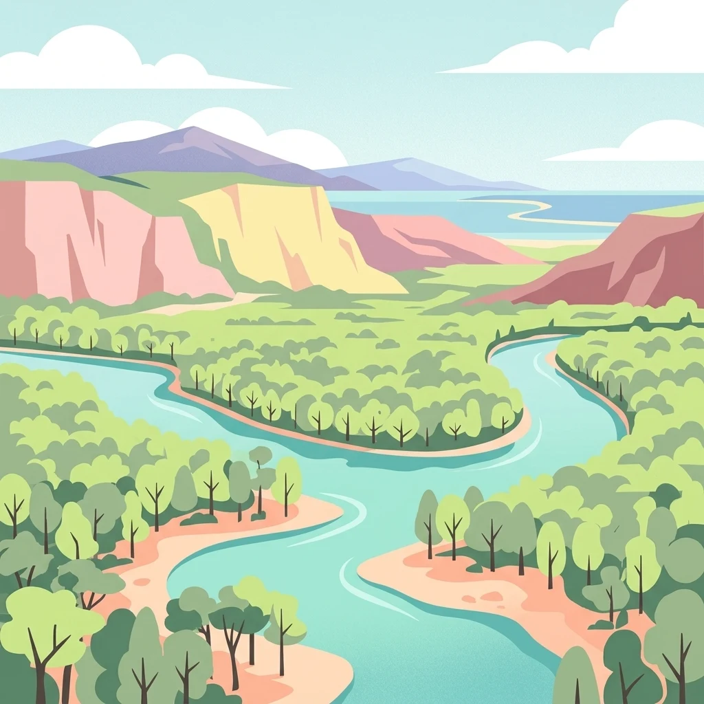
A flat-style vector illustration of a river meandering through a green landscape with forested banks and rocky hills in the background under a blue sky.

Anjajavy Forest

Protected area

Park overview

Structured park overview, official facts, and landscape profile for Anjajavy Forest

Anjajavy Forest park facts, protected area profile, and essential visitor context

Review the core facts for Anjajavy Forest, including designation, size, terrain, visitor scale, habitats, and operating context in one park-focused overview.

About Anjajavy Forest

Anjajavy's Protected Area covers approximately fifty square kilometres of dry deciduous forest on a coastal peninsula in northwest Madagascar, close to the town of Antonibe and accessible from the surrounding region via an unpaved provincial road. The peninsula lies between Majajamba Bay to the south and Narinda Bay to the north, with mangrove rivers and their tidal channels wrapping around much of the protected landscape. Its position in the Sofia region places it firmly within the broader Madagascar dry deciduous forests belt that runs along the western side of the island.

The defining feature of the Anjajavy landscape is the way its forest grows directly out of the tsingy, the jagged karst limestone formations created over millions of years of erosion. These limestone outcrops rise in towers, spurs, and spurs-like blades both within the forest and along the coast, forming caves, gorges, grottos, and dramatic walls of weathered rock. Because the tsingy is nearly inaccessible to people and highly resistant to fire, fragments of primary forest have survived here that have been wiped out across more accessible parts of Madagascar, especially on the central highland plateau where decades of slash-and-burn agriculture have caused widespread desertification and erosion. The distance from Antananarivo has further protected Anjajavy from the heaviest human pressures.

In ecological terms, Anjajavy lies at the intersection of dry forest, mangrove, and marine habitats, with each system supporting a different slice of the area's biodiversity. The deciduous canopy is composed of species that shed their leaves during the long dry season from May to September, with at least two endemic baobab species forming iconic emergent trees. Beneath the canopy, lianas, orchids, aloes, palms, and endemic hardwoods such as ebony and rosewood thrive in the karst soils. Toward the coast, mangrove swamps fringe coastal estuaries, serving as nursery habitat for fish, feeding grounds for birds, and natural buffers against storms, fire, and erosion. Together these systems support not only the protected dry forest itself but a marine reserve established in the surrounding waters.

Anjajavy is also recognised as an important conservation reference area for western Madagascar's dry forest ecoregion, classed by major international nature conservation organisations as a global critical priority for protection. The site's diversity of large animals, breeding raptors, reptiles, lemurs, and plants, combined with the relatively intact state of its habitats, makes it a significant benchmark for understanding what northwestern dry forests and adjacent mangroves can support when left relatively undisturbed.

Quick facts and research context for Anjajavy Forest

Anjajavy's Protected Area lies on the Indian Ocean coast of northwest Madagascar, on a peninsula in the Analalava district of the Sofia region. The forest covers roughly fifty square kilometres and is bordered by Majajamba Bay, Narinda Bay, and a network of mangrove rivers. It sits within the Madagascar dry deciduous forests ecoregion, where expansive tsingy limestone formations rise directly out of both the forest and the sea.

Inventories have identified at least five critically endangered species, fifteen endangered species, and thirteen vulnerable species within the protected area, alongside more than 134 bird species. It is recognised by international conservation bodies as a global critical priority ecoregion, offering some of the last relatively undisturbed examples of western Malagasy dry forest together with karst, mangrove, and marine habitats.

Protection and recognition

Documented conservation scope and official designation records

Anjajavy Forest Protection Status and International Recognition Data

Anjajavy Forest protection status brings together verified management scope and official designation records for conservation analysis. Documented protection details outline the administrative framework governing this natural landscape without assuming specific regulatory outcomes.

Protection details

Protection scope
Mixed
Transboundary protection
No
Park context

Deeper park guide and search-rich context for Anjajavy Forest

Anjajavy Forest history, landscape, wildlife, and travel context

Explore Anjajavy Forest through its history, landscape character, ecosystems, wildlife, conservation priorities, cultural context, and seasonal travel timing in a structured park guide built for atlas discovery and search intent.

Why Anjajavy Forest stands out

Anjajavy is best known for being one of the rare places where Madagascar's western dry deciduous forest, towering tsingy karst limestone, and mangrove-lined coast occur together on a single peninsula. The forest is recognised for its very high level of floral and faunal endemism, including baobabs clinging to limestone islets in turquoise bays, large breeding populations of the critically endangered Madagascar fish eagle, and a remarkably accessible community of lemurs such as Coquerel's sifaka and the common brown lemur. The site is also renowned for the striking meeting of forest and sea around Moramba Bay, sometimes compared to a Malagasy Halong Bay, where jagged marine tsingy cliffs rise close to 30 metres from the water. This rare combination of dry forest, karst towers, baobabs, and mangrove estuaries gives Anjajavy a distinctive ecological identity within Madagascar's network of protected areas.
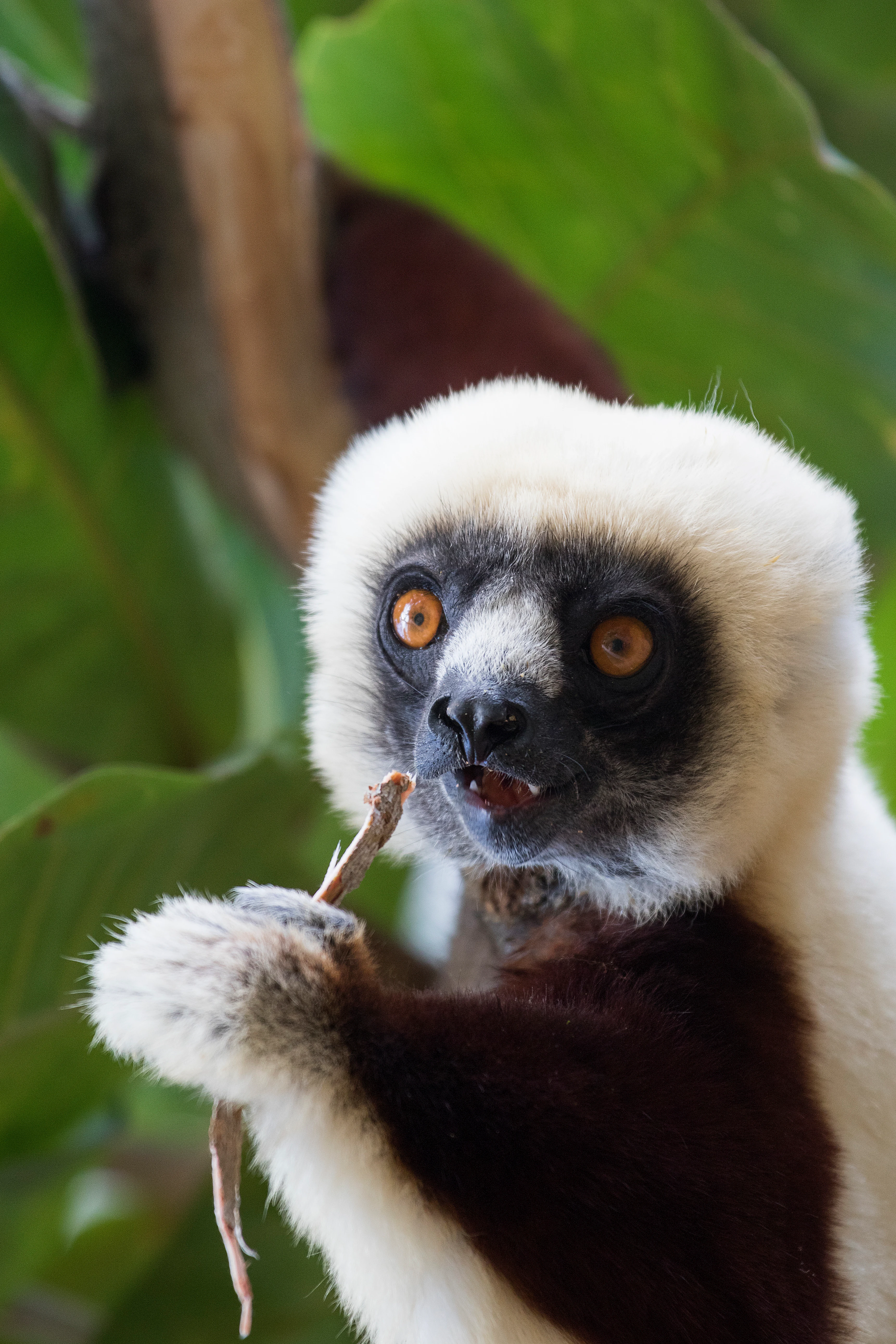
Close-up of a Coquerel's sifaka with white fur and dark limbs, looking toward the camera while holding and eating a small piece of vegetation in a forest setting.
A Coquerel's sifaka foraging in the trees of Anjajavy Forest.

Anjajavy Forest history and protected-area timeline

Anjajavy's Protected Area has been shaped as much by what never happened here as by deliberate conservation planning. Because the forest grows on rugged tsingy limestone and lies far from Madagascar's main population centre of Antananarivo, the area has been spared the intensive slash-and-burn farming and settlement expansion that have devastated more accessible forests, particularly on the central highland plateau, where decades of cultivation have led to severe desertification and erosion.

Local communities have long lived alongside the forest, the surrounding mangroves, and the seasonally productive coastal waters. Traditional fishing has remained one of the economic mainstays of the area, and the mangrove ecosystem supports this activity by functioning as a nursery and shelter for fish and shellfish. Cultural bonds between people and the forest are reflected in the sacred status given to certain baobabs, at the base of which offerings such as zebu horns, coins, rum, and honey are placed in the hope of receiving ancestral protection.

In more recent decades the site has gained formal protection as Anjajavy's Protected Area, encompassing both the dry forest reserve and the adjacent marine reserve, and it has been included within the network of Madagascar's dry deciduous forests recognised by international conservation organisations as a global critical priority ecoregion. Ongoing management efforts combine species monitoring, community awareness campaigns, and specific programmes such as the conservation of the Madagascan big-headed turtle, whose reproduction sites are under continuous observation.

Anjajavy Forest landscape and geographic character

The Anjajavy landscape is dominated by the dramatic meeting of forest, karst, and sea. The peninsula on which the protected area lies is bounded by Majajamba Bay to the south and Narinda Bay to the north, with two networks of mangrove-lined tidal rivers outlining much of the reserve's edges and providing both a natural border and a means of exploration. Inland, the terrain is a classic example of Madagascar's western dry forest topography: deciduous trees adapted to arid conditions shelter a complex understorey, while tsingy limestone outcrops emerge from the canopy in sharp ridges, towers, and rugged spurs.

The tsingy formations reach their most spectacular expression along the coast at Moramba Bay, where jagged marine karst cliffs rise close to 30 metres from the water, creating scenery sometimes compared to a Malagasy Halong Bay. The limestone landscape is not only scenic but ecologically critical, as its crevices, gorges, and caverns have sheltered primary forest fragments from fire and human activity for millennia. Some of these caves were used by early inhabitants of the region and continue to provide cool roosting habitat for bats today.

At the interface between the forest and the sea, mangroves colonise the estuaries and tidal flats. Their tangled root systems form stilts and buttresses that stabilise soft soils, protect the coast from erosion, and act as a natural firewall against salty winds for the dry forest behind them. The result is a layered landscape in which mangrove wetland, deciduous forest, tsingy karst, and marine bays are all visible within a relatively compact peninsula.
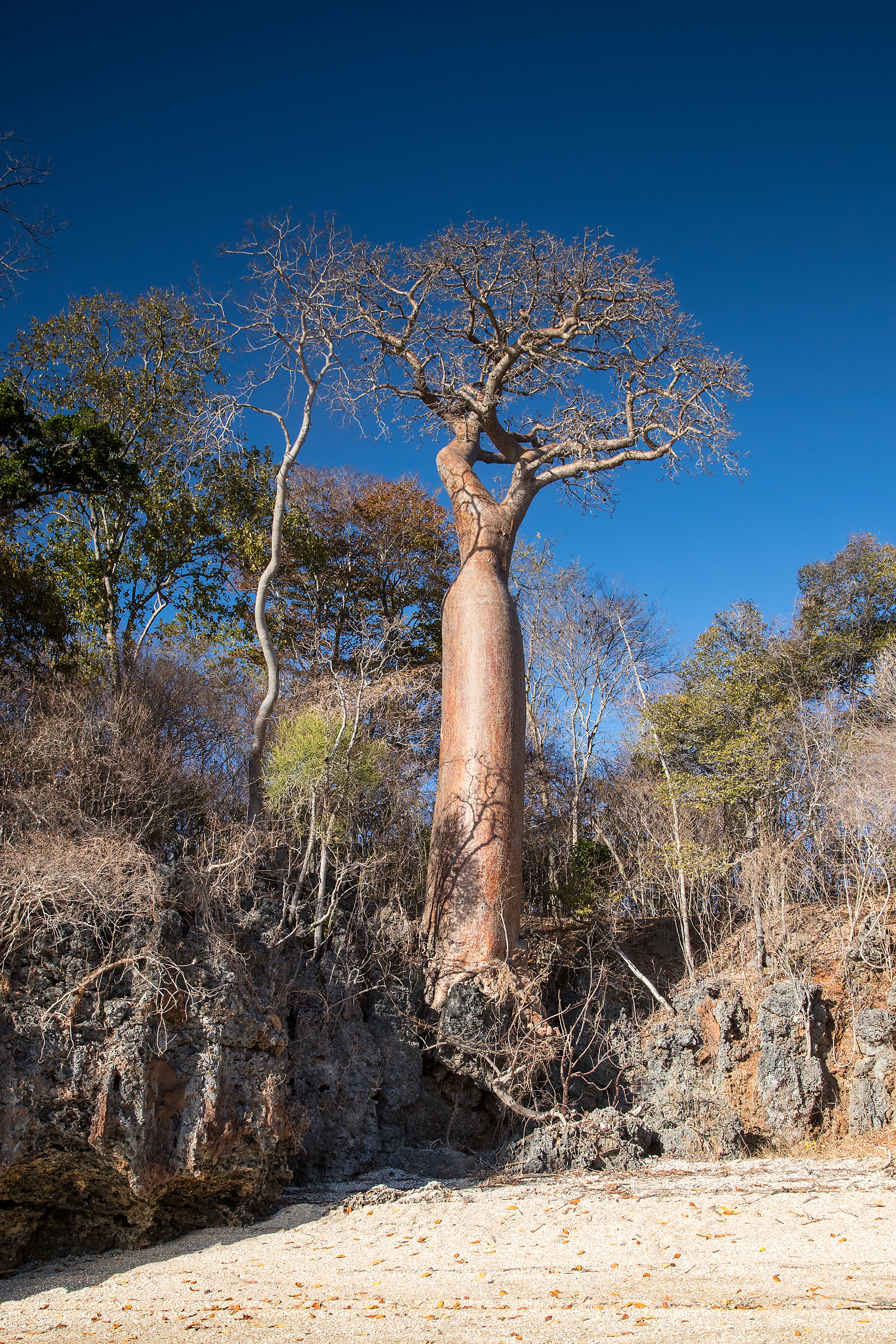
A large, leafless baobab tree standing atop a jagged, dark limestone rock formation overlooking a light-colored sandy beach under a clear blue sky.
A prominent baobab tree growing from rocky coastal terrain in Anjajavy Forest.

Anjajavy Forest ecosystems, habitats, and plant life

The forests of Anjajavy are part of the western Madagascar dry deciduous forest ecoregion, a habitat of global conservation significance. The canopy is composed of trees that shed their leaves in the dry season from May to September to reduce evapotranspiration, including at least two endemic baobab species, Adansonia rubrostipa and Adansonia madagascariensis. Some species, notably the baobabs, also store water in their bulbous trunks as an adaptation to the warm, arid climate.

Beneath the main canopy, the flora includes trees such as Terminalia catappa (known locally as antafana) and Grewia ciclea (andilambarika), along with abundant lianas, herbs, orchids, aloes, euphorbias, and Madagascar vanilla vines that climb up the sharp limestone of the tsingy. Endemic hardwoods such as ebony and rosewood are plentiful, and much of the flora is still being identified, with new species regularly discovered during the rainy season from December to April. Many common shrubs, including Vepris ampody (ampoly) and Rhizophora mucronata, contribute to the understorey.

Where the forest meets the coast, mangrove swamps take over in the estuaries and tidal channels. Trees and shrubs adapted to salty water thrive here, including the jajavy tree (Salvador angustifolia), from which the village of Anjajavy takes its name. These mangroves act as nurseries and shelters for fish, shellfish, insects, and waterbirds, while their root entanglement stabilises the soft soils and filters coastal waters. Together with the plankton communities of the surrounding marine muds, they underpin both the terrestrial forest and the traditional fishing economy of the area.
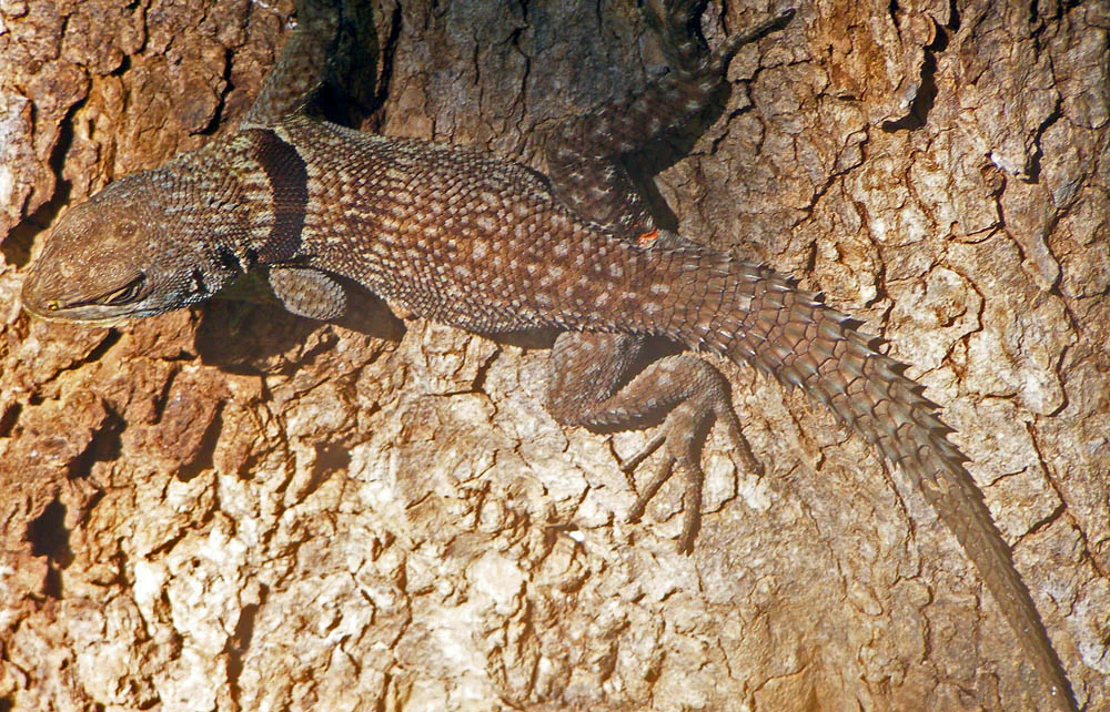
A brown collared iguana with a textured, speckled back rests vertically on a piece of rough, light-brown tree bark.
A collared iguana, Oplurus cuvieri, clinging to the rough bark of a tree at Anjajavy Forest.

Anjajavy Forest wildlife and species highlights

The wildlife inventories and observations compiled for Anjajavy reveal exceptionally high biological wealth, with no fewer than five critically endangered species, fifteen species in danger of extinction, and thirteen vulnerable species recorded. The great majority of these are endemic either to Madagascar as a whole or to the nearby region, and the locality owes much of its importance to this concentration of rare, restricted-range species.

Lemurs are among the most visible animals in the Anjajavy forest. Diurnal species such as Coquerel's sifaka and the common brown lemur are frequently seen and show little fear of humans, while nocturnal species include three mouse lemurs (including the golden brown mouse lemur, Danfoss mouse lemur, and gray mouse lemur), the Milne-Edwards sportive lemur, and the fat-tailed dwarf lemur. The aye-aye is also present. The nocturnal lemur populations are not yet fully researched, and some may represent species still undescribed by science.

Carnivores, bats, and raptors add further ecological weight. The endangered fossa, Madagascar's largest mammalian carnivore and the primary predator of lemurs, ranges through the area with territories spanning up to thousands of hectares. Tsingy caves shelter bat species such as Commerson's leaf-nosed bat and the Tiavato bat, while Madagascar flying foxes are commonly seen over the mangroves at dusk. The tsingy cliffs and forests support important breeding populations of raptors, and birdwatching lists include duck species, herons and egrets, vangas, parrots, and a wide range of shorebirds and seabirds.

Reptiles and amphibians are similarly rich. Roughly forty reptile species occupy the forest, including multiple chameleon species such as Oustalet's chameleon, panther chameleon, and various Brookesia leaf chameleons, alongside snakes such as the Madagascar ground boa and tree boa, geckos, iguanid lizards, and the Madagascan big-headed turtle in the freshwater streams. The freshwater turtle has become a focus of local conservation work because its habitat is under pressure from rice cultivation and collection for traditional Asian medicinal markets.
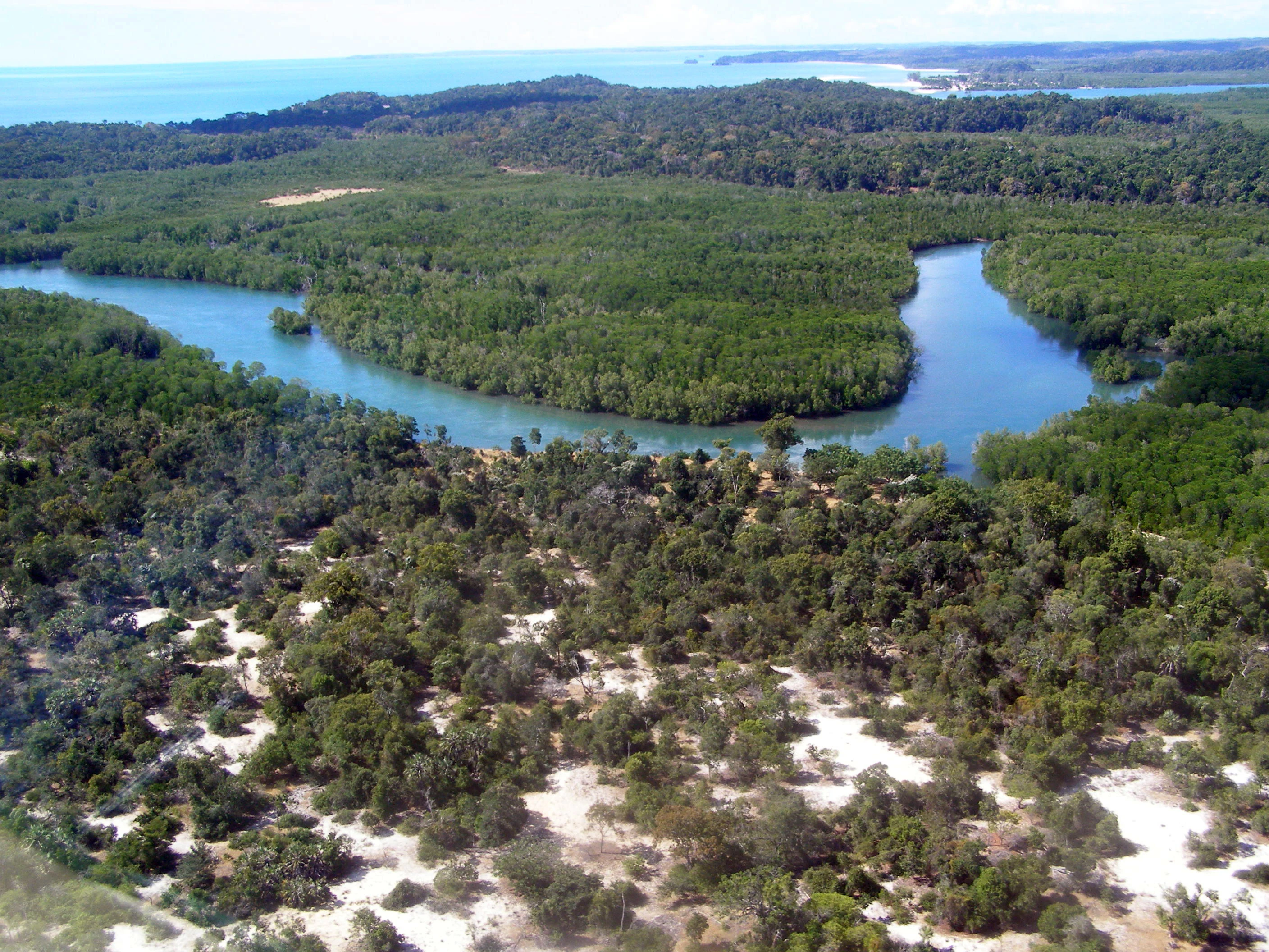
An aerial view of a forested region in Madagascar, showing a winding blue river cutting through dense green vegetation, with sandy patches visible in the foreground and the ocean on the horizon.
An aerial view of the Anjajavy Forest in Madagascar, showcasing the contrast between the dense forest and a meandering mangrove river.

Anjajavy Forest conservation status and protection priorities

Anjajavy's Protected Area is recognised by major international nature conservation organisations as part of a global critical priority ecoregion: the dry deciduous forests of northwest Madagascar. The site's particular value lies in the way its tsingy karst terrain, remoteness from major population centres, and surrounding mangrove rivers have combined to preserve habitats and species that are heavily depleted or lost elsewhere on the island. The forest here remains a benchmark of what relatively undisturbed western dry forest can support.

The protected area combines both terrestrial and marine reserves. The mangrove rivers serve as natural borders, nurseries for commercially and ecologically important fish species, and buffers that protect the dry forest from salt spray, fire, and erosion. On a global scale, the mangrove muds are also a major carbon sink, with carbon sequestration rates many times higher than those of tropical forests, and they host plankton communities that form the base of the food web on which local fisheries depend.

Conservation work within Anjajavy combines scientific monitoring with community engagement. The protected area hosts breeding populations of the critically endangered Madagascar fish eagle, with only a small number of pairs estimated to remain in Madagascar as a whole, and supports species such as the fossa, the aye-aye, and several lemur species that are vulnerable or endangered. Local projects specifically address the survival of the Madagascan big-headed turtle by protecting its reproduction sites through monitoring and awareness campaigns among nearby communities.

Anjajavy Forest cultural meaning and human context

The cultural context of Anjajavy is shaped by a long-standing coexistence between local communities and a landscape of forest, mangrove, and sea. Traditional fishing along the coast and the Mozambique Channel has remained one of the principal economic activities of the area, supported directly by the mangrove estuaries, which act as nurseries and refuges for fish and shellfish. The village of Anjajavy itself takes its name from the jajavy tree, a mangrove species (Salvador angustifolia) central to the coastal ecosystem.

The relationship between people and the forest is also expressed in the sacred status given to certain baobabs. These long-lived trees, some of which are centuries old, are revered by local communities, and offerings such as zebu horns, coins, rum, and honey are placed at their bases in the hope of receiving ancestral protection. Tsingy caves in the area were also used by early inhabitants of the region and remain part of the broader local heritage of the karst landscape.

Traditional land use in the surrounding region, including seasonal exploitation of the dry forest, has coexisted with the more intact interior of the protected area largely because the rugged tsingy terrain has been difficult to clear or cultivate. This natural inaccessibility has helped preserve both the ecological and cultural character of the site, allowing local traditions of forest stewardship, sacred tree veneration, and sustainable fishing to persist alongside formal conservation planning.

Top sights and standout views in Anjajavy Forest

Among Anjajavy's most distinctive features is the juxtaposition of dry deciduous forest, tsingy karst, and mangrove-lined coast within a single accessible peninsula. The presence of large, free-standing baobabs, including endemic species clinging to bare limestone in turquoise bays, gives the protected area some of Madagascar's most photographed scenery, while Coquerel's sifakas, common brown lemurs, and nocturnal mouse lemurs offer unusually close wildlife encounters.

Other major highlights include the marine tsingy cliffs and limestone arches of Moramba Bay, the mangrove rivers that double as natural reserve borders and exploration routes, and the regular sightings of the critically endangered Madagascar fish eagle breeding along the coast. Combined with the protected area's recognition as a global conservation priority ecoregion, these features give Anjajavy a uniquely compact profile of Madagascar's western dry forest heritage.

Best time to visit Anjajavy Forest

Anjajavy's character shifts significantly between its dry and rainy seasons and offers very different experiences depending on when it is visited. From May to September the climate is warm and arid, the deciduous trees shed their leaves to conserve water, and the thinner canopy makes it easier to observe wildlife such as lemurs, chameleons, snakes, and other reptiles that are more active in the cooler, drier conditions. This period tends to favour terrestrial wildlife observation and clear viewpoints over the dramatic tsingy and baobab silhouettes.

From December to April the rains return and the forest transforms. New plant species are regularly discovered during this wet season, orchids and other flora come into bloom, and the mangroves and rivers swell with freshwater. Bird activity can be particularly rewarding, water levels rise, and the scenery takes on a lush, intensely green character, though some areas may become harder to access. Travellers interested in the full botanical richness of the protected area and in discovering new plant species generally align with the rainy season, while those focused on easier walking, drier trails, and reptile and lemur observation tend to favour the cooler months.
Monthly climate preview

Long term temperature and precipitation patterns sampled from representative park coordinates

Anjajavy Forest Climate Normals and Annual Weather by Month

Anjajavy Forest exhibits a measured annual rhythm of sustained monthly warmth alongside shifting precipitation averages spanning the year. Examining the full twelve month climate profile reveals complete statistical breakdowns for temperature and rainfall across the protected area.
Annual mean27 °C
25 °C28 °C
Jan28°
Feb28°
Mar28°
Apr28°
May27°
Jun26°
Jul25°
Aug25°
Sep25°
Oct26°
Nov27°
Dec28°
Warmest month
April

28.3 °C

Coolest month
August

24.9 °C

Wettest month
January

13.4 mm/day

Driest month
August

0.3 mm/day

Park location guide

Geography guide, regional context, and park location map for Anjajavy Forest

Anjajavy Forest park geography, regions, and map view in Madagascar

Understand where Anjajavy Forest sits in Madagascar through a broader geographic reading of the surrounding landscape, nearby location context, and its mapped position within the national park landscape.

How Anjajavy Forest fits into Madagascar

Madagascar is an island nation in the Indian Ocean, positioned off the southeastern coast of Africa. As the world's fourth-largest island and second-largest island country, it stands out for its exceptional biodiversity, over 90% of its wildlife is endemic, making it one of 17 megadiverse countries. The population is approximately 32 million, with Antananarivo as both the capital and largest city.

Wider geography shaping Anjajavy Forest in Madagascar

Madagascar lies in the Indian Ocean off the southeastern coast of Africa, separated from the mainland by the Mozambique Channel. The island is situated approximately 400 km from the African continent. As the world's fourth-largest island, it also includes numerous smaller peripheral islands.

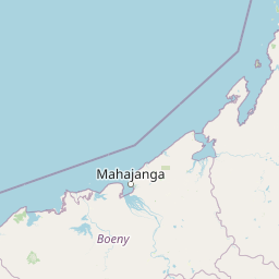
Map view of Anjajavy Forest

Use this park location map to pinpoint Anjajavy Forest in Madagascar, understand its exact geographic position, and read its mapped placement within the surrounding landscape more clearly.

Pigeon | © OpenStreetMap contributors

Location context for Anjajavy Forest

Sofia

Visual reference for dry deciduous forests, tsingy limestone, and coastal mangrove habitats

Anjajavy Forest Photos, Scenery, and Protected Area Landscapes

Visual records reveal the striking juxtaposition of towering karst formations, seasonal canopy layers, and turquoise bays across the protected peninsula. Examining these field photographs helps clarify the complex terrain and unique ecological boundaries that define the regional reserve.

Close-up of a Coquerel's sifaka with white fur and dark limbs, looking toward the camera while holding and eating a small piece of vegetation in a forest setting.

A brown and white raptor, the Malagasy Fish Eagle, perched on a branch against a clear blue sky.

A large, leafless baobab tree standing atop a jagged, dark limestone rock formation overlooking a light-colored sandy beach under a clear blue sky.

A brown collared iguana with a textured, speckled back rests vertically on a piece of rough, light-brown tree bark.

An aerial view of a forested region in Madagascar, showing a winding blue river cutting through dense green vegetation, with sandy patches visible in the foreground and the ocean on the horizon.

Park atlas

Compare surrounding regional geography and connected dry forest reserves

Explore Protected Areas and Parks Near Anjajavy Forest in Madagascar

Browsing parks near Anjajavy Forest reveals connected protected landscapes and regional biodiversity corridors across coastal Madagascar. Comparing adjacent tsingy habitats and mangrove ecosystems provides deeper geographical context for western dry forest conservation.
National parkBoeny
About 133 km away#1 closest

Southwest

Baie de Baly National Park: Mapped Boundaries and Protected Landscape Context

Explore the geography and natural terrain of this national park.

Baie de Baly National Park presents a critical focal point for understanding protected areas within the Boeny region. As a national park, it showcases specific mapped boundaries that contribute to the broader geographic understanding of Madagascar's conservation landscapes. This detailed view allows for an atlas-driven exploration of the park's natural terrain and its significance as a distinct protected landmass within its regional context.

Area
571.42 km²
Established
1997
IUCN
II
Climate
Tropical
National parkBoeny Region
About 158 km away#2 closest

Southeast

Ankarafantsika National Park: Protected Area Atlas and Regional Geography Discovery

Explore mapped boundaries and natural landscape context.

Ankarafantsika National Park serves as a key protected area for understanding the geography of Madagascar's Boeny Region. This canonical page offers a detailed atlas-style view, highlighting the park's mapped boundaries and its role as a distinct natural landscape. Engage with structured geographic data to comprehend the park's protected status and its contribution to the regional terrain, facilitating a deeper appreciation of protected lands.

Area
1,365.13 km²
Established
2002
IUCN
II
Relief
Lowland
National parkMahajanga Province
About 168 km away#3 closest

South

Tsingy de Namoroka National Park: Geography, Karst Formations, and Regional Context

Protected karst landscapes in Mahajanga Province.

Tsingy de Namoroka National Park stands as a prime example of Madagascar's unique geological heritage, featuring sprawling fields of razor-sharp limestone pinnacles and intricate cave networks. This protected area offers deep insight into the intersection of subterranean hydrology and dry forest ecology within the broader Mahajanga Province.

Area
220.71 km²
Established
1927
IUCN
II
Relief
Mixed relief
National parkMadagascar
About 230 km away#4 closest

Northeast

Sahamalaza National Park: A Key National Park and Ramsar Wetland in Madagascar

Explore Madagascar's unique protected landscape and biodiversity hotspot

Sahamalaza National Park is a significant protected area in Madagascar, designated as both a National Park and an internationally important Ramsar Wetland. It protects vital transitional forest ecosystems and extensive coastal wetland habitats, offering a crucial refuge for critically endangered lemur species and migratory birds. The park's unique geography and ecological role provide rich context for understanding Madagascar's celebrated endemic biodiversity and conservation efforts through mapped landscape exploration.

Area
260.35 km²
Established
2007
IUCN
II
Climate
Tropical
Protected areaMayotte
About 238 km away#5 closest

North

Pointes et plages de Saziley et Charifou Protected Area Geography and Map Context

Coastal ridgelines, mangrove habitats, and Mayotte island terrain

Delve into the physical geography and protected area configuration of Pointes et plages de Saziley et Charifou. This site presents a striking contrast between steep, dry inland ridges and low-lying coastal mangrove systems, offering an essential look at the complex environmental layering found across the southeastern coast of Mayotte.

Area
6.65 km²
Established
1997
IUCN
IV
Relief
Upland
A soft watercolor painting of a calm bay with a small island in the center, surrounded by gentle hills and green coastal land.
Wildlife reserveMayotte
About 247 km away#6 closest

North

Baie de Bouéni Wildlife Reserve: Mapping Coastal Biodiversity and Volcanic Terrain

A protected bay and mangrove system on the coast of Mayotte.

Baie de Bouéni stands as a significant wildlife reserve in Mayotte, framed by the volcanic massifs of Mont Bénara and Mont Choungui. This coastal sanctuary protects the largest mangrove belt in the Comoros and offers a clear example of the meeting of intertidal mudflats and marine ecosystems within the western Indian Ocean.

Area
5.19 km²
Established
2007
IUCN
IV
Relief
Lowland
Nature reserveMayotte
About 254 km away#7 closest

North

Vasière des Badamiers: Mapping the Protected Coastal Wetlands of Petite-Terre

Nature reserve geography and intertidal ecosystem character

Vasière des Badamiers is an essential protected coastal wetland in Mayotte, characterized by its tidal mudflats and mangrove fringes. This site acts as a key migratory refuge for waterbirds while functioning as a natural filter for the surrounding lagoon. Use this data to analyze the unique brackish basin and the ecological boundaries that define this Ramsar-recognized environment.

Area
1.25 km²
Established
2002
IUCN
IV
Wildlife reserveDiana
About 294 km away#8 closest

East

Manongarivo Special Reserve: Protected Wildlife and River Landscapes in Northern Madagascar

Examining the humid forest terrain and geographic boundaries of the Diana region

Located in the Diana region, Manongarivo Special Reserve serves as a critical protected area within the northern humid rainforest system of Madagascar. The territory is defined by steep forested hills, narrow river valleys, and diverse ecological niches. By analyzing its specific topographic markers and river systems, this entry details the natural landscape and protected status of this significant biodiversity reserve.

Area
327.35 km²
Established
1956
IUCN
IV
Climate
Tropical

Common questions about visiting, size, designation, and location context for Anjajavy Forest

Anjajavy Forest FAQs for park facts, access, geography, and protected area context

Find quick answers about Anjajavy Forest, including protected-area facts, park geography, trail and visitor context, and how the park fits into its surrounding country and regional landscape.
MoriAtlas Explorer

Continue Your Protected Areas Search Across the Global Atlas

Deepen your exploration by continuing the structured search for national parks and protected areas worldwide. Utilize the comprehensive filtering capabilities to compare different conservation landscapes and refine your understanding of global park geography. Discover more about the distribution and characteristics of protected natural areas.

Global natural geography