Anna's Reservoir Conservation Reserve history and protected-area timeline
Anna's Reservoir Conservation Reserve marks a location that has been of practical and symbolic importance since the mid-nineteenth century. The first European visitation to the area was recorded in April 1860, when the explorer John McDouall Stuart passed through during one of his expeditions north through central Australia. Stuart named the rock-hole after the youngest daughter of James Chambers, a pastoralist whose family sponsored the expedition.
The rock-hole proved so valuable as a dependable water source that Stuart returned to it on three further attempts to reach the north coast of Australia. Subsequent travellers also relied on the reservoir, including the builders of the Overland Telegraph Line who used it for water during construction. In 1879, the explorer and pastoralist Alfred Giles made use of the same reservoir while overlanding some 4,000 cattle and 8,000 sheep to establish Springvale Station near Katherine.
Formal protection of the site came in 1971 when the area was gazetted as a conservation reserve. The heritage significance of the reserve was further recognized in 1980, when it was entered on the Register of the National Estate, and again in 1995, when it was listed on the Northern Territory Heritage Register. These listings reflect the area's enduring importance as a node of exploration and pastoral history within the arid Northern Territory landscape.
Anna's Reservoir Conservation Reserve landscape and geographic character
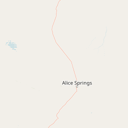
The reserve occupies a modest footprint in the arid interior of the Northern Territory but centres on a natural rock-hole that has long served as a critical water source in an otherwise dry region. The surrounding landscape is characteristic of central Australia, with sparse vegetation and broad open spaces typical of the pastoral country north of Alice Springs.
The reservoir itself is a depression in natural rock formations that holds water after rainfall, making it a focal feature of the local terrain. The reserve's 85 hectares protect not only the rock-hole but also the surrounding catchment context, preserving an important natural and historical landmark within Aileron Station.
Anna's Reservoir Conservation Reserve cultural meaning and human context
The land on which Anna's Reservoir Conservation Reserve sits is the traditional country of the Anmatyerre people, who continue to maintain their connection to the area as its traditional owners. The rock-hole itself carries cultural significance as a long-standing water source in the arid landscape and as a place embedded in Indigenous knowledge of the region.
The reserve also holds a layered European cultural history, beginning with John McDouall Stuart's 1860 expedition and continuing through the era of Overland Telegraph construction and major overland cattle drives. The naming of the reservoir reflects the patronage of the Chambers pastoral family, whose support was important to Stuart's explorations. Together, these layers give the reserve a cultural profile that extends well beyond its small size, linking Indigenous heritage with key chapters of inland Australian exploration and pastoral development.
Top sights and standout views in Anna's Reservoir Conservation Reserve
The reserve's most distinctive feature is the natural rock-hole that gave the site its name and served Stuart and subsequent travellers as a critical water source in central Australia. The site's documented association with John McDouall Stuart's 1860 expedition and his three later attempts to reach the north coast gives it a strong place in the history of inland European exploration.
The reserve's listing on both the former Register of the National Estate and the Northern Territory Heritage Register highlights its enduring heritage value. Its location on Aileron Station, north of Alice Springs, places it within a landscape shaped by both Indigenous custodianship and the pastoral development of the Northern Territory.