

Mori Atlas logo
Marine protected areaArafura Marine Park

Mapping the dramatic submarine canyons, shelf systems, and ancient coral shoals of Australia's northernmost marine reserve

Arafura Marine Park: A Comprehensive Geographic Atlas of Tropical Marine Protected Environments

Arafura Marine Park occupies a vast stretch of the Arafura Sea, serving as a critical component of the Northern Territory marine network. This protected area features a diverse underwater terrain that transitions from sunlit shelf plains and the landmark Money Shoal to deep submarine canyons exceeding 500 metres in depth. The park provides an essential geographic look at how ancient geological structures and complex seafloor bathymetry shape tropical marine habitats and regional conservation zones.

marine parktropical watersArafura SeaNorthern Territorycoral shoalssubmarine canyon

Arafura Marine Park

Marine protected area

Park overview

Structured park overview, official facts, and landscape profile for Arafura Marine Park

Arafura Marine Park park facts, protected area profile, and essential visitor context

Review the core facts for Arafura Marine Park, including designation, size, terrain, visitor scale, habitats, and operating context in one park-focused overview.

About Arafura Marine Park

Arafura Marine Park is one of Australia's most remote offshore marine reserves, situated in the tropical seas that lie north of the Northern Territory. It was established in 2018 as part of the North Network of Australian Marine Parks, a national system designed to protect representative examples of the country's marine environments while still allowing carefully regulated use. The park sits well offshore, around 250 kilometres north-east of Darwin, in waters that transition from the broad continental shelf of northern Australia out toward deeper parts of the Arafura and Timor seas.

What makes the reserve especially distinctive is its seafloor geology. The park covers roughly 22,924 square kilometres and reaches from depths of about 5 metres down to more than 500 metres. Its benthic environment is dominated by a wide shelf plain, but it also contains a substantial submarine canyon system, raised shoals, ridges, terraces, and aprons, producing a varied underwater landscape that supports many different kinds of marine life. The most celebrated feature is the Money Shoal, a plateau of elevated seabed that is thought to be the remnant of ancient coral reef growth during the Quaternary period, when fluctuating sea levels shaped much of the tropical Australian shelf.

Management of the park follows an IUCN Category VI model, meaning it is a protected area where sustainable use of natural resources is allowed under strict zoning. Three zones are recognized: a multiple use zone, a special purpose zone, and a special purpose zone reserved for trawl fisheries. This approach reflects both the ecological importance of the area and its long-standing role in supporting regional fishing industries. The park also has cultural significance, as the waters fall within the sea country of several Aboriginal clans whose traditional responsibilities extend across the region.

Quick facts and research context for Arafura Marine Park

The Arafura Marine Park is a Commonwealth marine protected area located in the Northern Territory, roughly 250 kilometres north-east of Darwin in the tropical seas north of Australia. Established in 2018, the park covers approximately 22,924 square kilometres of continental shelf, slope, and deep submarine canyon. It is designated as an IUCN Category VI protected area, allowing multiple sustainable uses within defined zones.

The park includes the Money Shoal, a shallow seafloor feature believed to have formed through ancient coral reef growth during the Quaternary period and changes in sea level. Habitats within the park range from shallow coral communities and shoal margins to deep sediment plains with limited benthic life. The reserve is also part of the sea country of several Aboriginal clans, including the Mandilarri-Ildugij, Mangalara, Murran, Gadura-Minaga, and Ngaynjaharr peoples.

Protection and recognition

Examine the documented marine protection scope and official recognition status.

Arafura Marine Park Protection Status and Conservation Recognition

Arafura Marine Park features a documented marine protection scope and defined governance parameters within the global conservation network. Structured conservation data outlines the established management boundaries and official protection status for this marine environment.

Protection details

Protection scope
Marine
Transboundary protection
No
Park context

Deeper park guide and search-rich context for Arafura Marine Park

Arafura Marine Park history, landscape, wildlife, and travel context

Explore Arafura Marine Park through its history, landscape character, ecosystems, wildlife, conservation priorities, cultural context, and seasonal travel timing in a structured park guide built for atlas discovery and search intent.

Why Arafura Marine Park stands out

Arafura Marine Park is best known for its sheltered offshore location in Australia's tropical north, its dramatic seafloor geology that combines shallow coral shoals with deep submarine canyons, and for its role as part of an internationally significant marine conservation network. The Money Shoal is the park's flagship feature, a raised seabed area believed to be a relict of Quaternary reef growth that now supports dense branching corals, soft coral and macroalgae communities, filter feeders along the shoal margins, and reef sharks in the surrounding waters. The park is also well known for its zoned management approach, which balances protection with carefully regulated commercial and recreational use. Its mix of shallow shelf, canyon, ridge, terrace, and apron geomorphic features produces an unusually high diversity of marine habitats for a single offshore reserve this close to the coast.
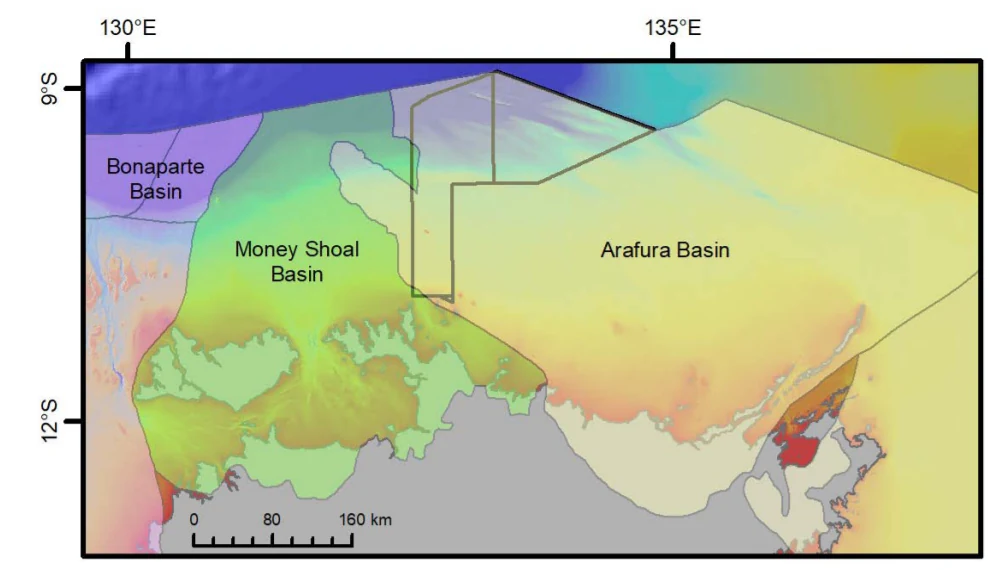
A geological map illustrating the Arafura Basin, Money Shoal Basin, and Bonaparte Basin off the northern coast of Australia, with coordinate markers and a distance scale.
Geological map showing the Arafura Basin and Money Shoal Basin in the vicinity of Arafura Marine Park.

Arafura Marine Park history and protected-area timeline

The Arafura Marine Park was formally established in 2018 as part of Australia's contemporary system of Commonwealth marine reserves. Its creation followed a national review of marine protection in Australian waters and reflected the government's intention to build a coherent North Network of marine parks that would safeguard representative habitats of the northern continental shelf, slope, and offshore waters while supporting sustainable fisheries.

The underlying geological heritage of the park is much older. The Money Shoal, one of the park's defining features, is thought to be the product of repeated cycles of coral reef growth and changing sea levels during the Quaternary period. These ancient reefs were left as elevated seabed formations when sea levels fell, and they continue to shape the benthic structure and ecological character of the reserve today.

The waters within the park have long been part of the sea country of Traditional Owners, including the Mandilarri-Ildugij, Mangalara, Murran, Gadura-Minaga, and Ngaynjaharr peoples. Their continuing cultural responsibilities over these waters are acknowledged in the park's management framework, alongside modern conservation and fisheries arrangements.

Arafura Marine Park landscape and geographic character

Despite being an entirely offshore reserve, Arafura Marine Park has a striking and varied physical landscape defined by its seafloor topography. The park includes a broad continental shelf plain that accounts for about half of its area, providing the relatively shallow seafloor environments that characterise much of northern Australia. Beyond this shelf, the terrain drops away into a large submarine canyon system that covers roughly 30 percent of the park, giving the reserve some of its most dramatic depth variation.

Around the margins of this canyon system lie smaller but ecologically important features, including ridges, terraces, aprons, and the shallow bank and shoal formations of the Money Shoal. The Money Shoal is the park's most iconic geomorphic feature, an area of raised seabed thought to have formed through ancient coral reef growth during the Quaternary period and fluctuating sea levels. The result is an underwater landscape that shifts from sunlit shallow shoals to darkened canyon walls more than 500 metres deep, only a short distance from one another.
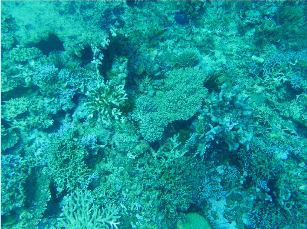
Underwater view of diverse branching coral reef formations in varying shades of blue and green.
Dense branching corals at Money Shoal within Arafura Marine Park.

Arafura Marine Park ecosystems, habitats, and plant life

The marine ecosystems of Arafura Marine Park are shaped by the same seafloor variety that defines its landscape. Shallow shelf and shoal environments around the Money Shoal support coral communities, with dense branching corals dominating the most exposed areas and soft corals and macroalgae taking over in intermediate depths. Along the margins of the shoal, filter feeders thrive where currents bring nutrients past the raised seabed, while the deeper sediment plains further from the shoal support comparatively little benthic life.

This mosaic of habitats gives the park an unusually rich ecological character for an offshore reserve. Coral reef communities, soft sediment plains, canyon walls, and rocky outcrops all occur within the same protected area, allowing different species groups to find suitable conditions. The combination of warm tropical waters, varied depth, and structural complexity makes the park an important refuge for marine biodiversity in the northern Australian region.
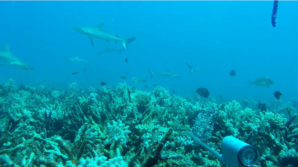
Underwater view of grey reef sharks swimming above a coral reef, with a camera lens housing visible in the foreground.
Grey reef sharks swimming over a coral reef at Money Shoal within Arafura Marine Park.

Arafura Marine Park wildlife and species highlights

The wildlife of Arafura Marine Park reflects the tropical character of northern Australian seas. The shallow coral environments of the Money Shoal support reef-associated fishes, sharks, and a wide range of invertebrates typical of Indo-Pacific coral reef systems. Grey reef sharks have been recorded patrolling the shoal, and large reef-associated predators such as the giant grouper (Epinephelus lanceolatus) have also been documented in the area. Snappers are particularly well represented, with species such as the Malabar blood snapper, crimson snapper, red emperor, and goldband snapper occurring in the park.

Sea turtles are another important component of the marine park's fauna. Both the green turtle (Chelonia mydas) and the olive ridley turtle (Lepidochelys olivacea) have been recorded in the region. The presence of these long-lived, migratory species adds to the conservation significance of the reserve, as they depend on healthy offshore habitats as well as nesting beaches elsewhere in the tropical north. Spot-tail sharks (Carcharhinus sorrah) and a broader community of reef and demersal fishes round out the known fauna.
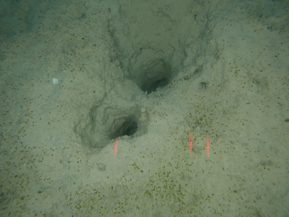
An underwater view of the sandy seafloor showing two dark circular burrow holes, with two small red laser scale markers visible near the holes.
Underwater survey of the seafloor at Money Shoal within Arafura Marine Park.

Arafura Marine Park conservation status and protection priorities

Arafura Marine Park is significant from a conservation perspective because it safeguards a large, highly varied area of tropical marine habitat in one of the most productive marine regions in the world. Its zoned approach, with multiple use, special purpose, and special purpose (trawl) zones, is designed to protect the most sensitive seabed and reef features while still allowing carefully regulated activities such as commercial fishing under permits. The IUCN Category VI designation reflects this balance between protection and sustainable use.

The park's conservation value is closely tied to its coral shoals, particularly the Money Shoal, which supports dense coral communities, reef-associated predators, and filter feeder assemblages that are vulnerable to physical damage and environmental change. Deep canyon and shelf habitats provide additional refuges for species that depend on the less disturbed seafloor environments further offshore. Together with Indigenous sea country governance, these protections help maintain ecological function across a broad swath of northern Australian waters.

Arafura Marine Park cultural meaning and human context

The waters of Arafura Marine Park are recognised as the sea country of several Aboriginal clans, including the Mandilarri-Ildugij, Mangalara, Murran, Gadura-Minaga, and Ngaynjaharr peoples. Traditional Owners share some of the responsibilities for the park alongside government agencies, reflecting a model of co-management of sea country in the Northern Territory.

For these communities, the marine environment is not only an ecological resource but also a cultural landscape with longstanding connections, knowledge, and obligations. Sea country identity is woven into the way the park is governed, with traditional responsibilities acknowledged alongside modern conservation and fisheries frameworks.

Top sights and standout views in Arafura Marine Park

Standout features of the Arafura Marine Park include the Money Shoal, an ancient raised seabed system with dense coral communities, reef sharks, and a giant grouper presence, as well as an extensive submarine canyon system covering nearly a third of the reserve. The park combines shallow coral-rich environments with deep offshore waters more than 500 metres deep, creating one of the most geologically varied marine reserves along Australia's northern coast.

Other notable highlights include the park's role as part of the North Network of Australian Marine Parks, its IUCN Category VI zoning that balances sustainable use with protection, and its cultural significance as shared sea country for several Aboriginal clans of the Northern Territory.

Best time to visit Arafura Marine Park

Arafura Marine Park is an entirely offshore reserve, so traditional on-land visitation patterns do not apply. Tropical conditions prevail year-round, with warm sea-surface temperatures typical of the Arafura-Timor Sea region. Calm, dry-season months are generally the most favourable window for offshore activity in northern Australia, when seas tend to be calmer and weather conditions more predictable, while the wet season can bring stronger winds, higher rainfall, and reduced visibility.

For those interested in marine wildlife and reef scenery, the cooler dry-season window also offers better conditions for viewing coral habitats, reef sharks, and other reef-associated species. Anyone planning offshore activity should rely on Parks Australia guidance for the most current access and permit information.
Monthly climate preview

Long-term representative point measurements tracking temperature and precipitation rhythm

Arafura Marine Park Climate Normals and Annual Weather by Month

Representative point records show average temperatures ranging from 25.37 degrees Celsius to 30.04 degrees Celsius alongside distinct seasonal precipitation shifts. Detailed monthly normals provide deeper analytical context regarding temperature ranges and rainfall distribution across the marine park.
Annual mean27 °C
25 °C29 °C
Jan28°
Feb28°
Mar28°
Apr28°
May28°
Jun26°
Jul26°
Aug25°
Sep26°
Oct27°
Nov28°
Dec29°
Warmest month
December

28.8 °C

Coolest month
August

25.4 °C

Wettest month
February

9.7 mm/day

Driest month
August

0.2 mm/day

Park location guide

Geography guide, regional context, and park location map for Arafura Marine Park

Arafura Marine Park park geography, regions, and map view in Australia

Understand where Arafura Marine Park sits in Australia through a broader geographic reading of the surrounding landscape, nearby location context, and its mapped position within the national park landscape.

How Arafura Marine Park fits into Australia

Australia is a constitutional monarchy and federal parliamentary democracy comprising six states and ten territories. With a population of nearly 28 million, it is one of the world's most urbanised countries, with most people concentrated on the eastern seaboard. The country has a high Human Development Index and is known for its cultural diversity, ancient Aboriginal heritage, and unique wildlife.

Wider geography shaping Arafura Marine Park in Australia

Australia occupies the entire Australian continent, the island of Tasmania, and numerous smaller islands. It is the world's flattest and driest inhabited continent, featuring vast deserts in the interior (the Outback), tropical rainforests along the eastern coast, and a coastline bordering the Indian and Pacific Oceans.

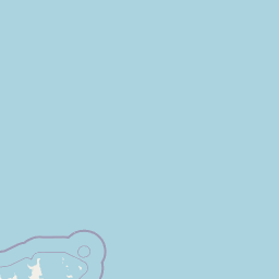
Map view of Arafura Marine Park

Use this park location map to pinpoint Arafura Marine Park in Australia, understand its exact geographic position, and read its mapped placement within the surrounding landscape more clearly.

Pigeon | © OpenStreetMap contributors

Location context for Arafura Marine Park

Northern Territory
Recorded earthquake history

Explore the Arafura Marine Park Seismic History and Recorded Earthquake Records

Examine the established record of seismic activity associated with Arafura Marine Park. This curated collection through MoriAtlas provides a clear view of historical earthquake data, helping users understand the seismic context of the seafloor canyons and shoals within this protected northern territory waters.

Arafura Marine Park Earthquake History

Catalogued events

5 events

Strongest magnitude

Magnitude 4.7

Most recent event

Dec 27, 2006

This history includes earthquakes recorded inside the park or within 50 km of its borders

Visual reference for raised coral shoals, deep canyons, and tropical marine habitats

Arafura Marine Park Photos, Scenery, and Submarine Landscapes

Visual records reveal the striking underwater terrain of Arafura Marine Park, stretching from sunlit shallow coral shoals down to dark seafloor canyons exceeding five hundred metres in depth. Examining protected area imagery provides essential context for understanding the complex geomorphology, varied habitats, and marine environments that define northern Australian conservation zones.

A geological map illustrating the Arafura Basin, Money Shoal Basin, and Bonaparte Basin off the northern coast of Australia, with coordinate markers and a distance scale.

An underwater view of a seabed densely covered with soft coral colonies and patches of green macroalgae.

Underwater view of diverse branching coral reef formations in varying shades of blue and green.

Underwater view of grey reef sharks swimming above a coral reef, with a camera lens housing visible in the foreground.

An underwater view of the sandy seafloor showing two dark circular burrow holes, with two small red laser scale markers visible near the holes.

Park atlas

Compare regional protected areas and connected marine conservation networks across northern waters.

Explore Other Parks Near Arafura Marine Park and Surrounding Marine Reserves

Browsing other parks near Arafura Marine Park reveals broader patterns in regional marine geography and offshore conservation zones. Comparing these protected habitats provides essential context for understanding tropical shelf environments and submarine canyon systems.
National parkNorthern Territory
30 km away#1 closest

South

Garig Gunak Barlu National Park: Northern Territory's Remote Protected Coastal Wilderness & Map Atlas

Explore its unique marine protected area and mapped landscape context.

Garig Gunak Barlu National Park is a significant protected coastal wilderness, covering the entire Cobourg Peninsula in Australia's Northern Territory. This national park designation protects extensive terrestrial landscapes alongside vital adjacent marine waters. The park is renowned for its comprehensive safeguarding of marine turtle habitats and its designation as a Ramsar Wetland, emphasizing its ecological importance. Understanding Garig Gunak Barlu National Park involves exploring its mapped protected boundaries and its role as a crucial element of Northern Territory's protected landscapes, offering a unique atlas-style view of coastal conservation.

Area
2,260.06 km²
Established
2000
IUCN
II
Relief
Lowland
National parkAustralia
129 km away#2 closest

South

Kakadu National Park: Australia's Protected Landscape and Regional Geography

Explore Kakadu National Park's mapped boundaries and natural terrain.

Kakadu National Park stands as a significant national park entity within Australia, providing rich geographic context for atlas discovery. This page details the park's protected area identity, its mapped natural landscapes, and its place within the broader Australian continent's geography. Understand the unique regional setting and the specific topographic features that define Kakadu National Park for detailed exploration and comparative geographic analysis.

Area
19,804 km²
Established
1979
IUCN
II
Visitors
250K annual
Marine protected areaNorthern Territory
152 km away#3 closest

West

Oceanic Shoals Marine Park: A Regional Overview of Protected Marine Geography

Explore the seafloor features and protected shelf waters of Northern Australia.

Oceanic Shoals Marine Park is a sprawling marine protected area located off the coast of the Northern Territory. It serves as a cornerstone of the North Marine Parks Network, featuring distinctive geological formations such as the Van Diemen Rise and the pinnacles of the Bonaparte Basin. This atlas entry details the park's bathymetric diversity, ranging from shallow carbonate banks to the deep shelf break of the Arafura Sea, highlighting its role as a productive corridor for migratory marine megafauna and reef ecosystems.

Area
71,743 km²
Established
2018
IUCN
VI
Relief
Lowland
National parkNorthern Territory
163 km away#4 closest

South

Mary River National Park: National Park in Northern Territory, Australia

Mapped protected landscape and regional geographic context.

Mary River National Park is an officially designated national park located in the vast Northern Territory of Australia. This protected area offers rich opportunities for geographic discovery, allowing users to explore its mapped boundaries and understand its significance within the regional landscape. Discover the natural context and atlas positioning of Mary River National Park, contributing to a broader understanding of protected lands in Northern Australia.

Area
1,215.25 km²
Established
1966
IUCN
II
Visitors
336.4K annual
Watercolor illustration of a landscape with trees, open fields, and distant hills.
National parkNorthern Territory
189 km away#5 closest

South

Djukbinj National Park: Protected Landscape and Geographic Atlas Entry for Northern Territory

Mapped boundaries and regional landscape context for Djukbinj National Park.

Delve into Djukbinj National Park, a designated national park situated within the extensive Northern Territory of Australia. This entry provides an atlas-style examination of the park, highlighting its protected landscape features and geographic positioning. Discover detailed information on its mapped boundaries and how it contributes to the overall regional geography and natural terrain of Northern Australia, offering a unique lens for protected-area exploration.

Area
554.41 km²
Established
1997
IUCN
II
Climate
Tropical
Protected landscapeNorthern Territory
About 210 km away#6 closest

Southwest

Vernon Islands Conservation Reserve: Northern Territory Coastal Protected Landscape and Island Geography

Tropical reef and island system in the Northern Territory

Vernon Islands Conservation Reserve stands as a protected landscape encompassing three distinct islands and the exposed Knight Reef. Located in the tropical waters near Darwin, this area defines a crucial marine and intertidal seascape within the Northern Territory, shaped by complex tidal dynamics and significant Aboriginal land tenure history.

Area
81.58 km²
Established
1974
IUCN
V
Relief
Lowland
Protected areaNorthern Territory
About 230 km away#7 closest

Southwest

Shoal Bay Coastal Reserve Protected Landscape Mapping and Geographic Context

Coastal wetlands and eucalypt woodland in Northern Territory

Shoal Bay Coastal Reserve protects an expansive coastal fringe characterized by large tidal mud-flats and surrounding saline wetlands. This Northern Territory site offers a complex landscape where monsoon vine forests and woodland-covered uplands meet tidal substrates, providing significant habitat for migratory waterbirds.

Area
123 km²
Established
2000
IUCN
VI
Relief
Lowland
Nature reserveNorthern Territory
About 231 km away#8 closest

Southwest

Fogg Dam Conservation Reserve: Mapping the Floodplains of the Northern Territory

A critical monsoonal wetland and protected nature reserve.

Fogg Dam Conservation Reserve serves as a primary example of Top End floodplain geography. This detailed look covers the shifting landscape patterns, from expansive wet season inundations to the receding pools of the dry season, providing a clear overview of the reserve's protected environmental boundaries and ecological setting.

Area
37.08 km²
Established
1982
IUCN
V
Visitors
63.2K annual

Common questions about visiting, size, designation, and location context for Arafura Marine Park

Arafura Marine Park FAQs for park facts, access, geography, and protected area context

Find quick answers about Arafura Marine Park, including protected-area facts, park geography, trail and visitor context, and how the park fits into its surrounding country and regional landscape.
MoriAtlas Explorer

Continue Your Protected Areas Search Across the Global Atlas

Deepen your exploration by continuing the structured search for national parks and protected areas worldwide. Utilize the comprehensive filtering capabilities to compare different conservation landscapes and refine your understanding of global park geography. Discover more about the distribution and characteristics of protected natural areas.

Global natural geography