
Mori Atlas logo
Protected landscapeÁrea natural de manejo integrado El Palmar

Mapping the endemic janchicoco palm groves and rugged canyon topography of the Bolivian Andes.

Área natural de manejo integrado El Palmar: A Comprehensive Protected Landscape Atlas

(Área Natural de Manejo Integrado El Palmar)

Área natural de manejo integrado El Palmar represents a vital protected landscape situated within the mountainous terrain of the Chuquisaca department in central Bolivia. This atlas entry provides a detailed geographic overview of its steep serranías, deeply incised canyons such as Cañón Misión, and the unique ecological transition between inter-Andean dry forests and montane systems. Users can examine the spatial distribution of the endemic janchicoco palm groves that define the reserve's protected status and its diverse natural boundaries.

Andean valleysdry inter-Andean forestsendemic palmsjanchicoco palmcanyons and quebradasCordillera Oriental
A digital illustration of a canyon with layered rock formations, a waterfall, and palm trees under a sunny sky.

Área natural de manejo integrado El Palmar

Protected landscape

Park overview

Structured park overview, official facts, and landscape profile for El Palmar

El Palmar park facts, protected area profile, and essential visitor context

Review the core facts for El Palmar, including designation, size, terrain, visitor scale, habitats, and operating context in one park-focused overview.

About El Palmar

El Palmar is a protected natural area in the eastern Andes of Bolivia, located in the Presto municipality of Chuquisaca's Zudáñez province. At roughly 595 square kilometers it occupies a rugged section of the Cordillera Oriental, where deeply dissected mountain ranges, deep canyons, and steep quebradas are threaded with rivers that ultimately flow toward the Amazon basin through the Río Grande and Río Zudáñez systems. The terrain hosts four main ecological levels, ranging from valley-bottom dry forests through montane evergreen patches to subpuna shrublands, all compressed within relatively short horizontal distances.

Designated as an Área Natural de Manejo Integrado, El Palmar falls within a Bolivian management category that explicitly aims to reconcile biodiversity conservation with the sustainable livelihoods of local communities. Nine rural communities live partially or fully within the reserve, and traditional activities such as extensive livestock grazing, small-scale agriculture, and seasonal palm exploitation are accommodated through a zonification that reserves about 54 percent of the area for moderate pastoral use and 43 percent for agroproductive use while protecting the core palm groves and historical sites.

Endemic flora, especially the janchicoco palm (Parajubaea torallyi), shaped the area's conservation history from the early 1990s onward. Forest inventories have documented more than 300 plant species across multiple families, and the area has emerged as an important refuge for Andean fauna including the spectacled bear, puma, Andean condor, and several endemic or range-restricted birds. The combination of endemic palms, diverse altitude-driven habitats, and rich human heritage makes El Palmar one of the most biodiverse protected landscapes in the Chuquisaca department.

Quick facts and research context for El Palmar

El Palmar is located in the municipality of Presto, in the Zudáñez province of Chuquisaca department in central Bolivia. It was officially established on May 20, 1997, by Supreme Decree 24623, and is administered nationally by SERNAP since 2001. The protected area covers about 594.8 square kilometers and lies in a transition zone between the inter-Andean dry forests, the Tucumano-Boliviano montane forests, and the Serrano Chaco. Its ecological profile is defined by steep mountain ranges, deep canyons, endemic palm groves, and nine rural communities that include Yampara heritage and important archaeological sites such as rock paintings and chullpas.

Protection and recognition

Terrestrial protected area parameters and documented recognition context

Área natural de manejo integrado El Palmar Protection Status and Conservation Scope

Terrestrial protection status parameters define the administrative scope for Área natural de manejo integrado El Palmar within the broader conservation network. Documented recognition records assemble official designation frameworks without assuming external international listings or unverified management outcomes.

Protection details

Protection scope
Terrestrial
Transboundary protection
No
Park context

Deeper park guide and search-rich context for El Palmar

El Palmar history, landscape, wildlife, and travel context

Explore El Palmar through its history, landscape character, ecosystems, wildlife, conservation priorities, cultural context, and seasonal travel timing in a structured park guide built for atlas discovery and search intent.

Why El Palmar stands out

El Palmar is best known for its groves of the endemic janchicoco palm (Parajubaea torallyi), a Bolivian endemic that grows in deep quebradas between roughly 2,400 and 3,200 meters elevation. These palm stands, covering approximately 34 square kilometers, are the central reason the area was originally proposed for protection and remain its ecological and symbolic core. Beyond the palms, the reserve is also valued for its dramatic canyon scenery, especially Cañón Misión, and for its position at the meeting point of dry inter-Andean valleys and humid Tucumano-Boliviano montane forests, a transition that produces unusually concentrated biodiversity in a relatively small zone.
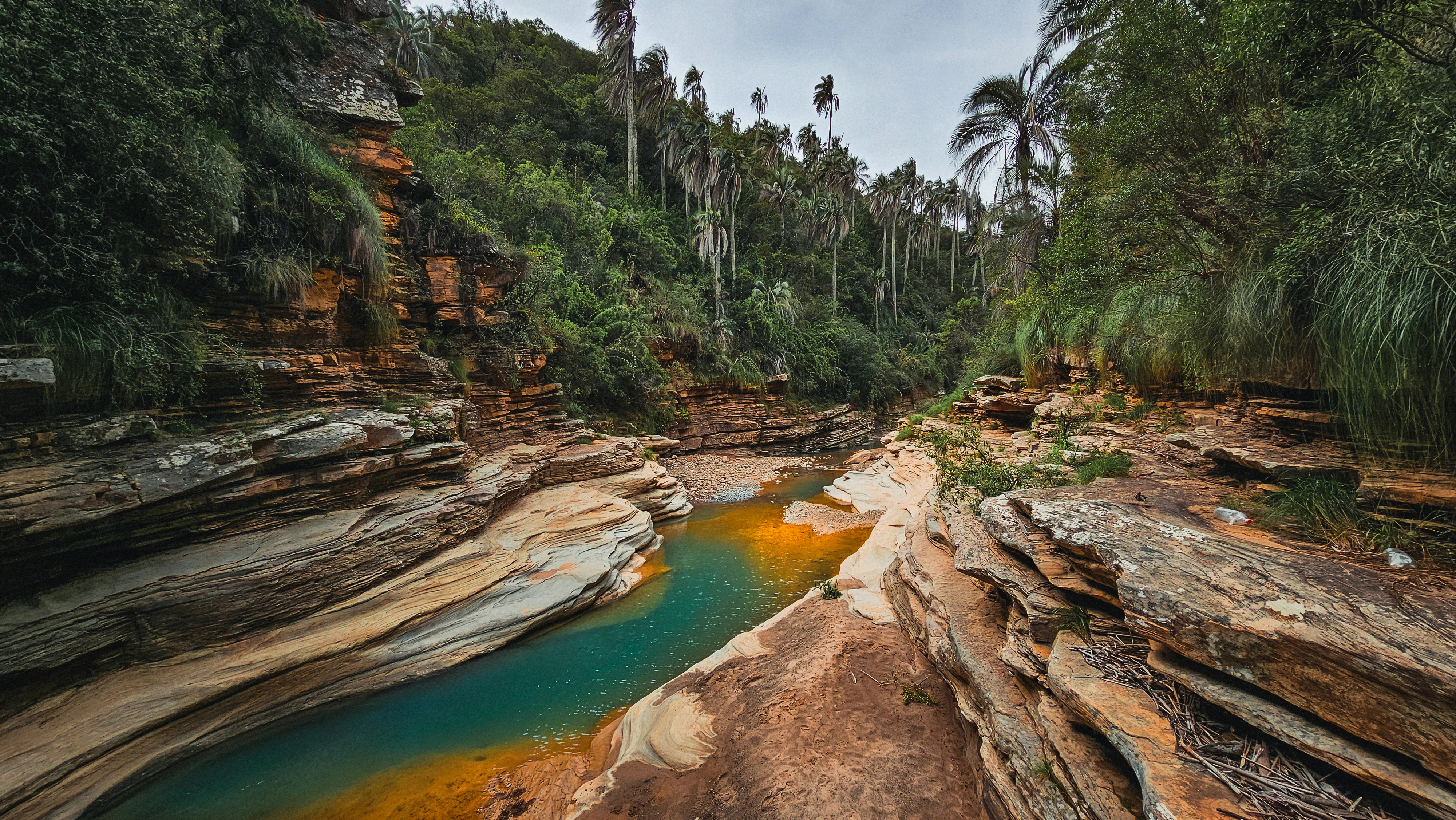
A narrow canyon with layered rock walls and a turquoise stream flowing through the center, surrounded by tall palm trees and dense vegetation.
Janchicoco palm trees line the rocky canyon of El Palmar.

El Palmar history and protected-area timeline

The origins of El Palmar as a protected area lie in early 1990s concerns about the future of the endemic janchicoco palm. In 1992, the Chuquisaca Development Corporation (CORDECH) proposed a flora and fauna sanctuary in the former cantons of Pasopaya and Rodeo specifically to safeguard Parajubaea torallyi, and this idea was taken up in 1993 by the ACLO Foundation and the PROBONA native forests program. Field studies they initiated confirmed the palm's ecological context and noted the presence of emblematic wildlife such as the spectacled bear, puma, and Andean condor.

By 1994, several departmental institutions recognized that Chuquisaca, despite its high biological diversity linked to its relief, was the only Bolivian department without formally designated protected areas. A proposal emerged to create five conservation areas, with El Palmar among them. After technical inspections, boundary work, and extensive consultation with peasant organizations and local institutions, the area was officially established on May 20, 1997, through Supreme Decree 24623.

From 1997 to 2001 the reserve was administered by the Chuquisaca Prefecture during a transitional phase, after which the National Service of Protected Areas (SERNAP) assumed direct management in September 2001 and put in place a technical and operational structure. Beginning in 2005, work on the Management Plan was supported by the World Bank's GEF II Project and, despite political setbacks, produced a participatory framework that still guides the area today.

El Palmar landscape and geographic character

El Palmar's landscape is shaped by the intersection of geological complexity, steep topography, and a strongly seasonal dry climate, producing one of the more visually dramatic protected areas in central Bolivia. The reserve belongs to the Central portion of the Eastern Cordillera, with mountain chains running roughly north to south that are interrupted by tectonic depressions filled with sediments and subject to intense erosion. Nearly 68 percent of the territory consists of high serranías with strong dissection, while medium-height serranías and other dissected units make up most of the remainder, leaving a fundamentally mountainous and canyon-cut terrain.

The most iconic landscape features are the deep canyons and quebradas, with Cañón Misión standing out as the reserve's signature scenic corridor. Cerro de Pucara Punta rises above the surrounding ridges, and the Rodeo-Cóndor Bañana trail crosses contrasting ecosystems from palm-filled valleys to open ridges. Between roughly 2,400 and 3,200 meters elevation, stands of the janchicoco palm fill the quebradas, giving the landscape a distinctive turquoise canopy against steep rocky walls.

Geologically, the area consists of Paleozoic sedimentary sequences along with Tertiary and Quaternary volcanic formations, including old cones and lava flows. Diamictites, sandstones, shales, and limonites are widespread, and the combination of folding phases and volcanic rocks has produced the rugged structural backdrop visible throughout the reserve. The resulting landforms combine high serranías, deeply cut valleys, and palm-filled quebradas into a landscape that is at once ecologically varied and visually striking.
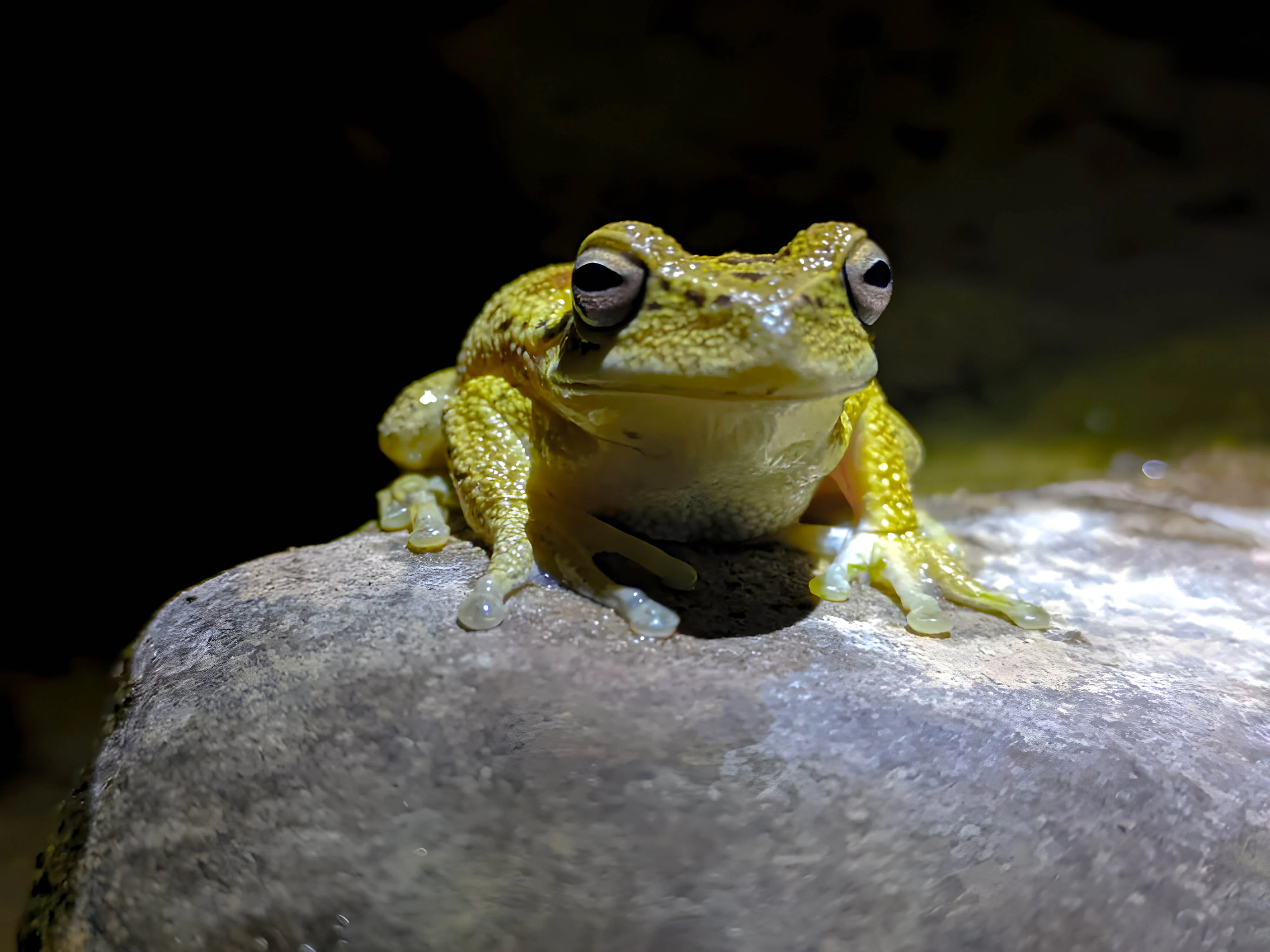
A pale, yellowish tree frog with prominent dark-rimmed eyes resting on a smooth grey rock against a dark, out-of-focus background.
A Boana riojana frog perched on a rock within El Palmar.

El Palmar ecosystems, habitats, and plant life

The natural character of El Palmar is defined by its position at the meeting point of three distinct ecological formations: the inter-Andean dry forests, the Tucumano-Boliviano montane forest, and the Serrano Chaco. This convergence, combined with strong altitudinal gradients, generates four ecological belts within the protected area, ranging from Subpuna grasslands and shrublands through Subandino vegetation and humid montane forest patches down to dry valley bottoms. Vegetation can change dramatically across short horizontal distances, a feature that gives the area considerable ecological interest beyond its total size.

Plant inventories have recorded more than 300 species of higher plants across 81 families, with Asteraceae, Poaceae, Fabaceae, Cactaceae, and Bromeliaceae especially well represented. Roughly 47 endemic plant species have been identified, many restricted to the semi-arid Andean settings, and a significant number of plants in the area are classified as threatened. Between 1,000 and 2,000 meters elevation, dry deciduous forests dominated by soto, sotomara, chari, quebracho, and thorny acacias prevail, with algarrobo near the rivers. Higher up, between 2,000 and 2,500 meters, shrublands of tola and tolilla give way to trees such as pino del cerro, aliso, and sahuinto, while between 2,800 and 3,200 meters subpuna shrubs and Polylepis woodlands appear. Most characteristic are the pure stands of janchicoco palm above 2,400 meters, where the species coexists with Podocarpus, Myrcianthes, Cedrela, and Polylepis in steep quebradas.
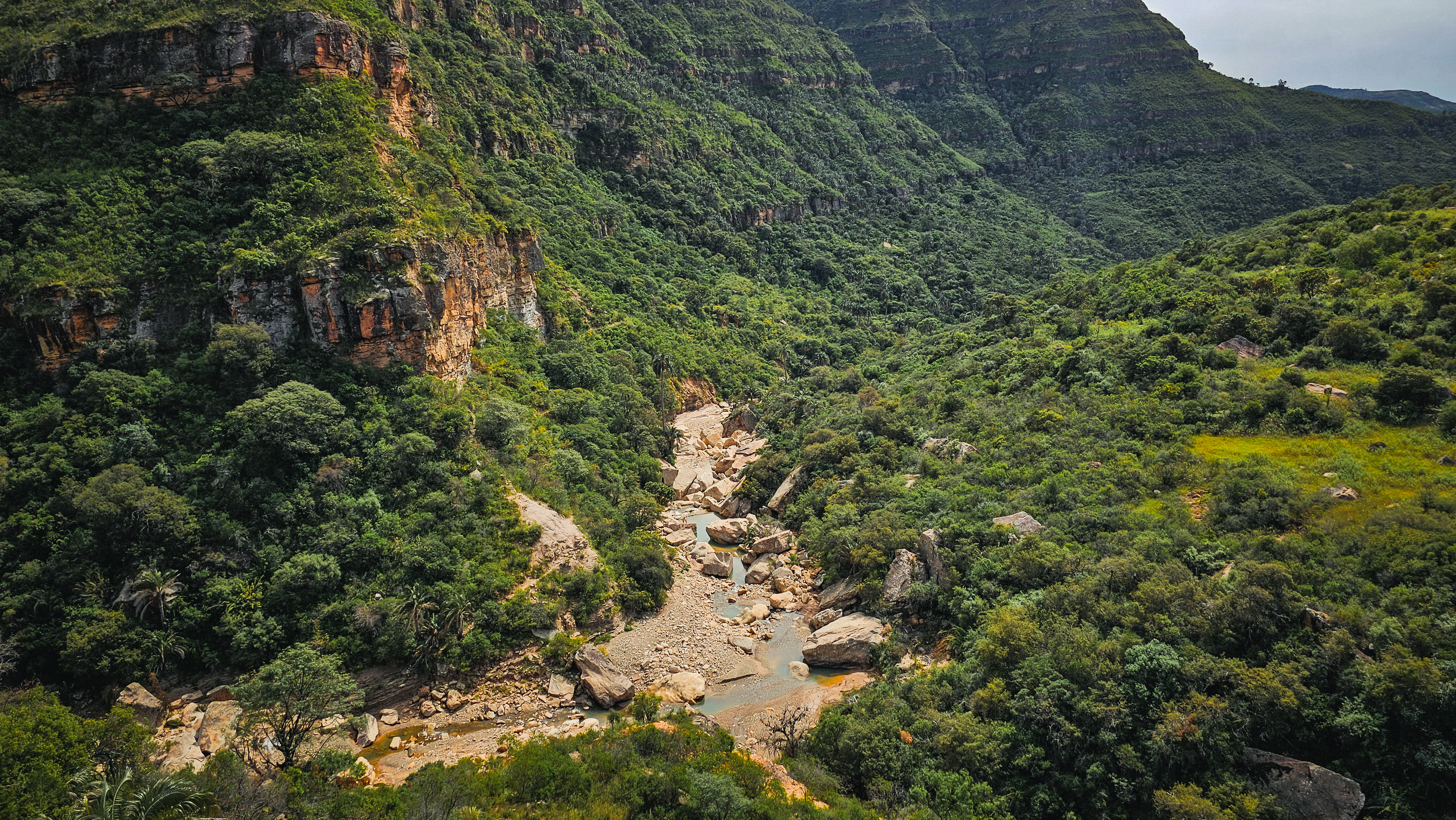
An elevated view of Mision Canyon, showing a rocky stream bed winding through dense green forest and steep, cliff-lined valley walls.
The rugged topography and dense vegetation of Mision Canyon in El Palmar.

El Palmar wildlife and species highlights

El Palmar supports a remarkable diversity of Andean wildlife relative to its area. By 2012, vertebrate inventories had recorded 173 species, including 30 mammals, 115 birds, 17 reptiles, 8 amphibians, and 3 fish species, along with 53 insects. Among mammals, the spectacled bear (jucumari), the puma, and the Andean vizcacha stand out, both for their ecological role and their conservation status, with the vizcacha being endemic to Bolivia.

The bird life is particularly rich, with at least 118 recorded species. Endemic and range-restricted species include the Bolivian sparrow (Oreopsar bolivianus), the red-fronted macaw (Ara rubrogenys), and the Andean vizcacha. A notable ornithological discovery has been the southernmost record of the Bolivian mountain tanager within the palm groves of El Palmar, extending the known range of this species. The Andean condor regularly rides the thermal currents above the canyons, making it one of the park's most iconic birds.

By contrast, amphibians, reptiles, and fish in the area, while present and ecologically important, do not include endemic or strongly threatened species of particular conservation concern. The wildlife profile of El Palmar is therefore defined less by single charismatic species than by a combination of high bird diversity, important endemic mammals, and the overlap between dry Andean and Tucumano-Boliviano faunas at the altitudinal transition.
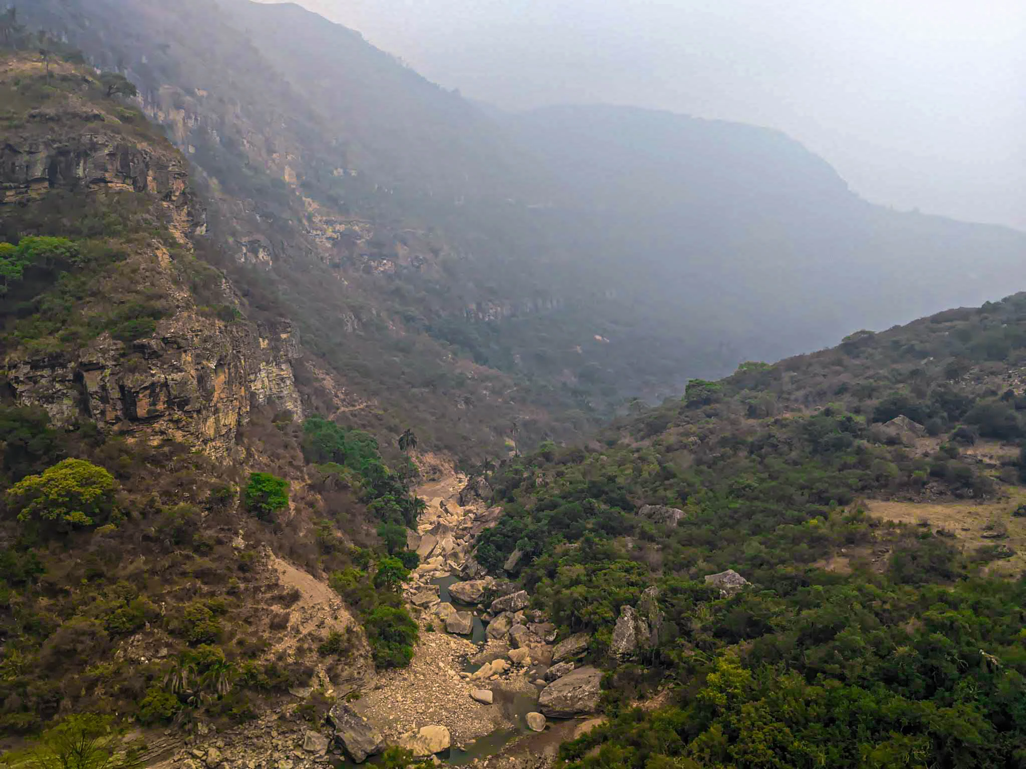
An aerial perspective of a rocky canyon valley featuring steep, vegetation-covered slopes and a dry, boulder-strewn creek bed at the base, under a hazy sky.
A view of the rugged Mision Canyon within El Palmar, with haze partially obscuring the distant ridges.

El Palmar conservation status and protection priorities

El Palmar was created primarily to safeguard the endemic janchicoco palm, and protecting Parajubaea torallyi remains the central conservation justification for the area. The palm's limited range within Bolivia, restricted to steep quebradas in Chuquisaca, makes these groves disproportionately important for the species' long-term survival. Around 14 plant species in the area are classified as endangered and another 10 as vulnerable, reinforcing the area's role as a refuge for elements of the inter-Andean dry flora.

Beyond its botanical importance, the reserve protects a critical transition between three major ecoregions, supporting populations of emblematic Andean mammals such as the spectacled bear and puma, as well as endemic birds. Hydrological conservation is also significant: the area's rivers, including the Rodeo, Presto, Rumi Cancha, and Algodonal, originate in the serranías and supply both rural communities and downstream agricultural areas. The headwaters are partially protected by palm groves and remaining forest cover, which help regulate flow and reduce erosion.

Locally, however, conservation faces pressures. Upstream deforestation and limited vegetation cover in some watersheds contribute to erosion and sediment transport, while solid waste and septic seepage from nearby communities affect water quality in certain stretches. The participatory Management Plan, developed with World Bank GEF II support, is therefore central to balancing the conservation of endemic palms and wildlife with the agricultural and pastoral livelihoods of the nine communities living within or around the reserve.

El Palmar cultural meaning and human context

El Palmar is not only an ecological reserve but also a cultural landscape with deep roots. Nine rural communities, six of them fully inside the protected area, have inhabited these Andean valleys for generations, and communities of the Yampara nation maintain a visible cultural presence within the reserve. Local livelihoods revolve around extensive livestock raising, small-scale agriculture, and seasonal palm harvesting, activities that the Integrated Management category is designed to accommodate.

Migration rates in the area are low, with the vast majority of residents both born and living within El Palmar, reflecting strong territorial attachment. The population is predominantly young, and short-term outmigration of working-age youth during the dry season reflects a strategy to complement agricultural income rather than abandonment of the land.

The reserve also protects important cultural heritage sites, including rock paintings, chullpas, and other archaeological elements, which have been formally recognized in a dedicated zone of historical-cultural interest within the management plan. This combination of living indigenous and peasant communities alongside pre-Hispanic heritage sites gives El Palmar a strong cultural dimension that complements its natural values.
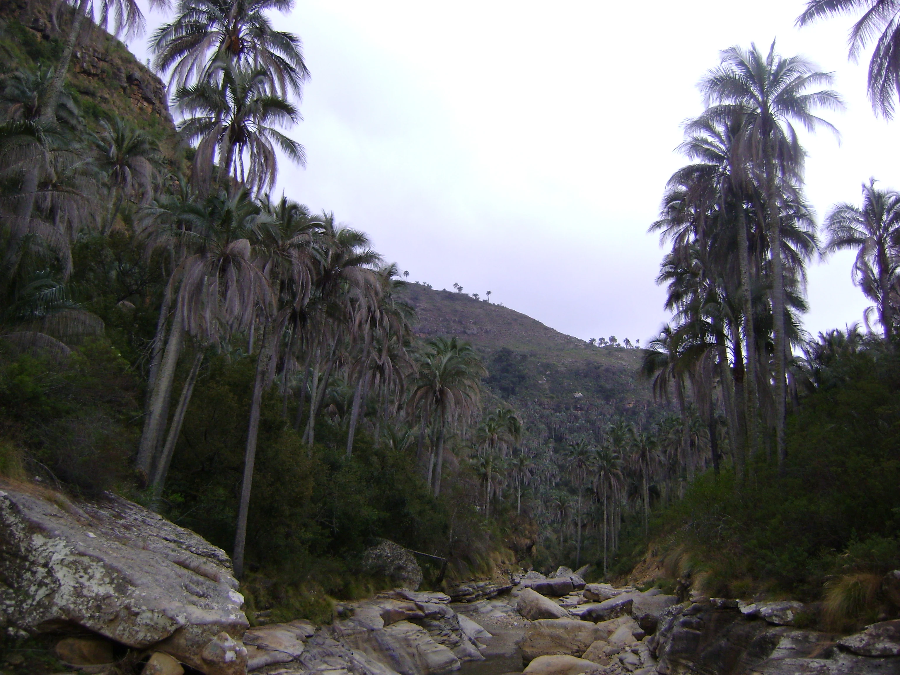
A group of tall, slender palm trees growing in a rocky, mountainous valley under an overcast sky.
A scenic view of the endemic janchicoco palms in the El Palmar protected area.

Top sights and standout views in El Palmar

El Palmar combines endemic botany, dramatic Andean geomorphology, and living community heritage within a single protected landscape. Its defining feature is the grove of janchicoco palms that frames the deep quebradas between roughly 2,400 and 3,200 meters elevation, an ecosystem found nowhere else. Equally compelling are the towering canyon walls of Cañón Misión, the soaring flight of the Andean condor above the ridgelines, and the rich overlap between inter-Andean dry forests and the Tucumano-Boliviano montane forests.

The reserve's participatory management model, which integrates nine rural communities into a zoning scheme balancing grazing, agriculture, palm extraction, and strict conservation, is itself a highlight. The presence of rock art, chullpas, and contemporary Yampara heritage adds a cultural layer that makes the area a rare example of an Andean protected landscape where biodiversity and traditional land use coexist within a single management framework.

Best time to visit El Palmar

The character of a visit to El Palmar is strongly shaped by the alternation between a long dry season and a concentrated rainy season. Between roughly December and March, the area receives the majority of its annual precipitation, and the quebradas, palm groves, and surrounding slopes are at their greenest, with fuller rivers and more active landscapes. The dry season, which extends through much of the rest of the year, brings clearer skies, easier access along trails and roads, and more reliable conditions for viewing canyon scenery and watching raptors such as the Andean condor riding thermals above the ridges. Because temperatures vary with altitude across a wide range, visitors should expect warm valley floors and noticeably cooler conditions at higher elevations, especially at night.


Monthly climate preview

Long-term representative temperature and precipitation patterns across twelve monthly periods

Área natural de manejo integrado El Palmar Climate Normals and Weather by Month

Representative coordinates record measured monthly temperature and precipitation rhythms across the protected terrain. Analyzing the complete twelve-month climatology profile reveals detailed variations in average temperature and precipitation normals.
Annual mean17 °C
14 °C19 °C
Jan18°
Feb18°
Mar18°
Apr17°
May15°
Jun15°
Jul14°
Aug15°
Sep17°
Oct18°
Nov19°
Dec19°
Warmest month
December

19.1 °C

Coolest month
July

14.1 °C

Wettest month
January

3.9 mm/day

Driest month
July

0.2 mm/day

Park location guide

Geography guide, regional context, and park location map for El Palmar

El Palmar park geography, regions, and map view in Bolivia

Understand where El Palmar sits in Bolivia through a broader geographic reading of the surrounding landscape, nearby location context, and its mapped position within the national park landscape.

How El Palmar fits into Bolivia

Bolivia, officially the Plurinational State of Bolivia, is a landlocked country in central South America. It features diverse geography including the Andean mountain range, Amazonian plains, Gran Chaco, and the Pantanal wetland. The country has a population of approximately 11.4 million and is administratively divided into nine departments, with La Paz as the seat of government and Sucre as the constitutional capital.

Wider geography shaping El Palmar in Bolivia

Bolivia is located in central South America, bordered by Brazil to the north and east, Paraguay to the southeast, Argentina to the south, Chile to the southwest, and Peru to the west. The country is divided between a western Andean region and tropical lowlands to the east and north. It includes the Amazonian plain, Gran Chaco, temperate valleys, the high-altitude Altiplano plateau, and part of the Pantanal wetland along its eastern border.

Map view of El Palmar

Use this park location map to pinpoint El Palmar in Bolivia, understand its exact geographic position, and read its mapped placement within the surrounding landscape more clearly.

Pigeon | © OpenStreetMap contributors

Location context for El Palmar

Chuquisaca

Visualizing endemic palm groves, dramatic Andean canyons, and rugged mountain terrain

Área natural de manejo integrado El Palmar Photos and Landscapes

Examine high-resolution photographs illustrating the striking topography, steep canyons, and unique vegetation of Área natural de manejo integrado El Palmar. Visual records reveal the distinct ecological transition between arid inter-Andean dry valleys and mountainous protected habitats.

A narrow canyon with layered rock walls and a turquoise stream flowing through the center, surrounded by tall palm trees and dense vegetation.

A deep rocky canyon with layered stone formations and a small stream at the bottom, surrounded by lush green hillsides covered in tall, thin palm trees.

A pale, yellowish tree frog with prominent dark-rimmed eyes resting on a smooth grey rock against a dark, out-of-focus background.

An elevated view of Mision Canyon, showing a rocky stream bed winding through dense green forest and steep, cliff-lined valley walls.

An aerial perspective of a rocky canyon valley featuring steep, vegetation-covered slopes and a dry, boulder-strewn creek bed at the base, under a hazy sky.

A person wearing traditional Andean clothing stands in a grove of tall palm trees, playing a small stringed instrument.

A group of tall, slender palm trees growing in a rocky, mountainous valley under an overcast sky.

Park atlas

Compare surrounding Andean landscapes and regional conservation areas in Bolivia

Explore Protected Areas and Parks Near Área natural de manejo integrado El Palmar

Browsing nearby parks helps place the rugged canyons and endemic palm groves of Área natural de manejo integrado El Palmar into a broader regional geography. Comparing adjacent protected areas reveals the wider ecological transitions and mountainous terrain shaping central Bolivia.
Protected areaCochabamba
About 27 km away#1 closest

North

Area Natural Lagarpampa: Protected Inter-Andean Landscapes and Regional Geography

Community-led conservation in the Cochabamba dry valleys.

Spanning over thirty thousand hectares, Area Natural Lagarpampa serves as a significant example of community-driven land protection. The geography features an intricate mix of semi-arid slopes, seasonally active watercourses, and dry-forest ravines that define this part of the Cochabamba highlands. This landscape supports a vital population of the red-fronted macaw, illustrating the intersection between rural agricultural heritage and specialized ecological preservation within the Andean valley system.

Area
303.08 km²
Established
2009
Relief
Upland
Climate
Arid
National parkCochabamba Department
About 89 km away#2 closest

North

Carrasco National Park: National Park Status and Protected Landscape Geography

Explore mapped boundaries within Cochabamba Department.

Carrasco National Park, situated within the Cochabamba Department, represents a critical national park entity. This focus provides users with an atlas-centric view of its protected landscape, detailing its geographic significance and mapped features. Understand the park's terrain and regional context, offering a clear perspective on its conservation value and mapped presence.

Area
6,226 km²
Established
1991
IUCN
II
Relief
Mountain
National parkSanta Cruz Department
About 94 km away#3 closest

Northeast

Amboró National Park: Its Protected Area Identity and Geographic Context

Mapped boundaries and regional landscape details.

Amboró National Park is a designated national park situated within the Santa Cruz Department, Bolivia. This entry provides detailed insights into its protected landscape, focusing on its geographical significance and mapped boundaries. Users can explore how Amboró National Park fits into the broader regional geography, enhancing their understanding of conservation areas and mapped natural terrains for atlas-based research and discovery. Its specific location and protected status are crucial for understanding its ecological and geographic role.

Area
4,425 km²
Established
1984
IUCN
II
Relief
Mountain
National parkPotosí Department
About 108 km away#4 closest

Northwest

Torotoro National Park: Paleontology and Karst Landscape Exploration in Bolivia

Discover prehistoric footprints within dramatic Andean canyon geography.

Torotoro National Park in the Potosí Department is a protected area distinguished by its rich paleontological significance and unique semi-arid mountain terrain. Featuring dramatic canyon systems plunging hundreds of meters deep, the park showcases thousands of Cretaceous dinosaur footprints alongside its complex karst topography, complete with caves and sinkholes, offering a profound glimpse into both ancient life and sculpted natural geography.

Area
165 km²
Established
1989
IUCN
II
Relief
Mountain
National parkChuquisaca Department
About 137 km away#5 closest

Southeast

Iñao National Park and Integrated Management Natural Area: Bolivia National Park and Protected Landscape

Explore the Serranía del Iñao's geography and conservation role.

Iñao National Park and Integrated Management Natural Area is a protected territory located within Chuquisaca Department, Bolivia, centered on the prominent Serranía del Iñao mountain range. This page offers detailed geographic context and an atlas perspective on the park's landscape, its role as a national park, and its contribution to regional conservation efforts in the Andean foothills.

Area
2,630.9 km²
Established
2004
IUCN
II
Scope
Terrestrial
Watercolor illustration showing a mountain range with green fields, a river, and soft pastel colors
National parkCochabamba Department
About 177 km away#6 closest

Northwest

Tunari National Park: Protected Landscape Atlas and Geographic Context

Mapped boundaries within Cochabamba Department's geography.

Tunari National Park represents a vital protected landscape within the Cochabamba Department of Bolivia. This page offers an atlas-centric exploration of the park's geographic boundaries, its relationship to the surrounding regional terrain, and its significance as a national park. Delve into the mapped context of Tunari National Park to understand its protected area status and its contribution to Bolivia's diverse geography.

Area
3,090 km²
Established
1992
IUCN
II
Relief
Mountain
A watercolor painting showing a landscape of sandy dunes, small pools of water, and green vegetation against a white background.
Regional parkSanta Cruz
About 198 km away#7 closest

East

Parque Regional Lomas de Arena: Protected Landscapes and Geographic Features

Inland dune and Chaco forest ecosystems in the Santa Cruz lowlands

Covering 14,000 hectares near Santa Cruz de la Sierra, Parque Regional Lomas de Arena showcases a rare inland sand dune field anchored by transitional Chaco forest and savanna. This protected area provides a unique window into the geography of the Bolivian lowlands, where lagoon habitats and sandy ridges create a distinct ecological mosaic that bridges historical Chané heritage with modern conservation efforts.

Area
140.759 km²
Established
1989
IUCN
V
Relief
Lowland
A soft watercolor painting showing a winding river through a valley with trees and palms on the banks and rolling hills in the background.
Nature reserveSanta Cruz
About 203 km away#8 closest

Northeast

Parque de Protección Ecológica del Río Piraí: Protected Geography and Riverine Landscapes

Nature reserve and flood-control corridor in Santa Cruz, Bolivia

This nature reserve encompasses a narrow, sediment-rich corridor following the Río Piraí. It protects representative lowland habitats including Chiquitano dry forest and gallery woodlands, while balancing vital flood-mitigation roles against the pressures of urban expansion. Explore the map of this unique alluvial landscape to understand its ecological significance and role in the regional geography of Santa Cruz.

Area
15.868 km²
Established
1991
Relief
Lowland
Climate
Tropical

Common questions about visiting, size, designation, and location context for El Palmar

El Palmar FAQs for park facts, access, geography, and protected area context

Find quick answers about El Palmar, including protected-area facts, park geography, trail and visitor context, and how the park fits into its surrounding country and regional landscape.
MoriAtlas Explorer

Continue Your Protected Areas Search Across the Global Atlas

Deepen your exploration by continuing the structured search for national parks and protected areas worldwide. Utilize the comprehensive filtering capabilities to compare different conservation landscapes and refine your understanding of global park geography. Discover more about the distribution and characteristics of protected natural areas.

Global natural geography