

Mori Atlas logo
Protected landscapeÁrea Natural de Manejo Integrado San Matías

Mapping the ecological transition between Chiquitano dry forests and the Bolivian Pantanal

Área Natural de Manejo Integrado San Matías: A Continental Mosaic of Wetlands and Savannas

Spanning the eastern lowlands of the Santa Cruz department, Área Natural de Manejo Integrado San Matías represents a significant convergence of South American ecosystems. This protected landscape preserves a vast network of seasonally flooded wetlands, tropical dry forests, and rolling savanna hills. By examining the complex terrain and hydrologic systems of this region, users can trace the transition from the ancient Chiquitano Shield to the sprawling floodplains of the Paraguay River basin.

pantanalwetlandschiquitano dry forestcerradoprotected areabolivia lowlands
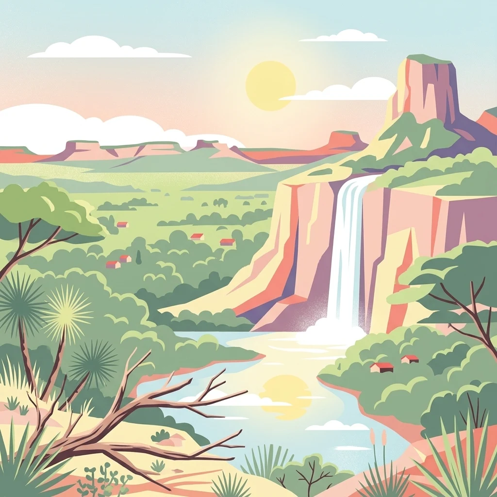
A flat-style digital illustration depicting a sunlit landscape with a waterfall falling from a tall, flat-topped mesa into a lush green valley with a river. A bare, branching tree is in the foreground, with cacti and scrub vegetation.

Área Natural de Manejo Integrado San Matías

Protected landscape

Park overview

Structured park overview, official facts, and landscape profile for Área Natural de Manejo Integrado San Matías

Área Natural de Manejo Integrado San Matías park facts, protected area profile, and essential visitor context

Review the core facts for Área Natural de Manejo Integrado San Matías, including designation, size, terrain, visitor scale, habitats, and operating context in one park-focused overview.

About Área Natural de Manejo Integrado San Matías

The Área Natural de Manejo Integrado San Matías represents one of the most ambitious conservation efforts in Bolivia, combining the protection of ecosystems as diverse as wetlands, savannas, dry forests, and ancient mountain ranges within a single contiguous area. Its location in the far east of the Santa Cruz Department places it along Bolivia's border with Brazil, where the upper Paraguay River system flows across vast seasonal floodplains.

The core identity of San Matías rests on its ecological transitions. Where the Chaco-Pantanal plain meets the Precambrian Chiquitano Shield, the landforms shift from shallow wetlands and meandering rivers to rocky ridges, rolling hills, and isolated mountain ranges such as the Serranía de Sunsas. This environmental diversity enables biological richness rarely matched elsewhere in Bolivia, supporting species typical of distinct biogeographic realms within a relatively small geographic radius.

The protected area is part of Bolivia's National System of Protected Areas and is managed by SERNAP. While primarily a conservation zone, San Matías also encompasses long-established Indigenous communities, traditional cattle ranches, and emerging pressures from infrastructure projects, mining, and commercial fishing. These overlapping pressures make the area a focal point for discussions about balancing biodiversity protection with regional development in South America's lowland heartland.

Visitors and researchers are drawn to San Matías for its pristine aquatic ecosystems, including Laguna Mandioré, Laguna Cáceres, and the Curiche Grande river, as well as for opportunities to observe large mammals, rare birds, and intact stretches of Chiquitano forest. Its Ramsar status underscores the global importance of the wetlands contained within its boundaries.

Quick facts and research context for Área Natural de Manejo Integrado San Matías

The Área Natural de Manejo Integrado San Matías covers roughly 29,185 square kilometers across the eastern lowlands of Bolivia's Santa Cruz Department. Administered through Bolivia's National Service of Protected Areas (SERNAP), it was created in 1997 through Supreme Decree 24734 and declared a Ramsar site of international importance in 2001. Its elevations range from about 88 meters near Laguna Mandioré up to roughly 1,210 meters in the Sunsas mountains. The area sits within the upper Paraguay River basin, part of the greater Río de la Plata system.

Protection and recognition

Documented protection scope, designated year, and international recognition records

Área Natural de Manejo Integrado San Matías Protection Status and Designation History

Área Natural de Manejo Integrado San Matías maintains a mixed protection scope established through official designation records from 2001. Documented status details, management scope, and recognition sources provide structured context for this protected natural area.

Protection details

Protection scope
Mixed
Designated year
2001
Transboundary protection
No
Park context

Deeper park guide and search-rich context for Área Natural de Manejo Integrado San Matías

Área Natural de Manejo Integrado San Matías history, landscape, wildlife, and travel context

Explore Área Natural de Manejo Integrado San Matías through its history, landscape character, ecosystems, wildlife, conservation priorities, cultural context, and seasonal travel timing in a structured park guide built for atlas discovery and search intent.

Why Área Natural de Manejo Integrado San Matías stands out

ANMI San Matías is best known for protecting the Bolivian side of the Pantanal, the largest tropical wetland in the world, while also embracing the transitional landscapes of the Chiquitano dry forest and the Cerrado. The protected area is recognized for its seasonal flooding cycle, where dramatic wet and dry seasons reshape rivers, lagoons, and savannas. The area's extraordinary biodiversity is another defining feature. It hosts emblematic species such as the jaguar, the maned wolf, the marsh deer, the giant otter, the giant armadillo, the hyacinth macaw, and the spectacled caiman, alongside hundreds of bird species, dozens of amphibians, and a wide variety of mammals. The presence of endemic cacti and bromeliads from the Cerrado further highlights the area's botanical uniqueness.
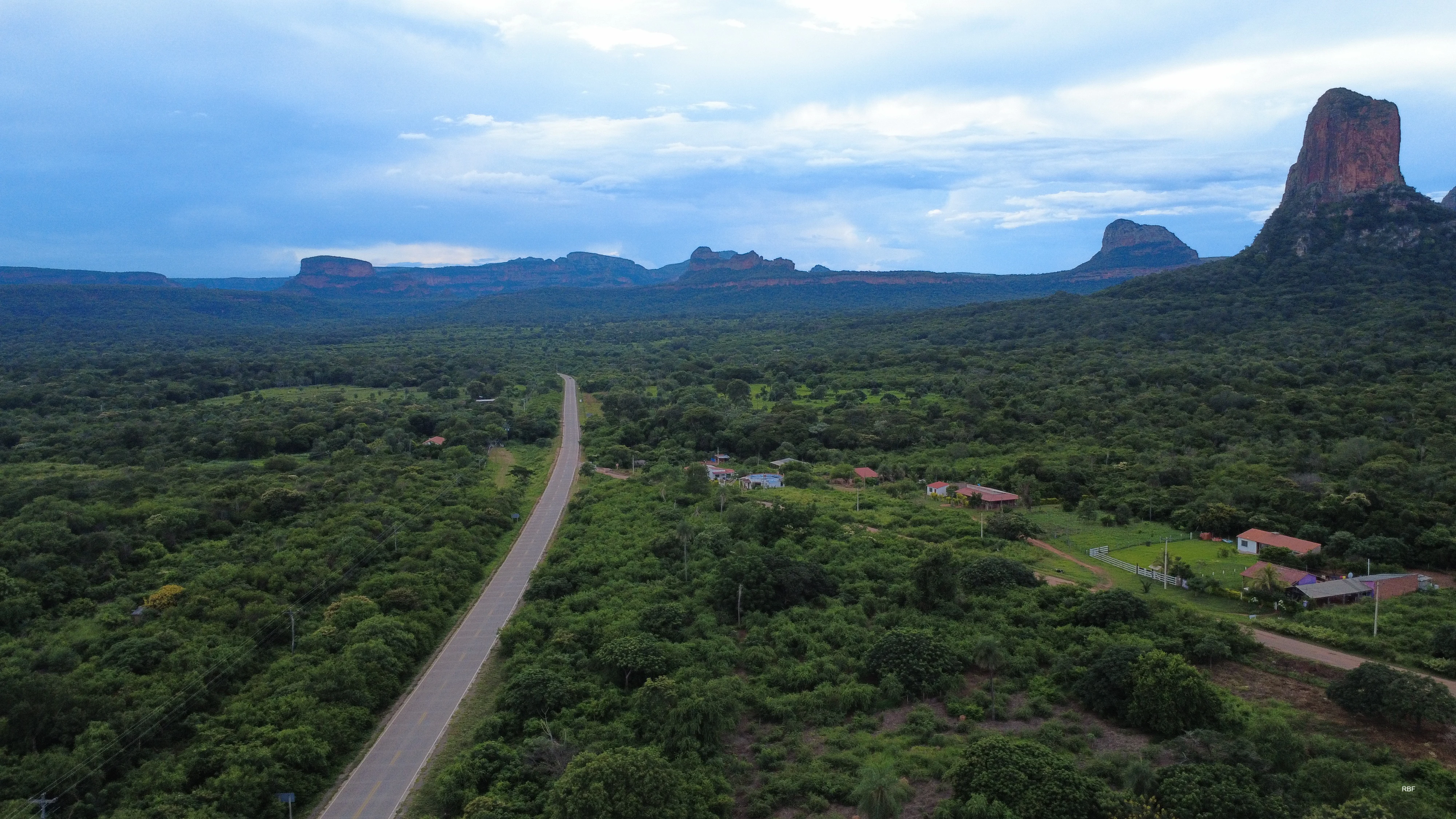
An aerial view of a paved road running through a dense green forest, with prominent, steep red-rock mesas and a tower-like geological formation in the background under a cloudy sky.
The Chochis Tower rising above the landscape near Route 4 in the Chiquitos region.

Área Natural de Manejo Integrado San Matías history and protected-area timeline

The idea to protect the San Matías territory first appeared in the 1995 Land Use Plan (PLUS) of the Santa Cruz Department, which identified the area as a Reserve of Immobilization because of its exceptional ecological features and its importance for safeguarding the Chiquitano dry forest, the Bolivian Pantanal, and the Cerrado. Following this designation, the Noel Kempff Mercado Natural History Museum, the Prefecture of Santa Cruz, and the National Directorate for Biodiversity Conservation, with the support of the World Wildlife Fund (WWF), conducted studies and developed the technical proposal that led to its formal establishment.

On July 31, 1997, the Área Natural de Manejo Integrado San Matías was officially created through Supreme Decree 24734 as part of Bolivia's National System of Protected Areas. The original objective was the protection of the Bolivian Pantanal, but the area was subsequently expanded to include significant portions of the Chiquitano dry forest and the Sunsas mountain range.

In 2001, San Matías received international recognition when it was declared a Wetland of International Importance under the Ramsar Convention. This designation highlighted the area's critical role in regional hydrology and its exceptional value as one of the most important tropical wetland complexes in South America.

Área Natural de Manejo Integrado San Matías landscape and geographic character

The landscape of ANMI San Matías is defined by a fascinating geological transition at the southern margin of the Amazon Craton. The area lies between two major physiographic regions: the Chiquitano Shield and the Chaco-Pantanal plain. In the east and northeast, the land descends into the floodplains of the Paraguay River, while in the center and west, ancient crystalline rocks form rolling hills and low ridges. Toward the south and southwest, the terrain rises dramatically into the Sunsas and La Cal mountain ranges.

Elevation ranges from around 88 meters above sea level along the shores of Laguna Mandioré at the Brazilian border to over 1,200 meters in the highest points of the Sunsas range. This wide elevation range contributes to a great diversity of microclimates, soil types, and vegetation formations within a relatively compact geographic area.

Water shapes much of the landscape's identity. The Paraguay River basin dominates the eastern portion of the protected area, with major sub-basins such as Curiche Grande, Laguna Cáceres, and the Tucavaca-Otuquis system creating extensive networks of lagoons, meandering rivers, and seasonally flooded savannas. The wet and dry seasons drive the dramatic transformation of these wetlands, with the flood cycle determining ecological rhythms across the entire region.
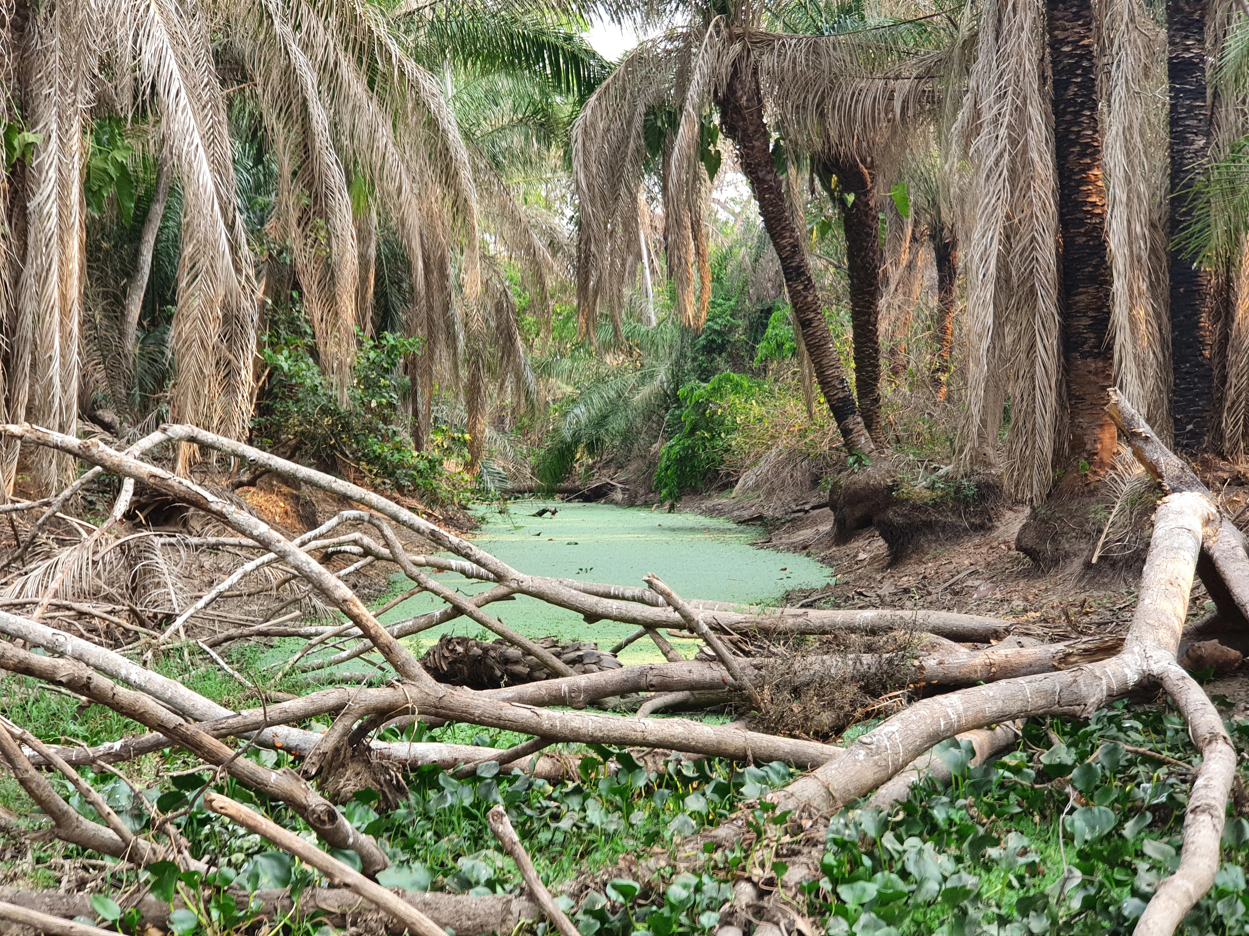
A small, stagnant pool of water covered in green algae, surrounded by dry palm trees and fallen branches in a forested area.
A small, algae-covered water site within the San Matias Integrated Management Natural Area during the dry season.

Área Natural de Manejo Integrado San Matías ecosystems, habitats, and plant life

The ecological identity of San Matías centers on the convergence of three major ecoregions: the dry Chiquitano forest, the Pantanal wetlands, and the Cerrado savannas. This convergence produces a remarkable habitat mosaic that includes seasonally flooded grasslands, permanent and temporary lagoons, gallery forests, cerrado woodlands, dry deciduous forests, and elevated rocky outcrops.

Strong seasonal contrast defines the ecological rhythms of the area. The rainy season, which extends roughly from November through March, swells waterways and floods vast stretches of lowland savanna, while the dry season, from May to September, reduces wetlands to fragmented pools and parches the open landscapes. This cyclical drought-flood dynamic shapes vegetation patterns, animal behavior, and reproductive cycles across the entire protected area.

Vegetation varies strikingly across habitats. The Chiquitano dry forest is dominated by legume-rich families such as Fabaceae, Bignoniaceae, and Mimosaceae, with characteristic species including morado, tajibo, curupaú, cuta, and alcornoque. The Cerrado portions of the area feature grasses, Vochysiaceae-dominated woodlands, and a notable presence of endemic cacti and bromeliads. Wetland margins host palm stands of carandá and aquatic species such as Victoria regia and tarope. The botanical diversity of the area has been recognized for its high levels of endemism, especially within the herbaceous and shrubby strata.

Área Natural de Manejo Integrado San Matías wildlife and species highlights

ANMI San Matías is home to one of the most diverse faunal assemblages in Bolivia, reflecting the overlap of three major biogeographic regions. Among the most emblematic mammals are the lowland tapir, the maned wolf, the jaguar, the giant armadillo, the giant otter, the marsh deer, the pampas deer, and the white-lipped peccary. The combination of floodplains, dry forests, and cerrado habitats allows species typical of very different ecosystems to coexist within the same protected area.

Birdlife is equally impressive. The area hosts dozens of conservation-relevant species, including the hyacinth macaw, the jabiru stork, and a wide variety of wetland and forest birds. Reptiles such as the spectacled caiman and Caiman yacare are common in the waterways, while amphibians thrive in both aquatic and terrestrial habitats. According to documented inventories, hundreds of bird species, nearly 500 mammal species, and more than 120 amphibian species are believed to inhabit the area, though ongoing research continues to refine these figures.

The presence of flagship and threatened species is one of the defining conservation values of the protected area. Species such as the giant otter, the marsh deer, the hyacinth macaw, the maned wolf, and the giant armadillo highlight the area's importance as a refuge for South American wildlife facing regional population declines.

Área Natural de Manejo Integrado San Matías conservation status and protection priorities

The conservation significance of ANMI San Matías lies in its protection of three globally important ecoregions within a single contiguous area. As the largest protected area in Bolivia's lowlands after Kaa Iya, San Matías plays a strategic role in safeguarding the Bolivian share of the Pantanal, the world's largest tropical wetland system, while also protecting extensive tracts of Chiquitano dry forest and cerrado habitats. Its designation as a Ramsar site in 2001 gave the wetlands international recognition and enhanced protection status.

The area also serves as a critical refuge for endangered and vulnerable species. The presence of healthy populations of jaguars, giant otters, hyacinth macaws, marsh deer, and giant armadillos gives it outsize importance for South American biodiversity conservation, especially as surrounding landscapes face increasing human pressure. Its watersheds contribute to regional hydrological balance, supporting downstream ecosystems in both Bolivia and Brazil.

Conservation in San Matías is complicated by multiple overlapping pressures. Poaching, illegal logging, unregulated commercial fishing, mining concessions, wildfires, and extensive cattle ranching all threaten the integrity of the area. Additionally, expanding road infrastructure, including the controversial Transpantanera route, risks opening previously remote habitats to settlement, extractive activities, and further deforestation. Effective management therefore depends not only on ecological strategies but also on addressing governance, Indigenous rights, and regional development pressures.

Área Natural de Manejo Integrado San Matías cultural meaning and human context

San Matías is not only an ecological landscape but also a deeply human one. The area and its surrounding zone of influence are home to 26 Indigenous communities, of which 22 are Chiquitano communities established through regional migrations over generations. Santo Corazón, founded in 1760, stands out as one of the oldest and most historically significant Chiquitano settlements in the region. Four Ayoreo communities, consolidated in 1999 as the Guayé Indigenous Territory (TIOC Guayé), represent a more recent but deeply rooted Indigenous presence.

Land tenure in many of these communities follows communal ownership patterns, and social organization blends the modern Territorial Base Organization (OTB) system with traditional Indigenous structures led by a cacique. Chiquitano communities are represented through organizations such as CIRPAS, CICHGB, and the broader Chiquitano Indigenous Organization (OICH), while Ayoreo communities belong to CANOB.

In addition to Indigenous communities, the area has historically hosted mestizo populations, Jesuit and Franciscan mission settlements, and a notable presence of Brazilian nationals linked to ranching and missionary activity. Traditional cattle ranching, with estancias occupying large portions of the landscape, remains a defining cultural and economic feature of the Chiquitania and the Pantanal borderlands. This blending of Indigenous heritage, missionary legacy, and rural frontier culture gives San Matías a complex human identity shaped by centuries of interaction between people and a demanding but ecologically rich environment.

Top sights and standout views in Área Natural de Manejo Integrado San Matías

ANMI San Matías stands out for its combination of vast scale and ecological complexity. Few protected areas in South America span the transition between tropical wetlands, dry forests, and savannas in such a seamless continuum. The Ramsar-recognized wetlands, including Laguna Mandioré and Laguna Cáceres, are among the most pristine freshwater ecosystems in the Bolivian lowlands.

The area also holds exceptional wildlife value, particularly for flagship species such as the jaguar, the giant otter, the hyacinth macaw, the marsh deer, and the maned wolf. The presence of endemic plants, especially cacti and bromeliads of the Cerrado, adds a botanical dimension of global significance. Together with the cultural presence of Chiquitano and Ayoreo communities, San Matías offers an unusually complete portrait of lowland South America's natural and human heritage.

Best time to visit Área Natural de Manejo Integrado San Matías

The experience of visiting San Matías varies dramatically with the seasons, which is one of its defining characteristics. The rainy season, from November to March, transforms the landscape: rivers swell, lagoons expand, and vast stretches of savanna become flooded wetlands. This is generally the best period for observing waterbirds and aquatic wildlife, though many dirt roads may become difficult to access.

The dry season, from May to September, produces a very different atmosphere. Wetlands shrink, wildlife concentrates around remaining water sources, and mammals such as jaguars, deer, and peccaries become easier to observe. Forest trails are more accessible, and cooler temperatures make travel more comfortable, though daytime heat can remain intense, especially in the eastern portion of the protected area. July is typically the driest month. Travelers interested in the full ecological rhythm of the Pantanal often consider splitting their visit between seasons to experience both extremes of the landscape.
Monthly climate preview

Long term temperature and monthly precipitation patterns from representative coordinates

Área Natural de Manejo Integrado San Matías Climate Normals and Weather by Month

Historical climatology records for Área Natural de Manejo Integrado San Matías show distinct shifts in average monthly temperature and precipitation across the annual cycle. Reviewing the complete twelve month profile provides deeper insight into measured long term climate norms for this protected area.
Annual mean27 °C
24 °C30 °C
Jan28°
Feb27°
Mar27°
Apr27°
May25°
Jun24°
Jul24°
Aug27°
Sep29°
Oct30°
Nov29°
Dec28°
Warmest month
October

30.2 °C

Coolest month
June

24.1 °C

Wettest month
January

5.9 mm/day

Driest month
July

0.5 mm/day

Park location guide

Geography guide, regional context, and park location map for Área Natural de Manejo Integrado San Matías

Área Natural de Manejo Integrado San Matías park geography, regions, and map view in Bolivia

Understand where Área Natural de Manejo Integrado San Matías sits in Bolivia through a broader geographic reading of the surrounding landscape, nearby location context, and its mapped position within the national park landscape.

How Área Natural de Manejo Integrado San Matías fits into Bolivia

Bolivia, officially the Plurinational State of Bolivia, is a landlocked country in central South America. It features diverse geography including the Andean mountain range, Amazonian plains, Gran Chaco, and the Pantanal wetland. The country has a population of approximately 11.4 million and is administratively divided into nine departments, with La Paz as the seat of government and Sucre as the constitutional capital.

Wider geography shaping Área Natural de Manejo Integrado San Matías in Bolivia

Bolivia is located in central South America, bordered by Brazil to the north and east, Paraguay to the southeast, Argentina to the south, Chile to the southwest, and Peru to the west. The country is divided between a western Andean region and tropical lowlands to the east and north. It includes the Amazonian plain, Gran Chaco, temperate valleys, the high-altitude Altiplano plateau, and part of the Pantanal wetland along its eastern border.

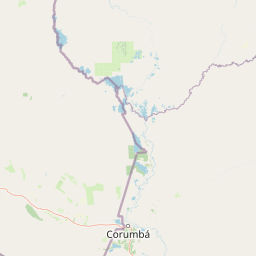
Map view of Área Natural de Manejo Integrado San Matías

Use this park location map to pinpoint Área Natural de Manejo Integrado San Matías in Bolivia, understand its exact geographic position, and read its mapped placement within the surrounding landscape more clearly.

Pigeon | © OpenStreetMap contributors

Location context for Área Natural de Manejo Integrado San Matías

Santa Cruz

Visualizing wetlands, dry forests, and savanna habitats across the protected area

Área Natural de Manejo Integrado San Matías Photos and Landscape Scenery

Visual documentation of Área Natural de Manejo Integrado San Matías reveals the diverse terrain of Bolivia, capturing seasonal floodplains, rocky ridges, and river networks. Examining these habitats provides a clearer understanding of the ecological transition zone bridging the Pantanal wetlands and the Chiquitano dry forest.

An aerial view of a paved road running through a dense green forest, with prominent, steep red-rock mesas and a tower-like geological formation in the background under a cloudy sky.

A silhouetted shoreline along a body of water under a vibrant sunset with deep purple, orange, and blue clouds.

A small, stagnant pool of water covered in green algae, surrounded by dry palm trees and fallen branches in a forested area.

Park atlas

Compare surrounding wetland reserves, dry forests, and connected lowland landscapes.

Parks Near Área Natural de Manejo Integrado San Matías and Regional Protected Areas

Browsing other protected areas near Área Natural de Manejo Integrado San Matías reveals the broader ecological continuity of the eastern lowlands. Examining adjacent regional parks provides valuable context on wetland hydrology, savanna terrain, and tropical conservation.
National parkSanta Cruz Department
About 102 km away#1 closest

South

Otuquis National Park and Integrated Management Natural Area: Mapped Protected Landscape in Santa Cruz Department

Bolivia's designated national park for atlas exploration.

Gain detailed geographic context for Otuquis National Park and Integrated Management Natural Area, a significant protected landscape within Bolivia's Santa Cruz Department. This page serves as a dedicated entry point for understanding the park's mapped boundaries, its role as a national park, and its natural terrain within the regional atlas. Explore its unique geographic features and its place within Bolivia's network of protected areas.

Area
10,059.5 km²
Established
1997
IUCN
II
Relief
Lowland
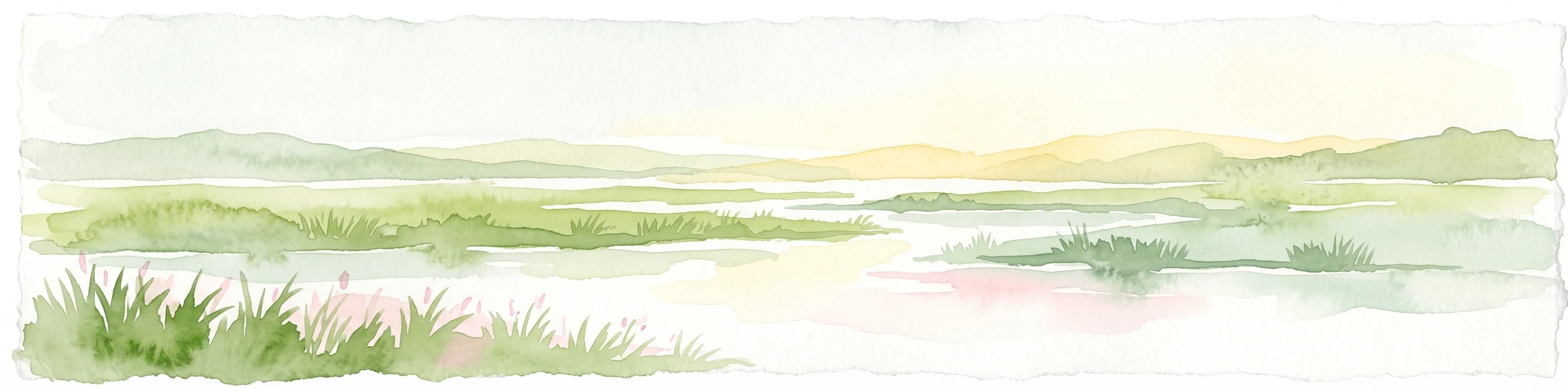
A watercolor illustration of a soft, hazy landscape featuring grassy wetlands in the foreground, water channels, and rolling hills in the background.
Protected areaDepartamento de Santa Cruz
About 113 km away#2 closest

Southwest

Área de Conservación e Importancia Ecológica Ñembi Guasu: Atlas of Protected Dry Forest

Chaco plain geography and indigenous-led conservation zones

Spanning roughly 12,000 square kilometers, this landmark conservation area in Departamento de Santa Cruz protects a continuous mosaic of dry tropical forests. The terrain features a distinct gradient from Andean-influenced foothills to the open plains, playing a critical role in regional biodiversity as a connector for neighboring reserves.

Area
12,046.3 km²
Established
2019
Relief
Lowland
Scope
Terrestrial
National parkAlto Paraguay
About 155 km away#3 closest

South

Nationalpark Río Negro: Mapping Protected Landscapes in the Alto Paraguay Department

Ecological transition zone between Pantanal, Chaco, and cerrado

Nationalpark Río Negro encompasses a critical mosaic of habitats at the edge of the Bolivian border. This protected area acts as a meeting point for three major South American biomes, resulting in diverse terrain ranging from seasonal wetlands to dry quebracho forests. The park provides an essential geographic anchor for understanding the ecological connectivity of the Paraguayan Pantanal and its unique environmental transitions.

Area
1,238 km²
Established
2004
Relief
Lowland
Climate
Tropical
National parkSanta Cruz Department
192 km away#4 closest

Northwest

Noel Kempff Mercado National Park: Detailed Protected Landscape Map and Geography

Explore national park boundaries and regional landscape context in Santa Cruz.

Noel Kempff Mercado National Park is a crucial protected area offering deep insights into Bolivia's natural geography. This entry provides specific details on its mapped landscape and geographic position within the Santa Cruz Department, enabling users to explore its protected boundaries and understand its regional context for atlas-based discovery. Dive into the mapped terrain and natural features that define this significant national park.

Area
15,523 km²
Established
1979
IUCN
II
Relief
Mixed relief
National parkBolivia
About 240 km away#5 closest

Southwest

Kaa-Iya del Gran Chaco National Park and Integrated Management Natural Area: Bolivia's National Park and Protected Landscape

Explore the mapped geography and regional natural landscape.

Kaa-Iya del Gran Chaco National Park and Integrated Management Natural Area stands as a crucial component of Bolivia's protected lands, offering a distinct entry point for exploring its natural geography. This page details the park's status as a national park and integrated management natural area, providing context for its mapped boundaries and its role within the country's diverse landscapes. Engage with structured information designed to illuminate the park's geographic setting and its significance for atlas-style exploration and understanding of Bolivia's protected areas.

Area
34,411.1 km²
Established
1995
Relief
Upland
Climate
Subtropical
Protected areaSanta Cruz Department
About 329 km away#6 closest

Northwest

Área protegida municipal Bajo Paraguá: Geographic and Protected Area Overview

Lowland forest landscapes in Santa Cruz Department, Bolivia.

Deepen your knowledge of the Área protegida municipal Bajo Paraguá, a significant protected landscape that anchors conservation efforts in the Chiquitano dry forest. This area borders the Noel Kempff Mercado National Park and serves as a vital transition zone for lowland ecosystems and indigenous territorial defense.

Area
9,830.06 km²
Established
2021
Visitors
16K annual
Relief
Upland
Protected areaSanta Cruz
About 351 km away#7 closest

West

Área Protegida Municipal Palmera de Saó: Mapping the Chaco Lowlands and Protected Forest Zones

A vital protected landscape in the Santa Cruz department.

The Área Protegida Municipal Palmera de Saó represents a critical effort to safeguard the saó palm and associated dry forest ecosystems in eastern Bolivia. Stretching along the Río Grande, this protected area features a mosaic of riverine vegetation and alluvial terrain. Understanding its geographic setting reveals how this compact, municipal-level reserve supports both native Chaco wildlife and the cultural crafts of surrounding Guaraní and local communities.

Area
7.58 km²
Established
2006
Relief
Lowland
Scope
Terrestrial
Wildlife reserveSanta Cruz
About 375 km away#8 closest

Northwest

Reserva de Vida Silvestre Ríos Blanco y Negro: Protected Area Geography and Landscape Map

Transitional lowland forests and river floodplains in Santa Cruz

The Reserva de Vida Silvestre Ríos Blanco y Negro protects a massive stretch of lowland forest in northeastern Bolivia. This area is characterized by its transitional ecology where dry forests meet the Amazon, shaped by the dynamic flooding of the San Pablo and Blanco rivers. Access this detailed geographic overview to understand the conservation significance and territorial extent of this critical wetland and forest environment.

Area
14,000 km²
Established
1990
Relief
Lowland
Climate
Tropical

Common questions about visiting, size, designation, and location context for Área Natural de Manejo Integrado San Matías

Área Natural de Manejo Integrado San Matías FAQs for park facts, access, geography, and protected area context

Find quick answers about Área Natural de Manejo Integrado San Matías, including protected-area facts, park geography, trail and visitor context, and how the park fits into its surrounding country and regional landscape.
MoriAtlas Explorer

Continue Your Protected Areas Search Across the Global Atlas

Deepen your exploration by continuing the structured search for national parks and protected areas worldwide. Utilize the comprehensive filtering capabilities to compare different conservation landscapes and refine your understanding of global park geography. Discover more about the distribution and characteristics of protected natural areas.

Global natural geography
