
Mori Atlas logo
Protected areaBagno Pulwy

Analyzing the terrain and marshland boundaries within Northern Mazovia

Bagno Pulwy Protected Area: A Detailed Geographic Atlas of the Mazovian Wetlands

Bagno Pulwy encompasses a significant lowland wetland and peatland complex in east-central Poland, stretching between the Puszcza Biała forest and the Narew river valley. This protected landscape features an open mosaic of hay meadows, drainage channels, and rewilding peat cuttings that define the local geography. The area serves as a critical habitat, maintaining an open terrain character that reflects centuries of human interaction with the Mazovian plains.

wetlandpeatlandmarshwet meadowsbird sanctuaryNatura 2000
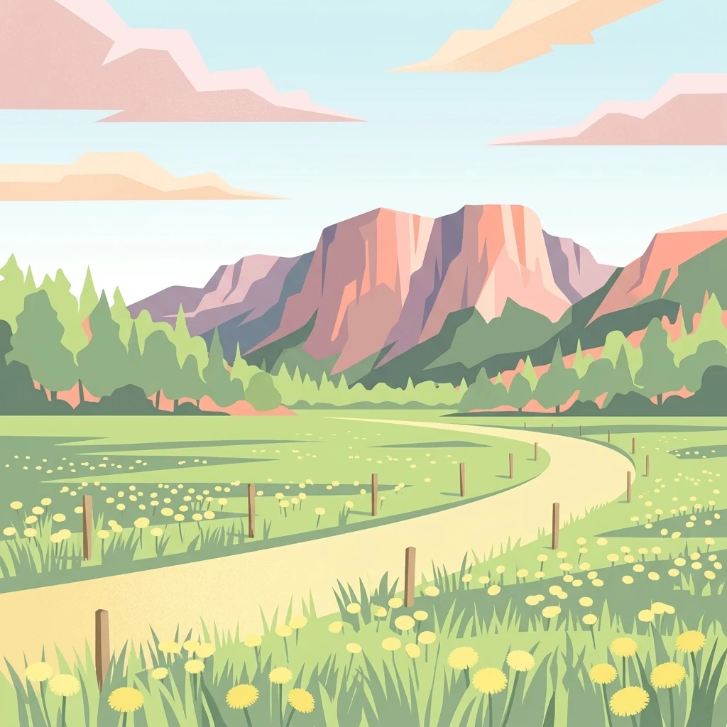
A flat vector illustration of a grassy meadow with yellow dandelions, a winding dirt path lined with fence posts, a forest in the midground, and large mountains in the background under a sky with pink clouds.

Bagno Pulwy

Protected area

Park overview

Structured park overview, official facts, and landscape profile for Bagno Pulwy

Bagno Pulwy park facts, protected area profile, and essential visitor context

Review the core facts for Bagno Pulwy, including designation, size, terrain, visitor scale, habitats, and operating context in one park-focused overview.

About Bagno Pulwy

Bagno Pulwy is a large open-wetland landscape situated in the northern part of the Mazowieckie voivodeship, between the forested landscape of Puszcza Biała to the south and the broad valley of the Narew river to the north. Across roughly 60 square kilometers it preserves an unusually complete sequence of lowland wetland habitats, including treeless hay meadows, wet pastures, marshes, regenerating peat cuts, willow-dominated shrub communities, and scattered patches of pine woodland. The area's flat topography, rich peat soils, and historically high water table have shaped both its ecological character and its long history of human attempts to drain and convert it to farmland.

Ecologically, the southern part of Pulwy consists of expansive, open, almost tree-free meadows that are still cut for hay. The northern part, lying between the embankment of the historic Rząśnik peat railway and the Narew floodplain, is a more heterogeneous mosaic of meadows, pastures, arable plots, overgrown former peat workings, low willow stands, and small pine forests. This combination of open wet meadow, scrub, peat-bog remnants, and small woodlots creates a habitat mosaic that is highly attractive to breeding and migratory birds, which is why the area was designated as the Bird Special Protection Area Bagno Pulwy under the Natura 2000 network.

Hydrologically, the wetland is defined by an extensive system of drainage channels. Water is collected locally from springs and snowmelt and ultimately discharged into the Narew through a main canal running through the villages of Wincentowo, Cygany, and Ulaski. The presence of the historical Rząśnik Droga embankment and traces of the old peat railway give the landscape a distinctive cultural texture, while the village of Grądy Polewne, located in the heart of Pulwy and connected by raised embankment roads to Porządzie and Rząśnik, marks the long-standing human presence within this otherwise open landscape.

Quick facts and research context for Bagno Pulwy

Bagno Pulwy lies in the Mazowieckie voivodeship, within the gminas of Rząśnik and Długosiodło. In physical-geographical terms it sits in the Dolina Dolnej Narwi mesoregion, on the flat valley floor framed by the Narew river and the Puszcza Biała forest. The protected portion of the area, designated as the Bird Special Protection Area PLB140015, covers 4,112.4 hectares and supports breeding and migratory bird communities typical of large lowland wetlands. The complex is dissected by a dense drainage canal network that historically connected to the Narew via the villages of Wincentowo, Cygany, and Ulaski.

Protection and recognition

Documented conservation status and international designation records for Bagno Pulwy.

Bagno Pulwy Protection Status and Natura 2000 Recognition

Bagno Pulwy features verified Natura 2000 recognition records within its documented protection framework. Conservation analysts utilize these structured designation facts to evaluate the ecological status of the protected landscape.
Park context

Deeper park guide and search-rich context for Bagno Pulwy

Bagno Pulwy history, landscape, wildlife, and travel context

Explore Bagno Pulwy through its history, landscape character, ecosystems, wildlife, conservation priorities, cultural context, and seasonal travel timing in a structured park guide built for atlas discovery and search intent.

Why Bagno Pulwy stands out

Bagno Pulwy is best known as one of the larger surviving lowland wet meadow and peatland complexes of the Mazovian plain, and as a designated Natura 2000 Bird Special Protection Area. Its open southern meadows, mosaic of pastures and peat-bog remnants in the north, and position between a major forest (Puszcza Biała) and a lowland river valley (the Narew) give it a distinctive combination of habitats that are rare in this part of Poland.
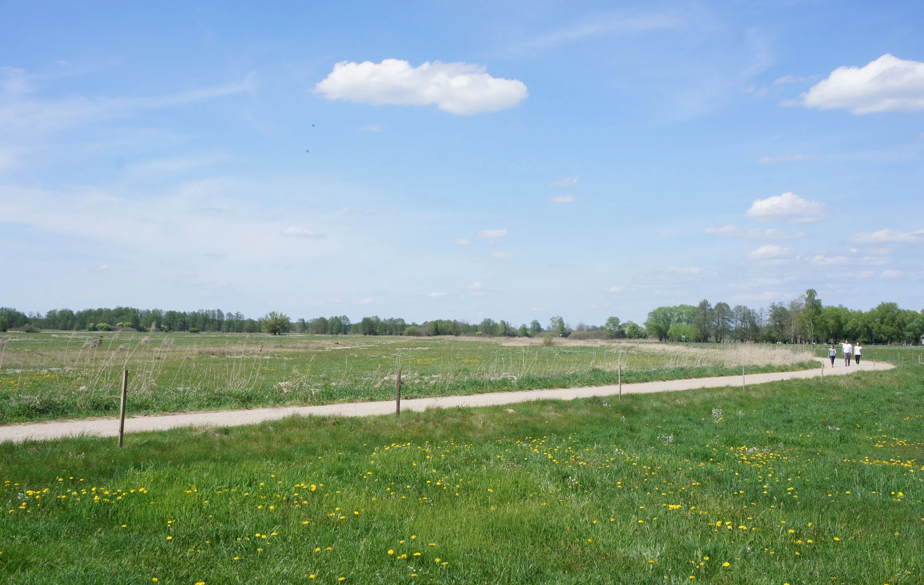
A wide shot of a gravel path cutting through a green, grassy field with a line of trees in the background under a blue sky with scattered clouds.
A gravel trail winding through the Bagno Pulwy meadows.

Bagno Pulwy history and protected-area timeline

The history of Pulwy is closely linked to repeated efforts to drain a vast peatland and convert it to agricultural use. The first documented plan to canalize the wetlands toward the Narew was prepared by the Prussian administration in 1798, attracting German settlers in the early nineteenth century whose traces remain in the form of abandoned Protestant cemeteries at Wincentowo, Nury, and Marianowo, as well as in a wooden Protestant church from Marianowo that was dismantled in 1945 and reassembled at Kunin, where it still stands.

The Duchy of Warsaw did not continue the large drainage project, and only partial, piecemeal melioration works were carried out by private landowners. The Government Commission of Goods and Treasury revisited the project in 1859, expecting landowners to share the costs, but the scheme was abandoned in 1867. Some of the peatlands were leased to peasants from Ochudno, and efforts to sell off the rest failed for lack of buyers, with peat identified as the principal natural resource.

During the November and January uprisings, the bogs served as a refuge for insurgents, and on 14 and 15 July 1863 a Polish insurgent detachment fought a battle with Tsarist forces in the Pulwy area. After the January Uprising the estate was taken over as an entailed property by the Tsarist colonel Czerewin, who organized a cluster of manorial farms. During World War I the property was nationalized, and in 1918 it passed to the provincial office, with much of the land being parceled out, partly afforested, and 800 hectares transferred to the Leszczydół Forest District for leasing to farmers.

A new drainage project launched in 1922 led to main works in 1932-1934, clearing and plowing in 1933, and sowing from 1934 onward, with male youth from the Junackie Hufce Pracy (labor service battalions) participating. On 8 March 1935 the Minister of Agriculture and Agrarian Reform established the State Meadow Farm on part of the Pulwy bogs and the Rząśnik estate; this mechanized, experimental farm introduced grasses from America, Japan, and China, kept a dairy herd of red cattle, and produced hay and oil crops, becoming regarded as a model holding visited by agricultural excursions. After World War II it was absorbed into a large state agricultural farm at Rząśnik, where a documentary film about the model farm was made in 1965 and which Edward Gierek visited in 1974. In the postwar years the area was also briefly an operating ground for the unit of Jan Kmiołek, alias Wir.

Bagno Pulwy landscape and geographic character

The landscape of Bagno Pulwy is a flat, lowland mosaic dominated by open wet meadow and peatland rather than by forest. The southern portion of the area is a vast, almost treeless expanse of hay meadows, framed to the south by the wooded edge of Puszcza Biała and bordered to the north by the historic Rząśnik Droga, a road that runs along the embankment of a former peat railway. The northern portion, extending from that embankment down to the Narew floodplain, is more varied: a patchwork of grassy meadows, pastures, cultivated fields, abandoned peat cuttings now in various stages of rewilding, low willow carrs, and small stands of pine.

Hydrological features strongly mark the terrain. A dense network of drainage channels crosses the bog, converging on a main canal that carries water through Wincentowo, Cygany, and Ulaski to the Narew river. The earlier, now-vanished Pulewna stream once drained the southern meadows and powered a mill until 1806, and the village of Grądy Polewne sits at the heart of Pulwy, connected by raised-causeway roads through the wetland to Porządzie and Rząśnik. The overall impression is of a wide, open, gently sloping peatland plain punctuated by shallow ditches, low embankments, scattered shrubs, and isolated farmsteads, set between the forested upland to the south and the broader Narew valley to the north.

Bagno Pulwy ecosystems, habitats, and plant life

The ecological character of Bagno Pulwy is defined by its extensive open wetland habitats on peat soils, including species-rich wet meadows, marshy depressions, regenerating peat cuttings, willow shrub communities (łozowiska), and small islands of dry-ground pine woodland. The contrast between the largely treeless southern meadows and the more heterogeneous northern mosaic creates a high level of habitat diversity within a relatively compact area.

Because the substrate is peat-rich and groundwater-fed, the area supports plant communities typical of lowland transitional mires, wet tall-herb meadows, and recovering cut-over bogs, while the surrounding drainage canals and embankments add structurally important linear features. The Natura 2000 designation reflects the value of this habitat mosaic for breeding waders, waterbirds, and wetland raptors, as well as for migratory species that use large open wet meadows as stopover habitat within the broader Narew valley system.

Bagno Pulwy wildlife and species highlights

Bagno Pulwy is recognized primarily for its birdlife, which is the main reason it was designated as the Bird Special Protection Area PLB140015. Raptors documented in the area include the common buzzard, rough-legged buzzard, northern goshawk, common kestrel, marsh harrier, and Montagu's harrier, while waterfowl include species such as the Eurasian wigeon, garganey, and northern pintail. The area also hosts white stork, short-eared owl, and black woodpecker, illustrating a mix of open-wetland and woodland-edge species.

Beyond birds, the wetland mosaic of meadows, marshy channels, scrub, and small woods supports mammal and invertebrate communities typical of lowland Polish peatlands and wet meadows, and the area's value as a refuge for breeding and migratory wetland birds is the core of its ecological importance within the Dolina Dolnej Narwi region.

Bagno Pulwy conservation status and protection priorities

The principal conservation significance of Bagno Pulwy lies in its formal designation as a Bird Special Protection Area (Obszar Specjalnej Ochrony Ptaków) under the European Union Natura 2000 network, with reference code PLB140015 and a designated area of 4,112.4 hectares. The site was recognized because the open wet meadows, marshes, and peatland mosaic of Pulwy provide important breeding, feeding, and migratory habitat for a range of raptors, waterfowl, harriers, and other wet-meadow birds in a region where such large open wetland complexes are increasingly rare.

At the national level the area sits within the Dolina Dolnej Narwi mesoregion and is part of Poland's Natura 2000 protected-area framework, granting the wetland legal protection from activities that could significantly degrade its bird habitats. Conservation interest focuses on maintaining the open character of the southern meadows and the hydrological conditions that sustain the northern mosaic, ensuring that the historical drainage network and ongoing agricultural use do not undermine the area's value for breeding and migratory birds.

Bagno Pulwy cultural meaning and human context

The cultural imprint on Bagno Pulwy is unusually rich for a wetland landscape. The area was targeted for drainage by the Prussian administration as early as 1798, attracting German settlers whose Protestant cemeteries survive at Wincentowo, Nury, and Marianowo, and whose wooden church at Marianowo was dismantled after World War II and re-erected at nearby Kunin. The Pulwy bogs also served as a refuge during the November and January uprisings, with a battle fought on 14 and 15 July 1863 near the area, and the bog's role in hiding insurgents remains part of local historical memory.

In the twentieth century the landscape was shaped by large-scale agricultural experiments, including the mechanized State Meadow Farm established in 1935, its absorption into a major post-war state agricultural farm, the 1965 documentary film Na łąkach PGR Rząśnik, and Edward Gierek's visit in 1974. Material traces such as the Rząśnik Droga embankment, the canal network, abandoned peat workings, and the embankment roads linking Grądy Polewne, Porządzie, and Rząśnik give the bog a layered history of drainage, settlement, farming, and conflict that remains legible in the landscape today.

Top sights and standout views in Bagno Pulwy

Among the most distinctive features of Bagno Pulwy are the vast, largely treeless hay meadows of the southern section, which remain actively mown and represent one of the larger surviving examples of open lowland wet meadow in this part of Poland. Equally distinctive is the northern landscape mosaic of pastures, regenerating peat cuttings, łozowiska, and small pine woods, set against the broader Narew valley.

The site's formal identity as the Bird Special Protection Area PLB140015 and its inclusion in the Natura 2000 network emphasize its regional importance for raptors, harriers, and waterfowl, while the historic Rząśnik Droga, the old peat-railway embankment, the canal network, and the embanked roads through Grądy Polewne give visitors and researchers a tangible sense of centuries of human interaction with the bog.

Best time to visit Bagno Pulwy

Because Bagno Pulwy is a lowland open-wetland landscape, the most rewarding periods for experiencing its character are late spring and early summer, when the southern hay meadows are at their floristic peak and breeding birds, including harriers and storks, are most active. Late summer and early autumn, after the hay meadows have been cut and migrant waterfowl begin moving through the Narew valley, also offer a different perspective on the area's open landscape and waterbird use. Winter can emphasize the stark, almost steppe-like openness of the meadows, though access depends on local conditions on the unpaved embankment roads.

Monthly climate preview

Track monthly temperature variations and precipitation averages across the park coordinate

Bagno Pulwy Climate Normals, Annual Temperature and Precipitation Profiles

Representative coordinate measurements reveal the long-term annual rhythm of average temperatures and monthly precipitation patterns for Bagno Pulwy. Examining the complete twelve-month climatology profile provides deeper analytical context on thermal variations across the protected landscape.
Annual mean8 °C
-4 °C20 °C
Jan-4°
Feb-2°
Mar
Apr
May14°
Jun18°
Jul20°
Aug19°
Sep14°
Oct
Nov
Dec-2°
Warmest month
July

19.8 °C

Coolest month
January

-3.9 °C

Wettest month
July

2.4 mm/day

Driest month
March

1.3 mm/day

Park location guide

Geography guide, regional context, and park location map for Bagno Pulwy

Bagno Pulwy park geography, regions, and map view in Poland

Understand where Bagno Pulwy sits in Poland through a broader geographic reading of the surrounding landscape, nearby location context, and its mapped position within the national park landscape.

How Bagno Pulwy fits into Poland

Poland, officially the Republic of Poland, is a Central European country spanning from the Baltic Sea in the north to the Carpathian Mountains in the south. It borders Germany, Czech Republic, Slovakia, Ukraine, Belarus, Lithuania, and Kaliningrad Oblast. The country has a temperate climate, diverse landscapes, and is known for its rich history, cultural heritage, and strong economic position within the EU.

Wider geography shaping Bagno Pulwy in Poland

Poland occupies 312,696 km2 in Central Europe, extending from the Baltic Sea coast in the north to the Sudetes and Carpathian Mountains in the south. It borders Germany to the west, Czech Republic and Slovakia to the south, Ukraine and Belarus to the east, and Lithuania and Kaliningrad Oblast to the northeast. The landscape includes lowland plains, uplands, and mountain ranges.

Map view of Bagno Pulwy

Use this park location map to pinpoint Bagno Pulwy in Poland, understand its exact geographic position, and read its mapped placement within the surrounding landscape more clearly.

Pigeon | © OpenStreetMap contributors

Location context for Bagno Pulwy

Mazovia Voivodeship

Visual reference of lowland peat meadows, drainage canals, and regional habitats

Bagno Pulwy Landscape and Scenery Photography: Exploring the Protected Wetland

Visual records capture the wide open wet meadows, regenerating peat cuttings, and drainage networks that characterize Bagno Pulwy. Photographic documentation reveals the distinct terrain and lowland habitat mosaic situated between the forest edge and the river valley.

A wide shot of a gravel path cutting through a green, grassy field with a line of trees in the background under a blue sky with scattered clouds.

Park atlas

Compare adjacent lowland reserves and connected regional habitats across Mazovia

Exploring Parks Near Bagno Pulwy and Surrounding Protected Wetland Landscapes

Browse other parks near Bagno Pulwy to evaluate connected wetland habitats and lowland river valleys across the surrounding region. Extending your geographic comparison reveals broader protected landscapes and similar peatland ecosystems throughout Mazovia.
A pale, soft-focus watercolor illustration showing a horizontal landscape of rolling green hills, distant hills in shades of purple and grey, and groups of conifer trees.
Protected landscapeMasovian Voivodeship
Park boundaries overlap#1 closest

Southeast

Puszcza Biała Protected Landscape: Map and Geography of the Mazovian Lowland Forests

Extensive pine-dominated woodlands of Masovian Voivodeship

Puszcza Biała is a massive, continuous lowland forest in east-central Poland, characterized by its dominant Scots pine stands and post-glacial sandy soils. Positioned between the Bug and Narew rivers, this protected landscape provides a quiet, expansive green space that serves as an essential component of the regional natural geography of the Masovian Voivodeship.

Area
850 km²
Relief
Lowland
Scope
Terrestrial
Water
Major water bodies
Nature reserveMazovia Voivodeship
About 27 km away#2 closest

East

Rezerwat przyrody Mokry Jegiel: Protected Wetland Forest Geography in Mazovia Voivodeship

A rare mosaic of bog and riparian forest communities

Rezerwat przyrody Mokry Jegiel functions as a key protected area within the Lower Bug valley of east-central Poland. The reserve preserves an increasingly rare sequence of hydrologically sensitive forest types, ranging from nutrient-poor coniferous bogs to dense alder swamps and periodically inundated riparian forests, making it a focal point for regional wetland studies.

Area
1.161 km²
Established
2002
Relief
Lowland
Climate
Temperate
A wide watercolor illustration showing a river flowing through a grassy landscape with a line of trees in the background, rendered in soft greens, pinks, and purples.
Nature reserveMazovian Voivodeship
About 34 km away#3 closest

South

Rezerwat przyrody Dębina Nature Reserve: Exploring Protected Landscapes in Mazovian Voivodeship

A preserved oak-hornbeam forest featuring glacial erratics and ancient woodland

Rezerwat przyrody Dębina is a significant nature reserve situated in the Mazovian Voivodeship, noted for its 200-year-old oak stands and multi-species deciduous canopy. As the oldest protected area in the region, it preserves a vital remnant of the Polish Lowlands landscape, offering a dense, ecologically rich forest environment defined by subtle topography and unique Pleistocene glacial boulders.

Area
0.512 km²
Established
1952
Relief
Lowland
Climate
Temperate
Nature reserveMazowieckie
About 38 km away#4 closest

Southeast

Rezerwat przyrody Moczydło: Protected Ornithological Landscapes in the Masovian Voivodeship

Mapping wetland habitats and forest bird refuges

Rezerwat przyrody Moczydło occupies a compact, ecologically significant forested area within the Mazowieckie region. As a designated faunistic reserve, it preserves critical breeding sites for water and marsh birds, contributing to the regional biodiversity and the expansive conservation efforts of the Nadbużański Landscape Park. This profile traces the reserve's geographic boundaries and its role in regional environmental protection.

Area
0.581 km²
Established
1991
Scope
Terrestrial
Water
Major water bodies
Nature reserveMasovian Voivodeship
43 km away#5 closest

North

Zachodniokurpiowskie Bory Sasankowe: Protected Forest Geography and Reserve Map

A study of dry pine habitats in the Masovian Voivodeship

The Zachodniokurpiowskie Bory Sasankowe nature reserve serves as an essential reference for continental pine forest ecosystems. By protecting the delicate interplay between sandy dune topographies and lichen-rich woodland floors, this site provides a rare window into the post-glacial geography of the Kurpie Plain.

Area
22.141 km²
Established
2018
Relief
Lowland
Climate
Temperate
A horizontal watercolor painting showing soft, layered green rolling hills and wooded ridges on a white background.
Nature reserveMasovian Voivodeship
About 53 km away#6 closest

Southwest

Dolina Wkry Nature Reserve: A Protected River Gorge and Riparian Forest Ecosystem in Masovia

Geographic analysis of breakthrough valley landscapes and lowland river habitats

This protected area centers on a narrow, gorge-like section of the Wkra River, which cuts through the older land surfaces of the Masovian Voivodeship. The reserve protects vital floodplain forest fragments and demonstrates a clear transition from river-edge alder woodlands to drier plateau slopes, providing a compact example of lowland riverine geomorphology.

Area
0.244 km²
Established
1991
Relief
Lowland
Climate
Temperate
National parkMasovian Voivodeship
54 km away#7 closest

Southwest

Kampinos National Park: Geographic Profile and Protected Forest Landscape Map

Inland dune formations and wetland habitats in Masovian Voivodeship

The expansive woodland of Kampinos National Park represents a critical protected area in Poland, characterized by its parabolic sand dunes and low-lying marshes. Gain insights into the geomorphological features of this UNESCO biosphere reserve and trace the complex hydrological network that defines its unique forest environment.

Area
385.44 km²
Established
1959
IUCN
II
Relief
Lowland
A soft watercolor illustration of a marshy landscape with low rolling hills, scattered trees, and a winding stream, rendered in light green and yellow tones on a white background.
National parkMasovian Voivodeship
54 km away#8 closest

Southwest

Kampinoski Park Narodowy: Mapping the Inland Dune and Wetland Landscapes of Central Poland

A vital protected area in Masovian Voivodeship

The landscape of Kampinoski Park Narodowy is defined by the Grochalskie Piachy dune complex and diverse riparian habitats. This atlas entry covers the geological history and protected boundaries of this significant lowland forest, tracing the Vistula river valley's influence on the surrounding terrain and ecological character.

Area
385.443 km²
Established
1959
Visitors
1M annual
Relief
Lowland

Common questions about visiting, size, designation, and location context for Bagno Pulwy

Bagno Pulwy FAQs for park facts, access, geography, and protected area context

Find quick answers about Bagno Pulwy, including protected-area facts, park geography, trail and visitor context, and how the park fits into its surrounding country and regional landscape.
MoriAtlas Explorer

Continue Your Protected Areas Search Across the Global Atlas

Deepen your exploration by continuing the structured search for national parks and protected areas worldwide. Utilize the comprehensive filtering capabilities to compare different conservation landscapes and refine your understanding of global park geography. Discover more about the distribution and characteristics of protected natural areas.

Global natural geography