Mori Atlas logo
Nature reserveBalule Nature Reserve

Mapping the Olifants River corridor and subtropical lowveld terrain across this integral conservation zone.

Balule Nature Reserve: A Detailed Geographic Overview of the Greater Kruger Protected Landscape

Balule Nature Reserve stands as a foundational protected area within the Limpopo province, serving as a critical western gateway to the Greater Kruger National Park. This expansive nature reserve features a landscape dominated by the perennial Olifants River, mopane woodlands, and classic subtropical savannah. Through this atlas entry, observe the integrated ecological boundaries that connect private conservation lands into a singular, vast, and functioning wilderness corridor.

lowveldsavannahriverine forestBig Fiveecotourismmopane woodland

Balule Nature Reserve

Nature reserve

Park overview

Structured park overview, official facts, and landscape profile for Balule Nature Reserve

Balule Nature Reserve park facts, protected area profile, and essential visitor context

Review the core facts for Balule Nature Reserve, including designation, size, terrain, visitor scale, habitats, and operating context in one park-focused overview.

About Balule Nature Reserve

Balule Nature Reserve occupies a privileged position on the western boundary of Kruger National Park, sitting in the heart of South Africa's subtropical lowveld. Although it is administratively a federation of private conservancies rather than a single block, the reserve reads on the ground as one continuous stretch of bushveld stretching from the Olifants River floodplain outward into mopane woodland and mixed savannah. The result is a protected area that blends the wild, unmanaged character of Kruger with the more personal, lodge-based feel of a private game reserve.

Ecologically, Balule benefits enormously from being part of the Greater Kruger system. By joining the Associated Private Nature Reserves and later having fences dropped between those properties and Kruger itself, Balule's wildlife gained access to far larger ranges, healthier gene pools, and broader seasonal foraging grounds. Animals here share the same roaming landscape as their counterparts inside the national park, and conservation outcomes (genetic diversity, predator-prey balance, drought resilience) are correspondingly stronger than they would be on an isolated reserve of comparable size.

The Olifants River is the spine of the reserve. Its permanent water draws hippos, crocodiles, and dense concentrations of plains game, while its banks shelter riverine vegetation and raptors that hunt along the channels. Away from the river, the land rises gently into bushveld dotted with baobabs, fever trees, knobthorns, and marula, creating the layered, photographic scenery that has made this part of South Africa internationally famous for safari travel.

For visitors, Balule offers a classical African safari experience centered on guided game drives, birdwatching, and interpretive bush walks, with a network of private lodges that range from small owner-run camps to larger luxury retreats. Because the reserve is integrated with Kruger, sightings of lion, leopard, elephant, rhinoceros, and buffalo are considered a normal expectation rather than a rarity, reinforcing Balule's standing as one of the more rewarding lowveld destinations in the Greater Kruger complex.

Quick facts and research context for Balule Nature Reserve

Balule Nature Reserve lies along the western edge of Kruger National Park in South Africa's Limpopo Province, immediately southwest of the mining and gateway town of Phalaborwa and within easy reach of Hoedspruit.

The reserve covers on the order of 40,000 hectares and is made up of a cluster of smaller private conservancies that have merged their fences into a single open system. It is one of the Associated Private Nature Reserves (APNR) linked fence-free into the Greater Kruger National Park, and the seasonal Olifants River runs roughly 20 kilometers through its interior, supplying permanent water for both resident wildlife and visiting safari travelers.

Protection and recognition

Documented terrestrial protection scope and conservation designation records

Balule Nature Reserve Protection Status and International Recognition Data

Balule Nature Reserve maintains a documented terrestrial protection scope within the global conservation network. Structured records outline the official designation framework and administrative parameters governing the protected landscape.

Protection details

Protection scope
Terrestrial
Transboundary protection
No
Park context

Deeper park guide and search-rich context for Balule Nature Reserve

Balule Nature Reserve history, landscape, wildlife, and travel context

Explore Balule Nature Reserve through its history, landscape character, ecosystems, wildlife, conservation priorities, cultural context, and seasonal travel timing in a structured park guide built for atlas discovery and search intent.

Why Balule Nature Reserve stands out

Balule is best known for being part of the open-system Greater Kruger landscape, where dropped fences create a continuous wilderness between private reserves and the national park. Its Big Five game presence and its setting along the Olifants River give it the reputation of a flagship lowveld safari area. The reserve is also recognized for the sheer plant diversity packed into its subtropical lowveld setting, with more than 300 documented tree species across its varied eco-zones. This combination of ecological richness, riverine habitat, and predator-rich savannah is what sets Balule apart from many other private game reserves in the region.
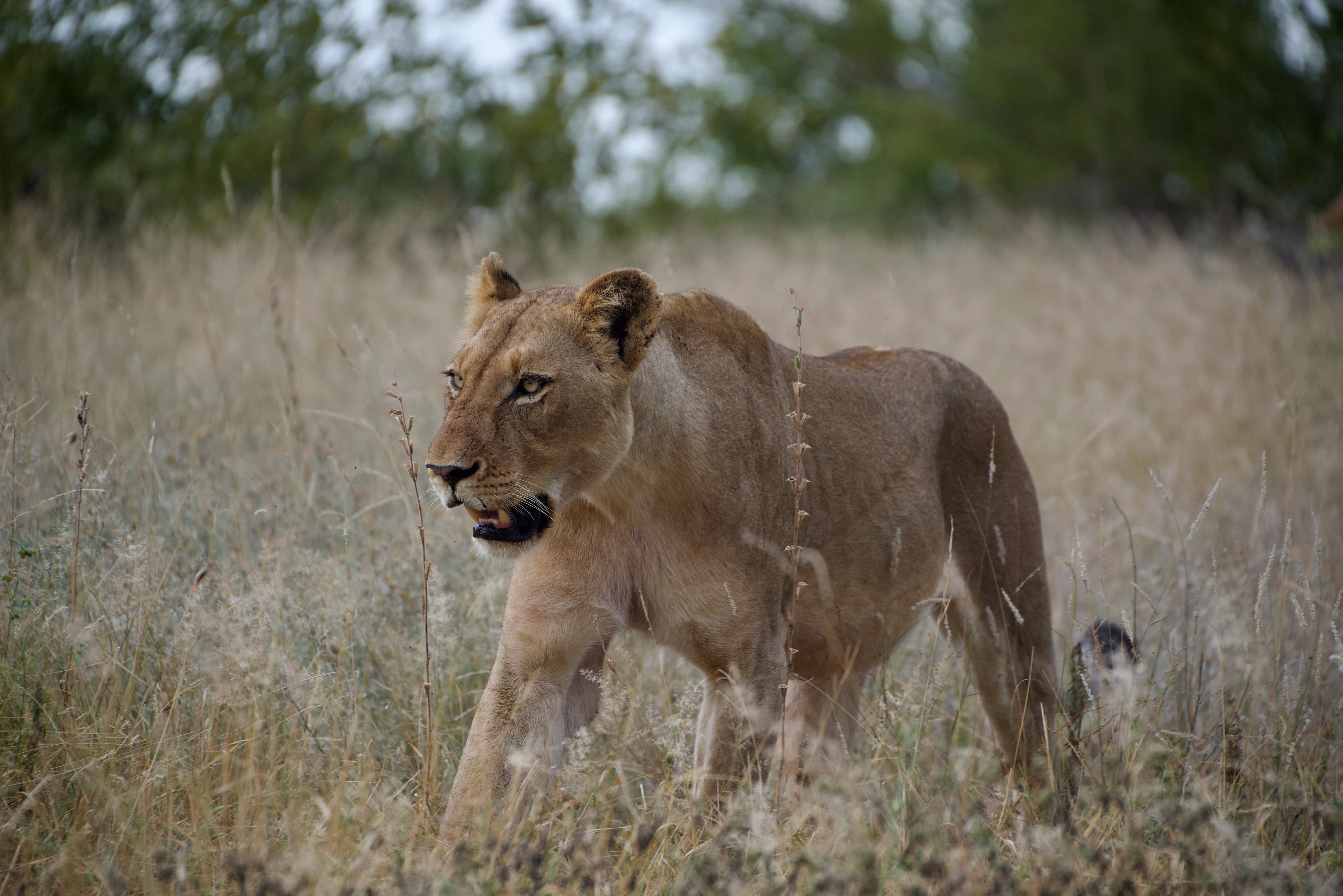
A side profile of a female lion walking through dry savannah grasses.
A lioness walking through the tall grass in the Balule Nature Reserve.

Balule Nature Reserve history and protected-area timeline

The modern Balule Nature Reserve is the product of a deliberate fencing-down process that began in the early 1990s. Before that, the area had been a patchwork of separate, fenced game farms where each landowner managed wildlife in isolation, often with hunting as a primary use.

In the early 1990s, a group of landowners began removing the fences between their properties to expand grazing ranges for wildlife and improve the genetic diversity of local animal populations. By the end of the decade, the majority of Balule's landowners had joined the initiative, creating a single, much larger open area where game could roam uninterrupted. Hunting was curbed, and the reserve's identity shifted decisively toward conservation and ecotourism.

Kruger National Park authorities observed the ecological benefits of this restored landscape and decided to extend it further by removing the fences between the Klaserie Game Reserve, the Olifants Game Reserve, and Kruger itself. This linked Balule and the other Associated Private Nature Reserves into the broader Greater Kruger National Park. Over time, additional properties have been absorbed, so the reserve's footprint continues to expand beyond its original consolidated size.

Balule Nature Reserve landscape and geographic character

Balule sits in the subtropical lowveld, a zone defined by hot summers, mild winters, and a mix of bushveld, savannah, and riverine forest. The terrain is generally flat to gently undulating, but the visual scenery changes significantly as one moves between habitats. Near the Olifants River, the landscape softens into lush riparian woodland and grassy banks; farther from the water, the bush thickens into mopane-dominated woodland and open mixed savannah.

The perennial Olifants River is the landscape's dominant feature, flowing roughly 20 kilometers through the center of the reserve. Its banks support dense vegetation and provide a permanent water source that shapes how wildlife distributes itself across the property. Baobabs, fever trees, knobthorns, and marulas rise above the grass layer, creating the classic big-tree, big-sky character that this part of South Africa is known for.

Although Balule lacks dramatic mountains or coastlines, its landscape is the kind that rewards slow observation: sudden clearings where giraffe browse at eye level, dust roads that trace old migrations, river bends where crocodiles surface, and dry mopane flats that catch the orange Lowveld light at the end of the day.
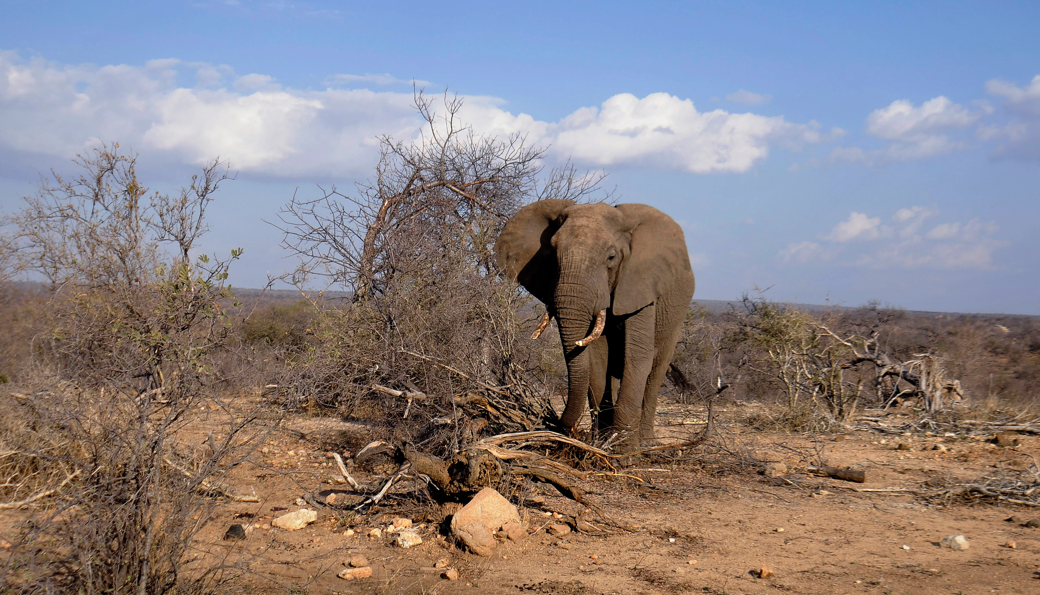
A large African elephant standing in dry, sparse savannah brush under a blue, partly cloudy sky.
An African elephant bull roaming in the lowveld savannah of Balule Nature Reserve.

Balule Nature Reserve ecosystems, habitats, and plant life

The reserve lies within a multi-eco-zone section of the lowveld, and the variety of overlapping habitats (riverine, mopane woodland, mixed bushveld, open savannah, and seasonal floodplain) is what gives Balule its unusual botanical richness. More than 300 tree species have been documented in the broader region, and individual conservancies within Balule support baobabs, fever trees, knobthorns, marulas, and extensive mopane tracts.

This mosaic of vegetation creates room for specialized niches: riverine thickets along the Olifants, taller canopies where knobthorn dominates, and drought-tolerant mopane woodland on poorer soils. The result is an ecosystem that feels layered and varied even within short drives, and that supports an unusually wide spectrum of herbivores, predators, and birdlife at the same time.
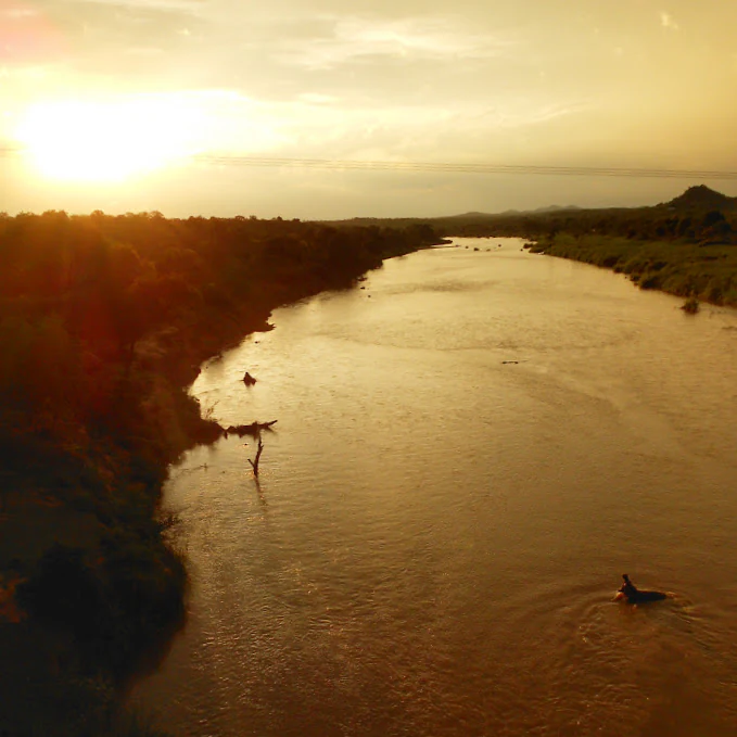
A wide, golden sunset illuminates a winding river, with silhouettes of trees along the bank and a hippo visible in the water.
Sunset view over the Olifants River within the Balule Nature Reserve.

Balule Nature Reserve wildlife and species highlights

Balule's open integration with Kruger National Park means its wildlife population mirrors the typical lowveld Big Five profile. Elephant, lion, leopard, rhinoceros, and buffalo all occur within the reserve, and the sighting of one of these species (or several in a single drive) is a regular expectation rather than a rare event.

The reserve hosts more than 30 mammal species in total. Plains game such as zebra, wildebeest, and South African giraffe are widespread, and the predator community includes lion, African leopard, and Southeast African cheetah. The Olifants River and its associated pools support large herds of hippos and a resident population of Nile crocodiles, and these water sources become focal points for wildlife traffic during the long dry season.

Birdlife is similarly rich, with more than 220 recorded species. Raptors are a particular highlight; lappet-faced vulture, Pel's fishing owl, and martial eagle are among the sought-after sightings, while larger, more conspicuous birds include kori bustard, southern ground hornbill, and saddle-billed stork.

Balule Nature Reserve conservation status and protection priorities

Balule's conservation value lies as much in its connectivity as in its own footprint. By surrendering internal fences and later integrating with Kruger National Park, the reserve became part of a much larger continuous ecosystem, giving resident wildlife access to seasonal grazing, breeding ranges, and genetic exchange that no 40,000-hectare block could provide on its own.

The early-1990s decision by landowners to remove fences was the defining conservation moment for Balule. It shifted the area from fragmented, hunt-oriented game farms into a wildlife-first landscape where animals determine their own movements. The subsequent links with the other Associated Private Nature Reserves (Timbavati, Klaserie, Umbabat) and with Kruger itself multiplied these benefits.

Today, the reserve continues to expand incremental as additional landowners join the open-system model. This continuing growth reinforces Balule's role not as an isolated protected patch but as a living, expanding component of one of Africa's most important transboundary conservation complexes.

Top sights and standout views in Balule Nature Reserve

Balule stands out for its fence-free integration with Kruger National Park, a design choice that gives it ecological depth far beyond most private reserves of similar size. The Olifants River corridor, with its hippos, crocodiles, and riverine forest, is the reserve's scenic and ecological backbone.

For safari travelers, the headline combinations are Big Five game viewing on open lowveld, more than 200 bird species, and a network of private lodges set inside a continuous wilderness. For conservation-minded visitors, Balule is one of the clearest examples anywhere in Africa of how private landowners, working together and with a national park, can stitch fragmented land back into a single functioning ecosystem.

Best time to visit Balule Nature Reserve

Balule's climate follows the broader lowveld pattern: hot, sometimes humid summers with concentrated rainfall, and dry, mild winters with clear skies and lower bush density. The dry winter months, broadly from May through August, are commonly associated with easier game viewing because animals concentrate around the Olifants River and remaining waterholes, and vegetation thins enough to improve visibility.

The summer months bring lush bush, vibrant bird activity around breeding and migrant arrivals, and dramatic skies, though heavier rainfall can make some roads slower and game sightings more dispersed. Shoulder periods at the limits of summer and winter can offer a balance between green scenery, manageable temperatures, and active wildlife, and are often considered broadly rewarding for visitors who want a mix of comfort, atmosphere, and game viewing.
Monthly climate preview

Long-term representative monthly temperature and precipitation data for Limpopo conservation landscapes

Balule Nature Reserve Climate Normals and Annual Weather Patterns

Balule Nature Reserve exhibits a measured annual cycle of monthly temperatures and precipitation values recorded across representative coordinate baselines. Reviewing the complete twelve-month statistical profile clarifies long-term meteorological rhythms across the protected terrain.
Annual mean23 °C
18 °C27 °C
Jan27°
Feb27°
Mar26°
Apr23°
May21°
Jun18°
Jul18°
Aug20°
Sep23°
Oct25°
Nov26°
Dec27°
Warmest month
December

26.9 °C

Coolest month
July

18 °C

Wettest month
January

3.6 mm/day

Driest month
June

0.2 mm/day

Park location guide

Geography guide, regional context, and park location map for Balule Nature Reserve

Balule Nature Reserve park geography, regions, and map view in South Africa

Understand where Balule Nature Reserve sits in South Africa through a broader geographic reading of the surrounding landscape, nearby location context, and its mapped position within the national park landscape.

How Balule Nature Reserve fits into South Africa

South Africa is the southernmost country in Africa, spanning 1.22 million km² with a population of over 63 million. The country operates with three capital cities, Pretoria (executive), Cape Town (legislative), and Bloemfontein (judicial), and is renowned for its biodiversity, national parks, and multicultural society.

Wider geography shaping Balule Nature Reserve in South Africa

South Africa occupies the southernmost region of Africa, with coastline along both the Atlantic Ocean to the west and the Indian Ocean to the east. The interior features elevated plateaus including the Highveld, with the Drakensberg escarpment marking the eastern highlands. The country shares borders with Namibia, Botswana, Zimbabwe, Mozambique, Eswatini, and Lesotho.

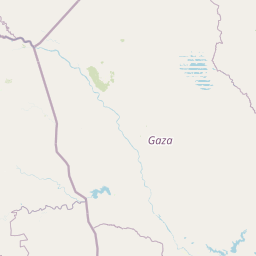
Map view of Balule Nature Reserve

Use this park location map to pinpoint Balule Nature Reserve in South Africa, understand its exact geographic position, and read its mapped placement within the surrounding landscape more clearly.

Pigeon | © OpenStreetMap contributors

Location context for Balule Nature Reserve

Limpopo

Explore protected area views, riverine habitats, and lowveld terrain

Balule Nature Reserve Photos and Landscape Scenery Visuals

Visual documentation captures the varied terrain, subtropical bushveld, and riverine forest characteristic of Balule Nature Reserve. Browsing these detailed landscape photographs provides a clear understanding of the protected area environment and regional ecosystems.

A side profile of a female lion walking through dry savannah grasses.

Two giraffes grazing amongst dry shrubs in a sunny, open savannah landscape with a clear blue sky.

A large African elephant standing in dry, sparse savannah brush under a blue, partly cloudy sky.

A wide, golden sunset illuminates a winding river, with silhouettes of trees along the bank and a hippo visible in the water.

Park atlas

Compare connected wildlife habitats and regional reserves across the Greater Kruger landscape.

Explore Parks Near Balule Nature Reserve and Surrounding Lowveld Protected Areas

Browse other protected areas and regional reserves connected to the broader subtropical lowveld ecosystem surrounding Balule Nature Reserve. Expanding the geographic comparison reveals how adjacent conservation landscapes and river corridors link together across South Africa.
A soft watercolor illustration showing rolling green hills with sparse native vegetation, set against a pale, warm-toned horizon.
Biosphere reserveLimpopo
About 8.8 km away#1 closest

Northeast

Kruger to Canyons Biosphere: An Atlas of Protected Lands and Geographic Diversity in Limpopo

Integrated conservation across savanna, canyon, and montane ecosystems

Covering the stretch between the Letaba and Sabie Rivers, this biosphere reserve serves as a vital conservation landscape in South Africa. Its unique geography captures the transition from rugged escarpment cliffs to open bushveld, showcasing a high density of protected land and biodiversity. Use this map-oriented resource to understand the structural role of the biosphere as a model for landscape-scale environmental management and its geographic placement within the Limpopo province.

Area
28,748.1 km²
Established
2001
Relief
Mixed relief
Access
Access unknown
National parkSouth Africa
About 25 km away#2 closest

East

Kruger National Park: South Africa's Iconic National Park for Geographic Discovery

Explore savanna landscapes and mapped protected area boundaries.

Kruger National Park serves as a paramount example of a protected landscape, offering a rich tapestry of savanna ecosystems and varied terrain across South Africa's Lowveld. This canonical entry details its vast geographic scope, approximately 19,623 square kilometres, and its status as the nation's first national park. Understand the park's environmental context, from the Lebombo Mountains to the Limpopo River, and its integral role within larger transfrontier conservation initiatives, providing critical insight for atlas-based geographic exploration.

Area
19,623 km²
Established
1926
IUCN
II
Visitors
1.7M annual
Wildlife reserveLimpopo
About 31 km away#3 closest

South

Kapama Game Reserve: Geographic Atlas and Protected Landscape Map of Limpopo

Explore the diverse terrain and riverine ecosystems of this South African wildlife reserve

Kapama Game Reserve sits within the Limpopo Lowveld, featuring a complex mix of open savanna, mixed bushveld, and dense riverine corridors shaped by the Blyde River. This record provides a detailed look at the reserve as a functional piece of the greater regional conservation landscape, highlighting its topography and its role in protecting South Africa's native habitat.

Area
130 km²
Established
1993
Scope
Terrestrial
Nature reserveMpumalanga
About 42 km away#4 closest

Southeast

Timbavati Private Nature Reserve: Protected Landscape and Regional Map Overview

Savanna bushveld geography in Mpumalanga, South Africa

Spanning over 534 square kilometres, Timbavati Private Nature Reserve provides a crucial habitat mosaic within the Mpumalanga region. The area is defined by its pioneering unfenced conservation model, linking private land with the Greater Kruger National Park to protect a broad spectrum of woodland habitats and diverse savanna ecosystems.

Area
534 km²
Established
1956
Relief
Upland
Climate
Subtropical
Wildlife reserveLimpopo
About 47 km away#5 closest

South

Thornybush Game Reserve: A Protected Wildlife Landscape in Limpopo, South Africa

Mapped savanna corridors and riverine ecological zones

Located in the Limpopo province of South Africa, Thornybush Game Reserve is an essential private wildlife area known for its open savanna and rich riparian vegetation. By maintaining an unfenced boundary with the neighboring national park, it acts as a critical extension of the Greater Kruger wilderness. This entry details its geographical scope, terrain features, and its function as a managed, integrated component of the regional conservation landscape.

Area
140 km²
Water
Minor water
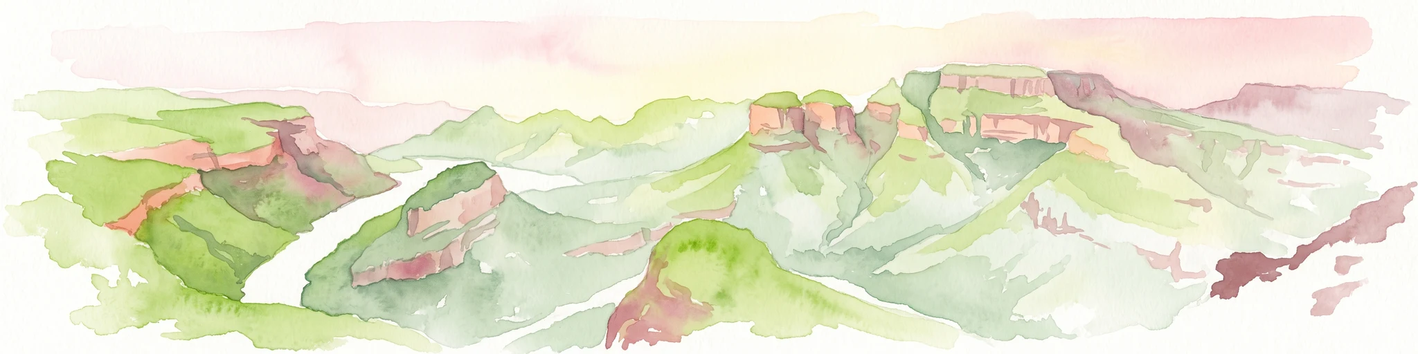
A horizontal watercolor painting depicting the Blyde River Canyon with green slopes, reddish cliff faces, and a winding river.
Nature reserveMpumalanga
About 52 km away#6 closest

South

Blyde River Canyon Nature Reserve: Escarpment Geography and Protected Landscape Map

Mapping river-carved canyons and plateau ecosystems in Mpumalanga

Blyde River Canyon Nature Reserve protects a vast stretch of the Mpumalanga Drakensberg, characterized by vertical cliffs, rocky massifs, and deep river gorges. This atlas-focused resource highlights the reserve's geological landmarks, including the Three Rondavels and Bourke's Luck Potholes, offering a clear view of the complex terrain and protected natural boundaries defining this northeastern South African landscape.

Area
290 km²
Established
1965
Relief
Mountain
Climate
Subtropical
Wildlife reserveMpumalanga
About 71 km away#7 closest

Southeast

Manyeleti Game Reserve: Protected Area Boundaries and Lowveld Landscape Mapping

Ecological connectivity within the Mpumalanga conservation mosaic.

Manyeleti Game Reserve offers significant insights into the Lowveld landscape of Mpumalanga. Known for its unfenced connection to neighboring wildlife areas, the reserve provides a case study in contiguous protected land management and bushveld geography that sustains large mammal populations across regional boundaries.

Area
227.5 km²
Established
1967
Water
Minor water
Season
Year-round
National parkMozambique
About 85 km away#8 closest

East

Limpopo National Park: Mozambique's Savanna Ecosystem and Protected Landscape

Explore its mapped boundaries and transfrontier park significance.

Limpopo National Park is a protected national park in Mozambique, distinguished by its savanna ecosystem and its critical role as the eastern segment of the Great Limpopo Transfrontier Park. This page offers an atlas-driven exploration of its geographic scope, mapped protected area boundaries, and its function as a key wildlife migration corridor, providing essential context for understanding this significant conservation landscape.

Area
10,000 km²
Established
2002
IUCN
II
Relief
Lowland

Common questions about visiting, size, designation, and location context for Balule Nature Reserve

Balule Nature Reserve FAQs for park facts, access, geography, and protected area context

Find quick answers about Balule Nature Reserve, including protected-area facts, park geography, trail and visitor context, and how the park fits into its surrounding country and regional landscape.
MoriAtlas Explorer

Continue Your Protected Areas Search Across the Global Atlas

Deepen your exploration by continuing the structured search for national parks and protected areas worldwide. Utilize the comprehensive filtering capabilities to compare different conservation landscapes and refine your understanding of global park geography. Discover more about the distribution and characteristics of protected natural areas.

Global natural geography